Get PeakVisor App
Sign In
Search by GPS coordinates
- Latitude
- ° ' ''
- Longitude
- ° ' ''
- Units of Length

Yes
Cancel
❤ Wishlist ×
Choose
Delete
Sompio Strict Nature Reserve (Sompion luonnonpuisto) is one of the 19 strict nature reserves in Finland. Located in the Lapland region, the main feature of the reserve is a complex of unusual granite structures on the summit of Pyhä-Nattanen or Pyhätunturi (506 m / 1,660 ft). Another major feature is Sukkulalampi Pond. There are 10 named mountains in the reserve, the highest and most prominent of which is Terävä-Nattanen (544 m / 1,785 ft).
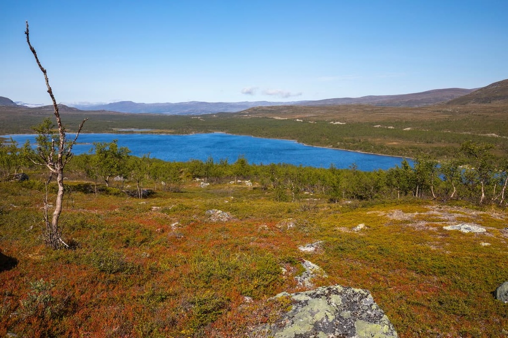
Sompio Strict Nature Reserve is named after an old village. It’s also named after the large Sompiojärvi Lake, which is located on its southern borders. The name ‘Sompio’ is a word from the language of the Indigenous people of what is now northern Finland, the Sámi.
The reserve was established in 1956. Just like all other natural areas in Finland, it is managed by Metsähallitus, which is the main forestry agency of the country.
Among the 19 strict nature reserves in Finland, which were designated for flora and fauna conservation and research by scientists, only three are accessible to tourists. Besides Sompio, the other two reserves that visitors can visit are Kevo and Malla.
The reserve is located in the municipality of Sodankylä in the Lapland region of northern Finland.
The total area of the reserve is 179 sq. km (61 sq. mi). Together with Urho Kekkonen National Park (2,550 sq km / 984 sq mi), which borders the reserve to the east and north, it makes up one of the largest natural areas in the country.
To the west, the reserve is bounded by the largest highway in Lapland, the E75, which cuts it in two roughly equal parts: western and eastern.
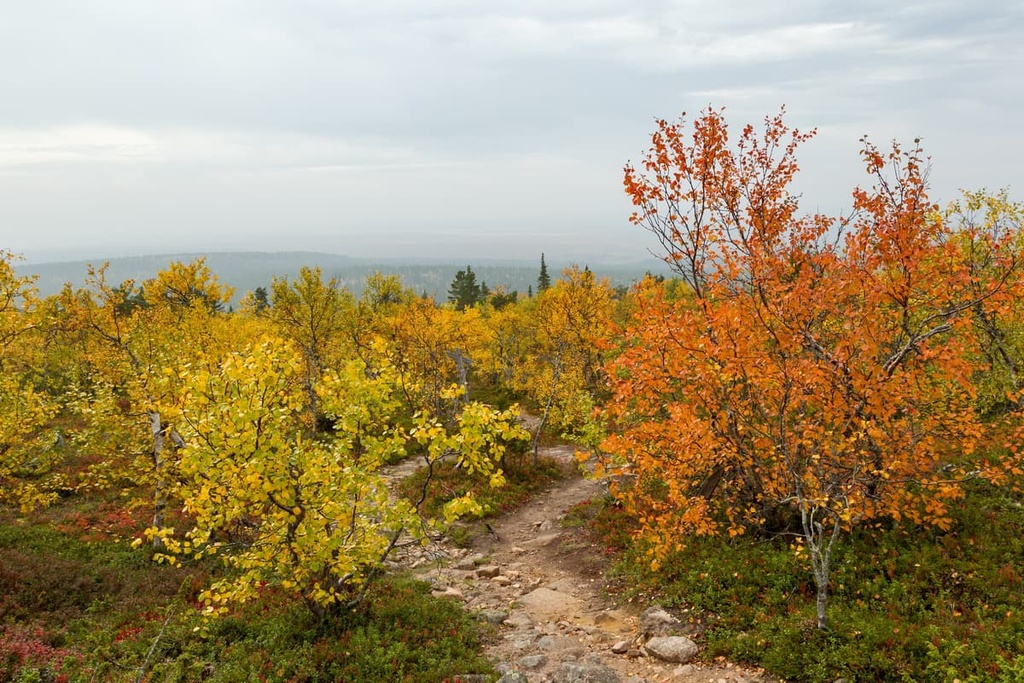
Sodankylä is located some 128 km (79.5 mi) or 1 hour and 30 minutes by car from the capital of Lapland, Rovaniemi. In turn, it can be reached from Helsinki in another 9–10 hours of continuous driving (812 km / 504 mi).
From Rovaniemi to the reserve, there are regular buses on the following route:
Rovaniemi – Sodankylä – Vuotso (the closest town to the reserve) – Tankavaara – Kakslauttanen – Saariselkä – Ivalo
You can also get to Rovaniemi from Helsinki by bus, train, or plane.
Another interesting way to get here is from northern Norway and Russia. Or you could take a tour of the entire Lapland cultural region, which is located in Finland, Norway, Russia, and Sweden. Locals do this quite regularly, so it’s worth considering if you’re in the area.
The Sompio Strict Nature Reserve belongs to the largest geological stratum in Lapland and Eastern Finland, which is called the Karelian Domain. The Karelian Domain is part of the Baltic Shield, a segment of the Earth’s crust that’s located beneath the entire territory of Scandinavia and that is between 1.5 and 3 billion years old.
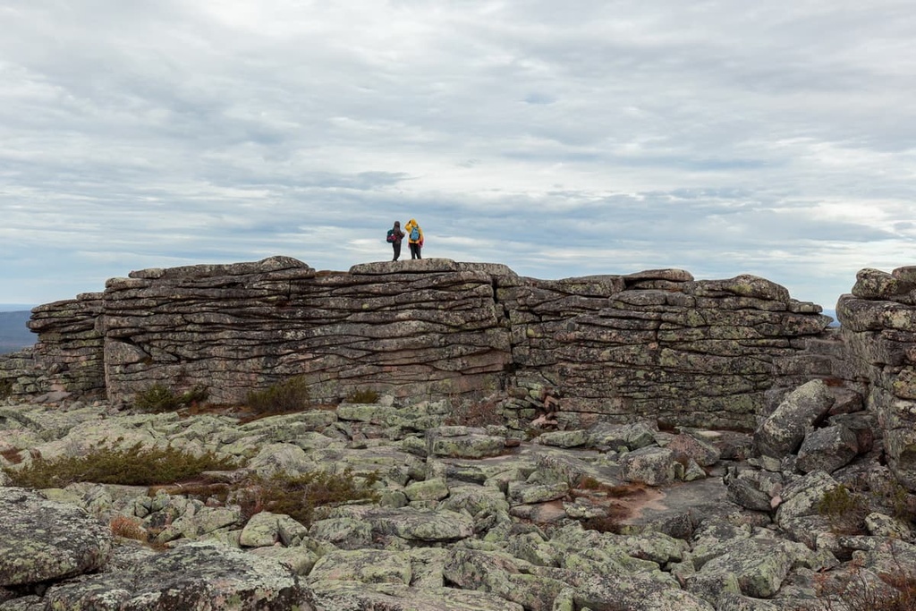
Therefore, the primary rocks found in Lapland come from this Karelian Domain. This includes various types of granites, gneisses, shales, and quartzites, which are also found in other parts of Finland. However, the Nattastunturit Fells, the main mountain range in the reserve, were formed by a granite type that is rare in the region called “Nattaset red granite.”
Another feature of the region’s local geology is the presence of gold, which was actively mined in the region before the creation of the nature reserve. You can learn more about it at the Tankavaara Gold Village, which is located a couple dozen kilometers from the borders of the reserve.
The Tankavaara Gold Village is an open air museum that tells the history of 150 years of gold mining in Lapland, as well as the history of the gold rushes in different parts of the world.
Here, you can also try to search for gold on your own through a guided excursion. These excursions are offered every day from 10 am to 6 pm from early June until September.
There is also the annual Tankavaara World Gold Panning Championships, which have been held in the area every year since 1973. The tradition still lives very strong in the hearts of locals, some of whom still hope to sustain themselves through gold mining. The championships are often scheduled in the summer months around July. You can sign up for the event on TankavaaraGold.fi. The organizers warn: “Gold fever is real!”
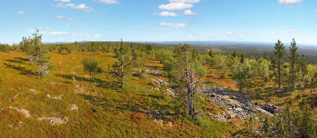
The landscape of the reserve is typical of Lapland. It features a chain of low mountains (Nattastunturi) that’s surrounded by endless old-growth pine forests, ponds, and lakes (Sukkulalampi and Sompiojärvi).
As elsewhere in Lapland, many rivers (Nalijoki, Muteniajoki, and others) cross the territory of the reserve. There are also many aapa bogs (Riestonaapa mire), which can be both wetland and dry areas.
Reindeer husbandry is also an integral part of the reserve's landscape. The Lapin paliskunta cooperative is the main organization of reindeer herders in the region.
But of course, among the region’s fells, water, and forests no two are alike, so traveling to this area will give you a different experience from what you get in other places in Lapland. The Sompio Nature Reserve and Urho Kekkonen National Park area is one of the best places to visit in the region, alongside Pallas-Yllästunturi National Park and Lemmenjoki National Park and Paistunturi Wilderness Area.
Like other 19 strict nature reserves in Finland, Sompio was created primarily to protect local flora and fauna, landscape features, and history, rather than for tourism purposes.
The main typical tree of the reserve is Siberian spruce. The ground is mostly covered by blueberries, different moss species, and other plants. Among flowers there are a lot of dwarf cornel, globe flower, wood cranesbill, and other types.
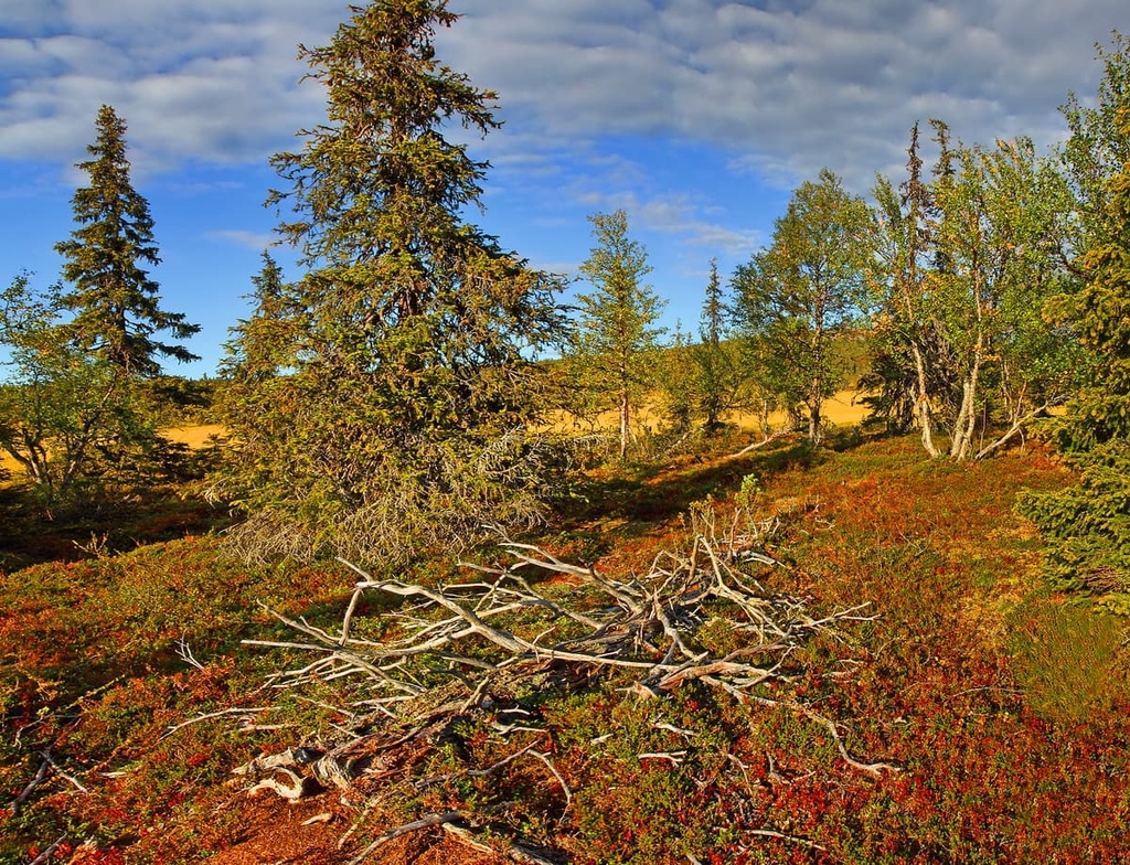
The reserve is inhabited by a squirrel, mountain hare, grey-sided vole, least weasel, stoat, wolverine, pine marten. There are bears, foxes, lynx, and wolves, too. But the animal you are most likely to see in the region is reindeer. Among birds, there are also waterfowl, wader, golden plover, osprey, broad-billed sandpiper, duck, crane, geese, swan, diver, and many others.
The heart of the Sompio Reserve is a group of six mountains called Nattastunturit Fells, which are undoubtedly the reserve’s main attraction.
In addition to the highest fell, Terävä-Nattanen (544 m / 1,784 ft), the peaks in the reserve include:
All of these peaks are located in the southern part of the reserve.
An interesting difference between these mountains and others in the Urho Kekkonen National Park and the rest of Lapland is that they feature rugged summits due to the fact that they consist of Nattaset red granite. This is a harder and less-erosion-prone type of rock compared to its other types in the region.
Therefore, glaciers during the last glacial maximum didn’t erode the peaks found in this part of Lapland as much as the peaks in Urho Kekkonen National Park and other parts of Lapland.
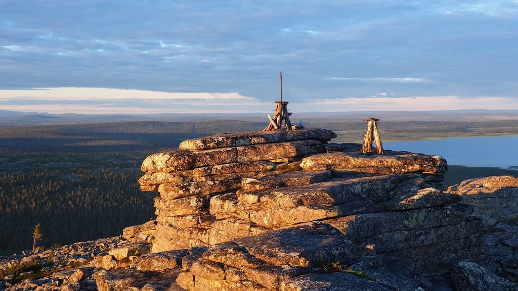
The most famous peak of Nattastunturit Fells is Pyhä-Nattanen because it contains the following features:
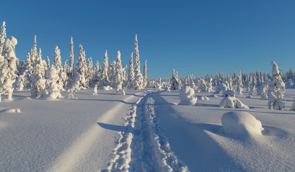
There are three marked trails in the reserve for hikers. According to the rules, you must stay on the trails at all times.
However, despite the presence of frequent trail markings in the reserve, I recommend having orienteering and wilderness survival skills if you venture into the region, because some of the trail markers are old and it is possible to get lost during a hike.
This is an easy nature trail at Tankavaara Gold Village that introduces visitors to the flora and fauna of the reserve and its surroundings. There is also an observation tower on the trail with great views. Note that there is no route to the reserve from the trail, so you will have to return south along the highway.

The Pyhä-Nattanen Trail is the main hiking trail in the Sompio Nature Reserve. It leads to the reserve’s most famous peak, Pyhä-Nattanen. The trail begins at the southern border of the reserve, which can be reached by taking the Sompiojärventie road from the nearby village of Vuotso.
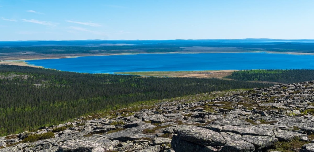
The trail runs along the riverbed of the Nalijoki to the top of the mountain and back. From the top, you will have an iconic view of Sukkulalampi Pond, which is surrounded by pine forests on all sides. You’ll also see the huge Sompiojärvi Lake, the amazing Sokosti (718 m / 2,355 ft), and the Korvatunturi (486 m / 1,535 ft) fells in the Urho Kekkonen National Park in clear weather.
Note that this hike is fairly steep, so it’s only recommended for experienced hikers in solid physical condition.
The Ruijanpolku Trail is the longest trail in the park. It runs from Sompiojärvi Lake through Urho Kekkonen National Park to Kiilopää Fell Center on the western borders of the park or to the neighboring village of Laanila.
The Sompio route is a part of an ancient Finnmark Route leading all the way from the Bothnian Bay in the Baltic Sea to the Barents Sea in the Arctic Ocean. It is Lapland's oldest wilderness route. The following sections travel through the reserve and the nearby national park:
Along the way, you can see all that Lapland is known for, including forests, bogs, lakes, and cliffs. You can also climb to the highest peak of the reserve, Terävä-Nattanen, and to the top of Nattaset Fell (Nattasduottar) in the national park.
There is no visitor center at the reserve, but you can get more information about the place and ask questions at the Sompio Tourism Association:
Sompio Tourism Association
Tankavaarantie 35, 99695, Sodankylä, Finland
+35816626158
The nearest visitor center is located at the Urho Kekkonen National Park in Saariselkä village to the north of the reserve:
Urho Kekkonen National Park Customer Service Kiehinen
Lutontie, 16 (Santa's Hotel Tunturi's Gielas building), 99830, Saariselkä (Inari), Finland
Open all year round with varying hours
+358206397200
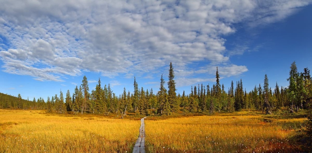
You can pitch your tent at Sompiojärvi Lake while hiking in the reserve. While at the lake, you can also make a fire at the campfire site and relax in the campfire shelter.
There is also a traditional Sámi hut named “kota” and a lean-to shelter where you can stay overnight during the summer. In any case, the park staff recommends sleeping on the lake for no more than three days at a time.
In other parts of the park, there are also several places to stay including a lean-to shelter on the Nalijoki River shore on the way to Pyhä-Nattanen. However, near Terävä-Nattanen, there is only a campfire site.
Before and after the hike, you can find accommodation in the villages of Sodankylä and Saariselkä.
The closest large village to the reserve is Sodankylä, which is located some 102 km (63.3 mi) to the south of the reserve on highway E75 next to the Kitinen River, a tributary of the larger Kemijoki River.
Sodankylä is the fourth most populous municipality in Lapland, after Rovaniemi, Tornio, and Kemi with a population of 8,185 people (2021). It is also the second-largest municipality in size (12,415 sq km / 4,793 sq mi). Some people call it the center of eastern Northern Lapland, but the municipality has no official city status.
The main attractions of Sodankylä include:
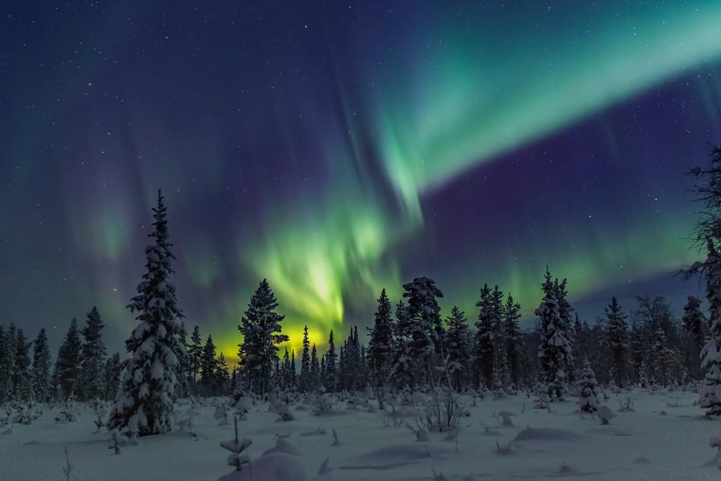
The main annual event in the municipality is the Midnight Sun Film Festival (Sodankylän elokuvajuhlat), which has been held here since 1986.
For more information, check out the official tourist site of Sodankylä: VisitSodankyla.fi
Explore Sompion luonnonpuisto with the PeakVisor 3D Map and identify its summits.


