
Scan the QR code and open PeakVisor on your phone
Paistunturi Wilderness Area is one of the 12 wilderness areas in Finland. It is located in the northernmost part of Lapland. The main feature of the area is Paistunturit Fells, which gave the name to it, as well as locally famous Ailigas Fell with a great view on a territory. There are 84 named mountains in Paistunturi Wilderness, the highest of which is Koutoaivi (588 m / 1,929 ft), and the most prominent of which is Várddoaivi (538 m / 1,765 ft).
In Finland, wilderness areas are regions of untamed wilderness without human intervention. Here, you can wander for weeks and literally meet no other people.
Wilderness areas differ from national parks, nature reserves, and other natural areas, however, in that there is no developed infrastructure. This usually means that there are no marked hiking trails, huts, places to make a fire and set up tents, and other services. The visitor center of a wilderness area is every high hill you climb rather than a designated building.
Nevertheless, in some areas or parts of areas, including Paistunturi, you can find marked trails or places to stay, but they may be poorly marked. Alternatively, many of these trails are informal old trails that hundreds of hikers have paved before you and then spread the word about them on Internet forums, social networks groups, chats and so on.
So, moving through such areas requires navigation skills and the appropriate equipment (compass, knife, fire-making tools, cooking equipment, and so on) for an extended period of time in the wilderness. Physical endurance is also a must-have. Here you can only rely on yourself.
There are a total of 12 wilderness areas in the country, totaling some 15,000 sq. km (5,791 sq mi) in area. They are all located in the Northern Lapland region and were created by the main Forestry Administration of Finland called Metsähallitus in 1991.
The primary goal of these wilderness areas is to preserve the wild characteristics of their landscapes and to preserve the cultural and historical livelihoods of the Sámi people who have called this place home since time immemorial.
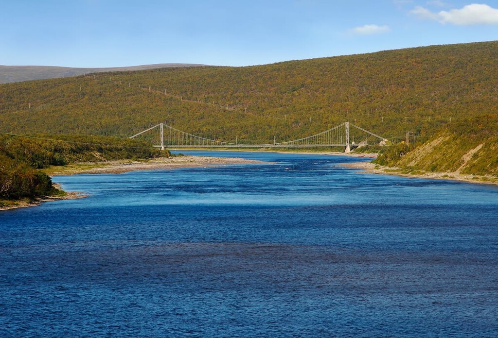
The Paistunturi Wilderness Area is located in the municipality of Utsjoki, the northernmost in the whole country. It is situated in the Northern Lapland region along the country’s border with Norway, which follows the Kárášjohka / Karasjohka River and which forms the northern and western borders of the area.
The total length of the river is 161 km (100 mi). Together with Anarjohka River (153 km / 95 mi), the Kárášjohka, it is one of the two main tributaries of the larger Tenojoki (Tana or Teno) River. The Tenojoki is a 361-km long (224.3 mi) river that flows between Lapland and the Arctic Ocean. The Sámi call it “The Great River” in their language.
The total area of the wilderness area is approximately 1,570 sq km (610 sq mi). It extends from north to south, but it also covers a wide area from east to west.
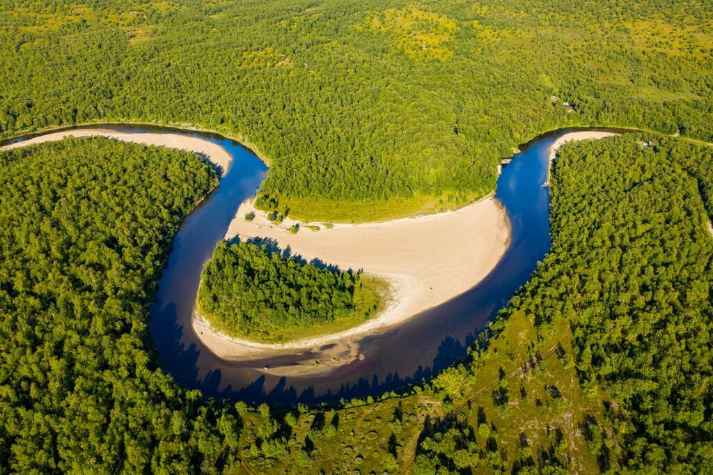
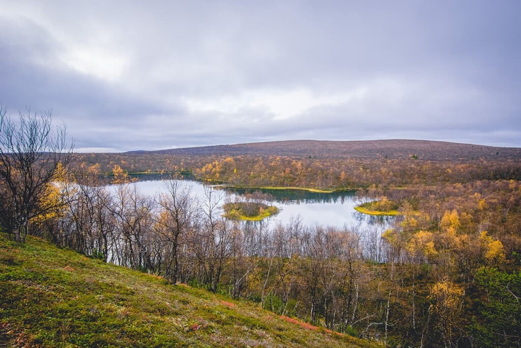
Another great feature of Paistunturi is Kevo Strict Nature Reserve, the largest reserve in Finland, which is located right in the center of the wilderness, dividing it into two parts. Kevo is one of the many nature reserves in Finland, and it is famous because of the 40-km-long (24.8 mi) and 80-meters-deep (262 ft) canyon formed by the Kevojoki River. The aim of the reserve is to protect the sensitive nature of the canyon and the fells ( hills) surrounding it.
The Paistunturi Wilderness Area is bordered by two other similar wilderness areas: the Muotkatunturi Wilderness Area to the south, and the Kaldoaivi Wilderness Area to the east. There is also Inari Lake, the third-largest in Finland after Saimaa and Päijänne, to the southeast of all three areas.
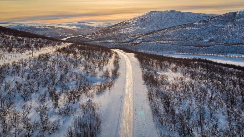
The wilderness area is located about 5 km (3.1 mi) from Utsjoki village, which you can reach from Rovaniemi, the capital of Lapland region—451 km (280.2 mi) or a 5-hour drive by car. There is a large highway (E75) that runs between the village and the city, so you won’t get lost.
If you have a car, consider also driving the “Teno Route” or “The Most Beautiful Road in Finland” between Karigasniemi and Nuorgam through the breathtakingly beautiful Tenojoki River valley and the western and northern borders of the wilderness area.
To do this, after you pass Inari on your way to Utsjoki from Rovaniemi, turn onto Road 92 at Tuurukoskenniemi. The whole Teno Route is a 275 km (170.8 mi) journey on Road 970 that is parallel to the road E6 in Norway.
Rovaniemi, on the other hand, can be reached from the capital city of Helsinki (812 km / 504.5 mi or about 10–11 hours) by car or train, bus, or airplane if you travel by public transport. Utsjoki is also served by the Kirkenes Airport in Norway. The airport is 2.5 hours away from Nuorgam by car.
Due to the presence of Kevo Reserve, there is a regular bus service from Utsjoki to the eastern and southern parts of the Paistunturi area, as well as the Rovaniemi—Tana / Vadsö bus connection. You can also get here by bus from Inari. To get to the western and the northern parts, you need to take a taxi from Utsjoki or the village of Karigasniemi. Check the local bus schedule at Matkahuolto.fi.
The main rocks types in all of Lapland are different kinds of granite, gneisses, shales, and quartzites, including some of the oldest types in Europe.
This is because the entire territory of Scandinavia, including Finland, is located on the Baltic Shield—a segment of the Earth's crust. Accordingly, some of the rocks we see on the surface come from deeper layers of this crust, which is 1.5 to 3 billion years old.
Most of the 1,462 named mountains or fells in Lapland, including the 86 peaks we have in the Paistunturi Wilderness Area are the remnants of Karelides—the ancient mountain chain, which existed on the territory of Finland 2 to 3 billion years ago. It extends from Lapland to the Finnish part of the Karelia region, consisting of North Karelia and South Karelia.
Nowadays, in the area and everywhere in Lapland we can only see the bases of these mountains of no more than 500–1,000 m (1,640–3,280 ft) high. But, at their highest extent, they reached the height of Mont Blanc (4,807 m / 15,774 ft) in the Alps.
Only a small part of Lapland and Finland mountains are the peaks of more than 1,000 m (3,280 ft) high, including the highest one, Halti (1,365 m / 4,478 ft). They are located on the western border of Finland and Norway and considered to be a part of the Scandinavian Mountains.
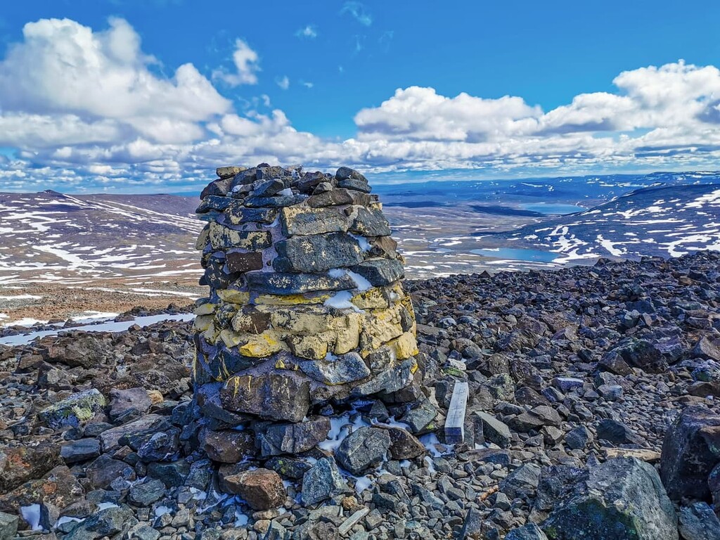
To help you to navigate in the Paistunturi Wilderness Area and avoid getting lost, I'll point out a few peaks here also. They can be found on PeakVisor’s 3D Maps:
Like geology, the landscape of Paistunturi Wilderness Area is also typical of the whole of Lapland, which is a vast, sparsely populated area.
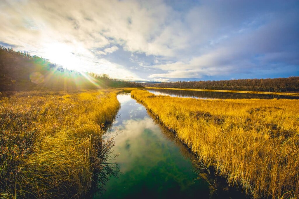
It has five main features, four of which you will find in this wilderness area: the long chains of fells or small hills (Luomusharju Ridge, Ailigas and Paistunturit Fells, which gave the name to the area) up to 600–700 meters (1,968–2,296 ft) in elevation, reindeer pastures and farms, gorges and canyons (Kevo Canyon), and rich water resources.
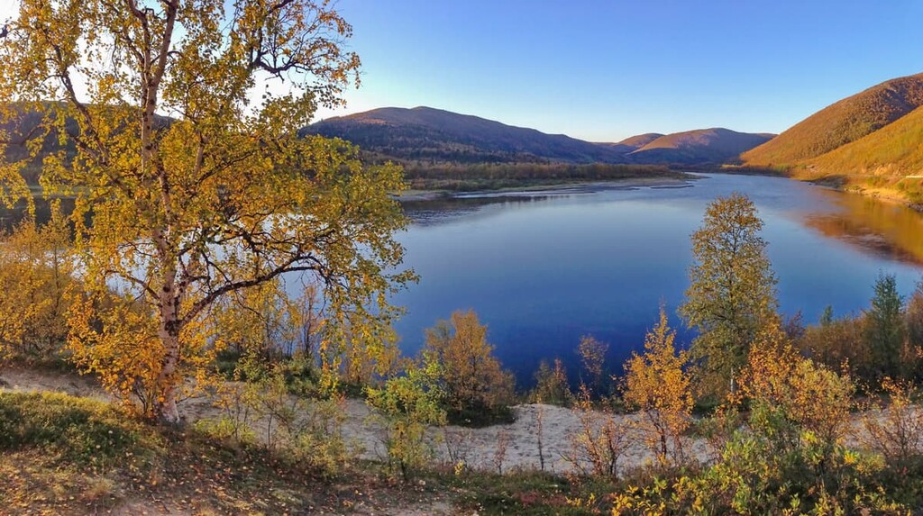
The latter includes many rivers such as Kaamasjoki River in the south, and Tenojoki River in the west and the north, and swamps of the two main types: aapa mires and palsa mires. There are some lakes (Luomusjärvet) and ponds, too, but not as many as in the Lake District of Finland in the southeast of the country.
In Paistunturi, however, we do not see the fifth characteristic feature of Lapland's landscape—an old-growth pine forest. Just as in the mountains, where high trees and other vegetation stop growing at heights above 2,000 m (6,561 ft), the further north you go, the fewer plants can survive. Only small trees and shrubs thrive at such latitudes.
However, there are still many trees here but these are mostly low mountain birch forests. They are contrasted with the bare treeless fell fields. But they have one incredible advantage: the birch leaves are very beautifully colored gold and red in the fall. This effect is called ruska in Finnish. Hundreds of thousands of Finns and tourists from other countries come here every year to see this gorgeous event.
In addition to the different shrubs and low birch forests typical of fells, the Paistunturi Wilderness Area has mostly marsh plants or those that like river and lake banks: dwarf willow, blue heath, Lapland diapensia, great pond-sedge, and others.
There is a lot of crowberry and cloudberry in the mires, too. These are medicinal and food plants that contain a lot of vitamin C. You can eat them fresh, freeze them for the winter, or make jam from them. Local northerners have been doing so for centuries due to the lack of fruit and vegetables here—so did I living for 7 years in the north of Russia.
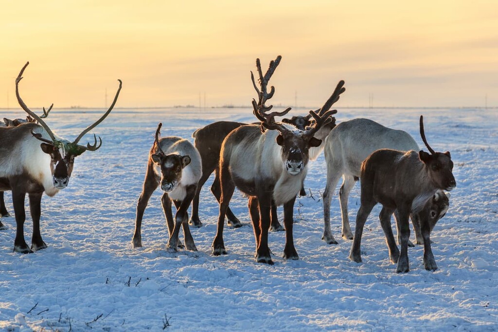
Speaking of animals, in addition to reindeer and moose, there are voles, lemmings, hares, martens, and foxes, among other species.
There were also traditionally a lot of Arctic Fox (Alopex lagopus) but they have almost disappeared from the area. The same goes for gyrfalcons (Falco rusticolus). They are so rare here now that staff at the local Natural Heritage Services of Lapland ask to be notified by phone if you see these rare birds.
Among other birds, here you can still see the willow grouse, Eurasian golden plover, and rough-legged buzzard. The willow grouse is especially important for Paistunturi because it used to be the main prey of local hunters, who even sold them to the Norwegians or traded them for flour, butter, sugar, and other food.
They caught the birds using the special traps placed throughout the territory. It is said that one person could take care of about 400 traps a day. So the birds were caught in great numbers. The hunters lived for weeks in sod huts to check the traps several times a day before the birds were taken by foxes, and other predators.
It is also worth noting that many of the wilderness’ ponds, lakes, and rivers have plenty of fish. In particular, all three major rivers in the Paistunturi area, including the Tara River, are very good for salmon fishing.
In general, Lapland is a paradise for those who love fishing. In addition, it is relatively close to the ocean—if you cross the border with Norway. I know from my experience with Finns from the tourism industry that many people come here to visit two countries at once, so it’s worth making the trek to the ocean if you have the time.
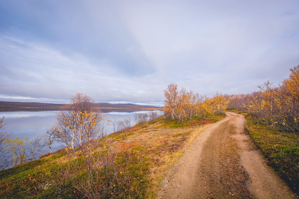
Due to the wilderness characteristics of the area, there is just one marked trail in Paistunturi called Utsjoki Hiking Trail. But, it offers amazing views and adventures on the way. Here’s what you need to know:
The Utsjoki Hiking Trail trail starts in the center of Utsjoki. Then there are two options: a 25 km (15.5 mi) point-to-point trail, which ends at the Mantojärvi Church at the southern end of this smaller area, or a 35 km (21.7 mi) loop trail with start and finish in Utsjoki.
On the 25 km (15.5 mi) route, you will see many natural attractions of the northern part of this wilderness, including numerous lakes (Goahppelašjávri, Nammajärvi) and river valleys such as Badjeseavttet River. Do note that you will need to cross the Badjeseavttet, so be cautious when doing so.
Additionally, this trail includes a chance to summit Roavveoaivi Fell (466 m / 1,528 ft), on top of which you can also see Rastigaissa Fell in Norway.
The longer 35 km (21.7 mi) route includes the previous trail plus an additional 10 km (6.2 mi) section between Utsjoki and Mantojärvi Lake. Here you will go through the valley of the Vuolleseavttet River and climb the Vuolleseavttetvárri Fell (299 m / 980 ft), before descending to Utsjoki.
You can also hike from Paistunturi to Kevo, where there are more trails, including two routes of 65 km (40.3 mi) and 85 km (52.8 mi) in distance.
Do note, however, that when hiking in the Paistunturi outside the Utsjoki Hiking Trail, you can enter and hike further in the Kevo only by and on the marked trails. Please take a look at the map of the official website of the national parks of Finland to better understand where these trails are located.
There is a small info point in Utsjoki with information and tips on hiking in the Utsjoki region, including in the Kevo Strict Nature Reserve and in nearby wilderness areas.
Utsjoki Nature Information Hut
Miessipolku, 2, 99980, Utsjoki, Finland
+358206397792
Read about particular rules and regulations in the wilderness area and in Kevo Nature Reserve on the official site of the Finnish national parks.
Note that the emergency phone number in Finland is 112. However, when hiking in the wilderness, try to keep your phone warm and bring a power bank because this is a place with cold temperatures, even in the summer. There are many locations with no mobile coverage in the area, too. Always let someone know about your itinerary and timetable before heading outside.
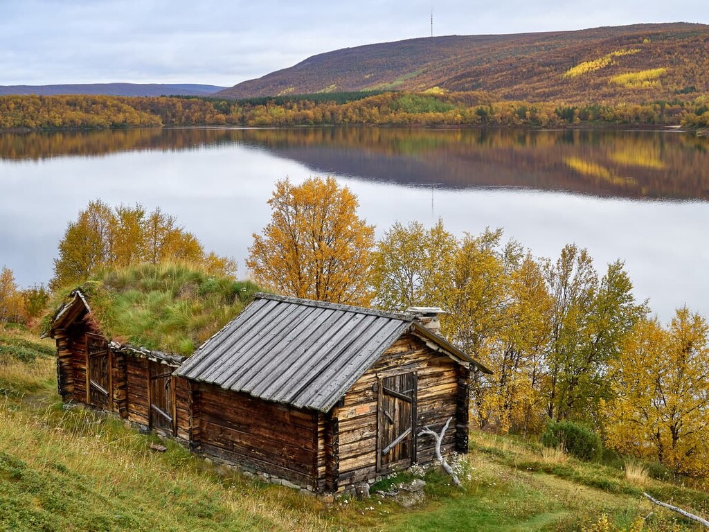
There are several campfire sites on the lakes along the only trail in the wilderness area, where you can cook food and pitch your tent. You can also pitch your tent everywhere in the wilderness, but not on the trail.
There is one open wilderness hut on the trail at the Goahppelašjávri Lake, where you can spend the night or even two. These are huts with shared rooms for 4 to 10 people, so there’s a chance of meeting others, even though this isn’t very likely.
In the village of Utsjoki, you can find other accommodation options, including parking lots for caravans. The village also has all of the basic services, including different shops, a post office, and a health center.
Founded in 1876, Utsjoki is the northernmost municipality in Finland on the border with Norway. Today it has 1,219 inhabitants (2021) who live in an area of 5,144 sq km (1,986 sq mi). The population density here is incredibly small—only 0.24 inhabitants per 1 sq. km (0.62 sq mi).
In addition to the village of the same name, the municipality includes Nuorgam and Karigasniemi, where the main population center is, as well as Nuvvus, Dalvadas, Outakoski, Rovisuvanto, and Kaamasmukka.
The village is distinguished by the fact that here lives the largest number of Sámi people—about 46.6% of the population—who speak the Sámi language and preserve their traditions and culture.
The main economic activity of the Sámi and other residents of the region, like hundreds of years ago, is reindeer breeding, hunting, and fishing, as well as tourism. Apart from hiking, tourism in Utsjoki is all about salmon fishing because the Tenojoki River is one of the largest and best salmon rivers in all of Europe. But, snow-based activities are limited here because there are no ski resorts.
Every year the sun does not set here from 17 May to 28 July (73 days) during the period of the Midnight Sun. At the same time, the sun does not rise from 26 November to 15 January (51 days) during the aptly named Polar Night.
The main architectural and cultural attractions of Utsjoki are the following:
The official site of the municipality is Utsjoki.fi. However, it is only available in Finnish, so check out these official tourist sites in English: Inarisaariselka.fi, Lapland.fi, and Exploreutsjoki.fi.


