Scan the QR code and open PeakVisor on your phone
The Muotkatunturi Wilderness Area is one of the 12 wilderness areas in Finland. It is located in the Lapland region and it is often referred to as “the wildest of all wilderness areas”. There are no marked hiking trails in the wilderness, though adventurous visitors can trek to see the huge Peltojärvi Lake. There are 68 named peaks in the Muotkatunturi Wilderness Area, the highest and most prominent of which is Kuarvikozza (591 m / 1,939 ft).
The name of the Muotkatunturi Wilderness Area comes from that of the mountain range Muotkatunturi. This is a word in Sámi, the language of the Indigenous people of Lapland, that ghly means “an arc between bodies of water.” It’s a reference to the old days when people traditionally used boats to travel around the area.
However, the second part of the region’s name—wilderness area—should also be briefly explained.
In Finland, wildernesses are areas that feature no human development. Here, you can wander for weeks and meet no other people. However, this is not designed to scare people, but rather to attract locals and tourists who want to experience nature first-hand. This is why all of Finland’s 12 wildernesses are as popular for hiking and other outdoor activities as national parks and nature reserves.
You can learn more about the meaning of Finland’s wilderness areas in the guides to Paistunturi and Käsivarsi.
Like all the 12 wilderness areas of Finland, Muotkatunturi is situated in the northern part of Lapland region. Administratively, it belongs to two municipalities: Utsjoki and Inari. The latter is the largest in the country and the capital of Sámi culture.
The total area of the Muotkatunturi Wilderness is 1,570 square kilometers (610 sq. mi). To the west, its border almost coincides with Finland’s border with Norway, while to the east lies the fifth largest lake in Finland, Inari.
To the north, Muotkatunturi is bordered by the Paistunturi Wilderness Area and the Kevo Strict Nature Reserve. Finally, to the south, it is bordered by Lemmenjoki National Park.
You can reach the wilderness area from the town of Inari, which in turn can be reached from Rovaniemi, the capital of Lapland.
The distance from Rovaniemi to Tirro, the nearest settlement to the southern border of the wilderness area, is 344 km (213 mi) or 4 hours by car. To Karigasniemi, which is located on the northern border of the area, the distance from Rovaniemi is 444 km (275 mi) or 5 hours and 30 minutes of driving.
During both summer and winter seasons, there are daily local buses that travel between Ivalo and Karigasniemi. Between the capital of Lapland and Helsinki, you can also use a bus, train, or plane.
In general, the geology of the wilderness area has the same features as that of the greater Lapland area.
The main rocks that you can see here during your hiking trip are various types of granites, gneisses, shales, and quartzites. They come from the Baltic Shield, a segment of the Earth’s crust that extends under all of Scandinavia and Finland. It is between 1.5 and 3 billion years old.
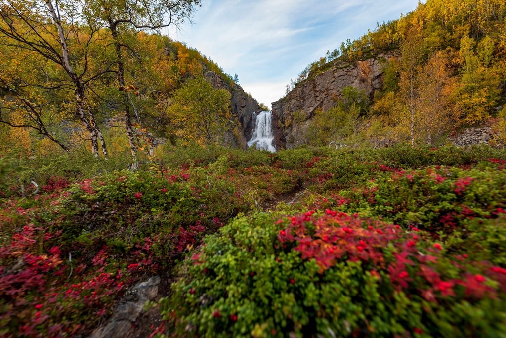
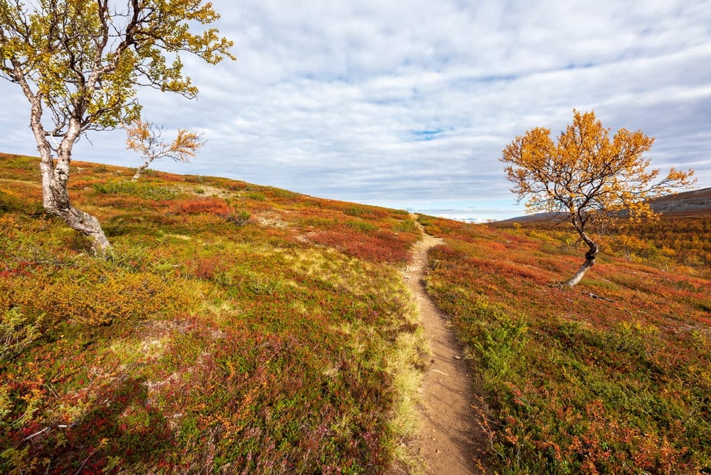
The landscape of the wilderness area can be described as quite diverse and very beautiful. For example, one of the locals describes his hike through the area this way: "I found something to photograph every hundred meters or so."
To the northeast of the wilderness, there are extensive marshes. Walking through them is not recommended because you can fall through. To the southwest, you will find yourself in a thick and wild pine forest, which is easy to get lost in, too.
There are also several chains of low hills separated by river valleys that extend outward from the center of the wilderness area. The summits of these hills provide you with 360-degree views of the region.
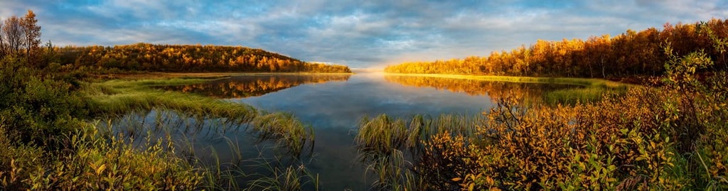
Finally, the main feature of the wilderness area is Peltojärvi Lake, which is located on the eastern borders of Muotkatunturi. It is the largest of more than a dozen lakes in the Muotkatunturi Wilderness, and it runs roughly in a southwest to northeast direction. The lake is about 6 kilometers (3.7 mi) long, yet it is also quite wide.
The lake is also famous among the locals as a great place for fishing. It is also a great place for anyone looking to take a beach vacation as the lake has sandy shores. While this may seem like a joke, it’s quite true. You can see the beachy aspect of the lake by checking out some archival photos from the local photographer Pertti Pitkanen.
The mountains in the Muotkatunturi Wilderness Area belong to the same mountain groups as most of the peaks in Lapland.
These are low hills or fells with an average height of 500–800 m (1,640–2,624 ft), although earlier—or rather to say, much earlier—about 2 to 3 billion years ago—they were the same height as the Alps and many of the peaks in the region reached 5,000 m (16,404 ft) above sea level.
This ancient mountain range that was once found in Lapland but does not exist today is called the Karelides.
Therefore, the Muotkatunturi mountains impress not because of their height but because of the vast views that you can enjoy from their summits. The open rolling fell landscapes of the southern, central, and northern parts of the area are what most hikers come here to enjoy.
The mountain range of Muotkatunturi includes at least 68 fells that are distributed roughly evenly over its territory. Of all these mountains, two are worth highlighting:
Kuarvikozza (591 m / 1,939 ft) is the highest mountain in the wilderness. It is located closer to the southern borders of the wilderness where there are roads and settlements.
The name of the mountain is a Sámi word in the local Inari dialect, which is made up of two words: kuárvi means “ledge” or “rim,” and kozzâ, which means “nail.”
Kuarvikozza features outcroppings of shale that give the peak a jagged summit. This makes Kuarvikozza stand out among the surrounding rounded fells. The best routes to the summit are from the northwest or southeast, as the southern slope of the peak is steeper than the rest.
Peltotunturi or Peldoaivi (567 m / 1,860 ft) is the closest major peak to Peltojärvi Lake. It is also located relatively close to Kuarvikozza.
The name of the mountain is also a word in the Sámi language, and it has two different variants: Bealdoaivi in the Utsjoki dialect and Piälduáivi in the Inari dialect.
While climbing Peltotunturi, you can enjoy a magnificent view of the lake, other mountains, and forests, which is why hundreds of travelers come here every year. The mountain is relatively easy to climb from all directions.
The flora in the wilderness primarily includes mountain birch forests and pine forests. There are also a number of shrubs, such as blueberries and lingonberries, and a small number of flowers in the wilderness.
By the way, remember that picking berries and mushrooms are allowed throughout the wilderness area under the “Everyman’s Right.” However, be sure to do your research to learn more about which berries and mushrooms are edible before your journey. When in doubt, it’s best not to eat an unknown berry or mushroom in Lapland.
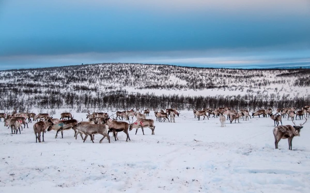
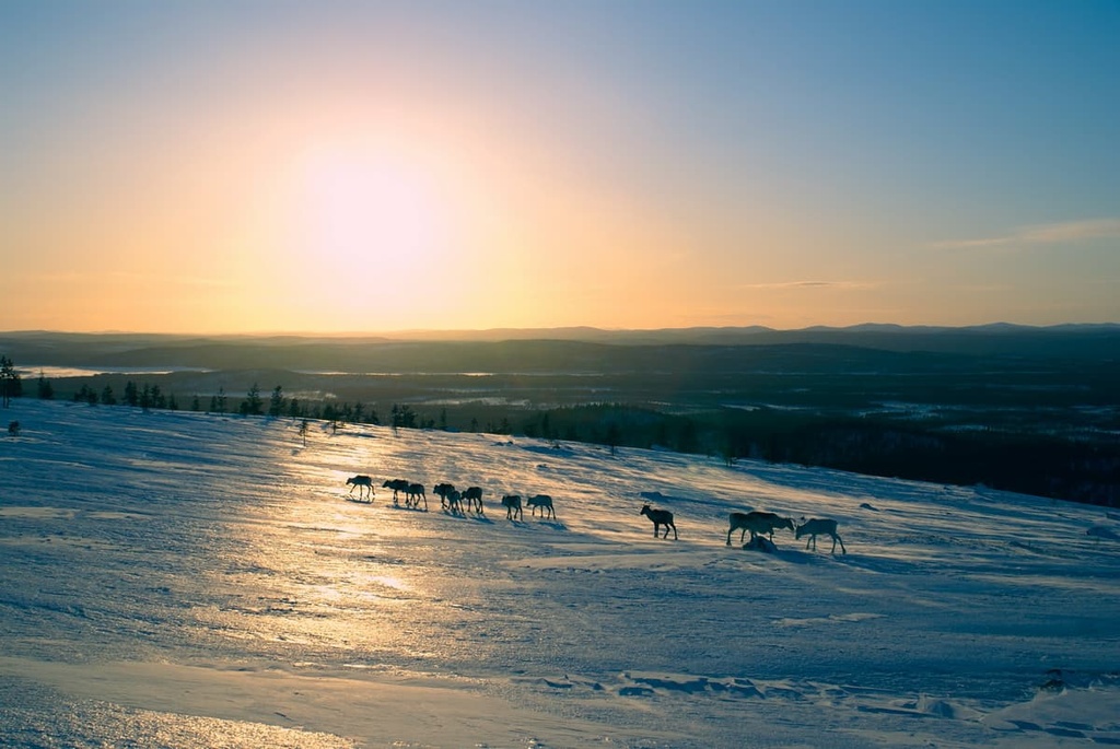
The animal life here includes hares, foxes, and other species that are typical of Lapland, such as the wolverine. However, like, again, everywhere in Lapland, the reindeer are considered the main animal in the wilderness. Reindeer herding is still an important source of livelihood in the region.
Among birds, there is a large population of golden eagles in the area as well as rough-legged buzzards, gray-headed chickadees, willow ptarmigans, and Siberian jays.
Finally, the rivers and lakes of the wilderness are rich in fish species such as grayling, trout, whitefish, pike, and perch, among others.
The Muotkatunturi Wilderness Area has no marked hiking trails, but you can navigate freely using a compass and orienteering skills. Given that hundreds of other people have done this before you, it’s very likely that you’ll stumble upon unmaintained herd paths or “folk trails” during your visit to the wilderness.
There is at least one such trail in the wilderness, an old postal trail that goes from the village of Tirro to the village of Karigasniemi past the highest point of the area, Kuarvikozza. The distance from Tirro to the fell is approximately 20 km (12.4 mi). But, keep in mind that this is only an unpainted trail without markings, so good orienteering skills are required.
Despite the lack of marked trails in Muotkatunturi, the area is relatively easy to walk through due to the presence of sparse birch forests and plenty of open spaces.
Creeks and rivers here are usually not deep, so they can be easily crossed. However, still be careful in spring, when rivers tend to flood. The Kiela and Peltojoki rivers are also the most full-flowing and difficult to cross streams all year round.
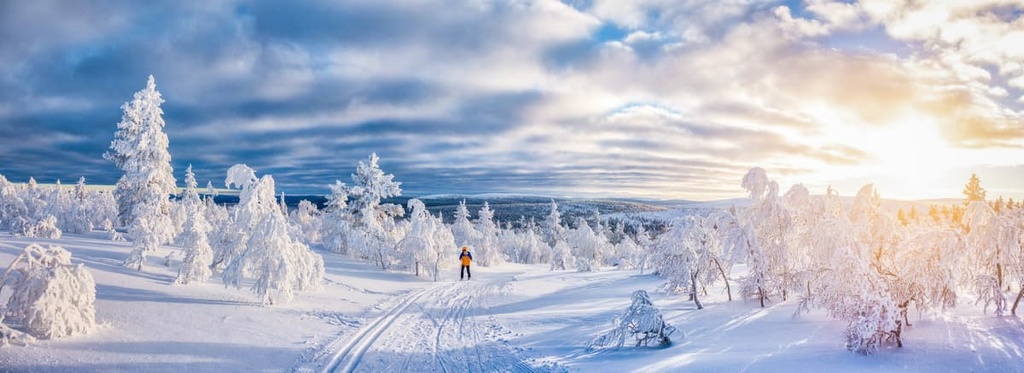
During the snowy winters, there are skiing opportunities throughout Muotkatunturi.
However, there are no marked ski trails, so the same rules and guidelines apply as for hiking: you will need to be in good physical condition and you need to have the right equipment and skills to venture into the Finnish wilderness during the winter.
The closest ski resorts with maintained slopes are located about 200–300 km (124–186 mi) to the south of the wilderness area. Actually, these are the largest resorts in the country, also known as “The Big Four:” Levi, Ylläs, Pyhä-Luosto, and Ruka.
Each of these resorts is located at an elevation of about 500 to 700 m (1,640 to 2,296 ft) and they boast ski trails of up to 3 km (1.8 mi) in length.
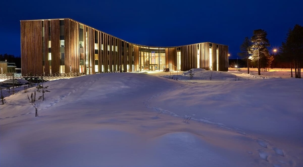
There is no visitor center within the Muotkatunturi Wilderness Area, but you can get more information about the region, buy paper maps and souvenirs, book rental wilderness huts, and more at the “Siida” Museum and Nature Center, which is located in Inari. This is also the main museum of Lapland and the local Sámi culture.
The Sami Museum and Northern Lapland Nature Center “Siida”
Inarintie, 46, 99870, Inari, Lapland, Finland
+358401689668
General opening hours: June to October, 9 am to 5 pm
Tickets:
As for the rules and regulations in the wilderness areas such as Muotkatunturi, most of the regulations that exist for national parks and nature reserves also pertain to wilderness areas.
However, in wilderness areas, you can generally also walk wherever you’d like (due to the lack of maintained trails).
You can also have fires wherever you’d like in a wilderness and you’re allowed to collect dead branches for your fire. The only exception is when there is a wildfire warning period, which usually takes place in the middle of summer in July and August. You can, however, use camp stoves during this time.
Read about particular rules and regulations in the wilderness on the official site of the Finnish national parks.
Note that the emergency phone number in Finland is 112. However, when hiking in the wilderness, try to keep your phone warm and bring a power bank because this is a place with cold temperatures, even in the summer. There are many locations with no mobile coverage in the area, too. Always let someone know about your itinerary and timetable before heading outside in the Finnish Wilderness.
As was mentioned at the beginning of this guide, Muotkatunturi Wilderness Area has no developed tourist infrastructure. Therefore, we have to thank Metsähallitus, the main forestry agency for Finland, which is also responsible for the management of all natural areas of the country, for the two open wilderness huts that they built in the wilderness.
The huts are called Kurtojoki and Stuorravzi and are located in the south and north of the wilderness area, respectively.
In Kurtojoki, you will find sleeping places for six people. In Stuorravzi, there is enough space for seven people. There are also several other buildings in the wilderness that you may well stumble upon during your hike.
However, given the lack of other lodging options in the wilderness, it’s best not to count on these huts being available. So bring a sturdy tent and a sleeping bag that’s rated for use in cold temperatures whenever you venture into the wilderness.
According to the rules of camping in Finnish wilderness areas, you can set up your camp in any spot you choose. However, the recommendation of the Metsähallitus is to use impacted tent sites from other hikers to reduce your impact on the terrain.
Before and after your hike, you can easily find lodging in one of the small settlements on the borders of the wilderness area. Most of the accommodation options that you’ll find are summer and winter cottages, the traditional type of vacation accommodation in Finland, which are well-built wooden buildings with a sauna.
There are many small towns and villages around the "wildest of wilderness areas" of Finland where you can begin and end your journey. Some of them are worthy places to visit in their own right.
For example, the main local town, Inari, east of the area is the capital of the Sámi people. In addition, it is located on the lake of the same name, Inari, which is very large and beautiful. You can read more about the town in the guide to Lemmenjoki National Park.
On the southern borders of the area, there are a number of small settlements that are convenient to start hiking from, such as Tirro, Saukko, Kotkajärvi, Tulvalahti, Riutula, and Kettukoskenniska. They are located a couple of kilometers from each other.
You will also pass towns such as Ahmaniemi, Kaamanen, and Tuurukoskenniemi on your way north along the eastern border of the wilderness area.
Finally, the largest settlement on the northern borders of the area, Karigasniemi, is located right on the border with Norway, which, in turn, forms the western boundary of the area.
There is a road along the border, which is considered one of the most picturesque in Finland. There are also many settlements located along it, such as Kamiljoki, Kuolna, Jokiranta, and Angeli
To learn more, check out the official tourist site of Inari: VisitInari.fi.