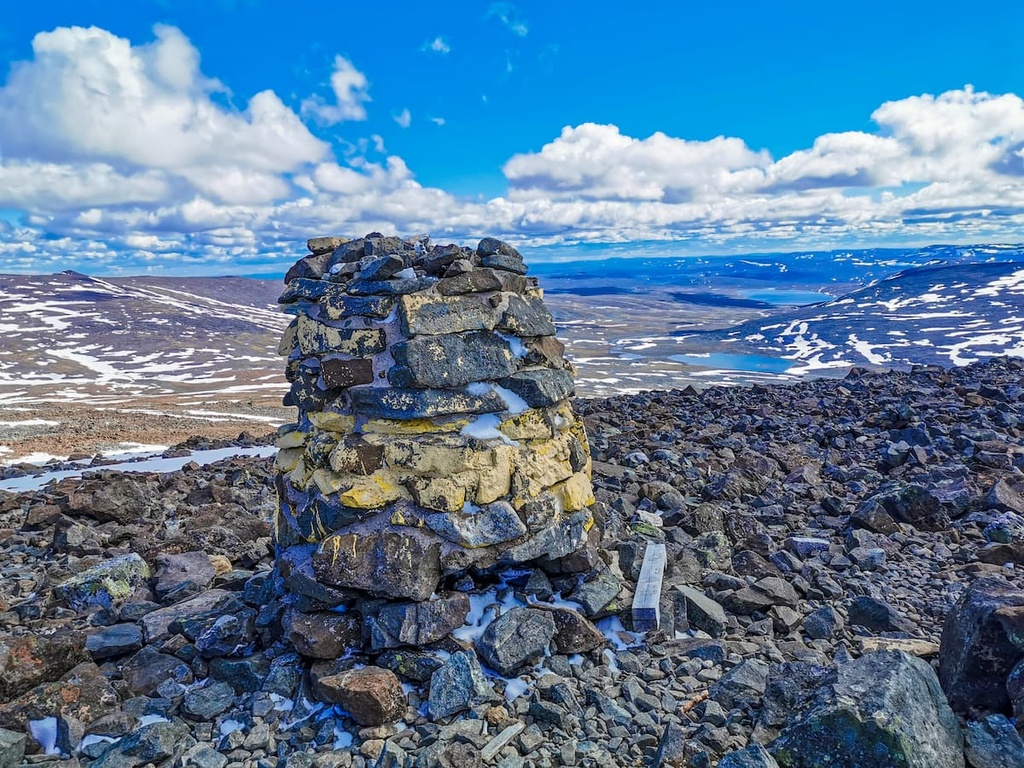
Halti (Finnish: Halti, rarely Haltiatunturi, Northern Sami: Háldičohkka, Swedish: Haldefjäll) is a fell at the border between Norway and Finland. The peak (elevation 1,365 m (4,478 ft)) of the fell, called Ráisduottarháldi, is in Norway, on the border Nordreisa Municipality and Gáivuotna Municipality (Kåfjord), about one kilometre (5⁄8 mile) north of the border with Finland. The highest point of the fell on the Finnish side is at 1,324 m (4,344 ft) above sea level, and thus the highest point in the country. The Finnish side of Halti belongs to the municipality of Enontekiö in the province of Lapland.
The highest point in Finland is on a spur of Ráisduottarháldi at 1,324 m (4,344 ft) known as Hálditšohkka at the border of Norway. The peak proper is not in Finland; the border marker is on a slope. The highest peak of a mountain that is entirely in Finland is Ridnitšohkka, at 1,316 m (4,318 ft) and a few kilometers from Halti.
The reason for the border being the way it is can be traced to a Swedish-Danish border treaty in 1734, when Norway belonged to Denmark and Finland was part of Sweden. The treaty specifies the border only by some of its biggest natural features like mountains. Thus, international boundary commissions would walk the border and place border markers where it was convenient. The actual border was then agreed to lie on a straight line between these markers, as was the usual practice at the time.
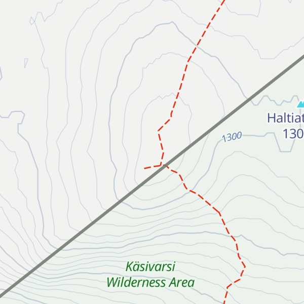
A 55 km (34 mi) trekking path leads from Saana, Kilpisjärvi to Halti. An easier route goes from a local road (open in summer only) going from Birtavarre in Norway, around 6 km (3+1⁄2 mi) hiking to the highest point in Finland. The route is rocky and not really adapted to hiking.
There's a demading hiking trail (T3) called Kalottireitti leading to the summit.
By elevation Halti is
# 1 out of 1462 in Lapland # 1 out of 77 in Käsivarsi Wilderness Area # 1 out of 3767 in Finland
We use GPS information embedded into the photo when it is available.
3D mountains overlay
Adjust mountain panorama to perfectly match your photos because recorded by camera photo position might be imprecise.
Move tool
Rotate tool
Zoom
More customization
Choose which peak labels should make into the final photo and what photo title should be.
Next
Photo Location
Satellitte
Flat map
Relief map
Latitude
Longitude
Altitude
OR
Latitude
°'''
Longitude
°'''
Apply
Register Peak
Peak Name
Latitude
Longitude
Altitude
Register
Teleport
PeakVisor
This 3D model of Sagarmatha National Park in Nepal was made using the PeakVisor app topographic data. The mobile app features higher precision models worldwide, more topographic details, and works offline. Download PeakVisor maps today.
Download OBJ model
PeakVisor
The download should start shortly. If you find it useful please consider supporting the PeakVisor app.
PeakVisor for iOS and Android
Be a superhero of outdoor navigation with state-of-the-art 3D maps and mountain identification in the palm of your hand!


.jpg)