Scan the QR code and open PeakVisor on your phone
Troms og Finnmark is Norway’s northernmost and largest county, formed by the 2020 merger of Troms and Finnmark. Located well north of the Arctic Circle, it’s the pinnacle of Norway’s natural beauty, with dramatic mountains, remote forests, some of the deepest wilderness in Europe, and a blend of Sámi and Norwegian culture. This vast region is a mountainscape; according to our models, there are at least 18552 named mountains in Troms og Finnmark. The highest and most prominent mountain is Jiehkkevárri (1,834 m / 6,017 ft). Read on for all the juicy details regarding recreation and the natural environment in Troms og Finnmark, including the geology, ecology, best hikes, and, of course, ski touring!
Troms og Finnmark occupies the northeastern corner of mainland Norway, bordering Sweden, Finland, and, to most people's surprise, Russia.
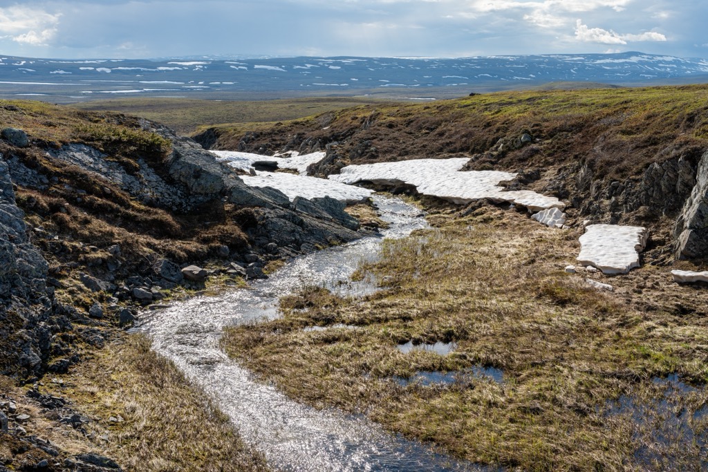
The county is divided into three main geographical zones: the coastal islands and fjords, the mountainous interior, and the arctic plateau of Finnmarksvidda.
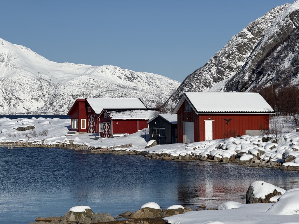
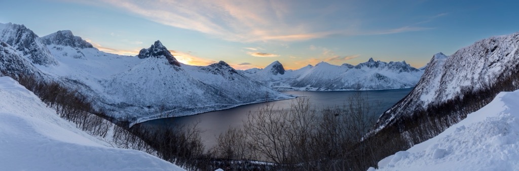
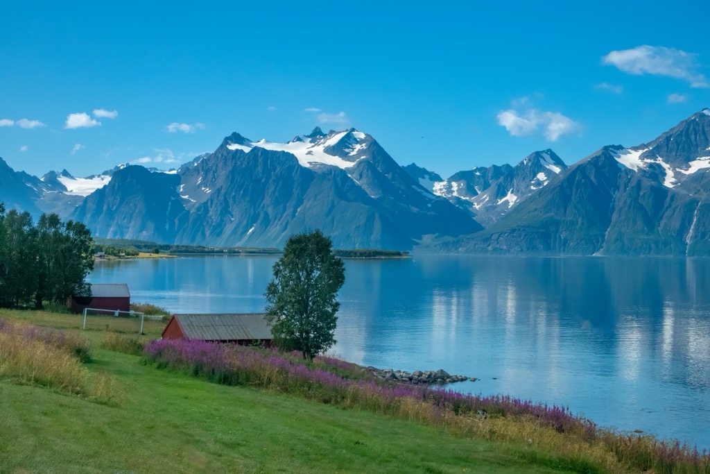
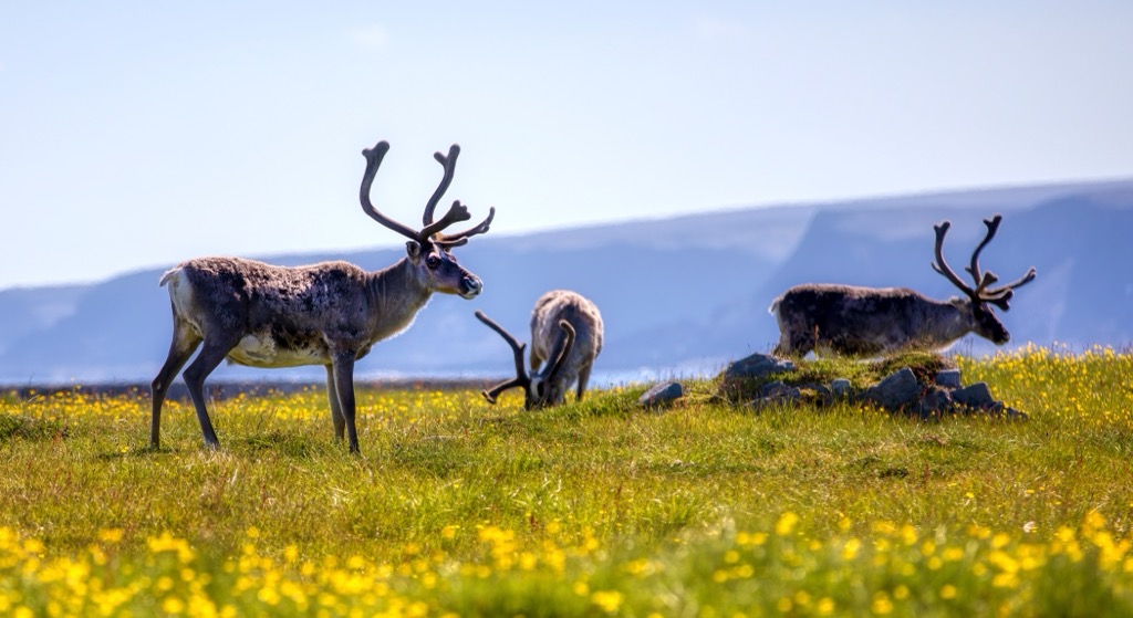
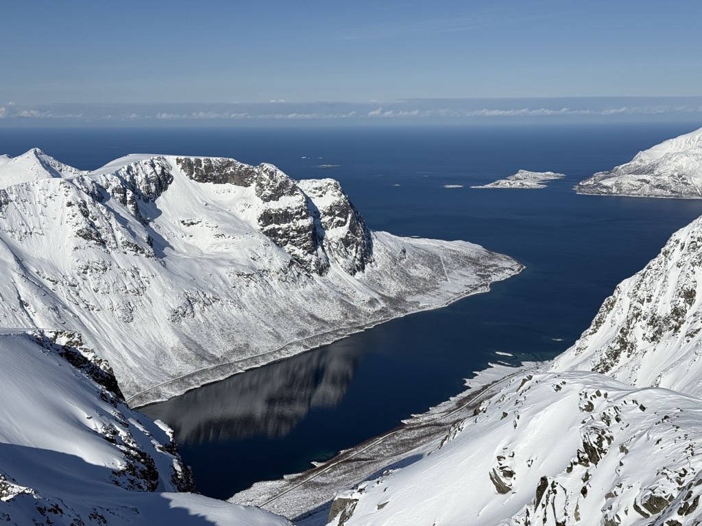
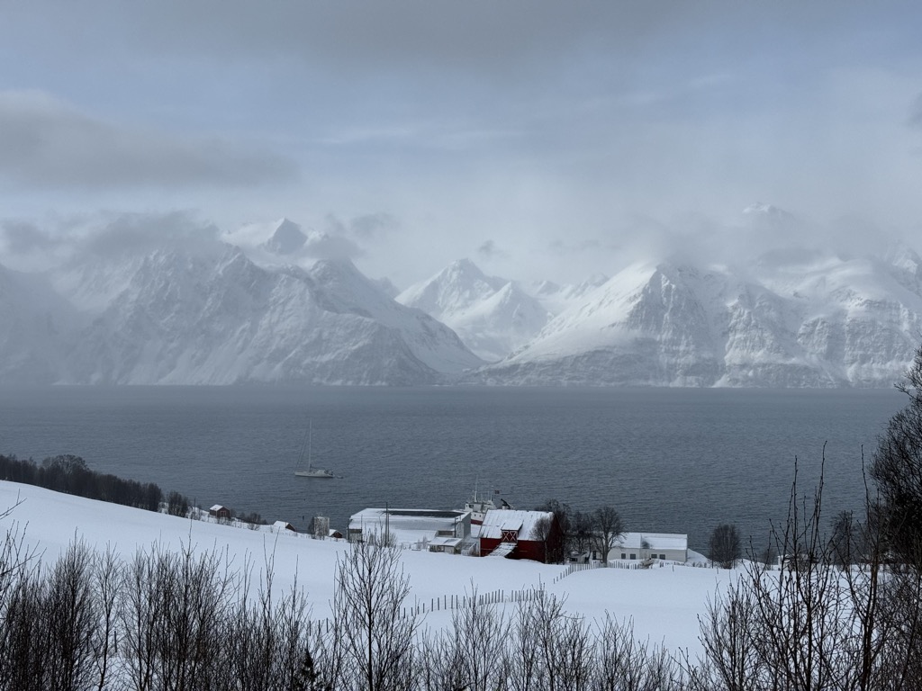
The coastline is deeply indented with fjords such as Lyngenfjord and Porsangerfjord, and is dotted with islands like Senja and Kvaløya. The interior is also rugged and alpine, with mountain ranges including the famous Lyngen Alps, which reach over 1,800 meters. Further east, the Finnmarksvidda plateau dominates the landscape. This vast tundra is one of the largest wilderness areas in Europe and is a traditional reindeer grazing area.
The climate varies drastically within the region. Coastal areas benefit from the moderating effect of the Gulf Stream, with relatively mild, wet winters, while inland and northern areas are subject to harsh Arctic conditions like permafrost.
Troms og Finnmark bedrock consists of ancient Precambrian rocks interspersed with younger Caledonian orogeny formations. The Caledonian orogeny, a mountain-building event that occurred roughly 400 million years ago, gave rise to much of the mountainous terrain in Troms.
The Lyngen Alps are an example of glacially carved landscapes, formed by intense glacial erosion during the Pleistocene epoch. These mountains exhibit classic U-shaped valleys, cirques, and sharp arêtes, which are all evidence of glacial sculpting. In Finnmark, sedimentary rocks like shale, sandstone, and limestone dominate, particularly in the Varanger Peninsula. The retreat of glaciers has left moraines, eskers, and outwash plains scattered throughout the region.
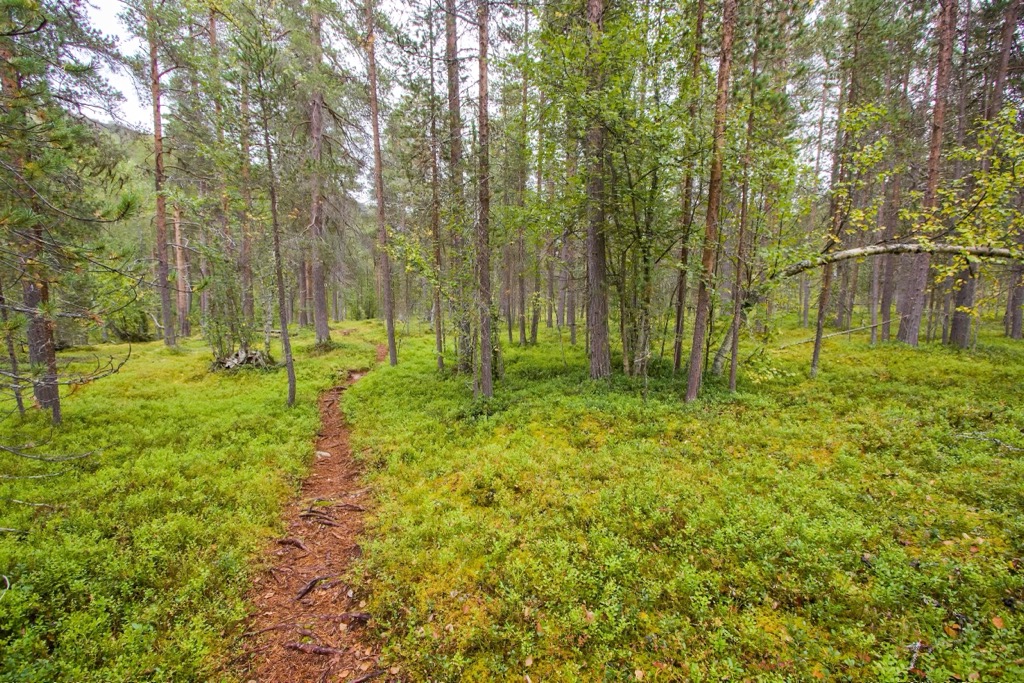
Coastal areas feature marine environments with kelp forests, seabird colonies, and populations of seals and whales. Inland, boreal forests of birch, pine, and spruce transition to subarctic tundra as one ventures farther north and away from the coast.
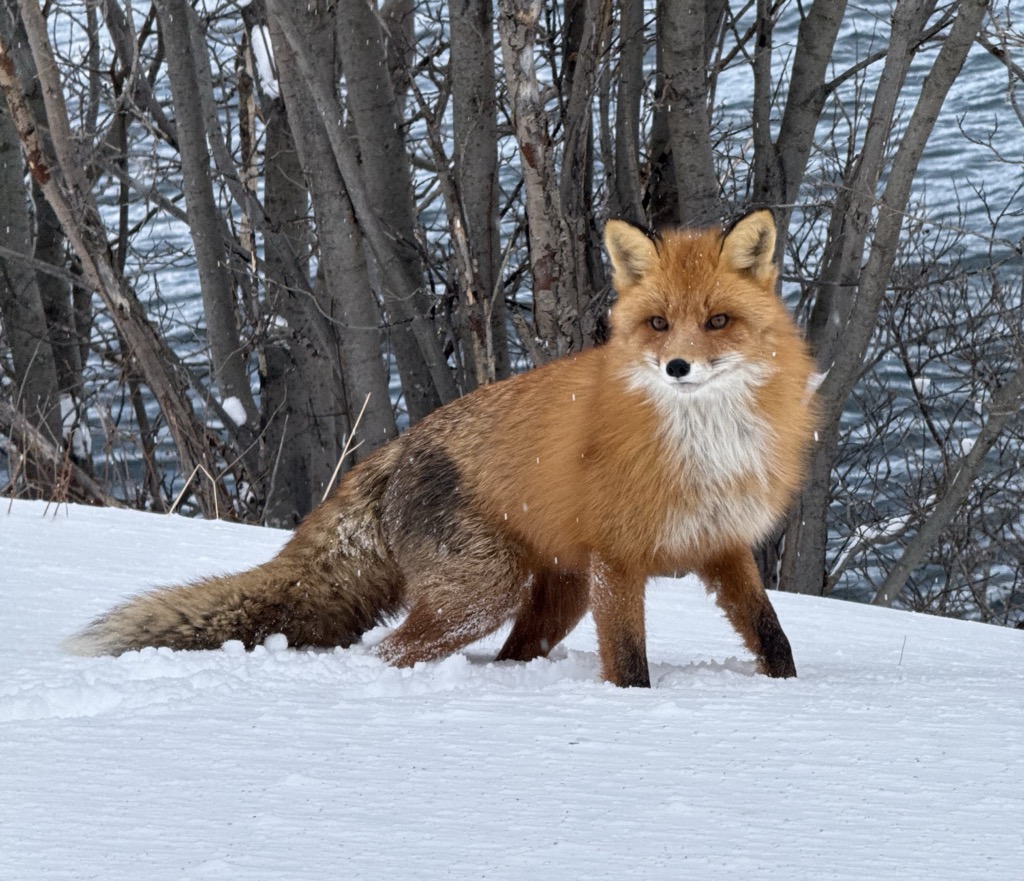
The region is a habitat for reindeer, both wild and domesticated, and is a breeding ground for bird species such as the gyrfalcon, snowy owl, and red-throated diver. In summer, wetlands and bogs bloom with insect life and become a hub for migratory birds. Red and Arctic foxes are both residents, though the Arctic fox population has been under stress since being hunted nearly to extinction, while the population of Red foxes continues to grow.
In alpine and tundra zones, mosses, lichens, and hardy flowering plants such as Arctic poppy and mountain avens dominate. The short growing season fosters high productivity in a narrow window, creating sudden, brilliant summer blooms.
Climate change has steadily been raising the snowline, creating warmer, wetter winters and springs. Heatwaves are becoming increasingly common, such as the one that melted away Sweden’s highest peak in the neighboring Swedish Lapland. Permafrost melt and increased precipitation are already affecting ecosystems and livelihoods.
Troms og Finnmark has been inhabited for over 10,000 years, with archaeological evidence showing continuous settlement since the Mesolithic. The indigenous Sámi people have been the stewards of the land for the past 3,000 or so years, especially in Troms og Finnmark. Sámi are Uralic peoples, having migrated up the Volga River basin through Northwestern Russia. Meanwhile, Norse Scandinavians, who now dominate the population of Norway, Sweden, and Finland, are Germanic-speaking peoples who came later.
During the Viking Age, these Norse settlers began to influence Norway’s coastline. In the Middle Ages, the region was contested by Norway, Sweden, and Russia, each seeking to control trade routes and taxation rights.
In World War II, Finnmark and parts of Troms were devastated during the German retreat in 1944, when a scorched-earth policy destroyed towns and infrastructure. Post-war reconstruction was rapid but reshaped much of the built environment.
Troms og Finnmark maintains a cultural duality. The majority of the estimated 40,000 Sámi individuals living in Norway live in northern Troms and Finnmark. Sámi institutions, such as the Sámi Parliament in Karasjok, play a key role in governance and cultural preservation. Festivals, museums, and language revitalization efforts continue to sustain Sámi heritage.
Troms og Finnmark is home to a lifetime’s worth of hikes. The stark, Arctic landscape limits the treeline and makes it easy to reach the alpine, where epic views abound. The biggest issue is the weather, in both summer and winter.
There’s no way around it; it rains and snows a lot in Troms og Finnmark, especially along the coast. Whether you’re heading out for a hike or a ski tour, there’s a good chance you’ll encounter precipitation, and clouds are the norm. A sunny day is something to be cherished.
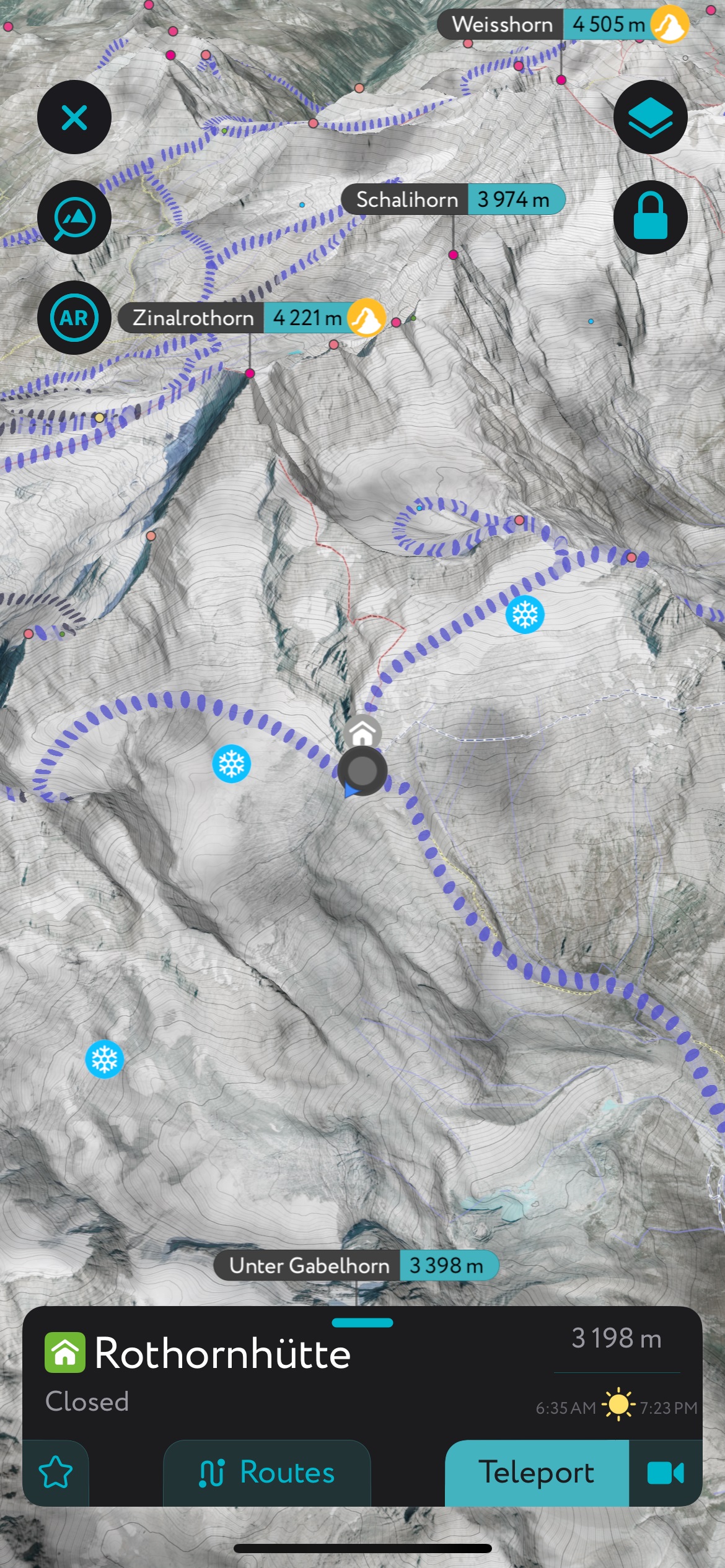
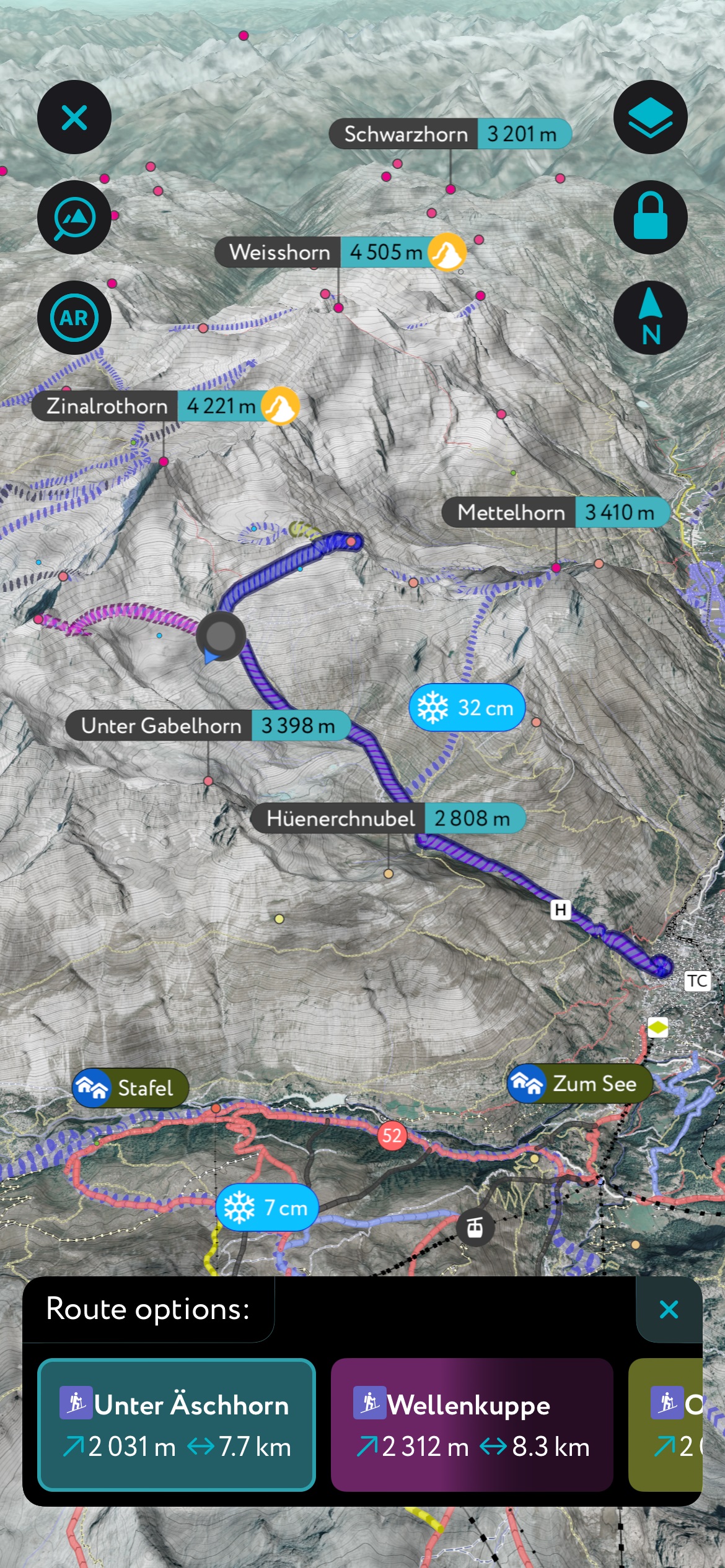
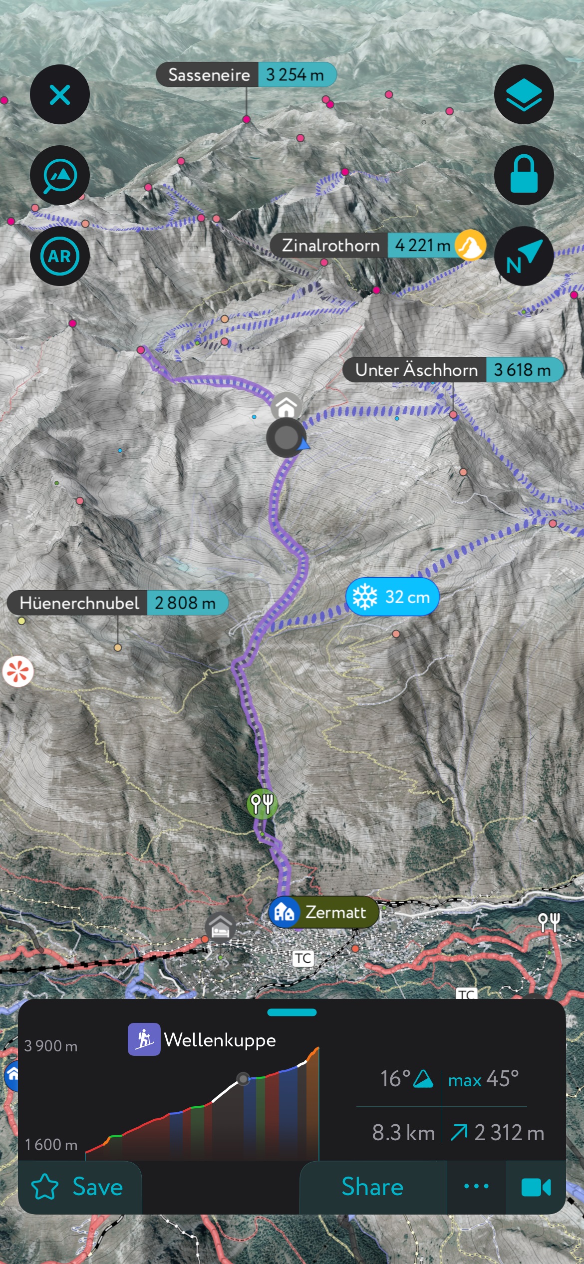
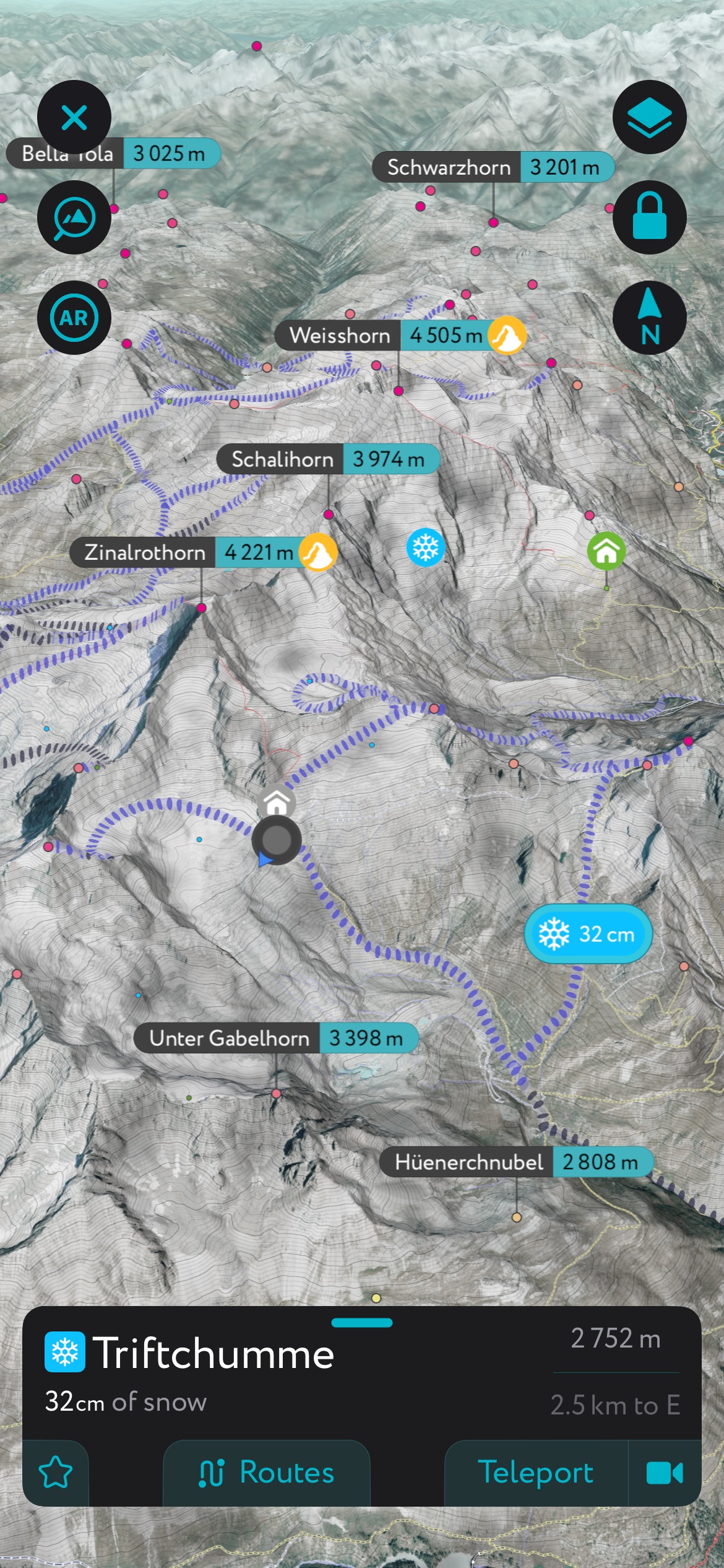
Many hiking routes in Troms og Finnmark are not shown on traditional maps. That’s because the terrain is almost entirely alpine, meaning it’s possible to hike off-trail, along rocks, dirt, and vegetation, and following terrain features like ridges. Generally, you’ll be following game trails or loosely defined hiking trails, but you’ll need route-finding skills. Follow the links to the PeakVisor hiking map, and check out all the information on our PeakVisor hiking app below.
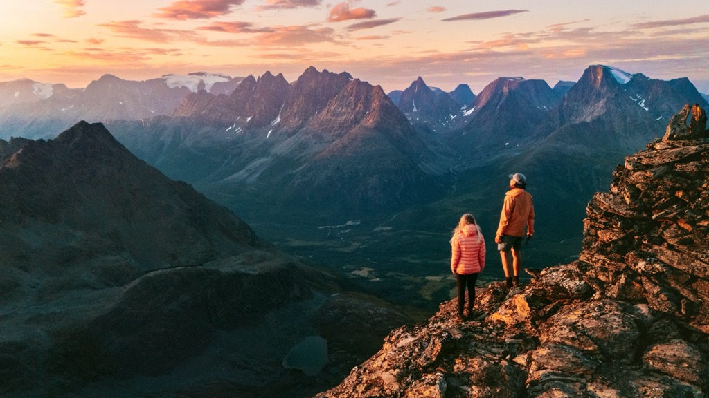
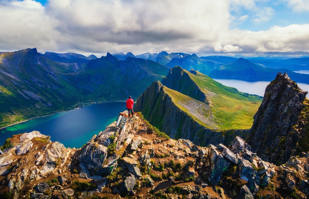
The Lyngen Alps are the most internationally famous destination in Troms og Finnmark. These are serrated, snow and ice-covered peaks that stretch nearly 2,000 meters in vertical relief (the bases are at sea level).
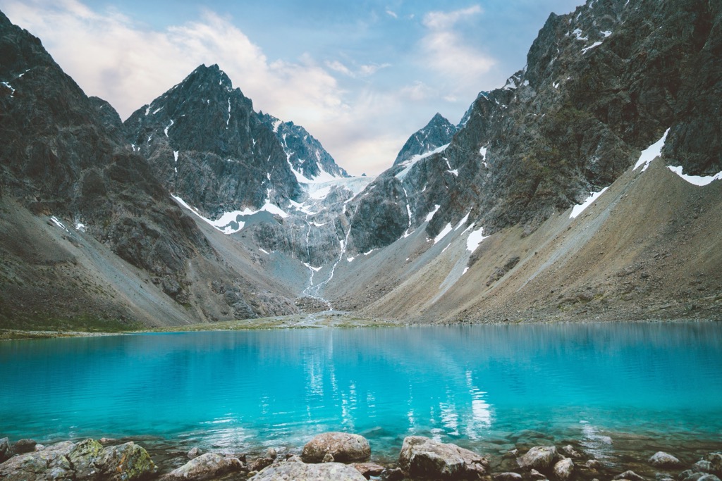
The most family-friendly option is Blåisvatnet—the Blue Lake—which is one of the most popular hikes in these mountains. It’s about 10 kilometers (6.2 miles) round-trip, with just 200 meters (660 ft) of elevation gain; most parties take about 3-4 hours, with time to stop and appreciate the turquoise waters of Blåisvatnet. Like other glacial lakes around the world, the water is turquoise due to the presence of rock flour, which is shaved off the mountain as glaciers slowly grind their way downhill.
Rørnestinden (1,041 m / 3,415 ft) is an excellent option for those looking for an accessible hike with plenty of vertical. The trail starts in the town of Lyngseidet and quickly ascends 1,000 meters to the summit. You’ll often see reindeer grazing on this hike, which is one of the most popular in the Lyngen Alps. Being in the center of the peninsula, it also offers some of the best views in the range. You can also stop at the Rørneshytta mountain refuge.
Daltinden (1,533 m / 5,030 ft) is among the highest non-technical peaks in the Lyngen Alps and is a fantastic summit for both hiking and ski touring. This behemoth offers incredible views of glaciers and fjords. Expect to encounter patches of snow late into the summer. It’s worthwhile to bring a pair of crampons or microspikes just in case. The trail begins in the valley near Furuflaten and climbs 1,400 meters (4,593 ft), over 16 km (10 miles) of distance round-trip. Expect to take at least 6-8 hours for this excursion.
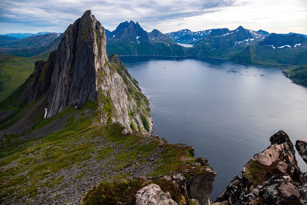
Senja is an island southeast of Tromsø, and is worth a visit from anyone coming to Troms og Finnmark. Though the Lyngen Alps are higher and more dramatic, they are also more frequented by international tourists. Meanwhile, Senja is remote and wild, accessible only by boat, and home only to a few fishing communities.
One of the most “Instagram famous” spots in Senja is the Segla, an aesthetically pleasing rock spire. The neighboring peak is called Hesten, and it’s the perch from where all those Segla pictures are taken. It’s one of the few hikes where you might see anyone else.
Hesten is a relatively easy mission from the village of Fjordgård. It’s about 3.5 km with 450 meters of elevation gain—expect it to take 2-3 hours.
The route is almost entirely alpine meadow, with epic views of the Segla and fjords throughout.
The Historic Nordkalottleden Route (including Mollisfossen) is one of northern Norway's most epic trails. Here’s a more detailed guide on this 60 km adventure.
The hike starts in Saraelv, where you’ll walk 9 km (5.5 mi) to Sieimma, the park entrance. You’ll have to cross the Reisa River by boat, where you’ll see 4,000-year-old rock paintings.
It’s about 10 km (6 mi) from here to Mollisfossen waterfall, which is 269 meters (882 ft) tall. Many people turn back and do the falls as a day hike; it’s the best option in the park.
Thru-hikers will continue across rugged canyons to Imofossen, and finally to Lake Reiavann, where the Reisavannhytta is available.
Three to four days is optimal for this thru-hike. There are many river crossings, and the season is limited to July and August.
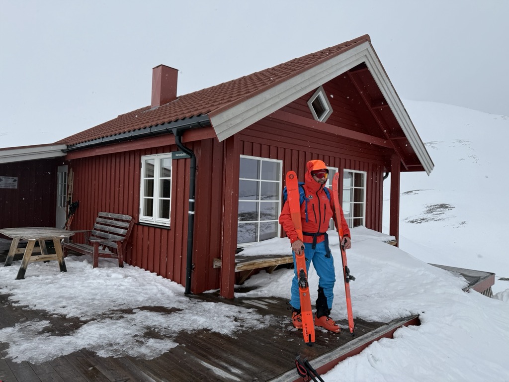
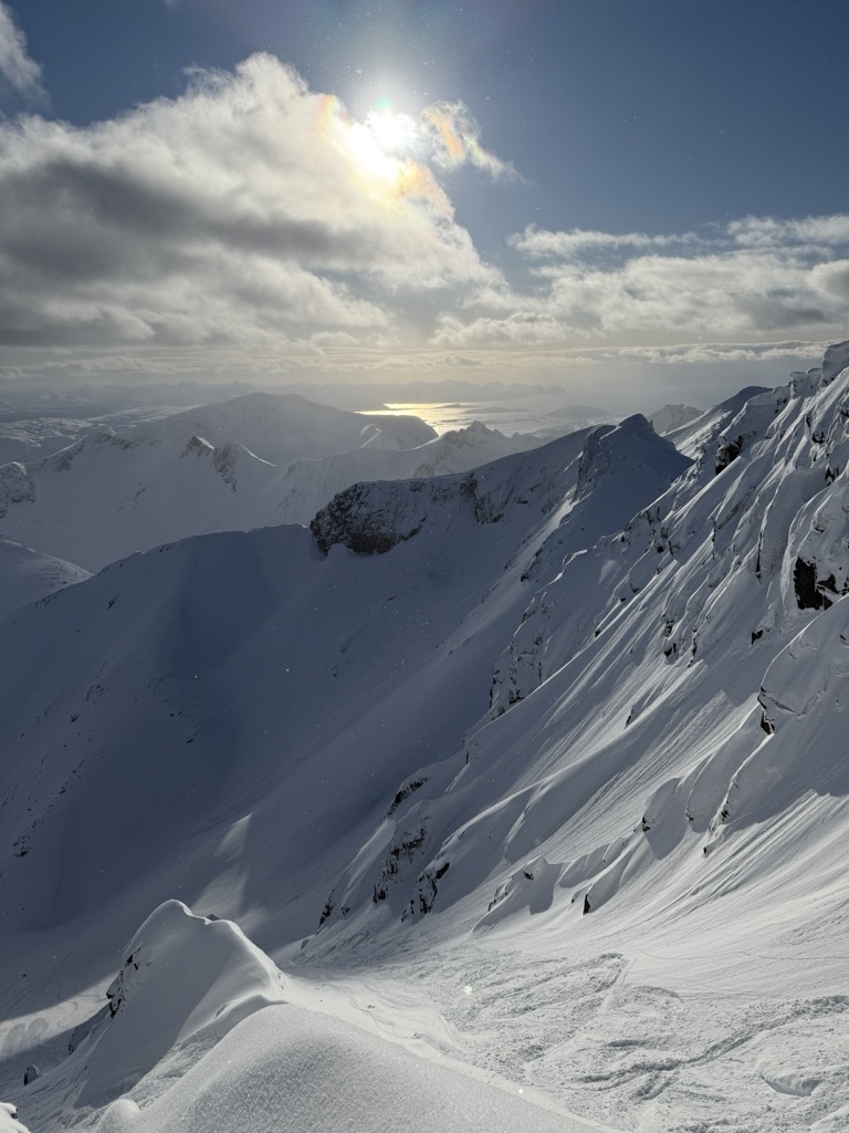
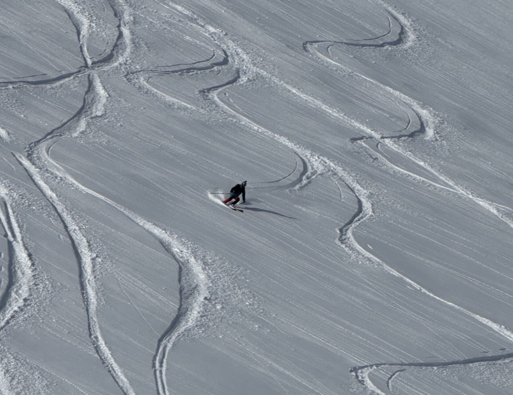
Recently, Troms og Finnmark has become an international destination for ski touring. Guides from across the Alps are taking clients here during March, April, and May; the conditions are often better than those down south these days. PeakVisor took a trip here in April 2025. Here’s the scoop.
If you come to Troms og Finnmark to ski, you’ll experience Tromsø. It’s home to an international airport with plenty of direct flights from European cities, and it’s the hub for anyone touring up here.
However, Tromsø isn’t just a travel stop; it’s a hub for skiing on its own. PeakVisor spent a week touring around here. The terrain is typical snowy Norwegian fjordland, with fantastic sea views. Follow the links to reach the PeakVisor Ski Touring Map.
On Kvaloya Island, we did Styrmannstinden in absolutely perfect weather, which is uncommon for Norway. In fact, it was the best weather of the trip. The skiing highlight also took place on Kvaloya Island, on a lesser-known peak called Skittentinden. A winding, pleasant ascent leads to a descent along a southwest-facing couloir, with some of the season’s best snow.
Another island near Tromsø is called Ringvassoya. There’s a classic skitour called “Rema 1000,” named after a local supermarket chain. Technically, it’s the northern summit of Solltinden, and received its nickname due to its precise altitude of 1000 meters.
We also visited Ullstinden, the northern tip of the Tromsdalen area with a view towards the open sea and the western side of the Lyngen Alps, and Sondre Bentsjordtinden, near Malangenfjord. Both mountains are technically part of the Norwegian mainland, rather than islands.
Somewhat isolated from the mainland, Senja’s mountains offer ski touring for aficionados who want wild access and remote adventures. Popular peaks like Husfjellet, Keipen, Skolpan, and Kvænan are perched above stunning fjords, with impressive views from the summits. When weather or snow conditions are less favorable, it’s worth exploring more sheltered areas in the central or inland parts of Senja, such as Kaperdalen, or heading to the mainland—for instance, Kvittind near Finnsnes.
Dyrøy Island is less frequented but offers excellent potential for ski touring due to its mountainous terrain. With some research, you’ll find plentiful options; safer tours include Dyrøygommen and Bergsheia.
The ferry route from Brensholmen to Botnhamn on Senja departs less than an hour's drive from Tromsø airport.
The Lyngen Alps are probably the most frequented locale for ski touring, especially for international visitors. Tafeltinden is one of the most popular classics.
Another lesser-known highlight is Litletinden, just over a 30-minute drive from Tromsø. Due to the topography, the approach valley is highly protected from wind, which preserves soft snow for longer.
The Lingen Alps are also notably more serious than other regions of Norway. The mountains are steep, with Alaska-like spines and large cornices. Be sure to do your own research before heading out here, or connect with Tromsø Ski Guides. PeakVisor used these guys for our 2025 trip, and we highly recommend them!
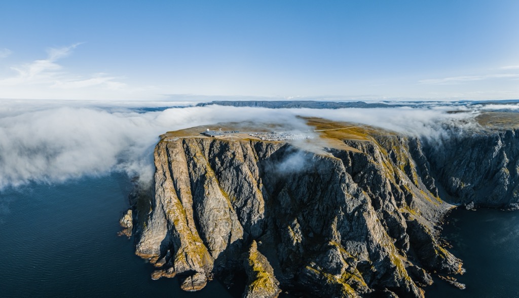
One of the most popular activities in Troms og Finnmark is reaching the Nordkapp, the northernmost point of mainland Europe accessible by vehicle (though it’s technically an island).
The site is starkly beautiful, perched atop a 307-meter (1,007-foot) cliff that plunges into the Barents Sea. Here, at over 71°N latitude, the sun shines from mid-May to late July.
Geographically, the actual northernmost point of Europe is Knivskjellodden, a nearby peninsula that extends about 1.5 kilometers farther north than Nordkapp. The 18-km (11-mile) round-trip hike may entice PeakVisor readers, but most tourists opt for the highway.
One thing any PeakVisor reader should know is that Norway has unique “right to roam” laws that allow visitors to camp anywhere as long as it is 150 meters (500 ft) from the nearest infrastructure (be respectful and don’t camp in somebody’s backyard). Visitors can legally stay at the same site for two days. It’s a great way to experience Norway’s natural beauty, as well as save some money in this very expensive country.
There are also plenty of paid campgrounds open in summer if wild camping just doesn’t float your boat.
Typically, we don’t write about fishing in PeakVisor articles, but it’s such a part of the national culture here, we’ll have to include a few details. The Sámi are master fishermen, with a tradition passed down for thousands of years, as are the descendants of Norse settlers, who originally occupied the coastal areas.
Sea fishing includes Atlantic cod, halibut, and haddock, with towns like Torsvåg, Skjervøy, and Havøysund serving as excellent bases. You can fish from shore, but many companies offer guided trips out at sea. Regulations allow foreign tourists to export up to 18 kg of fish if staying at a registered fishing facility.
Salmon fishing is very popular in freshwater rivers like Altaelva and Tanaelva. Meanwhile, inland lakes and rivers on the Finnmarksvidda plateau provide excellent fishing for Arctic char, grayling, whitefish, and trout.
Foreign anglers must purchase a national fishing license for salmon, sea trout, and Arctic char in rivers and lakes. Regulations on seasons, catch limits, and gear types vary. For sea fishing, no license is required.
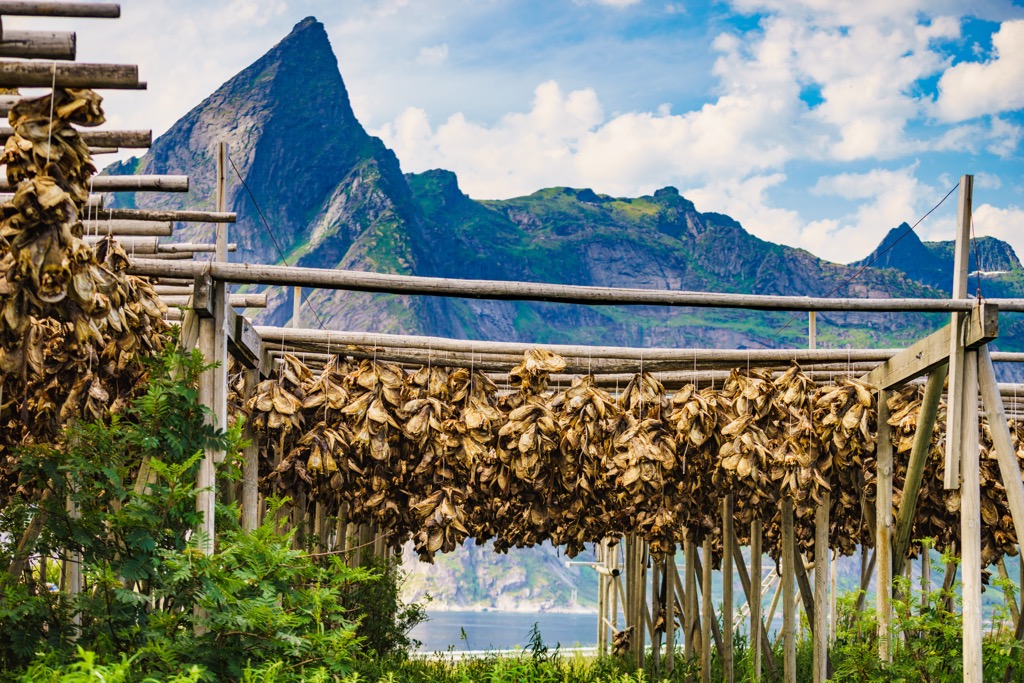
Millennia of hunting, fishing, and gathering define Norway's culinary tradition. The arctic climate meant that agriculture was simply not possible, like in southern Europe, and most other places in the world. Little grain could be grown for winter storage; instead, the Sámi relied on dried fish, ice fishing, and occasional reindeer hunting to make it through the Polar night.
The reindeer is used in dishes like bidos (a hearty meat stew) and dried or smoked reindeer meat. Coastal villages rely on the sea, with Atlantic cod, halibut, Arctic char, and king crab at the helm of the diet. Traditional preparations like mølje (cod with liver and roe) and stockfish are accompanied by flatbread.
Meanwhile, foraged ingredients such as cloudberries and lingonberries are also very important to the culinary tradition.
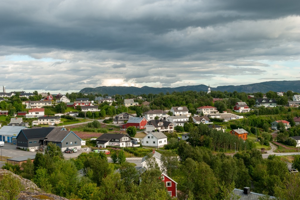
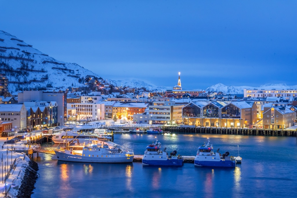
One of Northern Norway’s largest communities, Tromsø is located 350 km (217 mi) north of the Arctic Circle. The city has a population of about 65,000 people and is one of the largest fishing ports in the country. It is also a great place to visit in its own right.
The city has a recently expanded international airport with direct connections to many European cities. Once you’ve arrived, the city is full of coffee shops and relaxed vibes; it’s often called the “Paris of the North.” The University of Tromsø – The Arctic University of Norway means a youthful, college-town spirit. The Tromsøbadet is home to a swimming pool, fitness center, and climbing gym, among many other public amenities.
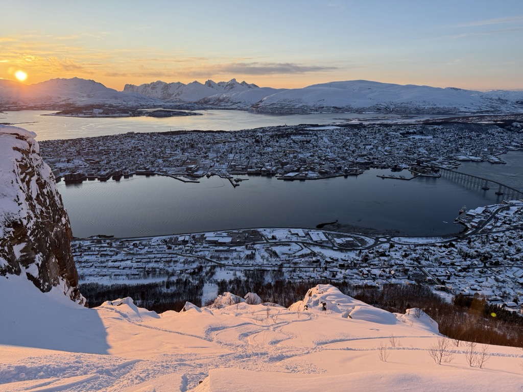
PeakVisor readers won’t want to miss the Fjellheisen Cable Car, which takes visitors about 400 meters (1,300 ft) above Tromsø. It’s more than just incredible views of the city and the surrounding fjords; the cable car’s long operating hours allow northern lights viewing during nighttime.
Last but not least are Tromsø’s unparalleled ski touring opportunities. As mentioned, the city has become a mecca for backcountry skiers worldwide. Local islands, like Kvaloya and Ringvassoya, provide easy access to touring. However, the big prize is the Lyngen Alps, which offer a lifetime of epic tours just an hour’s drive from Tromsø.
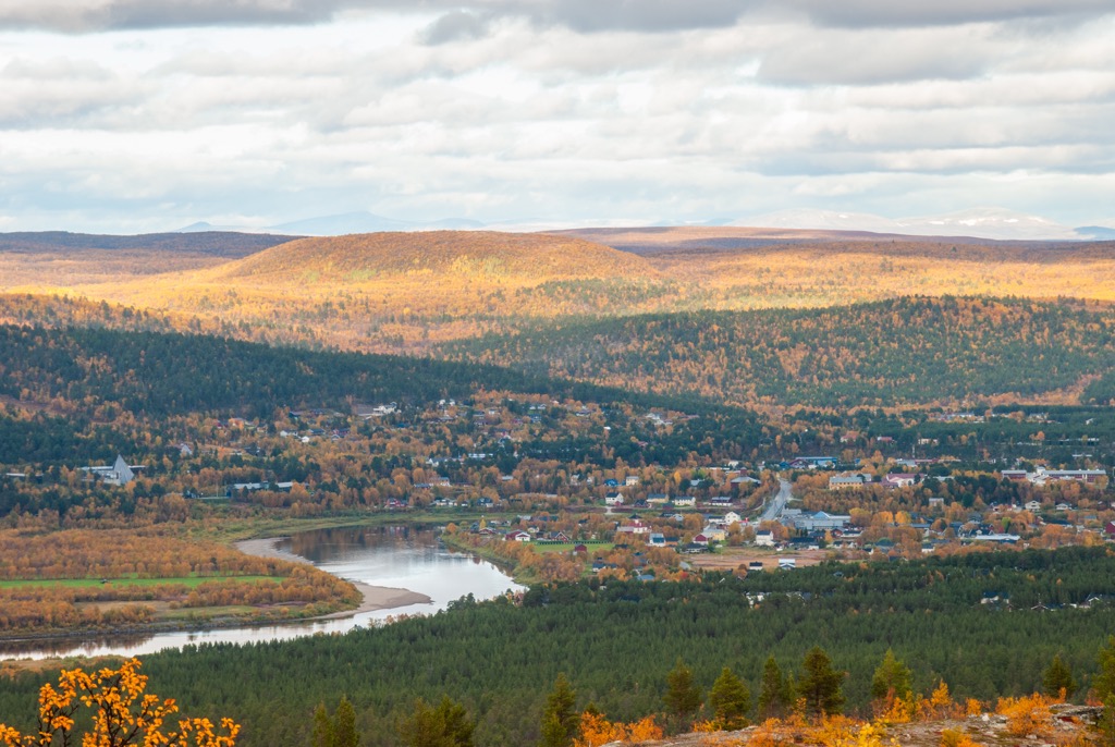
Positioned along the Altafjord and surrounded by rugged hills and taiga forests, Alta is a hub for outdoor activities year-round, from dog sledding and cross-country skiing in winter to hiking and river rafting in summer. The Alta River is one of Norway’s most famous salmon rivers. Alta is also one of the best places in Northern Norway to witness the northern lights, with the world’s first Northern Lights Observatory established here in 1899. Culturally, Alta is best known for the UNESCO-listed rock carvings at Hjemmeluft, which date back as far as 7,000 years.
Hammerfest sits proudly on the northwestern shores of Kvaløya island, at the edge of the Sørøy Sound, as one of the world’s northernmost cities. The town's coastal masonry was repeatedly destroyed, most notably by the British navy in 1809 and by German troops in 1944, as part of wartime scorched-earth tactics. Economically, modern Hammerfest thrives as a hub for fishing, Arctic resource extraction, and energy.
The nearby Melkøya LNG terminal, processing gas from the Snøhvit field, is Europe’s northernmost export plant, contributing about 5 % of Norway’s gas output. The town experiences midnight sun from late spring to midsummer, while the polar night envelops it through deep winter.
Outdoor enthusiasts can enjoy whale watching, hiking on nearby glaciers, and northern lights viewing. Despite its Arctic location, transport connections include Hurtigruten, an airport, and highway access.
Karasjok is the cultural and political center of Sámi Norway. With about 1,750 residents in the village and a majority Sámi population, it hosts the Sámi Parliament (Sámediggi), a striking Siberian larch-clad building established in 1989 to represent Sámi interests in culture, language, and land rights. The village is also home to the RiddoDuottarMuseat, Norway’s largest Sámi museum, which features an impressive collection of over 5,000 cultural artifacts and an open-air section highlighting traditional dwellings and tools.
Kautokeino (Guovdageaidnu in Northern Sámi), located within the expansive Finnmarksvidda plateau, is a vibrant center for Sámi education, arts, and reindeer herding. Nearly 85 % of its roughly 2,800 inhabitants speak Sámi as their first language, and community institutions include the Sámi University College, reindeer-herding school, Beaivváš Sámi Theatre, and Juhls Silver Gallery, a hub for Sámi silversmithing.
PeakVisor has been a leader in the augmented reality 3D mapping space for the better part of a decade. We’re the product of nearly a decade of effort from a small software studio smack dab in the middle of the Alps. Our detailed 3D maps are the perfect tool for hiking, ski touring, biking, and alpinism.
In addition to the visually stunning maps, PeakVisor's advantage is its variety of tools for the backcountry: