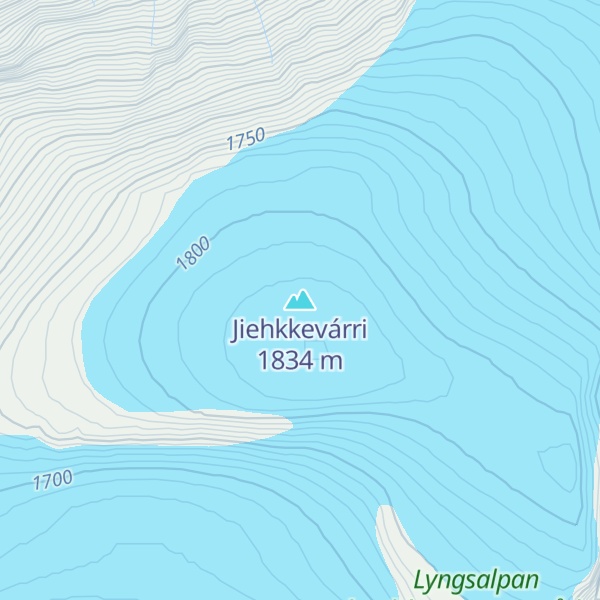
Jiehkkevárri (alternative spellings: Jiekkevarri, Jiekkevarre, or Jæggevarre) is a mountain on the border of Lyngen Municipality and Tromsø Municipality in Troms county, Norway. It is the highest mountain in Troms and has the second highest prominence (primary factor) among Norwegian mountains. The 1,834-metre (6,017 ft) tall mountain sits about 10 kilometres (6.2 mi) northeast of the village of Lakselvbukt and about 17 kilometres (11 mi) southwest of the village of Lyngseidet.
The first people known to have climbed it were Geoffrey Hastings (British) and Elias Hogrenning (Norwegian) in 1899. Its summit is ice-capped and any ascent involves a crossing of crevassed glaciers. Therefore, climbing it needs guiding by experienced mountaineers.
In winter, an experienced ski-mountaineer can traverse Jiehkkevárri in one long day, descending almost from the top via the steep, northeast facing couloir, described by the late Andreas Fransson as "a future classic for the new generation of mountain skiers". The descent route is exposed to serac fall from above, and is generally not recommended for ascending.
By elevation Jiehkkevárri is
# 1 out of 19071 in Troms og Finnmark
By prominence Jiehkkevárri is
# 1 out of 19071 in Troms og Finnmark # 3 out of 152052 in Norway # 3 out of 135828 in the Scandinavian Mountains
We use GPS information embedded into the photo when it is available.
3D mountains overlay
Adjust mountain panorama to perfectly match your photos because recorded by camera photo position might be imprecise.
Move tool
Rotate tool
Zoom
More customization
Choose which peak labels should make into the final photo and what photo title should be.
Next
Photo Location
Satellitte
Flat map
Relief map
Latitude
Longitude
Altitude
OR
Latitude
°'''
Longitude
°'''
Apply
Register Peak
Peak Name
Latitude
Longitude
Altitude
Register
Teleport
PeakVisor
This 3D model of Sagarmatha National Park in Nepal was made using the PeakVisor app topographic data. The mobile app features higher precision models worldwide, more topographic details, and works offline. Download PeakVisor maps today.
Download OBJ model
PeakVisor
The download should start shortly. If you find it useful please consider supporting the PeakVisor app.
PeakVisor for iOS and Android
Be a superhero of outdoor navigation with state-of-the-art 3D maps and mountain identification in the palm of your hand!