Scan the QR code and open PeakVisor on your phone
Hossa National Park is one the most visited of Finland’s 41 national parks. Located in the Kainu region, the park’s two main features are Julma-Ölkky Canyon Lake and Värikallionvaara (288 m / 945 ft) with rock drawings of Stone Age people. Hossa is also one of the two newest parks in the country (2017). The park boasts an extensive system of marked hiking trails totaling more than 90 km (56 mi), most of which run along the shores of the large lakes. There are 2 named peaks in Hossa. The highest and most prominent mountain is Miskallionvaara (298 m / 978 ft).
Hossa National Park draws its name from a tiny village with a permanent population of just over 50 people on its eastern borders. It is a Sámi word (indigenous people of Lapland) meaning “a place far away.” The names of the park in Finnish and Swedish, the country’s second official language, are Hossan Luonto and Naturen i Hossa, respectively.
Hossa National Park is located at the northernmost tip of the vast Kainuu region in Eastern Finland, on the border with the North Ostrobothnia region and the Republic of Karelia in Russia. The park's area is 111 sq km (43 sq mi).
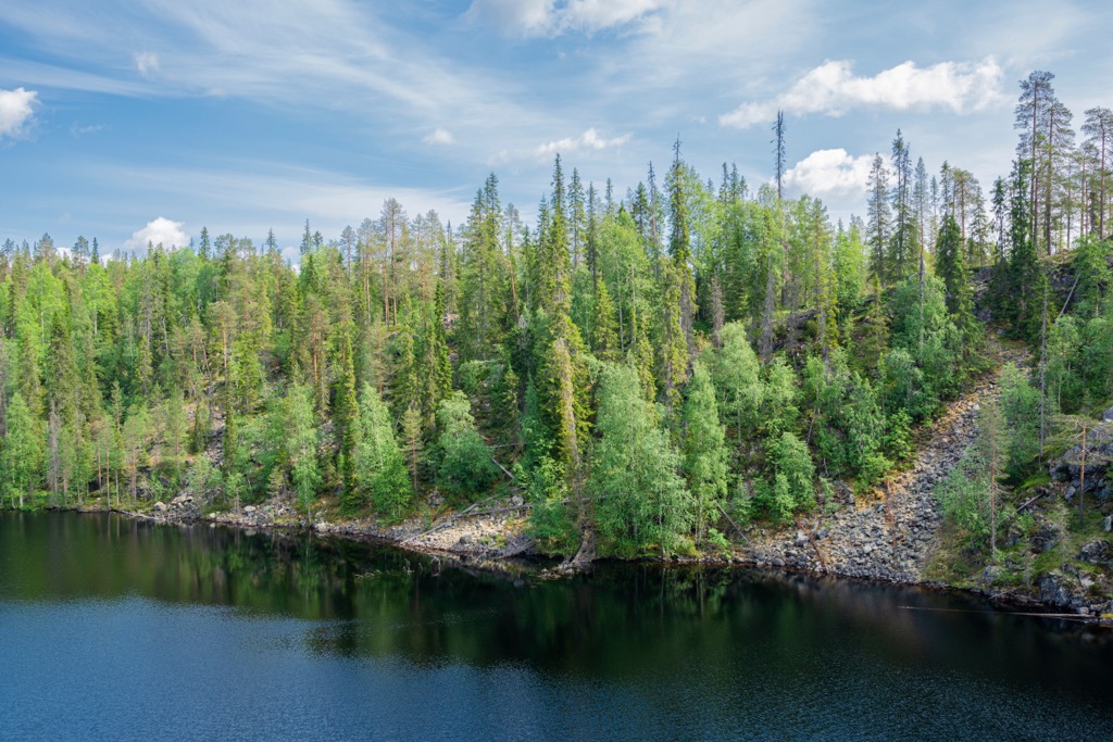
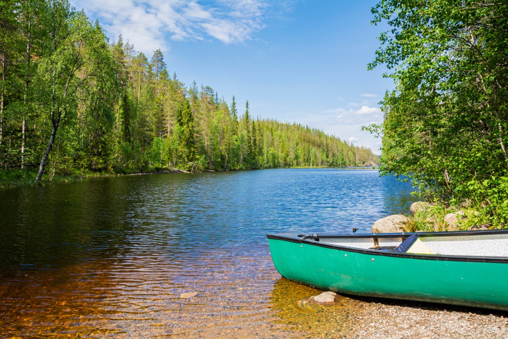
The park occupies an incredibly scenic landscape. A labyrinth of more than 130 lakes and ponds of glacial origin unique to Finland features crystal clear water because of the low content of microorganisms. At the same time, the water is oxygen-rich and supports an abundance of fish and other water-dwelling beasts.
The park’s lakes include:
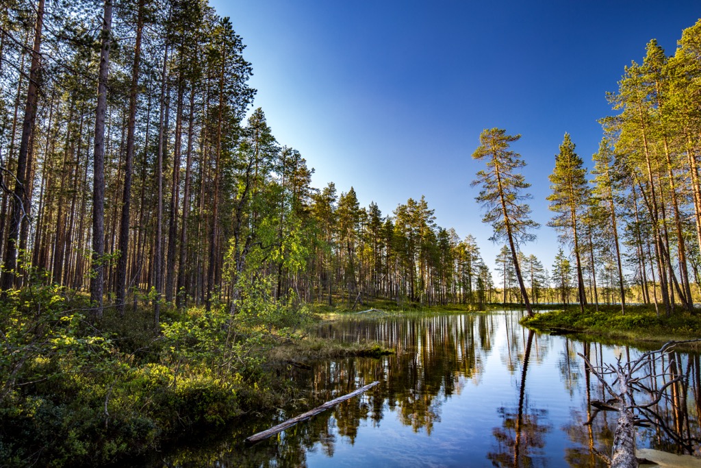
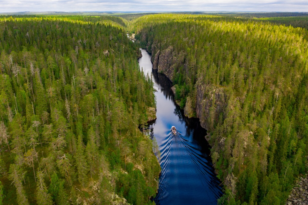
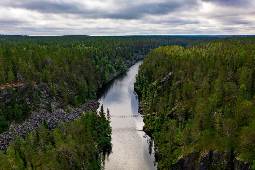
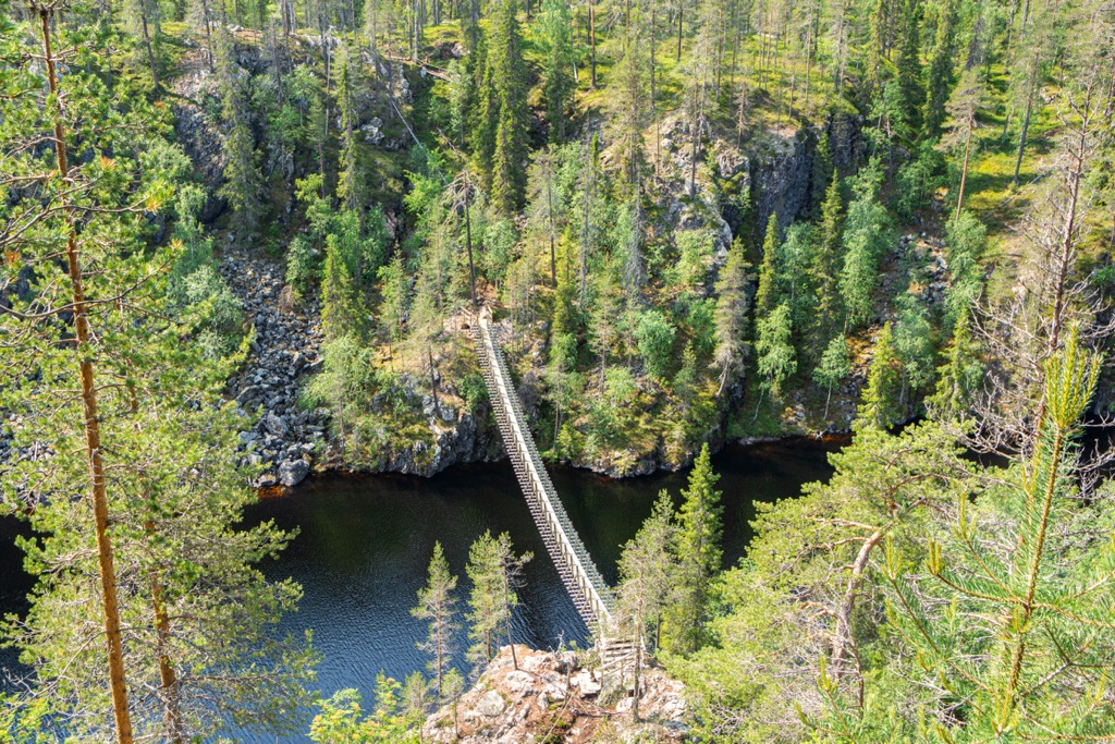
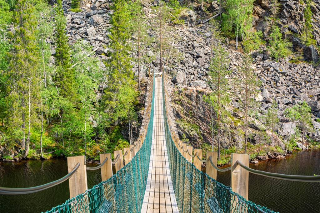
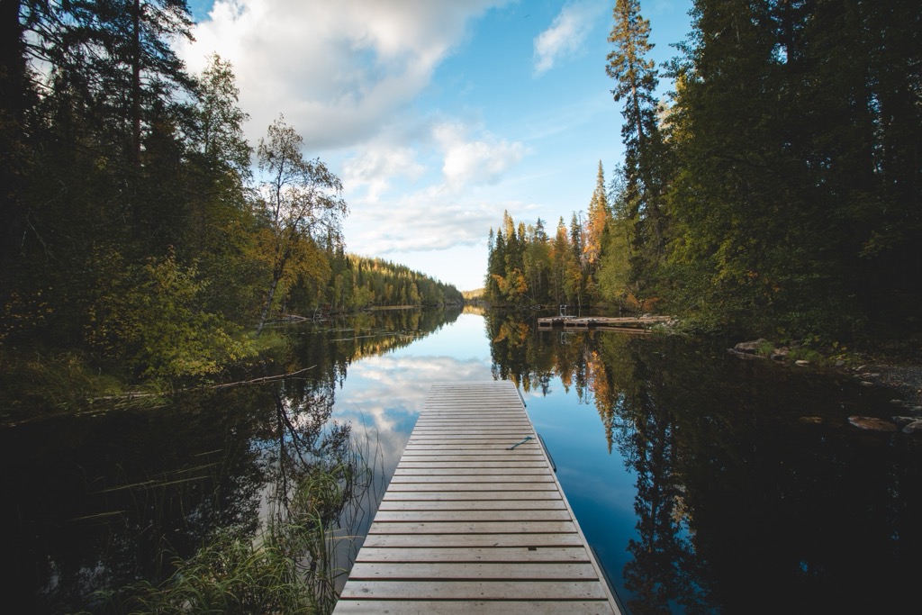
Incredibly elongated shape distinguishes Somerjärvi Lake and Julma-Ölkky Lake. These lakes were carved by glacial retreat over the course of the Pleistocene era, spinning about 2.5 million to 10,000 years ago. Julma-Ölkky is about 4 km (2 mi) long with a width of only 10 m (33 ft). Together with Alma Ölkky, it stretches for almost 10 km (6 mi). The lake is 50 m (ft) deep. Its outward appearance resembles a river due to its long, thin shape. However, unlike a river, water remains contained within its boundaries. Crossing Julma-Ölkky Lake is a famous bridge seen in many park images.
The Hossa water systems are a crossroads of rivers and lakes. Water circulates between the Baltic Sea, the White Sea in Russia, the Ladoga Lake (the largest in Europe), and the Arctic Ocean. These are the four central bodies of water in the region.
The park’s closest town, the quaint village of Suomussalmi, is 100 km (62 mi) to the south. The nearest large town is Kajaani, 212 km (132 mi) away. It’s about the same distance from Oulu on the Baltic Sea to the west. Kuusamo and the more distant Rovaniemi, the capital of Lapland, are also options for travel.
There are regular buses between towns, even during the winter season, as well as trains to Kajaani. The nearest airport is in Kuusamo, a popular access point to the local Ruka Ski Resort.
The landscape of Hossa National Park is dominated by old-growth spruce forest, which also contains larch, aspen, and birch. Swamps exist throughout the forest and cover almost 1/3 of the park. Hossa also shows traces of so-called "slash-and-burn agriculture," a once-popular method of cutting and burning forests for cultivated fields in the 19th century.
As for animals, fish thrive in the oxygen-rich waters of the park’s many rivers and lakes. While there are dozens of fish species within the park, the most common are whitefish and pike. Like many parts of Finland, you can easily hear and see many small birds, such as the common redstart. Among the larger animals are red foxes, moose, and reindeer. Hiss’s is also famous as a place of reindeer husbandry.
Värikallionvaara (288 m / 945 ft), or simply Värikallio, is a giant smooth granite cliff with drawings of Stone Age people (at least 3.5–4.5 thousand years ago). The peak and its cave art are one of the principal features of Hossa National Park. As a result of these paintings, the park attracts about 100,000 visitors annually and is one of Finland's 15 most visited natural areas.
The rock art is located on the eastern shore of the southern part of Somerjärvi Lake. Using red ochre, 60 images depict ancient scenes of hunting and shamanism. Thanks to the metal water observation platform installed right along the rock, you can easily reach the drawings to view them in detail. The cliff can also be reached on foot along the lake’s frozen surface in winter.
There are a few other examples of such rock art in Finland. Olhavanvuori (142 m / 465 ft), located in Repovesi National Park, also features a granite slab with ancient depictions. Prehistoric hunters sought massive, flat granite rocks as natural canvases for their paintings.
Värikallionvaara belongs to the Karelides, a now-defunct mountain range named after the region of Karelia (North and South in Finland), which stretches the eastern part of the country to northwestern Lapland. Eventually, the Karelides merge with the Scandinavian Mountains. Like many ancient ranges, the Karelides once featured towering peaks over 4,000–5,000 m (13,123–16,404 ft), like the present-day Alps. Time, the great equalizer, has gradually softened these peaks into today's landscape.
The main hiking trail in Hossa National Park leads around its most famous natural attraction, Julma-Ölkky Lake. The trail consists of two parts: Ölökyn ylitys Trail and Ölökyn ähkäsy Trail. At 15 km (9 mi), it is one of the two longest trails in the park. The trail is considered difficult by local standards because of the varied terrain with several hundred meters of elevation differences. Although this may seem small to those who often hike in higher mountains like the Alps, the terrain is deceptively strenuous.
Another equally popular trail is the Värikallion Kaarros Trail, an out-an-back to Värikallionvaara totaling 8 km (5 mi). The trail begins at a place called Lihapyörre in the northern section of the park.
Additionally, there are three great circular paths in Hossa around its other lakes:
Nearly all of the hiking trails in Hossa run along the lakeshore, a unique feature of the park. You can combine them however you like, creating a personal itinerary for longer hikes. There are over 90 km (56 mi) of trails in Hossa, so you can hike for more than a week without leaving the park or repeating a route.
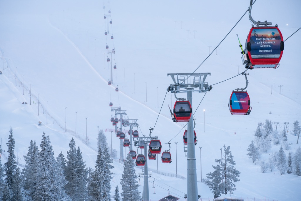
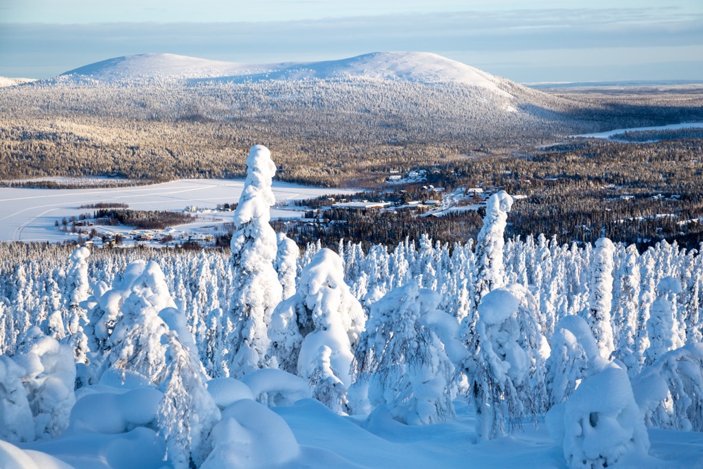
The main ski resort near Hossa National Park is Ruka, located just 103 km (64 mi) north. It is the fourth-largest of 80 ski resorts in Finland and has 19 km (12 mi) of slopes and 22 ski lifts (the three biggest resorts in the country include Ylläs, Levi, and Tahko).
Check the Finland ski resorts map in the World Mountain Lifts section of the site. It includes information about open ski lifts / slopes near Hossa in real-time with opening dates and hours. There are also year-round cable cars, funiculars, cog railways, aerial tramways, and all other types of mountain lifts.
Be sure to visit Hosaa National Park’s official Visitor Center to pick up a map, buy souvenirs, solicit advice, and more. The center also offers rental services for huts, boats (canoes, kayaks), bicycles, and hiking and fishing gear.
There is also a tourist office in Suomussalmi, the nearest town to the park.
Hossa Visitor Centre
Jatkonsalmentie, 6, 89920, Ruhtinansalmi (Suomussalmi), Finland
Monday to Sunday 10 a.m. to 4 p.m.
+358407517221, +358206396041
Suomussalmi Tourist Office
Jalonkaarre, 5, 89600, Suomussalmi, Finland
Monday to Friday 8 a.m. to 4 p.m.
+3580447773250
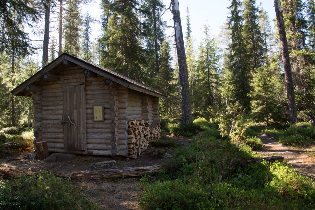
There are five open wilderness huts in Hossa National Park. They are always open, and you do not have to pay to stay there. While there is usually a stove and firewood, you need to bring your own sleeping bag.
There are 12 rental huts in the park. You can book them all in advance at Verkkokauppa.eraluvat.fi and pick up your key at the Visitor’s Center.
Additionally, the park offers many campsites with lean-to-shelters or tent space during the warm season. There is also a vehicle-accessible campground with plenty of tent sites and caravan parking.
Suomussalmi has more than 7,000 inhabitants within two dozen small villages. Here, you can see the following major architectural and cultural attractions:
Check the Hossa.fi for more cultural information about the region.