
Scan the QR code and open PeakVisor on your phone
Tavastia Proper is home to 242 named mountains. The highest is Koivistonmäki at 182 m.
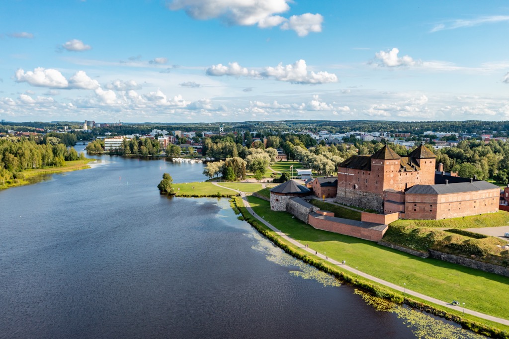
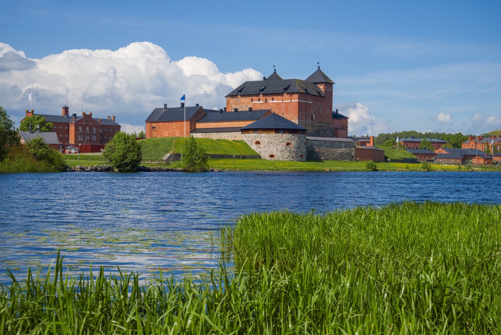
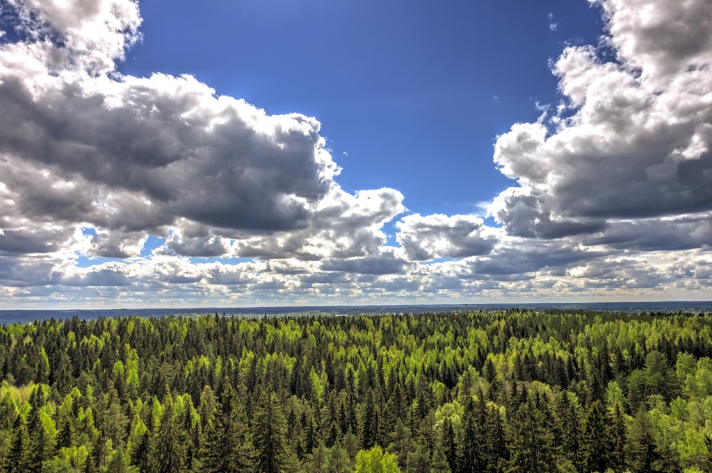
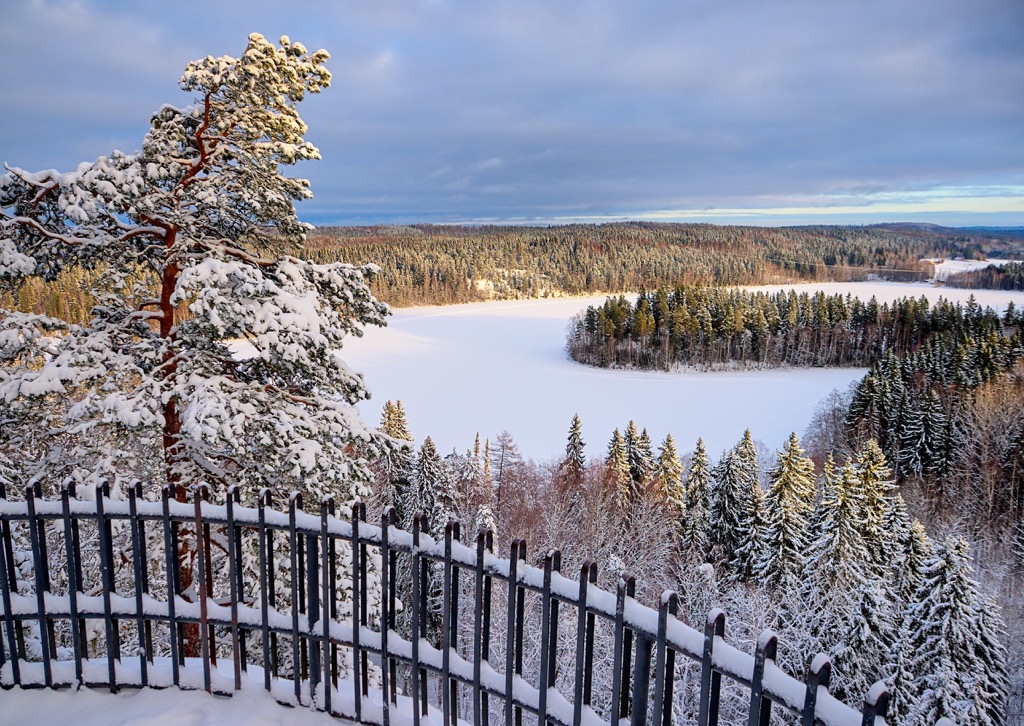
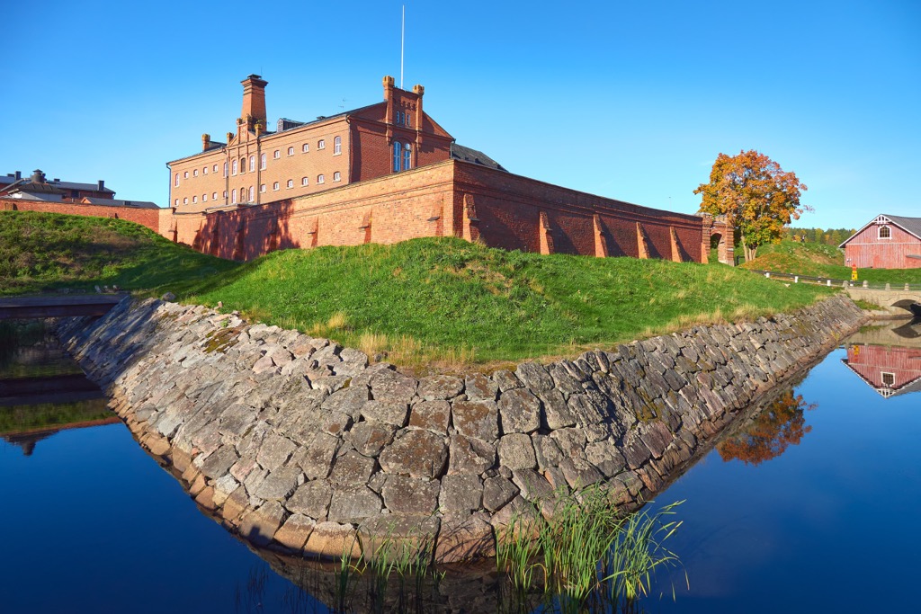
Kanta-Häme or Tavastia Proper is one of Finland's 19 regions located in the south of the country. The main feature of the region is the large Vanajavesi Lake and its surroundings, which are included in the list of 27 national landscapes of the country. The region also would not be so famous and loved by Finns without Hämeenlinna Castle, located on the shores of the lake. At the same time, Häme is home to the small Aulanko Nature Reserve, the country's oldest landscaped forest park. All this makes the region a must-see for those who will go further than capital Helsinki. There are 242 named mountains in Kanta-Häme. The highest and the most prominent mountain is Koivistonmäki (182 m / 597 ft).
Kanta-Häme is one of the nine historic provinces of Finland, also known as Tavastia, which is distinguished by its cultural, linguistic, and other identities. The province also includes the regions of Päijät-Häme or Päijänne Tavastia and Central Finland to the north of the former. But of the three regions, it is Kanta-Häme that is considered central. In turn, its own center is the city of Hämeenlinna with the famous Hämeenlinna Castle, the center of the capital itself. This is why the region is also called Tavastia Proper, i.e. "True Tavastia", Häme Tavastia or simply Häme. Being in the region you will also see its name in Swedish: Egentliga Tavastland, given that it is the second official language.
The Kanta-Häme region is one of the smallest (and cozy) in the country, with an area of 5,706.39 sq km (2,203.25 sq mi). To be precise, only Kymenlaakso, neighboring Päijänne Tavastia, Central Ostrobothnia and Åland Islands are smaller than it.
Besides the two parts of Tavastia, it borders Southwest Finland or Finland Proper (Turku), Pirkanmaa (Tampere), and Uusimaa (Helsinki) in the southwest and south.
After Hämeenlinna, there are just two other municipalities that have township status in the region: Riihimäki and Forssa.
You can get to Hämeenlinna from Helsinki quickly and easily by car, train, bus, or even bicycle. The distance between the cities is only 100 km (62.1 mi). In the latter case, it is more than possible thanks to the developed system of separate bicycle roads in the country, which go not only in cities but parallel to the highways between them.
The Häme region as a whole and especially its central part is one of the most interesting in the country in terms of human history. Here are its highlights:
On a separate note, Hämeenlinna is the birthplace of Finland's most famous classical composer Jean Sibelius. In particular, it was here that he wrote his immortal work "Finland" inspired by the landscapes of his native land.
Like most other low rocky mountains or should I say hills in Southern Finland, the 242 named peaks in Kanta-Häme belong to the Svecofennian orogeny geological layer, which was in place from 2,000 to 1,800 million years ago during the Paleoproterozoic Era.
The highest of the peaks, Koivistonmäki (182 m / 597 ft) is located south of the Hattula and Parola neighboring villages near a small lake. This is a residential area, so you can easily climb it by one of three trails from the nearby parking lots to see the area from above. It is also surrounded by many other halls of slightly lesser height.
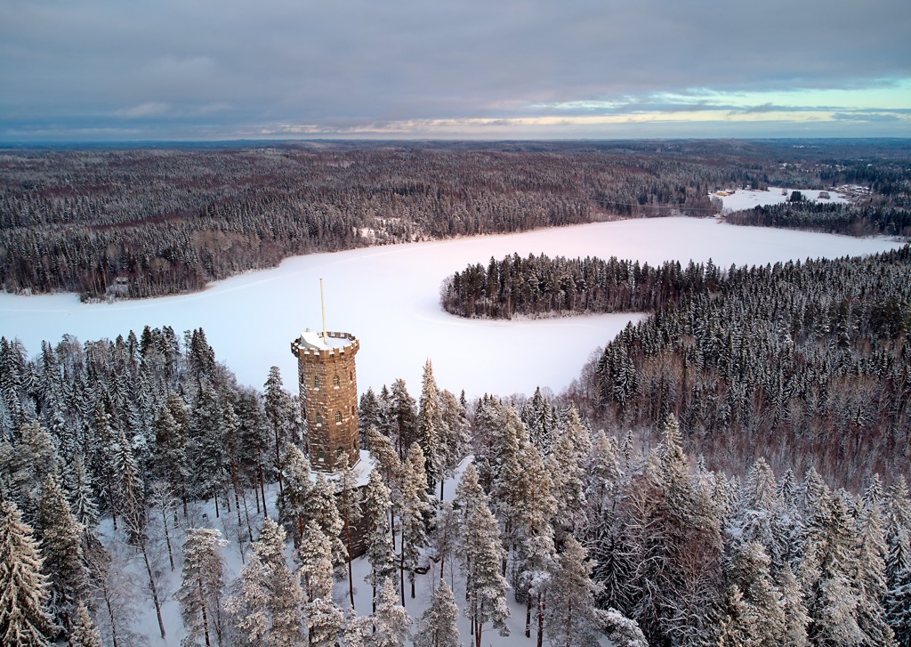
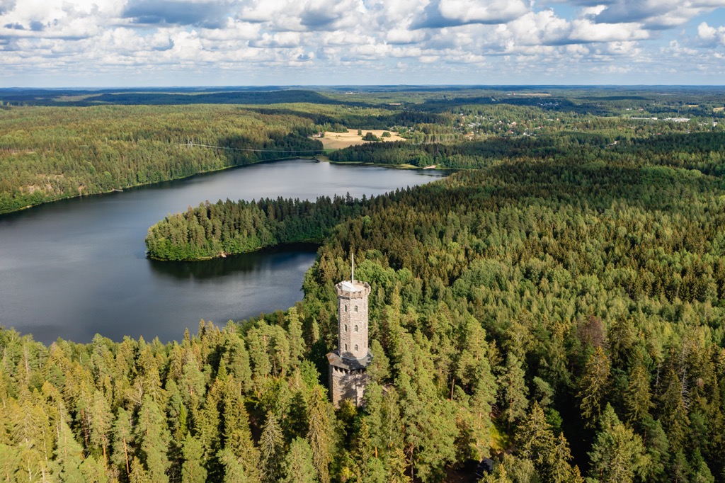
However, the most famous peak of the region is Aulangonvuori hill (154 m / 505 ft) in the heart of the small Aulanko Nature Reserve (Aulangon Luonnonsuojelualue) in Hämeenlinna itself. Already at the end of the 1800s, it was a popular destination among locals for short hiking trips and pic-nics. At that time a small wooden pavilion was built on top as a scenic lookout place for the Vanajavesi Lake. Nowadays, there is a huge 33 m-tall (108 ft) granite tower built at the beginning of the 20th century for the same reasons. It is so massive that it resembles another castle.
For higher mountains and equally beautiful views, I recommend heading north of the region to Päijät-Häme and Central Finland, located on the country's second largest lake, Päijänne. Here is also the region's most famous mountain range, Salpausselkä Ridge, including another natural wonder Pulkkilanharju Esker, and the highest peak in all of southern Finland, Tiirismaa (281 m / 921 ft).
To get more information, read separate guides to both of these regions on the PeakVisor site following the links.
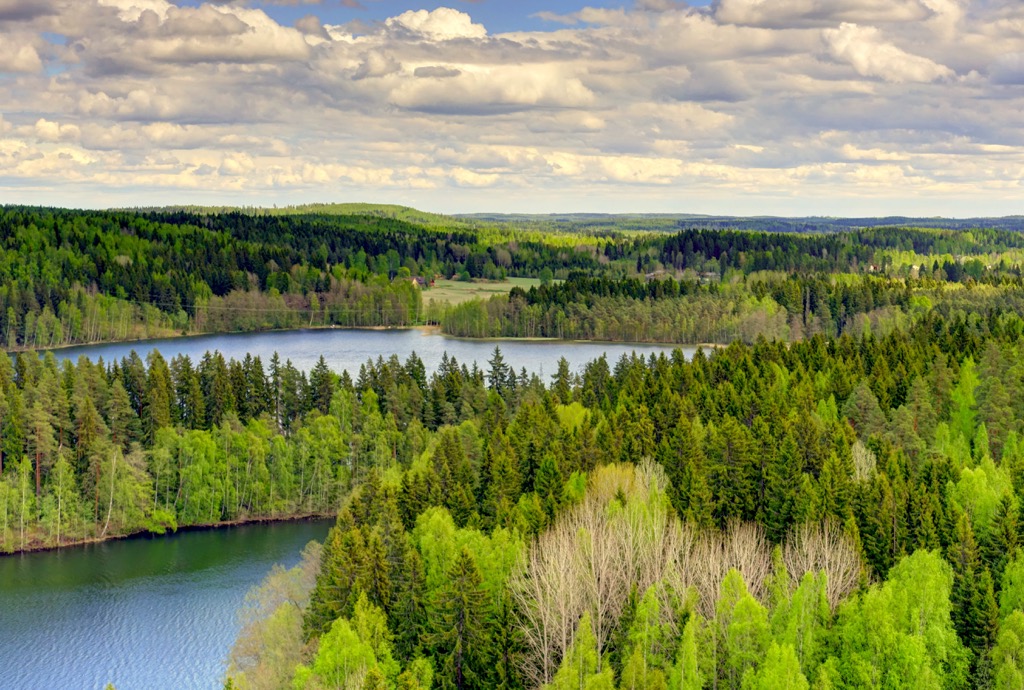
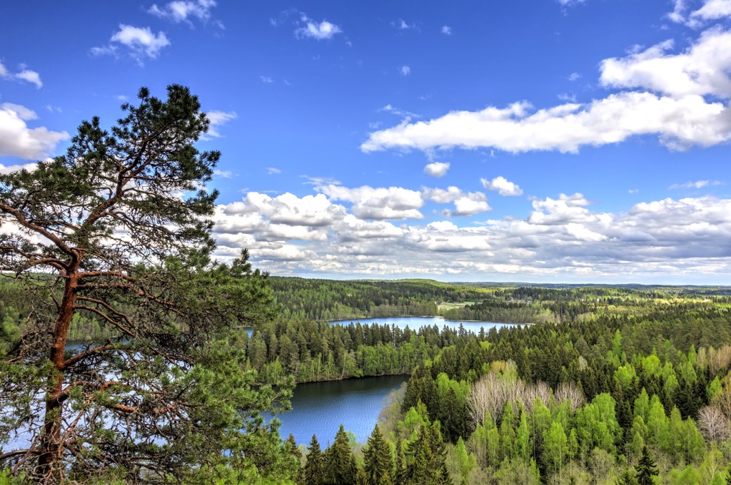
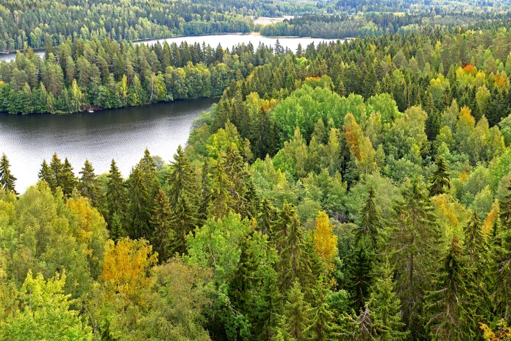
The truth is that Finland’s fifth-largest region (from the end) is packed to the brim with various hiking areas and trails — there are no other words I can think of. It looks as if the Finns have purposely put a little bit of everything here from what they can offer, except maybe the wilderness areas of Lapland.
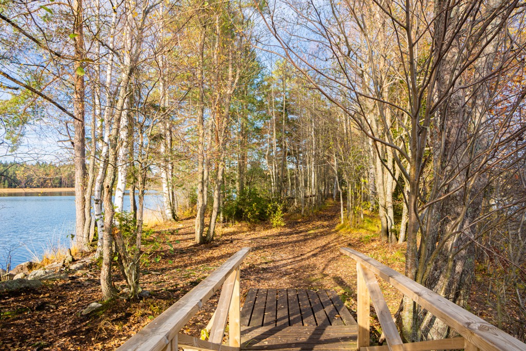
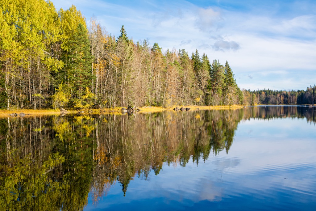
First, in addition to some short nature trails in Aulanko Nature Reserve itself, which I have already named several times, it is crossed by the 7 km (4.3 mi) long Aulangonjärvi Lake Trail. The trail is so named because it originates on a lake in another nature reserve, Sibelius Forest, named after a famous composer.
Second, Aulanko has recently been part of the larger (and first in the country) Hameenlinna National Urban Park, covering almost the entire city, which means even more hiking trails. This is a new series of parks in Finland, which already includes Forssa (also in Kanta-Häme), Heinola, Pori, Hanko, Porvoo, Kotka, Kuopio, and Kokkola.
Third, if you go just a bit outside the city to the west, you will get to the Evo Hiking Area, one of the seven so-called national hiking areas of Finland (six others are Arctic Circle, Evo, Inari, Iso-Syöte, Kylmäluoma, Oulujärvi, and Ruunaa). In this area, you can find the Ilvesvaellus Hiking Trail Network (70 km / 43.4 mi), which was established in 1987. It was created for hiking and other recreational use on lands controlled by the City of Hämeenlinna, Häme University of Applied Sciences and Metsähallitus, and the Finnish Forestry organization.
Fourthly, the region is home to two of Finland’s 40 national parks: Liesjärvi National Park and Torronsuo National Park. The longest route in the first is Pohjantikka Trail (5 km / 3.1 mi), the second has three—Piippurinsuon Kierros (5.3 km / 3.2 mi), Suotaival (8.5 km / 5.2 mi) and Torron Kylän Kierros (10 km / 6.2 mi).
Fifth, we must not forget the important historical site in the region—Rapola Hill Fort, located on Vanajavesi Lake near the Rapola Ridge. It is the largest ancient hill fort in Finland, and it was the site of a settlement in the fifth century CE.
Tavastia Proper has no major ski resorts, but you don't need to go to Lapland for skiing. Just go a little north to Lahti, the capital of the neighboring Päijät-Häme region, where the largest ski center in southern Finland, Messilä, is located.
It has 10 illuminated ski slopes and 70 km (43.4 mi) of cross-country ski tracks (20 illuminated in total), 9 ski lifts, ski school and ski rental service, and 2 restaurants. The highest elevation is 222 m (728 ft).
Find other ski resorts in Finland on the country's page in the World Mountains Lifts section on the PeakVisor site.
Before or after hiking in one of the region's natural areas, visit its official tourist center, located in Hämeenlinna, to pick up a paper map and ask for advice.
Hämeenlinna Tourist Information
Wetterhoffinkatu, 2, 13100, Hämeenlinna, Finland
+35836213373
In Kanta-Häme's hiking areas, as well as in the country as a whole, you can stay overnight in one of several types of accommodation. This includes lean-to-shelters, rental, reservable, and traditional Sámi huts.
Let's take two national parks in the region as an example: in Liesjärvi National Park there are two rental huts for 4 and 2 people respectively, but in Torronsuo National Park there are no options for overnight accommodation and even camping is prohibited because the park is located in the deepest swamp in Finland (but you can walk it on duckboards).
Within some parks or near their boundaries, you can also find other campgrounds, cabins, B&Bs, saunas, cottages, and other types of accommodation.
Thanks to Finland’s Everyman’s Right law, you can also pitch a tent in most areas of the country unless they’re specifically restricted as no-camping regions like in the case of Torronsuo.
In addition to the famous castle, Hämeenlinna has some other landmarks that work in its favor: Market Square, Town Hall, Hämeenlinna Church, Häme County Government House, Sibelius House, and others. In general, there are plenty of buildings of different architectural styles in the city center, and its four districts—Linnanniemi, Koilliskulma, Hämeensaari, and Saaristenmäki—offer even more.
The second and third largest cities in the region are Riihimäki and Forssa. You can visit them from the region's capital even for a couple of hours to broaden your view of the place. I've already said about the first being the city's new national urban park. The second is famous for the Finnish Glass Museum with its permanent display created by locally famous designer Tapio Wirkkala.


Yes. Tavastia Proper has 242 named mountains. The highest is Koivistonmäki at 182 m.
The highest mountain in Tavastia Proper is Koivistonmäki, at 182 m.
Tavastia Proper has 242 named mountains.


