Scan the QR code and open PeakVisor on your phone
Jostedalsbreen National Park (Norwegian: Jostedalsbreen nasjonalpark) is situated in the Vestland county in Norway. The park is home to the Jostedal Glacier (Norwegian: Jostedalsbreen) which marks the largest glacier in all of mainland Europe. There are 249 named mountains in Jostedalsbreen. The highest is Lodalskåpa (2,083 m / 6,833 ft) while the most prominent mountain is Fremsta Ryssenipa (1,684 m / 5,525 ft).
Jostedalsbreen National Park spans across Vestland county in western central Norway. The defining feature of the park is the Jostedal Glacier which spans 487 sq. km (188 sq. miles) across the region.
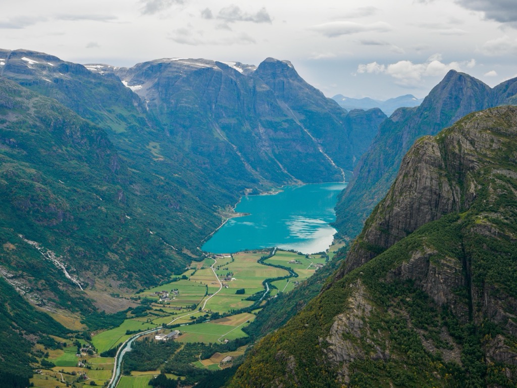
The entire national park spans 1,315 sq. km (508 sq. miles) between two of the longest fjords in the country; Sognefjord and Nordfjord. Nearly a third of the park is marked by the Jostedal Glacier, which marks the largest glacier in mainland Europe.
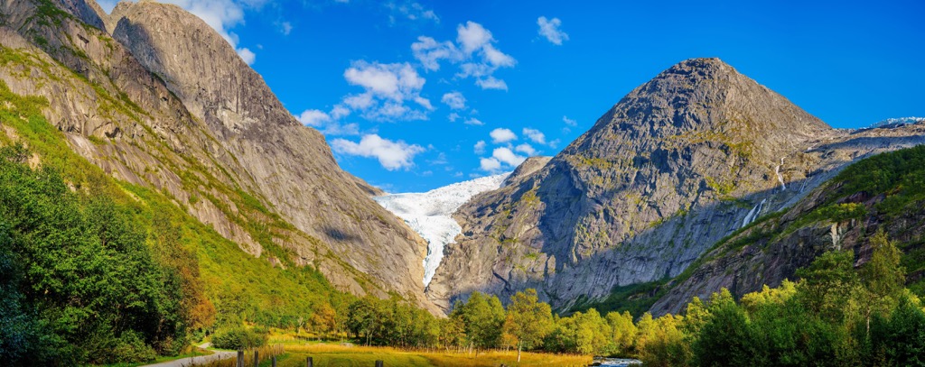
Within the park lies other smaller glaciers including Jostefonni, Grovabreen, and Myklebustbreen. Combined the glaciers cover about half of the entire national park. The portions of the park not covered by glaciers feature a wide range of landscapes.
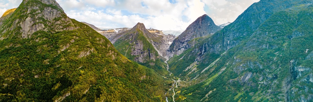
The park features deep valleys covered in dense and lush vegetation at lower elevations. As elevations increase the landscape transforms into bare mountains and ridgelines amidst the glacier landscape.
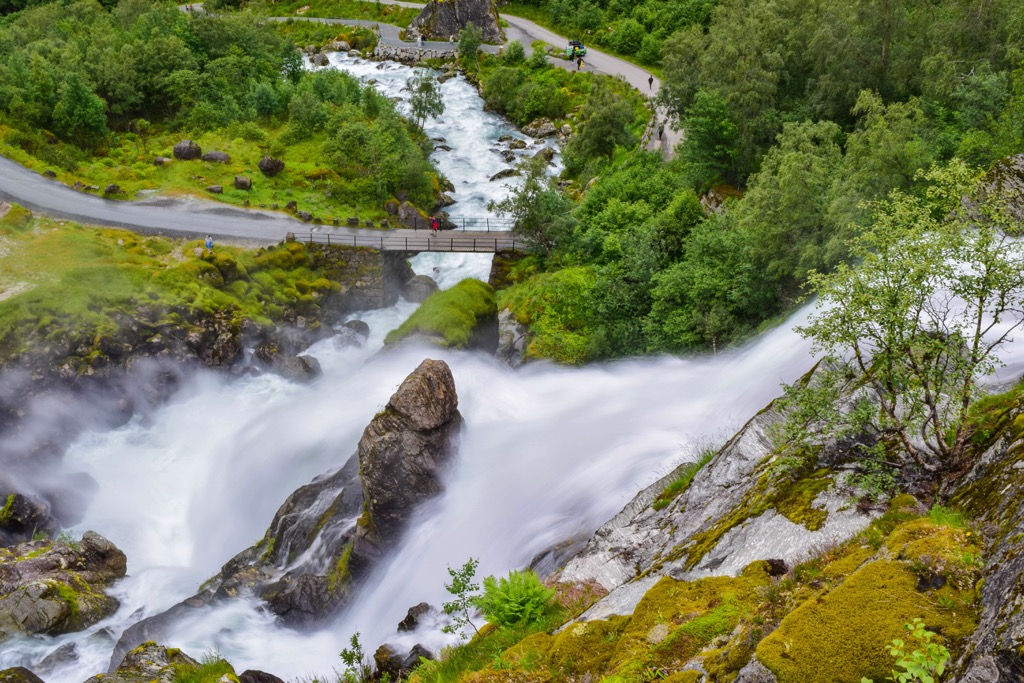
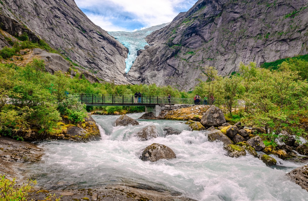
Hiking through the park allows visitors to often experience what feels like multiple seasons in just one day. Elevations in the park range from sea level along the edge of the fjords, up to the summit of Lodalskåpa. The steep fjords and cliffs found in the park feature a multitude of waterfalls throughout the year.
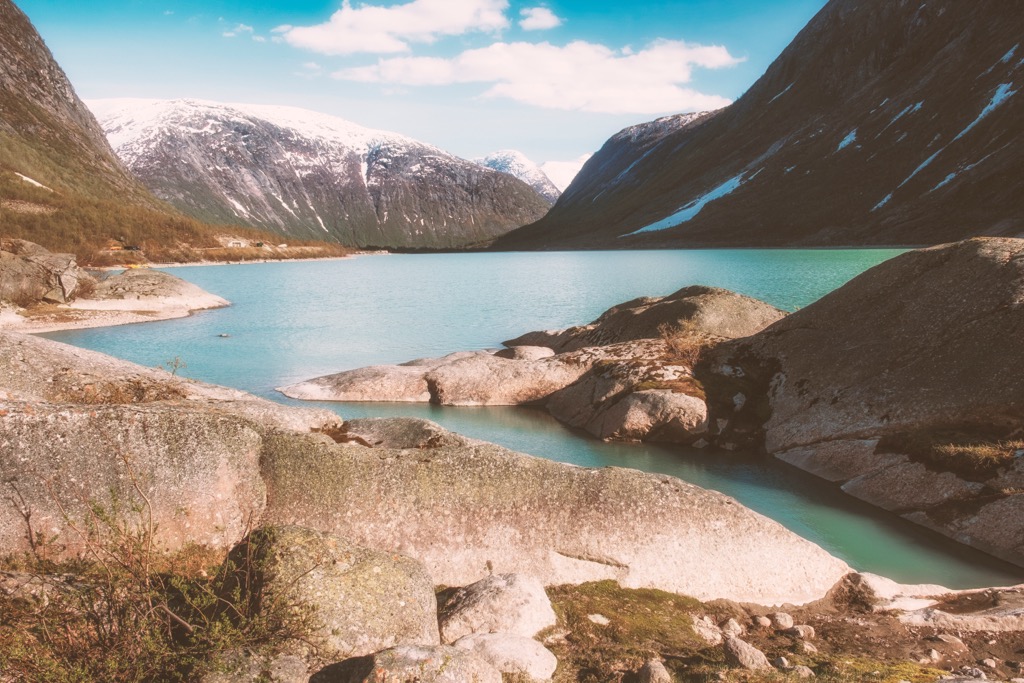
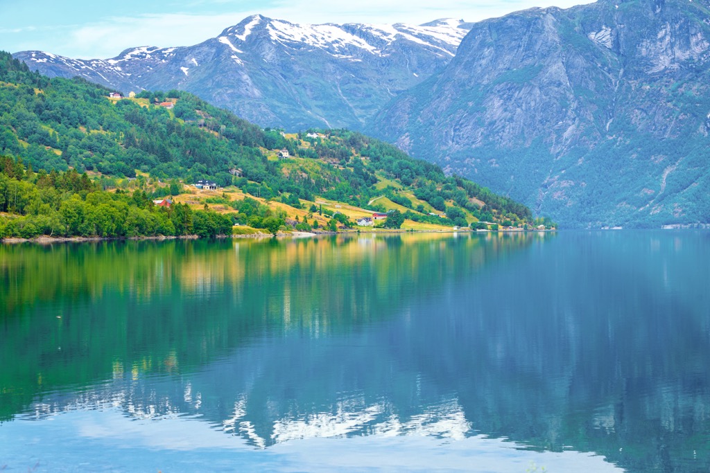
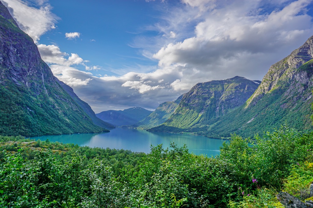
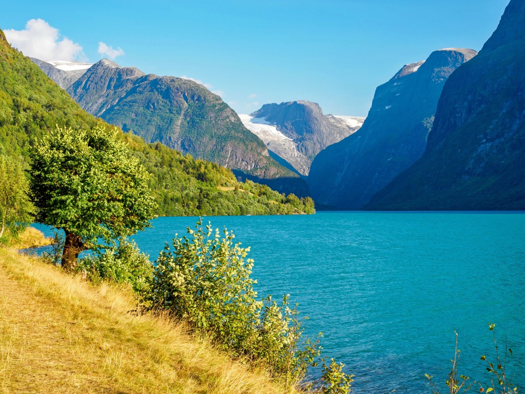
Major waterways found in the park include the Austerdalselvi, Langedøla, and Sumelvi. Some of the largest lakes include Oldevatnet and Lovatnet while Styggevatnet and Kupvatnet lie just outside the park boundaries.
Besides the stunning glaciers in the region, this national park is known for its dramatic changes in landscape within short distances. The glaciers visible today have helped shape the surrounding terrain including the dramatic changes in elevation and nutrient rich soil.
Those visiting the region can explore much of the national park including glacier hikes and glacier museums found in Jostedal and Fjærland. Easiest access to the park is from Jostedalen (Luster), Fjærland (Sogndal) and Veitastrondi.
Additionally, Jostedalsbreen National Park is surrounded by other popular outdoor recreation areas. Northeast of the park lies Breheimen and Reinheimen National Parks while Jotunheimen and Langsua National Parks are situated to the southeast.
Geologically the landscape within and surrounding the national park is part of the greater Scandinavian Mountains which extend throughout the countries of Norway, Sweden, and parts of Finland.
The base of these peaks were formed during the Caledonian orogeny. This major mountain building period occurred roughly 490-390 million years ago.
Tectonic shifting led to the collision of Laurentia and Baltica during the Scandian phase of the Caledonian orogeny around 420 to 405 million years ago. The entire range was slowly thrust upwards during both the Mesozoic and the Oligocene.
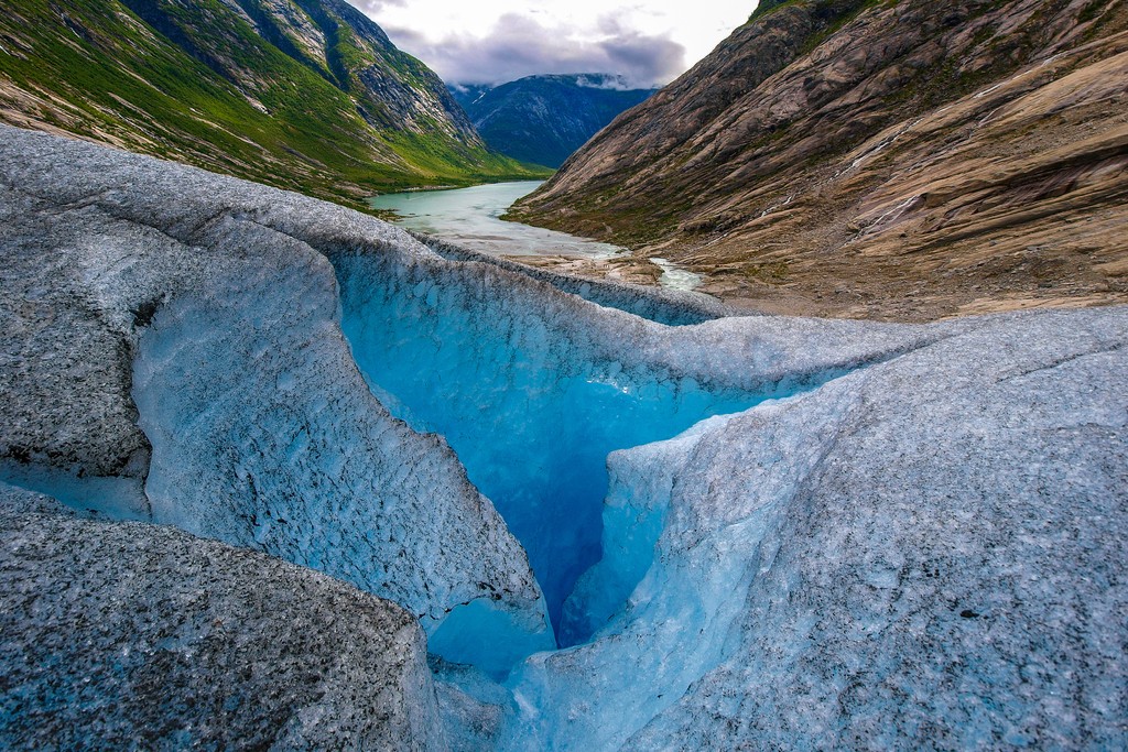
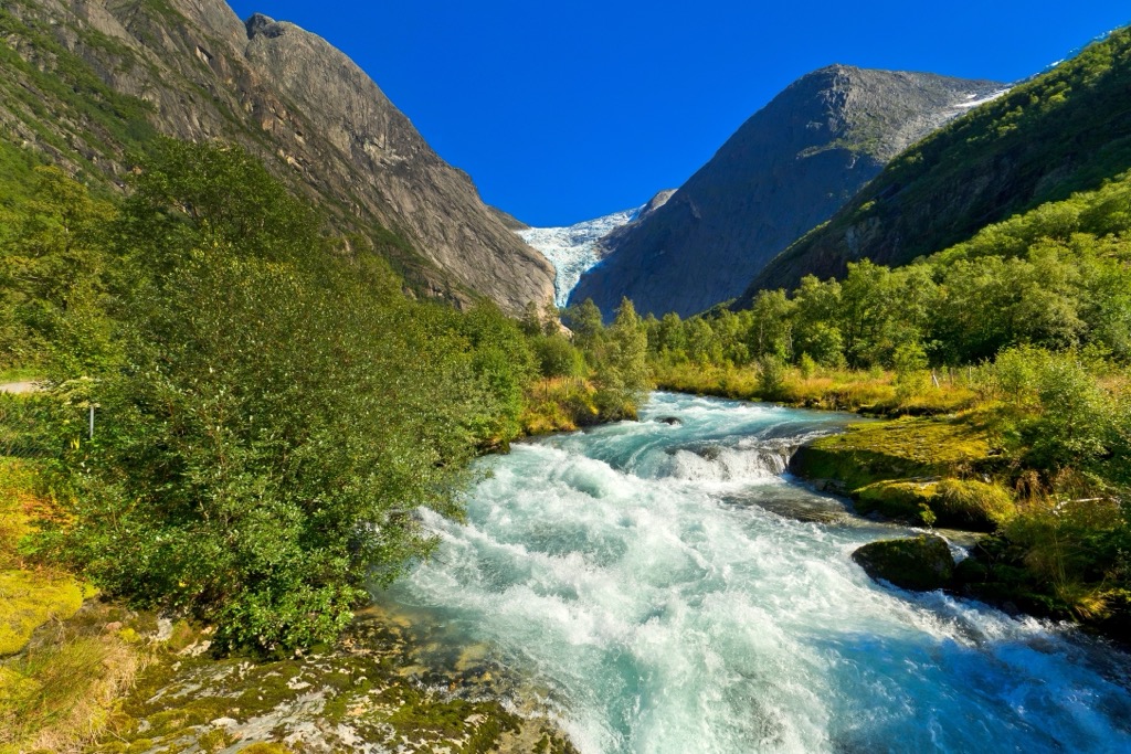
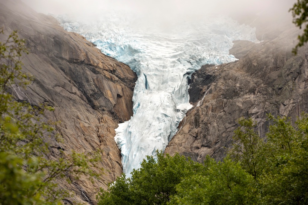
The Jostedal Glacier has also shaped the region into what is visible today. Widespread glaciation once defined the entire region. As the glaciers retreated, immense pressure pulled the glaciers towards the ocean, leaving behind the dramatic fjords that define Norway’s west coast.
Glacial retreating also left behind moraines, u-shaped valleys, sweeping plains and rockslides. Today the thickest part of the Jostedal Glacier is estimated to be 600 m (2,000 ft) thick.
Bedrock in the park primarily consists of gneiss which is known locally as “gråstein” or gray rock. In some places within the park the bedrock dates back over a billion years old.
Gravity continues to move the glaciers on the park, further shaping the landscape. Many of the rivers and lakes in the region appear emerald green due to the fine-grained rock flour of the glaciers which is washed away into the various waterways.
Major peaks within the Jostedalsbreen National Park include Lodalskåpa, Fremsta Ryssenipa, Snønipa, Grovabreen, Storskredfjellet.
The dramatic changes in elevation within the park allow for multiple ecosystems to thrive within the park boundaries.
The varied landscape provides an ideal habitat for large populations of deer and wild reindeer. Larger animals also include lynx, wolverine, and the occasional bear. A majority of the wild reindeer can be found in the eastern stretches of the national park.
Various species of bird inhabit the region including the white-tailed eagles, golden eagles, buzzards, kestrels, white-backed woodpeckers, and great spotted woodpeckers, along with various other species.
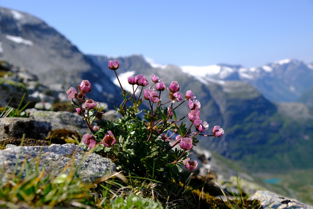
The influence of the nearby glacier has led to high amounts of diversity in the surrounding vegetation. The lowlands support populations of purple saxifrage and mountain chickweed while the forested regions are populated by elm, willow, and other heat tolerant species.
Other common trees include the gray alder, birch, and rowan. Hikers are also likely to spot a variety of lichen, mushrooms, wildflowers, and berries amidst the rugged landscape.
The land within and surrounding the Jostedalsbreen National Park has been inhabited by humans for thousands of years. Remnants of ancient hunting camps have been found in nearby Jotunheimen National Park, thought to date back to the Stone Age.
Settlements throughout the surrounding landscape date back to the Bronze Age and the Iron Age. For thousands of years the Norse people have inhabited parts of present day southern Norway while the Sami people primarily inhabited present day central and northern Norway.
The lush valleys and fjords in the park have long been used for farming, hayfields, grazing fields, and fields used for animal feed. Small communities were scattered throughout the region, marking cultural traditions for the Norse people.
In 1750 the nearby glacier reached a new maximum extent in what was referred to as the Little Ice Age. The rapid advance of the massive glacier led to the destruction of various farms in the surrounding fjords. Farms were destroyed in Oldedalen valley and Jostedalen, never to be seen again.
Modern day tourism surrounding the glacier began to thrive near the end of the nineteenth century. Word traveled throughout Europe of the stunning fjords and glaciers of Norway, leading to a large influx of tourists. Early tourists often arrived by ship in Fjærland and Olden and then traveled by horse carriage to the Bøyabreen and Briksdalsbreen glaciers.
The glacier outlets found in Jostedalsbreen are estimated to be some of the most popular travel destinations in the country. The glaciers in the park were also once used as a travel route for both people and livestock.
Jostedalsbreen National Park was established in 1991 and further expanded to its current size in 1998. Today the park marks one of the most visited national parks in the entire country.
Jostedalsbreen National Park is home to some of the most spectacular hiking trails in the entire country. With a varied landscape and stunning views of glaciers, hikers are sure to witness some of the most breathtaking beauty that Norway has to offer. Those wishing to explore the glaciers themselves should book a guided tour to ensure maximum safety precautions are taken. Below are a few of the most popular hiking routes in the park:
Briksdalsbreen is an arm of the larger Jostedal Glacier. The route to this portion of the glacier is one of the most popular and accessible hiking trails in the national park. The route begins in Briksdalen and travels along a gravel path.
Just a kilometer into the route hikers have views of the impressive Kleivafossen waterfall. The out and back trail turns around at a glacier lake which is fed by the Briksdalsbreen arm of the glacier. The entire hike is 5 km (3.2 miles) roundtrip with minimal changes in elevation.
Bødalsbreen is another arm of the Jostedal Glacier that defines much of the national park. The out and back trail winds through the lush alpine landscape with patches of forest, sweeping meadows, rocky cliffs, and cascading waterfalls.
The out and back trail climbs gradually throughout before reaching the edge of the glacier. This entire hike is 7.7 km (4.8 miles) in length and features 363 m (1,194 ft) of elevation gain. Hikers are greeted with breathtaking views throughout.
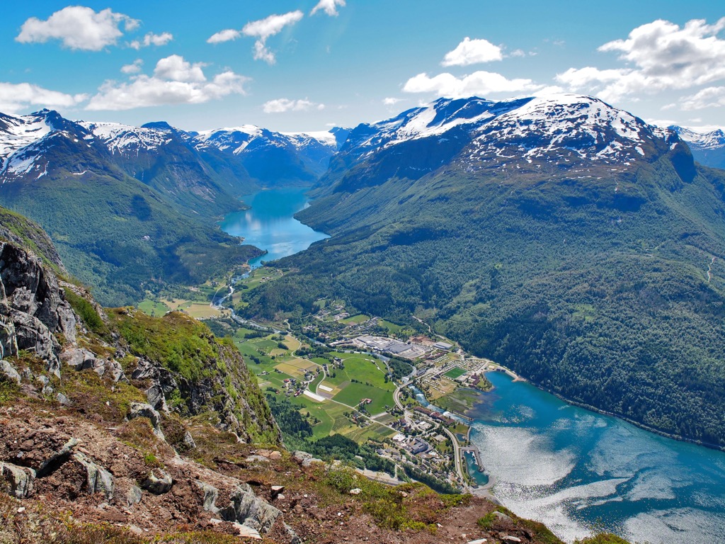
This hiking route begins by taking the Loen Skylift up above the Nordfjord. The skylift marks the steepest aerial tramway in the world. Once at the top, hikers have the option of completing this stunning loop with views of the fjord landscape throughout.
Rolling pastures and herds of sheep are common throughout the hike with much of the path following a gravel road. Hikers can extend the route by following some of the side trails for more views of the fjords. This loop hike is 7.7 km (4.8 miles) in length and features 509 m (1,669 ft) of total elevation gain.
Looking for a place to stay near the Jostedalsbreen National Park? Here are some of the best cities and villages to check out in the region:
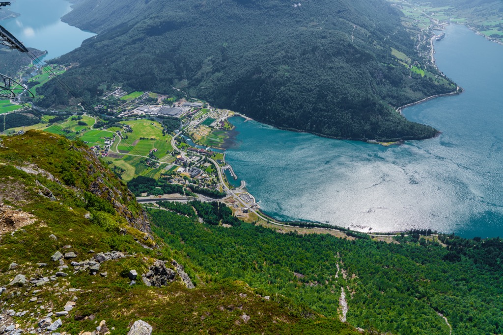
Loen lies along the northern edge of the national park along the eastern end of the Nordfjorden. The small village is home to the Loen Skylift which marks one of the steepest cable cars in the world. Visitors can ascend the cable car from the base of the fjord to an elevation of 1011 m (3,317 ft).
Once at the summit visitors can enjoy the views, go for a hike, or dine at one of the most stunning restaurants in the country. Loen offers easy access to the national park and is situated near branches of the main glacier in the park.
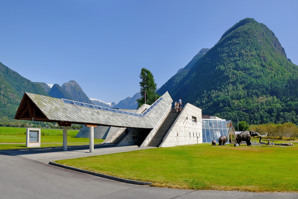
Fjærland lies along the southern edge of the national park at the end of the Fjærlandsfjorden. The village is home to the Norwegian Glacier Museum which showcases the geology and history of the national park and the surrounding region.
The Bøyabreen and Supphellebreen arms of the glacier are close by, providing visitors with easy access to some of the most stunning beauty in the national park. Besides the surrounding scenery, Fjærland is also known for its multiple bookshops scattered throughout the tiny village.
Fjærland acts as a gateway to the national park and the Jostedal Glacier. Though only around 300 residents live in the village, visitors flock to the region throughout the year.
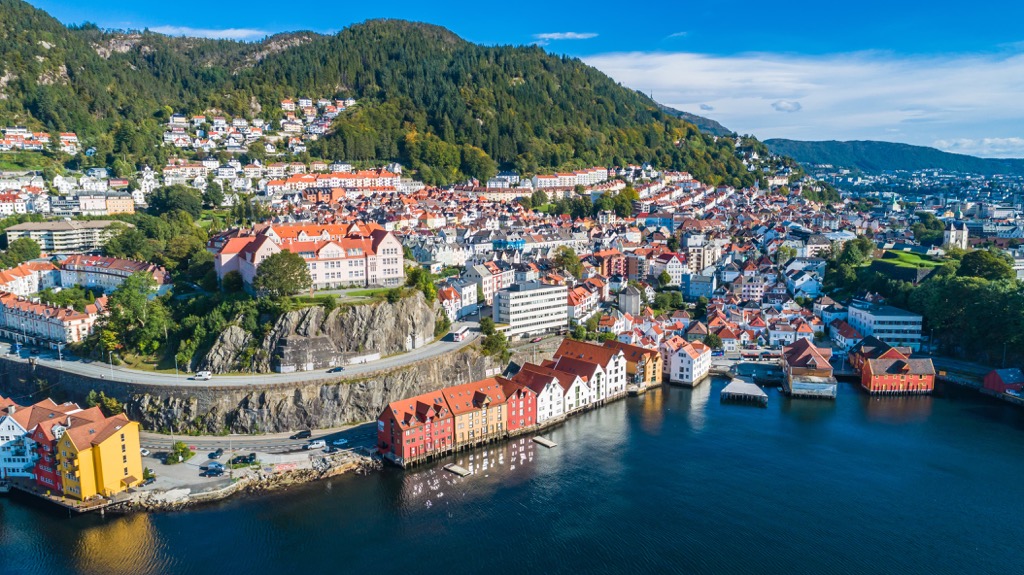
The closest major city to the national park is Bergen, situated around a four hour’s drive south of Fjærland. Situated within Vestland county, Bergen is home to around 286,000 residents, making it the second most populous city in the country. Commonly known as the “city of seven mountains” , various mountains and fjords define the region.
Mount Fløyen is perhaps the most well-known of the surrounding mountains and is accessible by foot or by railway from the city center. Despite the relatively large population of the city, Bergen lies in close proximity to the stunning fjords of western Norway. In just a few hours visitors can reach the famous Hardengerfjord and the Sognefjord.
Colorful wooden homes and the Bryggen Wharf mark the historic downtown streets of the city. The University of Bergen lies in the city and is home to around 30,000 students. A medieval fortress and castle mark the city’s center which also acts as the setting for the annual Bergenfest music festival.