Scan the QR code and open PeakVisor on your phone
Saltfjellet-Svartisen National Park (Norwegian: Saltfjellet-Svartisen nasjonalpark) is a stunning national park that spans across central Norway. The park covers land from the west coast of the country to the Swedish border in the east, marking the most intact and complex wilderness in the country. There are 191 named peaks with the tallest and most prominent being Ølfjellet at 1,751 m (5,745 ft) tall with 1,071 m of prominence (3,514 ft).
Saltfjellet-Svartisen National Park spans across central Norway, covering land from the west coast of the country to the eastern border with Sweden. The expansive park, along with the surrounding protected areas, marks the most intact wilderness in the entire country.
The national park spans 1,850 square kilometers (714 square miles) across central Norway. Including the three landscape protection areas and the four nature reserves, the park totals 2,875 square kilometers (1,110 square miles) throughout Nordland county.
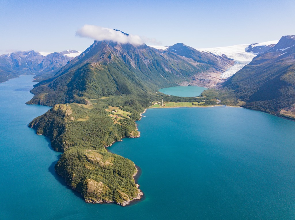
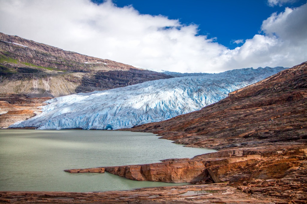
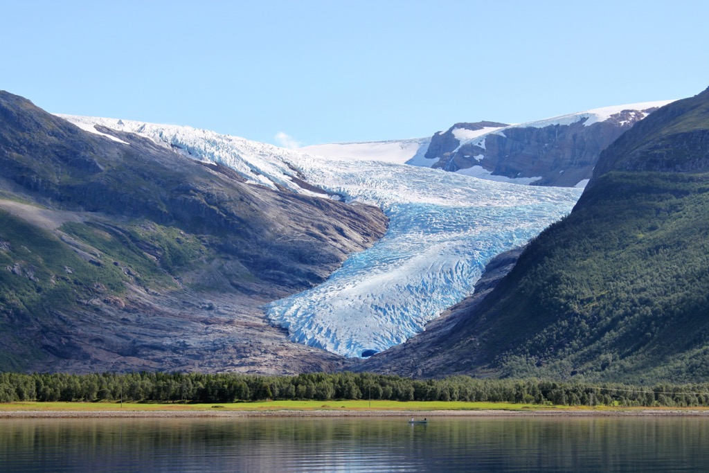
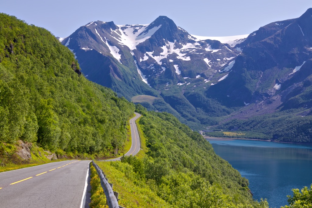
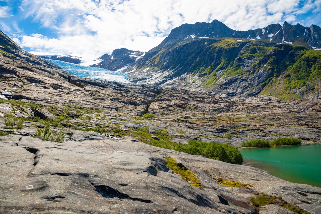
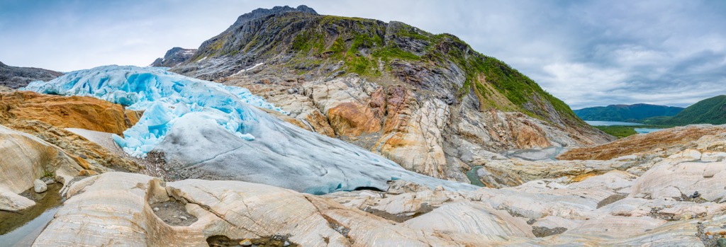
The park features a diverse array of landscapes, often being referred to as a miniature version of Norway. The western stretches of the park are characterized by the deep fjords and narrow valleys, found throughout the west coast of the country. This section of the park is also home to the Svartisen glacier.
The glacier consists of two major glaciers; Vestre Svartisen and Østre Svartisen. Vestre Svartisen marks the country’s second largest glacier, covering 221 square kilometers (85 square miles). Svartisen is also the lowest altitude glacier found in the European mainland. Visitors can easily view the glacier from the Engenbreen and Austerdalsisen glacier arms.
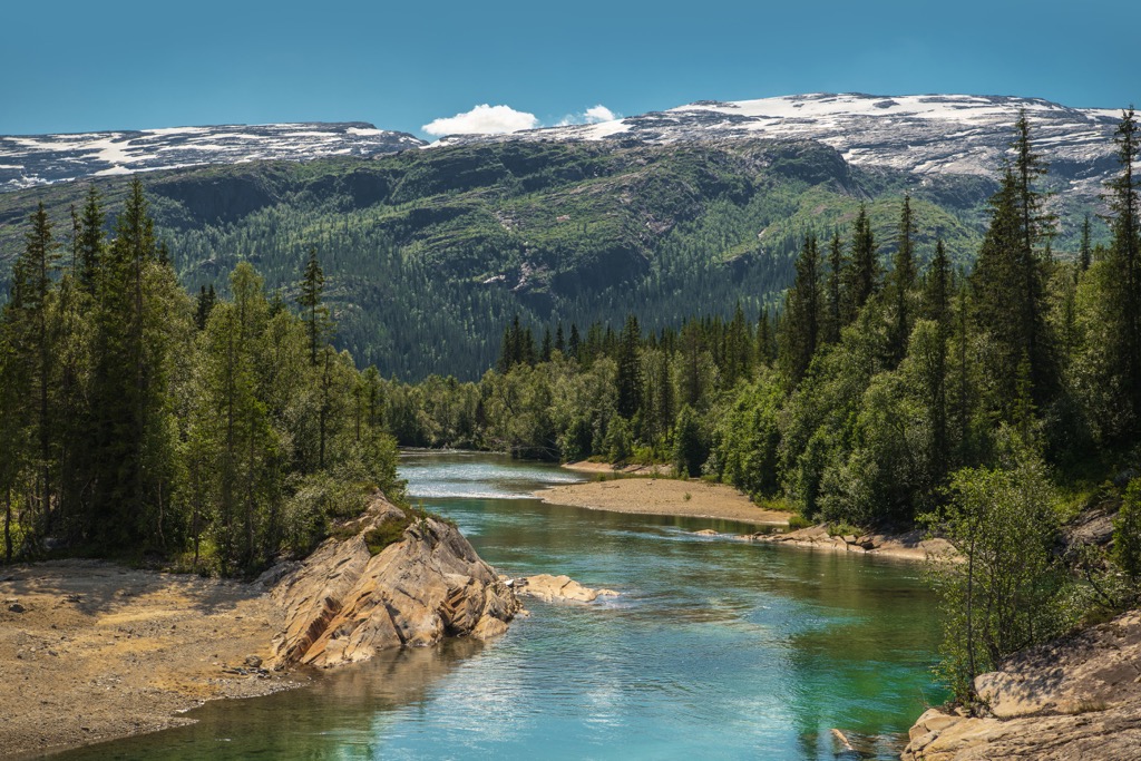
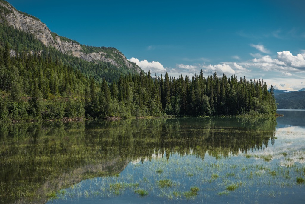
The southern portion of the park marks the lowlands of the region. Here the terrain is marked by a densely forested landscape of spruce and birch forests.
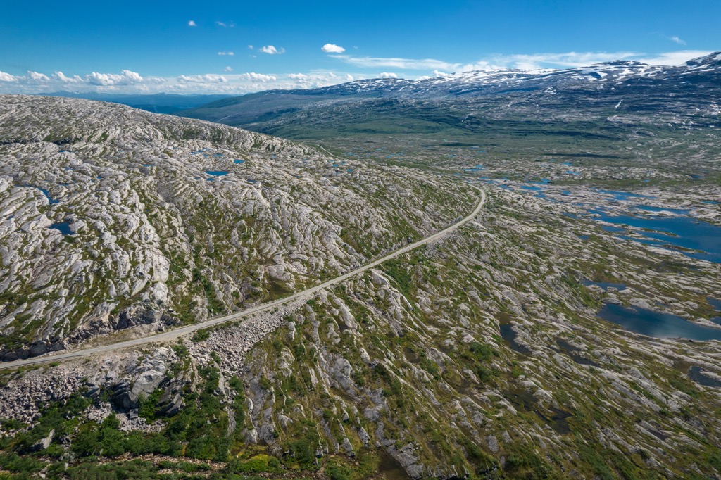
The northern and eastern stretches of the park are marked by the Saltfjellet mountain range and mountain plateaus. Situated along the edge of the Arctic Circle, the peaks span across the country from west to east. Here the terrain lies above the treeline, featuring rugged peaks, wide sweeping valleys and low growing flora.
The varied terrain found amidst the park has enabled a wide variety of flora and fauna to thrive. In the eastern stretches of the park lies the Bjøllåga river while the Lønselva river marks the western boundary of the park. Some of the large lakes found in the park include Bogvatnet and Nordre Bjøllåvatnet.
Additionally, Saltfjellet-Svartisen National Park is surrounded by other popular outdoor recreation areas. The Saltfjellet Landscape Protection Area lies directly east while the Gasvatnan Landscape Protection Area lies directly north. Junkerdal National Park is situated to the northeast while Láhko National Park is to the west.
The peaks found within the park are part of the Saltfjellet Mountains. These peaks mark a subrange of the Scandinavian Mountains, which span throughout Norway, Sweden and part of northern Finland.
The Scandinavian Mountains began forming around 400 million years ago during the Caledonian orogeny. This major mountain building period also formed peaks across other parts of northern Europe and North America.
The continents and terraces of Baltica and Laurentia collided with one another during the Scandian phase of the Caledonian orogeny, forming the base for the Scandinavian Mountains. The peaks were first thrust upwards during the Mesozoic era and again during the Oligocene.
Rocks found throughout the national park, and the rest of the range, consist primarily of granites and gneisses. Geologists believe these rocks are much older than the mountains themselves, dating back as early as 2.7 billion years.
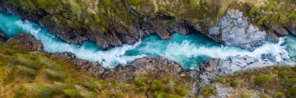
The fjords found in the western stretches of the park were formed by glacial erosion that occurred during the last major glaciation when massive glaciers once covered much of northern Europe.
As the glaciers were pulled towards the ocean, the immense pressure carved out the landscape, leaving behind the famous fjords visible today. Pressure from these glaciers was far less in the eastern stretches of the park, as seen by the wide and sweeping valleys.
Major peaks within Saltfjellet-Svartisen National Park include Ølfjellet, Skjelåtinden, Snøtinden, Stormdalsfjellet, and Svartisheia.
The wide range of terrain in the park has allowed an array of both flora and fauna to thrive in the region. Lower elevations in the southern stretches of the park support forested hillsides of spruce and birch trees.
The steep terrain of the fjords deters dense vegetation growth. Instead, the dramatic changes in elevation are covered in shrubs that remain lush and green throughout much of the year.

In the plateaus and mountainous regions of the park, the forest quickly thins, giving way to low growing grasses, shrubs, and seasonal wildflowers. The grasses found throughout the park mark important grazing grounds for reindeer in the area.
Saltfjellet-Svartisen National Park marks an important protected region for the endangered arctic fox. This national park, along with others throughout northern Norway, have slowly enabled their population to increase.
Other animals common throughout the park include reindeer, wolverines, golden eagle, gerfalcon, lynx, and elk. The sheer size of the park, coupled with minimal amounts of human activity, help increase visitor’s chances of seeing wildlife in the park.
The land within and surrounding Saltfjellet-Svartisen National Park has been used by the Sami people (also spelled Sámi or Saami) for reindeer herding since time immemorial. This region, along with much of northern Norway, is part of the Sápmi, the traditional territory of the Sami people.
Throughout the park lie multiple cultural sites for the Sami people who have lived throughout the Nordland region for over 2,000 years. The Sami people traditionally lived both inland and along the coasts of northern present-day Norway, fishing and hunting reindeer.
Though both the Sami and the Norse/Scandinavian people inhabited parts of present-day Norway the two groups had little interaction with one another. The Norse people established fishing routes in southern Norway and other parts of Europe.
During the Viking era, present day Nordland county was part of the kingdom of Hålogaland. The Sami and Norse people began experiencing increased conflicts during the nineteenth century. At this time the Norse people began to aggressively assert their claim over much of northern Norway.
The Sami people were then forced to attend Norse schools in order to assimilate. These schools separated families and greatly threatened the Sami peoples traditional way of life and beliefs system.
After the region was discovered to be rich in ore, mining began to grow in the surrounding land. During the early twentieth century the mining industry flourished with the nearby village of Mo i Rana becoming an industrial city.
Since the 1940s there had been resistance to expanding mining and energy interests throughout the region. After fifty years of ongoing protests and discussions, Saltfjellet Svartisen National Park was finally established in 1989 to protect the biodiversity of the region.
Saltfjellet Svartisen National Park is home to numerous trails for hiking and outdoor recreation. Here are some of the most popular trails in the region:
The Bredekrunde loop trail lies along the southern border of the national park. The trail begins along the Ranaelva river before climbing steeply through the forested landscape. Hikers pass along numerous creeks and streams with viewpoints of waterfalls.
At the higher elevations, the route passes along wild meadows and old farms while the snow-capped mountains tower above close by. This loop trail is 9 km (5.6 miles) in length and features 435 m (1,427 ft) of elevation gain.
This popular route lies along the river Glomåga. Hikers begin by climbing through the forested terrain before reaching the stunning landscape of the river. The unique rock formations have been formed over the course of thousands of years from loose rocks being washed away and carved out by the river.
Hikers can spot holes, arches, and other unique features amidst the rocks. Sections of the trail are quite steep and require scrambling on the rocks. The out and back route to Marmorslottet is 2.4 km (1.5 miles) in length and features 99 m (324 ft) of total elevation gain.
This route is one of the more popular trails for viewing the Svartisen glacier. Hikers begin by taking a boat from Holand which is situated along the Holandsfjorden. The first few kilometers are extremely flat and can be trekked by walking or by bike.
The trail then reaches the glacial lake of Svartisvatnet with the glacier itself situated along the lake’s eastern edge. Lush green hills rise steeply as water rushes from the glacier into the lake. This out and back trail offers some of the most stunning views of the glacier and totals 13 km (8 miles) and features 1,066 m (3,497 ft) of total elevation. To make the route easier, hikers can turn around once at the lake rather than climbing up towards the glacier.
Looking for a place to stay near the Saltfjellet Svartisen National Park? Here are some of the best cities and villages to check out in the region:
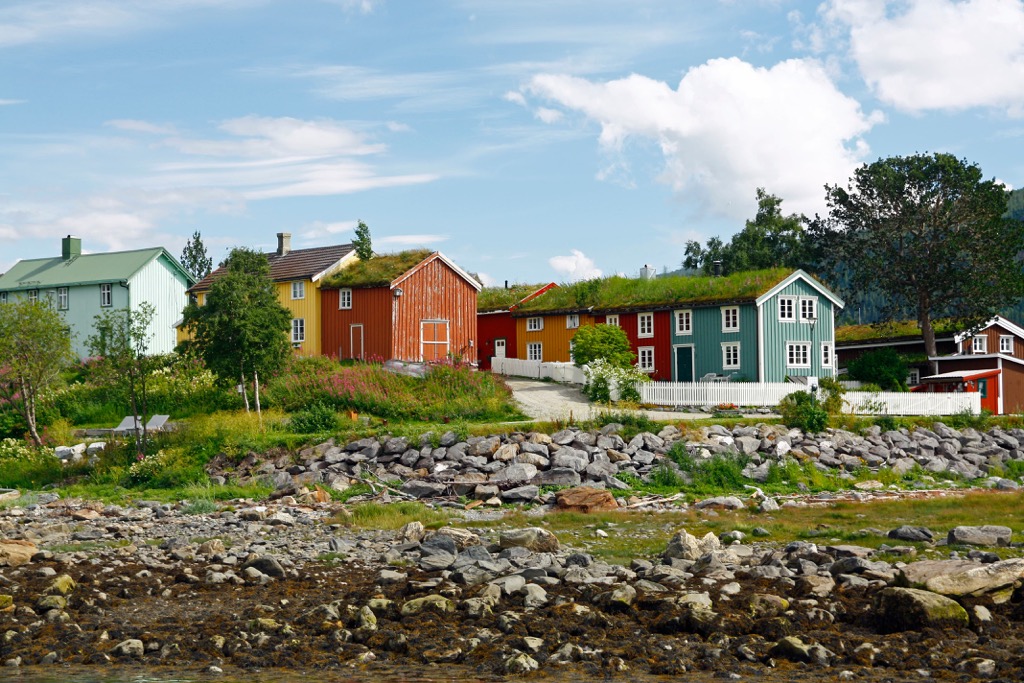
Mo i Rana is a city home to around 20,000 residents, situated just south of the national park. The city acts as the administrative center for the municipality of Rana, near the edge of the Arctic Circle.
The city was originally established as a trading post and now acts as a gateway to the region and the national park. Sites in the city include the Mo Church, Havmann sculpture, and the Rana Museum.
Each May the city hosts the festival of Havmanndagene. Mo i Rana lies along the southern edge of the Ranfjorden along the Ranelva river. The region is also known for its numerous caves including Grønligrotta and Setergrotta which are open to the public.
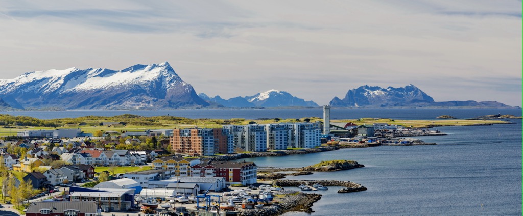
The town of Bodø lies north of the national park, is home to around 56,00 residents, and marks the second most populous city in northern Norway. Bodø is situated along Bodø peninsula between theSaltfjorden and the Vestfjorden.
Bodø lies just above the Arctic circle making it an ideal place to witness the northern lights during parts of the year. Stunning beaches and breathtaking countryside surround this northern city. Some of the most popular sites in town include Bodin Church and Bodø Cathedral. The Kjerringøy trading post lies in the city and is thought to be the best preserved trading post in the country.
Just off the shores Besides of Bodø lies Saltstraumen maelstrom. The whirlpool spans ten meters (33 ft) across making it the world's largest maelstrom.