Scan the QR code and open PeakVisor on your phone
Rondane National Park (Norwegian: Rondane nasjonalpark) is situated in the Innlandet county of north central Norway. As the oldest national park in the country, the terrain features 187 named peaks. The tallest and most prominent peak in the park is Rondslottet at 2,178 m (7,146 ft) with 1,230 m (4,035 ft) of prominence.
Rondane National Park spans across Innlandet county in north central Norway. The park boasts 10 peaks above 2,000 m (6,560 ft) with the tallest mountain being Rondslottet.

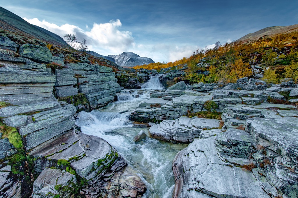
The terrain of the park consists of high and rugged peaks, intermixed with vast plateaus. Rondane National Park spans 963 sq. km (372 sq. miles) across the mountainous region. Elevations range from around 1,000 m (3,300 ft) up to 2,178 m (7,146 ft).
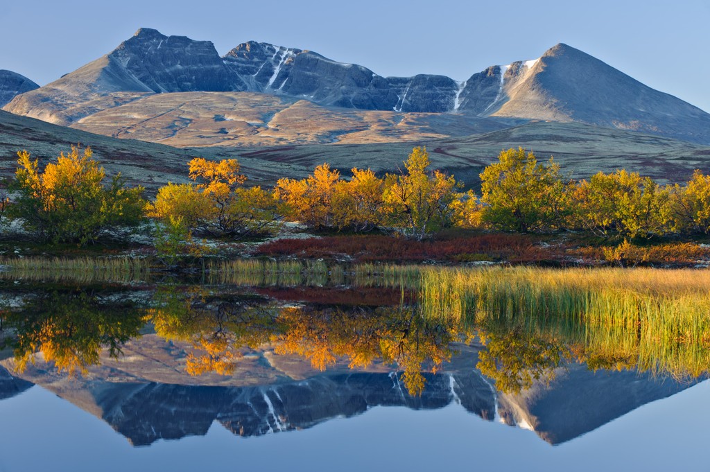
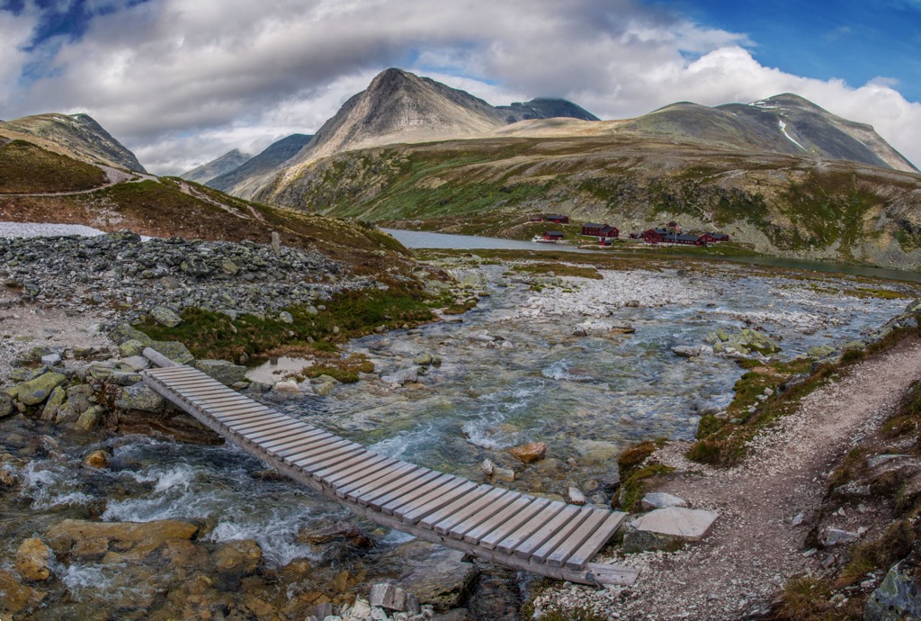
The vast plateaus of the region distinguish Rondane National Park from the other nearby national parks. Many of the main ridgelines are separated by deep and narrow valleys, carved out over the course of millions of years. Rondvatnet, a narrow lake, lies in the deepest valley of the park between the Storronden–Rondslottet massif and Smiubelgen.
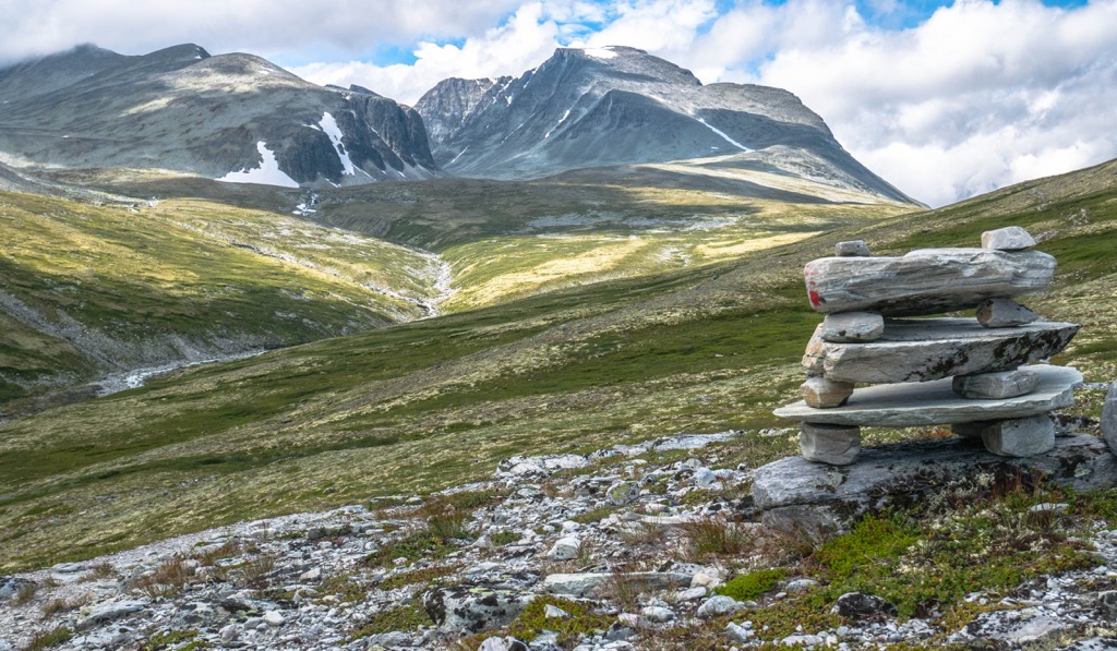
The massif situated near the center of the park, also features flat and dead stone valleys. The foothills of the peaks feature more gradual changes in elevation while the tallest peaks feature steep increases in elevation.
Unlike the nearby Jotunheimen National Park (Norwegian: Jotunheimen nasjonalpark), Rondane does not feature any mountain glaciers. The rather arid terrain receives less rainfall than the mountainous region directly west. Snowpack can be found in some of the flatter valleys throughout the year.
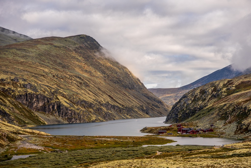
Lake Rondvatnet is one of the main features of the park and lies near the center of the protected region. From the lake shore many of the major sites and peaks can be reached by completing a day hike. Elevations are higher in the central and northern regions of the park while the south primarily consists of flatter plateaus.
Additionally, Rondane National Park is surrounded by other popular outdoor recreation areas. Both Dovre National Park and Dovrefjell-Sunndalsfjella National Park lie north of the park while Jotunheimen National Park is to the west and Langsua National Park is to the southwest.
The peaks found within and surrounding Rondane National Park are part of the greater Scandinavian Mountains. This large range extends through the countries of Norway, Sweden, and northern Finland. Peaks that lie within the national park are commonly referred to as the Rondane Mountains, a subrange of the larger Scandinavian Mountains.
Prior to the formation of peaks in the region, a shallow sea once covered the region, dating back approximately 500 to 600 million years ago. As the sea retreated both metamorphic rock and quartz were left behind. Lack of fossils in the region has led geologists to believe the shallow sea did not contain any animal life.
The peaks in the park began forming during the Caledonian orogeny, a major mountain building event that took place roughly 490-390 million years ago. Tectonic shifts led to the collision of the continents and terraces of Laurentia, Avalonia, and Baltica, ultimately closing off the Iapetus Ocean.
The Scandian phase of the Caledonian orogeny marked the collision of Baltica and Laurentia, beginning the formation of the Scandinavian Mountains around 420 to 505 million years ago. The peaks were uplifted during the Mesozoic era and further uplifted during the Oligocene.
While the northern and central sections of the park were thrust upwards, the southern portion of the park was stretched out, beginning the formation of the plateaus. Much of the landscape visible today was shaped during the last ice age, roughly nine to ten thousand years ago.
During this time, vast glaciers covered the landscape. As the glaciers and snowpack retreated, they carved out the deep canyons and valleys in the region. Sediment left behind filled in some of the valleys while others were filled with lakes. Some of the most prominent deep canyons in the park are Jutulhogget and Vesle-Ula.
Exposed rock on the Rondane massif features sandstone dating back hundreds of millions of years. Further evidence of the glaciers that once covered the region can be found in the kettle holes and eskers.
Major peaks within the Rondane National Park include Rondslottet, Storronden, Trolltinden, Høgronden, and Småhaugan.
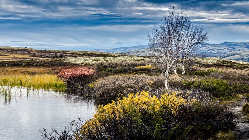
A majority of Rondane National Park is free of trees, with only the lowest elevations featuring patches of white birch trees. As elevations rise above 1,000 m (3,300 ft), the trees give way to heather and lichen.
Low growing grasses can be found amidst the rolling foothills and sweeping plateaus. The main peaks in the park are free of flora, featuring rugged and rocky terrain where only a few species of lichen are able to grow.
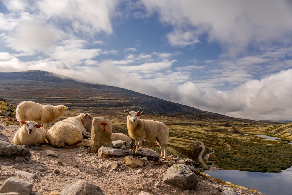
Rondane marks one of the only places in the country, and all of Europe, where wild reindeer live. Domestic reindeer are far more common compared to their wild counterparts. Recent studies suggest that anywhere from 2,000 to 4,000 reindeer live within the park boundaries. In order to further protect the population of reindeer, major hiking trails have been moved in recent years.
Hikers may also spot roe deer amidst the rocky peaks. Less common animals include musk ox, lynxes, wolverines, and occasionally wolves. Musk ox are more commonly spotted in the nearby Dovrefjell-Sunndalsfjella National Park.
The land throughout Rondane National Park has been inhabited by humans for thousands of years. Remnants of hunting grounds have been found amidst the mountain plateaus. These primitive sites showcase the hunter gatherer lifestyle of early humans who lived off the reindeer in the region.
Nearby settlements date back to the Bronze Age and the Iron Age, marking ancient trade routes across the mountains in the region. The barren landscape forced human settlements to be located at lower elevations where fresh water sources were more available.
Traps once used to catch reindeer can be found in Gravhø and Bløyvangen within the park. These early traps were made of stone walls, designed to lure in and trap unsuspecting reindeer. The trapped reindeer would be used for meat while their pelts were used for clothing and trading.
The nearby settlement of Otta was originally established as a farm area known as Aamot (or Åmot). From the 1600s to the 1800s, the nearby mountains were used for mining of both iron ore and copper.
In 1612, the Battle of Krigen took place in present day Otta. The battle was between Norwegians and Scottish mercenary soldiers who were en route to join forces with Sweden for the Kalmar War. Today a statue pays tribute to those who fought and died during battle.
The Otta Station was constructed in 1896 and marked the northern terminus for the railroad system for nearly a decade. The establishment of the railroad station led to a small town being established, later becoming the town of Otta.
Following over a decade of planning, in 1962 the mountainous region was established as Norwegian National Park, marking the first park of its kind in the country. When established the park covered 580 sq. km (224 sq. miles).
In order to further protect the wild reindeer of the region, the park was expanded in 2003 to its current size. During its expansion, the nearby Dovre National Park and Dovrefjell-Sunndalsfjella National Park were also established. Today, visitors have the right to roam throughout Norway, ensuring free access to all national parks unless otherwise posted.
Rondane National Park is home to a plethora of hiking trails. Here are a few routes to check out on your next visit to the park:
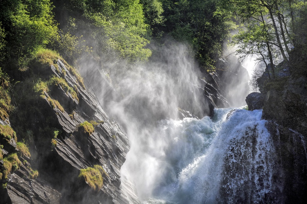
The Ulafossen Falls trail is one of the most stunning routes in the national park. When entering the park through Mysusæter the falls are visible, with a hiking option to descend right to the base of the falls.
Ulafossen has multiple falls with the main section cascading down 50 m (164 ft). The loop trail is 2.4 km (1.5 miles) in length and features roughly 55 m (180 ft) of elevation gain. This route takes the average hiker around one hour to complete.
The trail to the summit of Formokampen begins north of Otta, along the western edge of the national park. This route climbs steadily throughout, passing above the treeline and reaching the arid terrain that defines the park.
Once at the summit, hikers are rewarded with sweeping views of the Gudbrandsdalen Valley lying 800 m (2,625 ft) below. The entire out and back hike is 9 km (5.6 miles) in length and features 453 m (1,486 ft) of elevation gain.
Visitors to the region have the option of summiting the highest peak in the national park, Rondeslottet. Beginning in Rondvassbu the trail begins by gradually climbing through the rocky terrain. There is minimal flora throughout the hike, with much of the route following along the rocky hillsides.
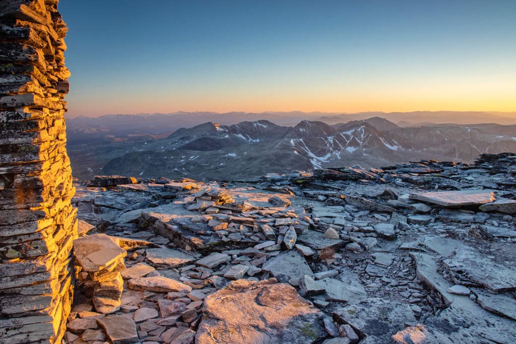
The trail begins to steepen when nearing the summit with stunning views throughout. From the top of the peak, hikers are greeted with panoramic views of the national park and the other prominent peaks in the region. This out and back trail is 23.8 km (14.8 miles) in length with 1,200 m (3,937 ft) of elevation gain.
Looking for a place to stay near the Rondane National Park? Here are some of the best cities and villages to check out in the region:
Otta lies just east of Rondane National Park, marking the closest town to the park. Situated in the Sel Municipality in Innlandent county, Otta is a gateway into the national park. The town is home to around 2,300 residents but is also popular amongst tourists, offering multiple hotels and campsites.
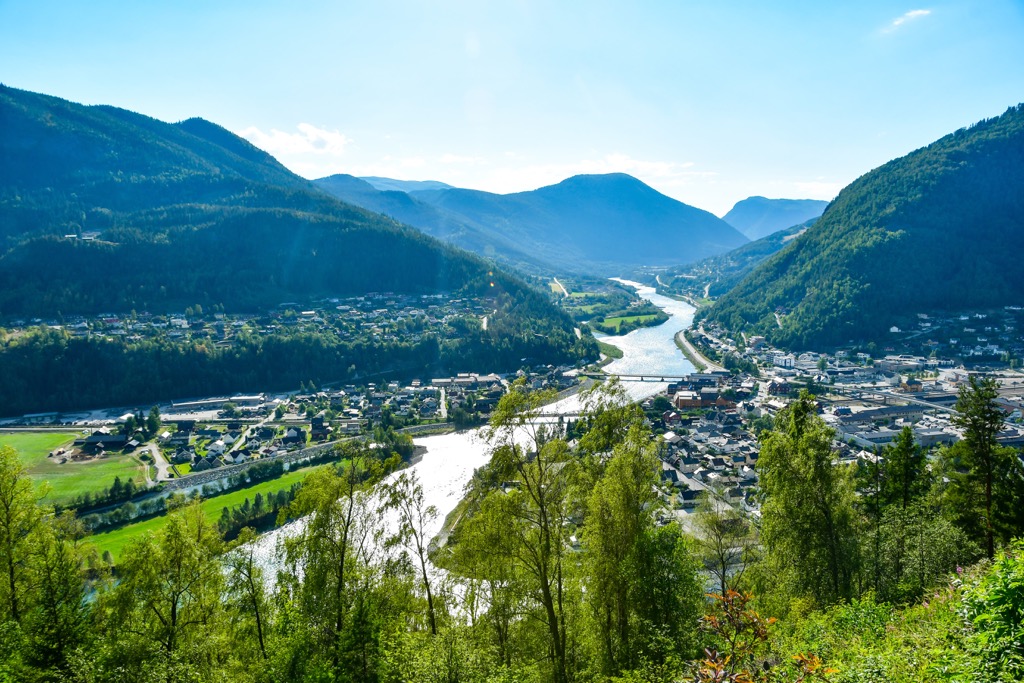
Otta lies at the confluence of the Gudbrandsdalslågen and Otta rivers in the Ottadalen valley. Surrounded by national parks, Otta is a perfect base point for those looking to explore multiple of Norway's national parks. In the town lies a monument for the Battle of Kringen and the Milorg hideout of Reiret.
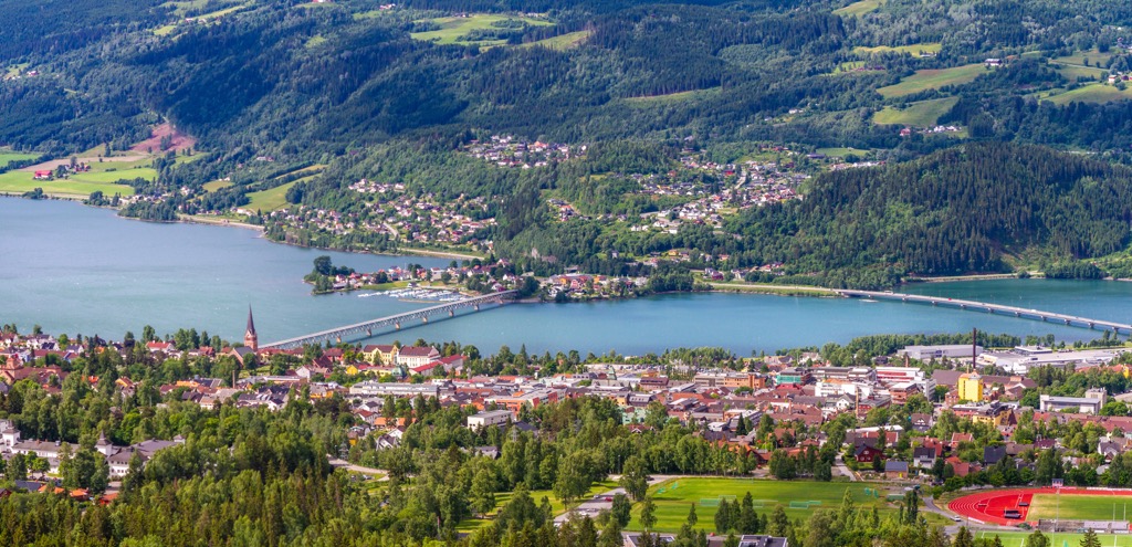
Situated an hour and half drive south of Otta lies the town of Lillehammer. Known for being a ski resort town, Lillehammer is home to around 28,500 residents. The town lies along the northern shores of lake Mjøsa and the river Lågen while surrounded by the stunning Norwegian mountains.
Visitors can explore the Norwegian Olympic Museum from when the city hosted the 1994 Winter Olympics. The town is also home to Maihaugen, the largest open air museum in the country, featuring 185 buildings. During the winter months, visitors can enjoy skiing at Hafjell just 15 km (9.3 miles) away, cross-country skiing, dog sledding, and snowshoeing. The summer months provide visitors with ample opportunities for kayaking, hiking, or biking.