
Scan the QR code and open PeakVisor on your phone
Dovrefjell-Sunndalsfjella National Park (Norwegian: Dovrefjell-Sunndalsfjella nasjonalpark) is situated in central Norway. The park is known for its varied landscape and population of wild reindeer. The tallest and most prominent peak in the park is Snøhetta at 2,286 m (7,500 ft) tall with 1,672 m (5,486 ft) of prominence.
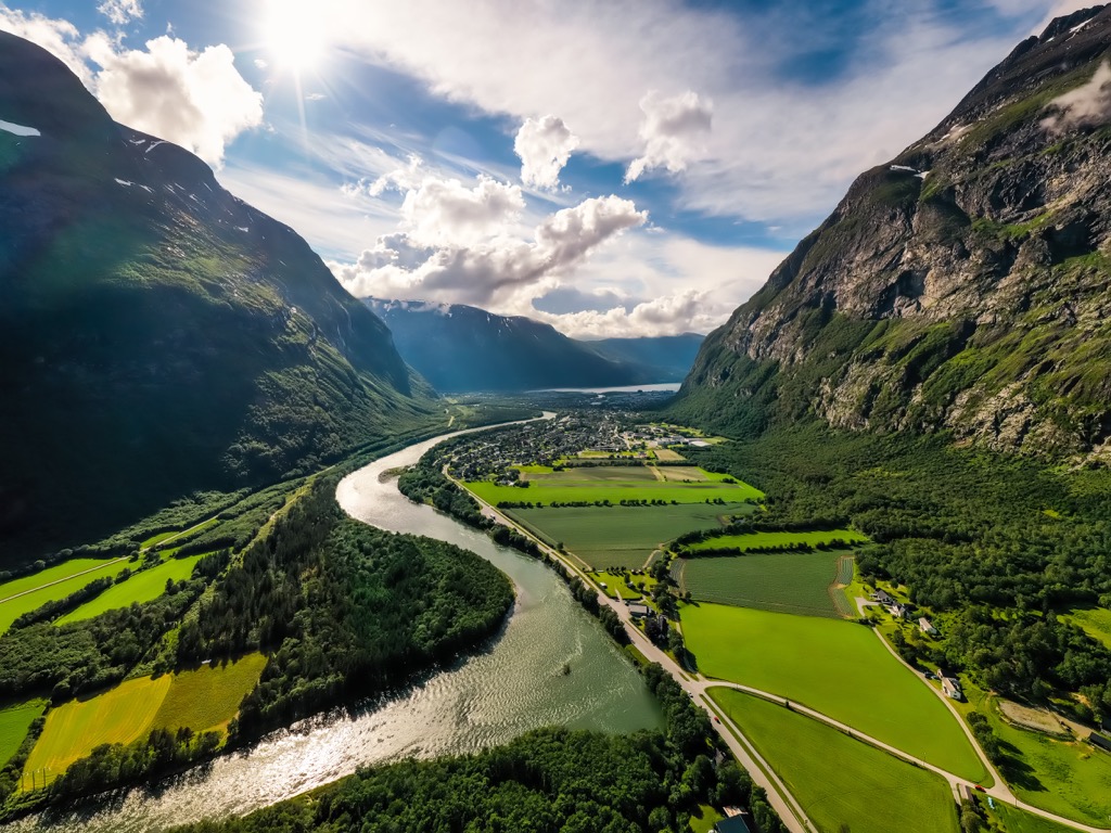
Dovrefjell-Sunndalsfjella National Park spans across central Norway and features a varied landscape including arid terrain in the east and alpine terrain in the west. The park covers land in Innlandet, Trøndelag, and Møre og Romsdal counties.
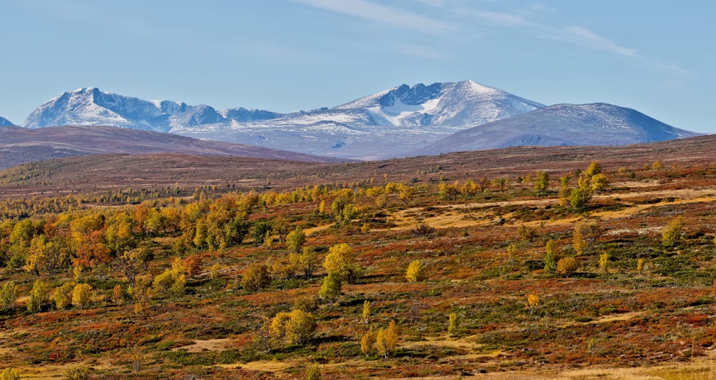
This national park is centered around the Dovrefjell mountain range that features dramatic changes in elevation, rocky summits, and alpine meadows. Dovrefjell-Sunndalsfjella National Park encompases 1,693 sq. km (654 sq. miles) of land.
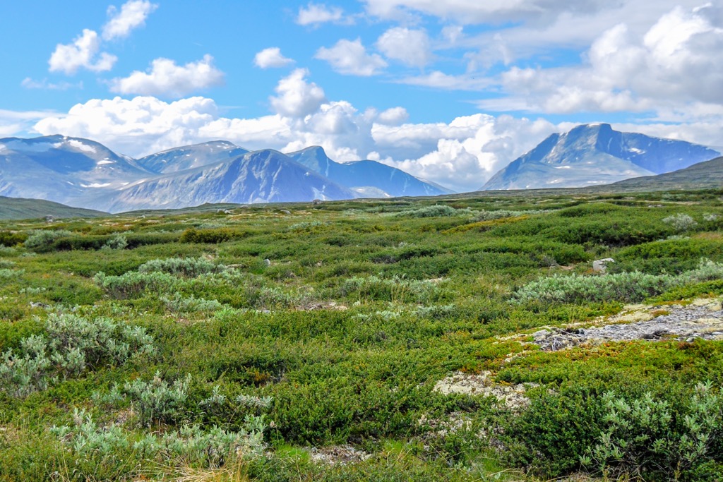
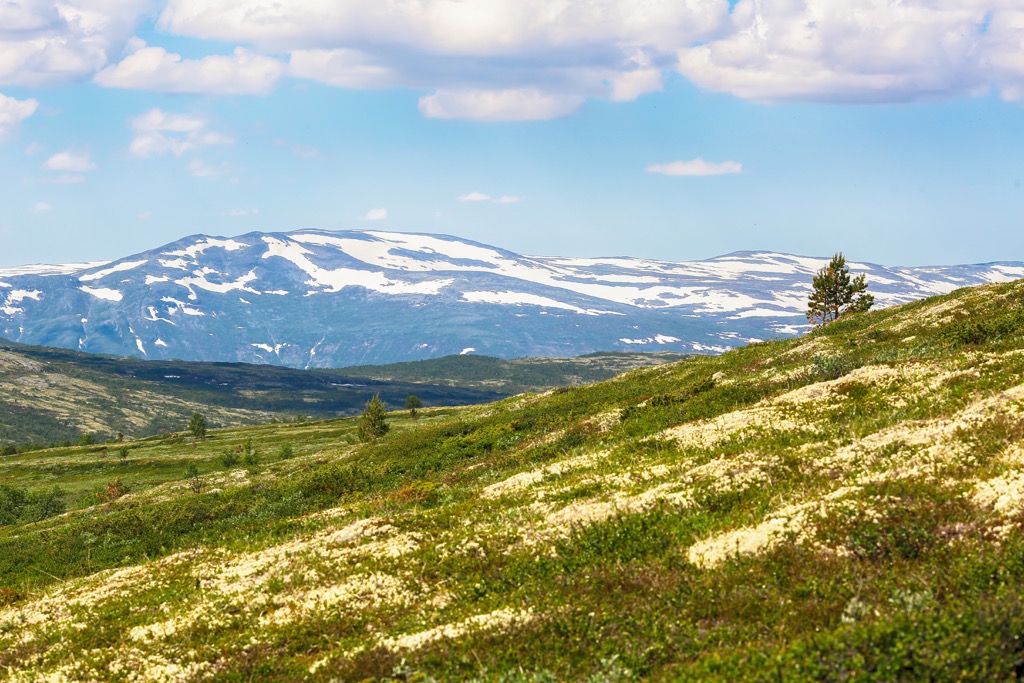
The northwestern region of the park is defined by its alpine scenery and lush waterfalls. The eastern stretches of the park features a more dry and arid landscape, similar to much of central and eastern Norway. Terrain in the westernmost portion of the park is centered around the Snøhetta mountain massif.
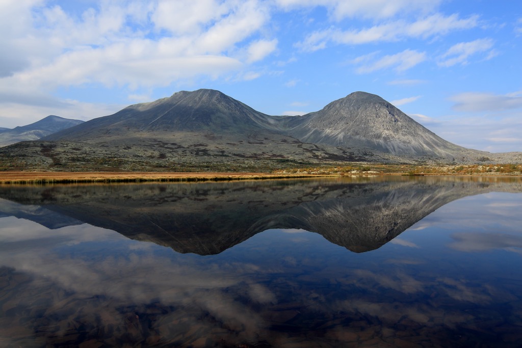
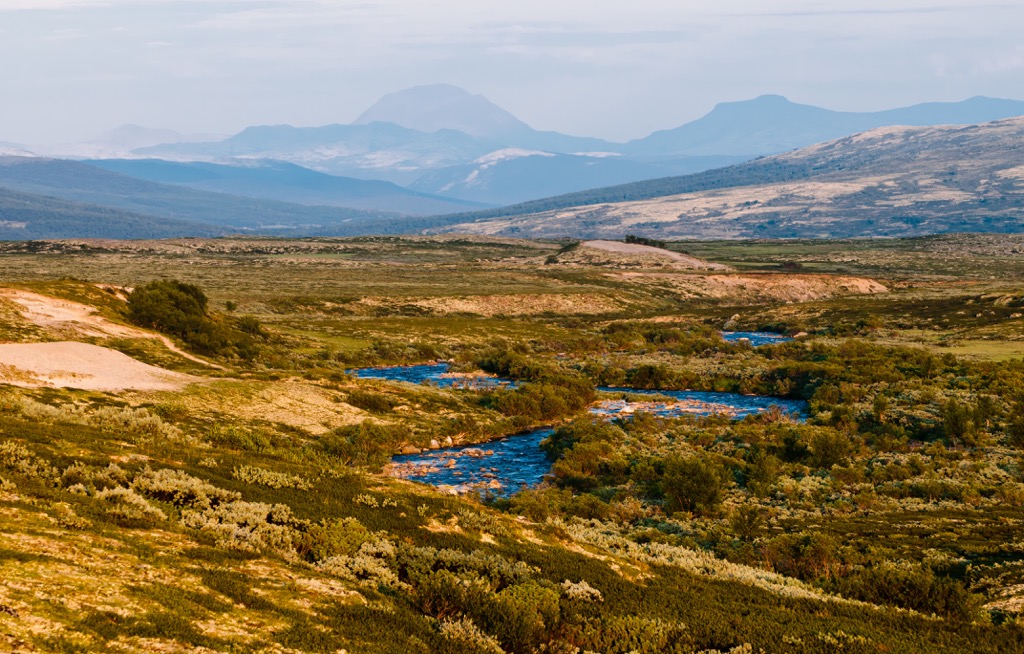
Around the massif the more gentle slopes give way to sharp and rugged ridgelines and vast forested valleys. Hundreds of lakes are scattered throughout the park, helping the flora and fauna of the region thrive. The park is also home to the county’s most intact ecosystem.
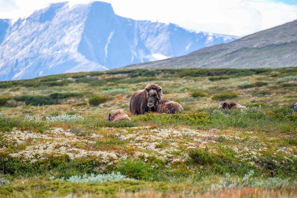
A majority of the park lies above the treeline with many of the hills featuring low growing grasses, shrubs, and rocky cliffs. The lush vegetation and high amounts of rainfall help the ecosystem thrive. The almost intact ecosystem features populations of wild reindeer, wolverines, arctic foxes, and musk oxen.
The peaks in the western stretches of the park are part of a coastal climate, receiving less snowfall than many of the inland peaks. The most eastern terrain of the park lies in the rain shadow of the nearby mountains, with less rainfall throughout the year.
Additionally, Dovrefjell-Sunndalsfjella National Park is surrounded by other popular outdoor recreation areas. Both Rondane National Park and Dovre National Park lie to the southeast while Jotunheimen National Park is to the south and Forollhogna National Park to the northeast.

The peaks found within and surrounding Dovrefjell-Sunndalsfjella National Park are part of the greater Scandinavian Mountains which span across Norway, Sweden, and northern Finland. Peaks that lie within the national park are also part of the Dovrefjell mountain range, a subrange of the larger Scandinavian Mountains.
Before the formation of the current landscape, a shallow sea covered the region approximately 500 to 600 million years ago. The peaks began to form during the Caledonian orogeny, 490-390 million years ago. During this major mountain building event, tectonic shifts led to the collision of Laurentia, Avalonia, and Baltica which closed off the Iapetus Ocean.
The Scandian phase of the Caledonian orogeny marked this collision which led to the formation of the Scandinavian Mountains around 420 to 505 million years ago. The rugged peaks were thrust upwards during the Mesozoic era and further uplifted during the Oligocene.
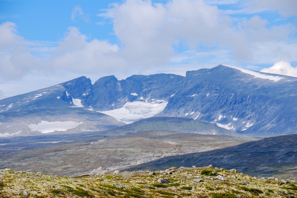
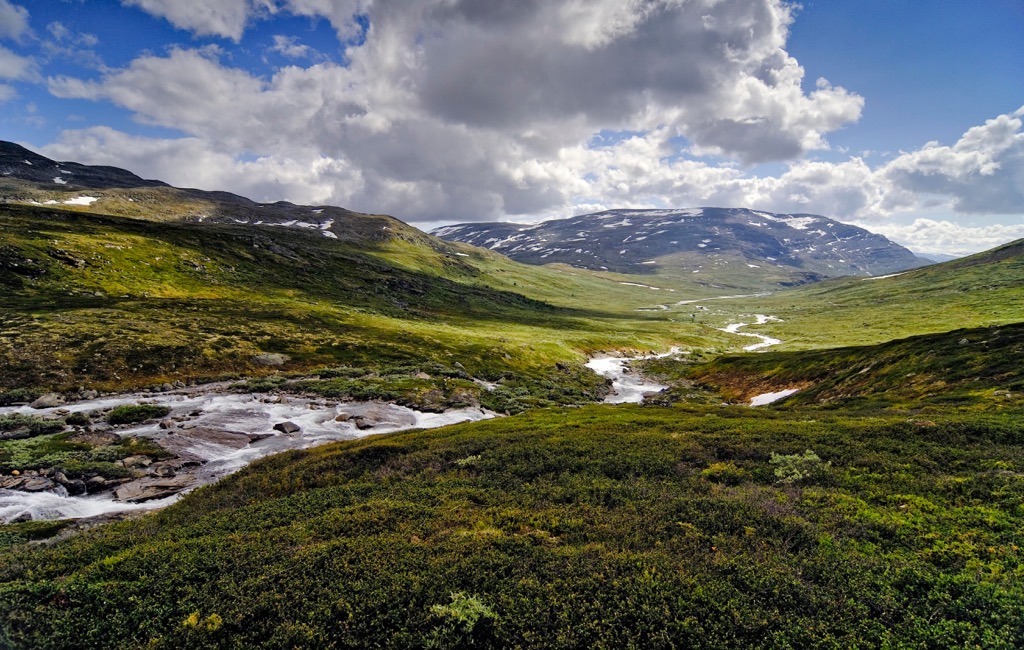
The landscape visible today was drastically shaped by ice ages of the Quaternary period. The most dramatic changes in elevation are visible in the western stretches of the park where the movement of ancient glaciers was strongest. Valleys in the east experienced less pressure from glacial retreating, as seen in the more rounded slopes.
Doverfjell marks a residual massif, formed when the surrounding rock was heavily eroded. The tallest peaks in the park mark the remnants of the once flat landscape of present day Norway.
Major peaks within the Dovrefjell-Sunndalsfjella National Park are Snøhetta, Knutshø, Storkalkinn, Storskrymten, and Midttoppen.
The Dovrefjell-Sunndalsfjella National Park contains an almost intact ecosystem, marking the most intact one found in the entire country. The park is known for its rich biodiversity, though a majority of the flora and fauna is found in the Drivdalen valley and in Grøvudalen valley.
The lowest elevations feature forested patches while the hillsides are covered with low growing shrubs, grasses, and wildflowers. Many of the hillsides remain lush and green throughout the year due to the evenly distributed amount of rainfall.
The Norwegian wild reindeer live in the park, marking one of the final wild reindeer populations in all of Europe. This species of reindeer has lived in the mountainous region for over 10,000 years and is a vital part to the history and culture of the region.
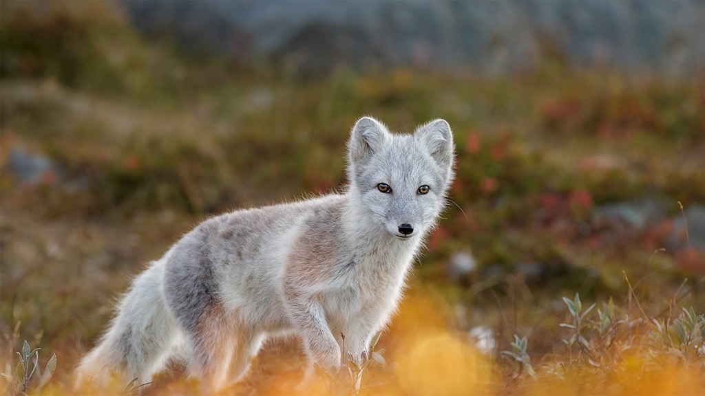
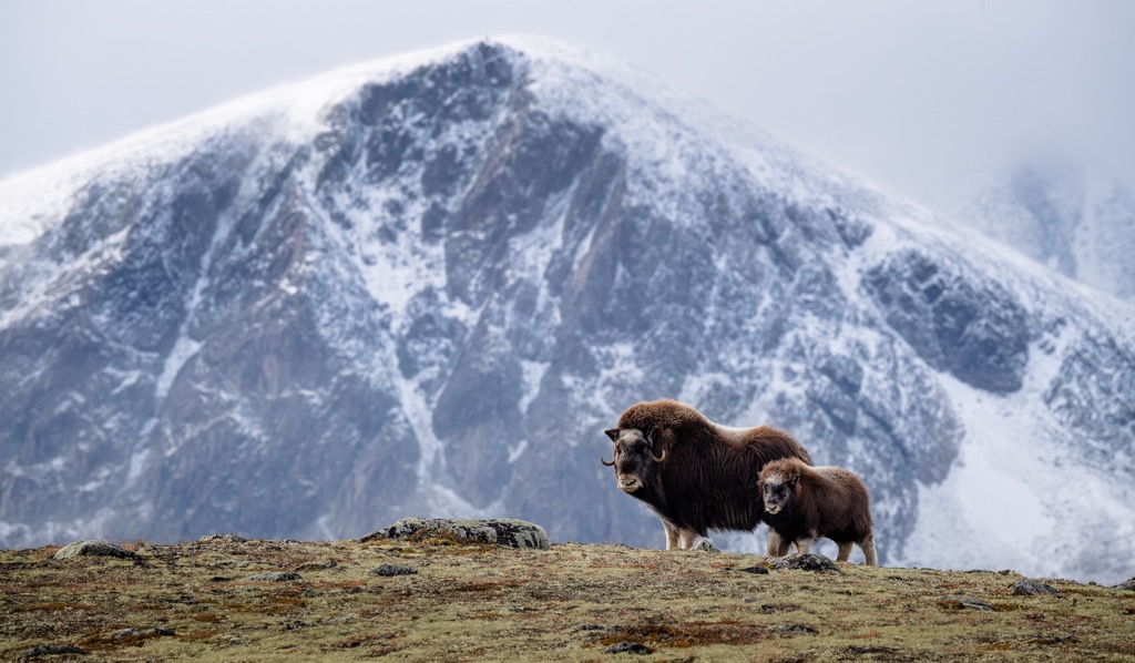
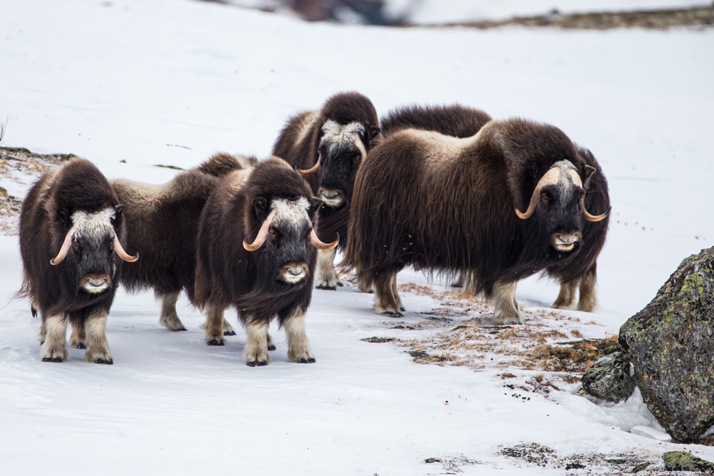
Other common mammals in the park include wolverines and arctic foxes. The park also marks the only population of musk oxen in Norway. The musk oxen of the region originally died out during the last Ice Age but were reintroduced during the 1930s. Common bird species in the park include golden eagle, rough-legged buzzard, and gyrfalcon.
The land within and surrounding Dovrefjell-Sunndalsfjella National Park has been inhabited by humans for thousands of years. Remnants of ancient hunting grounds have been found in the region, showcasing the long history of the early settlements who would hunt the reindeer.
The Pilgrim Path passes through the park, dating back to 1030 CE with the fall of St. Olva at Stiklestad. After this fall, pilgrims began the religious trek across Dovrefjell in search of the shrine of St. Olav. These pilgrim pursuits ended in 1537 following the introduction of the Reformation.
At the beginning of the 18th century the King’s Road was built across Dovrefjell. The road marked the first public high mountainous route in all of Norway. The introduction of the King’s Road allowed travel and trading to thrive, enabling small mountain settlements and towns to grow.
Mountain lodges and huts began being built over the following centuries, often used for stops along the route or retreats for royalty. Many of those who made these early treks noted how both dangerous and beautiful the road was.
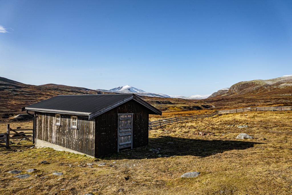
From the 17th century onwards, the mountain huts played a vital role for those crossing over Dovrefjell. The towns on either side of the mountain were far apart, often requiring the journey to be a multi-day trek. Today there are four mountain lodges between the towns of Dombås and Oppdal: Fokstugu, Hjerkinn Fjellstue, Kongsvold Fjeldstue and Drivstua.
The original structures of these lodges were burned to the ground in 1718 during the Great Northern War. They were burned by Norwegians who sought to prevent the Swedes from crossing the mountain. Today, all four of these lodges have been rebuilt.
The Dovre Line was constructed in 1921, establishing a railroad over Dovrefjell. Shortly after, in 1924, the Rauma Line was opened and featured 12 more stations.
In order to help protect the ecosystem in the region, Dovrefjell National Park was established in 1974. The park was later expanded in 2002 and renamed Dovrefjell-Sunndalsfjella National Park.
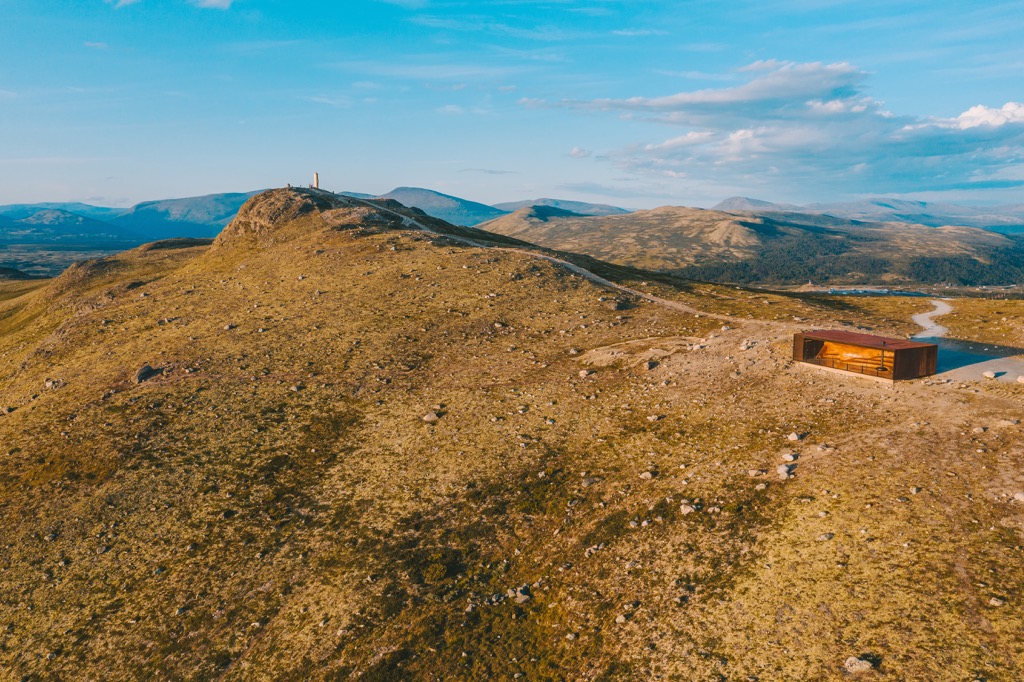
Dovrefjell-Sunndalsfjella National Park is home to a plethora of hiking trails. Here are a few routes to check out on your next visit to the park:
The Storhaugen Trail lies near the center of the park near Vinndøla. The route climbs steadily up through the forested landscape before reaching the rocky and rounded Storhaugen summit. Once the terrain opens up, hikers have sweeping views of the surrounding valleys and lakes.
This out and back trail totals 8.5 km (5.3 miles) in length and features 893 m (2,929 feet) of elevation gain. Hikers are also likely to spot wildlife along the route.
Moskusstien is a series of trails located just west outside the Kongsvoll train station. The network of trails offer hikers one of the best chances to spot musk oxen in the park. These trails climb steadily through the birch forest before reaching the barren mountain landscape.
Hikers can choose from a variety of hikes ranging from 4.5 km to 15 km (2.8 miles to 9.3 miles). A short side trip also takes hikers to the viewpoint Høgsnyta. The main loop totals 9 km (5.6 miles) in length and features 499 m (1,637 feet) of elevation gain.
The Trollheimen Trail, or Trollheimen Trek, is a multi-day loop that circles through the heart of the national park. Hikers begin the journey in Oppdal where they can find the second largest viking graveyard in Norway.
As the route travels west, the terrain transitions from a barren landscape to forested valleys and alpine terrain. The peaks on the west side of the loop feature more dramatic changes in elevation and snow capped peaks. Hikers also have the option of staying in the mountain cabins scattered throughout the park.
After passing through the Gate of Innerdalen, hikers have the option to extend the trail by reaching the summit of the Tower of Innerdalstårnet. The loop is 63 km (39 miles) and features 2,841 m (9,320 ft) of elevation gain, often taking hikers around five days to complete.
Looking for a place to stay near the Dovrefjell-Sunndalsfjella National Park? Here are some of the best cities and villages to check out in the region:
The village of Sunndalsøra is the administrative community in Sunndal Municipality. Home to around 4,100 residents, Sunndalsøra lies at the northwestern tip of the national park. Steep mountains and fjords rise above the small village which is situated at the mouth of the river Driva.
Some of the mountains surrounding the village have become popular spots for BASE jumping. The mountain Litlkalkinn lies just outside of Sunndalsøra and offers stunning views of the region from its summit. One of the most popular sites in the village is the Hov Church.
The municipality of Oppdal lies in the Dovre region of Norway, along the northeastern edge of the national park. Home to around 7,000 residents, Oppdal is one of the most popular winter destinations in central Norway.
The hillsides rise steeply around the community, featuring four ski mountains along with numerous lifts and slopes. The winter months also provide visitors with groomed cross-country tracks. Besides skiing, the region is also known for its impeccable trails for hiking, trail running, and mountain biking.
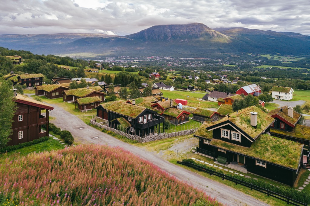
The community of Oppdal dates back to the Norwegian Iron Age and features traditional and local cuisine. During the summer months, visitors can also explore the pilgrim path which leads towards Trondheim. Throughout the year locals and visitors alike will often spot musk ox amidst the surrounding hills.


