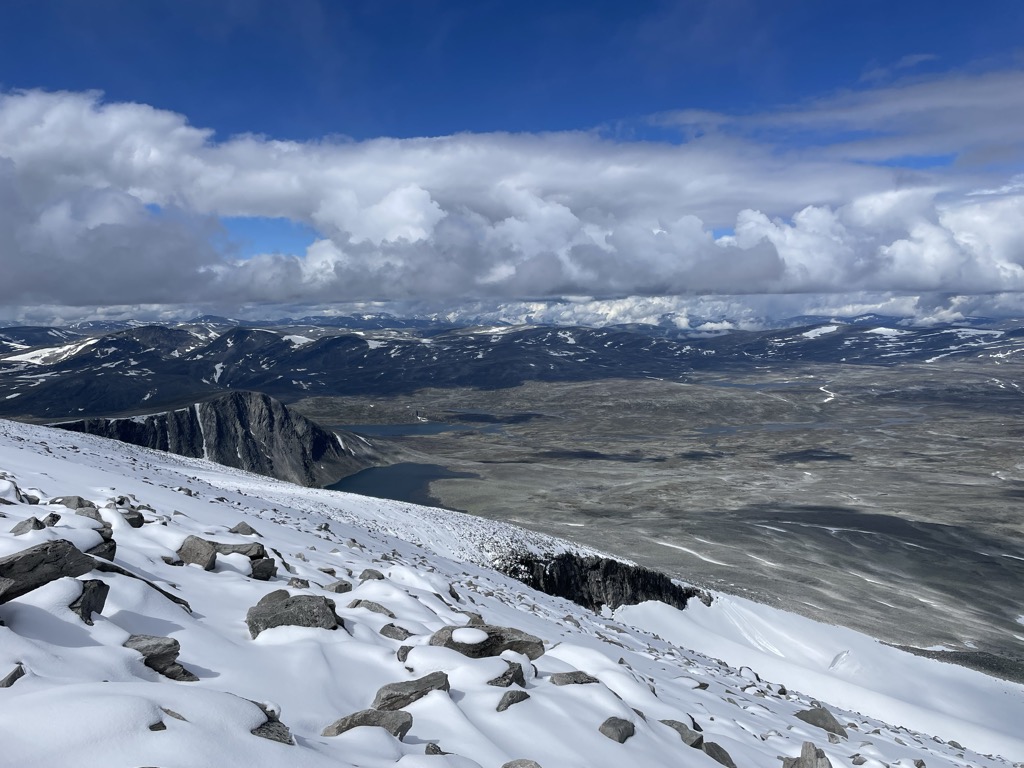
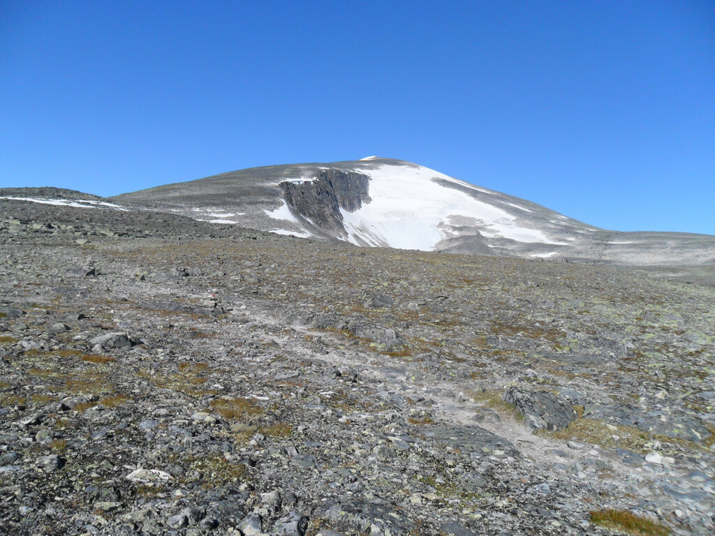
Snøhetta is the highest mountain in the Dovrefjell mountain range in Norway. At 2,286 metres (7,500 ft), it is the highest mountain in Norway outside the Jotunheimen range, making it the 24th highest peak in Norway, based on a 30-metre (98 ft) topographic prominence cutoff. At 1,675 metres (5,495 ft), its topographic prominence is the third highest in Norway.
The mountain is located in the Dovrefjell mountains in northern Innlandet county in Dovre Municipality. The mountain lies inside Dovrefjell-Sunndalsfjella National Park and it is the highest peak in the park. It is surrounded by several other mountains including Brunkollen to the east; Einøvlingseggen to the south; Skredahøin Bruri, Nordre Svånåtinden, and Storstyggesvånåtinden to the southwest; and Store Langvasstinden, Larstinden, and Drugshøi to the west.
The mountain has several peaks:
Stortoppen is the highest summit at 2,286 metres (7,500 ft).
Midttoppen is the next highest summit reaching 2,278 metres (7,474 ft) with a topographic prominence of 40 metres (130 ft).
Hettpiggen is the third highest peak on the mountain reaching 2,261 metres (7,418 ft) with a prominence of 50 metres (160 ft).
Vesttoppen is the fourth highest peak at an elevation of 2,253 metres (7,392 ft) and a prominence of 70 metres (230 ft).
Vesttoppen and Stortoppen are easily available by hiking or skiing, and traveling from Stortoppen, Midttoppen is easily accessible. Traversing Midttoppen, via Hettpiggen and to Vesttoppen requires climbing with a rope.
On Stortoppen there is a radio link station, originally installed by the Norwegian Army, and now serving primarily civilian purposes. The station and its emergency diesel generator, as well as a nearby helipad, detract somewhat from the aesthetics of the summit. For this reason, many recommend Vesttoppen as a better destination.
A small monument for the Norwegian philosopher, humourist, author and mountaineer Peter Wessel Zapffe is located near the summit of Vesttoppen.
Under good conditions in both summer and winter, the ascent is relatively easy. Common starting points are the DNT-cabins Reinheim, Snøheim, or Åmotdalshytta.
There's a trail leading to the summit.
By elevation Snøhetta is
# 27 out of 12661 in Innlandet # 1 out of 283 in Dovrefjell-Sunndalsfjella nasjonalpark # 33 out of 152052 in Norway # 33 out of 135828 in the Scandinavian Mountains
By prominence Snøhetta is
# 2 out of 12661 in Innlandet # 1 out of 283 in Dovrefjell-Sunndalsfjella nasjonalpark # 5 out of 152052 in Norway # 4 out of 135828 in the Scandinavian Mountains
We use GPS information embedded into the photo when it is available.
3D mountains overlay
Adjust mountain panorama to perfectly match your photos because recorded by camera photo position might be imprecise.
Move tool
Rotate tool
Zoom
More customization
Choose which peak labels should make into the final photo and what photo title should be.
Next
Photo Location
Satellitte
Flat map
Relief map
Latitude
Longitude
Altitude
OR
Latitude
°'''
Longitude
°'''
Apply
Register Peak
Peak Name
Latitude
Longitude
Altitude
Register
Teleport
PeakVisor
This 3D model of Sagarmatha National Park in Nepal was made using the PeakVisor app topographic data. The mobile app features higher precision models worldwide, more topographic details, and works offline. Download PeakVisor maps today.
Download OBJ model
PeakVisor
The download should start shortly. If you find it useful please consider supporting the PeakVisor app.
PeakVisor for iOS and Android
Be a superhero of outdoor navigation with state-of-the-art 3D maps and mountain identification in the palm of your hand!