
Scan the QR code and open PeakVisor on your phone
Faroe Islands is home to 433 named mountains. The highest is Slættaratindur at 880 m.
The Faroe Islands are a self-governing territory of Denmark located in the North Atlantic Ocean. With Europe’s highest sea cliffs, sublime fjords, and abundant wildlife, the islands are a trove of raw natural beauty and adventure. There are 433 named mountains; the highest and most prominent mountain is Slættaratindur (880 m/2,887 ft).
The Faroe Islands are approximately 320 km (200 mi) north of the United Kingdom and 430 km (270 mi) southeast of Iceland. The islands’ nearest inhabited neighbor is the Scottish Shetland Islands, situated roughly 285 km (177 mi) to the east.
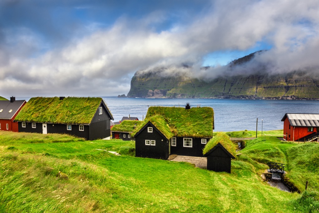
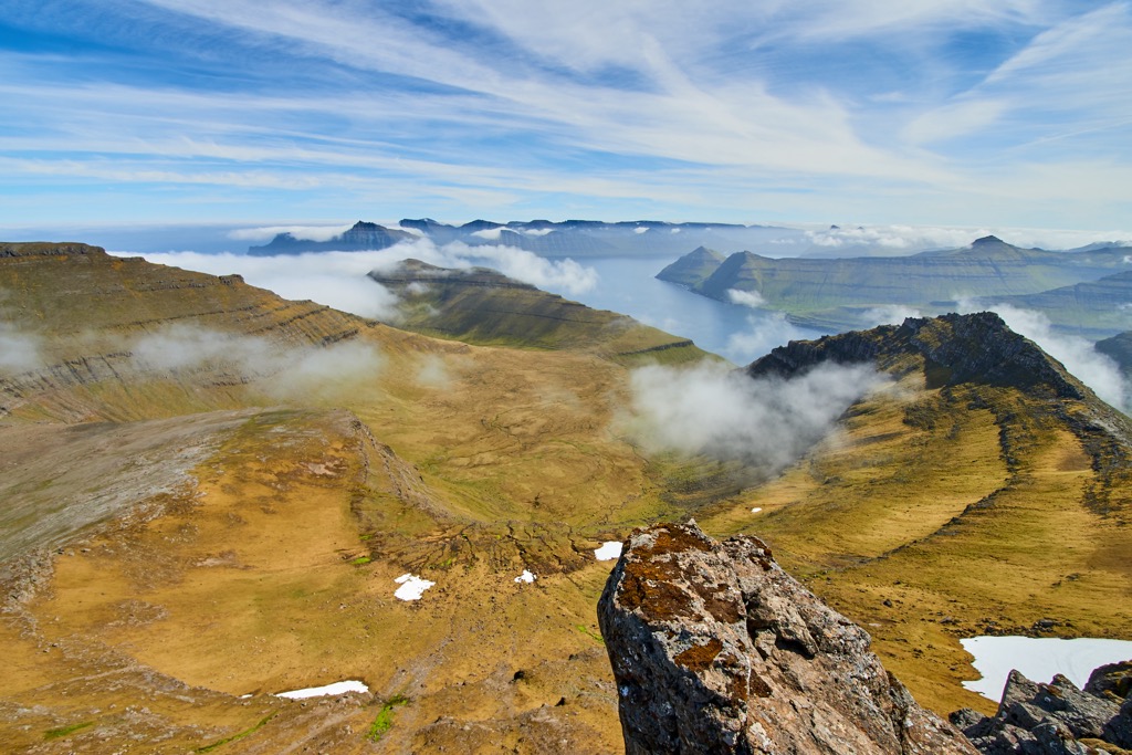
The Faroes are composed of 779 islands, islets, or skerries. There are 18 major islands, including the uninhabited Lítla Dímun. The entire group encompasses an area of approximately 1,393 sq km (538 sq mi), with no significant rivers or lakes. The landscape of the Faroe Islands is mainly rocky plains and low rugged mountains with no native forests. Of the islands’ 433 peaks, none exceed 900 m (2952 ft) in elevation.
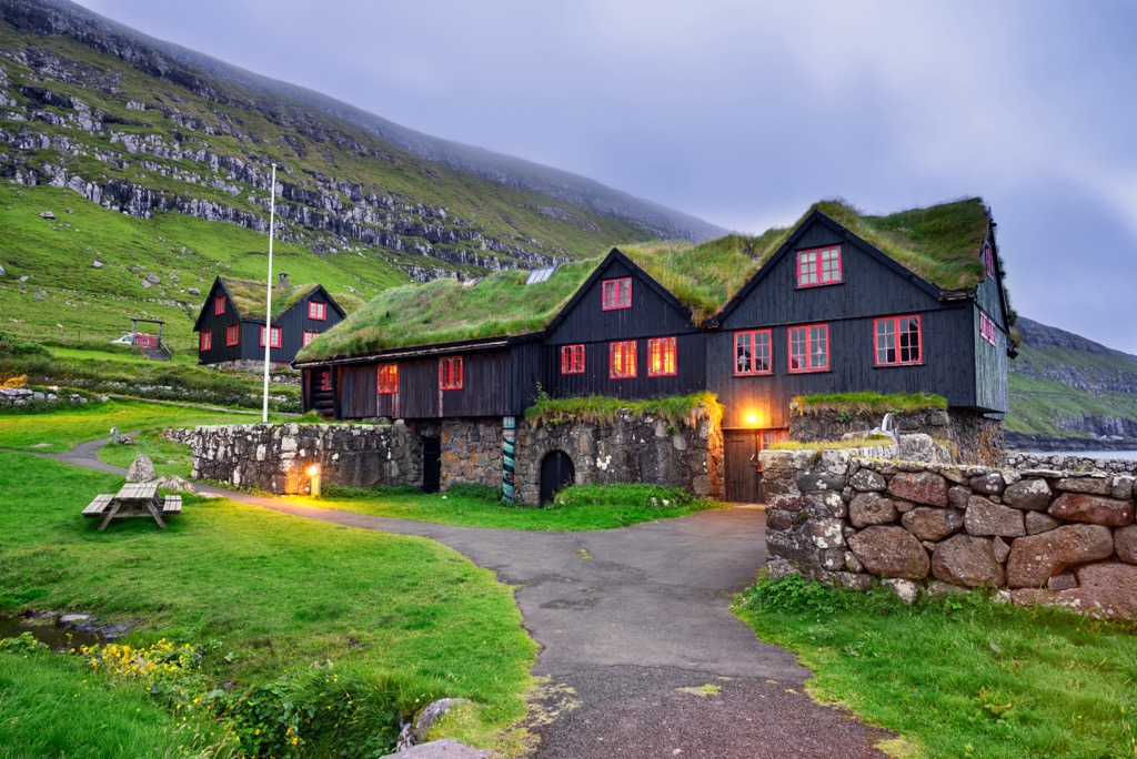
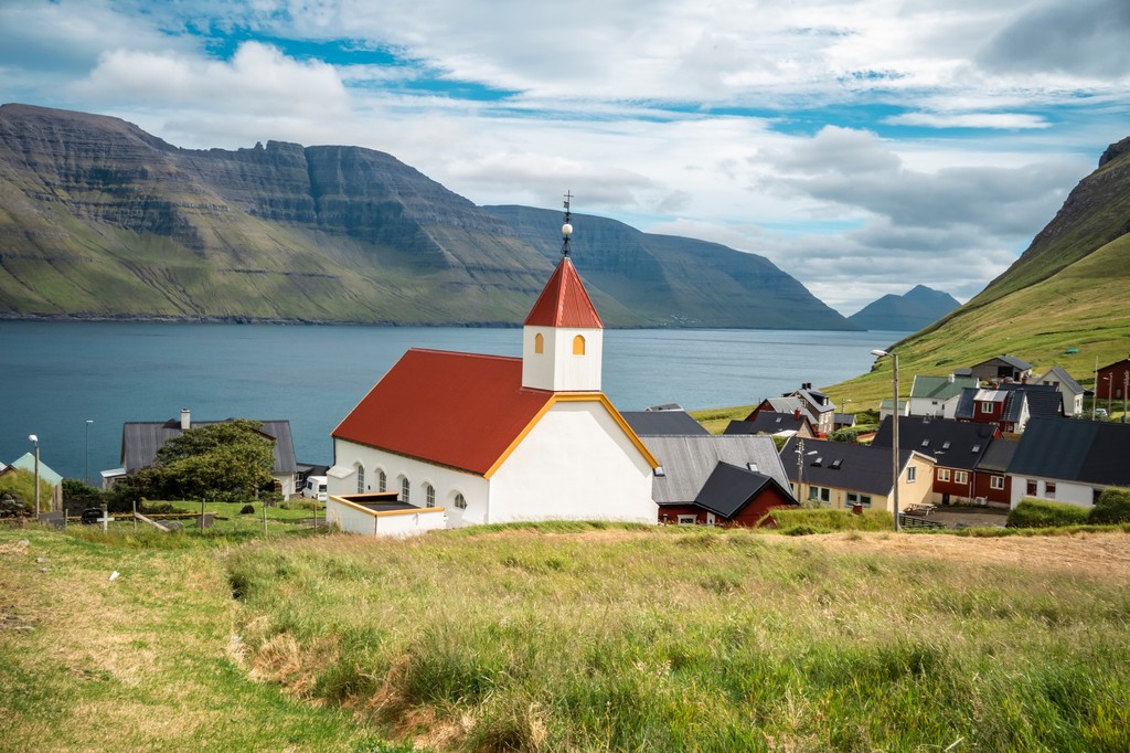
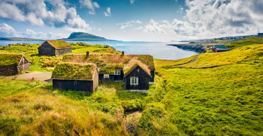
The largest and most populated island is Streymoy (Strømø), covering an area of 373.5 sq km (144 sq mi). Streymoy has a population of approximately 24,276 people, accounting for nearly half the population of the entire Faroe Islands. Other islands home to over 1,000 people include Eysturoy, Vágar (Vågø), Suðuroy (Suderø), Sandoy, and Borðoy (Bordø). Tórshavn is the Capital and largest city of the Faroe Islands, with a population of around 14,000. Other notable settlements include Hoyvík, Klaksvík, and Vágur.
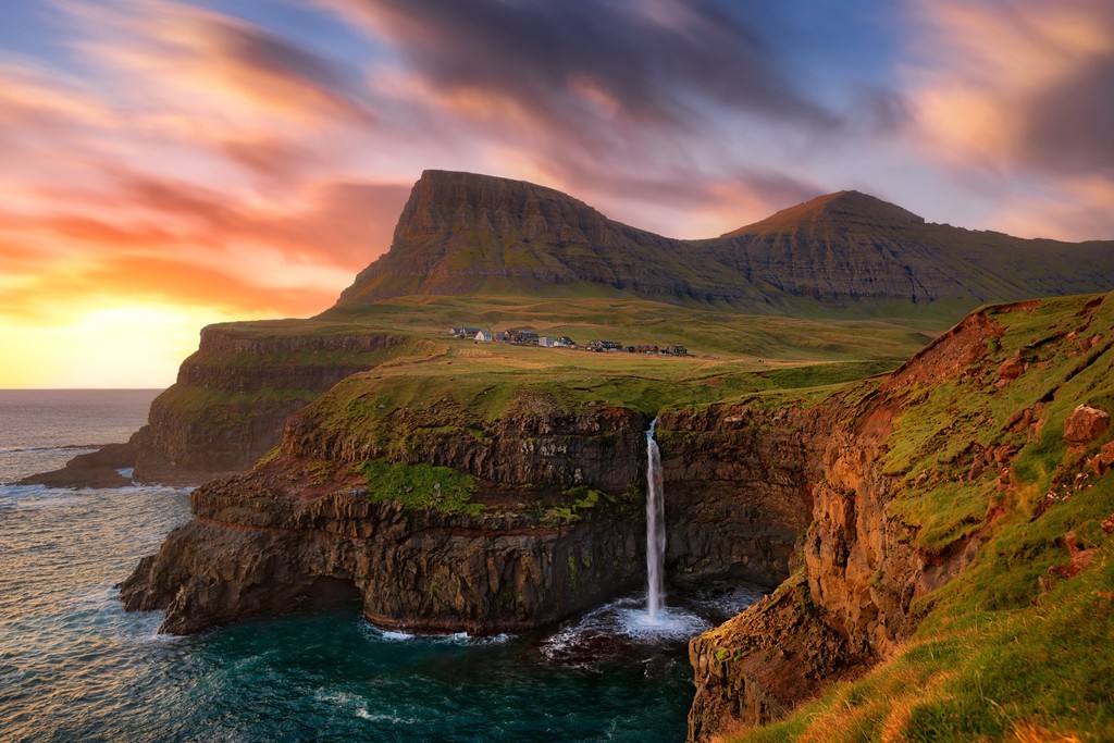
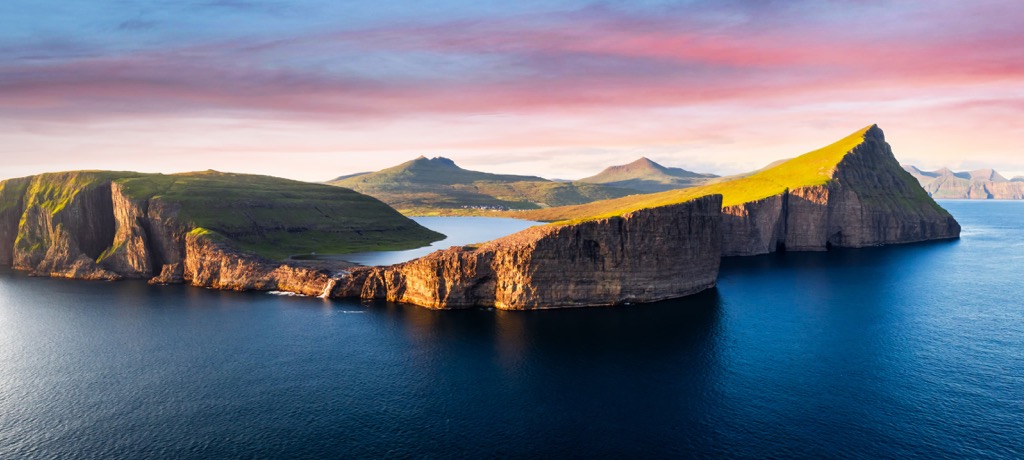
Most of the Faroes' 1,117 km (694 mi) coastline is high sea cliffs. The highlight of the coastline is Cape Enniberg on Viðoy, Europe's highest sea cliffs and one of the highest promontories in the world, with an elevation of 754 m (2,473 ft). Sørvágsvatn is the Faroe Islands' largest lake, with a surface area of roughly 3.5 sq km (1.3 sq mi), while Stórá on Vágar is the largest river.
The Faroe Islands consist of 6 km (3.7 mi) thick volcanic basalt interspersed with thin strips of tuff (volcanic ash). The islands formed around 55 million years ago during the Paleogene period.
The basalt exists in three distinct layers; each layer signifies a different significant volcanic eruption during the Paleogene.
Located on the Eurasian tectonic plate, the Faroe Islands began to form when Greenland and Europe separated, opening up the northeastern Atlantic Ocean. During this time, large-scale volcanic eruptions built up substantial basalt layers covering sizable areas from the Faroes and Rockall, a small islet located 692 km (430 mi) south of Iceland.
Each volcanic eruption produced basalt layers tens of meters thick. Volcanicastic and sedimentary fragments suggest lengthy periods between some eruptions. Vegetation, erosion, and sediment in lakes and rivers caused these sedimentary deposits. One particularly lengthy break in volcanic activity resulted in thin coal layers. These coal layers are especially prominent in northern Suðuroy. Due to the absence of recent volcanic activity, some parts of the archipelago are now covered in peat, a settled, carbon-rich layer that is a precursor to coal formation.
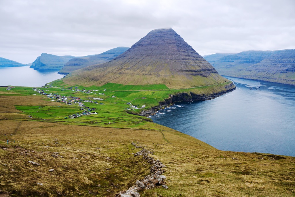
The middle basalt layer of the Faroes features a porous interlayer, which is highly susceptible to erosion. A greater degree of weathering at higher elevations has resulted in weathered materials collecting in low-lying areas. This erosion of the middle basalt layer is why the Faroes have a distinctive sloped topography, which is particularly apparent on Vágar, Eysturoy, and Streymoy.
Since the Paleogene period, the Eurasian Plate has moved the Faroe Islands away from volcanic activity, which now affects Iceland along the Mid-Atlantic Ridge. Most of the Faroe–Rockall Plateau now lies below sea level, with glaciation shaping the modern landscape.
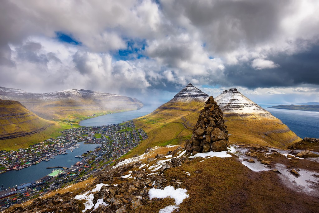
Only 900 m (2,952 ft) of this basalt plateau is above sea level, despite being over 6 km (3.7 mi) thick. The Faroes' highest mountain, Slættaratindur, is located on Eysturoy. Other significant summits on the Faroe Islands include Gráfelli (856 m/2,808 ft), Villingadalsfjall (841 m/2,759 ft), and Kúvingafjall (830 m/2,723 ft).
Due to its remote location in the North Atlantic, the Faroe Islands have a unique ecological makeup greatly influenced by humans.
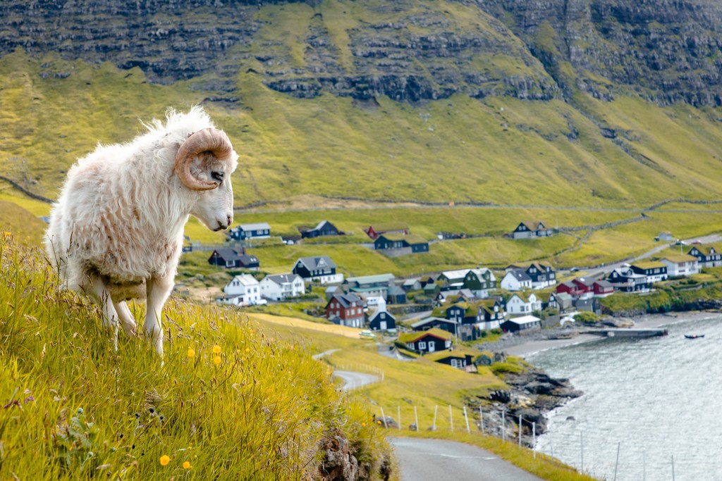
No mammals are native to the Faroe Islands — humans introduced all mammals present. The only three wild land mammals that survived introduction are mountain hares, house mice, and brown rats. The main domestic mammals on the Faroe Islands are local sheep and Faroe ponies.
Mountain hares were introduced from Norway in 1854, while house mice were likely carried accidentally by British and Irish monks in the sixth century. It is unclear when brown rats arrived, but they likely brought the Black Plague with them.
There’s a wider variety of marine mammals around the Faroe Islands than terrestrial mammals. Gray seals are common around the archipelago's shoreline, while harbor porpoises, long-finned pilot whales, bottlenose whales, and orcas are often spotted off the coast.
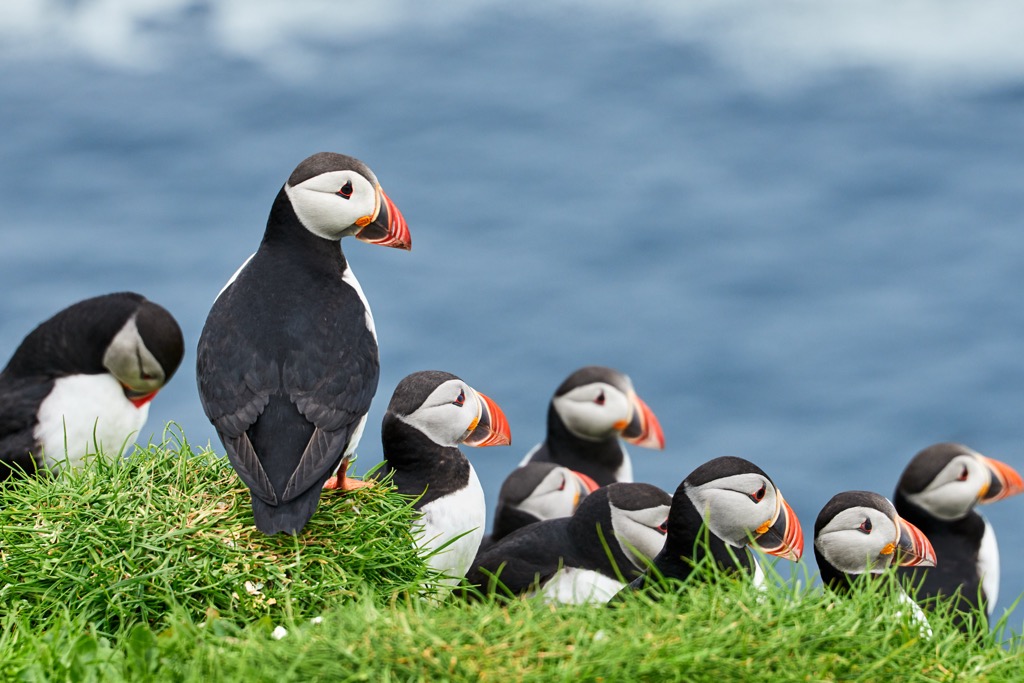
Around 358 bird species have been recorded on the Faroe Islands, including 40 common breeding species. Significant worldwide populations of seabirds inhabit the islands, including 600,000 fulmars, 550,000 puffins, and 250,000 storm petrels. Other notable bird species include guillemots, gannets, Manx shearwaters, and black-legged kittiwakes. Oystercatchers are the Faroe Islands' national bird.
No amphibians are indigenous to the Faroes: common frogs have been recently introduced and are successfully breeding on Nólsoy. However, many beetles, spiders, moths, and snails are indigenous. On the other hand, humans have introduced common wasps, New Zealand flatworms, and Spanish slugs.
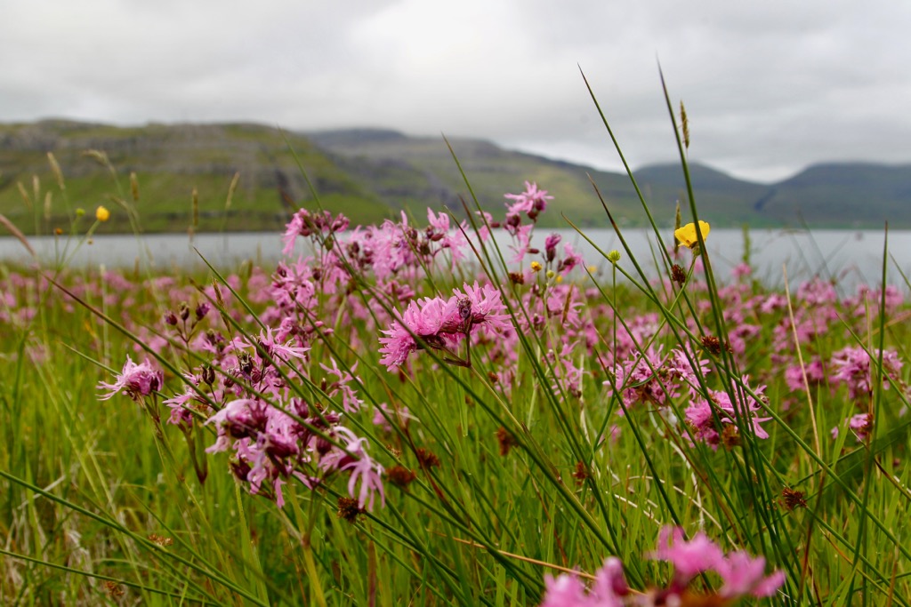
Over 400 plant species grow across the Faroe Islands, despite the lack of native forests.
Willow is the most common native tree species, with dwarf willow prevalent at higher elevations. Three other willow species are present: tea-leaved willow, Arctic willow, and wooly willow. Meanwhile, the common juniper is the only evergreen tree species.
Humans have introduced plant species to the Faroe Islands, many of which come from South America. Notable examples include monkey-puzzle trees, Chilean firetrees, and lenga beeches. Plants from Alaska also thrive in the Faroe Islands' unforgiving climate. The widest Alaskan pine in Europe is located in Selatrað on Eysturoy.
Heather is the most common plant on the Faroe Islands' grasslands. European swamp thistles are also widespread. Lady's Mantle, the first introduced garden plant, is considered an invasive species threatening the archipelago's ecosystems.
The Faroese people are primarily descendants of Norse Vikings who settled the archipelago in the ninth century CE. However, archeologists believe humans visited the Faroe Islands before Viking settlers. Sheep DNA was uncovered dating back to the sixth-century CE; historians have hypothesized that British or Irish tribes brought these sheep to the Faroes.
Norsemen introduced Old Norse to the archipelago, which developed into the Faroese language. Faroese is more closely related to the Icelandic language than Danish. It's believed many Norse and Norse-Gael settlers arrived on the Faroes from Scottish islands, specifically the Outer Hebrides, Shetland, and Orkney.
One of the best records of the Faroe Islands during the Middle Ages is the Færeyinga saga, which describes how the Faroe Islands converted to Christianity and became part of Norway. According to the saga, Sigmundur Brestisson, a Faroese Viking chieftain, ruled the southern Faroe Islands until his clan was nearly wiped out by invaders from the northern islands.
Sigmundur escaped to Norway, where Norwegian King Olaf Tryggvason sent him back to regain control of the islands and convert the population to Christianity. Sigmundur was successful, and despite his eventual assination, Norwegian rule continued. The Faroe Islands officially joined the Kingdom of Norway in 1035.
Norway had complete control of the islands until 1380, when they joined the Kalmar Union between Sweden, Norway, and Denmark. However, the Norwegian crown maintained sovereignty in the Kalmar Union and continued to control the Faroes. The Protestant Reformation in 1538 saw the Faroe Islands convert from Catholicism to Lutheranism.
The union between Denmark and Norway ended with the Treaty of Kiel in 1814, with Denmark gaining control of the Faroe Islands and Norway entering a union with Sweden. After the Napoleonic Wars, the Faroe Islands became a Danish county (amter).
Denmark established a trade monopoly over the Faroe Islands, forbidding them from trading with other nations, including the nearby United Kingdom. This trade monopoly ended in 1856. Between 1888 and 1906, there was an increasing nationalist sentiment in the Faroe Islands, with the archipelago's first political parties established.
British troops occupied the Faroe Islands during the Second World War following Nazi Germany's invasion of Denmark and Norway. Britain built the island's first and only airport during the occupation, Vágar Airport. Denmark regained control after the Second World War, but nationalist movements continued to gain momentum.
The 1946 Faroese independence referendum saw 50.73 percent vote in favor of independence. However, the Danish monarchy ignored the referendum, as only two-thirds of the population voted. The islands were eventually granted home rule in 1948.
The Faroe Islands declined to join the European Economic Community with Denmark in 1973, the precursor to the European Union (EU).
Uninterrupted sea views, remarkable rock formations, and sheer cliffs make the Faroe Islands a magical and unique hiking destination. The region offers 340 mountain peaks and dozens of marked hiking trails across 17 islands.
Consider hiring a mountain guide if you're still getting familiar with the islands due to unforgiving and changeable weather conditions. Bring warm clothing, hiking boots, and plenty of food and water. Check local weather forecasts and inform others of your itinerary.
Local authorities have produced a "safe travel" leaflet where you can fill out your itinerary. Leaving the leaflet under your windshield makes local authorities aware if you have yet to return by your stated time. You can download the leaflet here.
Slættaratindur (880 m/2,887 ft) is the highest mountain on the Faroe Islands. Located in northern Eysturoy, Slættaratindur is surrounded by the villages of Eiði, Gjógv, and Funningur. Funningur sits at the foot of the mountain. Gráfelli (856 m/2,808 ft), the islands’ second-highest summit, is just to the northeast of Slættaratindur.
Slættaratindur is a steep, strenuous climb, but no special gear or climbing skills are required to reach the summit. You can pick up the trail to Slættaratindur from the Eiðisskarð parking lot between Eiði and Funnigur.
There's no trail at the start of the Slættaratindur ascent. Instead, walk straight from the car park towards the mountain, keeping the fence on your right. At around 670 m (2,198 ft) in elevation, you'll reach a path that leads up to Slættaratindur.
You can take several paths once you get close to the summit, but the path that bends to the right up the mountain's back is the best. From the summit of Slættaratindur on a clear day, you can see the entire archipelago. Descend the way you came. The hike is approximately 5.5 km (3.4 mi) in length.
Klakkur (413 m/1,355 ft) is an easy family-friendly hike, offering one of the finest panoramas on the Faroes. Klakkur is located on Borðoy just northwest of Klaksvík. The short trek to the summit affords spectacular views of the Eysturoy, Kunoy, and Kalsoy islands.
The walk to Klakkur starts from the parking lot underneath the Christianskirkjan near Klaksvík's center. Head south out of town onto the Niðan Horn road. At the end of the path on the right is the Klakkur trailhead at Hálsur. You can use the cairn at the high point to the north to identify the trailhead. It's also possible to park in Hálsur itself and walk to the trailhead.
The route leads through old peat fields, where you can see many bird species, including oystercatchers, golden plovers, and Arctic skuas. This is also one of the few areas where it’s possible to ski in the Faroe Islands.
From atop Klakkur, you can see several villages, including Leirvík on Eysturoy and Trøllanes on the northern tip of Kalsoy. On a clear day, Nólsoy is visible to the south. As you descend the way you came, you'll see several of Kunoy's mountains, including Hálgafelli (502 m/1,647 ft) and Háfjall (651 m/2,136 ft). The hike is approximately 8.5 km (5.2 mi) in length.
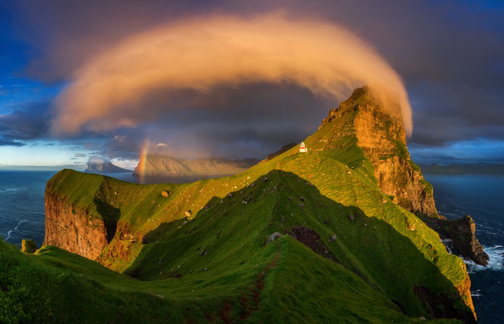
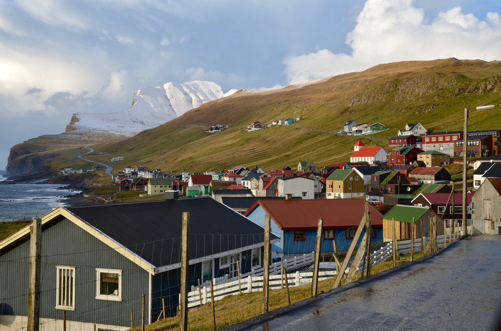
Villingardalsfjall (841 m/2,759 ft) is the highest mountain on Viðoy and the third-highest on the Faroe Islands. Towering over the village of Viðareiði, Villingardalsfjall is an unrelenting peak that should only be tackled in good weather. Low clouds and fog can make this a dangerous climb.
You can pick up the trail to Villingardalsfjall from the Við Garð Parking Area just north of Viðareiði. The hike is partially on private land, so you must pay a hiking fee for entry.
The trail steeply climbs uphill for the majority of the hike. Strong winds and slippery slopes mean sure-footedness is necessary. Blue posts along the path guide you to the mountain's summit. Ensure you bring plenty of food and water on this hike, as there are no stores or cafes on Viðoy.
Villingardalsfjall's summit is breathtaking, with views of the conical Malinsfjall (750 m/2,461 ft) and the village of Viðareiði to the south. The islands of Borðoy, Kunoy, and Kalsoy are visible to the west. Descend the way you came. This out-and-back is approximately 4.5 km (2.8 mi) in length.
Extending this hike to Cape Enniberg, one of the world's highest promontories, is possible. However, a professional guide is required as the route is dangerous.
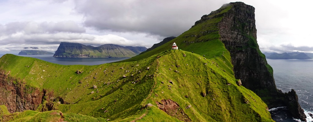
Of the Faroes' many lighthouses, Kallur Lighthouse is the most dramatic. It sits at the northern end of Kalsoy, in the shadow of the fin-like Borgarin (537 m/1,762 ft).
Despite its unforgiving appearance, the walk to Kallur Lighthouse is relatively straightforward. You can pick up the trail from Trøllanes village.
The hike leads along a narrow ridge to the lighthouse, with sublime views of Borgarin ahead, Eysturoy to the east, and Kunoy to the west. From the lighthouse, you'll return the way you came. The out-and-back is approximately 4.8 km (3 mi) in total.
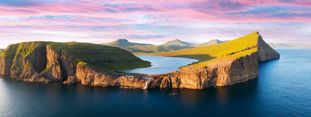
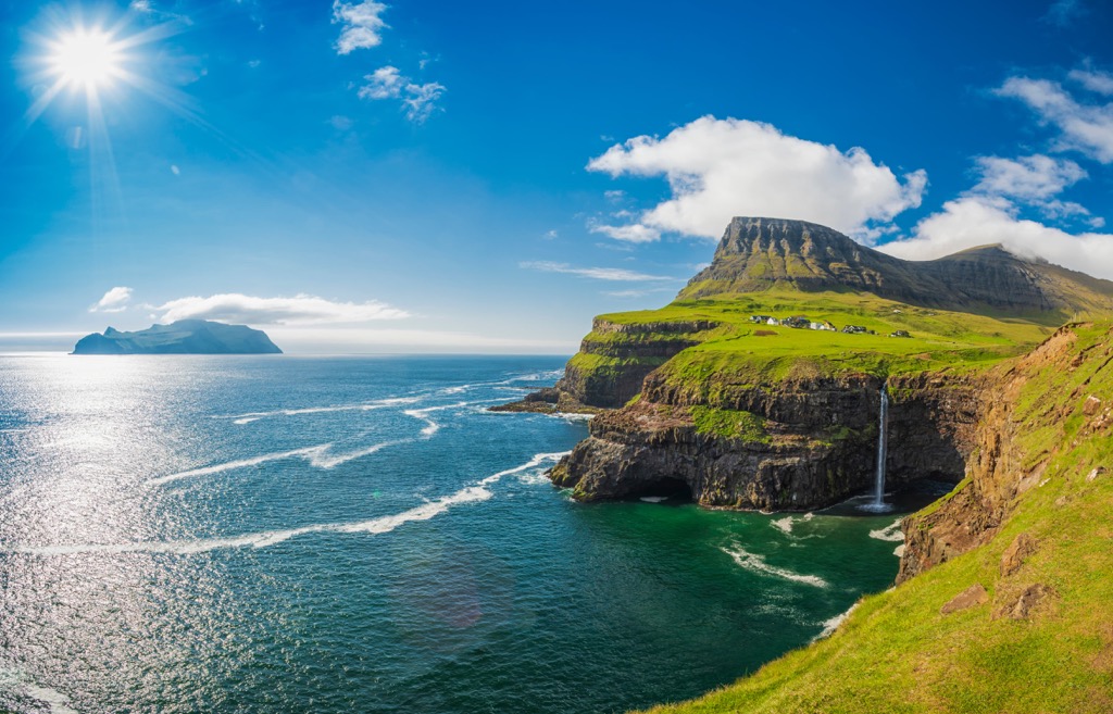
Lake Sørvágsvatn is one of the most celebrated natural features of the Faroe Islands. Located on Vágar atop sea cliffs, Lake Sørvágsvatn initially looks like an ordinary lake. But when viewed from the slopes of Trælanípa (142 m/466 ft), an optical illusion makes Sørvágsvatn seem like it's floating in mid-air over the ocean.
You can pick up the trail to Lake Sørvágsvatn from the Trælanípa/Bøsdalafossur trailhead in the village of Miðvágur. There's a hiking fee for this trail. Follow the clear path parallel to Lake Sørvágsvatn. After 2.7 km (1.6 mi), the trail turns left and up to the viewpoint on Trælanípa cliff. Trælanípa means Slave Cliff in English and supposedly got its name from the Vikings who pushed enslaved people to their deaths off the clifftop.
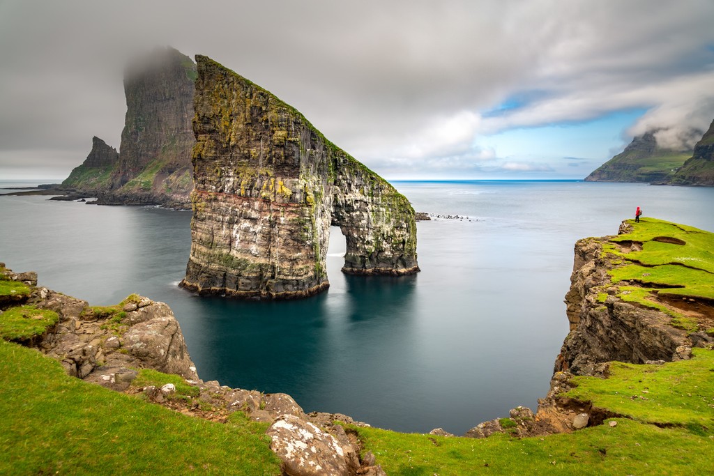
After enjoying the unique optical illusion, you can continue along the trail to the 30 m (98 ft) high Bøsdalafossur waterfall, which flows from Sørvágsvatn into the ocean. You can also spot the Geitisskoradrangur sea stacks from this viewpoint. Return to your starting point the way you came. The hike to Lake Sørvágsvatn and Trælanípa is approximately 6.8 km (4.2 mi) in total.
Charming Nordic villages and unique Faroese culture await visitors to the Faroe Islands.
Tórshavn is the capital of the Faroe Islands and home to over 40 percent of the archipelago's population. It's on the east coast of Streymoy, between Húsareyn (345 m/1,132 ft) and Kirkjubøreyn (351 m/1,152 ft).
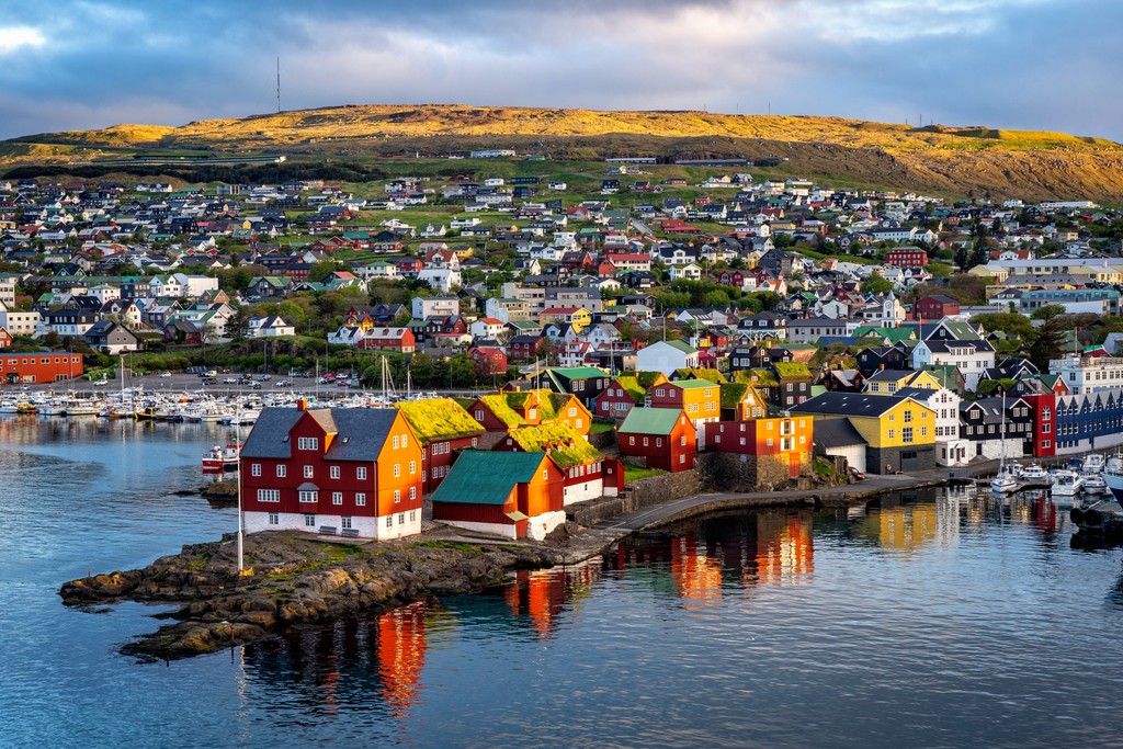
Tórshavn is a historic city, with Norse settlers establishing the Faroe Island's first parliament on the Tinganes peninsula in 850 CE. It has continuously remained the capital since. For a small city, Tórshavn boasts numerous restaurants, vibrant nightlife, and attractions. Learn about local culture at the Nordic House or tour the eighteenth-century Tórshavn Cathedral.
Tórshavn is the best-connected settlement on the Faroe Islands, with ferries to Suðuroy and roads leading to all major neighboring islands.
Klaksvík is the second-largest settlement in the Faroe Islands and the largest town on Borðoy. It's a picturesque port village with the pyramidal Suður á Nakki (703 m/2,306 ft) providing the perfect backdrop.
Despite being a traditional fishing town, there are some interesting sites in Klaksvík, including Føroya Bjór, the Faroes' oldest brewery, which produces alcohol and soft drinks for the rest of the archipelago.
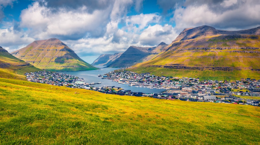
Klaksvík is a great place to stay if you plan to visit Kalsoy, with a 20-minute ferry to the island with several daily departures. You'll also be well-placed to hike Klakkur, located just northwest of Klaksvík.
Vágur is the largest town on the Faroe Islands' southmost island, Suðuroy. Located on the island’s east coast overlooking the Vágsfjørður fjord, Vágur is a small fishing village with a population of around 1,300 people.
It's a popular tourist destination, offering boat tours to Faroes’ second-highest bird cliff, Beinisvørð (470 m/1,542 ft). You'll also find some local cultural attractions in Vágur, including the Ruth Smith Art Museum.


Yes. Faroe Islands has 433 named mountains. The highest is Slættaratindur at 880 m.
The highest mountain in Faroe Islands is Slættaratindur, at 880 m.
Faroe Islands has 433 named mountains.


