Slættaratindur (English: Flat peak) is the highest mountain in the Faroe Islands, at an elevation of 880 metres. It is located in the northern part of Eysturoy, between the villages of Eiði, Gjógv, and Funningur. Funningur lies at the foot of the mountain, however, the summit is not visible from the village.
Its name means "flat summit". It can be climbed in about four hours, and although the routes are steep, technical climbing skills are not necessary to reach the summit. In clear weather, the summit gives views over the entire archipelago. Slættaratindur is one of ten mountains in the Faroe Islands which rise to over 800m above sea level. Gráfelli, the second-highest peak at 856 m, lies just to the north-east of Slættaratindur.
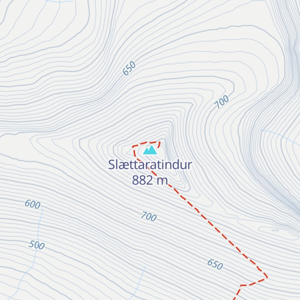
There's a hiking trail (T2) leading to the summit.
By elevation Slættaratindur is
# 1 out of 87 in Eysturoy region # 1 out of 433 in Faroe Islands
By prominence Slættaratindur is
# 1 out of 87 in Eysturoy region # 1 out of 433 in Faroe Islands
We use GPS information embedded into the photo when it is available.
3D mountains overlay
Adjust mountain panorama to perfectly match your photos because recorded by camera photo position might be imprecise.
Move tool
Rotate tool
Zoom
More customization
Choose which peak labels should make into the final photo and what photo title should be.
Next
Photo Location
Satellitte
Flat map
Relief map
Latitude
Longitude
Altitude
OR
Latitude
°'''
Longitude
°'''
Apply
Register Peak
Peak Name
Latitude
Longitude
Altitude
Register
Teleport
PeakVisor
This 3D model of Sagarmatha National Park in Nepal was made using the PeakVisor app topographic data. The mobile app features higher precision models worldwide, more topographic details, and works offline. Download PeakVisor maps today.
Download OBJ model
PeakVisor
The download should start shortly. If you find it useful please consider supporting the PeakVisor app.
PeakVisor for iOS and Android
Be a superhero of outdoor navigation with state-of-the-art 3D maps and mountain identification in the palm of your hand!