Scan the QR code and open PeakVisor on your phone
Featuring Europe's largest glaciers, stunning fjords, and active volcanoes, the country of Iceland offers unmatched opportunities for adventure. There are 4,145 named mountains in Iceland. The highest and the most prominent mountain is Hvannadalshnúkur (2,110 m/6,922 ft).
Iceland (Ísland) is a Nordic island country located in the North Atlantic Ocean. Iceland is located approximately 290 km (180 miles) southeast of Greenland and 970 km (600 miles) northwest of Norway.
The main island of Iceland covers approximately 103,000 square km (40,000 square miles) of land and it is one of the most northerly inhabited areas on the planet. Iceland is the second-largest island in Europe after Great Britain in the United Kingdom and the eighteenth largest in the world after the island of Newfoundland in Canada and the main island of Cuba.
Iceland is encircled by 30 to 40 minor islands, most of which are uninhabited. Heimaey in the Vestmannaeyjar archipelago off the south coast is the most populated island away from the mainland. Another well-known island is Grímsey, located 40 km (25 mi) off the north coast.
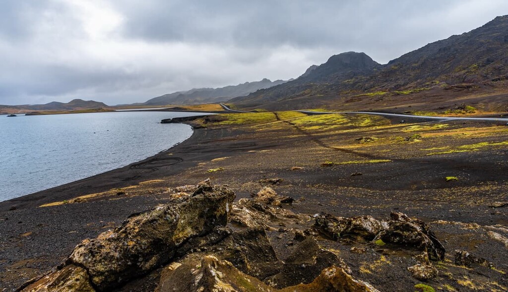
Iceland has over 4,800 km (3,000 miles) of coastline and 109 fjords. It's located just below the Arctic Circle and is surrounded by three seas: the Greenland Sea to the north, the Norweigan Sea to the east, and the Atlantic Ocean to the south and west. The Denmark Strait is the northwest, which separates Greenland from Iceland.
There are 3 national parks in Iceland: Snæfellsjökull National Park, Vatnajökull National Park, and Þingvellir National Park. The largest is Vatnajökull National Park, which covers 13,952 square km (5,387 square miles) and includes the whole of Vatnajökull, which is the largest ice cap in the country.
Despite its name and position near the Arctic Circle, Iceland is surprisingly warm, especially by the coast, due to the Gulf Stream. Only around 11 percent of the country is covered in ice. This makes it substantially different from nearby Greenland, which, despite its name, is approximately 79 percent ice.
Summer temperatures in eastern Iceland range from 10 degrees Celsius (51 degrees Fahrenheit) to 24 degrees Celsius (76 degrees Fahrenheit).
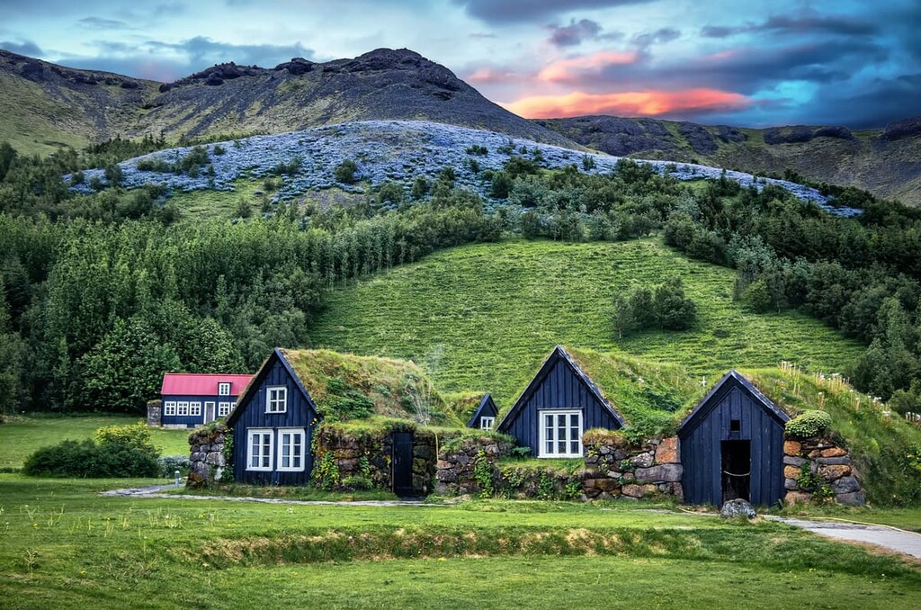
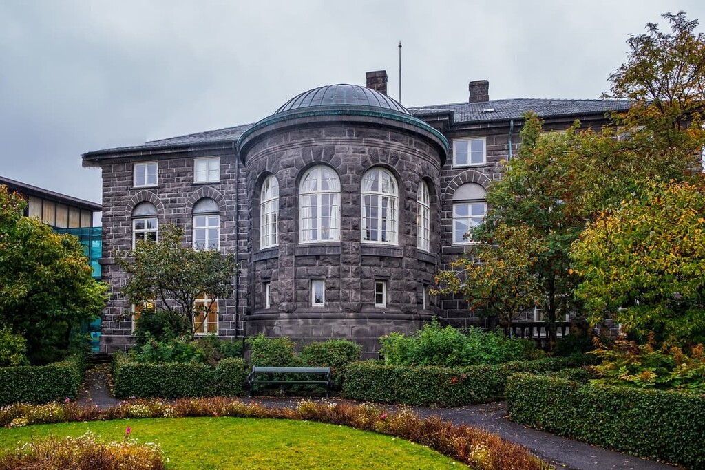
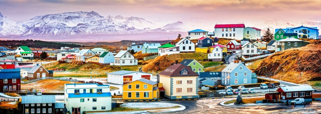
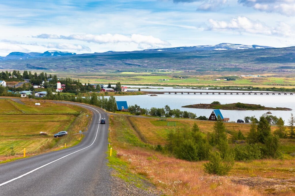
Almost all of Iceland's settlements are located near the coast due to warmer weather and the island’s inhospitable inland landscape. The largest and capital city of Iceland is Reykjavík, which is located along the southwest coastline. Reykjavík is also the northernmost capital on the planet. Other notable settlements include Kópavogur and the "Capital of North Iceland" Akureyri.
Iceland is informally divided up into eight regions. Although these regions hold no political or official purpose, they are recognized by Statistics Iceland for record keeping. These regions also group together communities with strong historical and cultural ties.
The eight regions of Iceland are:
The island of Iceland is a hotspot for geologists. Iceland is one of the geologically newest parts of the world, having formed less than 33 million years ago.
Iceland lies on one of Earth's major fault lines, the Mid-Atlantic Ridge, and is one of the only places on the planet where the divergent plate boundary is exposed at the surface. As a result, a large portion of the Earth's most important volcanic and geological activity occurs within an area the size of Switzerland.
Iceland was formed as a result of molten rock spewing out from between the Eurasian and Northern American tectonic plates. Iceland formed when the tectonic plates moved apart, and an abnormally large amount of lava rose from the mantle, creating Icelandic Plateau.
Iceland is in an area of high volcanic activity, with over 130 volcanoes on the island, 33 of which are active. Over the last 500 years, approximately a third of all lava flow on Earth poured from Icelandic volcanoes. There have been several famous eruptions in recent years, including the eruption of Eyjafjallajökull (1,651 m/5,416 ft) in April 2010, which caused severe air traffic disruptions across Europe.
The formation of Iceland was due partly to it sitting atop a volcanic hotspot, which is the reason for the island's high volcanic activity. The majority of Iceland consists of igneous basalt rock.
Over the years, many of Iceland's volcanoes have caused concern among geologists and residents. In 1783, Laki (812 m/2,664 ft), a volcano to the south of Iceland, erupted, causing a famine that wiped out nearly a quarter of Iceland's population.
Recently, geologists have been very concerned about Katla (1,217 m/3,992 ft), a volcano on the southern coast. Katla has not erupted for over a century, and there are worries it will cause more significant disruption and damage than nearby Eyjafjallajökull did in 2010.
Interestingly, Iceland is home to one of the youngest islands on the planet. Surtsey, which is part of the Vestmannaeyjar archipelago, formed as a result of a series of underwater volcanic eruptions between 1963 and 1968. The island is closed to visitors as it is being monitored for research purposes and to protect local wildlife.
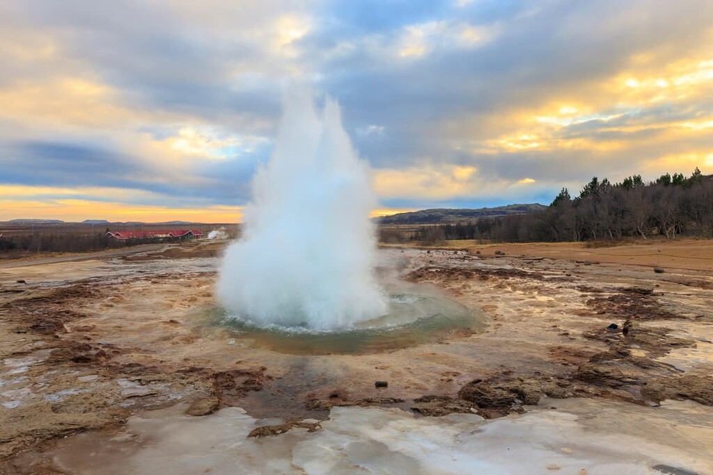
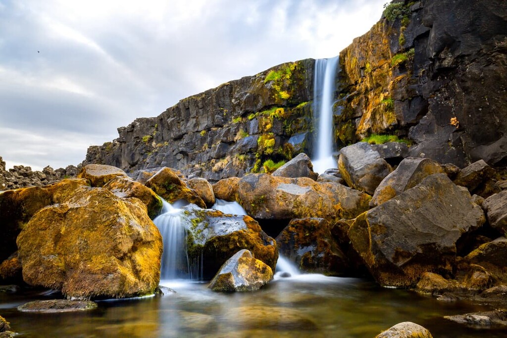
One of Iceland's most unique features is its geysers. There are just under 30 active geysers in Iceland, which are popular with tourists.
The English word geyser derives from Geysir, a geyser in southwestern Iceland that was the first recognized by Europeans. Strokkur, just east of Reykjavík, is one of Iceland's most popular and active geysers.
Visitors to Iceland can view some of the island’s many geysers along the Golden Circle tourist route. The route visits the geothermal area in Haukadalur, where you can see both Strokkur and Geysir. There is also a visitor’s center at the geysers that has educational information about the geysers themselves.
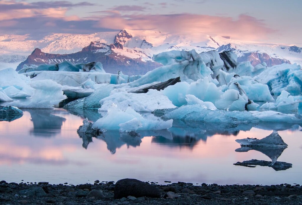
Approximately 20 percent of Iceland's landmass consists of glacier ice or cooled lava, creating a rugged and varied environment. Of that, approximately 11 percent of the land area of Iceland is covered in glaciers.
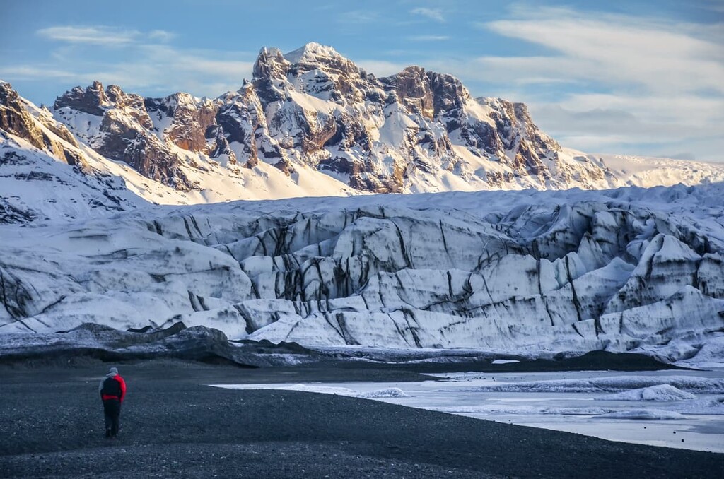
Located in the southeast of the country is Vatnajökull. Encompassing 7,900 square km (3,100 square miles), Vatnajökull covers around 8% of Iceland and is larger than all the glaciers on Continental Europe combined. Atop Vatnajökull is Iceland's highest mountain, Hvannadalshnúkur.
There are 13 large glaciers of note in Iceland. These include:
However, Iceland’s glaciers are not free from the damaging effects of climate change. The country has already declared one of its glaciers—Okjökull—to be extinct as of 2014. Okjökull no longer has the ice mass necessary to slide downhill, which is the defining feature of a glacier. As a result, it has been declared extinct.
Island is a country with a unique diversity of landscapes, ecosystems, and flora and fauna. The country’s northerly latitude, as well as its location at the intersection of a number of major weather systems has given it a climate that supports an interesting array of different species. Here’s a quick look at the flora and fauna of this amazing island.
The majority of plant life in Iceland is located within grasslands, bogs, and marshes. Prior to the arrival of humans, around 30 percent of Iceland was forested; however, overgrazing, deforestation, and the creation of permanent settlements significantly reduced the island's woodlands.
This human activity also caused the loss of critical topsoil, with approximately 18,000 square km (6,900 square mi) of Iceland's landscape completely barren. Around three-quarters of the island has been affected in some way by soil erosion.
Today, the most common trees in Iceland are northern birch, followed by aspens, common junipers, and rowans. There are also several recognizable flowers that grow across Iceland. There are thought to be around 470 native vascular plant species in the country.
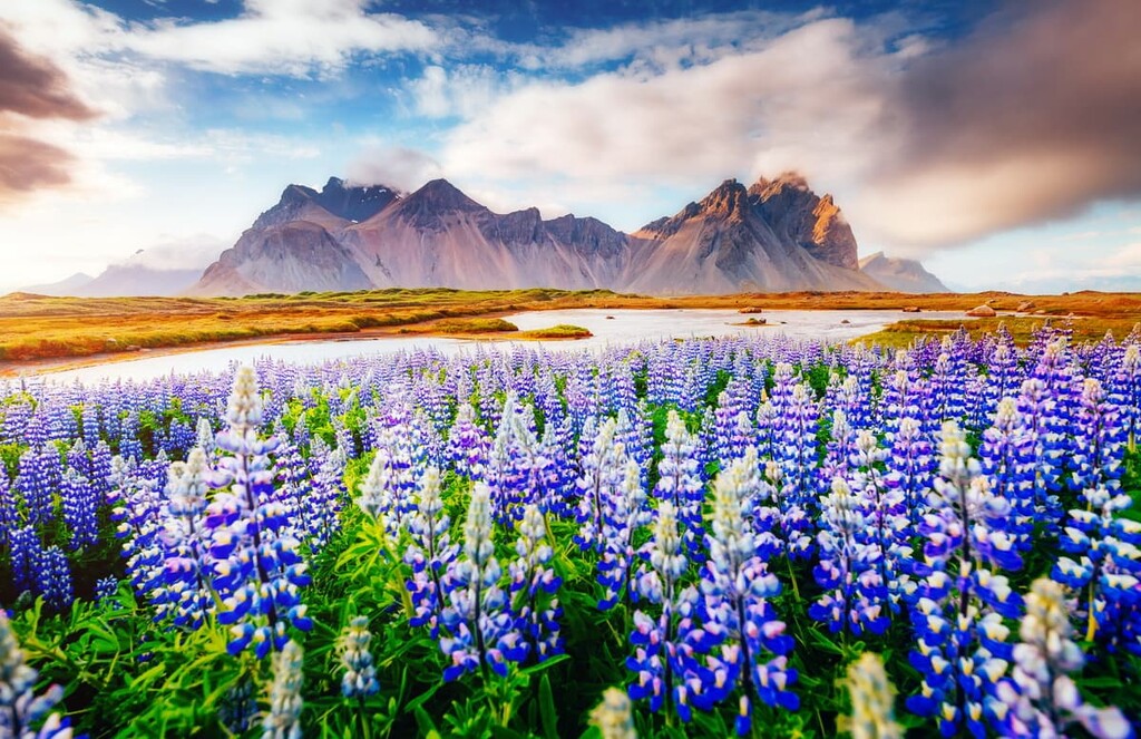
Holtasoley grows across Iceland and is common across moorlands and on mountain slopes. It is the national flower of Iceland. As you leave Reykjavík you'll be greeted with fields of purple, which consist of Nootka lupine. Other notable flora includes forget-me-nots, sheep's sorrels, and garden angelicas.
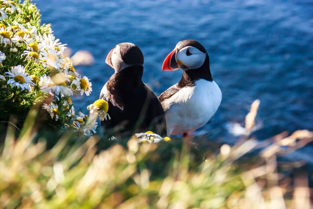
While Iceland is somewhat limited in its flora, the island is home to an array of bird and marine species. Iceland and its sea cliffs serve as important breeding grounds for puffins, kittiwakes, and skuas.
The oceans around Iceland are essential habitats for a number of aquatic mammal species, including a variety of dolphins, seals, and whales. Approximately 300 fish species live in the seas surrounding Iceland.
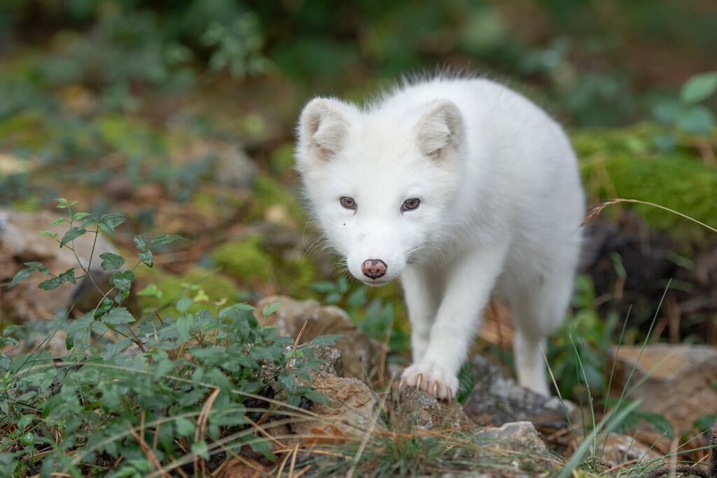
The arctic fox is Iceland's only remaining native mammal, and it's believed that the fox crossed over the sea ice to reach the island during the last glacial maximum. While arctic foxes are the only native mammal, settlers have brought over several other species that lived in Iceland for centuries. Due to their isolation, many of these mammals are unique to Iceland.
Famous examples of mammals living in Iceland include Icelandic horses, Icelandic sheep, and Icelandic sheepdogs. Other mammals common across Iceland include rabbits, mink, rats, and reindeer. Occasionally, Iceland receives polar bears as visitors, who travel across from Greenland on giant ice flows.
Like its geology, Iceland's human history is short yet fascinating, with no evidence of settlers in Iceland until the ninth or tenth century.
The earliest book on Icelandic history, Íslendingabók (The Book of Icelanders), was written around 1130. The book states earliest settlers in Iceland were Norse people during the Viking Age and their Celtic servants.
Another early book, Landnámabók (The Book of Settlements), which was also published in the twelfth century, states the first settler in Iceland was Ingólfr Arnarson from Norway in 874.
Ingólfr Arnarson settled in the area that's now Reykjavík on a farmstead with his wife, Hallveig Fródadóttir. The book also documents 400 other settlers on their journey to Iceland, most of which came from Nordic countries and the British Isles.
Following its settlement, Iceland was a commonwealth independent from Norway, ruled by ten goðar (chieftains). In 930, the chieftains of Iceland formed a government called the Alþing, one of the world's oldest parliaments.
However, Iceland fell into turmoil in the twelfth century during a 40-year period known as the Age of the Sturlungs, when the goðar violently feuded for control of Iceland. This led to the goðar swearing allegiance to Norwegian king Olaf Tryggvason in hopes he would restore peace to Iceland.
Norway ruled Iceland until all Nordic countries were united under the Kalmar Union between 1397 and 1523. After the Kalmar Union’s dissolution, Iceland was ruled by Denmark until the end of World War I. The Alþing was suspended in 1799 and wasn’t reinstated until 1844.
Under Danish rule, Iceland suffered through a period of economic hardship, known as the Móðuharðindin or "Mist Hardships." The rise of nationalism and the end of World War I led to the formation of the Kingdom of Iceland on December 1, 1918.
Following independence, Iceland was briefly and peacefully occupied by the British during World War II. This occupation was to protect Iceland following the German occupation of Denmark.
While Iceland gained sovereignty in 1918, Denmark handled the country's foreign affairs and continued to share its monarchy. After World War II, Iceland had greater autonomy, becoming an independent republic.
Throughout the rest of the twentieth century, Iceland went through a period of economic growth, due in part to its vast fishing industry. However, the 2008–2011 Icelandic financial crisis recently weakened the country's economy.
Today, Iceland has a population of approximately 370,000 people, with 60 percent of Icelanders living in the Capital Region around Reykjavík. As a result, Iceland is the most sparsely populated country in Europe. Iceland is not part of the EU but has strong ties to the union and forms part of the European Economic Area (EEA).
Planning the ultimate Icelandic adventure? Read on to discover the best hiking areas across Iceland's untouched landscape.
Vatnajökull National Park (Vatnajökulsþjóðgarður) is by far the largest of Iceland's national parks. Located in the southeast of the country, Vatnajökull National Park encompasses 25 percent of Iceland's central lowlands and the entirety of the Vatnajökull glacier. Vatnajökull National Park covers around 12 percent of Iceland.
Originally, Vatnajökull National Park was much smaller and was split into three national parks. Skaftafell National Park and Jökulsárgljúfur National Park became a part of Vatnajökull National Park in 2008.
Vatnajökull National Park is home to 236 named mountains, including Hvannadalshnúkur (2,110 m/6,922 ft), Iceland's tallest peak. Surrounding Iceland’s highest peak and largest glacier are some of the island’s most varied landscapes.
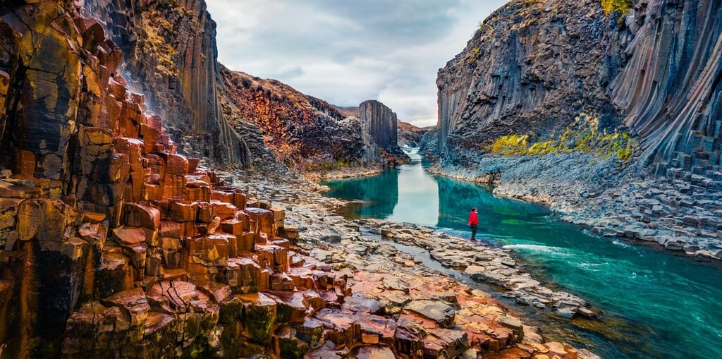
To the north, the volcanoes of Askja (1,056 m/3,464 ft), Kverkfjöll (1810 m/5,938 ft), Snæfell (1,833 m/6,014 ft), and Herðubreið (1,682 m/ 5,518 ft) overlook a highland plateau with glacial rivers. In the Jökulsárgljúfur canyon lies the sublime Dettifoss, Europe's second-most powerful waterfall after the Rhine Falls in Switzerland.
On the southside of Vatnajökull, you'll find sublime ridges separated by glacial valleys. This is the location of Iceland's highest mountain, Hvannadalshnúkur, as well as Öræfajökull (1,923 m/6,309 ft), the country’s largest active volcano.
Just west of Hvannadalshnúkur is the former Skaftafell National Park, an area that resembles the Alps and features Skaftafellsjökull, a glacial spur of Vatnajökull. Due to its favorable weather and beautiful scenery, Skaftafell is among Iceland's most popular hiking areas.
Perched on the edge of the Snæfellsnes peninsula at the westerly reaches of Iceland is Snæfellsjökull National Park (Þjóðgarðurinn Snæfellsjökull). The park encompasses 170 square km (65 square miles) of land and centers around Snæfellsjökull (1,129 m/3,704 ft), a 700,000-year-old stratovolcano capped with a glacier.
Snæfellsjökull is one of Iceland's most famous sights, gaining worldwide attention when it featured as the setting of the 1864 novel Journey to the Center of the Earth by Jules Verne. On a clear day, Snæfellsjökull is visible from Reykjavík, which is located 120 km (74 miles) to the southeast.
There are 24 named mountains in Snæfellsjökull National Park. The highest and the most prominent summit is Snæfellsjökull - Miðþúfa (1,446 m/4,744 ft). Miðþúfa is closely followed by Snæfellsjökull's other peak, Vesturþúfa (1,442 m/4,730 ft).
Snæfellsjökull's official name is Snæfell but is referred to as Snæfellsjökull to differentiate it from two other mountains with the same name. In August 2012, the mountain's summit was ice-free for the first time in recorded history.
During summer, Snæfellsjökull is one of Iceland's most popular hiking areas, with the saddle easily reachable when free from snow. However, hikers need to be careful to avoid Snæfellsjökull's hazardous crevasses.
As a result of the volcano's potential dangers, it's recommended hikers book one of the many tour guides who operate during the summer. Reaching Snæfellsjökull’s true summit requires ice climbing under challenging conditions.
As well as Snæfellsjökull, Snæfellsjökull National Park is home to some other amazing areas that are popular with tourists. Buðahraun lava field along the Snæfellsnes peninsula's southern shores is unlike anywhere else, with its craggy, blackened landscape and sandy beaches.
It's also worth taking a tour of Vatnshellir, the only accessible lava cave in the park. The cave is 200 m (656 ft) long and 35 m (114 ft) deep, and it formed during a volcanic eruption around 8,000 years ago.
Situated around 40 km (24 miles) northeast of Reykjavík is Þingvellir National Park (þjóðgarðurinn á Þingvöllum). Established in 1930, Þingvellir National Park is Iceland's oldest national park.
The park is one of Iceland's most historic areas, as it was the site of the original Alþing. This annual parliament was held from 930 until 1799 when it was suspended under Danish rule and subsequently moved to Reykjavík in 1881.
Parts of the Alþing from centuries ago are visible in the park, including 50 stone booths. However, the remains of the original tenth-century Alþing are thought to be buried. The area was designated a national park on Alþing's thousandth anniversary.
The park encompasses 92 square km (35 square miles) of land on the northern shores of Þingvallavatn, Iceland's largest natural lake. The park itself sits on the Mid-Atlantic Ridge and consists of a stunning rift valley. The park is the best place to see the continental drift between the North American and Eurasian plates.
Þingvellir National Park is home to 17 named peaks. The highest and most prominent mountain is Syðstasúla (1,093 m/3 586 ft).
The Öxará River runs through the length of the park and features the Öxarárfoss waterfall, one of the park's top tourist attractions. On the shores of Þingvallavatn is the Silfra fissure, a popular spot for snorkeling and scuba diving due to its crystal clear waters.
Þingvellir National Park forms part of Iceland's Golden Circle, a 300-km (190 miles) tourist route that loops from Reykjavík and includes the Haukadalur Valley, Gullfoss Falls, and Þingvellir National Park.
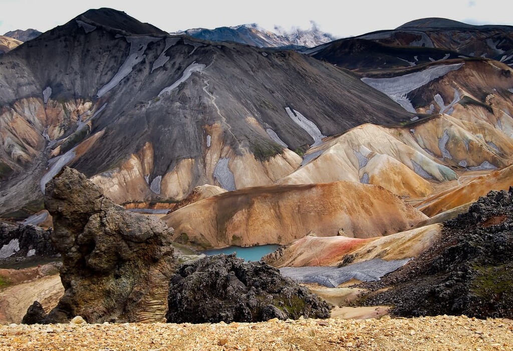
Located approximately 25 km (15 miles) to the west of Vatnajökull National Park is Fjallabak Nature Reserve (Friðland að Fjallabaki). Established in 1979, this nature reserve protects an area of 470 square km (181 square miles), including Landmannalaugar, one of Iceland's most popular hiking areas.
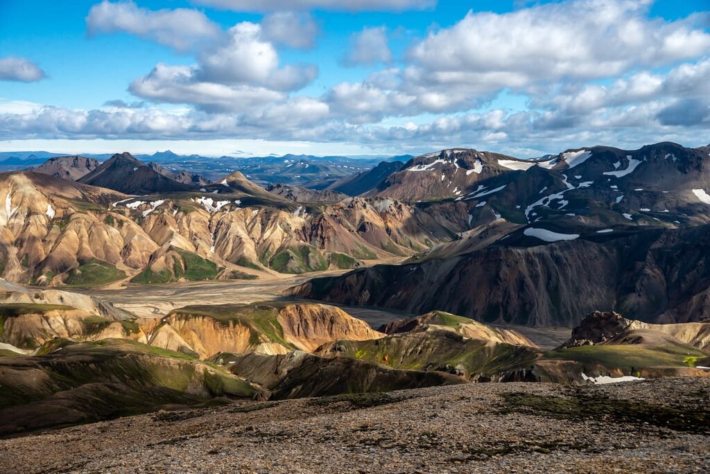
Landmannalaugar, also known as the "People's Pools," is an area of Iceland's Southern Highlands, the entirety of which is over 500 m (1,640 ft) above sea level.
Landmannalaugar is popular due to its vibrant geothermal valley, with rhyolite and obsidian making the ground a mixture of blue, green, red, pink, and yellow. It's known as the "People's Pools" due to the region's geothermal springs, with hikers often taking breaks from their hikes to take a dip in these natural baths.
There are 42 named peaks in Fjallabak Nature Reserve. The highest and the most prominent mountain is Háskerðingur (1,281 m/4,203 ft). Other notable peaks include Laufafell (1,184 m/3,885 ft), Löðmundur (1,077 m/3,533 ft), and Hábarmur (1,170 m/3,838 ft).
Fjallabak Nature Reserve is also home to one of Iceland's most popular long-distance hiking routes, the Laugavegur Highland Trail. This 55-km (34 miles) trek leads from Landmannalaugar to the stunning valley of Þórmörk.
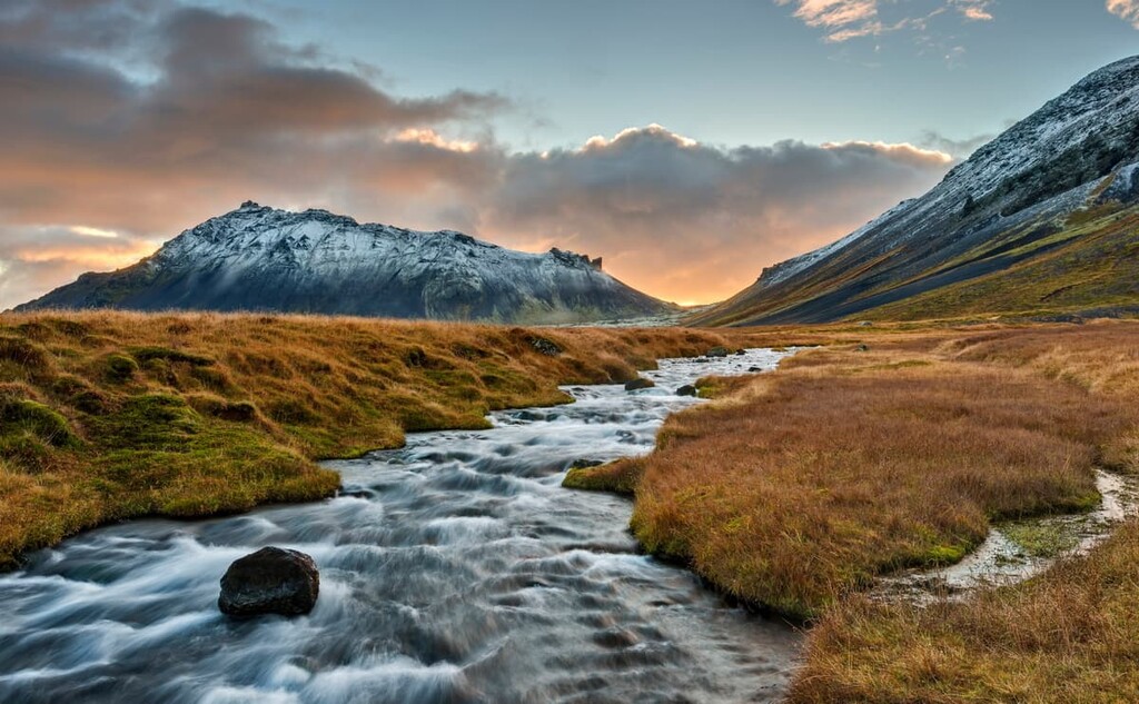
The Laugavegur Highland Trail is only accessible during the summer and takes most hikers 3 to 4 days to complete. Along the walk, you'll pass the Álftavatn lake and the black sand desert of Mælifellssandur, which is famed for its conical mountain, Stórasúla (918 m/3,011 ft). It also passes the Mýrdalsjökull and Eyjafjallajökull glaciers.
Located just 40 km (24 miles) from Reykjavík, the Reykjanes Nature Reserve (Reykjanesfólkvangur) is the perfect hiking destination for anyone looking to stay close to the capital.
The Reykjanes Nature Reserve covers 300 km square (115 square miles) of land on Iceland's southwestern Reykjanes Peninsula and an area known for its volcanic and geothermal activity. The Peninsula is home to Reykjavík and Iceland's world-famous Blue Lagoon.
There are 49 named peaks in Reykjanesfólkvangur. Hvirfill (621 m/2,037 ft) is the highest point. The most prominent hill is Grænadyngja (402 m/1,319 ft). Compared to the rest of Iceland's parks, Reykjanes Nature Reserve is relatively low-lying with no significant mountains.
There are several features of the Reykjanes Nature Reserve that draw in hikers. One popular landmark is Kleifarvatn, a mineral lake with depths of 97 m (318 ft) and thermal hot springs. It is the largest lake on the Reykjanes Peninsula.
Another highlight from the park is the Krýsuvíkurberg. These 40 m (131 ft) high sea cliffs are an oasis for birdwatchers and at 15 km (9 miles) long, they are among the largest bird watching sea cliffs in Europe. The Krýsuvíkurberg is home to over 60,000 sea birds, and common breeds include kittiwakes, guillemots, and fulmar.
There are several popular hiking trails in the Reykjanes Nature Reserve, including a loop of Kleifarvatn. Other popular hikes include treks along the Sveifluháls (397 m/1,302 ft) and Núpshlíðarháls (202 m/663 ft) ridges, which provide panoramic views across the park's volcanic landscape.
Adventure seekers looking to explore the most remote regions of Iceland should plan a trip to Hornstrandir Nature Reserve (Hornstrandir). Located in the isolated Westfjords, Hornstrandir Nature Reserve covers approximately 580 square km (220 square miles) of Iceland's most northwesterly peninsula.
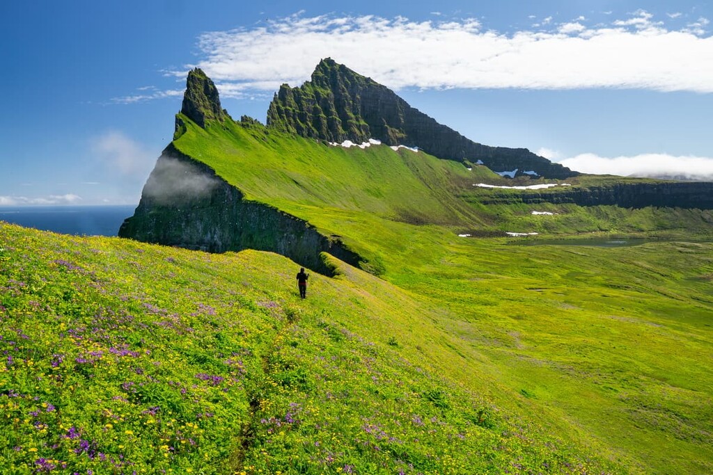
Established in 1975, this reserve sits just north of the Drangajökull glacier and features unspoiled tundras, towering sea cliffs, and an abundance of flora and fauna.
You'll find around 260 flowering plant species in the reserve and huge sea cliffs home to puffins and arctic terns. There's also nowhere better to spot arctic foxes than in the reserve. As there is a hunting ban in Hornstrandir, arctic foxes have no fear of humans and they regularly approach hikers.
There are 66 named mountains in Hornstrandir. The highest and the most prominent mountain is Bláfell (723 m/2,372 ft). Other notable peaks include Skarðsöxl (702 m/ 2,303 ft) and Breiðuskarðahnúkur (709 m/2,326 ft).
By far the best hike in the Hornstrandir Nature Reserve is to Hornbjarg, a series of massive sloped sea cliffs at one of Iceland's most northerly points. Prominent peaks on the cliffs include Kálfatindar (535 m/1,755 ft) and Jörundur (429 m/ 1,407 ft).
If you're planning an excursion to Hornstrandir, you'll need to come well-prepared. There are no roads or stores in Hornstrandir, and anybody staying in the park will have to camp.
Anybody visiting Hornstrandir should bring plenty of food, water, and warm clothes. It's also worth noting that the Hornstrandir Nature Reserve is only accessible during the summer months. The best way to reach the reserve is by boat from Ísafjörður, the largest settlement in the Westfjords.
Whether you're driving a ring around Iceland or just fancy a weekend away in a winter wonderland, here are some of the best places to stay.
Chances are you won't be able to avoid visiting Reykjavík during your hiking adventure in Iceland. The Capital Region is home to 60 percent of Iceland's population and is a major transport hub, welcoming nearly 5 million visitors annually.
Reykjavík is the perfect base for exploring the southwest of Iceland, with the Reykjanes Nature Reserve and Þingvellir National Park just a short drive away.
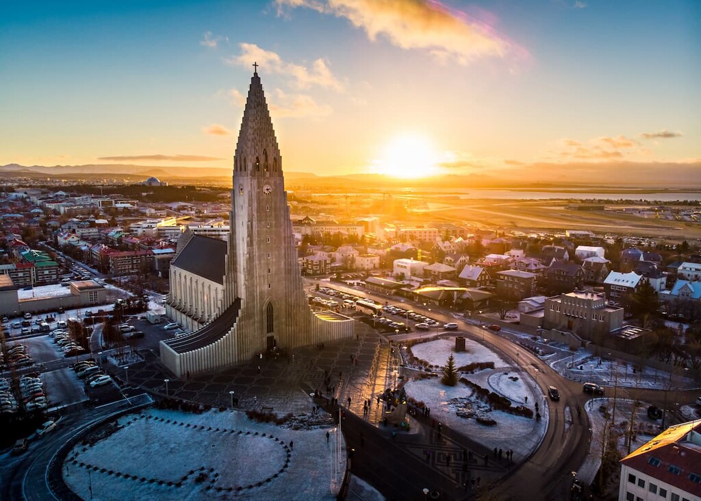
During your stay, ensure you stop to admire Hallgrimskirkja cathedral and catch a performance at the Harpa concert hall. For views of the city, take a hike up Esja (914 m/ 2,998 ft), located 10 km (6 miles) north of Reykjavík.
Before heading off to explore the Icelandic wilderness, ensure you stock up on supplies in Reykjavík. Most of Iceland's other settlements are small, and supplies are limited. Many of Iceland's best hotels are located in Reykjavík, like the Grand Hótel, the Hilton Reykjavík, and Midgardur by Center Hotels.
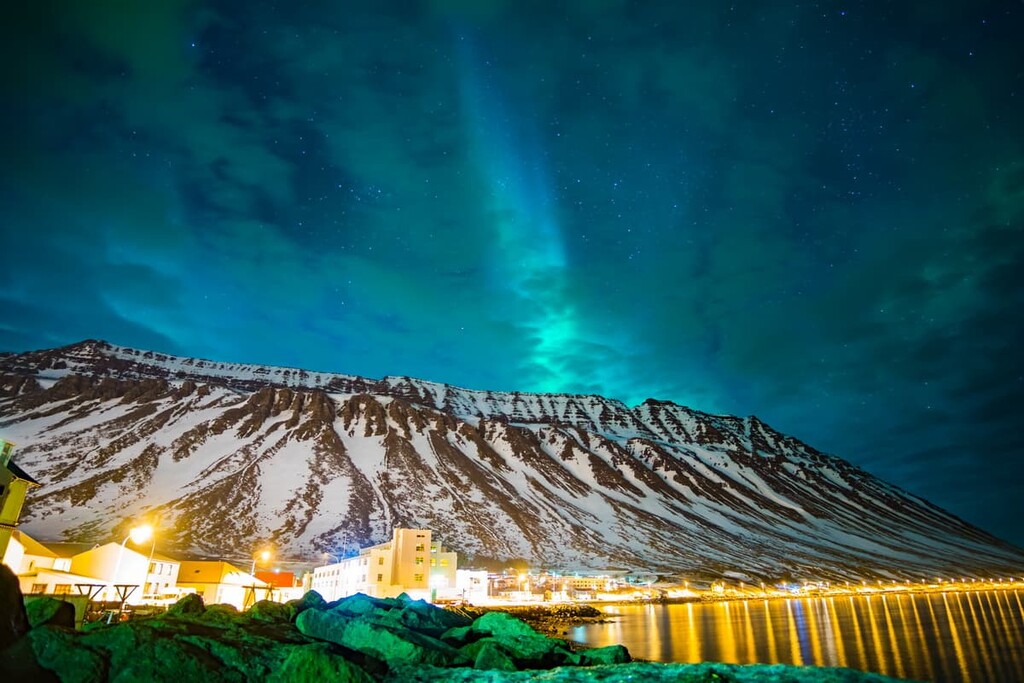
Dubbed "The Capital of North Iceland," Akureyri is a great place to stay if you're trying to avoid the busy Capital Region. Akureyri sits at the inland end of the Eyjafjörður fjord, encircled by sublime snow-capped mountains, including Kerling (1,536 m/5,039 ft) and Strýta (1,456 m/4,776 ft).
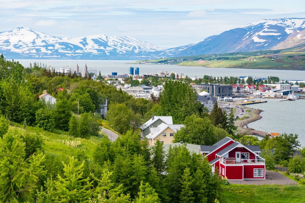
Many tourists come to Akureyri to visit Hlíðarfjall (1,101 m/3,612 ft), home to one of the largest ski resorts in Iceland. Akureyri also has some interesting cultural attractions, including the Akureyri Art Museum and the Akureyrarkirkja church. If you're planning to spend the night in Akureyri, book a room at Hotel Kjarnalundur or Hotel Kea.
One of the largest towns in southeastern Iceland, Höfn is a popular place to get a good night's rest before hiking through Vatnajökull National Park. This small fishing town is about 135 km from Skaftafell, and the Vatnajökull glacier is often visible from Höfn.
You'll also be a 10-minute drive from the jagged summits of Brunnhorn (435m/1 427ft), a stunning yet often overlooked peak nicknamed Batman Mountain due to its shape.
Planning to stay in Höfn? Book a room at the Hótel Höfn or the Hótel Edda.
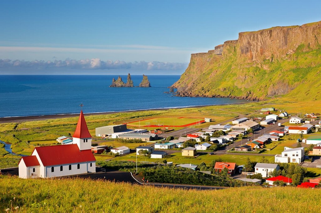
One of Iceland's most southerly settlements, Vík is another popular spot for tourists visiting Vatnajökull National Park. Despite having a population of just over 300, Vík is the largest town for 70 km (43 miles) and it is just 140 km (86 miles) from Vatnajökull National Park. Vík also sits just south of the active volcano, Katla.
There's no better place to stay if you're looking to visit the Reynisdrangar, a basalt column rock formation similar in appearance to the Giant's Causeway in Northern Ireland. Afterward, take a stroll along Reynisfjara Beach or plan a trek up Reynisfjall (340 m/1,115 ft). You'll find a few hotels in and around Vík, like the Hótel Vík and Hótel Kría.
Egilsstaðir is the largest town in Iceland's Eastern Region, with a population of nearly 3,000 people. Even by Icelandic standards, Egilsstaðir is a new settlement, having been established in 1947 and quickly growing into eastern Iceland's main transport hub.
Egilsstaðir is ideal if you're looking to explore the remnants of Iceland's once-great forests, with Hallormsstaðaskógur forest right on your doorstep. You should also take the 6 km (3.5 miles) hike up to the scenic Fardagafoss waterfall. Popular hotels in Egilsstaðir include Gistihúsið and Hotel 1001 Nott.
There are few areas of Iceland more remote than the Westfjords, and anybody looking for a taste of civilization during their visit to the northwest should spend a night in Ísafjörður.
Ísafjörður is the largest town in the Westfjords, with a population of over 2,600 people. The town sits within the minor Skutulsfjörður fjord, which runs into the larger Ísafjarðardjúp fjord.
During your stay, you can watch puffins nest on the Látrabjarg cliffs, stroll along the red sand beaches of Rauðasandur, and hike through the postcard-perfect Hornstrandir National Nature Reserve. If you're staying in Ísafjörður, spend the night at the Hotel Ísafjörður.