
Scan the QR code and open PeakVisor on your phone
Snæfellsjökull National Park has 24 named peaks. The highest is Snæfellsjökull - Miðþúfa at 1,446 m. Other notable peaks include Snæfellsjökull - Vesturþúfa, Norðurþúfa and Sandfell.
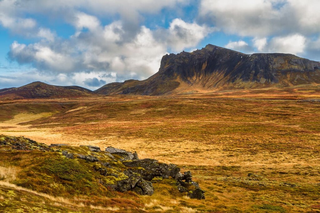
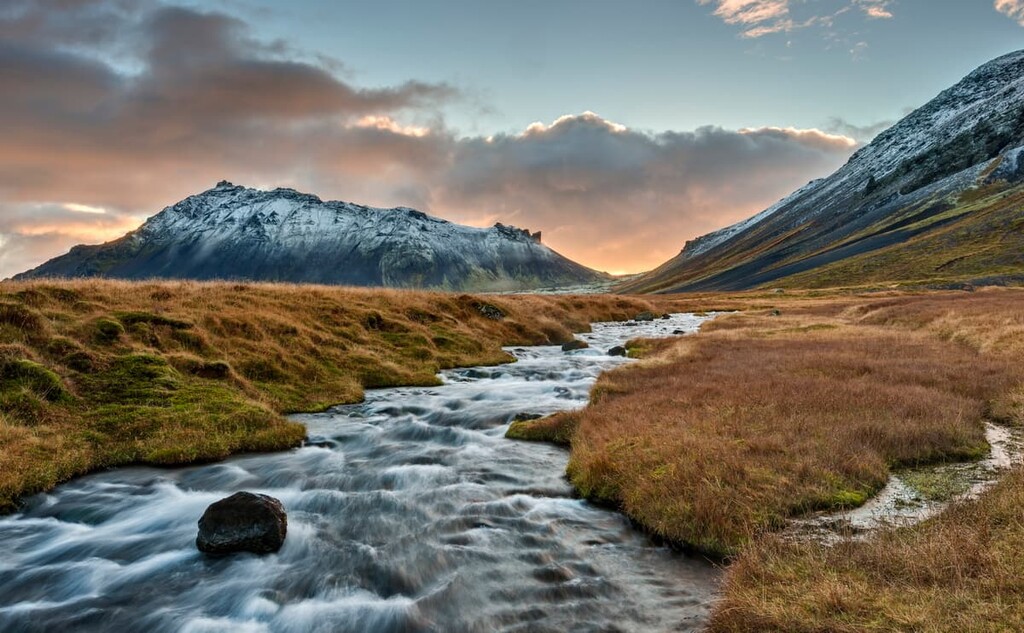
Glacier-capped volcanoes, otherworldly lava fields, and dramatic sea cliffs await anyone visiting Iceland's Snæfellsjökull National Park. There are 24 named summits in Snæfellsjökull National Park. The highest and the most prominent peak is Snæfellsjökull - Miðþúfa (1,446 m/4744 ft).
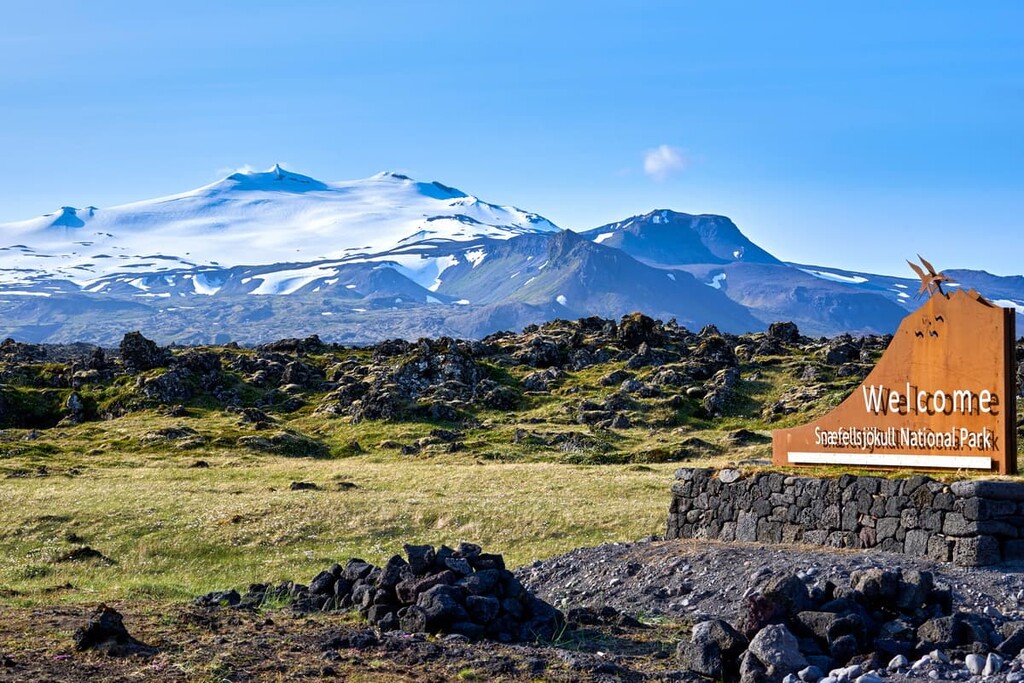
Snæfellsjökull National Park (Þjóðgarðurinn Snæfellsjökull) sits at the end of the Snæfellsnes Peninsula, one of Iceland's (Ísland) most westerly points. The park is located within Iceland’s Snæfellsbær region.
The park covers approximately 170 square km (65 square miles) and centers around Snæfellsjökull, a 700,000-year-old stratovolcano capped with a glacier. Snæfellsjökull has three peaks, Vesturþúfa (1,442 m/4,730 ft), Norðurþúfa (1,390 m/4,560 ft), and Miðþúfa (1,446 m/4744 ft), the latter of which is the park's highest point.
Snæfellsjökull National Park is home to some unique features that make it popular with tourists.
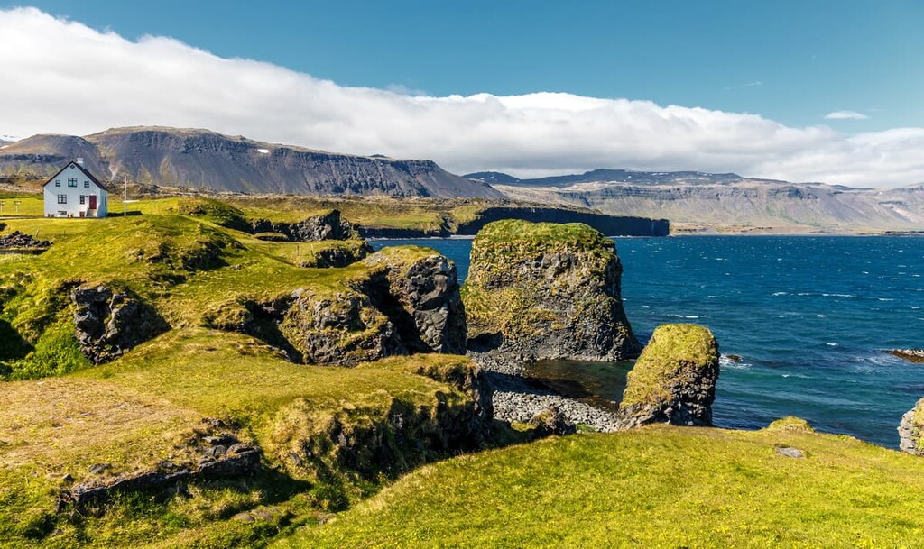
Located to the southeast of the park is the Búðahraun lava field, which surrounds the Búðaklettur (88 m/288 ft) crater. The lava field is a popular hiking destination and boasts some of the best beaches in the country, including Djúpalónssandur and Skarðsvík. Due to its geological and ecological importance, the Búðahraun lava field is designated a nature reserve.
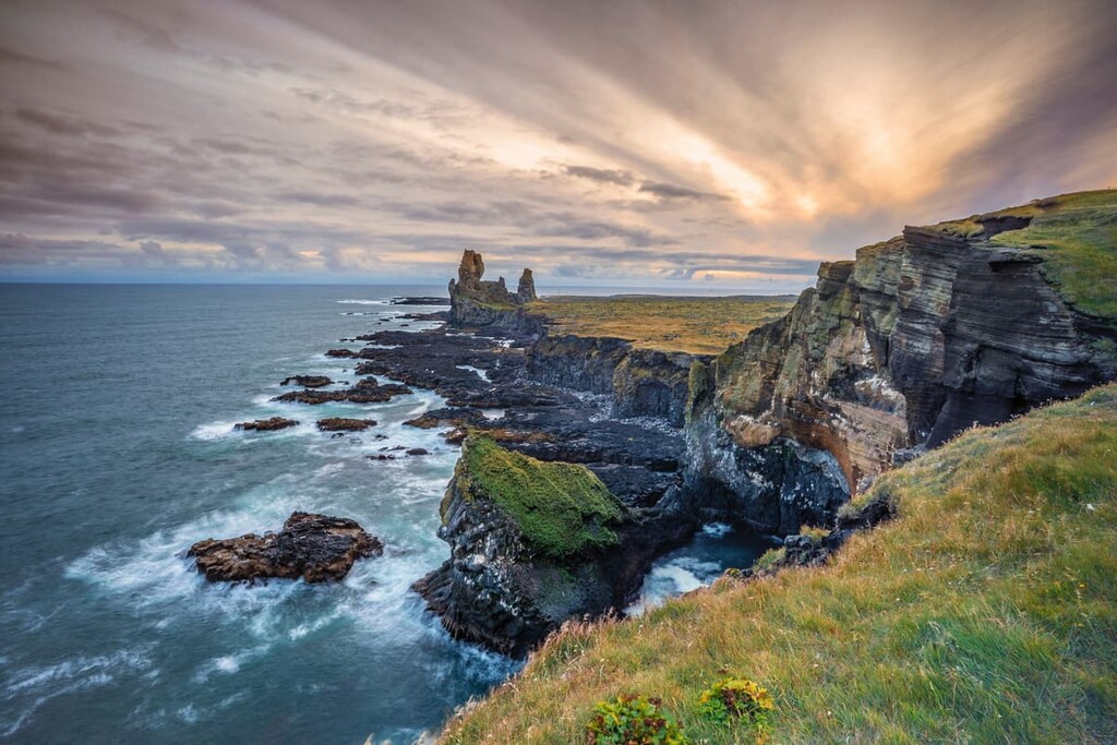
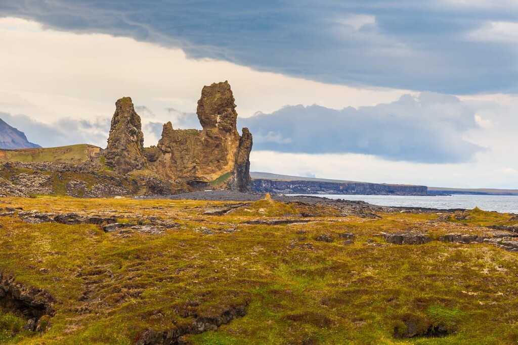
Another highlight of the park is the Lóndrangar basalt cliffs, which can be accessed from the park's visitor's center. Originally a volcanic crater, centuries of erosion mean that all that's left of the crater are two towering pillars some 75 m (246 ft) and 61 m (200 ft) high overlooking the ocean.
Snæfellsjökull National Park also has several lava caves. While most of these lava caves are inaccessible, the Vatnshellir Cave to the south is open for tours year-round. The Vatnshellir Cave is 200 m (656 ft) long and 35 m (114 ft) deep. It's one of Iceland's oldest lava tubes, having formed around 8,000 years ago.
Snæfellsjökull National Park was established in 2001 and is neither the oldest nor largest national park in Iceland. It's one of three national parks in Iceland, along with Vatnajökull National Park and Þingvellir National Park.
Due to Snæfellsjökull National Park's isolated location, there are few nearby parks. The next nearest park is Þingvellir National Park, which is approximately 220 km (136 miles) away.
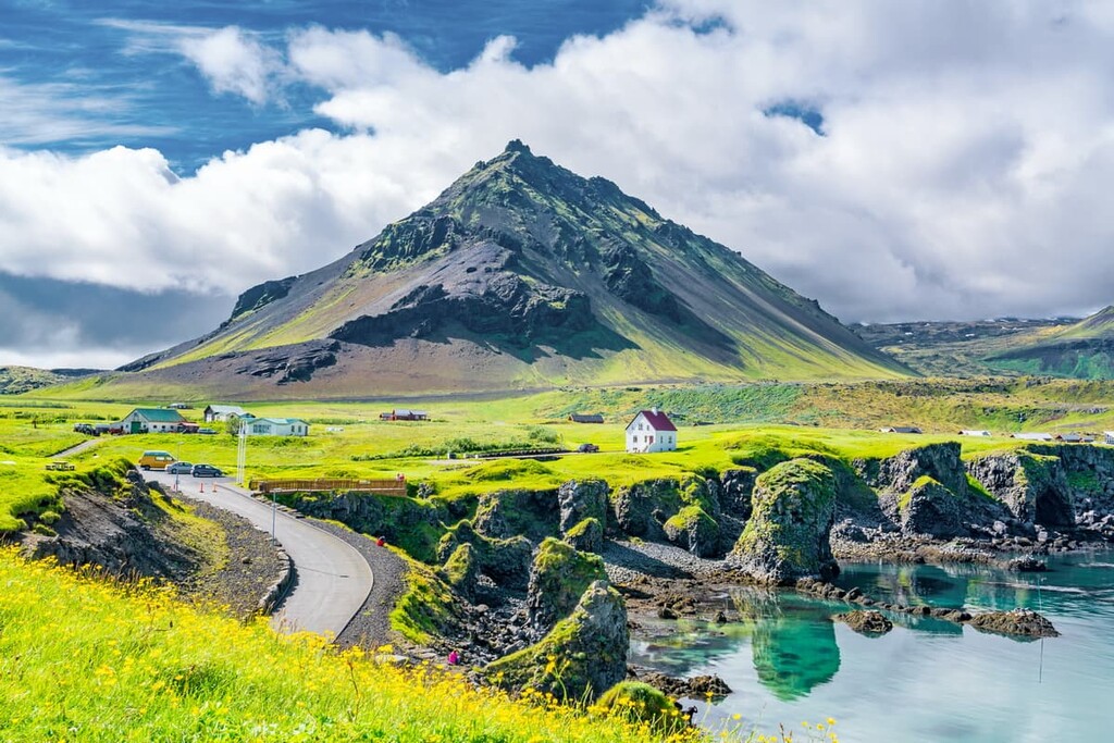
Other popular sights on the Snæfellsnes peninsula include Kirkjufell (463 m/1,519 ft), the Rauðfeldsgjá gorge, and the Bjarnarfoss waterfall. There are few significant settlements near Snæfellsjökull National Park, with mainly small traditional fishing villages on Snæfellsnes.
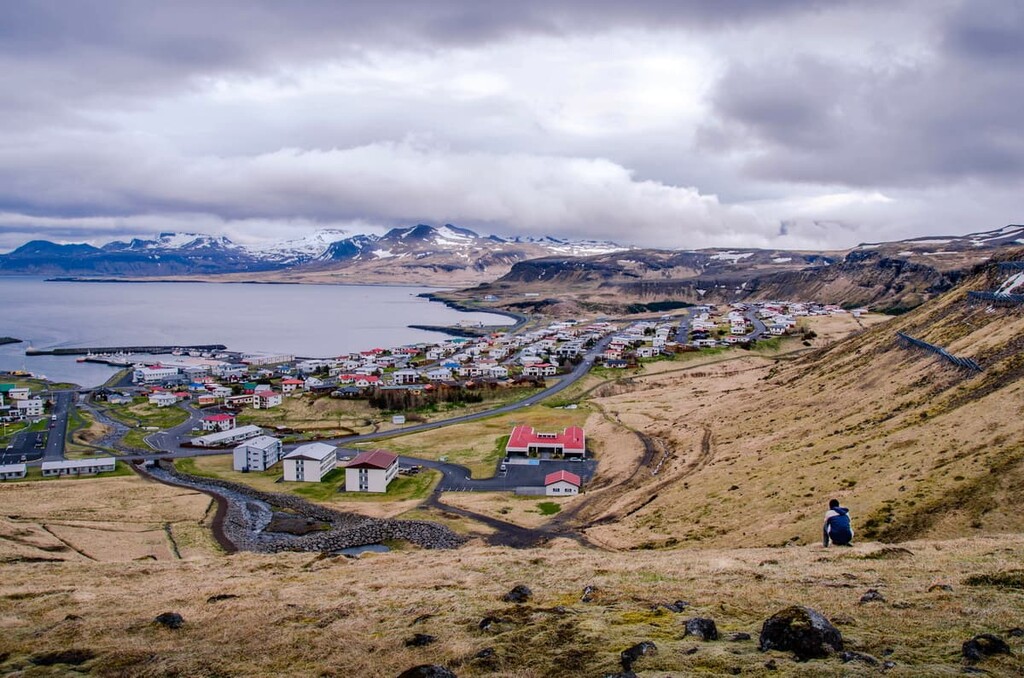
The nearest settlements are Arnarstapi and Hellnar to the south and Hellissandur and Ríf to the north. The largest nearby town is Ólafsvík, which is roughly 25 km (15 miles) away on the north coast of the peninsula. Each of these settlements offers accommodation.
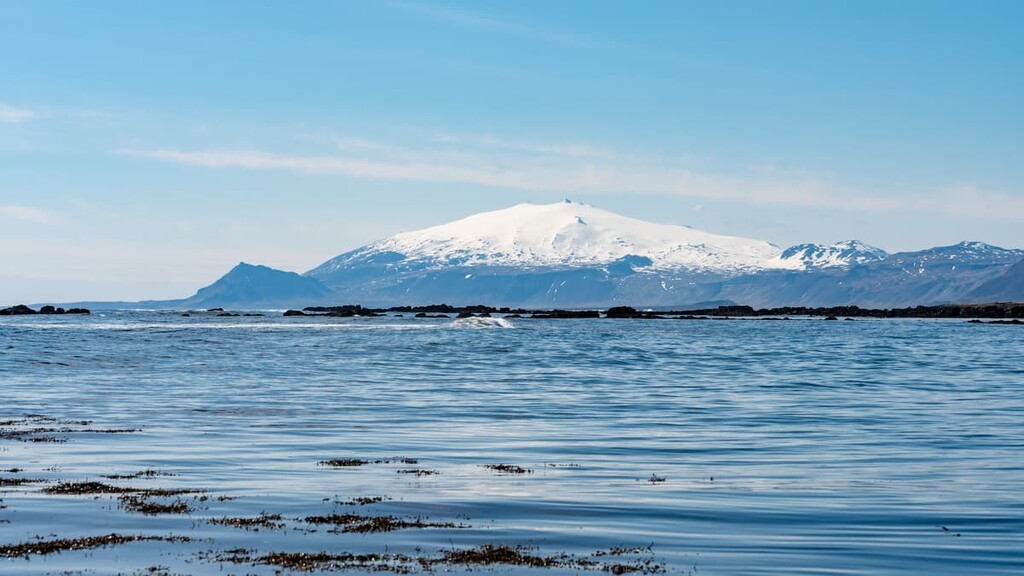
Despite being 120 km (75 miles) north of Iceland's capital, Reykjavík, the peaks of Snæfellsjökull are visible on a clear day across Faxa Bay.
As is the case for the whole of Iceland, Snæfellsjökull National Park is an area of great interest to geologists. Iceland is among the geologically newest places on Earth, having formed around 33 million years ago.
Snæfellsjökull National Park is ideal for geologists looking for a snapshot of Iceland's geology. There's evidence of the area changing during every period of Iceland's geological history.
The Snæfellsjökull volcano system has played a large part in forming Snæfellsnes, with evidence of eruptions dating from the last glacial period to recent times.
The Snæfellsjökull volcano system is 30 km (18 miles) long, extending from Mælifell (566 m/1,857 ft) in the east to the peninsula's westernmost point, Öndverðarnes. There are approximately 20 lava fields across the volcano system. There are two types of lava commonly seen across Snæfellsjökull National Park: ropey and smooth.
Many of the mountains to the north of Snæfellsjökull are composed of volcanic tuff, believed to have been created by eruptions from under the sea or the glacier.
Geologists believe that the peninsula was once home to a huge volcano that erupted underwater. It's thought that the Svalþúfa headland was the eastern edge of this crater, while the pillars at Lóndrangar served as the plugs.
Perhaps the best-known of all of Snæfellsjökull National Park's lava fields is the Búðahraun lava field. Geologists believe this area was created by lava flowing from the Búðaklettur (88 m/289 ft) crater 5,000 to 8,000 years ago.
One of the most interesting features of the Búðahraun lava field is that it sits on the sea bed. As a result, its foundation is waterlogged and during high tide, water will seep through hollows in the lava.
Snæfellsjökull (1,129 m/3,704 ft) is among the most recognizable volcanoes in Iceland and, for a long time, was regarded as the country's highest mountain. Snæfellsjökull is a stratovolcano, meaning it's been built up over time from layers of hardened lava with steep prominence near the summit crater.
The volcano itself is still considered active, with the last eruption happening around 200 CE. The layers of lava on the slopes of Snæfellsjökull and many of the nearby lava fields have been created by sporadic eruptions over the last 800,000 years.
The crater atop Snæfellsjökull is around 200 m (656 ft) deep and is surrounded by steep ice cliffs. The last eruption of Snæfellsjökull caused lava to flow down the volcano's southern slopes, creating several lava fields, including the Háahraun lava field.
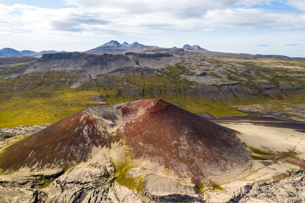
Along with Snæfellsjökull, there are several other notable smaller volcanoes in the lowland areas of Snæfellsjökull National Park, including Purkhólar (145 m/476 ft), Sauðhóll (110 m/361 ft), and Saxhólar (125 m/410 ft).
Over the years, the Snæfellsjökull glacier has shrunk and is currently around 11 square km (4 square miles). The summit of Snæfellsjökull was ice-free for the first time in recorded history in 2012. Research suggests the glacier will disappear entirely by the end of the century.
Snæfellsjökull National Park is home to an array of flora and fauna, ranging from colonies of nesting seabirds to moss-covered lava fields.
While exploring Snæfellsjökull National Park, it's hard to ignore the moss that coats most of the area's lava fields. Wildflowers grow in the cracks in the lava, and common species include geraniums, meadowsweets, and buttercups. In sandy areas of the park, you'll come across wild thyme, dandelion, red fescue, and meadow buttercup.
The many hollows across the park's lava fields are among the most fertile areas of the park, supporting approximately 130 plant species. This is partly due to the foundations being drenched in seawater, creating humid conditions that many plants favor.
There are no large trees in Snæfellsjökull National Park, but the park's hollows can support small trees, including birch and rowan. Approximately 11 of the 16 fern species native to Iceland grow within Snæfellsjökull National Park.
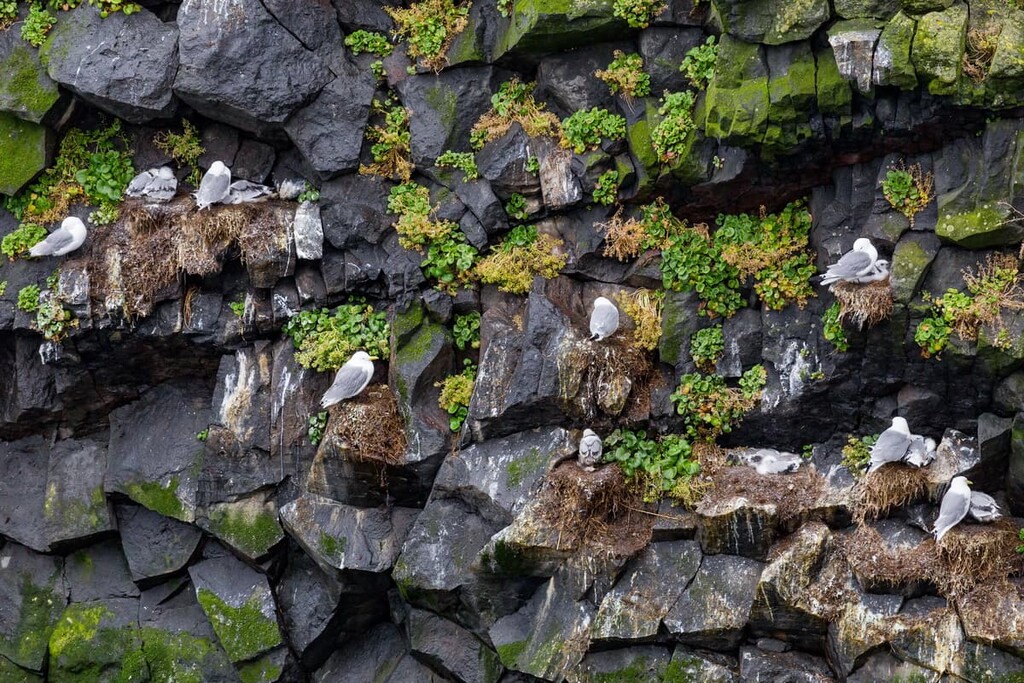
The most common animals you'll see in Snæfellsjökull National Park are seabirds. The sea cliffs around the entire park are ideal for nesting. Black-legged kittiwake, common murre, puffin, and northern fulmar can all be seen nesting at Lóndrangar.
Gulls are a common sight across the park, and you'll no doubt spot a black-backed gull, a seagull, or a herring gull during your visit. Other common bird species include golden plover, white wagtail, sandpiper, and raven. You might also get lucky and spot a rare bird of prey like a sea eagle or a merlin.
The most common mammals in Snæfellsjökull National Park are harbor seals and grey seals, which are often seen along the coastline. Iceland's last remaining native land mammal, the arctic fox, is also frequently spotted on the park's lava fields. Field mice also thrive on the peninsula.
If you're hiking along the coast, ensure you keep an eye out for some of the park's aquatic creatures. Large marine mammals like orcas, minke whales, and porpoises are sometimes spotted just off the coast.
The early human history of the western end of Snæfellsnes isn't as well documented in early manuscripts like the rest of Iceland. However, there is evidence of the remnants of farmsteads dating back to the ninth century in Berutóftir, Forni-Saxhóll, and Írskubúðir.
Bárðar saga Snæfellsáss, a late entry in the Íslendinga saga, was written in the fourteenth century, with the first part taking place on Snæfellsnes. However, the Bárðar saga Snæfellsáss is considered to be too unbelievable to have any basis in history.
One of the most interesting archeological finds on the peninsula is the remains of a stonewalled shelter likely used to store fish between 500 and 700 years ago. The shelter's age would make it one of the oldest artifacts connected to the Nordic fishing industry.
In the eleventh century, a church was built near Snæfellsjökull at Ingjaldshóll. At the time, this would have been the third-largest church in Iceland, suggesting the area was heavily populated. By the sixteenth century, two other churches were later built nearby, as well as a chapel at Öndverðarnes.
The area was likely popular due to its excellent fishing opportunities but was likely abandoned over time due to dangerous weather, the area's isolation, and improvements in fishing techniques. Evidence of the region's past popularity can be seen at Dritvík, a fishing station that would welcome 40 to 60 ships at a time.
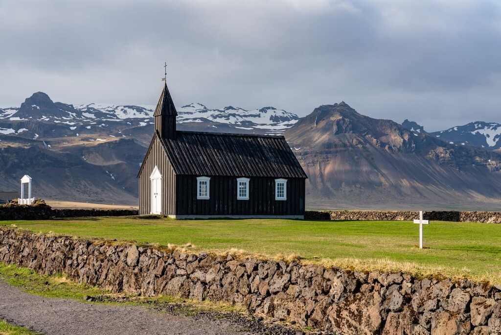
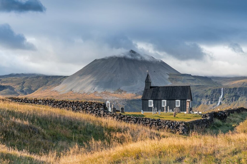
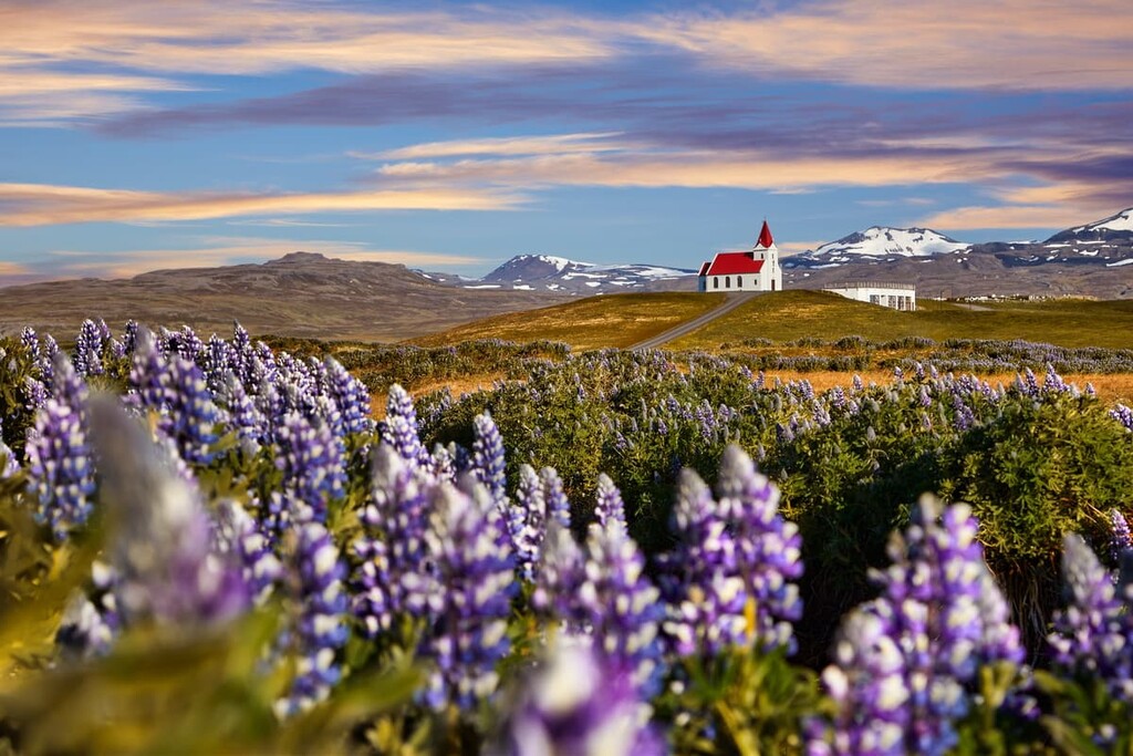
One of the most important landmarks in Snæfellsjökull National Park is the Búðakirkja. This small black church was originally built in 1703 by Bent Lárusson, a merchant from the trading port of Búðir. It then had to be reconstructed in 1848.
The church was then moved piece by piece to its current location in 1984. Due to its location on the Búðahraun lava field, the church is popular with tourists.
The first successful climb of Snæfellsjökull was recorded in 1754 by Eggert Ólafsson and Bjarni Pálsson. By the mid-nineteenth century, Snæfellsjökull was one of the most famous sights in Iceland. Snæfellsjökull became world-famous as it served as the setting for the novel Journey to the Center of the Earth by Jules Verne.
The area was designated a national park in 2001, and a visitor's center opened in Hellnar in 2004. The visitor's center is open from 10:00 to 18:00 during the summer months. The Environment Agency of Iceland (Umhverfisstofnun) manages the park.
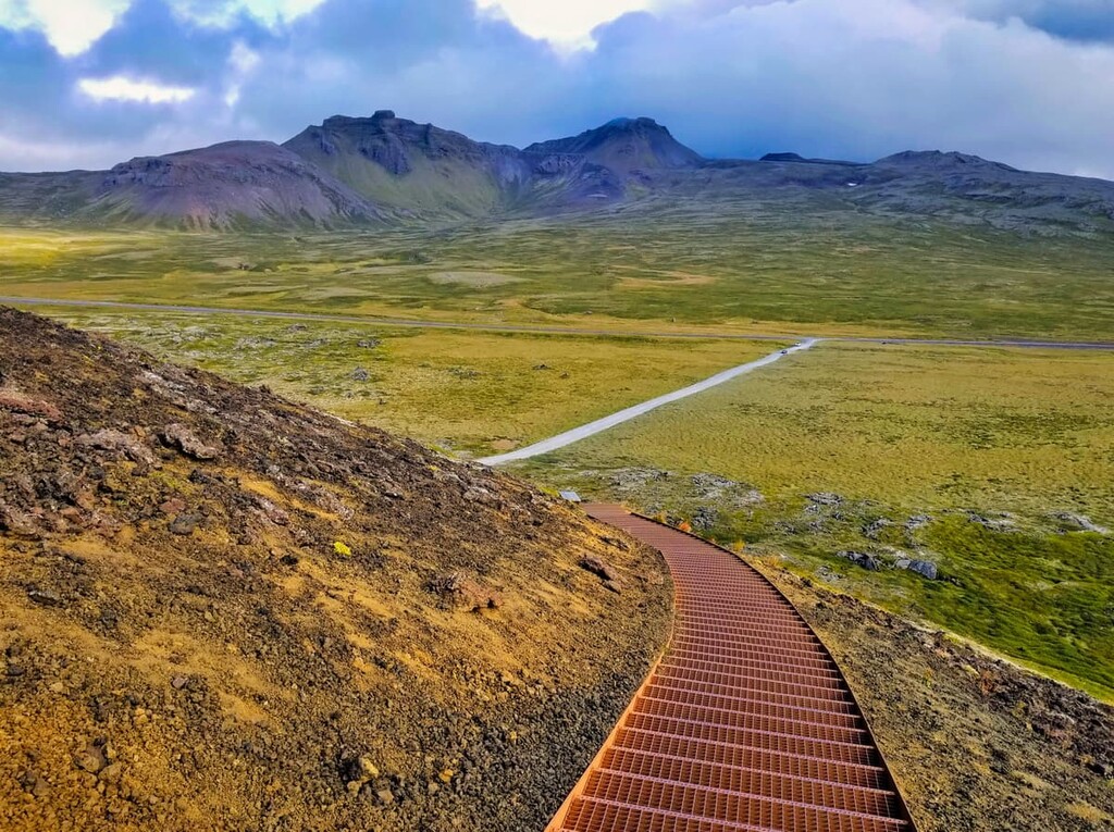
Snæfellsjökull National Park offers some of the best hiking opportunities in the Land of Fire and Ice. Read on to discover the park's main hiking trails and areas.
One of the most iconic natural sights in Iceland, Snæfellsjökull (1,446 m/4,744 ft) is among the best and most difficult hikes in the park. The hike is completed by following Efstivegur, an old walking trail with an 11 km (7 mi) long marked section near the Beruvíkurhraun lava field.
The hike up Snæfellsjökull takes between 3 to 5 hours, and there are several different routes. As well as bringing appropriate hiking gear, hikers should take plenty of water as there are few water sources in the park. For longer walks, hikers are required to report their itinerary to National Park staff.
The ascent of Snæfellsjökull is dangerous and shouldn't be attempted by inexperienced hikers. Due to quickly changing weather and trail conditions, many hikers bring along a guide for safe navigation. Hikers cannot scale Snæfellsjökull in the summer, as large crevasses form near the summit.
Perhaps the most challenging section of the hike up Snæfellsjökull is the final ascent up its highest peak, Miðþúfa, which is very steep. During your walk, ensure you keep an eye out for the legendary Bárður Snæfellsás, the half-man, half-troll protector of the glacier.
Hreggnasi (469 m/1,539 ft) is a hill approximately 6 km (4 miles) north of Snæfellsjökull and is among the most popular hiking areas in the park's northern tuff mountains. It's popular with hikers thanks to the stunning views it provides of the park and for the marked trail that leads to the summit.
The trail to the summit is short but steep. You can pick up the path from the entrance to Eysteinsdalur across the stream on the hill's eastern side. The there-and-back trail is around 1 km (0.6 mi) long, and it takes about an hour to complete. Despite Hreggnasi's modest elevation, the sheer cliffs on the far side of the summit mean hikers will need a head for heights.
During your visit to Hreggnasi, ensure you stop by the waterfalls along the Eysteinsdalur road. The Klukkufoss and Snekkjufoss waterfalls are both accessible, with short 20-minute walks from the road.
The Rauðhóll (155 m/508 ft) volcano is located just north of Hreggnasi along the Eysteinsdalur road. The last eruption of Rauðhóll created the Presthraun lava field along the north coastline between Skarðsvík and Hellissandur.
The easiest way to hike up Rauðhóll is from the Eysteinsdalur road on the trail marked with posts. The trail is about 1 km (0.6 mi) each way and should be manageable for hikers of varying experience levels.
An alternative route up Rauðhóll is by following the Móðulækur stream. Along the way, you'll follow the lava channels, passing by charming mountain ponds surrounded by reeds.
Bárðarkista (616 m/2,021 ft) is the highest summit in the park away from Snæfellsjökull to have a marked trail.
You can pick up the trail from the Útnesvegur car park. Follow the Saxhólslækur stream across open moorland, continuing further south to avoid a ravine. Past the ravine, the path turns north and heads for the summit.
Bárðarkista boasts some of the best views of the park, with Svörtutindar (605 m/1,985 ft) to the southwest and Hreggnasi to the north. Similar to Hreggnasi, Bárðarkista is encircled by crags and requires a head for heights.
Saxhóll (73 m/239 ft) is perhaps the most famous crater in Snæfellsjökull National Park. It's very popular due to its easy accessibility and short approach. Saxhóll is located around 9 km (5 miles) south of Hellissandur.
You can start this walk from the bridge across the nearby Móðulækur stream. The marked trail is approximately 2 km (1.2 miles) long and takes around an hour to complete.
The majority of the walk takes hikers across a lava field that erupted from Saxhóll over 3,000 years ago. In 2016, stairs were put up the side of the crater, making it a straightforward climb. At the lip of the crater, hikers should stay on the path and avoid stepping on anything that might damage the local ecosystem.
The hamlet of Búðir and the Búðahraun lava field are also well worth discovering during your trip to Snæfellsjökull National Park. There are several popular hiking trails across the area, including one that passes the famed Búðakirkja.
The trail starts from the Búðakirkja and leads to Frambúðir, the remnants of a winter fishing village where many ancient relics remain. After Frambúðir, return to the church by looping around and following the coastal trail. The trail is about 1 km (0.6 miles) and takes 30 minutes.
Another popular hike in this area is up to Búðaklettur (88 m/288 ft), the crater at the center of the lava field. The lava field was created by lava flowing from the crater around 8,000 years ago.
The majority of the walk follows the Klettsgata trail. The ecosystem around the Búðaklettur crater is very fragile, so hikers should stay on the path. The hike is around 4 km (2.5 miles) long and takes 2 or 3 hours to complete. You can also extend the walk to Miðhús, adding 2 km (1.2 miles) onto your journey.
Hikers looking for stunning coastal views will want to plan a hike to Lóndrangar. These dramatic twin pillars once formed a volcanic plug but now sit overlooking the ocean at 75 m (246 ft) and 61 m (200 ft) high. Lóndrangar and the surrounding cliffs are popular nesting spots for seabirds, making this hike a must for any avid birdwatcher.
The best way to reach Lóndrangar is by parking at the Lóndrangar car park along the Útnesvegur road. You'll follow the marked trail to the tuff head of Svalþúfa before walking to the cliffs to see the Lóndrangar.
The walk is straightforward and suitable for hikers of all abilities. You should bring along binoculars so you can admire the local wildlife from a distance. There are also some sensitive ecosystems near the trail, so ensure you stay on the path. The walk is 1 km (0.6 mi) long and takes about 30 minutes to complete. You can also extend your walk for 0.5 km (0.3 mi) to the lighthouse at Malarrif.
With several charming traditional fishing villages on Snæfellsnes, your visit to Snæfellsjökull National Park is sure to be memorable. Here are a few of the best places to stay near Snæfellsjökull National Park.
With a population of just over 1,000 people, Ólafsvík is the largest town at the western end of Snæfellsnes. Located on the northern coastline, Ólafsvík is conveniently located just 35 km (22 miles) from the heart of Snæfellsjökull National Park.
During your stay, ensure you pay a visit to the Bæjarfoss waterfall and the beautiful Ólafsvíkurkirkja. Ólafsvík also has some of the best hotels on the peninsula, including the Við Hafið Guesthouse and Hotel Ólafsvík.
The neighboring fishing villages of Arnarstapi and Hellnar are among the most popular places to stay near Snæfellsjökull National Park. These two villages sit on the southern coastline of Snæfellsnes, just 17 km (10 miles) from the center of the park.
Both areas feature historic fishing ports and are mentioned as place names in the ancient manuscript Bárðar saga Snæfellsáss. You’ll also find some amazing natural wonders in the area, including Gatklettur, a stone arch popular with photographers. Hotels in the area include Arnarstapi Hotel, Fosshotel Hellnar, and Guesthouse Snjófell.
The closest settlement to Snæfellsjökull National Park is Hellissandur. This north coast fishing village sits less than 1 km (0.6 mi) from the park boundary. Another small village, Ríf, is just 2 km (1.2 mi) down the coast.
Hellissandur is a small settlement but does offer some interesting local attractions. The Maritime Museum in the Fisherman's Garden is popular with tourists looking to see examples of the turf-covered houses that were once common across Iceland. The spectacular Svöðufoss waterfall is also just a short walk from either village.
If you're planning to spend the night in Hellissandur or Ríf, book a room at Hotel Hellissandur or the Freezer Hostel & Culture Centre.
The small hamlet of Búðir is popular with visitors due to the famed Búðakirkja and its proximity to the Búðahraun lava field. You'll also be well-positioned to visit another of Iceland's picture-perfect waterfalls, Bjarnarfoss.
Búðir itself is tiny and consists of only a few historic buildings. However, it is home to one of the region's most popular hotels, Hotel Búðir, which was originally built in the 1940s.


The highest peak in Snæfellsjökull National Park is Snæfellsjökull - Miðþúfa, at 1,446 m.
Notable peaks in Snæfellsjökull National Park include Snæfellsjökull - Miðþúfa, Snæfellsjökull - Vesturþúfa, Norðurþúfa, Sandfell and Þríhyrningur.


