
Scan the QR code and open PeakVisor on your phone
Thingvellir National Park has 17 named peaks. The highest is Syðstasúla at 1,093 m. Other notable peaks include Miðsúla, Háasúla and Súlnaberg.
Travel between continents and discover the world's oldest parliament at Iceland's Þingvellir National Park. There are 17 named mountains in Þingvellir National Park. The highest and the most prominent mountain is Syðstasúla (1,093 m/3,586 ft).
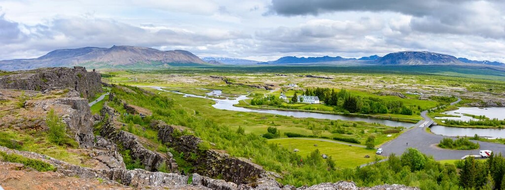
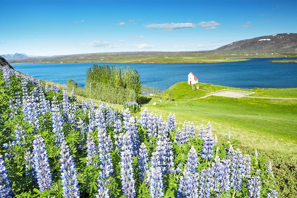
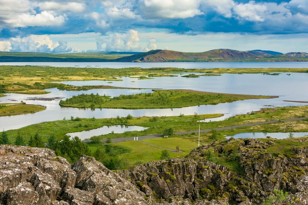
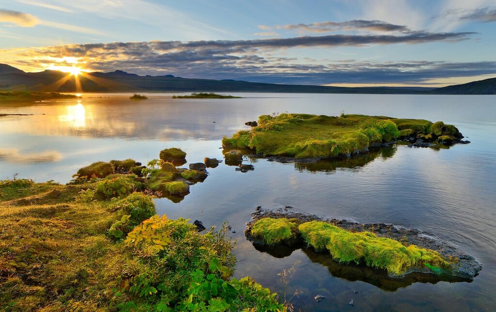
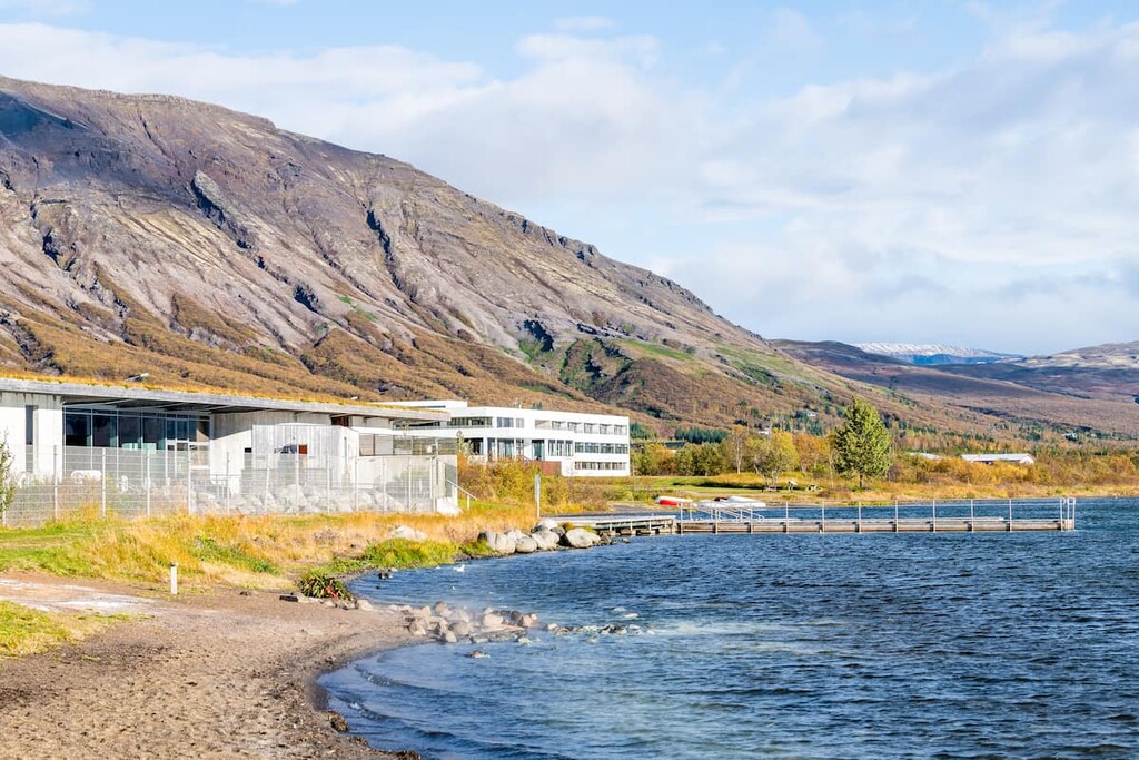
Þingvellir National Park (Þjóðgarðurinn á Þingvöllum; anglicized: Thingvellir National Park) is located in the southwest of Iceland (Ísland). It's perched on the northern shores of Lake Þingvallavatn, the largest natural lake in the country at 84 square km (32 square miles) in area. Þingvellir National Park is in the municipality of Bláskógabyggð.
Þingvellir National Park covers an area of 240 square km (92 square miles). It's a UNESCO World Heritage Site and is managed by the Þingvellir Commission.
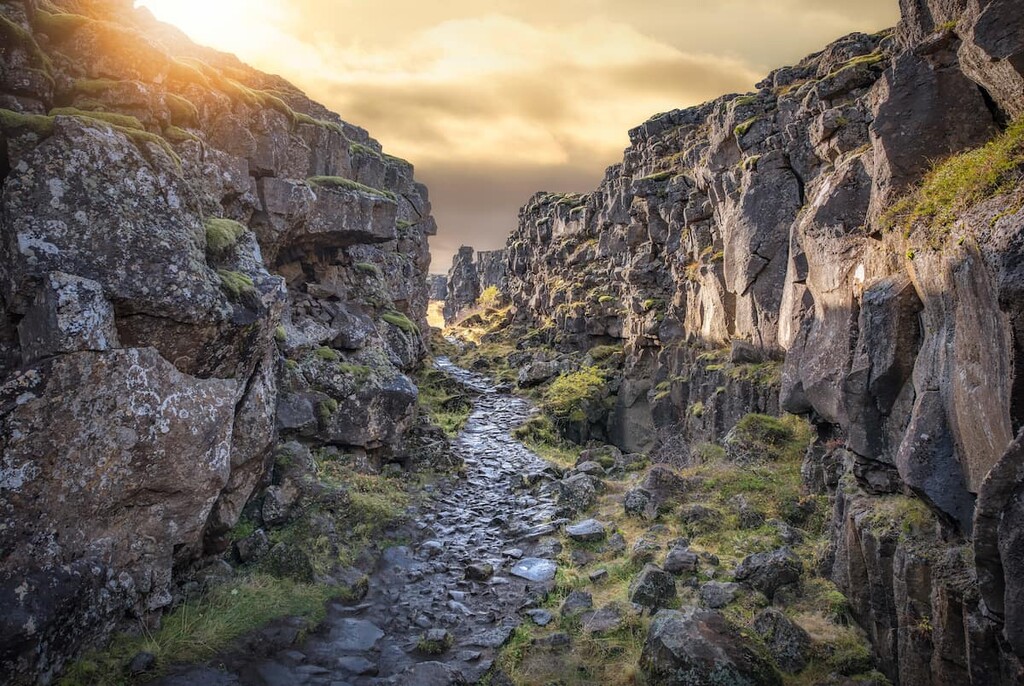
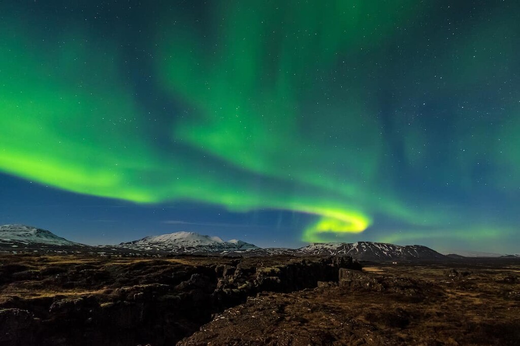
The park is a UNESCO World Heritage Site for several reasons. The park features a rift valley that sits on top of the Mid-Atlantic Ridge. The park is considered one of the only places in the world to see the exposed continental drift between North American and Eurasian Plates.
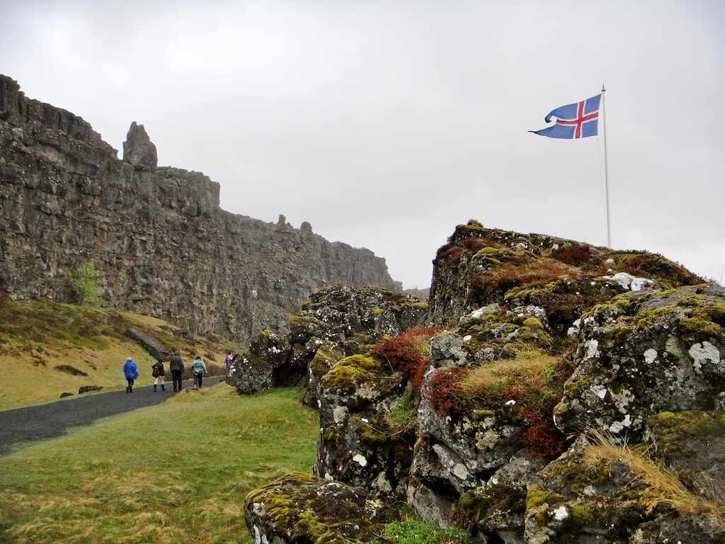
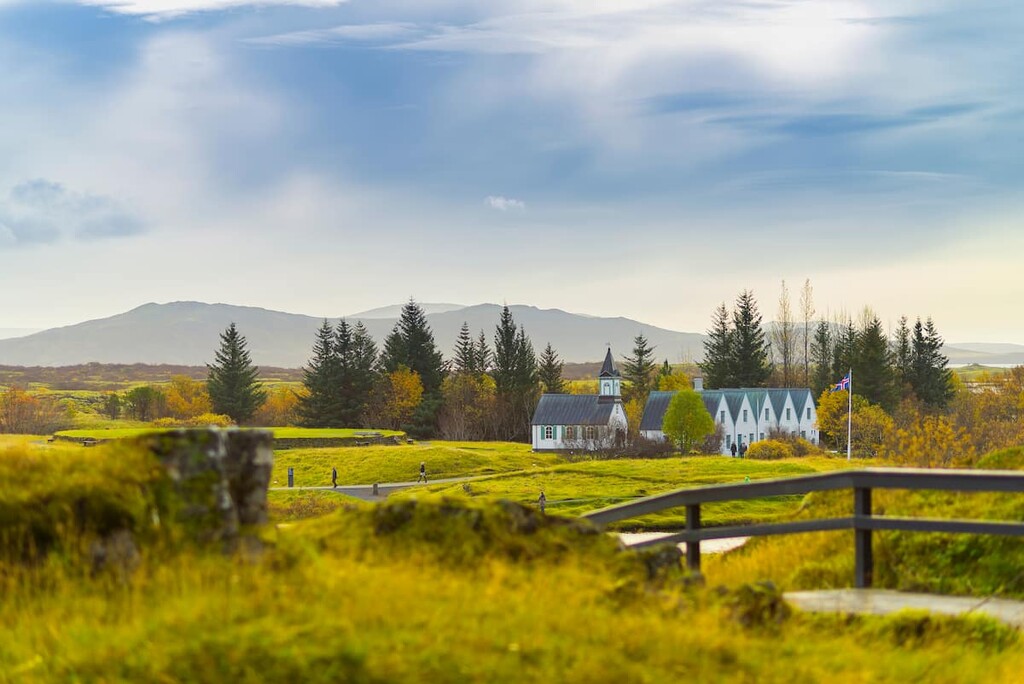
The park is also of great historical significance. It was the site of the original Alþingi (anglicized: Althing), the national parliament of Iceland. Founded in the ninth century, the Alþingi is the world's oldest surviving parliament. Lake Þingvallavatn also has a unique ecosystem, contributing to the Þingvellir's status as a World Heritage Site.
Þingvellir National Park is the oldest of Iceland's three national parks and was founded in 1930 on the thousandth anniversary of Alþingi. It's the second-largest national park in Iceland after Vatnajökull National Park (Vatnajökulsþjóðgarður).
Þingvellir National Park is very popular with visitors and forms part of the Golden Circle tourist route. This 300 km (190 miles) circuit starts in Iceland’s capital city, Reykjavík, and passes the Gullfoss waterfall, the Geysir and Strokkur geysers at Haukadalur, and Þingvellir National Park.
Due to its location in Iceland's heavily-populated southwest corner, Þingvellir National Park is close to many significant settlements and parks.
Reykjanes Nature Reserve (Reykjanesfólkvangur) is located 35 km (21 miles) to the southwest, and Fjallabak Nature Reserve (Friðland að Fjallabaki) is located 90 km (55 miles) to the southeast. Þingvellir National Park is approximately 40 km (25 miles) to the northeast of Iceland's capital city, Reykjavík.
Þingvellir National Park is one of the most geologically fascinating areas on the planet. Iceland itself is one of the geologically newest parts of the Earth, having formed less than 33 million years ago.
The tallest mountain in Þingvellir National Park is Syðstasúla (1,093 m/3,586 ft). Other notable peaks include Miðsúla (1,086 m/3,563 ft), Háasúla (1,023 m/3,356 ft), and Súlnaberg (954 m/3,130 ft).

During the last glacial period, Þingvellir was covered by Langjökull, the second-largest glacier in Iceland after Vatnajökull. The ice covering Þingvellir was 1,000 m (3,280 ft) thick in places, with volcanic activity under the glacier creating tuff and palagonite mountains.
Roughly 20,000 years ago, the glacier began to melt, with the first evidence of Lake Þingvallavatn dating back around 12,000 years. Þingvallavatn formed in the Þingvellir depression as a result of the glacier's retreat to the north. About 10,000 years ago, the glacier had reached its current position.
Around 1,000 years later, a shield volcanic eruption occurred, creating several significant volcanoes and covering the area in lava. One of the most famous volcanoes formed during this eruption was Skjaldbreiður (1,038 m/3,405 ft), which is considered one of the most beautiful volcanoes in Iceland.
Approximately 3,000 years ago, an 8 km (5 mi) long fissure opened up in Þingvellir's rift valley to the northeast of Hrafnabjörg (763 m/2,503 ft). The last eruption from the Þingvellir fissure happened around 2,000 years ago near Hengill (805 m/2,641 ft). Despite being dormant for 2,000 years, scientists expect eruptions from the fissure in the future.
Geologically speaking, Iceland sits on two continents, with the likes of Reyjavík and the Westfjords on the North American tectonic plate and the area of Vatnajökull on the Eurasian plate.
Þingvellir National Park is the only place on the planet where the continental drift between these two plates is exposed above sea level. The rift expands by around 2 cm (0.7 inches) each year, meaning the landscape has changed dramatically over the centuries. The valley would have looked a lot different during the establishment of the Alþingi.
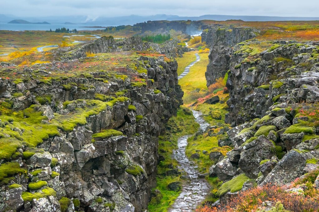
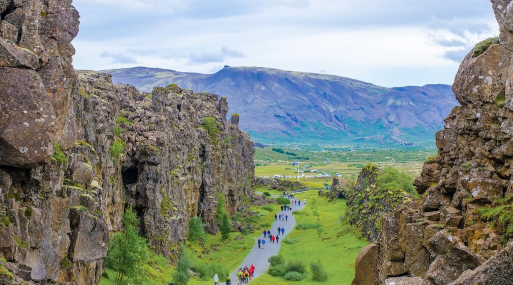
There are several areas in Þingvellir where the continental drift on the Mid-Atlantic Ridge is very evident. The Almannagjá gorge, which marks the edge of the North American plate, is one of the widest examples of continental rifting. Another example is Silfra, a ravine between the plates filled with crystal clear water and popular with snorkelers.
While the tectonic plates drift slowly year by year, the rift zones slowly build up tensional stress, which releases suddenly. The last example of such activity was in 1789. Since the landscape was covered by lava 10,000 years ago, Þingvellir's rift valley has sunk 40 m (131 ft), and the rift between the plates has grown 70 m (229 ft).
In 2000, two earthquakes shook Þingvellir, causing rocks to tumble off the exposed rift walls. While the earthquakes occurred around 45 km from Þingvellir National Park, they were caused by movement in the Eurasian and North-American plate boundaries.
As well as its geological and historical significance, Þingvellir National Park is also ecologically important, with Lake Þingvallavatn and the surrounding countryside supporting some unique ecosystems.
There are roughly 172 vascular plant species in Þingvellir National Park, accounting for roughly 40 percent of all species found in Iceland. There are also thought to be 150 plant species in Lake Þingvallavatn.
Birch is the most common tree species found in the park. At one time, birch woodland was common across the landscape, as suggested by the park's original name, Bláskógar, meaning "Blue Woods."
In the autumn, visitors get to see the landscape transformed by the blooms of dwarf birch, willow, and heath species. Other plant species you may encounter include mountain aven, Arctic thyme, and bog bilberry.
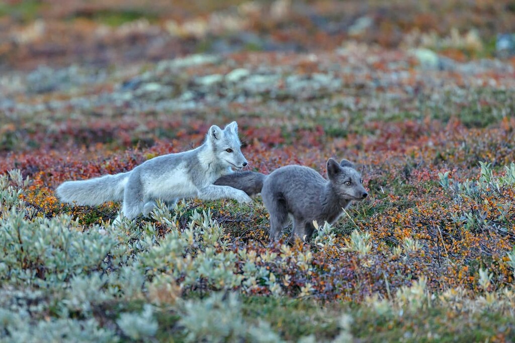
Iceland isn't known for its diverse land fauna, and most wildlife in Þingvellir National Park is found in and around Lake Þingvallavatn.
There are 52 bird species that live around the edge of Lake Þingvallavatn and 30 visiting species. The great northern diver is the most famous bird that nests along Lake Þingvallavatn due to its protective and aggressive nature. Other common species include harlequin duck and barrow's goldeneye.
Mammals are scarce in Þingvellir National Park but visitors may spot Iceland's only native mammal, the Arctic fox, scurrying across the area's hillocks. Mink, which were brought to Iceland for fur in 1931 and subsequently escaped, can sometimes be seen along Lake Þingvallavatn's shoreline.
Lake Þingvallavatn has become a protected site, providing vital insight into resource polymorphism due to its isolation from other ecosystems. Three of Iceland's five freshwater species live in Lake Þingvallavatn: Arctic charr, brown trout, and three-spined stickleback.
Arctic charr is the most common of these species, with four different morphs residing in the same area, something unseen across the rest of the subarctic. These variations are also among the most distinct from one another. As a result, the lake is of great scientific importance, as four unique morphs from the same species living harmoniously is a rare occurrence.
Þingvellir National Park is the most historically significant location in Iceland and is one of the most politically significant places in Europe.
Following the Viking settlement of Iceland in the ninth century, regional assemblies were established across the island. The first two assemblies were located in Þórsnes near Stykkishólmur and in Kjalarnes, with other smaller ones were also set up across the region.
As the population grew, there were increasingly loud calls across Iceland for a national assembly. By 930 CE, local goðar (chieftains) had sent a man named Úlfljótur to Norway to learn more about laws and customs for their new government. Meanwhile, Úlfljótur's foster brother, Grímur geitskór, traveled around Iceland to gain support for the Alþingi.
When deciding on where to host the Alþingi, both Úlfljótur and Grímur agreed the best spot would be Bláskógar, modern-day Þingvellir. Bláskógar was likely chosen due to its central location and the abundance of nearby wood and water.
It's thought that relatives of Ingólfr Arnarson, Iceland's first settler, played a key role in the establishment of the Alþingi in Þingvellir. The first Alþingi assembly was in 930 CE, and its first law was Úlfljót's Law, named after Úlfljótur.
From 930 until 1271, Iceland was a commonwealth independent from Norway. During this time, the Lögberg, or Law Rock, was the focal point of the Alþingi. The Law Rock was presided over by the Law Speaker, who served for three years and would have to memorize all the laws.
During the Alþingi, the Law Speaker was the most powerful person in Iceland. At Lögberg, anyone attending could step up and have their say, and many of these interactions were recorded in the Icelandic sagas.
The exact location of the Lögberg was lost by 1262 when Iceland converted to Christianity and swore allegiance to the King of Norway.
Another important feature of the Alþingi was the Lögrétta. The Lögrétta was a meeting of Iceland's 48 goðar, governed by the Law Speaker. The Lögrétta was the only part of the Alþingi that remained following Norwegian rule.
Norway ruled Iceland as part of the Kalmar Union until the union's dissolution in 1523. Following this, the Lögrétta swore allegiance to Denmark, and the Alþingi lost power and was suspended in 1798.
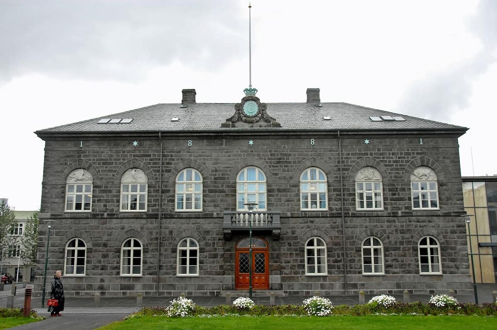
By the nineteenth century, Þingvellir had become a symbol of Icelandic independence. In 1844, the King of Denmark agreed to reinstate the Alþingi in Reykjavík. While the new Alþingi had no administrative power, it paved the way for Iceland's independence.
Following the end of World War I, Icelandic nationalism was at its height. The end of the war in 1918 led to the formation of the Kingdom of Iceland. The current parliament building, the Alþingishús, was built in 1888.
Þingvellir became a national park in 1930, on the thousandth anniversary of the Alþingi. Discussions about the establishment of a national park at Þingvellir originated from an article written in 1913 by teacher Guðmundur Davíðsson.
Today, Þingvellir National Park is one of the most-visited places in Iceland due to its natural beauty, historical significance, and proximity to Reykjavik. Approximately 1.3 million people visited Þingvellir National Park in 2019.
Discover one of the most geologically fascinating places on the planet by visiting Þingvellir National Park’s top hiking areas. When you arrive at Þingvellir, head to the Hakið Visitor Center and pick a brochure, which will show you the park's marked trails.
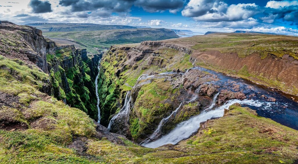
The highlight for many visitors during a trip to Þingvellir National Park is the hike to Öxarárfoss. Öxarárfoss flows off the edge of the Almannagjá gorge, which sits on the eastern edge of the Eurasian and North American plates. The waterfall is around 13 m (44 ft) high and is approximately 6 m (20 ft) wide on average.
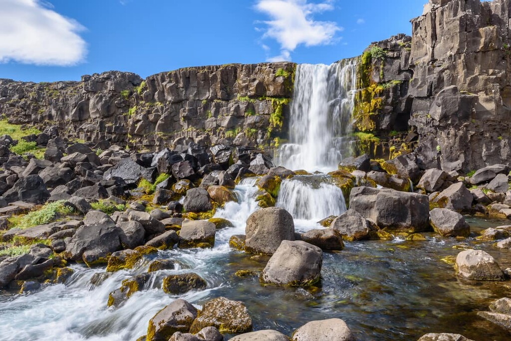
Öxarárfoss forms part of Iceland's Golden Circle, making it very popular with tourists. A scene from Games of Thrones was also filmed at the waterfall, boosting its popularity. An interesting fact about Öxarárfoss is that it's a human-made, rather than natural waterfall.
Located close to the Hakið Visitor Center, several marked trails lead to Öxarárfoss. These trails are easy to follow and suitable for all hikers. The waterfall is around 7 km (4.5 miles) from the visitor's center, and the hike takes about an hour or two.
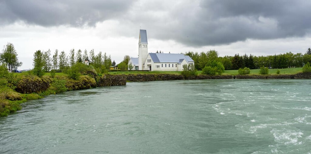
Along the way, you'll have the opportunity to take a detour to some of the area's other landmarks, like the Þingvallakirkja and the Silfra Fissure. Anyone looking for a unique experience should go snorkeling in Silfra's crystal clear waters.
Another must-see landmark near the Hakið Visitor Center is Lögberg. Translated as the Law Rock, this was one of the most important historical sights in Iceland. Lögberg was at the heart of the Alþingi, which is considered the world’s oldest surviving parliament.
While its exact location is lost, Lögberg is thought to be on a rocky outcrop located near the Drekkingarhylur, a deep pool in the river Öxará also known as the Drowning Pool. During the sixteenth and seventeenth centuries, Icelanders charged with "blood shame" (incest) and other similar crimes were drowned in Drekkingarhylur. Evidence suggests around 18 women died under these circumstances.
Hikers can reach Lögberg by following the marked looped trail from the Hakið Visitor Center. The trail is around 1.5 km (1 mile) long and takes less than an hour to complete. Many of the trails near the visitor's center are interwoven, and it's possible to extend your walk to several other landmarks, like the Silfra Fissure and Öxarárfoss.
Hikers looking for stunning views of Lake Þingvallavatn should check out Arnarfell (239 m/784 ft). Also known as Arnarfell við Þingvallavatn, this small peak sits on a peninsula overlooking Lake Þingvallavatn.
Despite its modest height, Arnarfell is an exciting hike due to its beautiful surroundings. There is a marked trail that leads to the summit. You can pick up the trail from the car park to the northeast of the peninsula off the Þingvallavegur road.
This looped walk up Arnarfell is around 5 km (3 miles) long and takes roughly 2 hours to complete. If you're looking for somewhere to stop on the walk, there's a scenic pond called Anbúatjörn just below the summit to the west.
Perched on the eastern boundary of Þingvellir National Park is Hrafnabjörg (763 m/2,503 ft). A volcano located to the northwest of the Alþingi, Hrafnabjörg is a favorite among hikers looking to step off the beaten track.
On its western side, Hrafnabjörg looks unclimbable with its crags. However, Hrafnabjörg is surprisingly easy to scale when approached from the south/southeast. You can start this hike by following the jeep track north from Gjábakkavegur road to the west of Laugarvatn.
Depending on your exact starting point, the hike up Hrafnabjörg is about 6 km (4 miles) long and takes around 3 hours to complete. Due to the isolated nature of this walk, you should bring appropriate hiking equipment, map out your route, and inform park officials of your hike.
The Leggjabrjótur (Leg Breaker) is among the most popular long-distance trails in Þingvellir National Park. Despite its foreboding name, the Leggjabrjótur is an enjoyable walk and is popular with hikers looking to see the Botnssúlur (Bottom Columns), a range of tuff peaks to the north of the Alþingi.
The Botnssúlur boasts the three highest peaks in Þingvellir National Park, including Syðstasúla (1,093 m/3,586 ft), Miðsúla (1,086 m/3,563 ft) and Háasúla (1,023 m/3,356 ft). You'll also get to walk along the river Öxará and see Glymur, the second-highest waterfall in the country at 198 m (649 ft) in height.
The Leggjabrjótur runs from the center of Þingvellir National Park up to the Botnsdalur valley near Hvalfjörður. The walk is around 16 km (10 miles) long, ascends 500 m (1,640 ft), and takes approximately 6 hours to complete.
The Leggjabrjótur is generally easy to follow and has waymarkers. Due to the length of this walk, hikers should bring supplies and appropriate clothing. Ensure you map out your route, check the weather, and inform park staff of your walk.
Ármannsfell (766 m/2,513 ft) is a tabular volcano located in the northeast of Þingvellir National Park. Legends say the volcano was named after Ármann, a half-man, half-troll said to be one of Iceland's first settlers.
You can reach Ármannsfell by heading north from the Hakið Visitor Center and along Uxahryggjavegur road, before turning left onto a snowy track which runs between Ármannsfell and Lágafell (539 m/1,768 ft). You can start your walk by parking at the first bend in the road.
The walk up Ármannsfell is roughly 11.3 km (7 mi) and takes around 4 hours to complete. There are several tracks to lead up the mountain, so map out your route beforehand to avoid confusion.
Atop the volcano's ridge, you'll likely pass over a false peak on the way to the true summit, which is marked with a small cairn. As with any self-guided mountain hike in Iceland, you should plan your route, bring appropriate hiking gear, and inform park staff of your walk.
You won't be short of somewhere to stay near Þingvellir National Park, as some of Iceland's largest settlements are less than an hour away. Read on to find out about some of the best places to stay near Þingvellir National Park.
There's nowhere better to stay during your trip to Þingvellir National Park than Reykjavík. Iceland's capital is thought to be the country's first settlement, founded by Ingólfr Arnarson in the ninth century. Today, it's by far Iceland's largest settlement, with over half the population living in Reykjavík and the surrounding Capital Region.
Reykjavík is conveniently located just 50 km (31 miles) from Þingvellir National Park, making the park easy to reach on a day trip. Reykjavík is also just 30 km from another popular nature area, the 300 square km (115 square miles) Reykjanes Nature Reserve (Reykjanesfólkvangur).
During your stay, ensure you check out some of the capital's architectural wonders, like Hallgrimskirkja and Harpan. Reykjavík is also home to some of Iceland's top hotels, including the Grand Hótel Reykjavík and Hotel Borg.
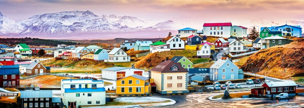
Located approximately 50 km (31 miles) to the south of Þingvellir National Park on the banks of the Ölfusá river is the town of Selfoss. With a population of over 9,000 people, Selfoss is the largest town in South Iceland.
While in Selfoss, consider hiking up nearby Ingólfsfjall (350 m/1,148 ft) and take a tour of the Bobby Fischer Center. The best time to visit Selfoss is in August during Summer in Selfoss (Sumar á Selfossi), a festival when residents decorate their houses in ribbons and there's a fair at the local library. If you're spending the night in Selfoss, book a room at Hotel South Coast.
If you'd prefer to stay between Reykjavík and Þingvellir National Park, check out Mosfellsbær. A town of around 12,000 people, Mosfellsbær is 15 km (9.3 mi) from the capital and 30 km (18.6 mi) from Þingvellir National Park.
The town sits on the Kollafjörður fjord and is close to some superb natural attractions. Go whale and puffin watching at Lundey Island, or swing by the serene Helgufoss waterfall. Popular hotels in and around Mosfellsbær include Hotel Laxnes and Fitjar Guesthouse.
The picturesque hamlet of Laugarvatn is ideal for hikers looking for somewhere to relax near Þingvellir National Park. The settlement is situated just 30 km (18.7 mi) from Þingvellir National Park on the shores of Lake Laugarvatn.
As well as being just a stone's throw from Þingvellir National Park, Laugarvatn is less than 30 minutes from other local attractions like the Gullfoss waterfall and Geysir. Laugarvatn also sits on top of geothermal springs, and visitors will love warming up at Fontana Spa after a long trek. Hotels in Laugarvatn include Héraðsskólinn Historic Guesthouse and the Golden Circle Apartments.


The highest peak in Thingvellir National Park is Syðstasúla, at 1,093 m.
Notable peaks in Thingvellir National Park include Syðstasúla, Miðsúla, Háasúla, Súlnaberg and Búrfell.


