
Scan the QR code and open PeakVisor on your phone
Vatnajökull National Park has 237 named peaks. The highest is Hvannadalshnúkur at 2,110 m. Other notable peaks include Bárðarbunga, Sveinstindur and Snæbreið.
Scale one of Europe's largest ice caps and discover some of Iceland's most dramatic landscapes at Vatnajökull National Park. There are 236 named mountains in Vatnajökull National Park. The highest and the most prominent mountain is Hvannadalshnúkur (2,110 m/6,922 ft).
Vatnajökull National Park (Vatnajökulsþjóðgarður) is located in the southwest of Iceland. The park covers approximately 14,141 sq. km (5,459 sq. mi) of land, which is around 14 percent of Iceland's total landmass.
Vatnajökull National Park sits within three regions of Iceland: the Southern Region (Suðurland), the Eastern Region (Austurland), and the Northeastern Region (Norðurland eystra).
The area which is now Vatnajökull National Park was initially split into three national parks, with Jökulsárgljúfur to the north and Skaftafell to the southwest. Vatnajökull National Park is currently the largest national park in Europe (if one doesn’t count the massive Northeast Greenland National Park in Greenland as part of Europe, despite its historical and cultural connections).
The current Vatnajökull National Park was formed in 2008 and designated a World Heritage Site in 2019. The Environment Agency of Iceland manages the park.
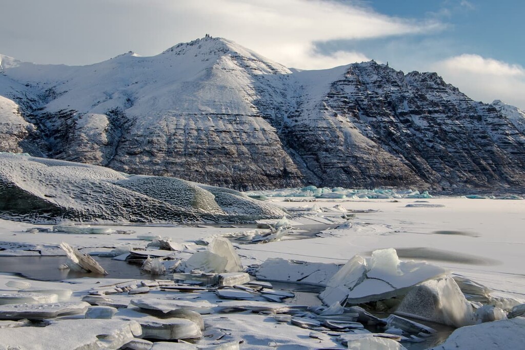
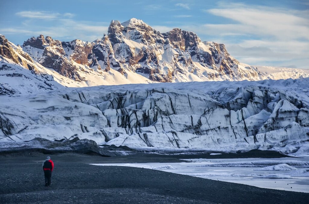
The park’s landscape is dominated by the Vatnajökull ice cap, Europe's second-largest ice cap at roughly 7,900 sq. km (3,100 sq. mi) in area. On the southern side of Vatnajökull is Hvannadalshnúkur, Iceland's highest peak. The summit of Hvannadalshnúkur sits on the northwestern rim of the Öræfajökull (1,923 m/ 6,309 ft) volcano.
Due to the Vatnajökull ice cap, a layer of ice around 500 m (1,640 ft) thick covers many of the park's geographical features, including its valleys and mountains. The glacier also covers several volcanoes, including Grímsvötn (1,725 m/5,659 ft) and Bárðarbunga (2,009 m/6,591 ft).
As Vatnajökull National Park is so large, it's split into four different territories, each independently managed. These regions are:
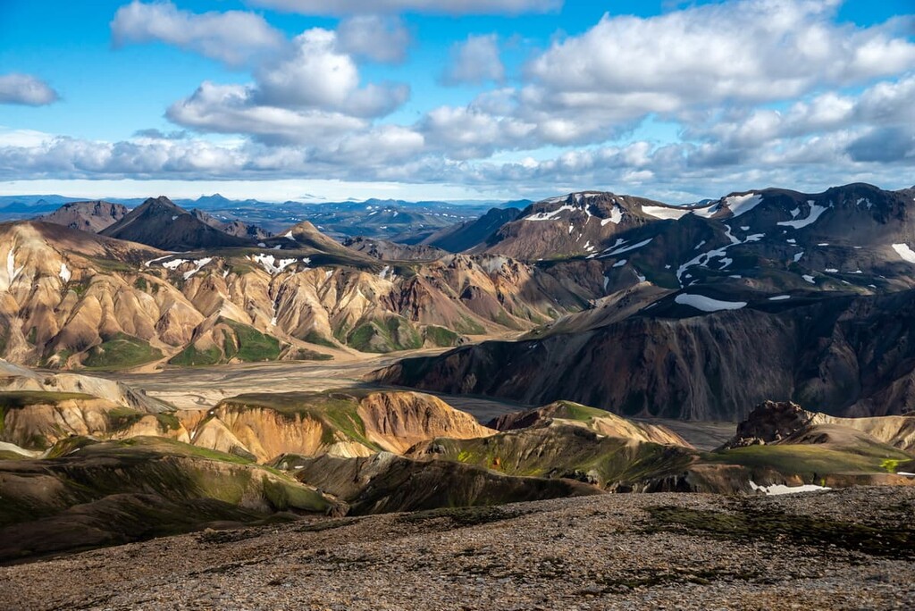
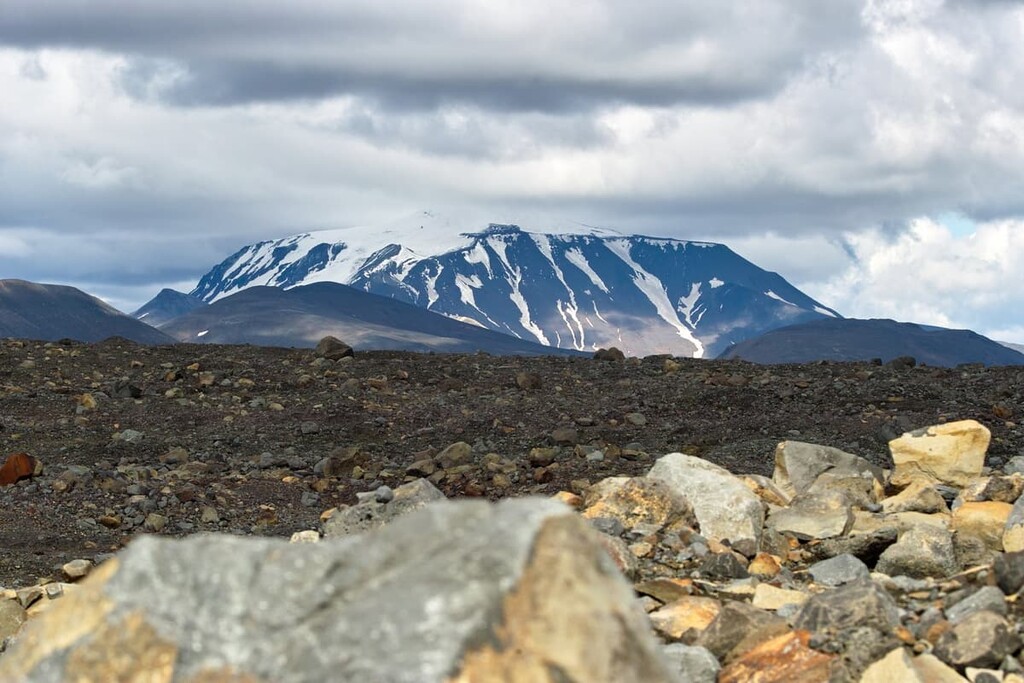
The landscape surrounding Vatnajökull is diverse. The north of the park features a highland plateau with glacial rivers. Several mountains and volcanoes dominate the skyline to the north of Vatnajökull, including Snæfell (1,833 m/6,014 ft), Herðubreið (1,682 m/5,518 ft), and Kverkfjöll (1,810 m/5,938 ft).
Jökulsárgljúfur, a 25 km (15 miles) long glacial canyon, is located to the north of the park. At the far northern end of the canyon is Dettifoss, the most powerful waterfall in Europe after Rhine Falls in Switzerland.
To the south of the ice cap is Skaftafell, an area popular with hikers due to its lush vegetation and mountainous surroundings. One notable characteristic of Skaftafell is the black sand beaches along the river Skeiðará, created by ash falling from Grímsvötn.
Vatnajökull National Park encompasses most of southeastern Iceland, with few major parks nearby. However, there are two nature reserves close to Vatnajökull National Park.
The Fjallabak Nature Reserve (Friðland að Fjallabaki), which features the popular hiking destination of Landmannalaugar, is located approximately 30 km (18 miles) west of Vatnajökull National Park. Another popular hiking area, the Þórsmörk Nature Reserve, is located 60 km southeast of Vatnajökull National Park.
Vatnajökull National Park is situated on the opposite side of the country from the densely populated Capital Region, around 180 km to the east of Iceland's capital, Reykjavík.
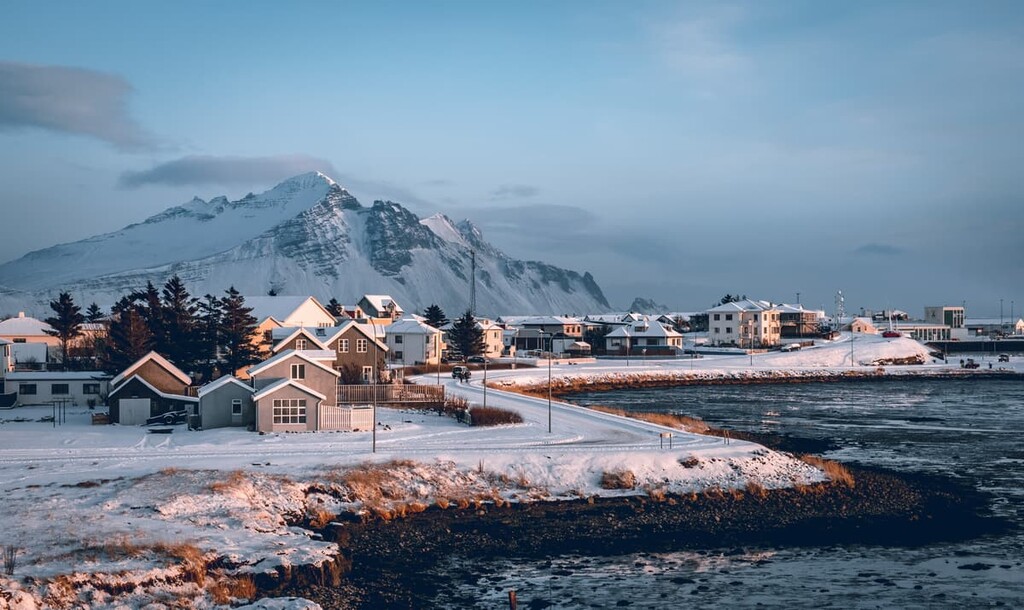
That being said, the Southern Region is Iceland's second most populated, with several significant towns nearby. Important nearby settlements include the village of Vík, which is approximately 140 km (86 miles) to the southeast of the Vatnajökull ice cap, and the town of Höfn, which is roughly 135 km northeast of Skaftafell.
Having only formed 33 million years ago, Iceland is one of the geologically newest and most interesting places on the planet. And with one of Europe's largest ice caps, a diverse landscape, and substantial volcanic activity, Vatnajökull National Park is one of the finest areas of the country.
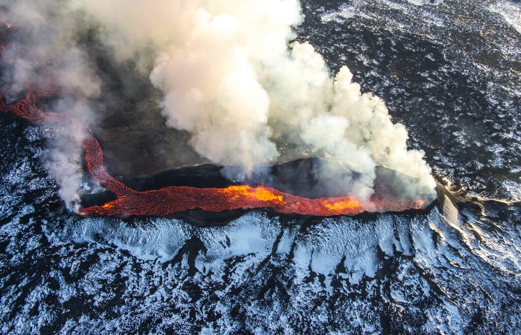
Vatnajökull National Park is home to ten volcanoes, eight of which are subglacial. The tallest volcano in Vatnajökull National Park is Bárðarbunga (2,009 m/6,591 ft). Other notable peaks in Vatnajökull National Park include Hvannadalshnúkur (2,110 m/6,922 ft), Snæbreið (2,027 m/6,650 ft), Snæfell (1,833 m/6,013 ft).
It’s easy to see why Iceland is nicknamed "The Land of Fire and Ice" during a visit to Vatnajökull National Park. Most of the landscape across the park has been formed by the interplay volcanoes and glaciers.
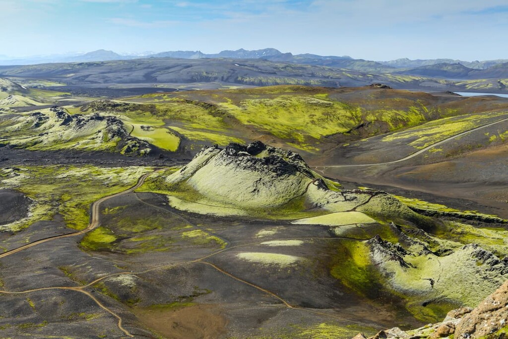
During the area's glaciation, Vatnajökull National Park's table mountains and ridges were formed by subglacial eruptions. Many of the park's ridges are hyaloclastite, a volcaniclastic glass accumulation rarely seen in modern times, formed by volcanic eruptions under water or ice.
Several areas of Vatnajökull National Park were shaped by sudden glacial flooding caused by subglacial eruptions. These floods are known as jökulhlaups. Some of these floods drained below outlet glaciers like Skeiðarárjökull and Tungnaárjökull, creating outwash plains also known as sandurs.
Iceland is home to some of the largest sandurs in the world, including Skeiðarársandur. These floods also moved north, carving canyons along Jökulsá á Fjöllum, Iceland's second-largest river.
Since the start of recorded history, one of the largest lava flows ever occurred within Vatnajökull National Park. From 1783 to 1784, the Lakagígar crater erupted at Laki (812 m/2,664 ft), creating ten fissures between 2-5 km (1.2-3 miles) in length.
The lava streams Brunahraun and Eldhraun flowed to the east and west of Lakagígar, respectively, and now over 0.5 percent of Iceland.
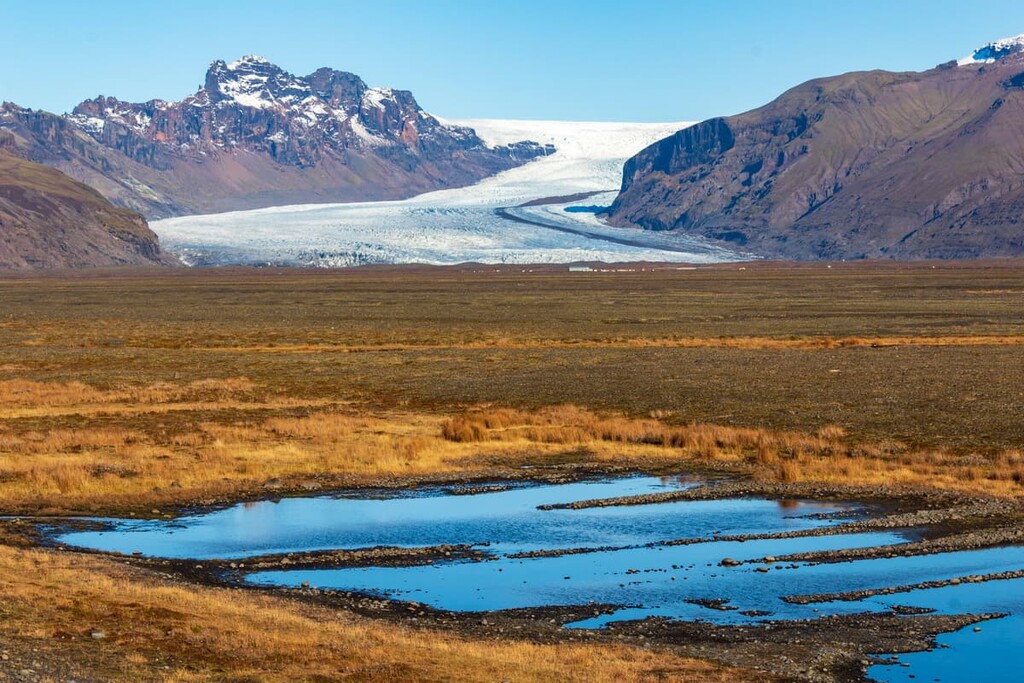
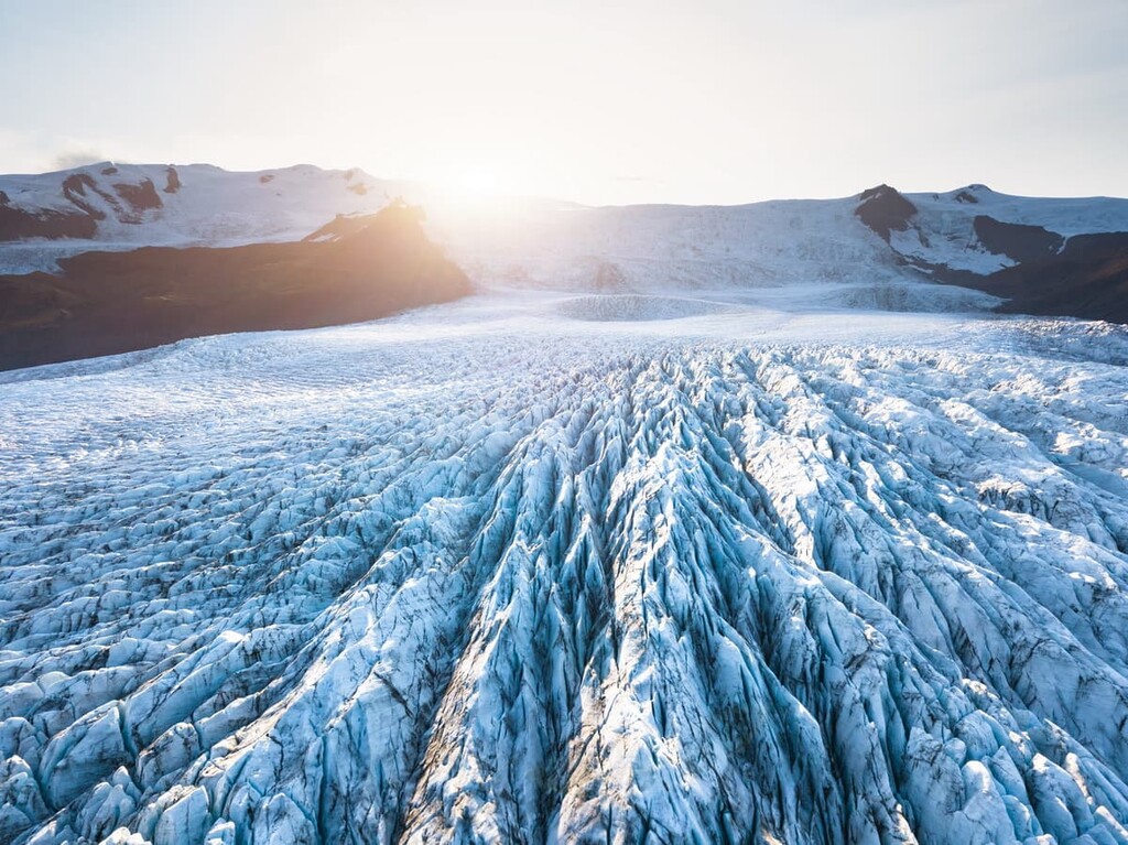
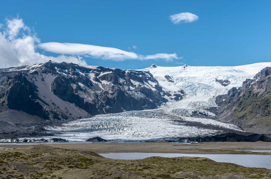
The most geologically important feature in Vatnajökull National Park is the Vatnajökull ice cap. The ice cap covers approximately 7,900 sq. km (3,100 sq. mi) of land and has 30 outlet glaciers that flow from it.
Outlet glaciers can be thought of as rivers of ice that flow down from an ice cap, ice field, or ice sheet through valleys between mountains. Notable examples of outlet glaciers in Vatnajökull National Park include Skeiðarárjökull, Dyngjujökull, and Skaftárjökull.

Vatnajökull as we know it today formed relatively recently around 2,000 to 2,500 years ago. Scientists initially thought that Vatnajökull was a remnant of the Weichselian glaciation, which covered the whole of Iceland over 18,000 years ago. However, evidence collected from Lake Lagarfljót suggests the Weichselian ice sheet had disappeared entirely from Iceland by around 3,000 BCE.
It's widely believed the Vatnajökull ice cap was formed when glaciers from surrounding mountains over 1,200 m (3,937 ft) in elevation merged. By the time settlers arrived in the ninth century, the ice cap had already formed.
By the end of the nineteenth century, Vatnajökull had reached its maximum size, and the surrounding outlet glaciers began to recede. Currently, due to climate warming, the ice cap is thinning by approximately 1 m (3 ft) each year. Scientists predict the ice cap could effectively disappear by the end of the century.
With the vast majority of the park covered in over 91 m (300 ft) deep ice, Vatnajökull National Park isn't known for its diverse wildlife. However, there are a number of plant and animal species that thrive in the areas surrounding the ice cap.
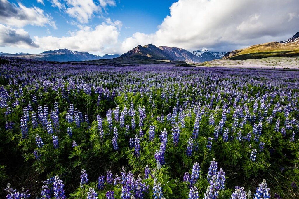
Due to high moisture levels, there is a reasonable amount of vegetation in Vatnajökull National Park. However, the park lacks tall trees and bushes due to the volcanic environment and harsh weather. There is also very little sunlight year-round to support trees. Scientists believe that trees last covered the region over 5 million years ago.
As with many lava fields across Iceland, Vatnajökull National Park's landscape is coated in lichen and moss. There have been around 314 moss species and 287 lichen species recorded in the park. Most of the flora in Vatnajökull National Park is to the south of the Vatnajökull ice cap, as well as in areas such as Jökulsárgljúfur to the north.

In Skaftafell, one of the greenest parts of the park, there are approximately 250 vascular plant species, with birch and rowan trees growing on the mountain slopes. There are about 344 vascular plant species across the park, representing 70 percent of Iceland's vascular plants.
Common vascular plant species you may spot during your adventure in Vatnajökull National Park include glacier buttercup, mountain aven, angelica, and Arctic thyme.
Similarly, Vatnajökull National Park doesn't have many animals due to harsh conditions and a lack of a major food source. Birds are the most common animals, with around 75 species known to have bred in the park's southern regions.
Outwash plains such as Skeiðarársandur and Breiðamerkursandur are important nesting areas for barnacle goose, great skua, and grey phalarope. Eyjabakkar, one of the largest wetlands in Iceland, is a significant nesting area for pink-footed geese, with approximately 7,000 breeding pairs.

Insects are uncommon in Vatnajökull National Park; however, Carabus problematicus, the largest beetle species in Iceland, lives in the mountains in the south of the park. Forty-four moth species have also been seen in the park.
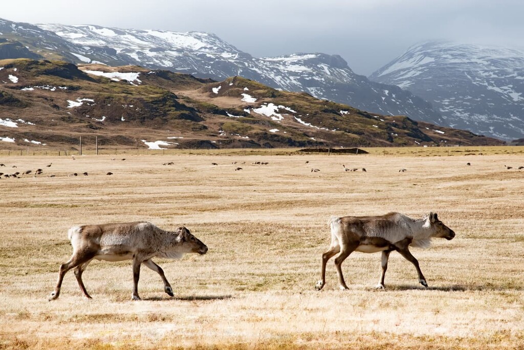
The largest mammal you're likely to see in Vatnajökull National Park is reindeer, which were introduced to Iceland in the eighteenth century. Reindeer herds are commonly spotted on the slopes of Snæfell. You may also get lucky and spot Iceland's only remaining native mammal, the Arctic fox, as well as elusive non-native species like American mink.
In the rivers, streams, and lakes of Vatnajökull National Park, you'll find Arctic char and brown trout, with some of these populations having been isolated from other regional populations since the last glacial period.
Due to a lack of wildlife, trees, and extremely harsh environments, the human history of Vatnajökull National Park isn't as well documented as in other parts of Iceland.
There is no evidence of human settlers living in the Highland areas of Vatnajökull National Park; however, there is evidence of human activity to the north and south of the ice cap. Interestingly, outlaws and criminals used to hide out to the north of the Vatnajökull ice cap, with many of the area's archeological features related to transport and herding.
In the lowlands near Jökulsárgljúfur and north of Skaftafell, archeologists have uncovered several ancient farmsteads. Many of these structures can be traced back to when Iceland was settled in the ninth century. Just under the turf near Skaftafell, the remains of an old church and several Christian graves were also uncovered, suggesting long-term settlement in the area.
Settlers faced many environmental challenges, which likely caused the abandonment of their homes and farms. Until the twentieth century, when the region's glacial rivers bridged, Vatnajökull was one of the most isolated areas of Iceland.
Many of the area's settlers likely had farms and homes destroyed by jökulhlaups (glacial flooding), glacier rivers, and volcanic activity. Currently, there are no working farms within Vatnajökull National Park.
The national park was founded in 2008 with an area of approximately 12,000 sq. km (4,633 sq. mi) of land. The park merged with two other adjacent parks, Jökulsárgljúfur National Park and Skaftafell National Park.
Vatnajökull National Park was then expanded several years later to include other nearby lakes and areas such as Lakagígar, Jökulsárlón, and Langisjór. The park is currently approximately 14,141 square km (5,459 square miles) and was designated a World Heritage Site in 2019.
Stretching nearly from coast to coast and covering around 14 percent of Iceland, Vatnajökull National Park is home to some of Iceland's best treks. Read on to find out about the Vatnajökull National Park's main hiking areas.
It’s worth noting that the Highlands of Iceland are only accessible during summer, and roads are closed during the rest of the year.
While the Vatnajökull ice cap is the centerpiece of Vatnajökull National Park, it isn't considered one of its main hiking areas. That being said, many hikers want to scale Hvannadalshnúkur (2,110 m/6,922 ft), the highest peak in Iceland; however, doing so isn't easy.
Due to unpredictable weather and numerous hidden crevasses near the summit of Hvannadalshnúkur, it's recommended you only attempt to hike on the Vatnajökull ice cap with a local guide. The walk is only possible during summer due to poor weather and visibility during the winter months.
Most tour groups start the ascent of Hvannadalshnúkur from the Skaftafell Base next to the visitor center. Hikers should come well-prepared with appropriate clothing and should bring along lunch. Most tour groups provide glacial climbing equipment. The length of the walk differs depending on conditions but generally takes around 16 hours to complete.
Skaftafell is arguably Vatnajökull National Park's most popular area, thanks to its stunning landscape, ranging from black sand beaches to snow-covered peaks. Hikers will want to start by visiting the Skaftafell Visitor Center and following the trails to Skaftafellsjökull and Svartifoss.

The trail to Skaftafellsjökull, a glacial tongue that extends from the Vatnajökull ice cap, is easy to follow with paved and gravel pathways. The walk is about 3.7 km (2.2 mi) long and takes 1–2 hours. At the end of the path, there's an observation point that provides sweeping views of the glacier.
Another popular trail from the Skaftafell Visitor Center leads to Svartifoss. This stunning waterfall is surrounded by dark basalt columns and is one of the park's top sights. Again the path is well-defined and leads gently uphill for 140 m (459 ft). The path loops by the Sjónarnípa viewpoint to return to the visitor's center.
There are several other trails from the Skaftafell Visitor Center which are well worth considering. These trails lead to the Skaftafellsheiði plateau, the Bæjarstaðarskógur woodlands, and Morsárjökull.
If you're looking for a challenging mountain trek in Skaftafell, turn your attention to the Kristínartindar mountain range. Visitors can take an 18 km (11 mi) hike into the mountains, which takes approximately 7 hours to complete.
From the visitor's center, you'll first walk up Sjónarsker (341 m/1,118 ft) before scaling the summit of Kristínartindar (1,126 m/3,694 ft). You'll return the way you came until you reach Kristínartindar’s ridge. Here, you'll head for Gláma (880 m/2,887 ft) and then back to the visitor's center via Sjónarnípa. Please note these trails are closed from early spring until June.
At the opposite end of Vatnajökull National Park to Skaftafell is Jökulsárgljúfur. The park's most northerly area, Jökulsárgljúfur is a 25 km (15 miles) long canyon with Jökulsá á Fjöllum, Iceland's second-longest river, running through it. The main visitor center is in Ásbyrgi.
Dettifoss, Europe's second most powerful waterfall, is the highlight of the canyon. You can approach Dettifoss from the east or west, although the west side has better hiking trails.

One of the best trails to Dettifoss gives hikers the chance to see another waterfall, Selfoss. This looped walk starts from the Dettifoss car park. The walk is 2.5 km (1.5 mi) long and takes an hour to complete.
Hikers looking to stay close to the Northern Territory's main visitor center should explore the Ásbyrgi horseshoe canyon. There are many unique walks in the area, which lead through rare birch woodlands and past lakes abundant with birdlife.
One of the best hikes in Ásbyrgi is up Áshöfði (99 m/324 ft). Despite being a modest hill, Áshöfði affords some of the best views of the Jökuslá river and Ásbyrgi. The loop path up Áshöfði is 7 km (4 miles) and takes 2-3 hours.
Other notable hiking areas in and around Jökulsárgljúfur include the unique rock formations at Vesturdalur and the lush landscape of Hólmatungur.
Snæfell (1,833 m/6.013 ft) is the highest mountain in Iceland without a glacier, and it is the focal point of the Snæfell Wilderness Area. Snæfell actually features a dormant central volcano that hasn't erupted for roughly 400,000 years. There are several superb mountain hikes here, including a trek to the summit of Snæfell.
You can start the walk up Snæfell from the Snæfell hut (798 m/2,618 ft) on the mountain's western side. This walk is around 13 km (8 miles) and is usually completed in 8 hours. Snæfell is a challenging walk, so you should come well prepared and map your route. Crampons are also recommended.
It's also possible to complete a loop of Snæfell. Upon reaching the Snæfell hut and passing through Þjófadalir, you'll walk on the high ground above the Þjófagilsá river, before following the Hafursá river through Vatnsdalur valley and back to the hut.
The walk is around 18 km (11.2 mi) long and will take all day, so ensure you plan your route carefully to finish before nightfall.
The Highlands north of the Vatnajökull ice cap are shrouded in legends of outlaws and supernatural occurrences. With haunting natural features like the Ódáðahraun desert and the Kverkfjöll mountain range, it's easy to see why this region stirred many imaginations over the centuries.
The area is relatively isolated, with 4WD needed to access some of the highland roads. Regardless, the Icelandic Highlands are a must for avid mountain climbers, with iconic mountains like Herðubreið (1,682 m/5,518 ft) and Askja (1,516 m/4,973 ft) dominating the landscape.
Among the most popular hikes in the Ódáðahraun/Krepputunga area is to Askja, the crowning jewel of the Dyngjufjöll mountains. Askja is one of the park's most popular volcanoes, with stunning natural attractions like the calderas dotted across the Dyngjufjöll mountains and Lake Askja (Öskjuvatn). The walk is also short and relatively straightforward.

You can pick up the trail to Askja from Vikraborgir car park. The path is well-marked and leads you to Víti, a geothermal pool adjacent to the Askja caldera.
While the pool isn't quite as warm as the Blue Lagoon, it's pleasant to bathe in at 22 degrees Celsius (71 degrees Fahrenheit). The walk is about 2.5 km (1.5 mi) long and takes an hour to complete. The trail is only accessible from June to October.
Other popular hikes near Askja include an 8-hour walk up Bræðrafell (897 m/2,942 ft) and a 10-hour trek to the Dyngjufjalladalur valley. Hikers looking for a real challenge could plan a hike on the Kverkfjöll glacier or through the beautiful yet remote oasis of Hvannalindir.
Hiking in the Kverkfjöll mountain range is especially tricky due to unpredictable weather, glacial crevasses, and falling ice. Hikers should bring all necessary equipment, including ropes, crampons, and a GPS unit.
While a difficult hiking area, there are some sublime mountains to climb in the Kverkfjöll range, including Skarphéðinstindur (1,944 m/6,377 ft), Virkisfell (1,000 m/3,280 ft), and Biskupsfell (1,204 m/3,950 ft).
Featuring deep canyons, hyaloclastite hills, and two glacial rivers, the southwestern region of Vatnajökull National Park is among the most impressive. The area is also home to some of the park's most popular mountains, including the geologically significant Laki (812 m/2,664 ft).
Laki is famous for the eighteenth-century eruption from Lakagígar, which covered 0.5 percent of Iceland in lava and created ten fissures over 2 km (1.2 mi) long. Despite its violent volcanic history, Laki is a straightforward, yet steep, climb.
From the car park, there's a marked looped trail that leads up the mountain. The walk is 4 km (2.5 mi) long and takes 1 or 2 hours to complete. The moss surrounding the paths is protected and will die if stepped on, so please stay on the trails.
Another worthwhile walk is through the Eldgjá valley to Ófærufoss, a waterfall once covered by a natural bridge before it collapsed in the 1990s. From the Eldgjá car park, follow the trail down the gorge to the waterfall. The walk is 5 km (3 miles) both ways and takes 2 or 3 hours.
If you happen to be near Lake Langisjór, take a hike to the top of Sveinstindur (1,089 m/3,572 ft). Towering above all surrounding hills and mountains, Sveinstindur affords panoramas of the Icelandic Highlands and boasts some of the best views in the country.
The simplest way to scale Sveinstindur is from the car park west of the mountain. From the car park, there is a short yet steep walk to the summit. The hike is approximately 4 km (2.5 mi) long and takes 2 or 3 hours to complete.
While Vatnajökull National Park may be located in Iceland's remote southeast, you won't be short of accommodation options nearby. Here are some of the main nearby settlements, ranging from quaint hamlets and to traditional fishing villages.
Höfn, or Höfn í Hornafirði, is the largest settlement in southeast Iceland and one of the most popular places to stay when visiting Vatnajökull National Park. Sat at the far end of a narrow peninsula, this picturesque village offers superb views of the Vatnajökull ice cap and the Hornafjörður fjord.
Höfn has some interesting nearby natural attractions like Bergarfoss, and it is less than two hours from Skaftafell. Höfn is also home to several highly-recommended hotels, like Hótel Höfn and Hotel Jökull.
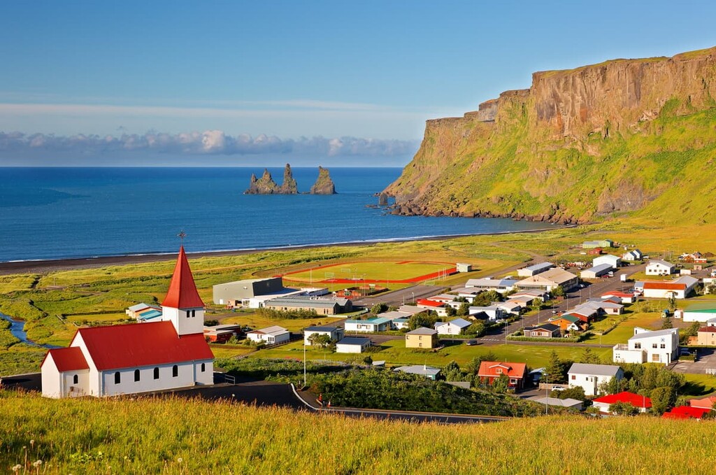
Situated around 100 km (62 mi) southwest of Skaftafell is the charming fishing village of Vík. Despite only having a population of approximately 750, Vík is the largest settlement for over 70 km (43 mi).
Vík is popular with tourists due to its beautiful black basalt beaches and its proximity to the Katla volcano. There's plenty to do near Vík, with one of Iceland's most popular hiking areas, Þórsmörk to the north, and great local attractions like Dyrhólaey and Reynisfjall (350 m/ 1,148 ft). If you plan to stay in Vík, book a room at Hótel Vík or Hótel Kría.
The small village Kirkjubæjarklaustur is one of the most convenient places to stay near Vatnajökull National Park. Located less than an hour from Vatnajökull National Park, Kirkjubæjarklaustur is the only village between Vík and Höfn that has essential amenities like a supermarket and a gas station.
Kirkjubæjarklaustur is a popular tourist destination due to the number of natural attractions nearby. There are three waterfalls in Kirkjubæjarklaustur as well as the Kirkjugólf basalt rock formation. Accommodation in and around Kirkjubæjarklaustur includes Hotel Laki, Hótel Klaustur, and Hotel Magma.

A collection of small hamlets and farmsteads just southeast of the Vatnajökull ice cap, Reynivellir and Kalfatellsstadhur are perfect for escaping civilization altogether.
While there aren’t many amenities or attractions in these areas, there are several hotels worth considering. The Ekra Glacier Lagoon in Reynivellir is an idyllic place to spend the night, while the Kálfafellsstaður Guesthouse also offers spectacular views of the Vatnajökull ice cap.


The highest peak in Vatnajökull National Park is Hvannadalshnúkur, at 2,110 m.
Notable peaks in Vatnajökull National Park include Hvannadalshnúkur, Bárðarbunga, Sveinstindur, Snæbreið and Skarphéðinstindur.


