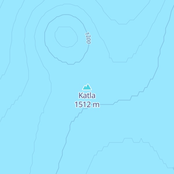
Katla (Icelandic pronunciation: [ˈkʰahtla] ) is an active volcano in southern Iceland. This volcano has been very active historically with at least twenty documented major eruptions since 2920 BC. In its recent history though, Katla has been less active as the last major eruption occurred in 1918. These eruptions have had a Volcanic Explosivity Index (VEI) of between 4 and 5 on a scale of 0 to 8. In comparison, the Eyjafjallajökull 2010 eruption had a VEI of 4. Larger VEI-5 eruptions are comparable to Mount St. Helens 1980 eruption. These eruptions have produced very large glacial outburst floods. Several smaller (minor) events measuring VEI-1 and below have occurred since.
Katla is one of the largest volcanic sources of carbon dioxide (CO2) on Earth, accounting for up to 4% of total global volcanic carbon dioxide emissions.
We use GPS information embedded into the photo when it is available.
3D mountains overlay
Adjust mountain panorama to perfectly match your photos because recorded by camera photo position might be imprecise.
Move tool
Rotate tool
Zoom
More customization
Choose which peak labels should make into the final photo and what photo title should be.
Next
Photo Location
Satellitte
Flat map
Relief map
Latitude
Longitude
Altitude
OR
Latitude
°'''
Longitude
°'''
Apply
Register Peak
Peak Name
Latitude
Longitude
Altitude
Register
Teleport
PeakVisor
This 3D model of Sagarmatha National Park in Nepal was made using the PeakVisor app topographic data. The mobile app features higher precision models worldwide, more topographic details, and works offline. Download PeakVisor maps today.
Download OBJ model
PeakVisor
The download should start shortly. If you find it useful please consider supporting the PeakVisor app.
PeakVisor for iOS and Android
Be a superhero of outdoor navigation with state-of-the-art 3D maps and mountain identification in the palm of your hand!