
Scan the QR code and open PeakVisor on your phone
Øvre Pasvik National Park is one of the 47 national parks in Norway. It is located in the northern part of the country near its border with Finland and Russia. The main feature of the park is the Pasvikelva River, which has picturesque and rocky banks. There are 21 named mountains in Øvre Pasvik National Park. The highest and the most prominent mountain in the park is Áibmevárri (219 m / 719 ft).
The name of Øvre Pasvik National Park can be broken up into two parts: øvre, which means ‘upper’ in Norwegian, and Pasvik, which is a shortened version of Pasvikelva, the name of the main river that runs through the area. It is also known as Paatsjoki in Finnish and Paz (Паз) in Russian.
The full name of the park in Norwegian is Øvre Pasvik nasjonalpark. In Finnish, it is Ylä-Paatsjoen kansallispuisto, and in Russian, it is nazionalniy park "Pasvik" (национальный парк "Пасвик").
Øvre Pasvik National Park is located at the northeasternmost tip of Norway in the Sør-Varanger Municipality of Troms og Finnmark. It is situated on the country’s border with the Lapland region in Finland and the Murmansk Oblast in Russia.
The park is also located where the borders of the three countries meet to form a tripoint. It has its own name, Treriksrøysa.
Pasvik is one of the two most remote national parks in mainland Norway, alongside Varanger National Park (Varangerhalvøya nasjonalpark), which is located to the north. The area of the park is 119 sq. km (46 sq. mi). It borders Vätsäri Wilderness Area to the west in Finland and Pasvik Nature Reserve to the north in Russia.
Together, these three areas form part of an even larger and more important nature conservation territory called Pasvik-Inari Trilateral Park, which is a part of EUROPARC, the largest network of European Protected Areas. It also includes the Øvre Pasvik Landscape Protection Area and Pasvik Nature Reserve in Norway, as well as the Korablekk Nature Park in Russia.
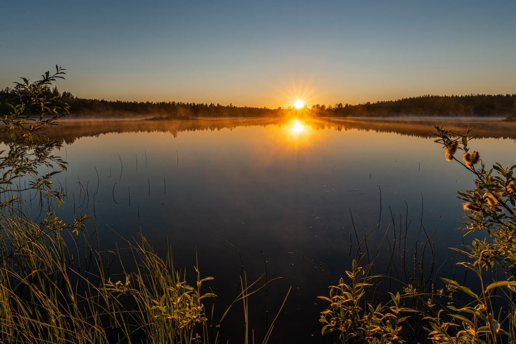
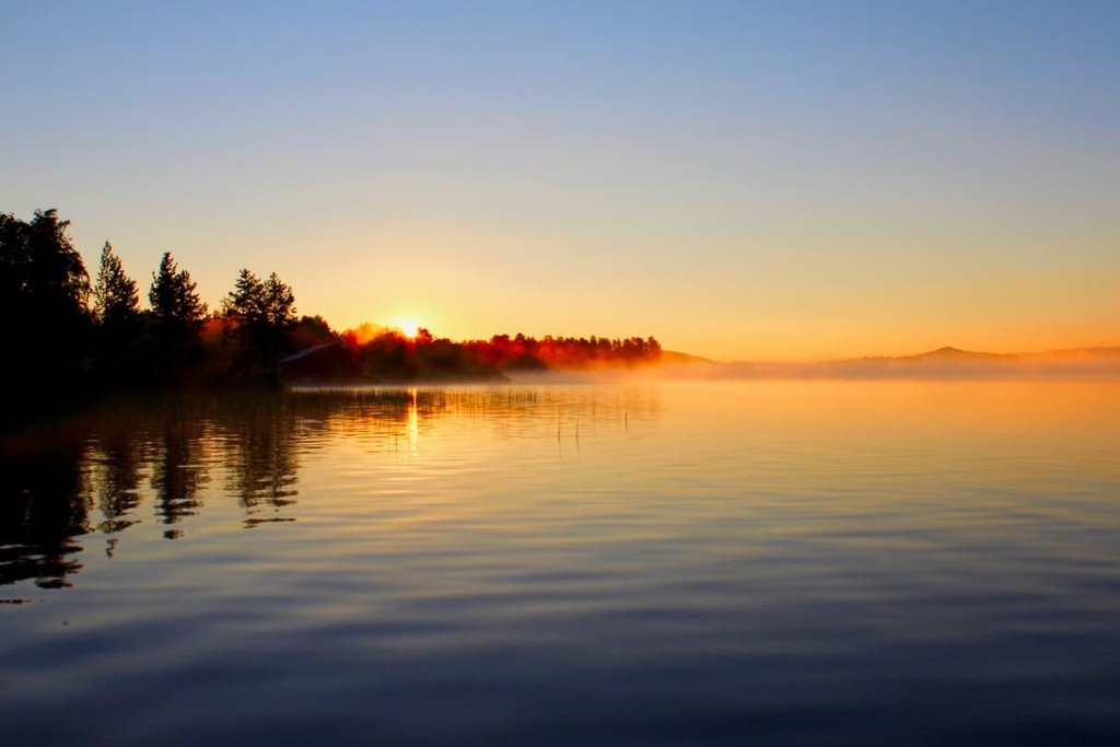
The main feature of the park’s landscape, the Pasvik River, which is 145 km (90 mi) long, and which forms its eponymous valley, Pasvikdalen, flows through the whole Pasvik-Inari Trilateral Park's territory from southwest to northeast. It also forms the natural border between Norway and Russia. The river originates in the largest Lapland lake, Inari, and flows into the Barents Sea of the Arctic Ocean through two Norwegian fjords (narrow sea bays with high rocky shores)—Bøkfjorden and Varangerfjorde.
The park is accessible by car from the Norwegian side of the border. The Norwegian National Road 885 leads to three different parts of the park, including near Svartbrysttjern, Ødevatnskoia, and Grensefoss.
The closest large town to Øvre Pasvik National Park is Kirkenes, which has an airport with connections to Oslo.
About half of the Øvre Pasvik National Park is covered by taiga forest, which consists mostly of old-growth Scots pine that’s between 300–400 years old as well as Norway spruce, birch, aspen, and other trees typical of these northern territories.
The other half of the park is occupied by vast swamps with low-lying vegetation like lingonberry, common bilberry, and bog bilberry. In these areas, you can also find large lakes, like Ellenvatnet and Ødevatnet. Within the park, you can even find many cliffs that are home to plants like Alpine chickweed, white bluegrass, and brittle bladder-fern.
The park’s main animal, which is featured on its logo, is the great gray owl. But, according to the park’s official website, it also has the densest population of brown bears in Norway. There are also many red foxes, stoats, weasels, American minks, European pine martens, and other animals that live in the park.
As is the case elsewhere in Lapland, there are huge populations of moose and reindeer in the park. In the case of moose, they tend not to be very shy around humans in this part of the world. However, moose can be dangerous, so never approach them in the wild.
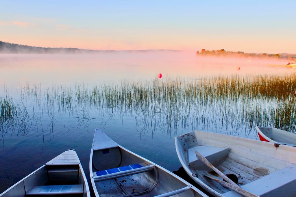
The Pasvik River and the many lakes in the park are full of fish, including species like Northern pike and European perch. You can also find species like grayling, common minnow, burbot, and brown trout in the park’s waterways.
The mountains in the Øvre Pasvik National Park belong to the Kola Domain (Lapland Granulite Belt and Inari Complex), which is one of the five major large geological layers in Finland, Scandinavia, and the Kola Peninsula and Murmansk Oblast in Russia.
The rocks themselves are mostly granites and gneisses, but there is some schist in the northern part of the park. The bedrock in the park can be seen relatively easily in its cliffs and low-lying hills.
The most famous hill in the park is Muotkavaara (161 m / 528 ft). However, this is the Finnish name of the mountain. In Norwegian, it is called Krokfjell. It is famous because it is home to Treriksrøysa, the tripoint cairn at the intersection of the border between Finland, Norway, and Russia. It is the second northernmost international tripoint in the world after the tripoint of Finland, Norway, and Sweden in the Malla Strict Nature Reserve.
Revsaksskaret cliff is maybe the second-most famous mountain in the park. It is an extension of a large crustal fault that also led to the formation of the sunning Ødevannet Lake.
The highest peak of the park, Áibmevárri, is not much higher than these two most famous mountains, as it has an elevation of only 219 m (781 ft). It is located in a less accessible area on its eastern borders east of the large Ellenvatnet Lake.
If you look at the 3D Map in PeakVisor, you will also note that almost all of the 21 mountains in the park are also located along or close to its borders. It is likely that the mountains served as natural landmarks during the creation of the park.
There are two main hiking trails in the park:
There are also several nature trails in Øvre Pasvik that you can enjoy. They are all located near the park’s visitor center.
Although there are no marked skiing trails in the park and all motorized vehicles are prohibited, you can ski freely on its territory, just as you can in neighboring Finland.
The closest ski resort to the park is Sandnes Alpine Center, which is located in the village of the same name about 10 km (6.2 mi) away from Kirkenes. It is considered the largest resort in the entire Finnmark Country for both cross-country and Alpine skiing.
The World Mountain Lifts section of PeakVisor will also help you find larger ski resorts in Norway that you can enjoy during your travels. Most of them are concentrated in the southern part of the country closer to Oslo and Norway’s other major cities.
If you’re headed to Øvre Pasvik National Park, don’t miss a chance to stop by the park’s visitor center, which is located at the Svanhovd Research Station of the Norwegian Institute of Bioeconomy Research (NIBIO) or NIBIO Svanhovd. It is located in the village of Svanvik, about 64.7 km (40.2 mi) to the north of the park itself on the upper Pasvik River.
The Norwegian Institute of Bioeconomy Research (NIBIO)
Svanhovd, 23, 9925, Svanvik, Norway
Monday to Friday: 9 am to 8 pm
Weekends: 10 am to 6 pm
+4746413600
Pasvik.no (Norwegian only)
If you’re looking for accommodation in Øvre Pasvik National Park, you can find lodging at the park’s visitor center, which offers single and double rooms for visitors to enjoy.
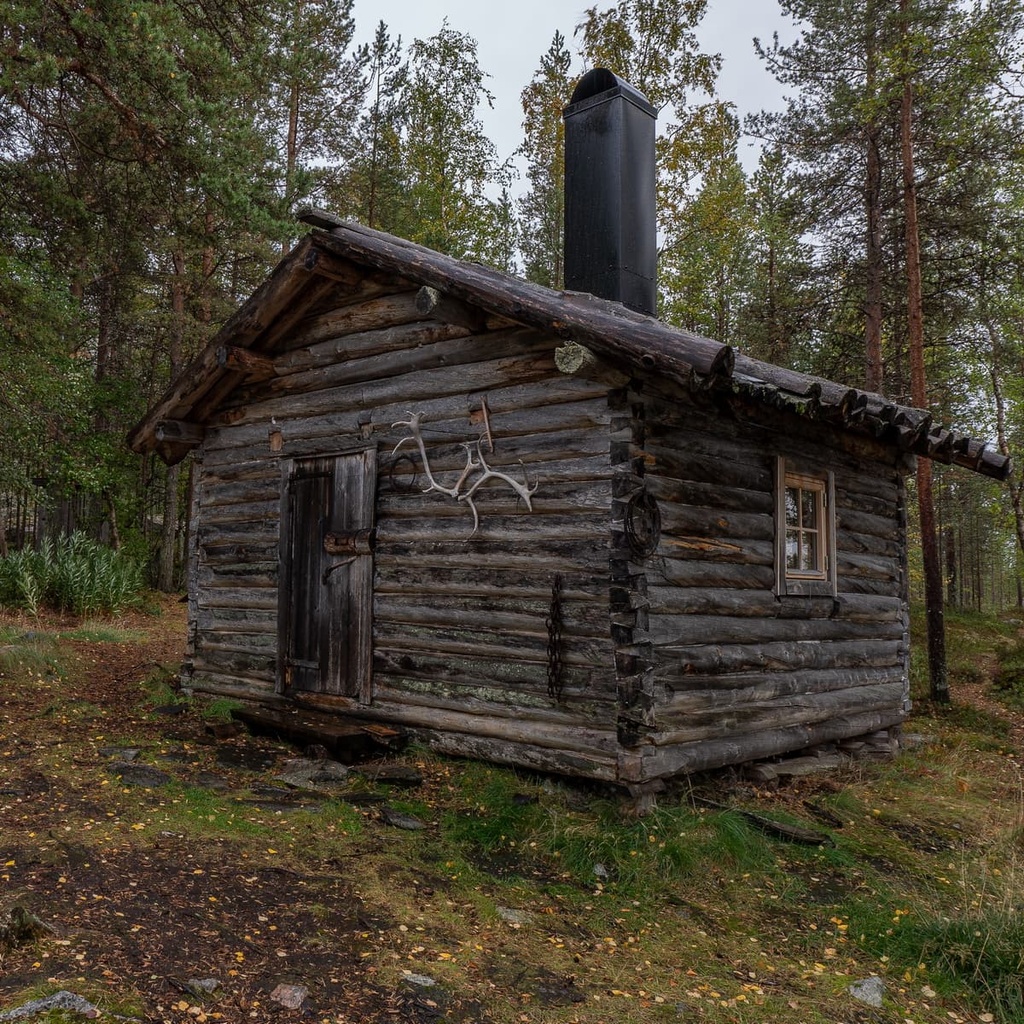
There are three open wilderness huts on the Piilola Trail, too: Ellenkoia in Norway, Pilola-porten on the border of the two countries, and Piilola in Finland, as well as several lean-to-shelters in both countries. You are free to pitch your tent nearly wherever you’d like in the park, too.
Before and after your trip to the park, you can easily book accommodation in Kirkenes. In Kirkenes, you can find everything from chain hotels to traditional Lapland huts.
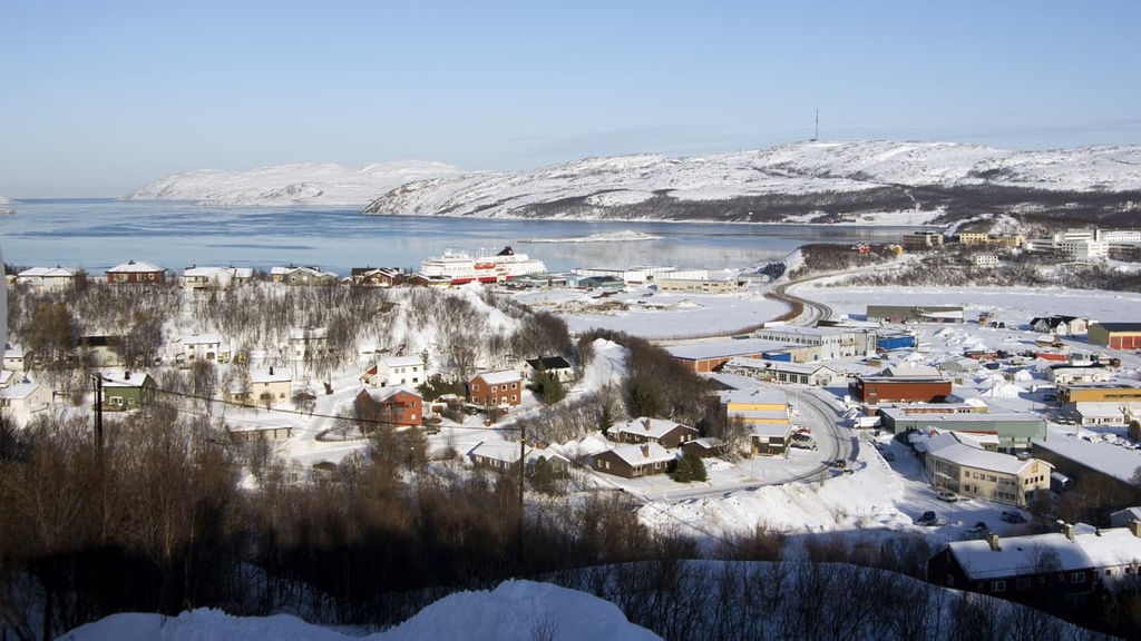
Kirkenes is the closest large town to Øvre Pasvik National Park. It is located 103 km (64 mi) to the north of it on the shore of the Arctic Ocean in the picturesque Bøkfjorden fjord, which is an arm of the larger Varangerfjorden fjord.
The town of Kirkenes has more than 3,500 inhabitants. But when considered together with the neighboring smaller villages, Hesseng, Sandnes, and Bjørnevatn, the population of the greater Kirkenes community is over 8,000 people.
The main architectural and cultural attraction of the town is Kirkenes Church (Kirkenes kirke). The white, concrete church was built in 1959 by the local architect Sofus Hougen.
Other points of interest in the city include its many museums, monuments, and former military installations, all of which tell the story of the difficult events that took place in this border region during the mid-twentieth century.
The city also has a large seaport with some services for tourists. For example, from the port, you can go on the King Crab Safari in the Neidenfjord during the spring, summer, and fall months.
For more information, check out Kirkenes’ official tourist site: VisitKirkenes.info.


