
Scan the QR code and open PeakVisor on your phone
Vätsäri Wilderness Area is one of the 12 wilderness areas in Finland. It is located in Lapland and its main natural feature is Inari Lake, which is sacred to the Sámi people. There are 9 named mountains in the Vätsäri Wilderness Area. The highest and the most prominent mountain in the wilderness is Haglklumpen (337 m / 1,236 ft).
The name of the Vätsäri Wilderness Area (Vätsärin erämaa-alue) comes from Skolt Sámi, which is the language of a group of Sámi people who originated in eastern Lapland.
The etymology of the mountain’s name is not exactly clear, but the word skolt means ‘eastern.’ It is interesting that the language of this subgroup of Sámi for a long time existed only in oral form until the late 1970s. They now use the Latin alphabet in written communication. Nevertheless, only a few dozen people continue to speak the language today.
For centuries, the Skolt Sámi have lived off of the land via fishing, reindeer husbandry, and hunting. Around the end of the twentieth century, tourism also became an important economic activity for the community.
Another interesting detail about the community is that the Skolt Sámi are primarily Orthodox Christians, not Lutherans like most Finns. This is likely a result of the fact that the Skolt Sámi have closer ties to Russia than to the rest of Finland.
The Vätsäri Wilderness Area is located in the municipality of Inari in the easternmost part of the Lapland region, which is the northernmost and largest region in Finland. The wilderness covers a total area of 1,550 sq. km (598 sq. mi).
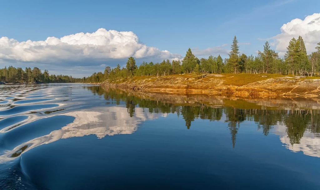
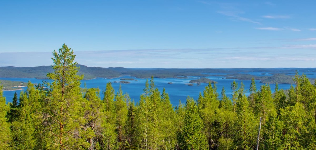
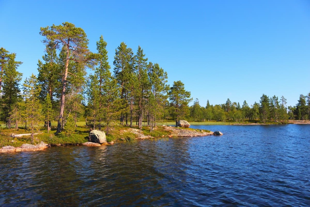
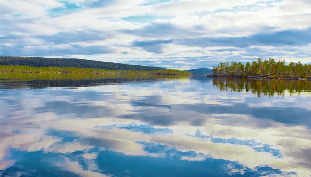
In the southwest, the wilderness area is bordered entirely by Inari Lake (1,040 sq. km / 401 sq. mi), which is the largest in the region and the third-largest in Finland, after Lake Päijänne in Central Finland and Lake Saimaa in Southern Finland.
Inari Lake is also a major feature of the wilderness area as a whole. Its shoreline is incredibly picturesque. In fact, in addition to the main body of water, the lake is actually a whole system of small lakes that are connected to each other by straits.
In the south, the wilderness area border almost touches the Finnish border with Russia. To the east, it actually runs along the border with Norway. To the north of the Vätsäri, there is the Kaldoaivi Wilderness Area, which is the largest in the country. In between, there is the small village of Sevettijärvi, which is one of the cultural centers of the Skolt Sámi and one of the main starting points for hiking in the region.
If you are coming to the wilderness from Norway or Russia, another popular starting point for hikes in the area is the village of Näätämö. It is located to the east of Sevettijärvi. However, the main and closest village to the Vätsäri Wilderness Area in the south is Nellim.
Vätsäri Wilderness Area is also included within a larger protected area called Pasvik-Inari Trilateral Park, which is a part of EUROPARC, the largest network of European protected areas.
Pasvik-Inari is a unique area that’s located on the eastern borders of Vätsäri. It also includes Øvre Pasvik National Park, Øvre Pasvik Landscape Protection Area, and Pasvik Nature Reserve in Norway as well as the Russian part of the Pasvik Nature Reserve and Korablekk Nature Park also in Russia.
The name of the area comes from the Pasvik River, which connects all five parts of Pasvik-Inari Trilateral Park. The river originates in Inari Lake and flows along the border between Norway and Russia into the Barents Sea of the Arctic Ocean.
You can reach the wilderness area from the village of Inari, which is the center of the Sámi people in Finland. It is located on the western shore of Inari Lake and is an easily accessible settlement. You can get there from the airport in Ivalo, which is located to the south. Ivalo can also be reached from Rovaniemi, the capital of the entire Lapland region.
For those who prefer to travel by public transport, on weekdays, there is bus service from Ivalo to Sevettijärvi and Näätämö that’s operated by Matkahuolto.fi, but there are no buses to Nellim.
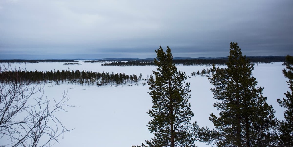
The wilderness area can also be accessed by water by boating across the lake or by riding a snowmobile across the lake during the winter when it is frozen.
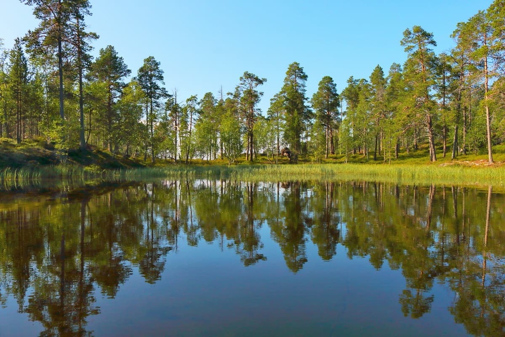
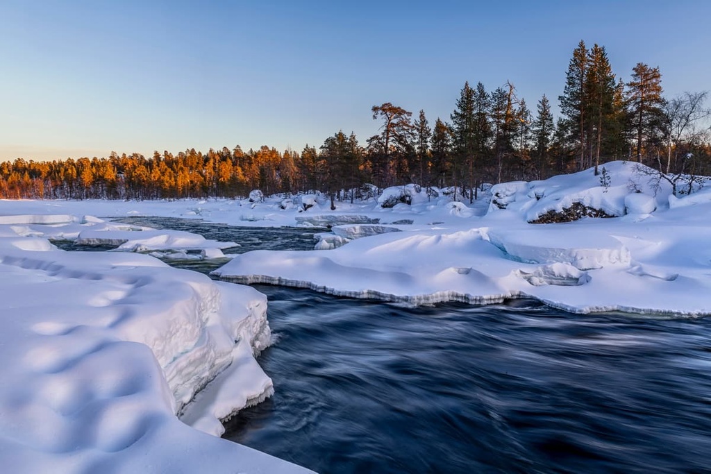
The flora of the Vätsäri Wilderness Area is typical of what you’d find in the rest of the northern part of Lapland. It is primarily covered with pine and spruce forests as well as bogs.
Some of the less common tree species that you’ll find in the area include goat willow, aspen, and rowan. One of the more interesting things to note about the region is that there are almost no birch forests in the wilderness. This is because they were all destroyed by the autumnal moth in the 1960s.
The fauna in the wilderness area also includes species that are typical of the region. Some of the animals found in Vätsäri include foxes, stoats, pine martens, brown bears, wolverines, and Arctic foxes, among others. Wolves also can be seen here, though they are very rare.
In fact, you are more likely to see reindeer in the wilderness area than wolves, bears, and even foxes because reindeer herding is still an important source of livelihood in the region. Vätsäri is one of four local herding co-operatives in the area alongside Muddusjärvi, Näätämö, and Paatsjoki.
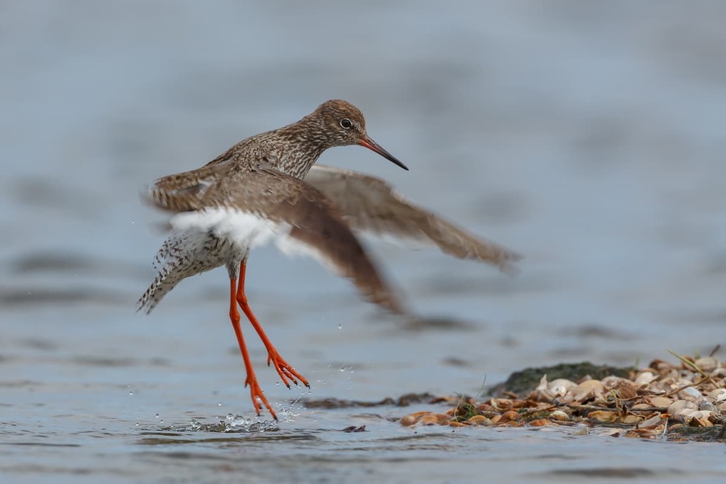
Vätsäri is also known as an important migration route for many northern bird species. The most common of these, the spotted redshank (Tringa erythropus), accounts for about 65 percent of the total bird population here.
The spotted redshank is a small and beautiful bird that’s easily recognized by its long beak. You can see it in large numbers in the wilderness area only during a short period of time in May. That’s because the female birds migrate further to the south to West Africa during the winter and they return to Lapland for only one month of the year to nest.
Another peculiarity of the fauna of the wilderness area is that Inari Lake is full of different fish species, including whitefish, lake trout, Arctic char, grayling, pike, perch, burbot, three-spined stickleback, minnow, lake salmon, vendace, and muksun—the list is almost endless.
The mountains in the Vätsäri Wilderness Area belong to the Kola Domain (Lapland Granulite Belt and Inari Complex), which is one of the five major large geological domains in Finland and Scandinavia. This domain extends further to the east to the Kola Peninsula and Murmansk Oblast in Russia and to the Finnmark region in Norway.
With respect to the main landscape features in the wilderness, it is worth noting that the northeastern part of the area is more mountainous than the rest of the region.
In fact, almost all of the wilderness area’s nine named peaks are located along the border between Finland and Norway, including the highest, Haglklumpen (337 m / 1,105 ft), and Muotkavaara (161 m / 528 ft), whose summit is nearly located at the tripoint of the border between Russia, Finland and Norway.
The main hiking area of Vätsäri is located in the southern part of the region. There is one major marked trail in the wilderness and several additional smaller ones that hikers can enjoy.
The first route, the Piilola Trail, is 35 km (21.7 mi) long. It connects Kessintie Road in the wilderness area and Sortbryststjern Lake in Øvre Pasvik National Park in Norway. The trail passes mostly through the rocky forest but there are mires, lakes, and small rivers that you can see along the way.
Of the other available marked trails in the wilderness, there are two routes that are located on the borders of the wilderness area, namely:
In any case, while walking in the wilderness area you will likely find yourself following the old Finnmark Route.
The Finnmark Route is a series of routes that traders and fishermen used to take while crossing the Vätsäri area on their way to the coast of the Finnmark region in Norway. This route was traveled for centuries before the wilderness area was created in 1991. The most important of these many routes traveled across Inarijärvi Lake to its Suolisvuono Fjord in the northeastern part of the lake and then overland to Norway.
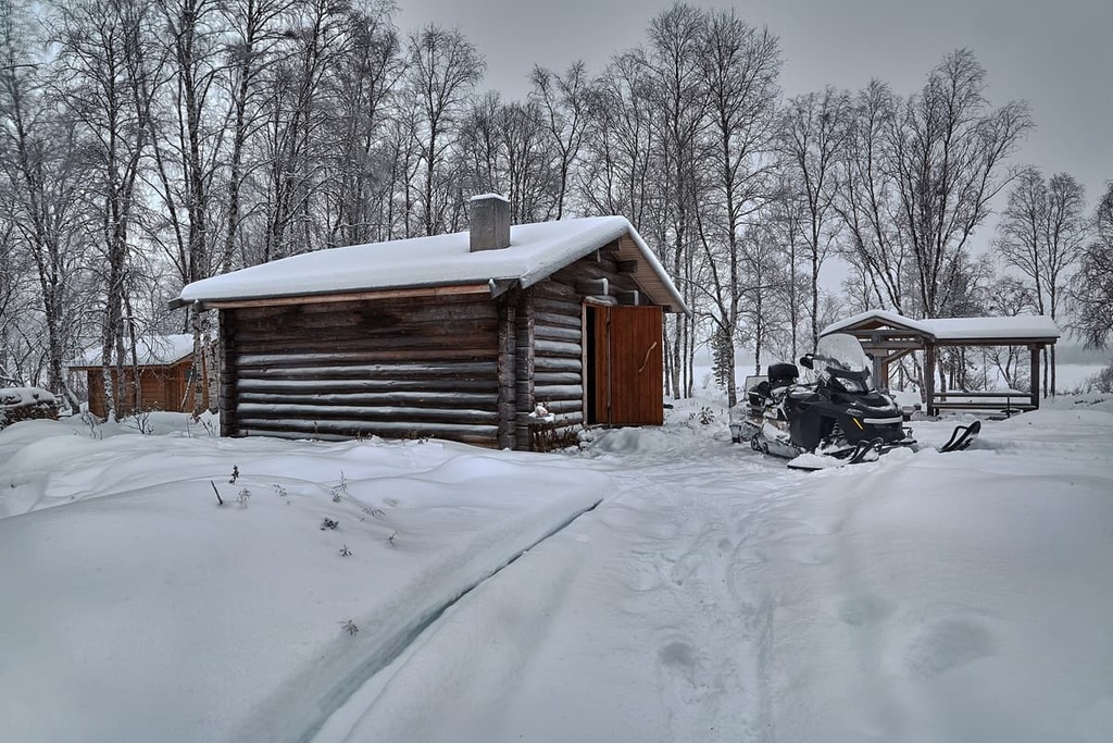
There are no marked skiing trails in Vätsäri, but you can ski off-trail through the wilderness area during the winter months. Within the wilderness, there are a number of open wilderness huts and rental cabins, too, that you can use for overnight stays or to simply rest during a day tour in the winter.
There are also snowmobile tracks all over the wilderness area between Nuorgam, Näätämö, Sevettijärvi, Nellim, Ivalo, and Inari that you can use for skiing.
For example, Muotkavaara is a popular snowmobile and cross-country ski destination in its own right. However, it is generally best to travel to the area on a guided trip as it is located near the border region and you don’t want to run afoul of the border authorities in Finland, Norway, or Russia.
You can learn more about the major ski resorts in Finland on the World Mountains Lifts section of PeakVisor.
If you want to learn more about the region around Vätsäri, be sure to check out one of the two main visitor centers in this part of Lapland. These visitor centers are located in Ivalo and Inari.
Metsähallitus Ivalo Customer Service
Sairaalantie, 3B, 99800, Ivalo, Lapland, Finland
+358206397701
Sámi Museum and Northern Lapland Nature Center "Siida"
Inarintie, 46, 99870, Inari, Lapland, Finland
+358206397740
For more information, head to the official tourist website of Lapland: Lapland.fi.
While hiking in the Vätsäri Wilderness Area. you are free to camp nearly wherever you’d like, thanks to Finland’s Everyman's Right law.
There are also four open wilderness huts in the area, namely:
There are even maintained campfire sites located near all of these huts. Furthermore, there are five open wilderness huts that are located around Inarijärvi Lake: Petäjäsaari, Jääsaari, Kaikunuora, Kärppäsaari, and Kahkusaari.
In addition, you can rent two huts in the wilderness area:
Kettuniemi can be rented via the Metsähallitus (The Finnish Forest Administration). You can rent Pakanajoki via the Lomarengas.fi website.
If you’re looking for other accommodation options, you’ll also find many rental cottages in Nellim, Partakko, Jorvapuolijärvi, Sevettijärvi, and Näätämö.
You can learn about many of the main towns and resorts in the greater Vätsäri Wilderness Area region on some of the PeakVisor guides for other nearby destinations, like Kaldoaivi Wilderness Area and Lemmenjoki National Park.
Therefore, it’s best to talk more about Nellim, as it’s where you’re likely to start a hike in the wilderness if you’re walking on the Piilola Trail to Øvre Pasvik National Park in Norway. From the town, a forest road leads to the parking lot that’s situated at the beginning of the trail.
Nellim is a very small village that’s located in the southern part of the wilderness on the shore of the Inari Lake, some 42 km (26 mi) from Ivalo and 9 km (mi) from the Russian border.
It consists of a few dozen wooden houses and it is the historic center of the Skolt Sámi community. This is because Nellim serves as a meeting place between eastern and western Sámi cultures, such as between the Sámi from Inari Lake and the Sámi from the Finnmark region and the Kola Peninsula.
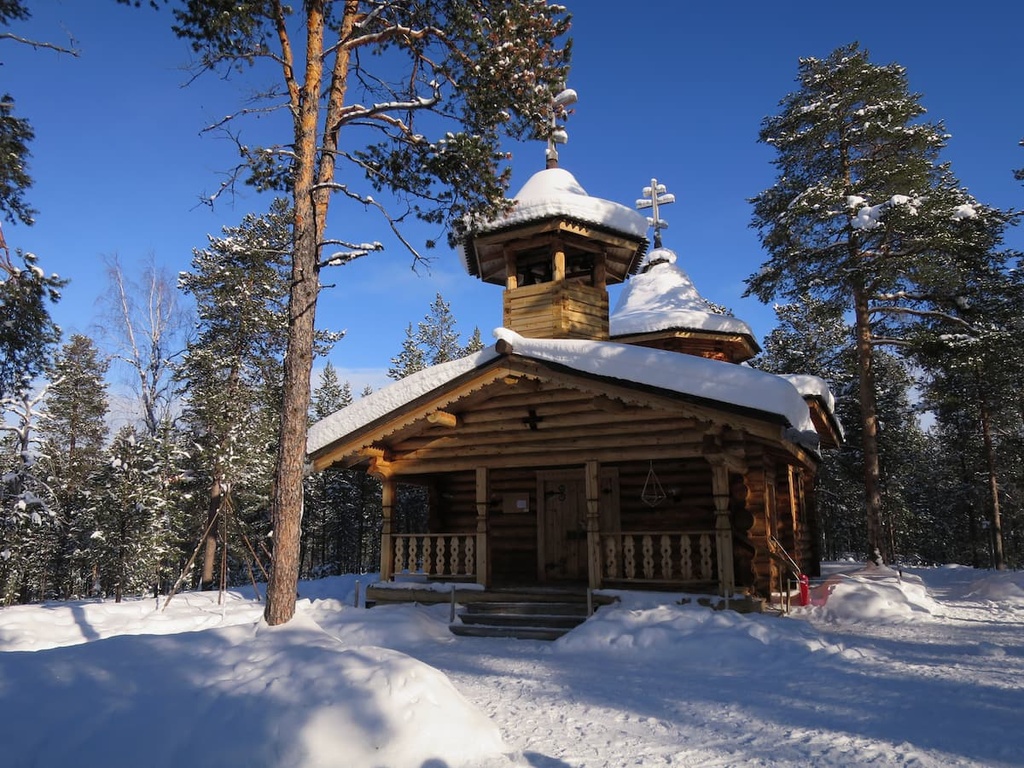
The main architectural and cultural attraction of the village is the wooden Skolt Sámi Orthodox Church, which is a large building that looks like both an ordinary wooden house and a church with two large domes.
Other attractions include the Nellim log-flume road and trail, the Travelers' Cross at Tsarmijärvi Lake, and the remnants of the Rautaportti Iron Gate fortifications that were constructed during the Second World War.
The village also has a store, a coffee shop, a marina, and a wilderness hotel, the latter of which is one in a series of four wilderness hotels in Lapland (others are located in Inari, Nangu, and Muotka). These hotels are popular places to visit if you want to try to see the Northern Lights.


