
Scan the QR code and open PeakVisor on your phone
Malla Strict Nature Reserve (Mallan luonnonpuisto) is a protected area located in the north of Finland in the Lapland region along the border with Sweden and Norway. The main features of the reserve are its rich history, the peak of Saana Fell, and its Arctic biodiversity. There are 3 named mountains in Malla Strict Nature Reserve, the highest of which is Iso-Malla (942 m / 3,091 ft) and the most prominent of which is Pikku-Malla (738 m / 2,421 ft).
The name of the Malla Strict Nature Reserve comes from the name of one of the three peaks located in its boundary: Iso-Malla Fell. It does not differ much in form from its two neighboring mountains, Pikku-Malla and Mallavuovdi (705 m / 2,313 ft).
But, Iso-Malla is located in the very center of the reserve, so it is considered the main peak in the area. Indeed, it offers the best view of the entire territory. Iso-Malla is also taller and larger than two other fells.
Malla Strict Nature Reserve is the first and oldest nature reserve in Finland. It was founded in 1938, a year after Finland became independent from Russia and Sweden for the first time in history. However, the territory had been originally protected 20 years earlier in 1916 due to its natural importance.
The reserve is also historically associated with the region of Kilpisjärvi. Kilpisjärvi is also the nearest and largest settlement to the reserve, even though it is a small village.
Like all other nature territories in the country, the Malla Strict Nature Reserve is managed by Metsähallitus, Parks & Wildlife Finland.
Malla Strict Nature Reserve is located in the very northwest of Finland in the Lapland region. It’s situated along the country’s border with Norway and Sweden. This area is also often referred to as Finland’s “arm” because it does look like an arm that the country has extended a hand to its two neighbors to say “Hey.”
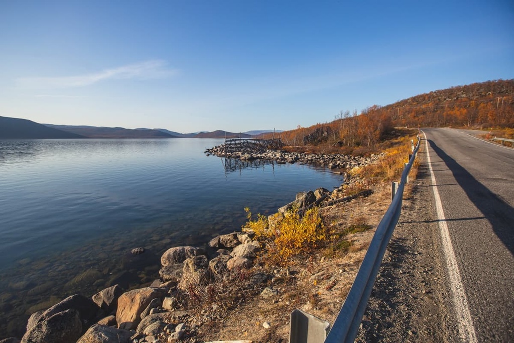
The border between Finland, Norway, and Sweden is located right along the boundaries of the reserve and is marked by the Three-Country Cairn or the Three Nations’ Border Point. It is a monument that looks like a huge yellow-colored fishing float. I don’t know about the reasons for this shape, but perhaps it looks like this because it is located in Lake Golddajarvi.
This kind of border point is the only such tripoint between these three countries, but it is not the only one in the world. It belongs to the so-called Tripoint areas, where the borders of the three countries meet. There are 176 places like this. For example, between Argentina, Brazil, and Paraguay, or Poland, Czech Republic, and Slovakia, and many others.
I’ll answer the expected question right away: Yes, you can reach this place by one of the marked trails, a description of which you will find further in this guide. There is also a boat service to the tripoint.
Now let’s go back to Finland. The reserve is administratively part of the municipality of Enontekiö, one of the largest in the region (8,391 sq km / 3,239 sq mi). The total area of the reserve itself is relatively small compared to other natural areas (national parks and wilderness areas) in Lapland as it is just 31 sq km (11.9 sq mi).
The northwestern border of the reserve runs along the border with Norway and the southern border with Sweden. On the southeastern borders of the reserve, there is also the large and majestic Lake Kilpisjärvi.
There are also two other natural areas nearby: Saana Nature Reserve and Käsivarsi Wilderness Area (Käsivarren erämaa-alue). Käsivarsi contains Finland’s highest peak, Halti (1,328 m / 4,356 ft), and the rest of the mountains in the wilderness are higher than 1,000 m (3,280 ft) in elevation.
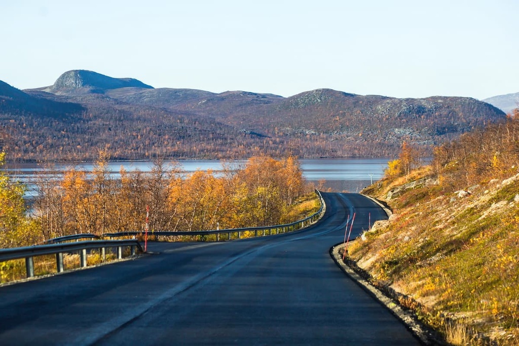
You can reach the Malla Strict Nature Reserve from Rovaniemi, the capital of Lapland, by taking Highway E8 to Kilpisjärvi. This journey takes about 5 hours by car or a little more by bus, which runs here every day. The distance is 428 km (265 mi).
Rovaniemi, in turn, can be reached from Helsinki also by car (1,240 km / 770 mi) in 14 hours 20 minutes. Other public transportation options also include bus, train, or plane.
However, I recommend the land route from Helsinki to Rovaniemi. This is, of course, the longer option, but it will let you see the whole country before you arrive in one of the wildest corners of Lapland. That way, you can understand it better in comparison to the rest of the country.

The far northwest of Lapland and Malla Strict Nature Reserve, in particular, is a unique place in Finland where the older geological layers of the Earth meet the younger ones.
The base of this area, and indeed all of Scandinavia, is a very old segment of the Earth’s crust called the Baltic Shield, which is 1.5 to 3 billion years old. The Baltic Shield contains all the types of rock that you can see on a hike through the reserve, namely granites, gneisses, shales, quartzites. But the most common rock type in the reserve is granodiorite. In fact, these are the oldest rocks in Europe.
The three peaks in the reserve and the northern part of the neighboring Käsivarsi Wilderness Area belong to the relatively young Scandinavian Mountains, which emerged on top of the Baltic Shield some 400 million years ago during the Devonian and Ordovician geological periods.
The youngness of the peaks in the reserve is obvious from their height (starting around 700 m / 2,296 ft) when compared to the other hills of Lapland, which are on average from 500 to 800 m (310 to 497 ft). As these peaks are much younger, they’ve experienced substantially less erosion over the years and are much higher than their older neighbors.
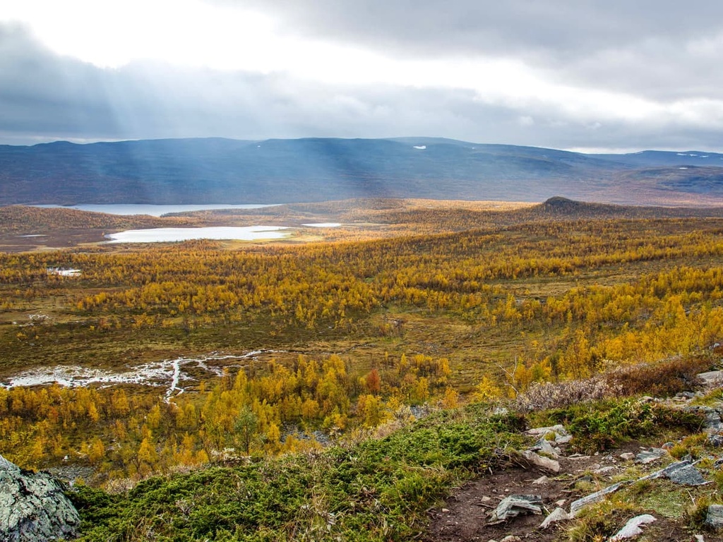
The Malla Strict Nature Reserve is another natural area that belongs to the Fell Lapland subregion. This ecological subregion is characterized by large open spaces, such as plateaus and river valleys, as well as a series of hills that reach heights of over 1,000 m (3,280 ft).
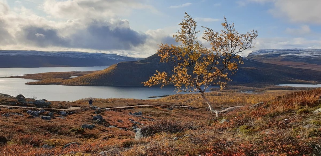
In addition to the three Malla Fells I mentioned earlier, another unmistakable feature of the landscape of the reserve is Saana Fell, which is located to the northeast of its borders. Saana Fell is not on the reserve’s territory, but it’s clearly visible from anywhere in the area. You’ll learn more about it later on in this guide.
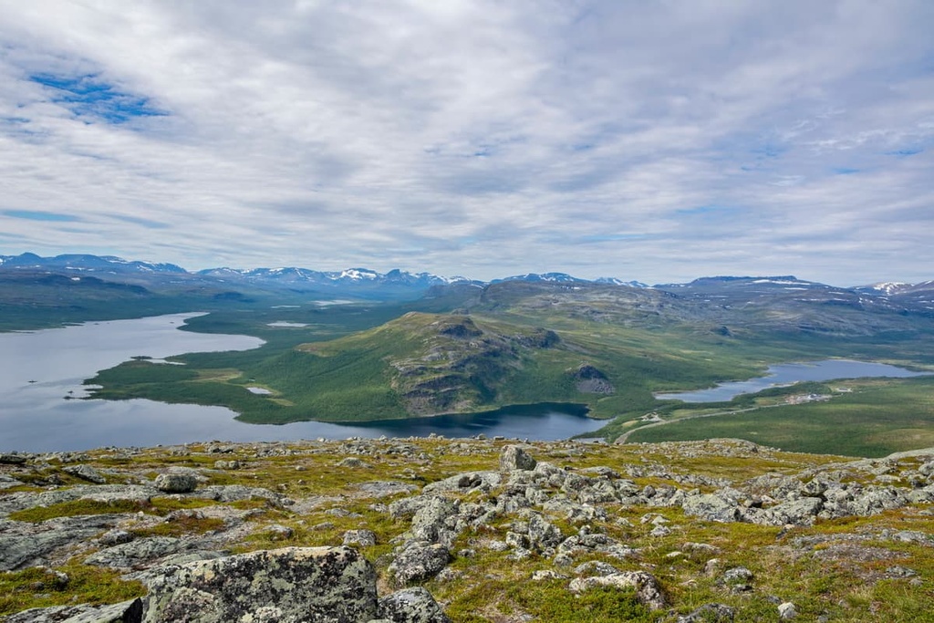
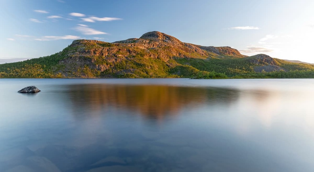
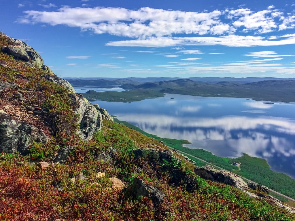
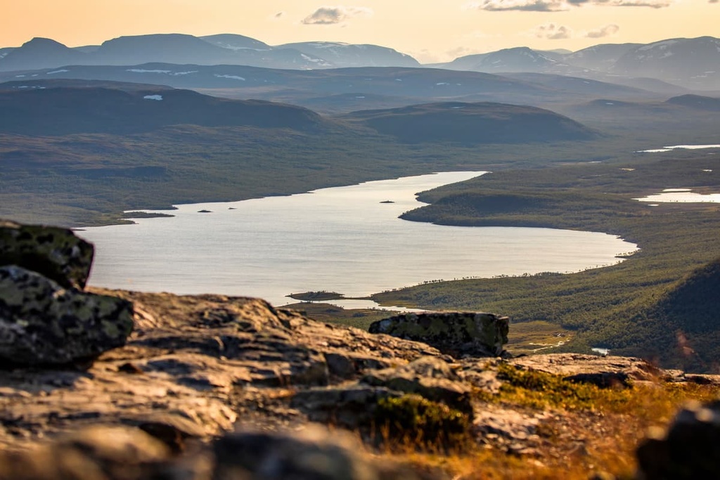
Like everywhere in Lapland, there are many lakes in the Malla Strict Nature Reserve, too. So the main landscape feature of the reserve is Lake Kilpisjärvi.
In reality, Kilpisjärvi is a medium-sized lake with a total surface of 37 sq km (14.4 sq mi). However, for an area with no lakes at all, it’s quite large. The lake is located at an elevation of 472 m (1,551 ft). The lake’s average depth is 19.5 m (64 ft) and the maximum depth is 57 m (187 ft).
If you go to the park by boat, you will need to walk just 2.5 km (1.5 mi) from the landing area to the point where the borders of Finland, Norway, and Sweden meet. Also, it’s good to know that the lake is frozen in winter like all lakes in Finland. But here, in Lapland the lake is ice-covered for about 223 days a year. This means that you can ski the lake in the winter.
There are several smaller lakes and rivers in the reserve, as well as some bogs that you will see and cross during your hiking trip there.
Malla Strict Nature Reserve is distinguishable from other protected areas in Finland by its unique flora and its rich fauna.
In fact, the well-known local forest researcher Justus Montell from Muonio was the first to express his opinion about the importance of protecting the Malla Fells back in the early twentieth century. By this time, he had already collected more than 30,00 plant types in what is now the reserve.
The fact is that the soil in this area is rich in calcium. Thanks to this, there are many plants that are adapted for life in this arctic territory, where the average summer temperature is only about 15 degrees Celsius (59 degrees Fahrenheit). There are also some rare plant species here that are not found in other parts of Lapland, Finland, or even Scandinavia.
For the same reason, in 1964, at the foot of the Saana Fell, the Kilpisjärvi Biological Station (the northernmost branch of the University of Helsinki), was established.
So, for more than 60 years students and specialists from the University have come here to conduct various research projects. For example, some of the researchers have studied the migration of lemmings from this research station.
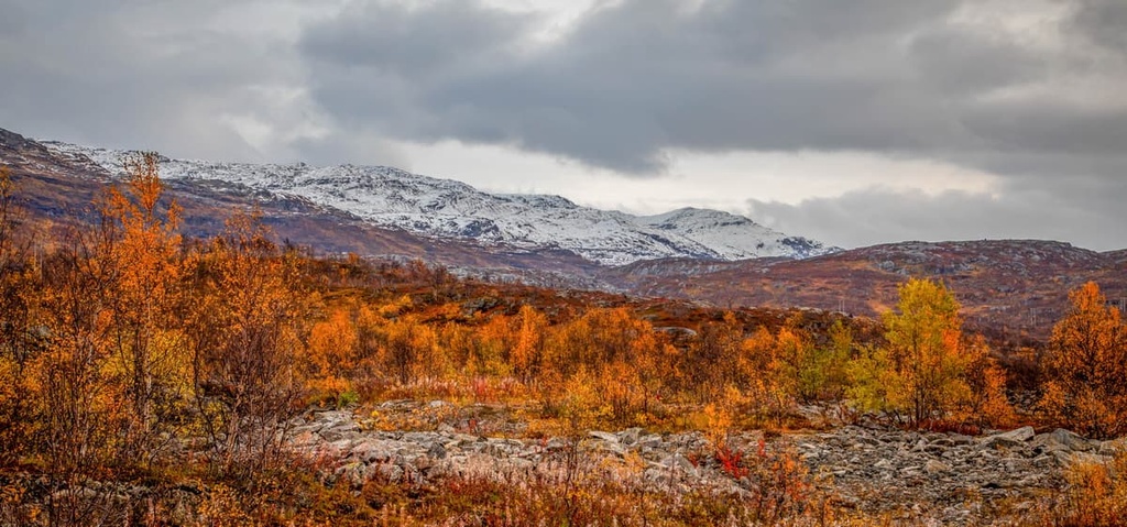
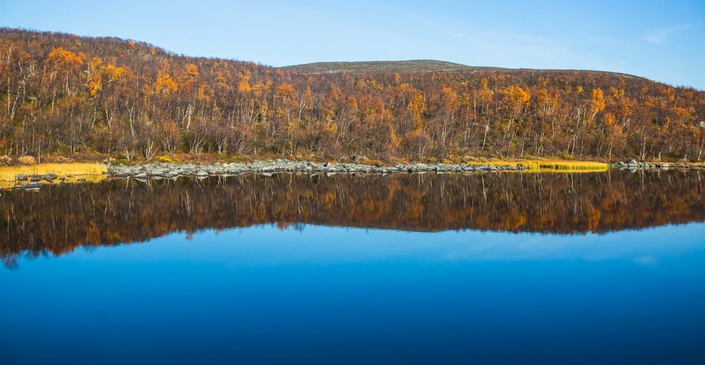
Up to about 600 m (1,968 ft) above sea level, the area in the reserve is covered with mountain birch forests, which turn a magnificent golden color in mid-September.
In the forests, valleys, and hills of the area there are also plants like the protected glacier buttercup—one of the symbols of the territory that must not be picked—as well as mountain aven, white Arctic mountain heather, dwarf willow, diapensia, Alpine azalea, and Alpine juniper, and many others.
Other particularly rare plants found throughout Scandinavia and the reserve include northern milkvetch, Lapland rhododendron, glacier crowfoot, and narrowleaf arnica. In total, there are 434 different plant species in Kilpisjärvi, 28 of which can only be found in the reserve.
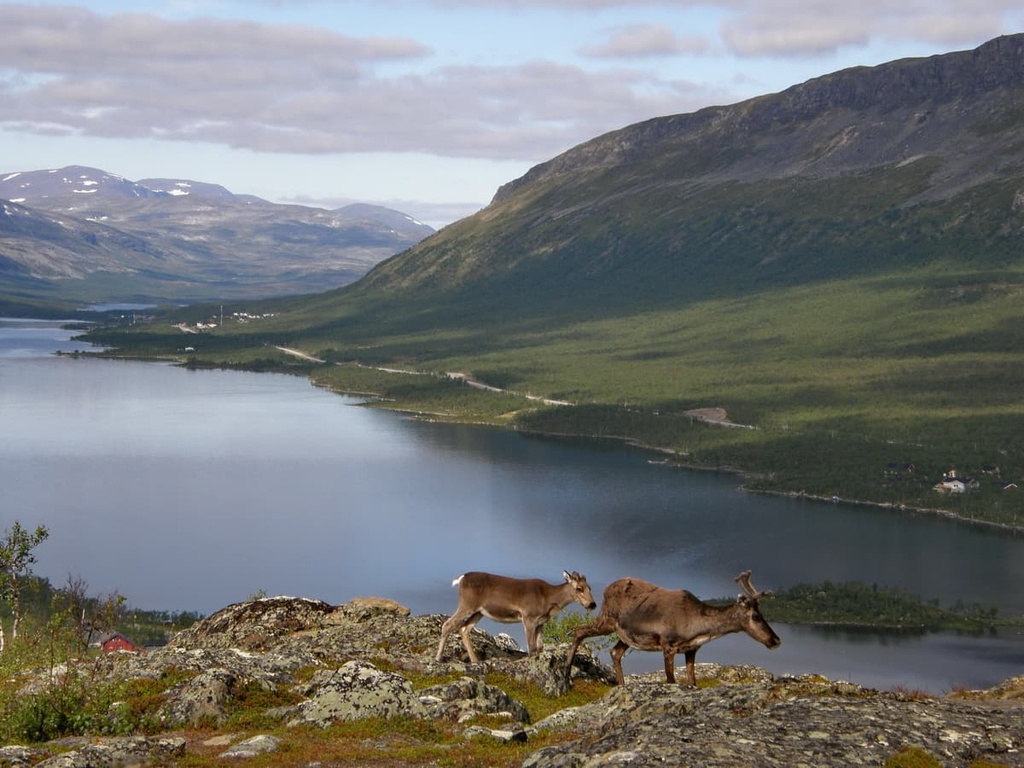
Several Arctic animal species live in the Malla Strict Nature Reserve. This includes the Norwegian lemming, vole, ermine, weasel, mountain hare, and even the Arctic fox. However, there are relatively few Arctic foxes in the region.
As far as birds go, bluethroats are arguably the most abundant. This is a small bird with a blue and orange throat. According to researchers, these birds live here in greater numbers than anywhere else in the world. The snowy owl, rough-legged buzzard, and gyrfalcon are also found in the reserve.
There are a lot of fish in the rivers and lakes of the reserve, too. These fish like the crystal clear waters in the rivers and lakes that are rich in oxygen. Some of the main fish species in the region include salmon, arctic char, brown trout, and whitefish.
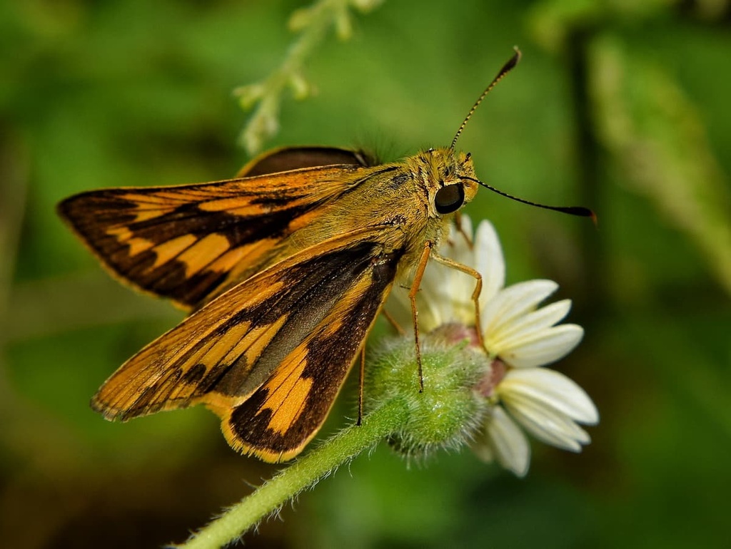
There are 340 types of butterflies in both Malla and Saana fells. These butterflies feed on many of the reserve’s flowering plants.
However, the most notable animal in the reserve is the Labrador tiger moth. It can be seen in Malla in June and July. But you can also view it all year long on the reserve’s official logo.
By the way, you can find such logos with images of local flora, fauna, and features of the landscape in every natural area of Finland. You can even buy them as souvenirs in the visitor centers of the territories in the form of badges or patches.
The only mountain range in Malla Strict Nature Reserve is the Malla Fells. This is a series of three peaks: Iso-Malla, Pikku-Malla and Mallavuovdi.
To the west of the reserve—between Malla and the Käsivarsi Wilderness Area—there are several other notable peaks. Overall, this area is unique to Finland because it contains all the highest peaks in the country, including several dozen mountains over 1,000 m (3,280 ft) high. All of these tall peaks belong to the Scandinavian Mountains.
Iso-Malla is the highest peak in the reserve. It is also located in the geographical center of the reserve. You definitely can’t miss Iso-Malla during the hike, because you’ll see it as you hike along the main trail in the reserve. You’re also able to hike up to the summit itself.
Pikku-Malla is the second-highest, yet most prominent (102 m / 335 ft of prominence), mountain in the reserve, trailing Malla by 2 m (6.5 ft). You can also climb Pikku-Malla to see the magnificent scenery of the area.
Saanatunturi is a mountain that’s located just west of the reserve. However, while it isn’t considered part of the reserve, you can’t miss it because it’s only a few kilometers from the local village. Additionally, it has an unusual shape and other features that make it stand out from the surrounding landscape.
Here are some of the most important features of Saana:
Salmivaara is the highest peak of the Kilpisjärvi Lake Peninsula, where the village of Kilpisjärvi is located. Getting to the top of this mountain is easy because there is a dirt road leading to it.
The peak is 3.2 km (1.9 ft) from the village. But do not confuse it with the peak of the same name located in eastern Lapland near the village of Salla.
Korkea-Jehkas is a peak located just to the northeast of the village of Kilpisjärvi. It can also be reached by dirt road. As is the case from the other mountains, the summit offers a magnificent panorama of the surrounding area, with the important difference that from the top you will also see the peak of Saana itself. This makes it well worth the climb.
Muotkatakka is not exactly a mountain but the highest point of Highway 21, which is, in turn, the highest road in Finland, a part of European E8 route. It is located 12 km (7.4 mi) to the south of Kilpisjärvi. You will not miss it on your way to the reserve as there is a blue sign on the road that indicates the high point and directs you to a parking area.
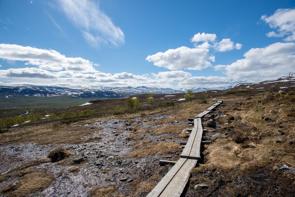
There are three main hiking areas around the Kilpisjärvi–Malla Strict Nature Reserve region. Here’s what you need to know about the region’s major trails:
This is a trail to one of the three peaks in the Malla reserve. Pikku-Mall offers stunning views of the area, including the neighboring peaks, lakes, and rivers of Lapland. The route is suitable for those who want to visit the reserve but don’t have time to travel the entire Malla Trail.
The Malla Trail is the longest route in the reserve. It travels from the village of Kilpisjärvi to the Three Nations’ Border Point.
Along the way, you will see all the sights of the reserve in the following order: River Siilasjoki, mountain birch forests, Pikku-Malla Fell (by the 1 km / mi side trail), small ponds, bogs and lakes, Kitsiputous Falls, reindeer fences, Iso-Malla Fell, and finally the Three Nations’ Border Point.
You can return the same way or take a loop route around the lake by boat.
This is an easy hike from Koltalahti on the small Lake Kuohkimajärvi to Three Nations’ Border Point. To get to the start of the trail, you will need to book a boat ride on Lake Kilpisjärvi. The trip takes half an hour. Along the way, you will also see the neighboring Paras Fell and Tuipali Fell in Norway.
This is a series of several separate trails that you can easily combine in a great loop from Koltalahti through the Three Nations’ Border Point into Norway and Sweden over the higher hills of those countries, including Paras Fell—one of the most famous outdoor destinations in Norway.
The route is as follows:
If you add the Malla Trail to this route, you’ll have an unforgettable adventure when compared to other similar long backpacking trails in Lapland, including the famous Hetta–Pallas Trail in Pallas-Yllästunturi National Park.
The Salmivaara Trail is an easy trail to the closest peak to the village of Kilpisjärvi, Salmivaara. The peak is located on a small peninsula in Lake Kilpisjärvi.
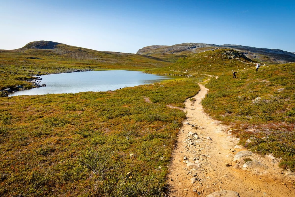
The Saana Trail is a trail to the most recognizable mountains in Finland—Saanatunturi or Saana. Along the way, you will cross River Skirhasjohka and also reach Jeahkas Fell, another peak in the region that is hard to miss.
The trail is quite long, so use the day-trip hut at Lake Saanajärvi located right in the middle of the way as a rest point.

Additionally, the trail has several options for different durations, making it suitable for all outdoor enthusiasts, regardless of fitness level or free time.
This is another route to the main summit of Finland. It’s sometimes called the Trail Around Saana or the Saana Fell Loop. The route is as follows:
In addition to summiting Saana, this trail passes by two small picturesque lakes: Tsahkaljärvi and Saanajärvi.
The Nordkalott Trail, or Arctic Trail, is a multi-day hiking and backpacking trail that’s some 800 km (497 mi) long. It travels through the northern parts of Norway, Sweden, and Finland.
It is the longest northern trail in Scandinavia and one of the northernmost long-distance trails in the world. It is also part of the European long-distance hiking route E1, which travels some 7,000 km (4,300 mi) from Nordkapp in Norway to Sicily in Italy.
The starting/ending points of Nordkalott are Kautokeino or Sulitjelma (Norway) and Kvikkjokk (Sweden).
The portion of this trek in Finland is 70 km (43.4 mi) long and it can be completed in 6 to 7 days. It ventures through Malla Strict Nature Reserve, Saana Nature Reserve, and Käsivarsi Wilderness Area.
The Norwegian and Swedish parts of the trail are 380 km (236 mi) and 350 km (217 mi) long, respectively.
In my opinion, it is a difficult route, for which you need to be prepared physically and mentally.
For example, it crosses two of the largest rivers in Finland, Bierfejohka and Vuomakasjoki. During the hike, you normally cross these rivers using bridges, but on July 1, 2021, a flood destroyed the Vuomakasjoki Bridge.
The new bridge will be built in 2022, but there is always a chance of another flood that will force you to cross the river without the help of a bridge. There are also many smaller river crossings during the hike.
In addition to hiking and backpacking, Malla Strict Nature Reserve offers other outdoor activities like canoeing, bird watching, guided trips and safaris, and swimming.
In winter, there are no restrictions on travel in the reserve, so you can cross-country ski all over the region.
Additionally, from March to May, when the weather is less cold, you can ski along the marked route from Kilpis Hotel (Kilpisjärven retkeilykeskus) in the village of Kilpisjärvi to the Koltalahti (11 km / 6.8 mi).
Another fun route to ski travels from Kilpisjärvi through Koltalahti to the Three Nations' Border Point (10 km / 6.2 mi).
Keep in mind that there are no marked routes in the uplands of the nature reserve.
You can get more information about hiking and other activities in the area at Kilpisjärvi Visitor Center, which is located near the nature reserve in the village of the same name. There is a permanent exhibition "At the Edge of Scandinavia" in the center, too, that showcases the nature, geology, animals and people of the Kilpisjärvi region.
Kilpisjärvi Visitor Center
Käsivarrentie, 14145, 99490, Kilpisjärvi (Enontekiö), Lapland, Finland
March 3—May 2: Mon to Sun, 10 am to 5pm,
June 7—October 3: Mon to Sun, 10 am to 5 pm
Closed on August 14–15
+358206397990
There is also the Fell Lapland Visitor Centre in Enontekiö, the capital of the municipality:
Fell Lapland Visitor Centre
Peuratie, 15, 99400, Enontekiö, Lapland, Finland
Open all year round with different schedules
+358206397950
Also note that since the Malla area is a strict nature reserve, it has some regulations that do not exist in Finnish national parks, wilderness areas, or some other nature reserves:
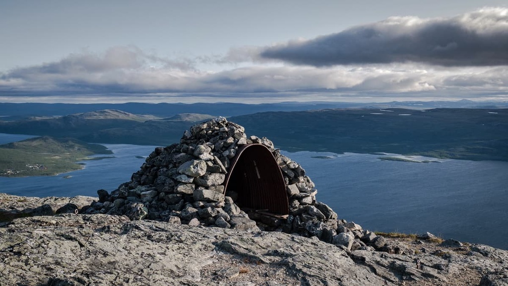
While hiking in the reserve, you can stay overnight in one of the two huts:
Both huts have stoves, a gas cooker, and some cooking utensils inside. There are pit toilets outside the huts.
Before and after hiking, in Kilpisjärvi village you can find several hotels and traditional Finnish cottages, too. These include:
Kilpisjärvi is the only major settlement located close to Malla Nature Reserve on a picturesque peninsula on Kilpisjärvi Lake in the municipality of Enontekiö.
Like many villages in Finland, Kilpisjärvi is located on both sides of the E8 highway but differs in that it is the highest settlement in the country at 565 m (1,853 ft) in elevation. Even before the road was built in 1941 and the first tourists arrived here, the E8 was the old market route between the three countries.
Kilpisjärvi is a traditional Sámi village with a population of only about a hundred people, many of whom work in reindeer herding or tourism.
The village became a popular destination for nature tourism immediately after the Malla Reserve was established here in 1936. A year later the first hostel was built here, and in 1953, the first hotel was built, too.
You can see what the community looked like in the 1970s and 1980s by looking at photos from local resident and photographer Pertti Pitkänen, who has been photographing Lapland and Finland regularly for over 50 years.
The main architectural and cultural attractions of the village, in addition to those I have already listed in the guide, are different sorts of military fortifications: bunkers, trenches, and so on, that were left here from World War II.
In particular, the Järämä Fortification Area was carved into the bedrock by Germans to protect the harbors on the Arctic Ocean. The name comes from the Järämä village, which is located along the E8 about 20 km (12.4mi) from the village of Karesuvanto. The distance to Kilpisjärvi from the fort is 91 km (56.5 mi).
For more information, check out the official tourist site of Kilpisjärvi: Lapland.fi.


