Scan the QR code and open PeakVisor on your phone
Øvre Anarjokka National Park (Norwegian: Øvre Anarjokka nasjonalpark, Northern Sami: Anárjoga álbmotmeahcci) is located in northern Norway within the interior of Troms og Finnmark county. The park is home to 102 named peaks with the tallest and most prominent being Gurbeš at 588 m (1,929 ft) tall with 232 m (761 ft) of prominence.
Øvre Anarjokka National Park lies in the northwestern section of Norway with Finland situated directly south. The terrain is similar to that found throughout the interior of Troms og Finnmark county.
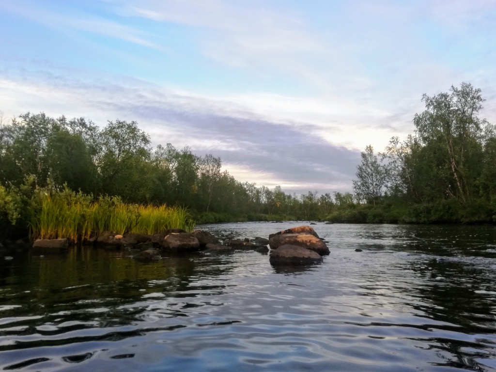
Situated along the Finnmark plateau, the region marks the country’s largest continuous plateau. One of the most important features in the park is the headwaters of the river Anarjokka (Northern Sami: Anárjohka) with the name of the park translating to “the upper part of the Anarjokka river”.
The terrain of the park is similar compared to that found throughout the northern stretches of Norway, Finland, and Sweden. Øvre Anarjokka National Park spans 1,414 sq. km (546 sq. miles) with the tallest peaks being scattered throughout the park.
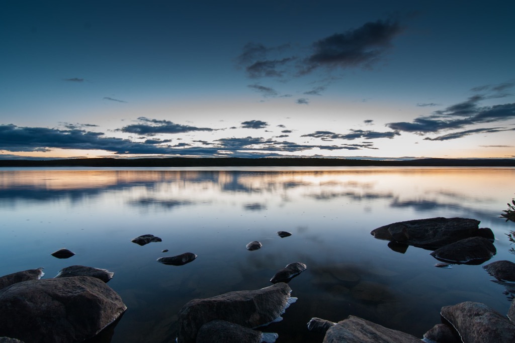
The park is defined by its sweeping and vast moorlands along with marshes, lakes, and forested sections. Changes in elevation are quite gradual, especially compared to the fjords found along Norway’s west coast. Nearly half of the park is marked by a treeless tundra
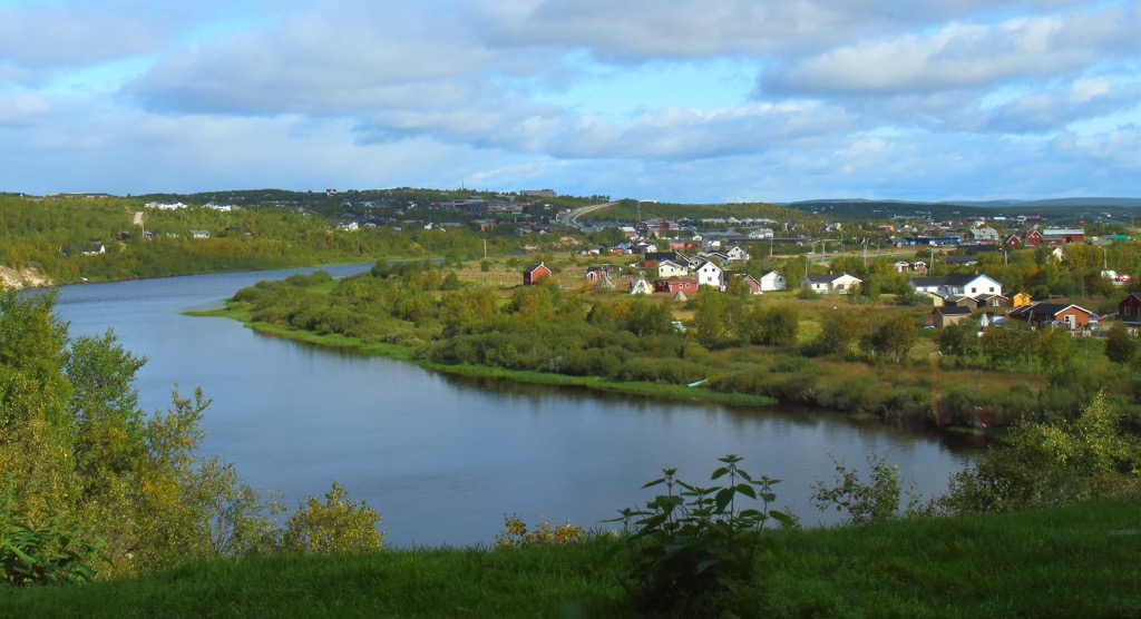
Flatter sections of terrain often feature pine barrens, bogs, and lakes, while the rolling hills feature birch woods or grass terrain. The upper reaches of both the Anárjohka and Kárášjohka rivers lie in the park. Some of the larger lakes in the region include Gavdnjajávri and Buolžajavri.
Additionally, Øvre Anarjokka National Park is surrounded by other popular outdoor recreation areas. Finland’s Lemmenjoki National Park lies directly south while Reisa National Park is situated to the west in Norway. Other nearby Norwegian national parks include Stabbursdalen National Park to the north and Seiland National Park to the northwest.
The geological history of most of Norway is dominated by the Scandinavian Mountains which also extend throughout Sweden and part of northern Finland.
The distinct land formations throughout the country began forming during the Caledonian orogeny. This major mountain building event took place roughly 490-390 million years ago. During this time tectonic shifts led to the collision of the continents and terraces of Laurentia, Avalonia, and Baltica.
Baltica and Laurentia collided with one another during the Scandian phase of the Caledonian orogeny which began the formation of the Scandinavian Mountains. These peaks were uplifted during both the Mesozoic era and the Oligocene.
Widespread glaciation carved out the dramatic changes in elevation along the country’s west coast, as well as the Finnmark plateau that the national park is situated upon. These peneplains mark vast regions where the relief has been largely eroded away.
Today the region is marked by thick deposits of limestone, sandstone, and conglomerate, known as spragmite. The pressure of the glaciers was relatively evenly distributed in the region which led to the gentle changes in elevation.
Major peaks within the Øvre Anarjokka National Park include Gurbeš, Galmat, Noarvváš, Lulimus Gurbeš, Geatkevárri.
Øvre Anarjokka National Park provides a safe haven for a wide range of both flora and fauna. Minimal amounts of human interaction have allowed the local ecosystems to thrive.
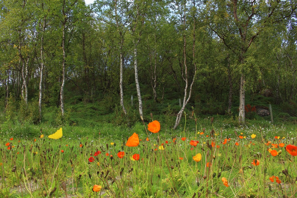
Low growing grasses make up some of the tree free portions of the park while other sections feature minimal amounts of plant life. Birch and pine trees are both common in the forested sections.
Some of the larger mammals found in the park include moose, reindeer, and brown bear. While brown bears create their dens within the park boundaries, the moose tend to head to the wooded sections of terrain just outside the park.
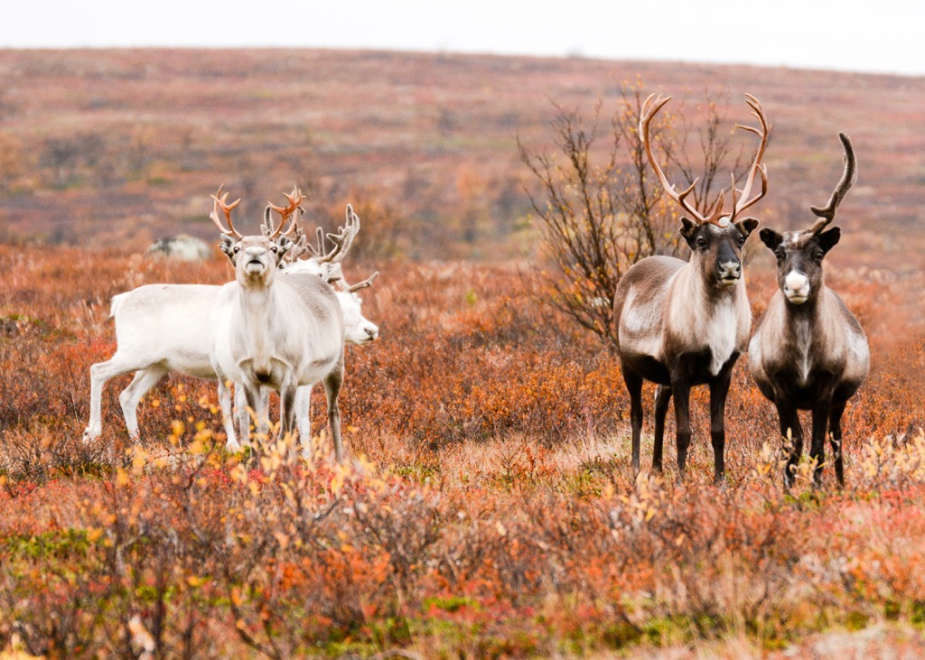
There are 12 designated reindeer grazing regions within the park. Other common animals include red fox, stoat, and wolverines. Various small rodents roam the park including field voles, lemmings, root voles, and northern water voles. Visitors may also spot shrews and hare.
The multiple rivers and lakes that define the region are home to grayling, three-spined sticklebacks, trout, pike, perch, burbot, salmon, and occasionally char.
The land within and surrounding Øvre Anarjokka National Park has had human activity dating back for 10,000 years. The land has historical ties for the Sami people (also known as Saami and Sámi).
The Norse people and the Kven people also have historical ties to the region. To this day the Sami people make up a majority of the population in the Finnmark interior. Much of northern Norway was part of the Sami territory, used for fishing and hunting reindeer.
The Norse/Scandinavian people lived in the southern stretches of the country, often never venturing to the extreme north of present-day Norway. For a majority of this time the two groups had little interaction with one another.
During the eighteenth and nineteenth centuries, the Norse people began to start Nowergianization, a policy which forced the Sami people, and later the Kven, to assimilate to the Norwegian way of life.
This assimilation was also coupled with the aggressive land claims by the Norse people who began traveling throughout northern Norway and establishing villages. The Sami people who lived in the interior were able to preserve more of their culture compared to groups located along the coastlines.
Near the end of World War II, Germans used the scorched earth war tactic across the Finnmark region. Because of this many homes and buildings were destroyed and much of the population was forced to retreat to the south.
Throughout the Cold War parts of eastern Finnmark were areas of high tension, especially along the long border shared with the Soviet Union. During the 1970s the Sami language began being taught in schools in order to help preserve the culture of the Sami people.
The national park was established in 1976, covering its current land area. Ongoing efforts to further expand the park began in 2009 but were halted in 2015 due to local opposition. Today the park features much fewer visitors than other parks in the country due to its relatively remote location.
Øvre Anarjokka National Park is home to minimal hiking trails. Those wishing to explore the wild wilderness of the park often visit during the months of July and August. While some day hikes can be navigated throughout the park, hikers should note that it often takes a few days of travel from nearby major cities to even reach the park boundaries.
Many who visit the park also bring a pack raft of portable canoe. The plateau is defined by the multitude of waterways that connect the region. Navigating on a boat offers hikers much easier passage throughout the region when the water levels are high.
When water levels are low, hiking can sometimes prove to be more effective. Anyone wishing to explore the terrain on a backpacking trip should be well versed in backcountry safety as the park is incredibly remote, making rescue difficult.
Looking for a place to stay near the Øvre Anarjokka National Park? Here are some of the best cities and villages to check out in the region:
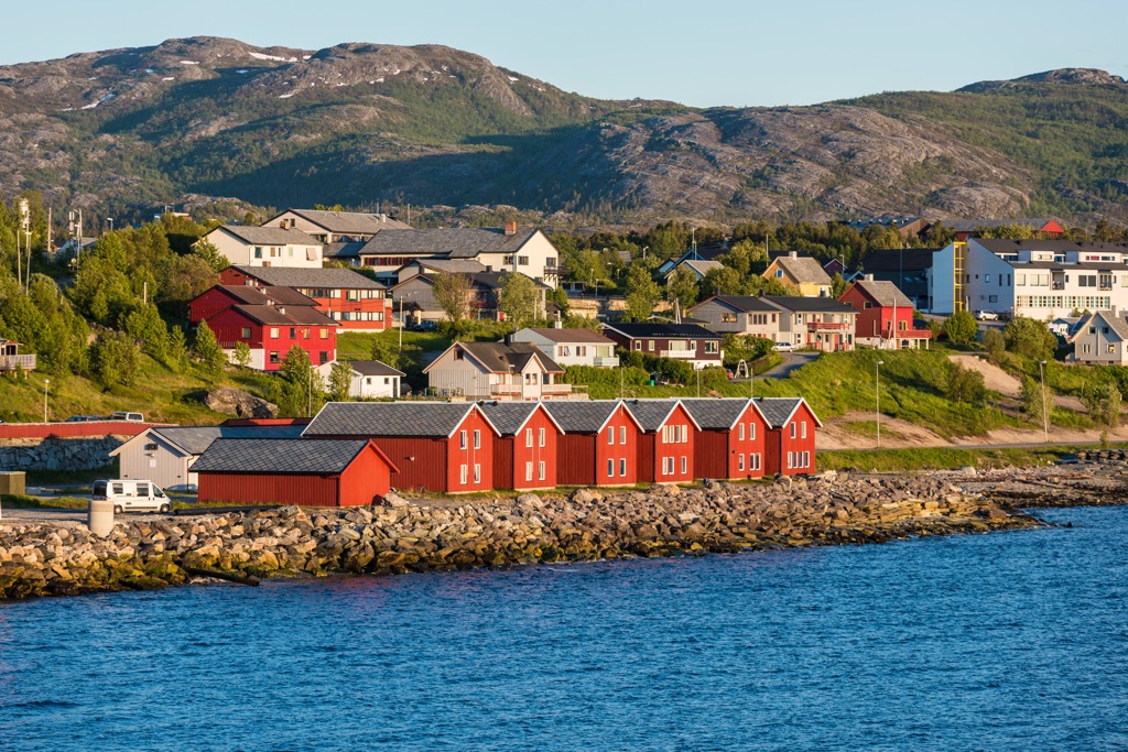
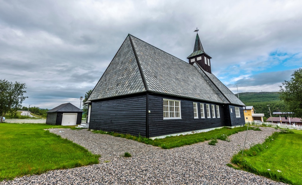
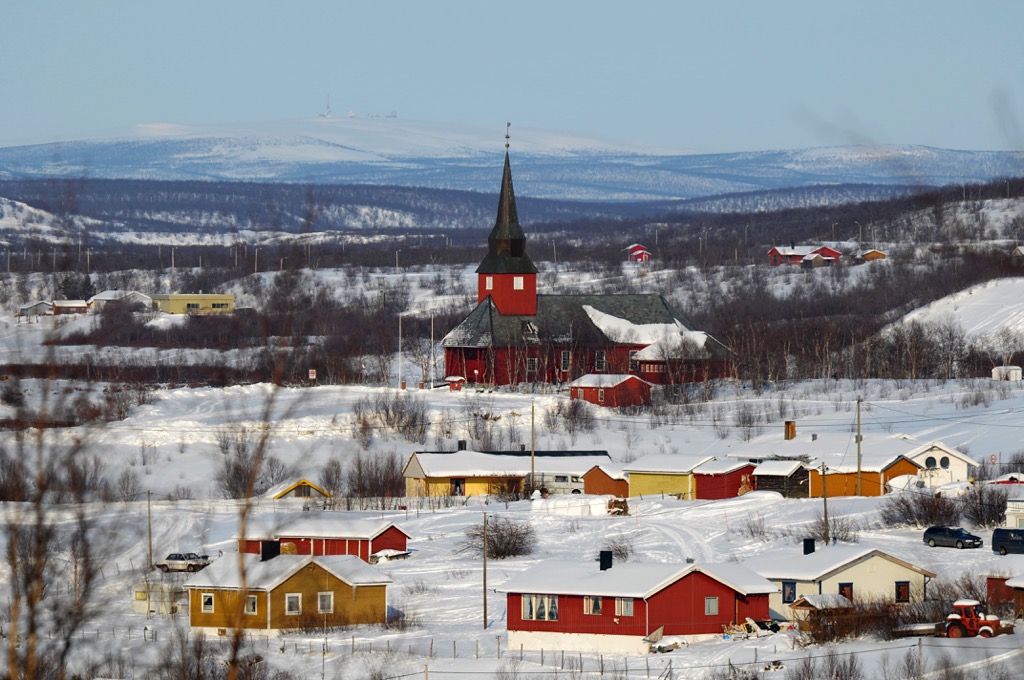
The village of Kautokeino is the closest established village to the national park. Situated along the banks of the Kautokeinoelva river, and home to around 1,500 residents, Kautokeino also features a small airport.
The Sami University College also lies within the city while the European route E45 runs through it. Though the village is quite small, it offers the closest access for those wishing to explore the national park.
The closest city to the national park is Alta, which acts as the municipality center for the Troms og Finnmark county. Situated along the southern end of the Altafjorden, along the mouth of the river Altaelva, the city is home to around 15,000 residents.
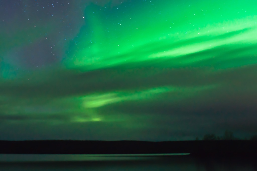
Referred to as the “northern lights city”, Alta is home to the Sorrisniva Igloo Hotel, Northern Lights Cathedral, and the Alta Museum. Tourists can enjoy viewing the northern lights, hiking the fjords, or exploring the plateau on a dog sledding tour.
Just a four hours drive north of Alta lies the northern cape, which marks the most northern point in mainland Europe.