Scan the QR code and open PeakVisor on your phone
Børgefjell National Park (Norwegian: Børgefjell nasjonalpark, Southern Sami: Byrkije vaarjelimmiedajve) is a remote and rugged national park situated in north central Norway. The park is known for being home to a population of the rare Arctic fox. There are 114 named peaks with the tallest and most prominent being Kvigtinden.
Børgefjell National Park spans across north central Norway, along the country’s border with Sweden. The expansive park consists of various different landscapes and is rarely visited by tourists.
The national park spans 1,447 sq. km (559 sq. miles) across central Norway in the counties of Nordland and Trøndelag. Rugged and remote terrain defines much of the region. Børgefjell can be divided into four distinct geographic regions; the western mountains, the eastern mountains, the high plateaus, and the southern mountains.
The peaks in the western region of the park feature dramatic changes in elevation along with rugged cliffs, ridgelines, and peaks. Here the valleys are quite narrow as the rivers cut through the landscape.
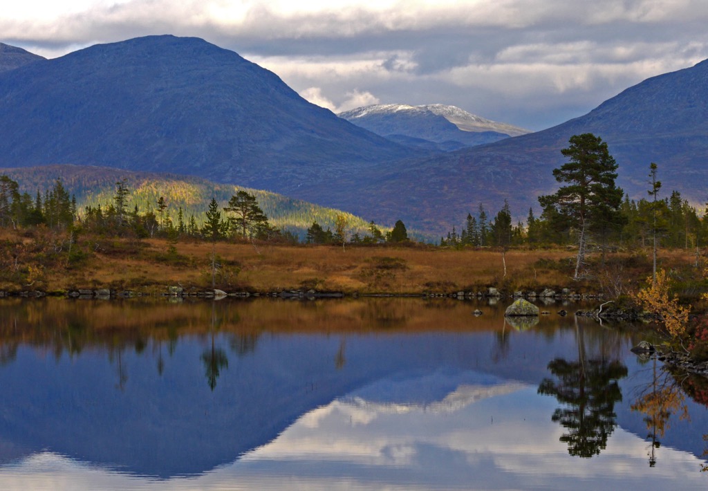
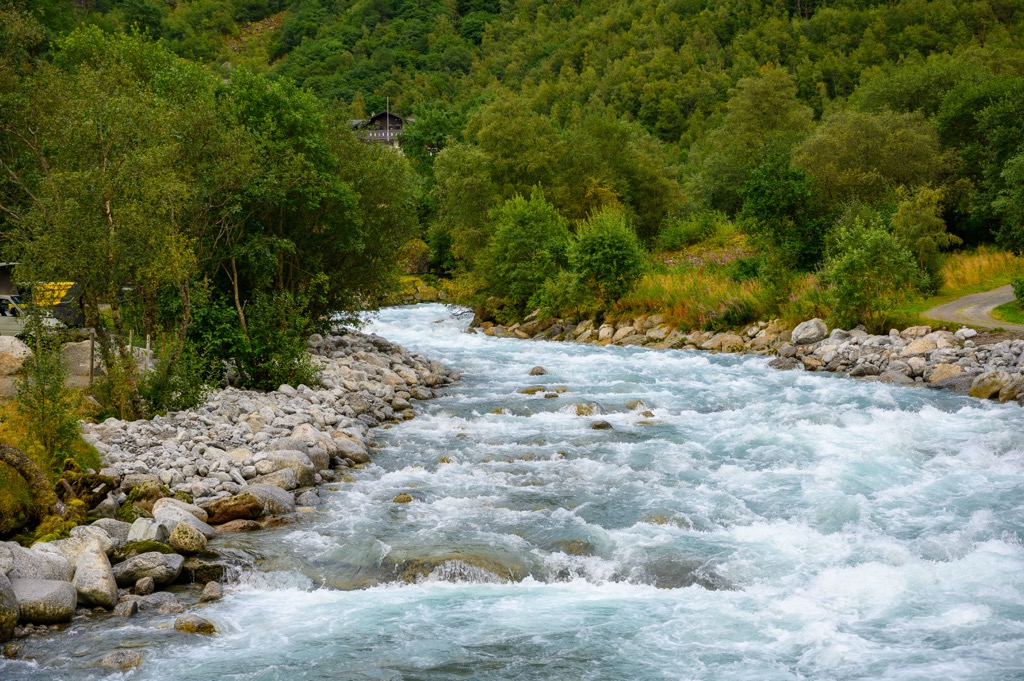
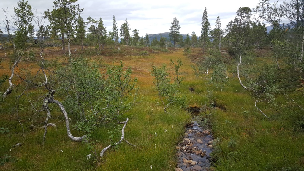
In the eastern stretches of the park lie more gentle slopes, featuring gradual changes in elevation gain. Here the landscape is characterized by long lakes, slow moving rivers, and sweeping wide valleys.
In between these two mountain ranges lie the high plateaus in the center of the park. This region spans from the valley of Susendalen to the valley of Virmadalen. South of the valley of Orvassdalen lies the southern mountains of the park, a smaller region compared to the mountains in the west and east.
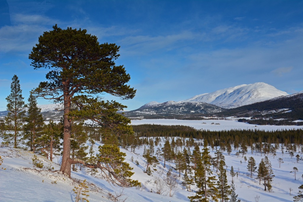
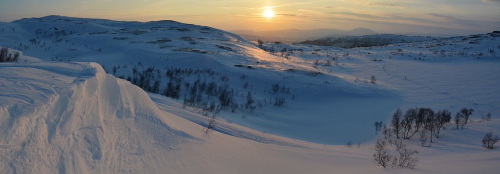
The mountains in the west feature minimal amounts of flora and are often covered in scree fields. The plateaus and eastern mountains feature rolling meadows and grassy hills. Despite the relatively large size of the park, there are virtually no established trails throughout, leaving the beauty of the region relatively untouched.
Additionally, Børgefjell National Park is surrounded by other popular outdoor recreation areas. In the west lies Lomsdal-Visten National Park while Bakomsmitt Nature Reserve and Indre Pantdalen Nature Reserve lie directly north. Blåfjella–Skjækerfjella National Park and Lierne National Park are situated to the south while Skåarnja Nature Reserve lies directly east in Sweden.
The peaks found within the park are part of the larger Scandinavian Mountains which extend throughout Norway, Sweden and part of northern Finland.
This entire range began forming during the Caledonian orogeny, a major mountain building event that took place roughly 490-390 million years ago. Tectonic shifts led to the collision of the continents and terraces of Laurentia, Avalonia, and Baltica.
Baltica and Laurentia collided with one another during the Scandian phase of the Caledonian orogeny, forming the base of the Scandinavian Mountains around 420 to 505 million years ago. These peaks were thrust upwards during the Mesozoic era and again during the Oligocene.
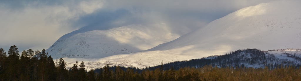
During the last ice age the entire region was covered in glaciers. As the glaciers began retreating, their pressure was much stronger in the west, leaving behind more dramatic changes in elevation compared to the sweeping valleys of the east.
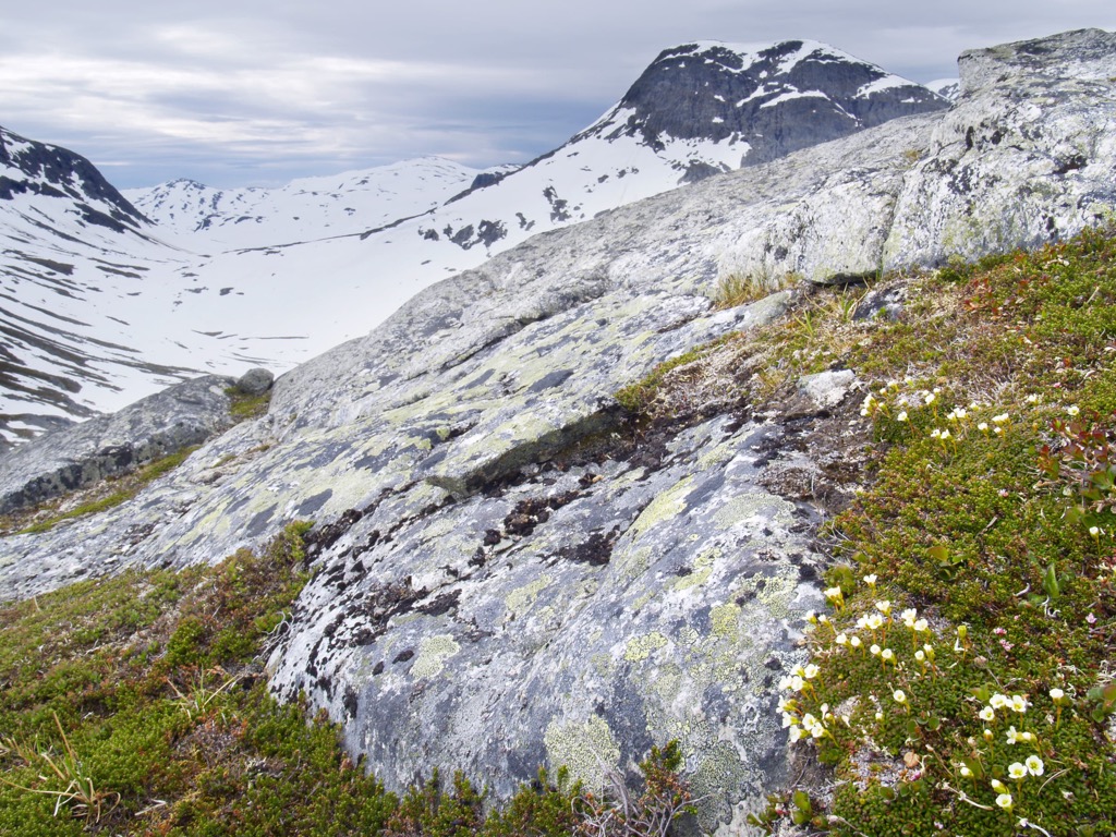
Present-day Norway was once a relatively flat landscape, as seen by the rolling hills on the eastern portion of the park. The terrain in the west showcases how much of the land was eroded by glacial retreating and pressure from the waterways of the region.
The peaks in the park primarily consist of dark granite, visible amidst the jagged ridgelines. The tallest peaks in the park feature dark Børgefjell granite which give the park its rather dark appearance.
Major peaks within Børgefjell National Park include Kvigtinden, Loypskardtinden, Jetnamsklumpen, Nursfjellet, and Rørskardtinden.
The varied terrain throughout the park, along with minimal amounts of human interaction, allow for a variety of both flora and fauna to thrive in the region.
Børgefjell National Park is best known for being home to a population of the rare Arctic Fox, which is part of the park’s logo. Despite the protection in the park, the fox is still threatened and struggling to increase its population.
Other common animals in the park include wolverine, lynx, brown bear, least weasel, pine marten, and red fox. Both willow and rock ptarmigan live in the park along with the snowy owl, golden eagle, and rough-legged buzzard.
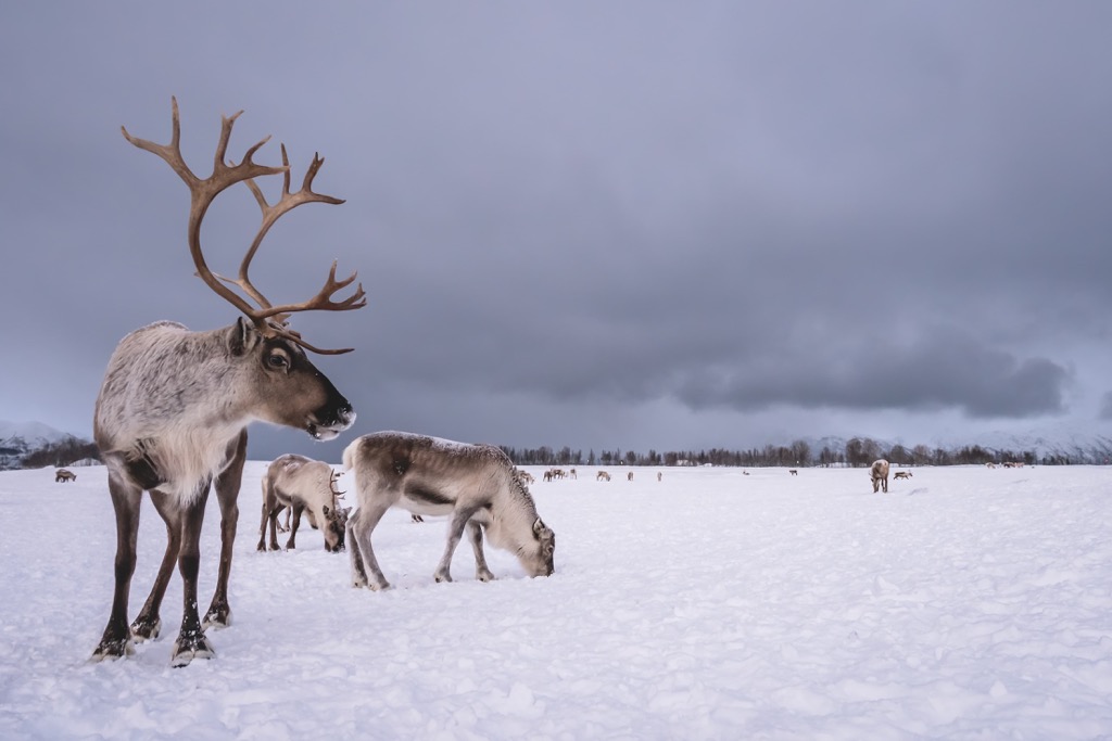
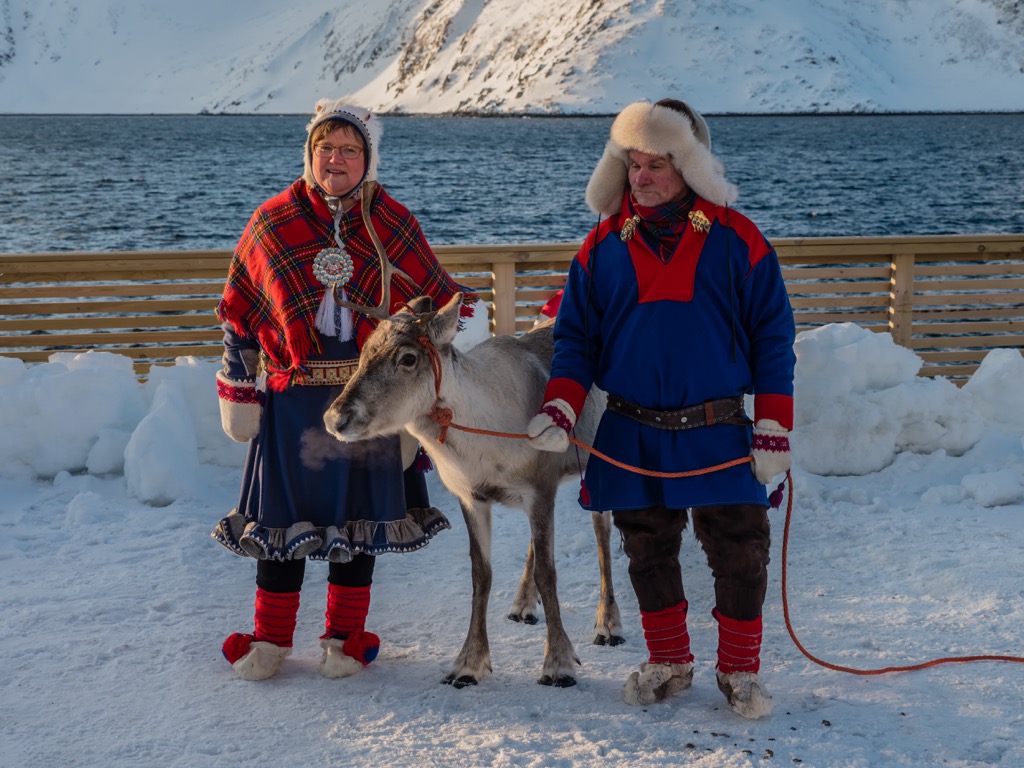
The park is also used for grazing purposes for domestic reindeer. The reindeer graze in northern stretches of the park throughout the year and the other sections of the park during the summer months.
The treeline in the park lies around 500-600 m (1,640-1,970 ft) with a majority of the forested landscape consisting of birch, pine, and spruce trees. Low growing grasses, wildflowers, and shrubs can be found throughout the eastern stretches of the park while the tallest peaks are free of flora.
The land within and surrounding Børgefjell National Park has been inhabited by humans for thousands of years. This region marks part of the traditional territory of the Sami people (also spelled Sámi or Saami). Within the park boundaries lie important cultural monuments and remnants of ancient settlements and hunting grounds.
Both the Sami people and the Norse/Scandinavian people have lived in parts of present-day Norway, Sweden, and Finland for thousands of years. For many centuries the two groups often had little interaction with one another.
While the Sami people lived in northern and central Norway, the Norse people tended to live along the southern west coast of the country. The Sami would hunt reindeer and fish in the various lakes and fjords while the Norse people established commerce and trading routes with other parts of Europe.
For over 500 years the Sami people have kept reindeer in parts of the park. Up until the beginning of the twentieth century the Sami people controlled all of the land within Børgefjell National Park.
During the eighteenth and nineteenth centuries, the Norse people began to aggressively assert land claims in central and northern Norway. These claims and attacks ultimately led to the Sami people being forced to attend Norse schools and adopt a new way of life, threatening their traditional belief systems and practices.
Populations in the region began to steadily grow as farming towns were established. To this day the region holds important cultural ties for the Sami people. In order to protect the ecosystems, and the threatened animals of the region, the park was established in 1963.
The park was later expanded in 1973 and 2003 to its current size. Despite the stunning landscape of the region, the park receives far less visitors than other nearby national parks. Those visiting are likely to spot a plethora of wildlife and little to no other humans.
Børgefjell National Park is home to virtually no established hiking trails. Those visiting the region must be equipped to navigate throughout the wilderness. While a majority of national parks in Norway have established huts, Børgefjell National Park only has a few within its boundaries.
All of the huts are situated on the outskirts of the park, available for those wishing to stay in a more protective shelter. Though having no established trails might make hiking slightly more difficult, those trekking through the wilderness are unlikely to encounter many other humans. A popular hut to stay in is Simskardhytta. The gentle route is 3.2 km (2 miles) to reach the hut with around 122 m (400 ft) of elevation gain. The route acts as a great starting point for those wishing to explore the western region of the park.
From the isolated village of Røyrvik, hikers can take a boat charter on Namsvatnet Lake to reach the Storforsen trailhead. From here a rough route climbs gently before reaching a series of glacial lakes. Once at the lakes visitors can enjoy fishing for arctic char and trout.
Looking for a place to stay near the Børgefjell National Park? Here are some of the best cities and villages to check out in the region:
The closest town north of the national park is Mosjøen, situated in Norland county. Mosjøen marks the oldest town in the entire Helgeland region and today has a population of just under 10,000 residents.
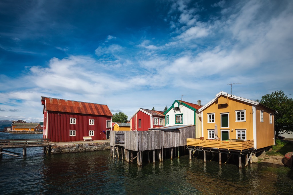
Situated in the Vefsn Valley, Mosjøen lies where the Skjerva and Vefsna rivers flow into the Vefsnfjord. Besides being surrounded by stunning landscape and ample hiking spots, other popular sites in Mosjøen include the Fru Haugans Hotel, Dolstad church, and Sjøgata.
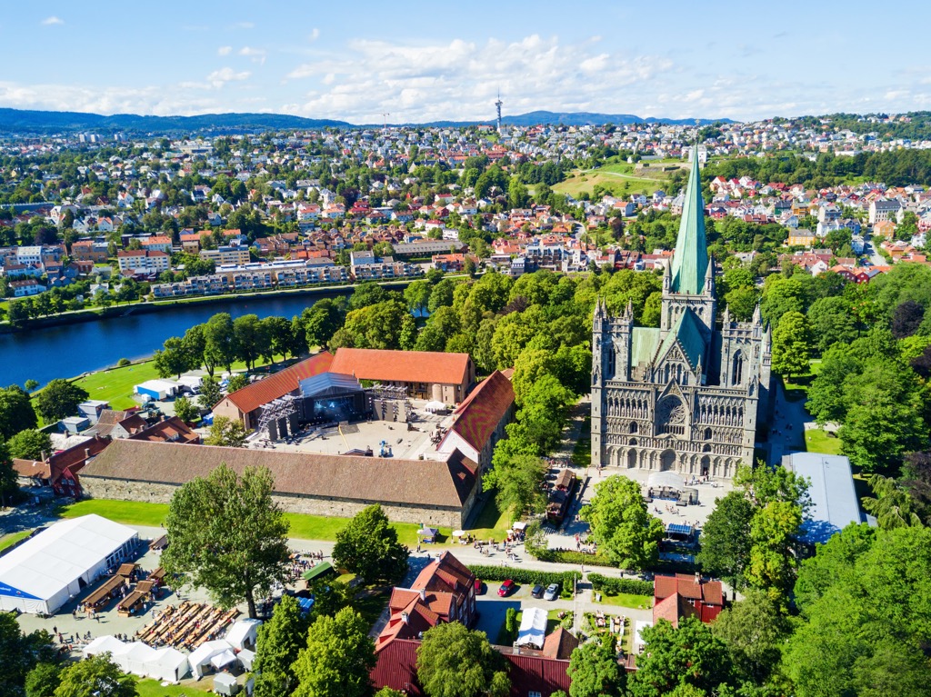
The closest major city to the national park is Trondheim, situated approximately a four hour drive to the south. The city is home to around 205,000 residents and is the third most populous city in the country. Trondheim’s history dates back to the first century CE and was established as the capital during the Viking Age.
Trondheim is the closest major city to many of the national parks in the region that extend throughout central Norway. The Nidaros Domkirke lies within the city limits, marking the world’s most northerly medieval building. The building is also constructed upon the grave of Saint Olav.
Other tourist sites in Trondheim include Mounkholmen (Mon’s Island), Gamle Bybro, Archbishop’s Residence, and the Folk Museum. Visitors can also enjoy multiple spots that feature traditional cuisine and art of the region’s history.