Scan the QR code and open PeakVisor on your phone
Blåfjella–Skjækerfjella National Park (Norwegian: Blåfjella-Skjækerfjella nasjonalpark, Southern Sami: Låarte-Skæhkere vaarjelimmiedajve) is situated in central Norway. The park marks the third largest national park in the country. The tallest and most prominent peak in the park is Midtiklumpen at 1,333 m (4,373 ft) tall with 823 m (2,700 ft) of prominence.
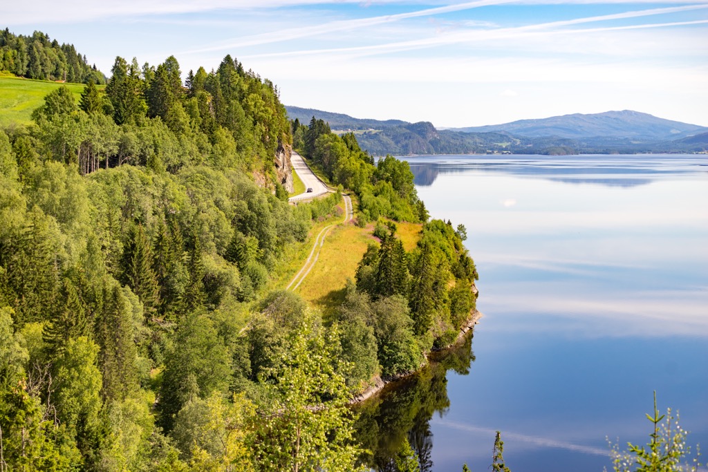
Blåfjella–Skjækerfjella National Park spans across central Norway along the country’s border with Sweden. The park features less dramatic changes in elevation compared to the fjords along the west coast of the country.
Spanning 1,924 sq. km (743 sq. miles), Blåfjella–Skjækerfjella National Park marks the third largest national park on the mainland of Norway. The park covers land in Trøndelag county in the municipalities of Verdal, Snåsa, Grong, Lierne, and Steinkjer.
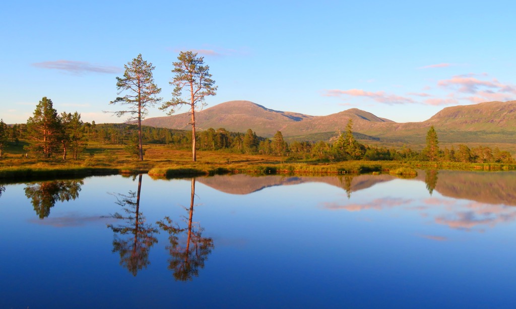
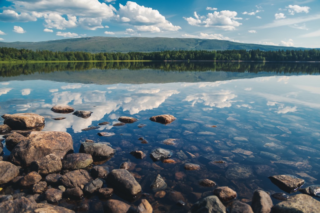
Terrain in the park is characterized by sweeping mountain plains interspersed with a multitude of lakes and rounded mountain peaks. Elevation changes in the park are far less dramatic than those found west of the national park.
Lower elevations are marked by forested valleys that thin as elevations increase. The high amounts of rainfall in the region have led to marshes forming throughout the park. A majority of the peaks are free of trees offering hikers sweeping views.
Several peaks reach about 1,000 m (3,281 ft) with rolling mountain terrain being found throughout. There are multiple cultural monuments of the Sami people found throughout the park including burial sites, settlements, and gathering places.
Additionally, Blåfjella–Skjækerfjella National Park is surrounded by other popular outdoor recreation areas. The Markesfloen Nature Reserve and Lierne National park lie to the east while Hogmannen Nature Reserve is to the west and Skarvan og Roltdalen National Park is to the southwest.
The peaks found within and surrounding Blåfjella–Skjækerfjella National Park are part of the greater Scandinavian Mountains. This range spans across Norway, Sweden, and northern Finland.
Prior to the formation of these peaks, a shallow sea once covered the region around 500 to 600 million years ago. During the Caledonian orogeny tectonic shifts led to the collision of Laurentia, Avalonia, and Baltica which closed off the Iapetus Ocean.
During the Scandian phase of the Caledonian orogeny, the tectonic collision formed the base of the Scandinavian Mountains, around 420 to 505 million years ago. The landscape was thrust upwards during both the Mesozoic era and the Oligocene.
Ice ages during the Quaternary period carved out much of the landscape visible today. The pressure from glaciers was much stronger in the west, resulting in the more dramatic changes in elevation along Norway’s west coast. The valleys in the park experienced less pressure from glacial retreating, leaving behind the gradual sweeping valleys and rounded slopes.
A majority of the bedrock in the park is Caledonian rock. Glacial retreating has revealed Precambrian rock underneath the Caledonian rocks.
Major peaks within the Blåfjella–Skjækerfjella National Park are Midtiklumpen, Skjækerhatten, Blafjellshatten, Vestre Brandsfjell, and Fossdalsfjellet.
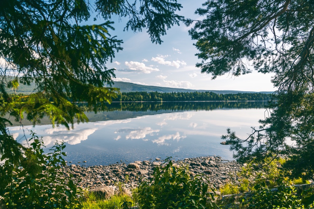
The Blåfjella–Skjækerfjella National Park is thought to be the first place where spruce trees were introduced in present-day Norway. The lower elevations feature sections of old-growth forested valleys.
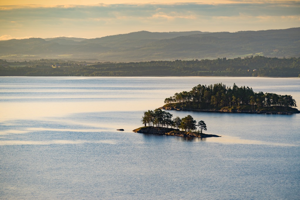
The relatively close proximity to the ocean has enabled both coastal species and inland species of flora to thrive. Higher peaks include low growing shrubs, grasses, and lichen. The type of bedrock drastically affects the type of plants likely to grow in different regions of the park.
Reindeer inhabit parts of the park, which features two distinct reindeer grazing districts. Other mammals include the Arctic fox, lynx, gray wolf, wolverines, roe deer, moose, and red deer. Grouse and forest birds live throughout the park and are occasionally used for hunting.
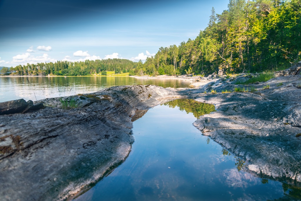
Waterways of the park often feature species of trout and char. Within the park lie four nature reserves aimed at protecting the fauna of the region; Arvasslia Nature Reserve, Berglimyra and Klumplifjellet Nature Reserve, Gaundalsmyra Nature Reserve, and Storfloa Nature Reserve.
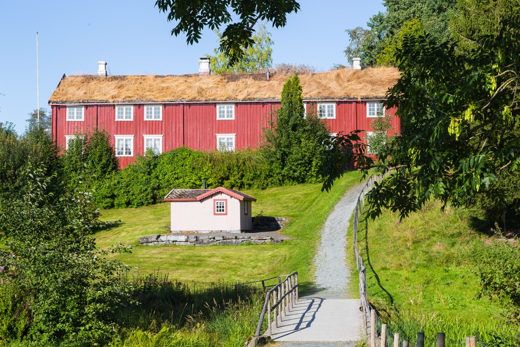
The land within and surrounding Blåfjella–Skjækerfjella National Park has been inhabited by humans for thousands of years. The land marks part of the traditional territory of the Sami people (also spelled Sámi or Saami). Remnants of ancient settlements, hunting grounds, gathering sites, and burial grounds can all be found within the national park.
For around 3,500 years, the Sami people and the Norse/Scandinavian people have both lived in parts of present-day Norway, Sweden, and Finland. For centuries the two groups had little interaction with one another.
A portion of the Pilgrim Path lies near the park and dates back to 1030 CE. After the fall of St. Olva at Stiklestad, pilgrims began to make a religious trek in search of the shrine of St. Olva. Following the introduction of Reformation in 1537 the pilgrim pursuits ended.
Historically the Sami people would hunt reindeer and fish throughout northern Norway. The Norse people tended to live along the western coast of Norway, establishing commerce and trading routes with other parts of Europe.
During the eighteenth and nineteenth centuries, the Norse people began to aggressively assert their claims throughout northern Norway and northern Sweden. The Sami people were forced to attend Norse schools and adopt their way of beliefs, threatening their traditional way of life and belief systems.
To this day, the land within the national park has experienced minimal amounts of human interaction. The land holds cultural importance for the Sami people as seen through the numerous cultural sites, burial grounds, and settlements throughout.
The Gressåmoen National Park was originally created in the region in 1970 and spanned 182 sq. km (70 sq. miles). In 2004 the park was expanded to become Blåfjella–Skjækerfjella National Park. Today there are minimal trails found throughout the national park.
Blåfjella–Skjækerfjella National Park is home to minimal amounts of hiking trails. Here are a few routes to check out on your next visit to the park:
While there are only a few established trails in the park, visitors should take time to visit the National Park Monument Stone. The trail winds steadily above the treeline, offering sweeping views throughout.
Hikers are likely to see reindeer roaming along the hillsides throughout the year. The out and back trail is 6 km (3.7 miles) in length and culminates at a large rock, marking the edge of the national park.
Hikers begin along the edge of Blåfjella–Skjækerfjella National Park. Low growing shrubs are interspersed with occasional trees while hikers have views of the rolling hills that define the national park.
Hikers follow the trail towards Lakavatnet via Lakavasshytta, followed by walking to the boathouse of Fjellstyrene i Lierne. Those wishing to fish at the lake must first acquire a fishing permit. Round trip the route is 6.5 km (4 miles) long with minimal amounts of elevation gain.
This challenging and unmarked path takes visitors into the heart of the national park, reaching some of the most stunning beauty found in the region. The loop route takes hikers to Goegkemesspielte, Midtiklumpen/Åakerebahke, Blåfjellhatten/Leastehke and Blåfjellet.
Those completing this loop should have extensive experience on navigating the backcountry. The route often takes 2-3 days of backpacking and maps, a compass, and clear weather are required in order to complete the route.
Looking for a place to stay near the Blåfjella–Skjækerfjella National Park? Here are some of the best cities and villages to check out in the region:
The town of Steinkjer lies west of the national park, at the head of the Biestad Fjord. Situated along the mouth of the By River, the port town is surrounded by agricultural neighborhoods. Steinkjerevla divides the town into two distinct neighborhoods; Nordisa and Sørsia.
The municipality population is around 20,600 residents. The Nordlandsbanen railway runs through the town along with the E6 route. Tourist attractions in the region include the historic burial sites to the east, Steinkjer Church Egge Church, and salmon fishing.
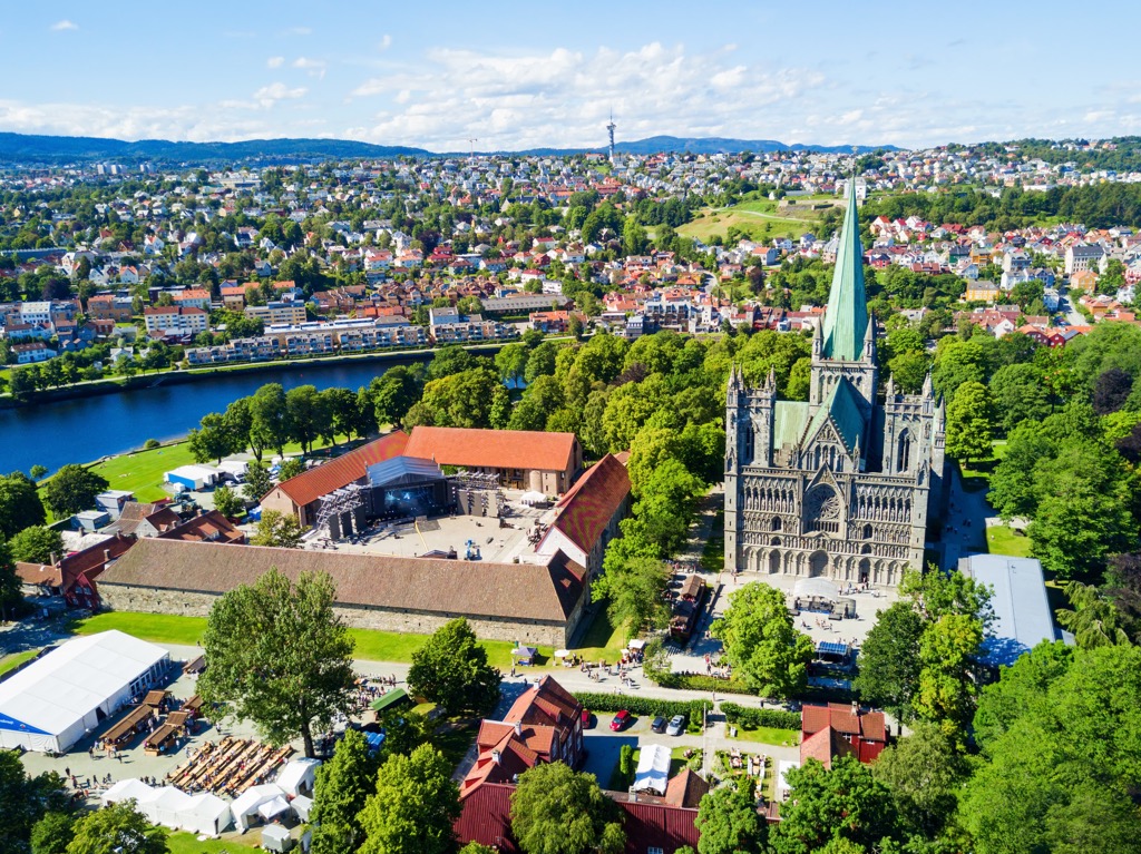
Trondheim marks the closest major city to the national park. Home to around 205,000 residents, Trondheim marks the third most populated city in the country. Originally established in the first century, the city once served as the capital during the Viking Age.
Despite the city’s relatively large size, Trondheim offers close proximity to a multitude of national parks in the region. The Nidaros Domkirke lies in the city and marks the world’s most northerly medieval building, built upon the grave of Saint Olav.
Other sites to see in the city include the Archbishop’s Residence, Folk Museum, Mounkholmen (Mon’s Island), Gamle Bybro, and a plethora of spots featuring traditional cuisine and arts. Trondheim offers a look into Norway’s history with less hustle and bustle compared to the capital city of Oslo.