Scan the QR code and open PeakVisor on your phone
Sjunkhatten National Park (Norwegian: Sjunkhatten nasjonalpark, Sami: Dávga) is a stunning national park situated along the west coast of central Norway. The park features stunning fjords and lakes throughout its terrain. There are 164 named peaks with the tallest and most prominent being Sjunkhatten at 1,186 m (3,891 ft) tall with 1,149 m (3,770 ft) of prominence.
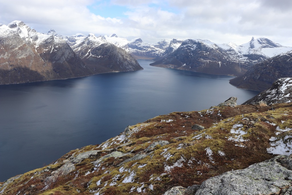
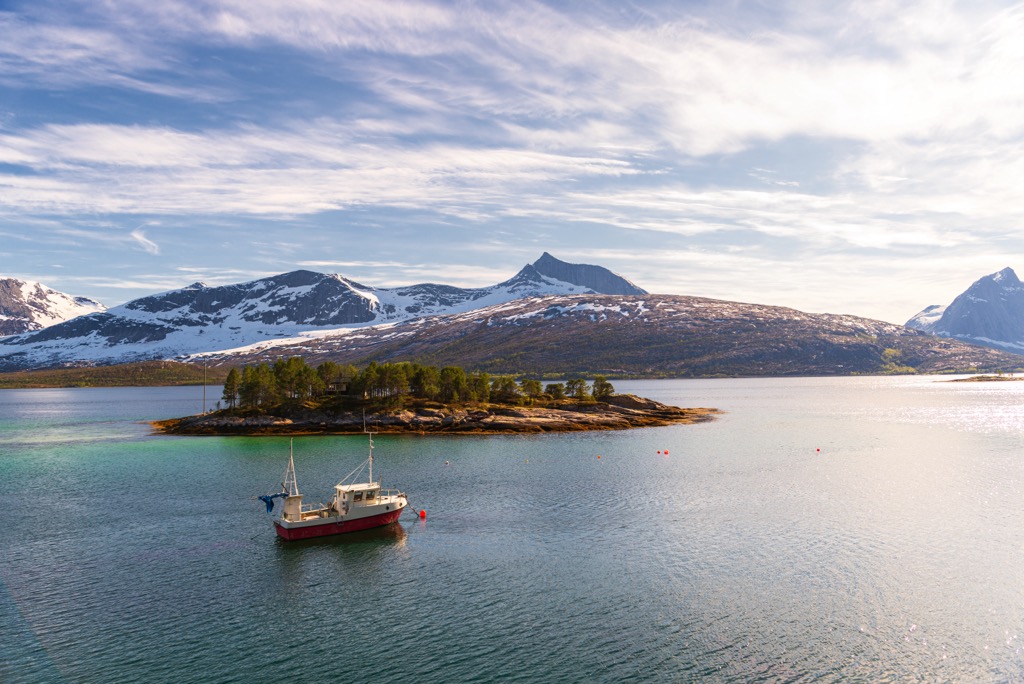
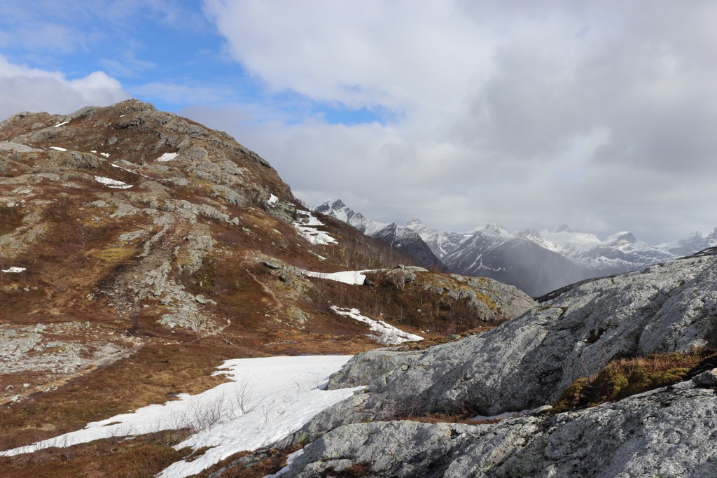
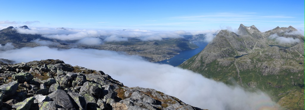
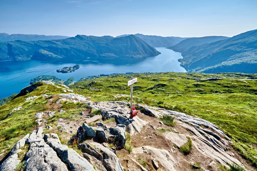
Sjunkhatten National Park lies along the west coast of central Norway. The park encompasses fjords along the coast which rise steeply into the rugged mountains and ridgelines of the region.
The national park spans 417 square kilometers (161 square miles) throughout Nordland county. Around 50% of the young people of Nordland county live close to the park, which is why it has been given the nickname of ‘the children’s national park’.
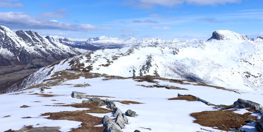
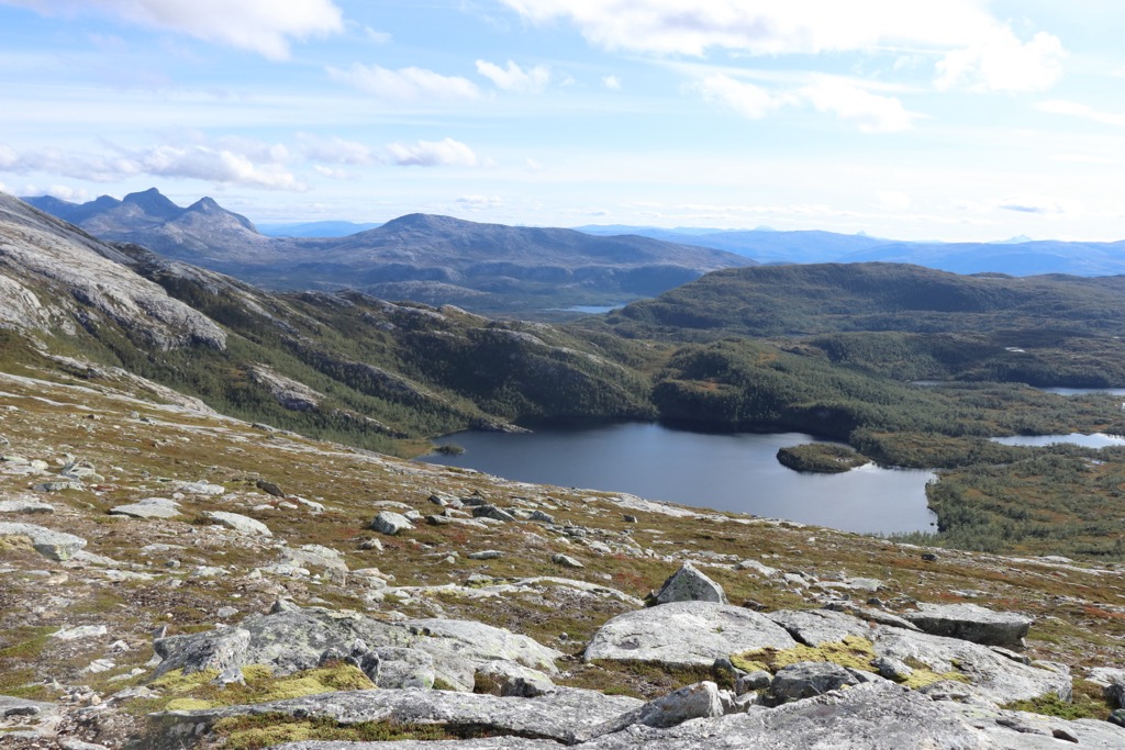
Deep fjords and narrow valleys mark the western stretches of the park. These famous natural features continue to rise steeply up to the jagged peaks of rocky terrain. Amidst the mountainous landscape lie some rounded mountains along with sweeping forested valleys.
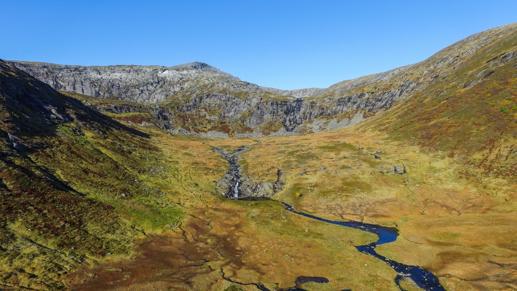
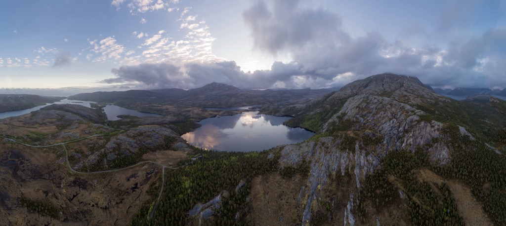
Wetland areas can be found throughout the park along with other coastal terrain. Despite the park’s close proximity to the cities and villages in the region, much of the landscape has been left relatively untouched.
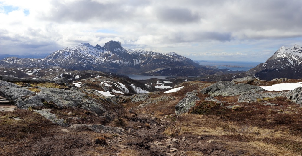
The more gentle slopes in the park allow visitors to hike during the summer and ski during the winter. Many of the tallest peaks are quite rugged and require climbing gear and extensive knowledge in order to reach the summit.
The city of Bodø lies just southwest of the park while smaller communities surround the park’s boundaries. The varied and steep terrain makes accessing some of the fjords by foot quite difficult. Visitors can visit Røsvik in the north and Kjerringøy in the west in order to view the fjords by boat.
Amidst the dramatic fjords and mountains lies numerous rivers, streams, and lakes. Some of the major lakes in the park include Heggmovatnet, Steigtindvatnet, and Sørskardvatnet.
Additionally, Sjunkhatten National Park is surrounded by other popular outdoor recreation areas. Saltfjellet-Svartisen National Park lies to the south while Junkerdal National Park is situated to the southeast. The small Rago National Park lies to the east, situated along the country’s border with Sweden.
The peaks found within the park are part of the Scandinavian Mountains. This massive range spans throughout much of Norway, Sweden and part of northern Finland.
Geologists believe that the Scandinavian Mountains began forming around 400 million years ago, during the Caledonian orogeny. During this time many other ranges were formed throughout northern Europe and parts of North America.
In the Scandian phase of the Caledonian orogeny, the continents and terraces of Baltica and Laurentia collided with one another. This tectonic shifting and collision helped form the base for the Scandinavian Mountains.
These peaks were uplifted during the Mesozoic era and again during the Oligocene. Rocks found in the park are much older than the mountain range itself, dating back as early as 2.7 billion years ago. Quartzite and granite are common throughout the national park.
During the last major glaciation, much of Norway was covered in vast glaciers. As the glaciers began retreating they slowly carved out the dramatic landscape that defines the park and much of western Norway.
The fjords were formed as the glaciers were pulled towards the ocean. This immense pressure led to the dramatic changes in elevation that are visible today. Pressure from glacial retreating was far less in the east, which led to the more gradual changes in elevation throughout eastern Norway.
Major peaks within Sjunkhatten National Park include Sjunkhatten, Steigtinden, Fagertinden, Osatinden, and Fjellryggen.
There is not a great deal of fauna found in the park due to the close proximity to villages and the sweeping regions of flora free terrain.
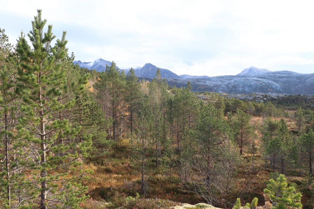
Some of the lower elevations in the park are covered by dense forested hillsides which quickly give way to low growing grasses, shrubs, and seasonal wild flowers. Pine, spruce, and birch trees are common in the forested patches of the park.
Some of the larger mammals found in the park include reindeer and sheep, which both use the national park lands for grazing. A majority of the fauna in the park are birds with the most common species being sea eagles.
The land within and surrounding Sjunkhatten National Park marks part of the Sápmi, the traditional territory of the Sami people (also spelled Sámi or Saami). Since time immemorial the Sami people have been using the surrounding region for reindeer herding.
It is estimated that the Sami people have lived throughout the Nordland region for over 2,000 years. Their traditional territory spanned across northern Norway, using the coastal lands for fishing and the inland mountains for hunting.
The Norse/Scandinavian people have also inhabited parts of present-day Norway for thousands of years. These people traditionally lived in southern Norway with established fishing and trade routes throughout other parts of Europe. Present day Nordland county was part of the kingdom of Hålogaland during the Viking era.
Despite their close proximity to one another, the Sami and Norse had relatively little interaction with one another. The nearby town of Bodø was a common ground for the two groups, offering a place to trade, interact, and build relationships.
During the nineteenth century, the Norse people began to aggressively assert land claims throughout central and northern Norway, establishing villages along the way. Despite resistance, the Norse population began forcing Sami people to attend Norse schools.
These schools threatened the Sami traditional way of life and beliefs system by forcing them to assimilate with Norse customs. In 1816 nearby Bodø was granted township status and later became a municipality in 1838.
Nearby villages continued to grow in the following decades as mountains in the east were deemed rich in minerals and rocks such as ore and marble. Following the fall of many of the major mining companies, much of the surrounding terrain began being established as national parks and protected areas.
The region became protected in 2009 and was established as a national park in 2010 in order to protect the wilderness region and help preserve rare animal species.
Sjunkhatten National Park is home to numerous trails for hiking and outdoor recreation. Here are some of the most popular trails in the region:
Sørfjorden is one of the most popular hiking trails in the national park. The route begins along the southern edge of the park before descending past a series of lakes. The trail passes through the sweeping valleys of the region before reaching the edge of the Sørfjorden.
In the distance hikers can see where the Sørfjorden meets the Mistfjorden and the Nordfjorden. This out and back route is 9 km (5.7 miles) in length and features 129 m (423 ft) of total elevation gain.
Finnkonnakeen lies along the western edge of the national park, along the Mistfjorden. The trail climbs steadily throughout, passing the forested landscape before reaching the sweeping views from the summit.
Once at the summit hikers can enjoy the Finnkonnakeen rock outcrop along with panoramic views of the Norwegian Sea, fjords, and rugged mountains. The out and back trail is 8.2 km (5.1 miles) in length and features 467 m (1,532 ft) of total elevation gain.
The trail to the summit of Heggmotinden begins in the same parking lot as the Sørfjorden trail. This route begins gradually in the pine forests, before climbing up to the rocky slopes that define the higher elevations in the region.
Once at the rocky summit hikers have views of Vestfjord, Kjærringøy and the rest of Sjunkhatten National Park. This out and back trail is 8.2 km (5.1 miles) in length and features 739 m (2,424 ft) of total elevation gain.
Looking for a place to stay near the Sjunkhatten National Park? Here are some of the best cities and villages to check out in the region:
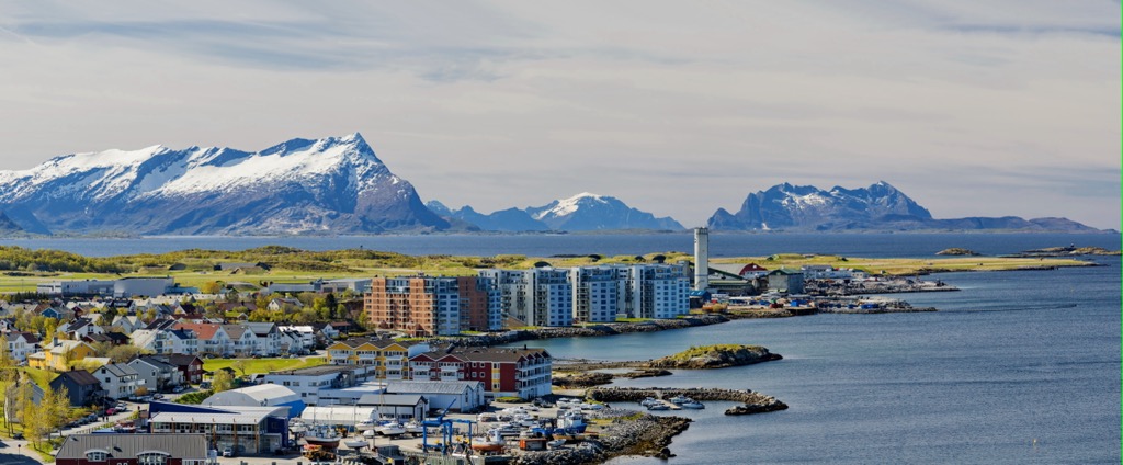
Bodø lies just southwest of the national park and marks the closest city. Home to around 56,00 residents it marks the second most populous city in northern Norway. Situated along Bodø peninsula between the Saltfjorden and the Vestfjorden, Bodø is home to an airport, major boat terminal, and a train station.
The city of Bodø lies just above the Arctic circle and is walking distance from the national park. The surrounding landscape is marked by deep fjords, rolling countryside and calm sandy beaches. Some popular sites within the town include Bodin Church, Bodø Cathedral, and the Kjerringøy trading post, which marks the best preserved trading post in the country.
The Saltstraumen maelstrom lies just off the shores Bodø. This massive whirlpool spans ten meters (33 ft) across, marking the world's largest maelstrom.
The town of Fauske lies just southeast of the national park along the Skjerstadfjorden, 60 kilometers (37 miles) east of Bodø. The southern side of the town is marked by lake Nervatnet which flows into the nearby fjord.
Fauske is home to around 6,500 residents and also lies in close proximity to Rago National Park and Saltfjellet-Svartisen National Park. Besides hiking through the surrounding nature, visitors can also enjoy kayaking and canoeing in the various waterways that surround the city.
During the winter months the town, along with nearby Bodø, are great spots for witnessing the northern lights. The summer months provide visitors with a chance to explore the region throughout the day as the midnight sun illuminates the sky.