Scan the QR code and open PeakVisor on your phone
Varangerhalvøya National Park (Norwegian: Varangerhalvøya nasjonalpark, Sami: Várnjárgga) is situated in Troms og Finnmark county in northeastern Norway. The park is defined by its vast and remote plateaus, a landscape formed before the last Ice Age. There are 72 named peaks in the park with the tallest and most prominent being Kjøltindan at 592 m (1,942 ft) tall with 353 m (1,158 ft) of prominence.
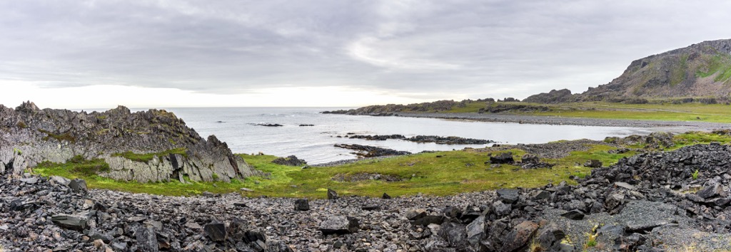
Varangerhalvøya National Park spans across Troms og Finnmark county in northeastern Norway. The entire park lies along the Varanger Peninsula (Norwegian: Varangerhalvøya). Situated along the Barents Sea, the Tanafjorden is to the west while the Varangerfjorden is to the south.
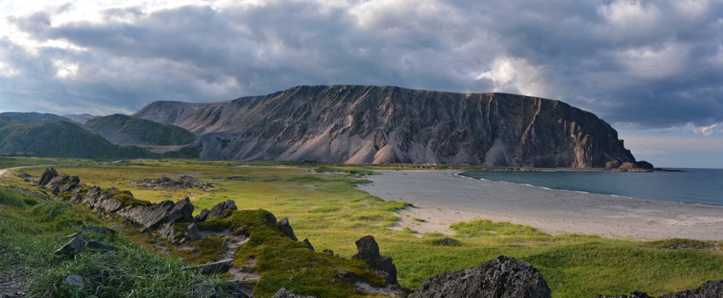
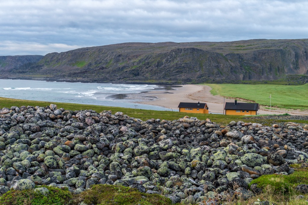
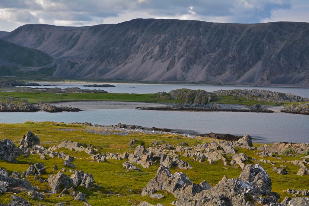
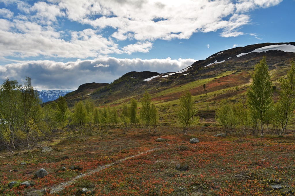
This national park spans 1,804 sq. km (697 sq. miles) all within the arctic circle. Here the landscape is similar to that found throughout the Arctic mainland. The expansive park features sweeping plateaus interspersed with bogs, valleys, waterfalls, and rivers.
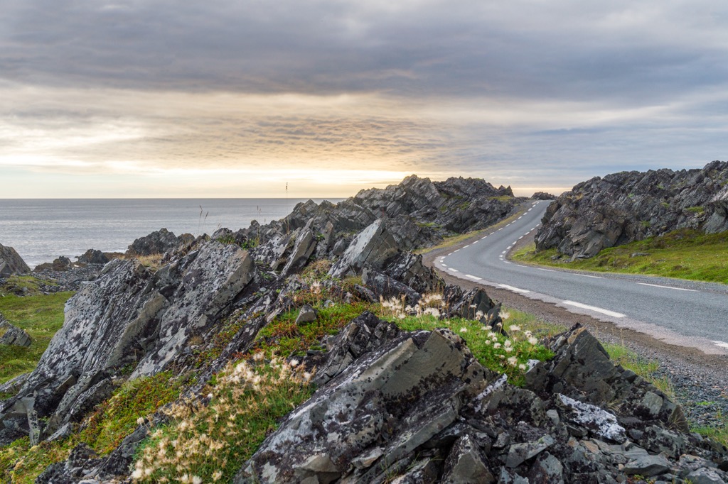
While there are no glaciers left in the region, the park features vast valleys and glacial cirques. Low growing plant life and rocky fields mark the plateaus on the peninsula while rocky cliffs can be found near the shoreline and within the steep canyons.
Elevations range from sea level up to the summit of Kjøltindan. Much of the region was once marked by an Arctic climate zone though rising temperatures has since classified it as alpine tundra.
The flora found in the park is similar to that found in other alpine tundra ecosystems. However, Varangerhalvøya National Park also acts as a safe haven for a wide variety of animal life including many endangered species.
South of the peninsula lies the countries of Finland and Russia with the park marking some of the easternmost land of Norway. Small sections of Russia that lie to the south actually lie further west than the park.
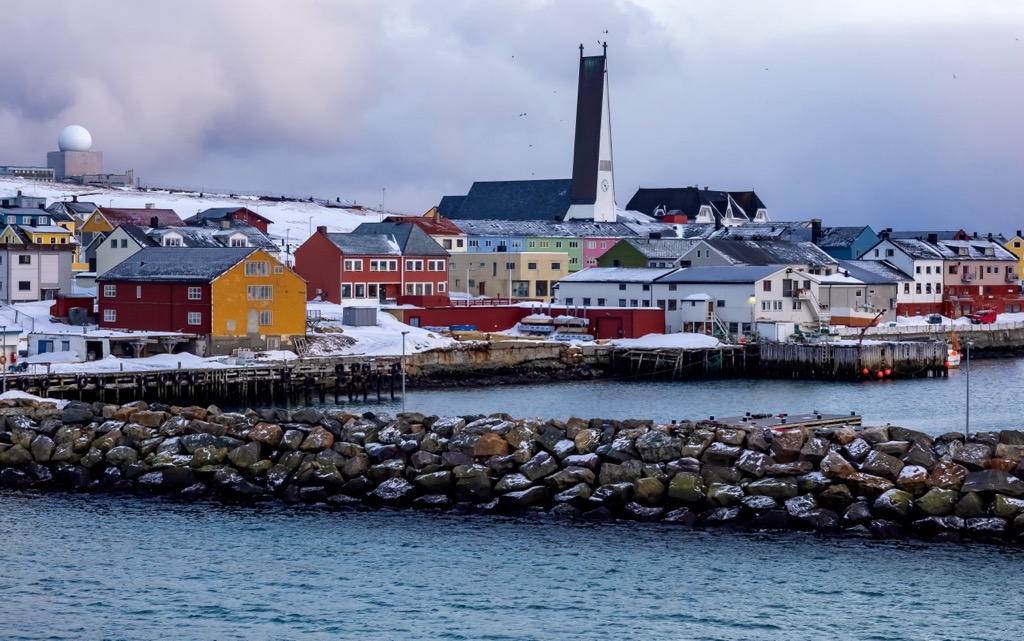
Despite being surrounded by other protected areas of land, Varangerhalvøya National Park is situated in an incredibly remote region of the country. The nearest town is Vadsø, a small community which lies along the southern shores of the Varanger Peninsula.
Additionally, Varangerhalvøya National Park is surrounded by other protected areas of land. Nearby protected areas include Syltefjorddalen Nature Reserve, Makkaurhalvøya Nature Reserve Barvikmyra, and Blodskytodden Nature Reserve among various others. The closest national park is Øvre Pasvik National Park which lies to the south.
The geological history of the region differs from much of the country. The vast majority of Norway has been created by the formation of the Scandinavian Mountains. This massive range spans throughout nearly all of Norway and extends into the countries of Sweden, and Finland.
The peaks, valleys, and terrain in Varangerhalvøya National Park is closely tied to the geological history of the Varanger Peninsula. Much of the base layer of Norway, extending into the park, began forming during the Caledonian orogeny, roughly 490 to 390 million years ago.
The base of the peaks, both within and surrounding the park, began forming during the Caledonian orogeny. This major mountain building period took place around 490 to 390 million years ago.
Widespread tectonic shifting led to the collision of Laurentia and Baltica. This collison helped force the Scandinavian Mountains upwards between 420 and 405 million years ago. The well-known fjords that lie west of the park were formed as large glaciers were being pulled towards the sea, leaving behind the dramatic changes in elevation.
The peninsula where the park lies was named after the Varangian glaciation which took place between 720 to 635 million years ago. Rock found in the region primarily consists of Neoproterozoic to Paleozoic sedimentary rocks.
Despite the relatively small size of the peninsula, the region has three distinct geological groups, separated by the Trollfjord-Komagelva strike-slip fault, Scandinavian Caledonides, and the Baltic Shield.
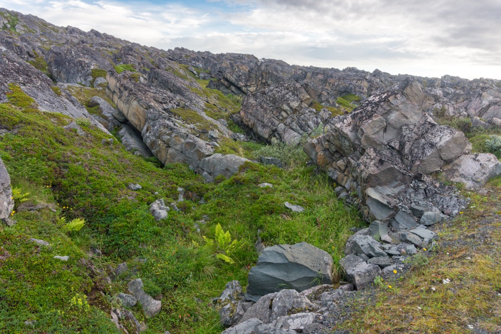
Common geological features within the park include molar tooth structures, flaser bedding, teepee structures, along with prominent cliffs and ridges. Notable rocks include glacial diamictite sedimentary rocks and barite crystals.
Major peaks within the Varangerhalvøya National Park include Kjøltindan, Ruitouccit, Juovkaidčærro, Steinelvdalfjellet, and Ravdulčåkka.
The remote location of the park allows for a plethora of animal species to thrive in the region. Minimal human contact in the region has led animals from the Arctic, Siberia, and Scandinavia to live together harmoniously.
This park is especially common amongst a variety of bird species. Visitors are likely to spot rough-legged buzzards, white-tailed eagles, and golden eagles.
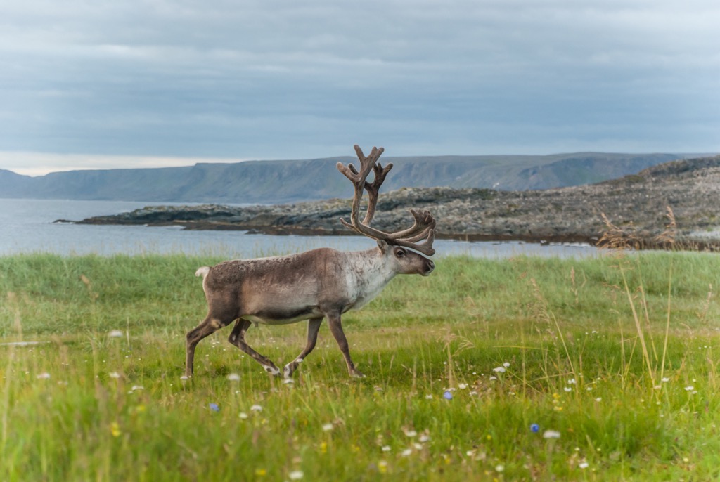
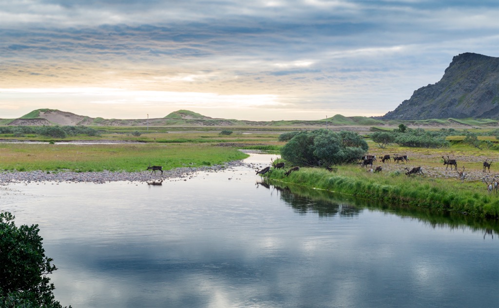
Some smaller bird species include shore larks, long-tailed skuas, red-necked phalaropes, and ruff dances. In the tundra sections of the park live populations of the Lapland bunting, snow bunting, and dotterel. Part of the park is also used for domestic reindeer herding.
The Arctic Fox is occasionally spotted throughout the park though they tend to be quite elusive creatures. Here the foxes breed both in the mountains and along the coast, with their fur turning white during the winter months.
The tundra region of the park is home to minimal plant life, primarily featuring scree fields and low growing grasses. Within the park lie some forested sections with willow and birch trees. Some of the more unique plant species include snow cinquefoil, Varanger poppy, and the field fleawort.
The land within and surrounding Varangerhalvøya National Park has been inhabited by humans for thousands of years. Ancient relics have been found on the peninsula, dating back to the Paleaeolithic.
Remnants of ancient dwellings suggest that communities lived in the mountains and down by the coasts. Other remnants include shooting positions and fences that were once used to herd the populations of wild reindeer.
The Sami people (also known as Saami and Sámi) have lived throughout present day northern Norway since time immemorial. Traditionally they were a seasonally nomadic people. During the summer months they lived further inland, often along rivers, and along the coast during the winter.
In the sixteenth century the settlement of Vadsø was situated along the southern edge of the peninsula. This fishing village steadily grew in size and was officially granted township status in 1833 leading to a rise of new settlers.
During the 1700s and 1800s, Kven people from northern Finland and Sweden began to immigrate to the area. By the eighteenth and nineteenth centuries, the Norse people had begun to start Nowergianization. This policy forced the Sami people, and later the Kven, to assimilate to the Norwegian way of life.
Nowergianization was less present near the park due to the remoteness of the region. Due to this assimilation the Sami people were forced to go against their traditional way of life including their system of beliefs.
During World War II, Vadsø was the sight of serveral air raids as the Soviet Union tried to bomb German troops occupying the region. While other areas in the region suffered greatly from the war, there are still some original wooden structures within the city center.
To protect the region, and provide a sanctuary for birds in the area, the national park was established in 2006. The area once marked the largest Arctic climate zone in mainland Norway but has transitioned into a boreal climate zone in recent years due to global warming.
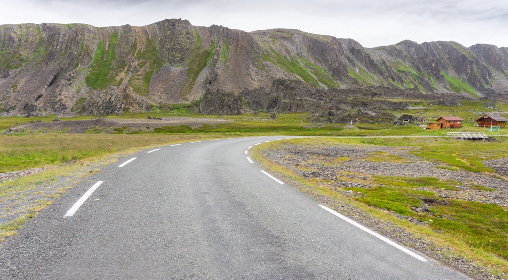
Varangerhalvøya National Park is home to remote and stunning scenery. There are minimal amounts of established trails as the region receives very few visitors. Those wishing to explore the area can do so throughout the year by hiking or skiing.
The relatively flat landscape makes traveling through the park quite easy despite the lack of trails. July to September is the best time to hike in the park while skiing can take place in the fall and spring. As the park lies within the Arctic Circle, there is little to no sunlight throughout the winter months.
The easiest way to access the park is through the Nattfjelldalen (Idjaávže in Sami) valley located in Vadsø, along the southern edge of the park and peninsula. Another common access point is in Båtsfjord or Komagdalen valley (Stuorrajohka) located in Vardø, on the east coast of the park. Below are a few options for hikes in and near the park.
This trail follows along the VestreJakobselv, one of the best salmon rivers in the region. The trail winds through forested landscape and lush fields before reaching a series of waterfalls. Hikers can see four waterfalls along with four salmon ladders. The route continues to the Solvarden cairn where hikers have stunning views of the nearby sea and landscape. Roundtrip the route is around 7 km (4.3 miles) in length.
The Nattfjelldalen trail begins in the Nattfjelldalen valley and offers a longer hiking experience within the park. Hikers have stunning views of the Varanger peninsula, nearby fjords and on a clear day the Fiskerhalvøya peninsula. This route travels around the edge of the national park along a river, showcasing important regions for bird populations. The out and back trail is 12 km (7.5 miles) in length.
Looking for a place to stay near the Varangerhalvøya National Park? Here are some of the best cities and villages to check out in the region:
Vadsø is a town situated along the southern edge of the Varanger Peninsula, just outside the park’s boundaries. Home to around 5,000 residents, this northern community is home to the midnight sun from mid May each year until the end of July.
The town marks the central area where the Kven immigrants came during the nineteenth century. Natural beauty surrounds the town with opportunities for hiking, skiing, fishing, and hunting. Vadsø’s close proximity to the park also makes it a popular spot for birdwatching.
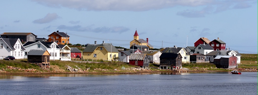
Common activities in the town include the Varanger Museum, fishing excursions, Vadsøya Culture Park, Varanger Bird Park, and the Varangerfestivalen, which marks the one of the oldest music festivals found in the high north.
The town of Vardø lies just off the east coast of the Varanger Peninsula, on the island of Vardøya. Home to around 1,900 residents, Vardø marks the most eastern town in the entire country.
The town is centered around fishing and fish processings with the island being connected to the mainland by the undersea Vardø Tunnel. The island was home to the Vardøhus Fortress in the fourteenth century and was the site of several witch trails in the seventeenth century. Besides exploring the stunning surrounding nature, Vardø is also home to the Pomor Museum, Partisan Museum, and the Steilneset Memorial.
Just east of the island lies the small uninhabited island of Hornøya. This island is home to an important bird sanctuary and the Hornøya bird cliffs. Here visitors can spot puffin, shag, razorbill, and guillemot birds. Besides the summer months, visitors can rent rooms in the lighthouse situated on Hornøya.