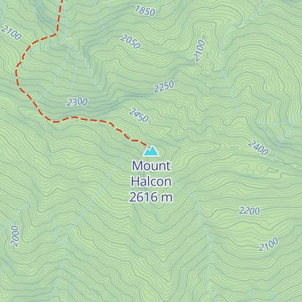
Mount Halcon (Filipino: Bundok Halcon) and (Spanish: Monte Halcón) is the highest mountain in the island of Mindoro in the Philippines. According to the new data released by Oriental Mindoro peakvisor as of 2022, it has an elevation of 2,616 metres (8,583 ft) above sea level, higher than the previous estimates of 2,586 m (8,484 ft). It is the 23rd-highest peak in the Philippines and 37th-highest peak of an island on Earth. Its steep slopes have earned it the reputation of being one of the most difficult and technically most challenging mountains to climb in the Philippines. The first documented ascent was made in 1906 by American botanist Elmer Drew Merrill and a party of forestry and military personnel.
There's a trail called Mt. Halcon Trail leading to the summit. Mount Halcon is one of the 1 peaks along the Mt. Halcon Bayanan Trail.
By elevation Mount Halcon is
# 1 out of 35 in Oriental Mindoro # 27 out of 3134 in Philippines # 27 out of 3031 in the Philippines
By prominence Mount Halcon is
# 1 out of 35 in Oriental Mindoro # 3 out of 3134 in Philippines # 3 out of 3031 in the Philippines
We use GPS information embedded into the photo when it is available.
3D mountains overlay
Adjust mountain panorama to perfectly match your photos because recorded by camera photo position might be imprecise.
Move tool
Rotate tool
Zoom
More customization
Choose which peak labels should make into the final photo and what photo title should be.
Next
Photo Location
Satellitte
Flat map
Relief map
Latitude
Longitude
Altitude
OR
Latitude
°'''
Longitude
°'''
Apply
Register Peak
Peak Name
Latitude
Longitude
Altitude
Register
Teleport
PeakVisor
This 3D model of Sagarmatha National Park in Nepal was made using the PeakVisor app topographic data. The mobile app features higher precision models worldwide, more topographic details, and works offline. Download PeakVisor maps today.
Download OBJ model
PeakVisor
The download should start shortly. If you find it useful please consider supporting the PeakVisor app.
PeakVisor for iOS and Android
Be a superhero of outdoor navigation with state-of-the-art 3D maps and mountain identification in the palm of your hand!