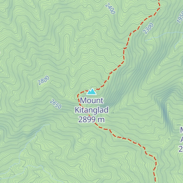
Mount Kitanglad is an inactive volcano located in the Kitanglad Mountain Range in Bukidnon province on Mindanao island. It is the fourth highest mountain in the Philippines and has an approximate height of 2,899 metres (9,511 ft). It is located between Malaybalay City and the municipalities of Lantapan, Impasugong, Sumilao, and Libona. It is home to one of the Philippines' few remaining rainforests.
The name "Kitanglad" was derived from a legend that there was once a great flood that submerged the native lands of Bukidnon and only the tip of the mountain, the size of a "tanglad" (lemon grass), remained visible ("kita" in Visayan). It is considered as an ancestral domain of several old cultural communities like the Bukidnons, Higaonons and Talaandigs. However, according to the Mines and Geosciences Bureau Lands Geological Survey Division, it was previously known as Mount Alanguilan, from an 1850 sketch of a Moro encampment in the summit overlooking the "Rio de Cumaycay", which is the Kumaykay River in Dahilayan, Manolo Fortich.
Mount Kitanglad was proclaimed a protected area under the natural park category through Presidential Proclamation 896 dated October 24, 1996. On November 9, 2000, Mount Kitanglad finally became a full-fledged protected area when Congress approved Republic Act 8978 also known as the "Mt. Kitanglad Range Protected Area Act of 2000."
In 2009, Mount Kitanglad Range Natural Park (MKRNP) was declared as an ASEAN Heritage Park.
Mount Kitanglad is recognized for its cultural and biological diversity. It is part of the ancestral domain of three major Indigenous groups: the Talaandig, Higaonon, and Bukidnon peoples.
Mount Kitanglad hosts over 600 rare and endemic species, including the Philippine tarsier and the Rafflesia schadenbergiana, the world's second largest flower. It is a nesting place for the critically endangered Philippine eagle. Other endemic species that are found here are the pygmy fruit bat Alionycteris paucidentata and two native mice, Katanglad shrew-mouse and Gray-bellied mountain rat.
Indigenous communities are working to have Mount Kitanglad recognized as Indigenous peoples' and community conserved territories and areas to enforce Indigenous customary rules on the mountain range.
Due to its high elevation, several communications and broadcasting companies constructed relay stations at the summit.
There's a hiking trail (T2) called Kitanglad Dulang-Dulang Traverse Trail leading to the summit. Mount Kitanglad is one of the 2 peaks along the Kitanglad Dulang-Dulang Double Traverse.
By elevation Mount Kitanglad is
# 2 out of 11 in Mount Kitanglad Range Natural Park # 8 out of 3134 in Philippines # 2 out of 99 in Bukidnon # 8 out of 3031 in the Philippines
By prominence Mount Kitanglad is
# 3 out of 11 in Mount Kitanglad Range Natural Park # 11 out of 99 in Bukidnon
We use GPS information embedded into the photo when it is available.
3D mountains overlay
Adjust mountain panorama to perfectly match your photos because recorded by camera photo position might be imprecise.
Move tool
Rotate tool
Zoom
More customization
Choose which peak labels should make into the final photo and what photo title should be.
Next
Photo Location
Satellitte
Flat map
Relief map
Latitude
Longitude
Altitude
OR
Latitude
°'''
Longitude
°'''
Apply
Register Peak
Peak Name
Latitude
Longitude
Altitude
Register
Teleport
PeakVisor
This 3D model of Sagarmatha National Park in Nepal was made using the PeakVisor app topographic data. The mobile app features higher precision models worldwide, more topographic details, and works offline. Download PeakVisor maps today.
Download OBJ model
PeakVisor
The download should start shortly. If you find it useful please consider supporting the PeakVisor app.
PeakVisor for iOS and Android
Be a superhero of outdoor navigation with state-of-the-art 3D maps and mountain identification in the palm of your hand!