
Scan the QR code and open PeakVisor on your phone
The island nation of Madagascar is situated just off the coast of East Africa in the Indian Ocean. It is primarily located on the island of Madagascar (the fourth-largest island in the world) and it has a population of over 28 million people. The island is considered to be an ecological hotspot as it is home to hundreds of endemic species. There are 1918 named mountains in Madagascar, the highest and most prominent of which is Maromokotro (2,876 m/9,436 ft).
Madagascar (officially the Republic of Madagascar/Repoblikan'i Madagasikara/République de Madagascar) is an island nation that is located about 400 km (250 mi) off the coast of East Africa in the Indian Ocean.
It is separated from the country of Mozambique on the mainland by the Mozambique Channel. As it is an island country, Madagascar does not have any land borders. However, it is located relatively close to a number of other island nations and territories including Réunion (France), Mauritius, Mayotte (France), and Comoros.
The country is primarily located on the island of Madagascar, which has an area of 587,041 sq. km (226,658 sq. mi). This makes the island of Madagascar the fourth-largest island in the world after Greenland (Denmark), Borneo (Indonesia), and New Guinea (Indonesia and Papua New Guinea).
In addition to the main island, Madagascar includes numerous small islands such as Nosy Be and Nosy Boraha (Île Sainte-Marie). The country is home to 19 national parks and three UNESCO World Heritage Sites: Tsingy de Bemaraha Strict Nature Reserve, the Royal Hill of Ambohimanga, and the rainforests of Atsinanana.
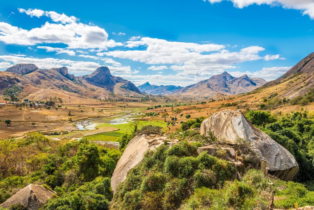
The country can be divided into three zones: the central plateau, the coastal strip in the east, and the low plateaus and plains in the west. The central plateau rises to elevations of about 760 m (2,500 ft) to 1,372 m (4,500 ft) above sea level.
Officially, the country is divided up into 23 regions (called faritra). These regions replaced the previous system of six autonomous provinces (aritany mizakatena) in the early 2000s. However, the country’s 2010 constitution reintroduced the role of provinces in the country. From north to south, these regions (and their associated provinces) are:
These regions are further divided up into 144 districts (fivondronana). Most of these districts are either stand-alone city districts or are divided up into communes (kaominina).
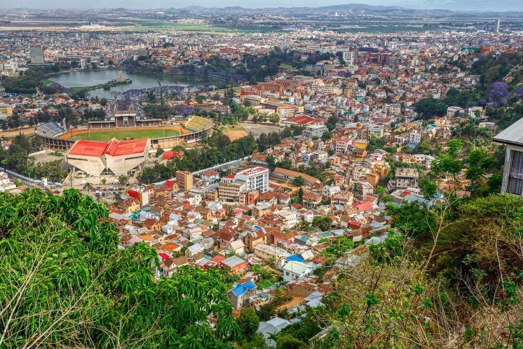
The largest cities in Madagascar are Antananarivo (commonly called Tana), the capital located on the central plateau; Mahajanga on the northwest coast; Fianarantsoa on the southern plateau; Toamasina on the east coast; Antsiranana in the north; Toliara in the southwest; and Antsirabe, which is a tourist center south of Tana. Tana, Fianarantsoa, and Toamasina are three of the oldest cities on the island as they predate French colonization.
Approximately 150 million years ago, the Madagascar-Indian landmass broke off of mainland Africa. Then, about, 88 million years ago, Madagascar split from the Indian subcontinent, creating the island that we see today.
Madagascar sits on two tectonic plates. The northern portion of the island rests on the Somali plate and the south part of the island is located on the Lwandle microplate. Recent studies suggest these two plates are separating. As a result, the island of Madagascar is likely to split into smaller islands many millions of years from now.
Additionally, Madagascar is home to a series of volcanoes. These volcanoes have been active in recent geological history. However, when we consider the fact that the island has experienced relatively little tectonic activity during the past 80 million years, the presence of volcanism on Madagascar is unusual.
Scientists believe that this volcanism is a result of the tectonic activity that occurred when Madagascar and India broke apart. The Marion hotspot that caused this landmass separation when the island formed likely caused part of the Earth’s crust and upper mantle to weaken. As a result, magma was able to flow up through the upper mantle and crust to the Earth’s surface.
The splitting of the mantle is also likely responsible for the raised elevations that we see in the northern part of the island of Madagascar. As it was subject to less pressure from above, the crust was able to rise upward as hot rock flowed beneath it.
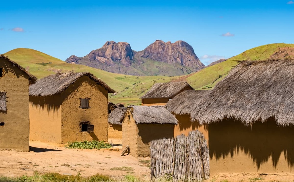
Meanwhile, the central plateau and eastern coast of Madagascar consist mainly of gneiss, granite, quartz, and other crystalline rock formations. The parts of the country that are underlain by gneisses typically feature red murrum and laterite soils. These soils have a distinctive red hue, and they are what gave Madagascar its nickname of the “Great Red Island.”
Across the country, you can find fertile alluvial soils that can support agriculture. Some of the main agricultural products that are produced in these fertile regions of Madagascar include rice, beans, sweet potatoes, cassava, sisal, vanilla, cocoa, coffee, and sugar cane. However, the western portion of the island is almost entirely underlain by sedimentary rock and its soils are less fertile, so they aren’t able to support much agriculture.
There is a lot of potential for mining in Madagascar, though much of the mining in the country to date has been on a relatively small scale. Some of the many resources in Madagascar that can be mined include ilmenite, graphite, gypsum, silica, titanium, silver, iron, copper, zinc, coal, uranium, rubies, sapphires, emeralds, aquamarines, diamonds, and topaz.
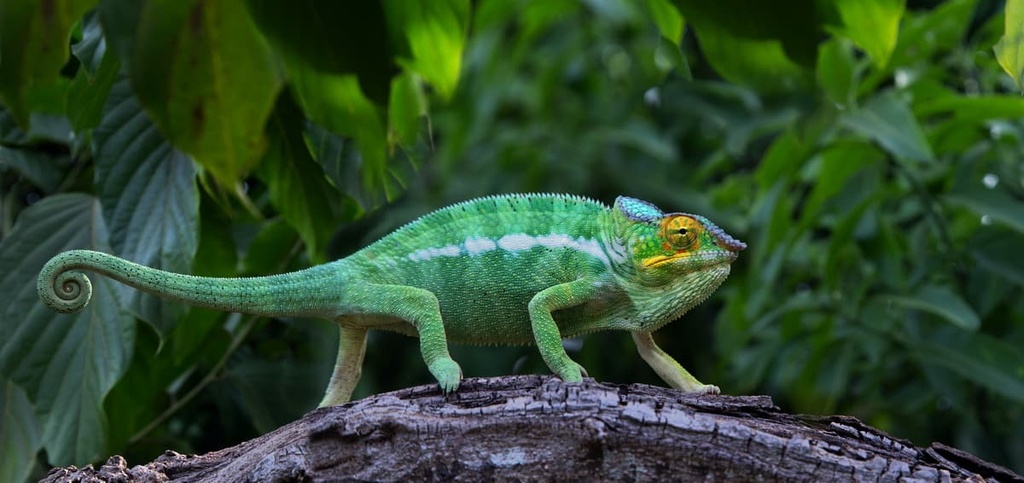
Madagascar is perhaps best known for its incredible number of endemic species. As a result of millions of years of isolation from mainland Africa, more than 80 percent of the flora and fauna in Madagascar is found nowhere else on the planet.
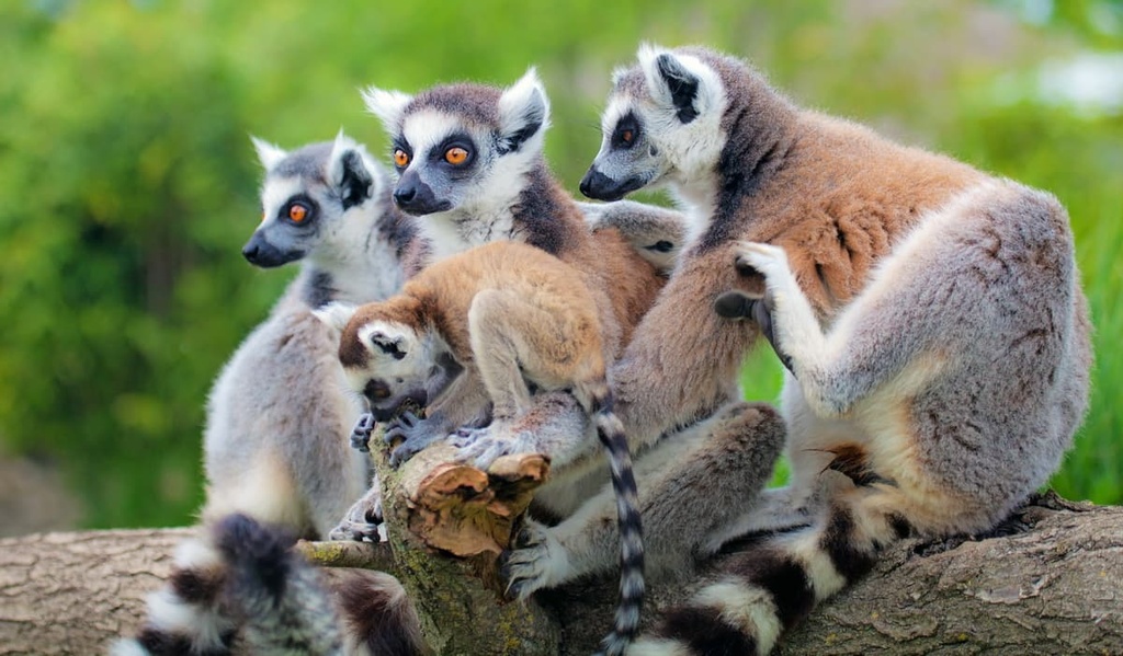
This includes more than 40 types of lemurs as well as fossas, tenrecs, and many species of chameleons. Except for crocodiles, the island does not host any large predators. There are no highly venomous spiders or snakes that are native to the island either.
Seasons in Madagascar are typically split into a hot wet season from November through April and a cooler and drier season from May through October. These seasonal variations are dictated by the southeast trade and northwest monsoon winds.
The island experiences a diagonal gradient for rainfall distribution. This means that the northeastern part of Madagascar receives the most precipitation, but the total amount of rainfall typically tapers off as you move across the country. As a result, the southwestern part of the country is arid and desert-like.
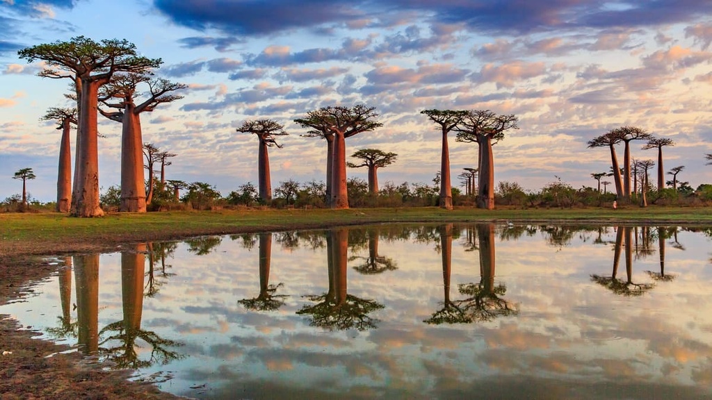
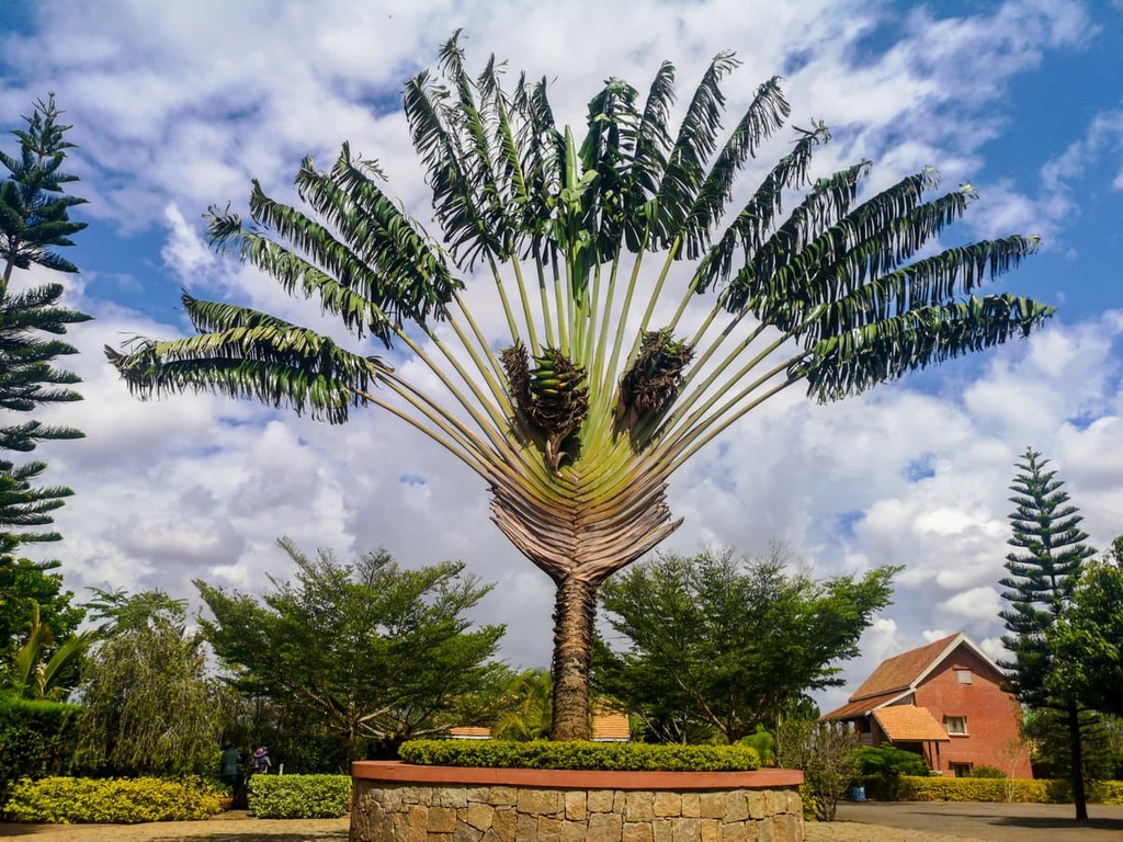
Ecoregions found in Madagascar include rainforests, dry forests, grasslands, spiny forests, and deserts. Around 90 percent of the flora found in Madagascar is endemic. Two of the most iconic plants are the za baobab (Adansonia za) and Ravenala, the latter of which is also known as the traveler’s palm.
Deforestation is a significant ecological threat in Madagascar, least of all because it contributes to high levels of erosion and soil loss in the country. Some estimate that as much as 90 percent of the country’s original tree cover has been removed to date.
Deforestation in Madagascar primarily occurs as a result of tavy (slash and burn agriculture). However, trees are also cut in the country for the production of fuel and building materials as well as for the export of valuable timber such as ebony, rosewood, and sandalwood.
Madagascar has been home to people for about 1,300 years. Malay-Indonesian settlers arrived on the island first, followed by Arab traders.
The vast majority of people in Madagascar are Malagasy, which is a larger ethnic group that can be divided up into 20 ethnic subgroups based on shared ancestry and cultural identity. The largest Malagasy ethnic subgroup is the Merina, who traditionally lived primarily in the central part of the island in its highland region.
Although each ethnic subgroup on Madagascar has its own dialect of the Malagasy language (one of the two official languages of Madagascar, alongside French), these dialects are mutually intelligible. Interestingly, the Malagasy language is actually an Austronesian language, rather than one with roots in mainland Africa.
Malagasy has more in common linguistically with the Ma'anyan language (spoken on the island of Borneo) and the languages spoken throughout Micronesia and Polynesia than it does with Bantu languages like Makhuwa, which is spoken in nearby Mozambique. This makes sense given the fact that the original settlers of the island of Madagascar migrated from the Malay archipelago and not from East Africa.
Prior to the arrival of Europeans during the sixteenth century, regional and ethnic groups in Madagascar were primarily organized into autonomous communities. The first people of European descent to arrive in Madagascar were likely the Portuguese, who established a colony on the island in the early 1500s.
The French started arriving in Madagascar in the late seventeenth century, primarily in search of trading opportunities. During this time, the French established many trading posts on the island. Many people in Madagascar were also enslaved by European traders during this time and sent to the Americas as part of the Atlantic slave trade.
By the mid-seventeenth century, some of the ethnic subgroups in Madagascar started to organize into larger kingdoms that consolidated power on the island. Toward the end of the nineteenth century, however, France started taking an interest in overthrowing the monarchies that had developed on the island.
In 1883, France invaded Madagascar, which started a military intervention that’s now known as the Franco-Hova Wars. As a result of this invasion, Madagascar became a French colony. During colonization, the French established a number of plantations on Madagascar, and forced labor was common throughout the island.
However, when France was occupied by Nazi Germany during World War II, the island was indirectly controlled by the Nazis (through Vichy France) for a short time. It was later captured and occupied by the British as a result of the Battle of Madagascar in 1942.
France regained control of the island after the war. As a result of the Brazzaville Conference in 1944, Madagascar became a French overseas territory with some rights of representation in the French National Assembly.
In 1947, nationalist rebels in Madagascar led the Malagasy Uprising in the hopes of gaining independence for the country. The uprising was eventually crushed by the French military, who are known to have committed many war crimes during this period.
As a result of decolonization, the Malagasy Republic was made an autonomous state within the French Community in 1958. The country gained full independence in 1960 and it became the Democratic Republic of Madagascar in 1975. This period of socialist rule ended in 1992 and was followed by a new state called the Third Republic of Madagascar, which lasted until 2010.
In 2010, the country adopted a new constitution and officially became the Republic of Madagascar. Today, the country is a unitary semi-presidential republic with a president, prime minister, and cabinet running its government.
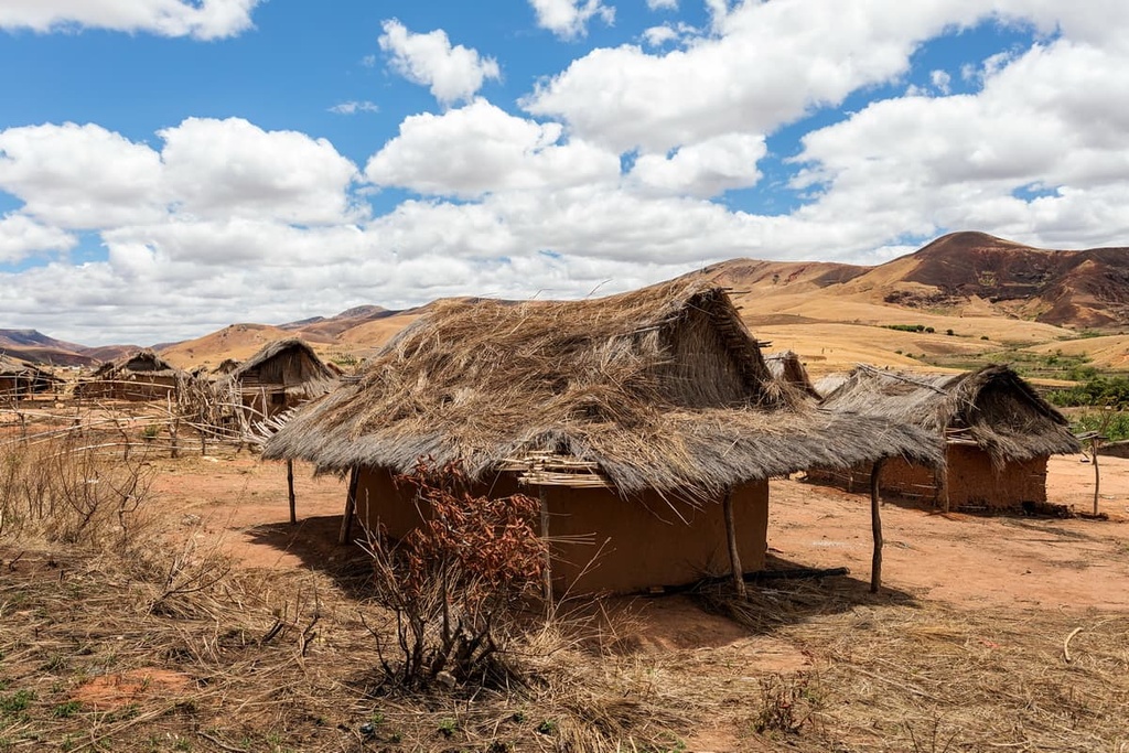
The culture of Madagascar is rich and diverse as each ethnic group in the country has its own cultural practices. However, ancestor worship is an important part of the broader Malagasy culture and it ties into many aspects of life, including economic decision-making and death rituals.
Religious views are also varied in Madagascar. Although more than three-quarters of the population might classify themselves as Christian, many also practice Islam or any of a number of traditional faiths. Many residents of Madagascar who identify as Christian also practice some aspects of more traditional Malagasy religions, such as practices like fady and famadihana.
Cattle (zebu) are an important unit of wealth in Madagascar, too. Although much of the land is used for crop-growing agriculture, the dominant land use is pastoral. Many families in Madagascar practice some degree of subsistence farming and agriculture accounts for more than 25% of the country’s GDP.
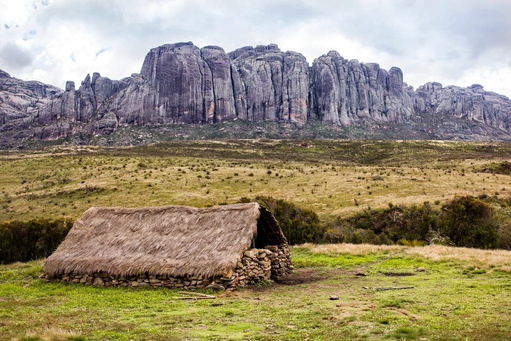
Madagascar has a couple of notable peaks, including Maromokotro and Imarivolanitra. There are also numerous national parks in the country with networks of hiking trails that traverse landscapes ranging from sandstone massifs and stony forests to lush rainforests.
With that in mind, here are some of the best hiking areas in Madagascar to check out during your next trip to the country.
Maromokotro (2,876 m/9,436 ft) is the tallest peak in Madagascar. It is located in the northern part of the country and climbing it typically takes about 10 to 14 days.
Climbing Maromokotro involves following a long route that passes through multiple villages and rainforests as you make your way to the mountain itself. Due to the remoteness of the mountain, most visitors opt to climb Maromokotro with a guide service.
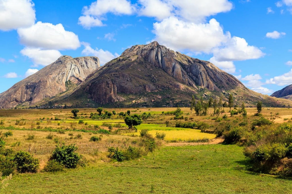
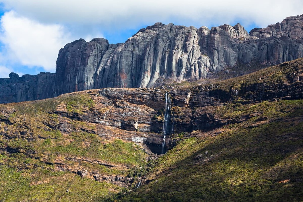
Andringitra National Park is home to Imarivolanitra (also referred to as Pic Boby), Madagascar’s second tallest peak at 2,658 m (8,720 ft) in elevation.
The park is located in the southeastern part of the country in the Fianarantsoa region, and it was established in the early 1990s. It currently encompasses 311,600 ha (769,980 acres) of terrain and it boasts elevations that range from lows of 650 m (2,133 ft) to highs of 2,658 m (8,720 ft).
Andringitra National Park contains over 100 km (62 mi) of hiking trails. Summiting Imarivolanitra usually takes three days but can be completed in two by ambitious hikers (hiring a guide is highly recommended for summit attempts).
Campsites in the park are rustic and may include communal showers and electricity only in certain areas. There are several alternative accommodation options located near the park boundary that offer bungalows or glamping.
Established in 1962, Isalo National Park protects around 77,000 ha (190,271 acres) of terrain in the south-central Fianarantsoa region of Madagascar. The semi-arid landscape of the national park boasts an impressive sandstone massif that has been eroded into pinnacles, plateaus, canyons, and gorges.
In the park, you can find a variety of hiking trails, including some routes that are suitable for multi-day expeditions. Keep in mind that permits are required for visitors to the park, so it’s typically best to hire a guide service for your trip that can arrange all of the logistics on your behalf.
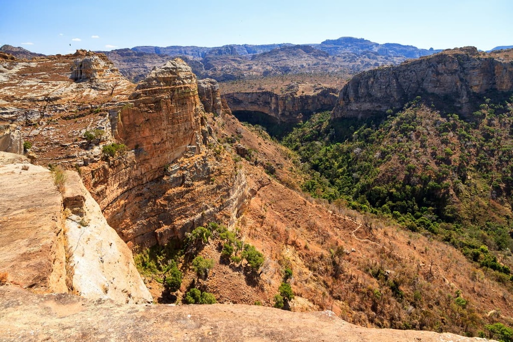
As is the case with the rest of Madagascar, the park houses numerous endemic species. The ring-tailed lemurs that live in the park are fairly habituated to people and lucky hikers can sometimes enjoy close encounters with these magical animals during their adventures.
Campsites are available in the park and can be arranged, along with gear rentals, through a tour operator. Ranohira is a town located about 16 km (10 mi) away that also offers some accommodation options for visitors. Several hotels are also located along the park’s southern border, too, if you’d prefer more luxurious accommodations.
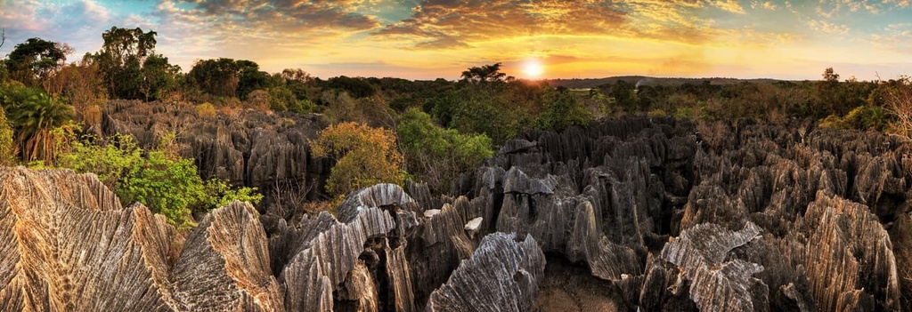
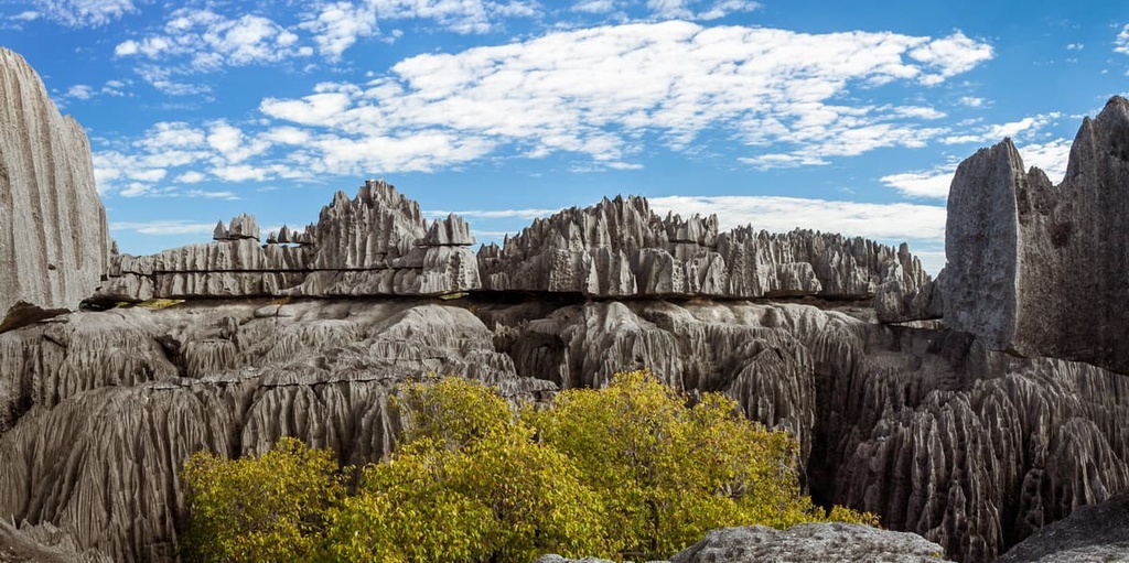
Tsingy de Bemaraha National Park in northwestern Madagascar encompasses a spectacular stone forest made up of limestone karst topography and rugged rock spires. The peculiar landscape in the park started forming around 200 million years ago when the region’s limestone bedrock was slowly eroded away by groundwater.
The 152,700 ha (377,330 acre) park includes two main limestone plateaus called Great Tsingy and Little Tsingy. The stone forest that dominates much of the park is interspersed with savannah, lakes, mangroves, and dry deciduous forest. Nearly half of the flora and fauna found in the park is endemic to the region.
In the park, you’ll find multiple hiking trails and climbing routes. However, most of the outings in the park are considered to be quite strenuous, so hiring a guide service is highly recommended.
The park is only open during the dry season from April through November. There are a few campsites in the park that offer gear rentals, too, but organizing logistics for a trip to the area can be tricky at times. Many visitors opt to stay in the nearby Bekopaka during their trip to the park.
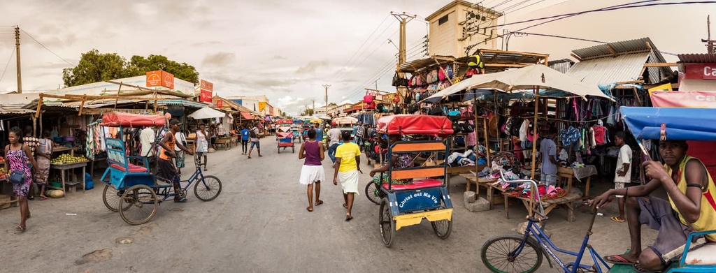
Whether traveling by hired car, bus, train, or airplane in Madagascar, remember to be patient when getting around the country. Road conditions can vary in Madagascar due to bad weather, flooding, or a lack of infrastructure, which can make overland travel challenging.
Timetables on public transport can be quite flexible in Madagascar, if not entirely nonexistent. So it is best to plan your travels accordingly and expect the occasional delay during your trip.
Listed below are some of the main cities in the country. If you’re willing to get off the beaten path, you can also visit many of Madagascar’s amazing small towns and villages, which are too numerous to name here.
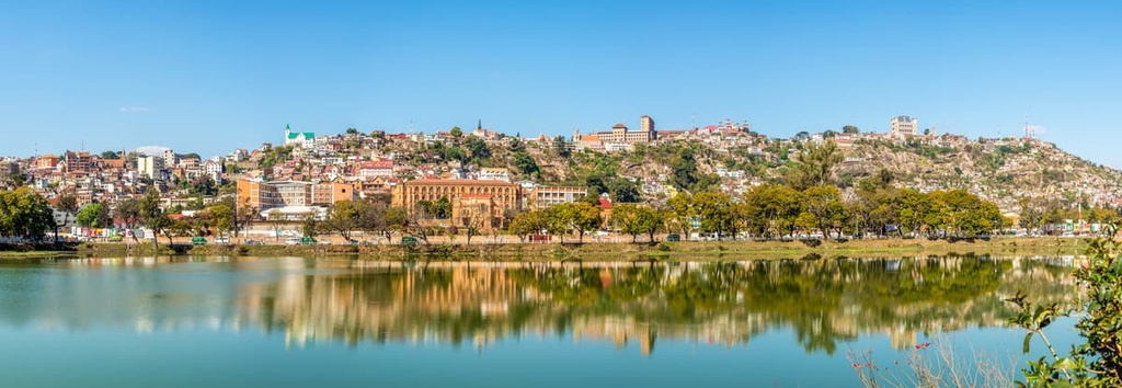
With a population of just over 1.25 million people, Antananarivo (Tana) is Madagascar’s diverse and busy capital. The city was founded in the early 1600s and later colonized by the French in the late nineteenth century. Madagascar’s main airport is also located on the outskirts of Antananarivo.
One of the most iconic spots to visit in the city is the Rova, a hilltop royal palace complex that includes tombs, a chapel, and the Queen’s palace and grounds. Hiring a local guide can help you learn more about the palace and the city as a whole.
Another great spot to visit in Antananarivo is Andafiavaratra Palace, the palace of Prime Minister Rainilaiarivony who governed the country from 1864 to 1896. The lower levels of the building display items rescued from a fire that burned the Rova complex in 1995.
Other good places to check out in the city are the Analakely Market, the Tsimbazaza Zoo, and the UNESCO World Heritage Site of Ambohimanga Rova, the latter of which is located just outside Antananarivo.
As it is the capital of Madagascar, Antananarivo offers an array of dining and accommodation options. Here, you can find everything from local eateries to international restaurants and a range of accommodations from hostels to fancy hotels. However, be sure to keep an eye out for pickpockets in some of the city’s more touristy areas.
Located in the south on St. Augustine’s Bay, Toliara is a city of around 170,000 people that’s also one of Madagascar’s most popular tourist destinations. It is a particularly popular destination for swimming, diving, and snorkeling.
Toliara offers a number of activities for visitors to enjoy. Some of the most popular sights in the city itself include the Antsokay Arboretum and Toliara’s many museums. While in the area, you can also visit Reniala Forest Reserve on a guided walk. Toliara is also located just a four-hour drive from Isalo National Park, so the city can serve as a good basecamp for trips around the southern part of the island.
Accommodation options in Toliara run the gamut from budget hostels to luxury lodges. The city offers all of the standard amenities (groceries stores, ATMs, medical clinics) that are often hard to find in the surrounding area, so be sure to stock up on supplies if you plan to leave Toliara. That said, it can get hot in Toliara, so it is best to start your outdoor excursions early in the day whenever possible.
Since Toliara is located a 20-hour drive away from the capital of Antananarivo, most visitors arrive in the city by flying into the local airport. Air Madagascar operates regular flights to Toliara from Anatananrivo and other major destinations, such as Saint-Denis de la Réunion on the island of Réunion.
With around 250,000 inhabitants, Mahajanga is the largest commercial port town on the west coast of Madagascar. It serves as the center of trade between the island and mainland East Africa.
Visitors to Mahajanga can learn more about the area’s rich history on a self-guided tour around town. You can pick up an informational pamphlet from the Tourist Information Center in the city to help you with your self-guided tour. This self-guided tour takes you to various points of interest in the city, many of which are also marked by informational plaques.
While in Mahajanga, be sure to visit the Cirque Rouge, a canyon formed from eroded sandstone and marked by rock pinnacles that’s located some 12 km (7 mi) to the north of the town. You can also take a ferry from Mahajanga to the small fishing village of Katsepy. Or, you can drive three hours to Ankarafantsika National Park if you want to enjoy some spectacular wildlife viewing, hiking, and boating opportunities.
Budget accommodation is available in Mahajanga itself while fancy lodges can be found just outside of the city. In Mahajanga, you can also find a range of dining options that feature both local and international cuisines.
Antsiranana (also known as Diego-Suarez) is a city located in the far northern part of the island of Madagascar. It was historically coveted by the French and British because of its strategic location as a port for trade and commerce.
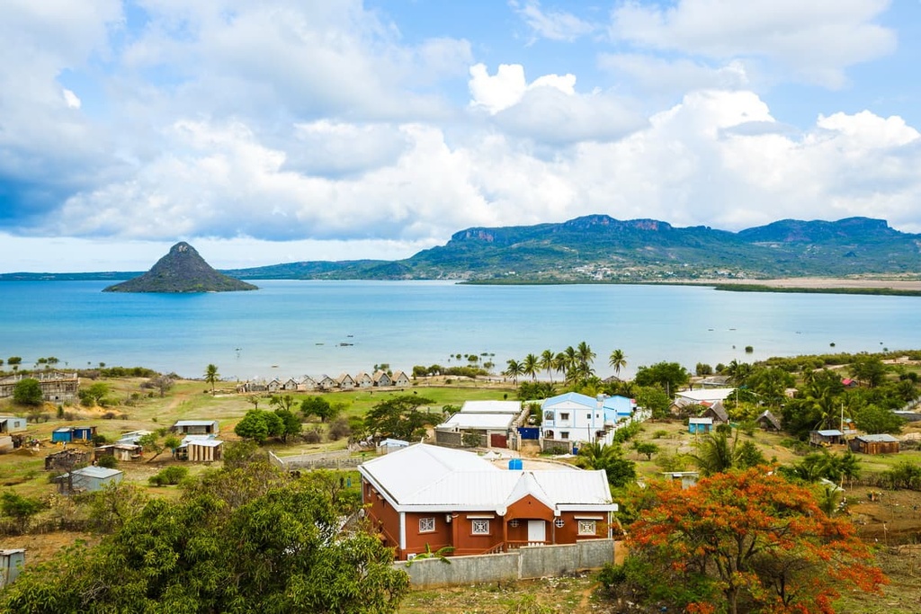
Nowadays, Antsiranana is a city with a population of 130,000. It is also a popular tourist destination as it offers beaches, nightlife, and opportunities for hiking, swimming, surfing, and kite surfing.
While in Antsiranana, potential activities include hiking French Mountain or traveling to Sakalava and Andovokonko Bay for some kitesurfing opportunities. Amber Mountain National Park is also located nearby and is worth checking out during your travels.
If you’re in Antsiranana for an extended period of time, you could also travel to Ankarana National Park (alternately called Ankarana Special Reserve), which is located about 3.5 hours away from the city by car. The park is known for its underground cave and rock pinnacles. Many of the lodges in the area offer complimentary transportation services from your accommodation to the park, too.


