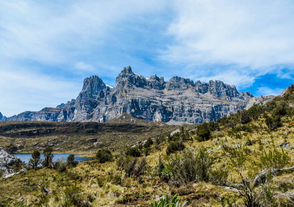
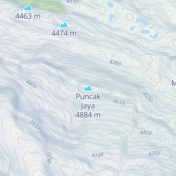
Puncak Jaya (Indonesian: [ˈpuntʃak ˈdʒaja]; literally "Glorious Peak", Amungme: Nemangkawi Ninggok) or Carstensz Pyramid (, Indonesian: Piramida Carstensz, Dutch: Carstenszpiramide) on the island of New Guinea, with an elevation of 4,884 m (16,024 ft), is the highest mountain peak of an island on Earth, and the highest peak in Indonesia. As the western half of New Guinea is politically associated with Southeast Asia (on account of being presently controlled by Indonesia), Puncak Jaya can be considered the 8th highest mountain of this region. However, as the whole island of New Guinea is biogeographically part of the Australian continent, the peak can also be considered the highest of all Oceania, and thus one of the Seven Summits.
The mountain is located in the Sudirman Range of the highlands of Mimika Regency, Central Papua, Indonesia. Puncak Jaya is ranked 5th in the world by topographic isolation.
The massive, open cut Grasberg gold and copper mine, the world's second-largest gold mine, is four kilometres (2+1⁄2 miles) west of Puncak Jaya.
Other summits are East Carstensz Peak (4,808 m [15,774 ft]), Sumantri (4,870 m [15,980 ft]) and Ngga Pulu (4,863 m [15,955 ft]). Other names include Nemangkawi in the Amungkal language, Carstensz Toppen and Gunung Soekarno. It is also the highest point between the Himalayas and the Andes.
By elevation Puncak Jaya is
# 1 out of 27724 in Indonesia # 1 out of 223 in Papua # 1 out of 1217 in the New Guinea
By prominence Puncak Jaya is
# 1 out of 27724 in Indonesia # 1 out of 223 in Papua # 1 out of 1217 in the New Guinea
We use GPS information embedded into the photo when it is available.
3D mountains overlay
Adjust mountain panorama to perfectly match your photos because recorded by camera photo position might be imprecise.
Move tool
Rotate tool
Zoom
More customization
Choose which peak labels should make into the final photo and what photo title should be.
Next
Photo Location
Satellitte
Flat map
Relief map
Latitude
Longitude
Altitude
OR
Latitude
°'''
Longitude
°'''
Apply
Register Peak
Peak Name
Latitude
Longitude
Altitude
Register
Teleport
PeakVisor
This 3D model of Sagarmatha National Park in Nepal was made using the PeakVisor app topographic data. The mobile app features higher precision models worldwide, more topographic details, and works offline. Download PeakVisor maps today.
Download OBJ model
PeakVisor
The download should start shortly. If you find it useful please consider supporting the PeakVisor app.
PeakVisor for iOS and Android
Be a superhero of outdoor navigation with state-of-the-art 3D maps and mountain identification in the palm of your hand!