
Scan the QR code and open PeakVisor on your phone
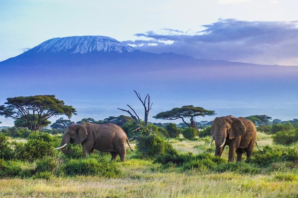
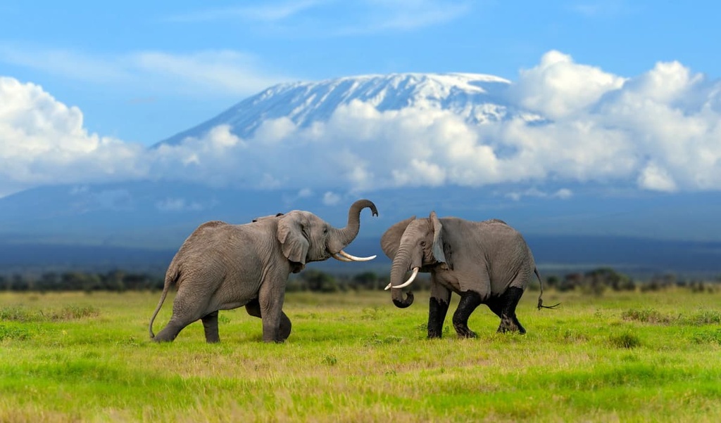
The United Republic of Tanzania is an East African nation that’s home to natural wonders such as Kilimanjaro, Serengeti National Park, and Gombe National Park, the latter of which is where Jane Goodall did her pioneering research on chimpanzees. There are 2395 named mountains in the country, the highest of which is Kilimanjaro (5,895 m/19,341 ft), the tallest peak on the continent. The second most prominent peak in Tanzania is the stratovolcano Mount Meru, which has 3,164 m (10,381 ft) of prominence.
Besides its status as the home of Kilimanjaro, the tallest mountain in Africa, Tanzania (officially the United Republic of Tanzania/Jamhuri ya Muungano wa Tanzania) is one of the largest countries in East Africa, and it boasts some of the world’s most spectacular wildlife.
Tanzania has a population of close to 60 million people, and it encompasses 939,699 sq. km. (362,820 sq. mi) of terrain, including 52 sq. km (20 sq. mi) of lakes and roughly 805 km (500 mi) of coastline.
The country of Tanzania shares a border with Kenya, Uganda, Rwanda, Burundi, Democratic Republic of Congo, Zambia, Malawi, and Mozambique. The landscape in Tanzania includes everything from highlands in the south and north to low-lying plains along the coast and an arid plateau in the central mainland.
The country is divided into 31 administrative districts. Dodoma, located in the country’s central steppe, became the official capital of Tanzania in the 1970s. However, the historic capital of Tanzania, Dar es Salaam, continues to serve as the country’s economic and de facto capital as many businesses and embassies opted to stay in this urban, coastal city.
In addition to its mainland territory, Tanzania’s borders include the islands of Zanzibar, Pembe, Ugunja, and Mafia. Mountain ranges in the country include the Usambara Mountains, Uluguru Mountains, Udzungwa Mountains, Pare Mountains, Kipengere Mountains, and Mahale Mountains.
Mount Kilimanjaro is one of only a few mountains in Africa with glaciers. The other notable glaciated peak in Africa is Mount Kenya, which is, as its name suggests, located in neighboring Kenya.
Tanzania’s Lake Victoria, which is situated in the northwestern part of the country, is also the second-largest freshwater lake in the world after Lake Superior in the US and Canada. Meanwhile, Lake Tanganyika in the southwestern part of Tanzania is the second-deepest freshwater lake in the world after Lake Baikal in Russia.
Tanzania contains 22 national parks and numerous conservation and wildlife management areas. Of these parks, four are UNESCO Natural World Heritage Sites, namely Ngorongoro Conservation Area, Kilimanjaro National Park, Selous Game Reserve, and Serengeti National Park.
One of the most significant geological features of Tanzania is the Rift Valley, which formed as the valley’s underlying tectonic plates separated over the course of millions of years, creating the East African Rift. Two branches of the Rift Valley run north-south through Tanzania—the Western and Eastern (Great) Rift Valleys.
Tanzania’s Western Rift Valley travels along Lake Tanganyika and Lake Rukwa near the country’s western border. The highlands in the southwestern region of Tanzania are a product of the Western Rift Valley. These highlands include features like the Ufipa Plateau and the Mbeya Mountains, which are home to peaks such as Rungwe (2,961 m/9,715 ft).
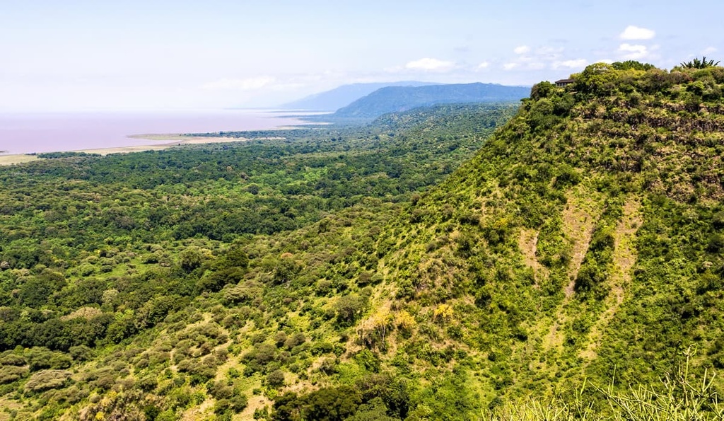
Meanwhile, the Eastern (or Great) Rift Valley, extends from the Kenyan border near Eyasi, Manyara, and Natron lakes south to Lake Nyasa near the border with Mozambique.
The mountains that stretch from south-central Tanzania up toward southeastern Kenya are part of the Eastern Arc Mountains. This mountain chain includes parts of the Pare, Usambara, Nguru, Ukaguru, Rubeho, Uluguru, Mahenge, and Udzungwa mountains.
For the most part, the peaks of the Eastern Arc Mountains were uplifted around 100 million years ago during a period of tectonic activity in the region. The mountains have experienced multiple phases of erosion and uplift since their original formation. The most recent uplift occurred around 7 million years ago with the development of the East African Rift System.
The Eastern Arc Mountains are made up of Precambrian crystalline rocks such as gneisses, granulites, quartzites, schists, marbles, and amphibolites. In many parts of the mountain range, younger volcanic and sedimentary rocks cover the crystalline bedrock. These include sandstones, shales, conglomerates, and mudstones. Furthermore, igneous rocks are some of the youngest rocks in the range as many date back only 5 million years.
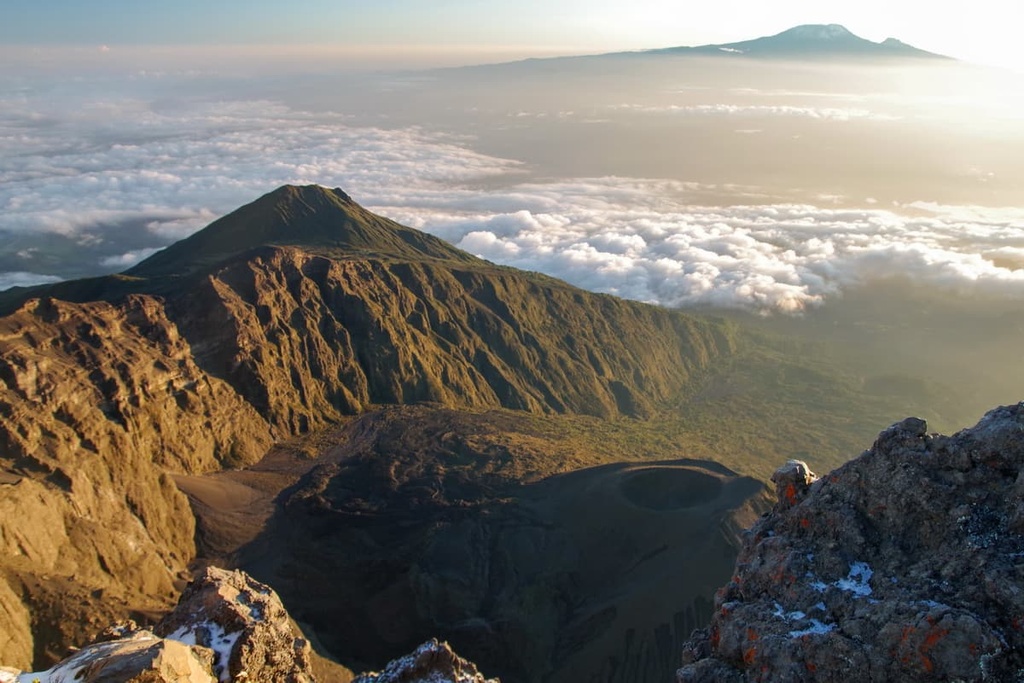
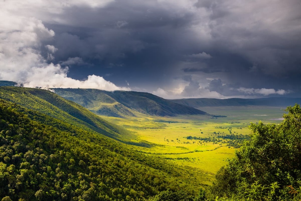
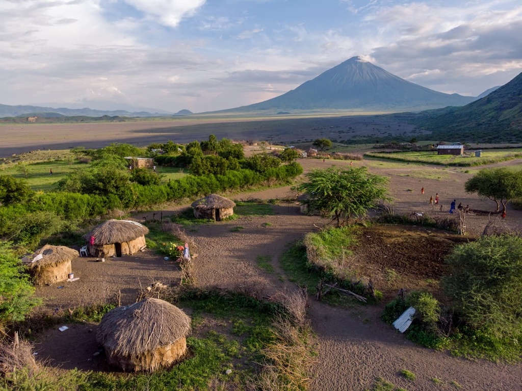
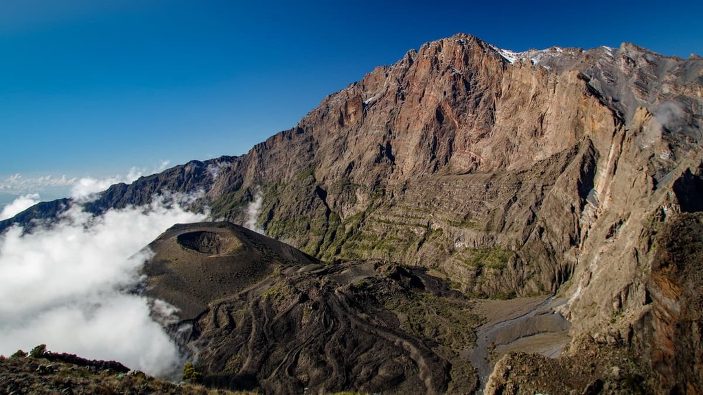
Kilimanjaro is the highest mountain on the continent and the fourth-most prominent mountain in the world. To the west of Kilimanjaro and Mount Meru lie a series of volcanoes and calderas. These include the still-active Ol Doinyo Lengai and the Ngorongoro Crater, the latter of which is one of the world’s largest calderas.
The volcanic soils that are found in the highlands of Tanzania are the most fertile in the country. They are ideal for subsistence and commercial agriculture, so much of the country’s food is grown in this part of Tanzania. The country’s river basins also tend to support rich soils, but seasonal flooding can leach nutrients from the soil without proper drainage mechanisms.
That being said, Tanzania’s interior plateaus experience higher temperatures and lower amounts of rainfall than the highlands. When it does rain on the plateaus, it often downpours, making it difficult for the soil to absorb the water. This regular flooding contributes to the poor, claylike quality of the soil and makes it difficult to farm in this part of the country.
Due to Tanzania’s position just south of the equator, temperatures in the country remain fairly steady throughout the year. Rather than seasonality, differences in elevation and the movement of the Intertropical Convergence Zone account for most fluctuations in temperature and precipitation across Tanzania.
Rainy seasons come either once or twice a year in Tanzania depending on the region. The Intertropical Convergence Zone (ITCZ) plays a big role in the timing and severity of these rainy seasons, as it does over much of the equator.
However, the ITCZ shifts fairly substantially from north to south over East Africa each year. It typically reaches its northernmost extent around July and its southernmost extent around January. Every time the ITCZ moves over an area, it typically brings with it rainy weather. As a result, many parts of Tanzania experience two intense rainy seasons each year (though this can vary from region to region).
Approximately half of the mainland region of Tanzania receives less than 75 cm (30 in) of rain annually. The central plateau gets less than 50 cm (20 in) of precipitation per year and sees only one rainy season from December to May. The coast and highlands have two rainy seasons, including a hot rainy season sometime between October and January, and a cooler rainy season in April and May.
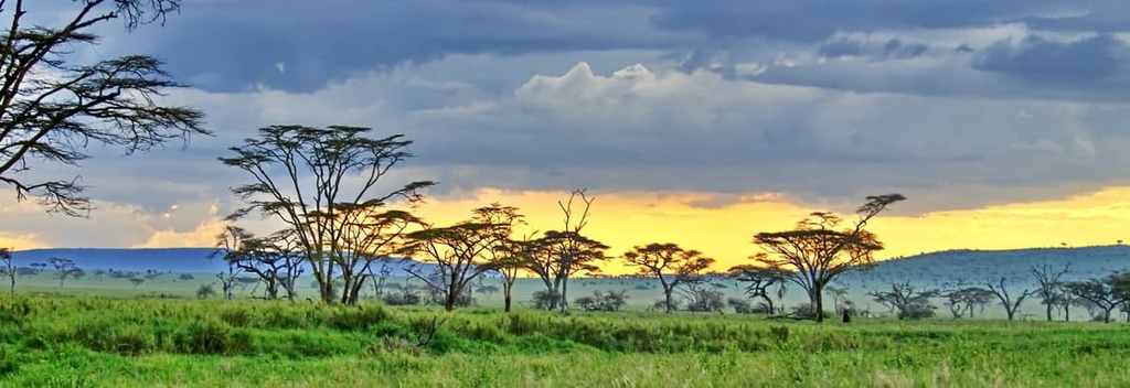
Many ecosystems exist in Tanzania including savannas, miombo woodlands, temperate deciduous forests, tropical rainforests, mangroves, alpine meadows, and arid plateaus.
Miombo woodland comprises much of the land cover in the western and southern plateaus of Tanzania. Tree species in the genera of Brachystegia, Isoberlinia, Acacia, and Combretum are among the most common in this ecosystem. However, areas of Tanzania with lower precipitation rates tend to primarily be covered in bushlands and thickets.
Grasslands and savannas arise in Tanzania where there is poor soil drainage. An excellent example of this is the grassland plains of the Serengeti, which are the result of a type of calcium-rich hardpan called calcrete.
On the other hand, swamps in Tanzania form in areas of perennial flooding. Tropical forests with high levels of biodiversity cover many of the country’s highland mountains and much of its coastal areas.
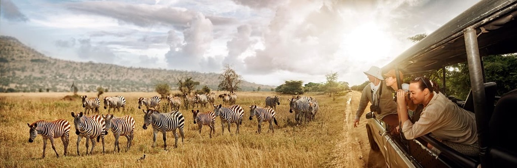
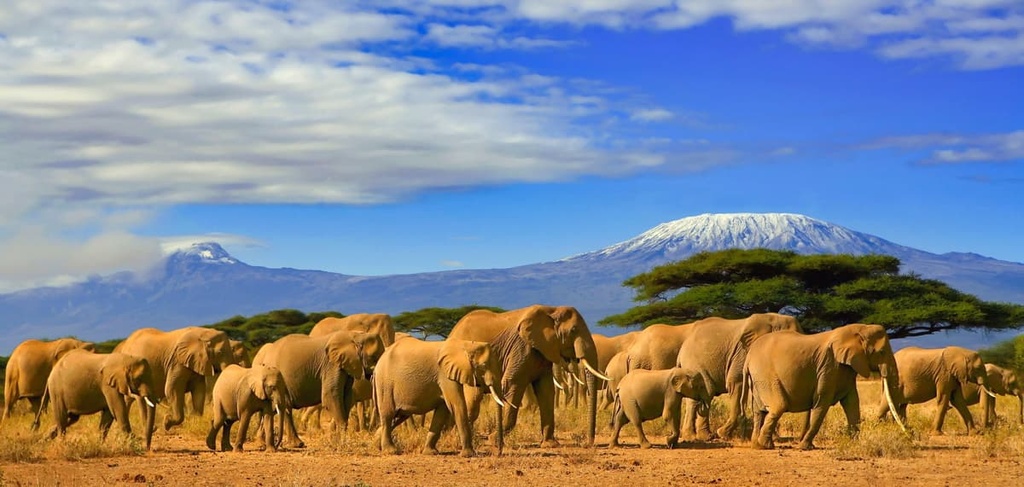
Apart from Mount Kilimanjaro, Tanzania is best known for the iconic wildlife that it supports in enormous numbers.
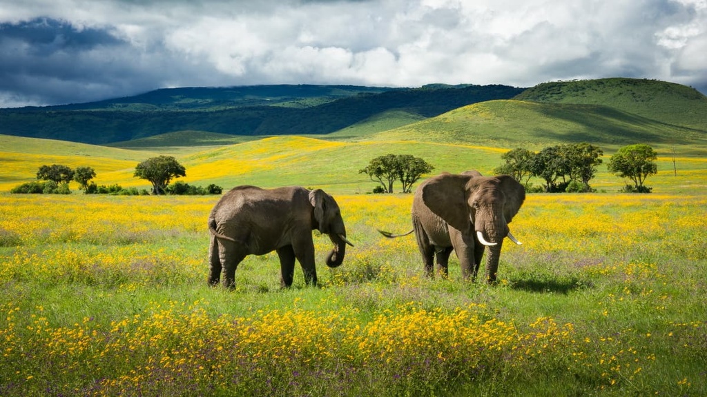
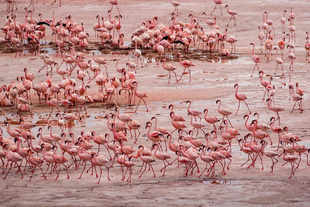
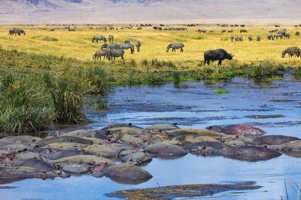
Visitors on safari in Tanzania often hope to see the “big five” animal species, namely rhinos, leopards, lions, cape buffalo, and elephants. Many species of ungulates roam Tanzania, too, including wildebeest (with their world-renowned migration through Serengeti and Kenya’s neighboring Maasai Mara), zebras, giraffes, gazelles, eland, kudu, and petite dik-diks.

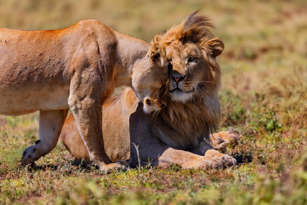
Carnivores are almost as diverse in Tanzania as ungulates. From lions, leopards, and cheetahs, to caracals, hyenas, jackals, and wild dogs, numerous carnivores thrive in Tanzania’s many ecosystems.
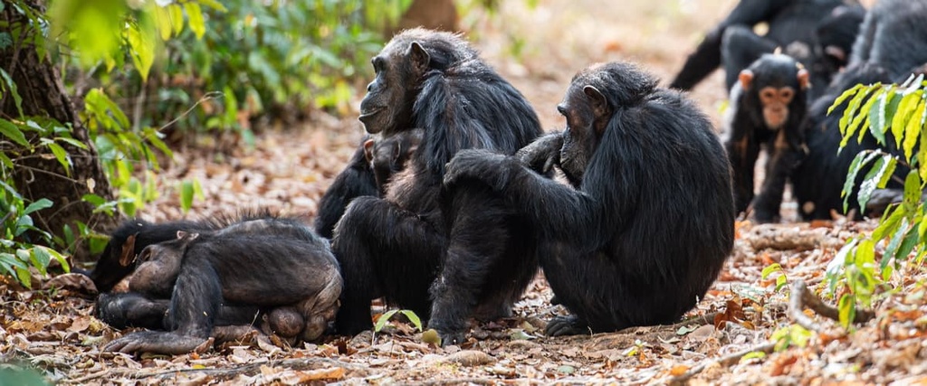
Primates that live in Tanzania include the chimpanzees found in Gombe National Park, as well as baboons, vervets, blue monkeys, and Zanzibar red colobus, which is endemic to its namesake islands. Bee-eaters, cranes, ibis, kori bustards, ostriches, starlings, and the remarkably colored roller are just several types of birds that draw larger numbers of birders to the country each year.
Snakes, chameleons, and marine wildlife along the coast and islands of Tanzania round out the impressive collection of wildlife that the country supports. The country’s swamps and lakes also support hippos and crocodiles. Each year, whale sharks migrate along the small island of Mafia just north of Zanzibar, too.
The country that is now called Tanzania has a history of human habitation that dates back potentially hundreds of thousands of years.
In fact, some of the oldest remains of early humans ever discovered in the world were found in Tanzania’s Olduvai Gorge. The gorge, which is located in the northern part of the country between Ngorongoro Conservation Area and Serengeti National Park, is home to a number of very important paleoanthropological sites.
This includes the remains of multiple individual specimens of Homo habilis, an early human ancestor that’s believed to have lived around 2.3 to 1.65 million years ago. The discovery of these early hominids helped scientists trace human origins to Africa, and the importance of the Olduvai Gorge to paleoanthropological studies can’t be overstated.
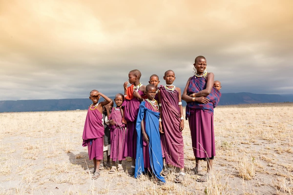
In more recent millennia, the area that is now called Tanzania became home to many Tribes and ethnic groups. There is some debate among scholars over which Tribes first settled in the country as there were many waves of migration that brought Tribes from other parts of Africa into what is now Tanzania. However, the Hadza (Hadzabe) and Sandawe are widely recognized as being some of the earliest people to settle in the country.

Around 120 tribes live in Tanzania to this day, each with distinct cultural practices and languages. Most people in the country are of Bantu descent, and their ancestors migrated into the region from the west and south. For example, the Sukuma, the country’s largest ethnic group, are of Bantu descent. Other ethnic groups such as the Iraqw and Mbugu, are Cushitic in origin and likely migrated to the country from Ethiopia in the north.
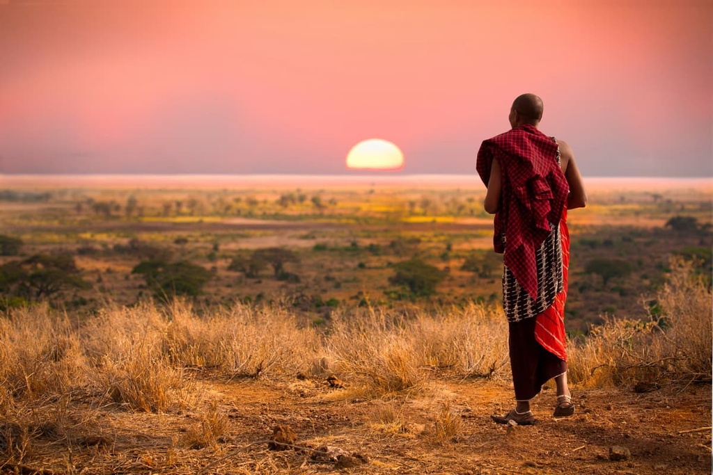
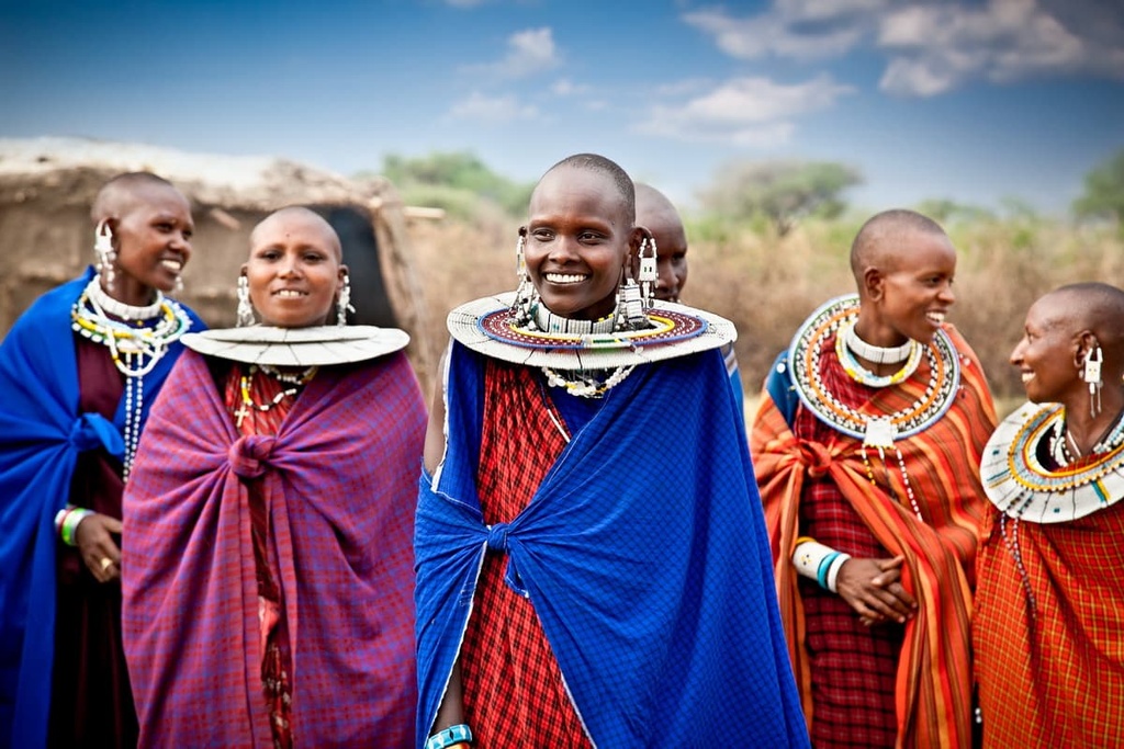
The hunting-gathering Hadza (Hadzabe) tribe thrives in Tanzania in small numbers in the northern part of the country around Lake Eyasi, too. Additionally, the Maasai, a semi-nomadic and pastoralist tribe that lives in both Tanzania and Kenya, are known for having retained much of their culture and tribal identity even with the influence of modernization.

During the early part of the first millennia CE, merchants and travelers from as far away as the Arabian Peninsula and even modern-day India started making their way to Tanzania. By about the eighth or ninth century CE, Islam also became a major religion in coastal East Africa.
Trade grew rapidly in the region by the eighth century, especially along the coast of what is now Tanzania. A number of medieval city-states, such as the Kilwa Sultanate, also started to grow in the area along the so-called Swahili Coast.
As was the case with most countries in Africa, Tanzania was colonized for a substantial portion of its recent history. The Omani Sultan Said bin Sultan actually moved his capital to Zanzibar in the mid-nineteenth century at the height of the Omani Empire.
During this time, Zanzibar became the slave trade capital of East Africa. For centuries, people captured in tribal and regional warfare in the region were often sold as slaves to traders from Northern Africa and the Middle East. Zanzibar’s location off the coast made it a convenient port for slave traders traveling to and from Africa’s eastern coast. The mainland towns of Bagamoyo and Tabora served as stops along this trade route as early as the 1800s.
European colonization of what is now Tanzania started in the late nineteenth century when Germany claimed the region as part of German East Africa. This colony also included parts of Rwanda, Mozambique, and Burundi.
After World War I, the colony of German East Africa was divided up by the League of Nations between Belgium, the United Kingdom, and Portugal. The United Kingdom eventually became the main colonial power in Tanzania with the establishment of the colony of Tanganyika in 1916.
The colony of Tanganyika declared its independence in 1961. It became a republic one year later in 1962, joining a wave of former British colonies that became sovereign nations during this time. The country officially joined forces with the People’s Republic of Zanzibar and changed its name to Tanzania in 1964.
A socialist period in the late 1900s contributed to a strong and cohesive national identity in Tanzania. For example, Ujamaa was a program in the 1960s under President Julius Nyerere where the country pursued a nationwide plan of collective agriculture and unifying the country under the Swahili language.
The following decade ushered in an initiative called villagization that mandated the relocation of millions of people to concentrated villages. Although this socialist vision faded with time, there is relatively little ethnic conflict among tribes in Tanzania as a result of this period of national unification.
Around the turn of the twentieth century, sisal production was a major industry in Tanzania as its dried fibers were used as packing material. As synthetic fibers were developed, however, the industry died out.
Nowadays, the country’s main industries include agriculture, tourism, and mining. Tanzanite, a gemstone with a typically blue or purple hue, comes only from a small region in northern Tanzania and is a relatively popular export from the country.
The cities of Arusha, Mwanza, Dar es Salaam, and Mbeya are now major commercial centers in Tanzania. Morogoro and Moshi are two towns in the country that were made affluent in part because of the fertile land and agricultural potential they hold. Zanzibar remains a popular tourist destination in Tanzania, too, as its beautiful beaches attract visitors from across the globe.
Mount Kilimanjaro draws thousands of visitors to Tanzania each year. But there are several other peaks and ranges that offer exciting opportunities for wildlife viewing and cultural immersion in Tanzania. Here’s a quick look at some of the best hikes in Tanzania to consider for your next trip to the country.
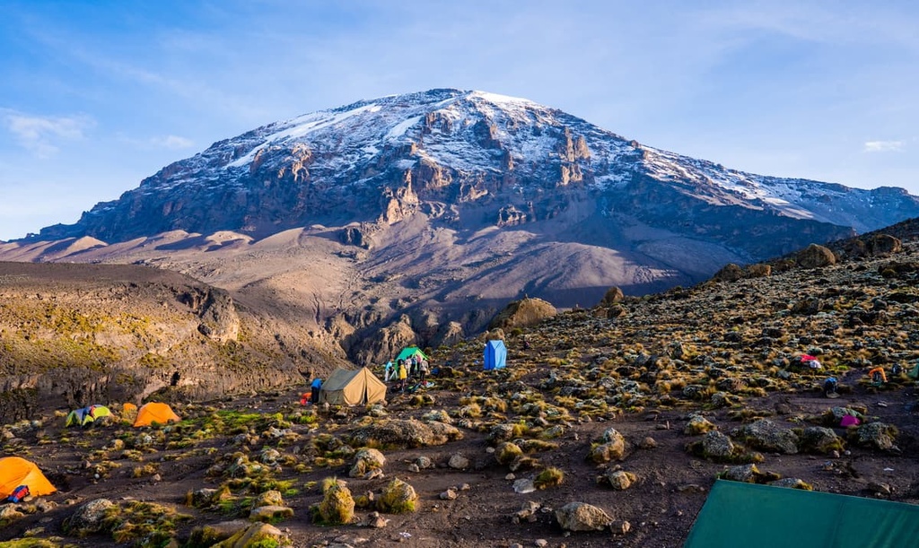
Of all Tanzania’s peaks, few evoke as much awe and respect as Kilimanjaro. As the tallest peak in both Tanzania and the continent of Africa, Kilimanjaro is easily one of the most popular mountains to climb in the country. Since it’s also one of the Seven Summits, Kilimanjaro is a must-climb for ambitious mountaineers.
That being said, country-wide and park regulations in Kilimanjaro National Park mandate that guides accompany all visitors on the mountain. Guides typically arrange all permits, porters, and accommodation logistics for climbers on the mountain, but trips to Kilimanjaro can range from simple mountaineering adventures to more luxurious guided expeditions depending on your budget.
Climbers can choose from seven routes to get to the summit of Kilimanjaro, including the Northern Circuit, Lemosho, Shira, Machame, Rongai, Marangu, and Umbwe routes. The Lemosho and Machame routes are typically recommended for first-time climbers.
Many guides argue that the Lemosho route is very scenic, though it gets more traffic than most of the other parts of the mountain. The Machame route is also very popular, as is the Marangu route. If you want to approach from the north where you can enjoy a more challenging hike with fewer crowds, the Rongai route is a good option to consider. Alternatively, you can aim for a longer hike via the Northern Circuit.
Although it’s possible to climb the mountain faster, climbers typically have the best success rate on Kilimanjaro during 7- to 8-day-long expeditions. This is because a longer trip provides hikers with time to acclimate to the high elevation of the mountain. Climbers have summited the mountain in as little as five days, but inclement weather or difficulty acclimating to the elevation can thwart a successful summit during shorter trips.
Mount Meru is the second-tallest mountain in the country and the fifth-highest mountain in Africa. It is located in Arusha National Park in the northern part of the country, just to the west of Kilimanjaro.
There is only one official route up the summit of Mount Meru that begins at Momella Gate. Most hikers take four days to complete the route, although it can be completed in three days. The potential for wildlife spotting is high on Mount Meru, especially in the mountain’s forested lower elevations.
Nestled along the eastern banks of Lake Tanganyika, Gombe National Park (also called Gombe Stream National Park) is home to the chimpanzee community Jane Goodall studied during her ground-breaking research in the 1960s.
At only 52 square km (20 square mi) in area, Gombe National Park is a small and remote protected area. However, with a guide, visitors can trek into the park’s incredible forest to locate one of the troops of chimpanzees that make the region so special.
The humid, off-trail hiking that takes place in the park can be challenging. The duration and distance that you’ll hike in a given day in Gombe depend greatly on where the chimpanzees are hanging out during your visit.

Treks into the park tend to start early in the day for the best chance of success in locating the chimpanzees. However, it’s recommended that you book two days' worth of trekking in the park in case you don’t find the chimpanzees on the first day.
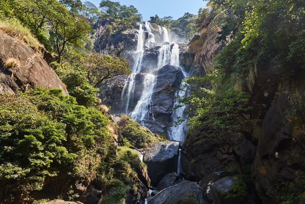
Central Tanzania’s Udzungwa National Park is a remote protected area that has no road access. This park, which is only accessible on foot, encompasses areas of tropical forest, montane forest, miombo woodland, grassland, and raised steppe. The elevation in the park ranges from lows of around 250 m (820 ft) to highs of 2,576 m (8,451 ft) on Lohomero.
One of the most popular hikes in Udzungwa is a 4-hour long trail that leads to the top of the Sanje Waterfalls. Visitors can swim in the pools below the waterfall to cool off after a day of hiking, too, though doing so is at their own risk.
The Usambara Mountains is a collection of rugged peaks located in the northeastern part of Tanzania.
Thanks to its lush tropical forest and views of the Indian Ocean on a clear day from some summits, mountain trekking in the range is extremely rewarding without being excessively challenging. Hiking routes in the range typically last a few days and you can often find accommodation in villages along your journey.
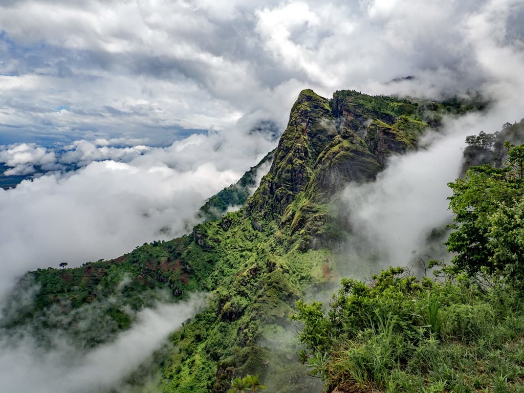
Trails in the Usambara Mountains typically pass through forest reserves and along local roadways, offering an intimate glimpse into life in the region and a more authentic cultural experience than more touristy spots in the country.
Many people visit Tanzania on organized tours. In some cases, a local guide is extremely helpful for navigating public transportation and permits in Tanzania, especially because entering many natural places and sites in the country typically requires an entry fee or other logistical considerations.
In addition to its two major international airports—Kilimanjaro International Airport and Dar es Salaam International Airport—Tanzania is home to many smaller regional airports that are serviced by airlines like Air Tanzania.
For reference, buses (costa), minivan buses (daladala), motorcycle taxis (bodaboda), and tuk-tuks (bajaji) are the main modes of public transportation in Tanzania. Camping spots can be a bit tricky to find outside of national parks in the country, but some online research or the help of a guide can help you locate places to stay wherever your travels might take you.
With that in mind, here are some of the best cities to check out during your next visit to Tanzania.
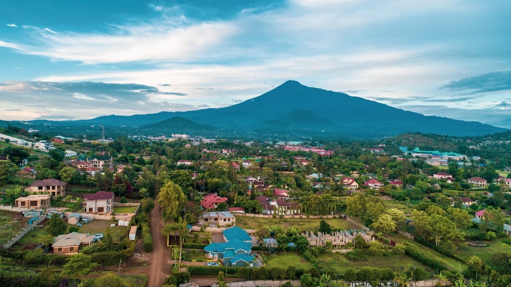
As the urban hub of northern Tanzania, Arusha is a major city with a population of just over half a million people.
The city is located about 50 km (30 mi) to the west of Kilimanjaro International Airport, less than 200 km (125 mi) from Ngorongoro Conservation Area, and about 80 km (50 mi) from Moshi (the base town for hiking Mount Kilimanjaro). As a result, Arusha hosts most visitors coming to hike Kilimanjaro or visit the iconic national parks of the north.

During a trip to Arusha, be sure to visit the Cultural Heritage Center, which is an enormous art museum celebrating Tanzania’s rich and diverse cultural history where everything is also for sale. You can also check out Shanga, a creative workshop that employs Tanzanians with disabilities, or you can spend hours wandering through local food and clothing markets.
If you’re looking for a way to adventure outside during a trip to Arusha, the closest spots to the city for wildlife viewing are Arusha National Park, Lake Manyara National Park, Tarangire National Park, Ngorongoro Conservation Area, and Serengeti National Park.
Several grand hotels and lodges offer high-end accommodation in Arusha, too. Plus, local budget hotels can be found for approximately 15 USD per night in Arusha, and they typically include breakfast, too. Alternatively, you can book a stay at one of the city’s many hostels or you can spend a few nights at one of the eco-camps or lodges that’s located in the surrounding region.
With nearly seven million inhabitants, Dar es Salaam is a major city located on the coast of Tanzania that’s jam-packed with activity.
In Dar es Salaam, you’ll find all the restaurants, sights, and accommodations of any big city, but be prepared to sit in traffic when traveling around town. While in Dar es Salaam, be sure to visit the city’s many museums and local markets. For more of an outdoor adventure, consider taking a ferry from Dar es Salaam to Zanzibar. Or, you can go wildlife spotting at the nearby Selous Game Reserve.

Due to the fact that Dar es Salaam is the most populous city in Tanzania, it’s relatively easy to get to it from elsewhere in the country and from further afield. One of Tanzania’s largest airports, the Dar es Salaam International Airport, is located in the city. Dar es Salaam also has road and rail links to much of Tanzania, so it’s a great place to start your travels in the country.
Mwanza is a bustling city with over one million inhabitants that’s located in northwestern Tanzania along the eastern shores of Lake Victoria.
Standard street food, local eateries, and international restaurants are all available throughout the city, so it’s a great place to visit for some of the foodies among us. Accommodation options in Mwanza also run the gamut from local hotels and hostels to luxury lodges, making it a suitable choice for nearly any traveler.
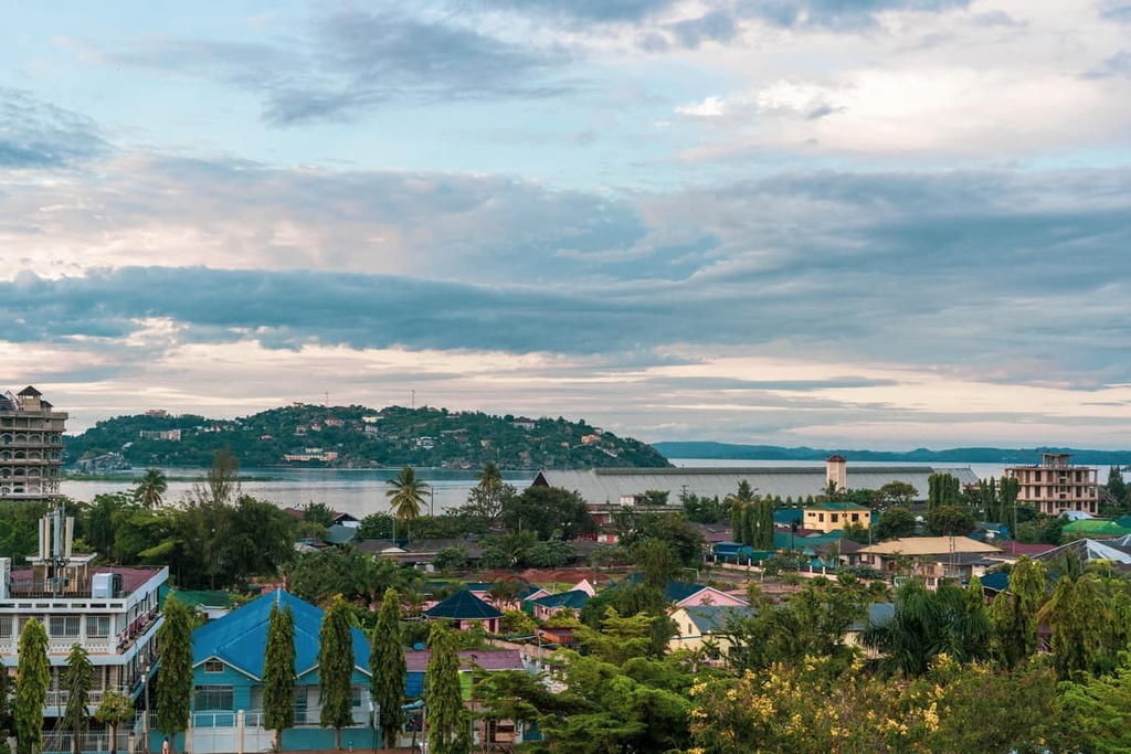
While in Mwanza, be sure to make the most of the nearby Lake Victoria by taking a cruise on the Kamanga Ferry or visiting Saanane Island National Park. That being said, travelers should avoid swimming in Lake Victoria because schistosomiasis, a waterborne parasite that enters the host through the skin, is present in the lake water (and in other still or slow-moving bodies of water throughout Tanzania).
Mwanza is relatively easy to get to from elsewhere in Tanzania and the surrounding area because it has its own regional airport with regular flights to Dar es Salaam and Nairobi. The city also has train and bus links to major cities in the country, so it’s easy enough to get to if you prefer to travel by public transport.
Iringa is one of the main cities in the southern highlands of Tanzania as over 100,000 people call the area home. From street food to international restaurants and local hotels to lodges, the city has dining and accommodation options to suit travelers with any budget.
During a visit to Iringa, a trip to Ruaha National Park for wildlife spotting is an absolute must. For the history and culture buffs among us, be sure to spend the day at the Isimila Stone Age Site or the Ligereke Rock Paintings. The Iringa Boma is also located in town and serves as the regional museum and cultural center, so be sure to stop by if you’re in the area.

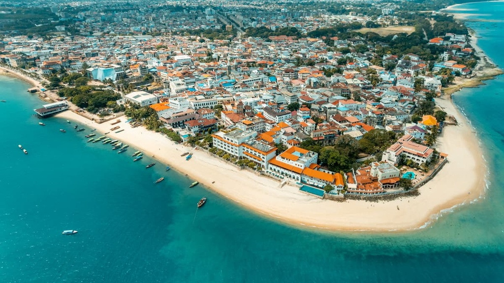
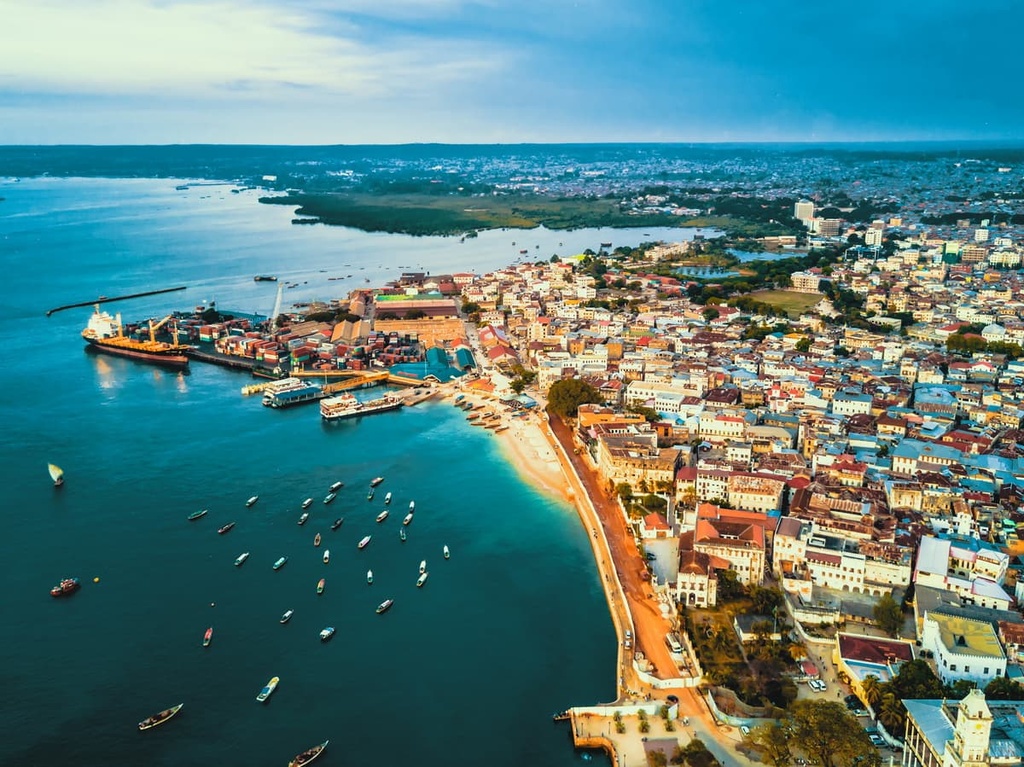
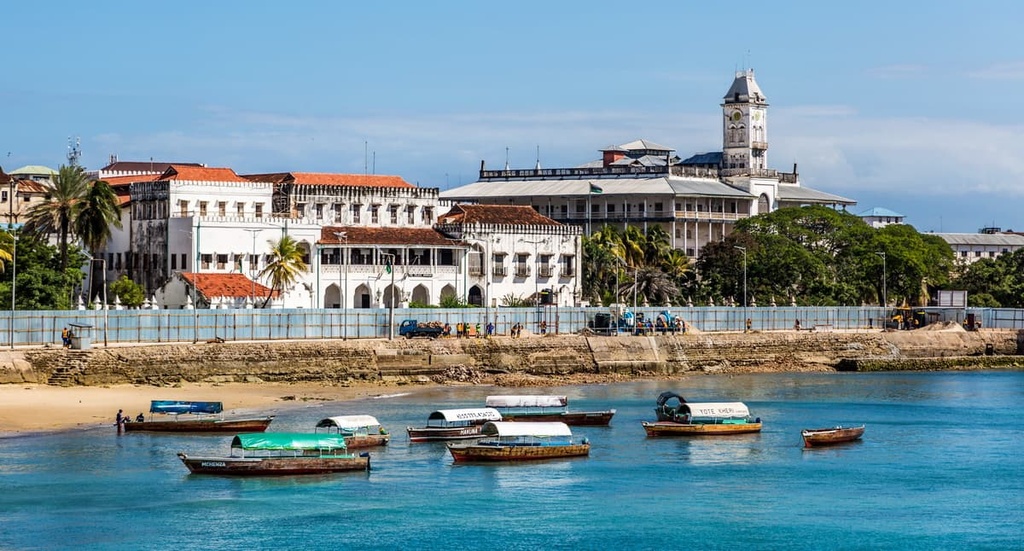
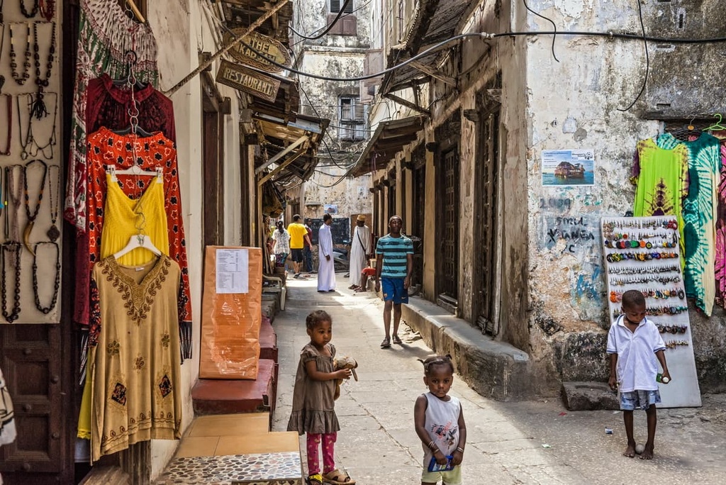
Stone Town of Zanzibar (also called Mji Mkongwe) is a community of around 16,000 people that’s located in Zanzibar City. It is the historic capital of Zanzibar and one of its major cultural attractions.
In fact, Stone Town is a UNESCO World Heritage Site that’s jam-packed with great places to visit. A wander through Stone Town will send you through numerous historic alleys and streets, many of which boast some of the most photographed doors in the world with their blend of Swahili, Arab, and Indian designs.
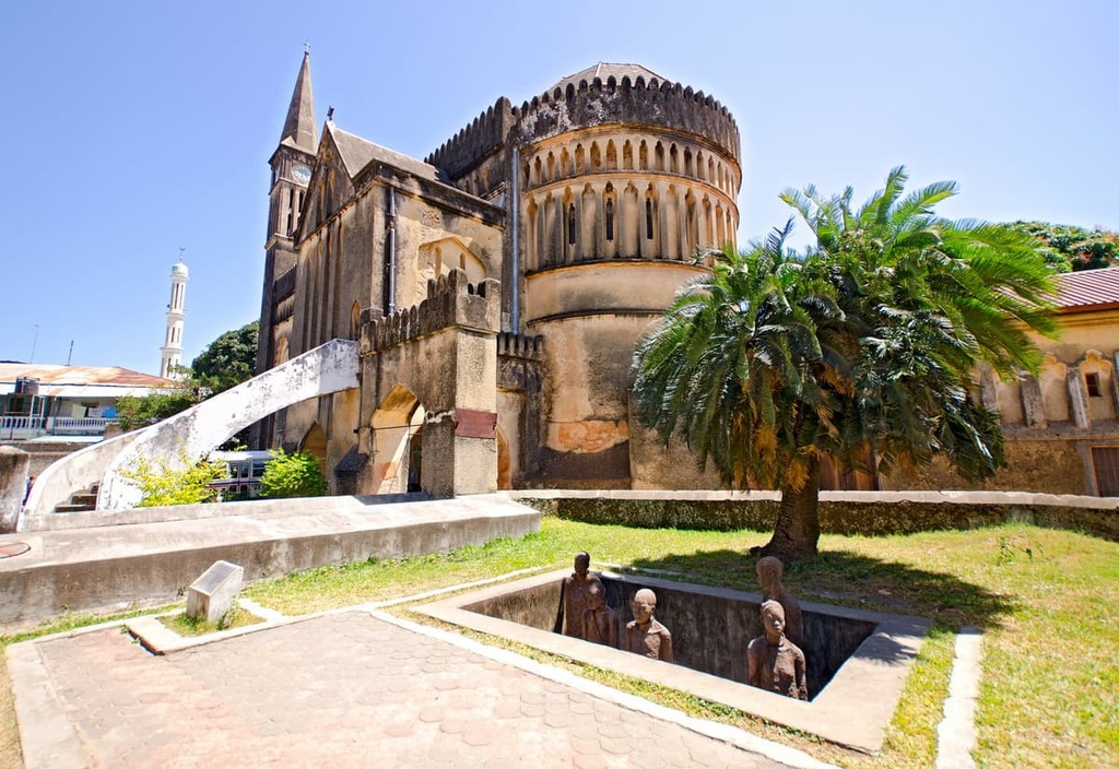
While in Stone Town, be sure to visit the slightly derelict Palace Museum, which is the former home of the Sultan of Zanzibar. It’s also worth making a visit to the Slave Trade Museum to learn more about the darker side of the city’s history.
No trip to Stone Town is complete without a day trip for a spice tour or a visit to the tiny Prison Island, which is home to a population of giant tortoises. Oh, and while in Stone Town, don’t miss the local nighttime food market where fresh seafood, Zanzibar pizza (a fried dough pocket with mixed vegetables and egg), spiced coffee, and chai are served fresh for everyone to enjoy.
Traveling around Stone Town is almost exclusively done on foot as the old town streets are very narrow. But, you can get around Zanzibar City by bus and share taxi, and you can get to the city itself by air and ferry from Dar es Salaam and other major destinations in East Africa.


ultra
volcano
africa-4000ers
tanzania-ultras
ultra
volcano
africa-4000ers
tanzania-ultras


