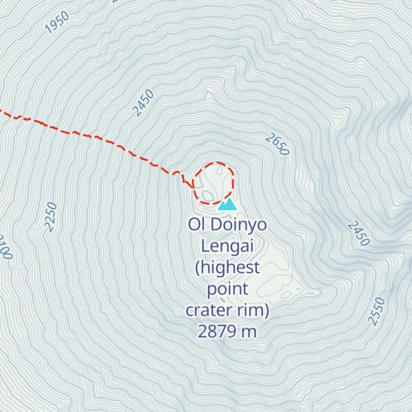
Ol Doinyo Lengai is an active volcano in northern Tanzania. It consists of a volcanic cone with two craters, the northern of which has erupted during historical time. Uniquely for volcanoes on Earth, it has erupted natrocarbonatite, an unusually low temperature and highly fluid type of magma. Eruptions in 2007–2008 affected the surrounding region.
By elevation Ol Doinyo Lengai is
# 12 out of 137 in Arusha # 19 out of 2392 in Tanzania # 19 out of 380 in the Pare Mountains
By prominence Ol Doinyo Lengai is
# 5 out of 137 in Arusha # 12 out of 2392 in Tanzania # 8 out of 380 in the Pare Mountains
We use GPS information embedded into the photo when it is available.
3D mountains overlay
Adjust mountain panorama to perfectly match your photos because recorded by camera photo position might be imprecise.
Move tool
Rotate tool
Zoom
More customization
Choose which peak labels should make into the final photo and what photo title should be.
Next
Photo Location
Satellitte
Flat map
Relief map
Latitude
Longitude
Altitude
OR
Latitude
°'''
Longitude
°'''
Apply
Register Peak
Peak Name
Latitude
Longitude
Altitude
Register
Teleport
PeakVisor
This 3D model of Sagarmatha National Park in Nepal was made using the PeakVisor app topographic data. The mobile app features higher precision models worldwide, more topographic details, and works offline. Download PeakVisor maps today.
Download OBJ model
PeakVisor
The download should start shortly. If you find it useful please consider supporting the PeakVisor app.
PeakVisor for iOS and Android
Be a superhero of outdoor navigation with state-of-the-art 3D maps and mountain identification in the palm of your hand!