
Scan the QR code and open PeakVisor on your phone
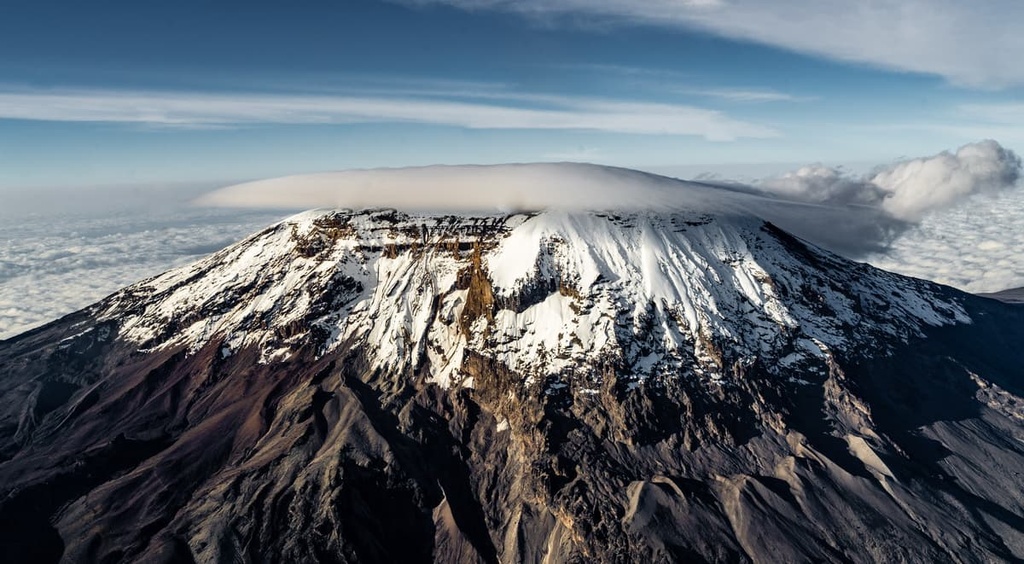
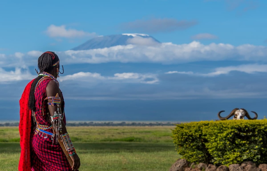
Kilimanjaro National Park is a protected area that’s located in northern Tanzania in East Africa. There are 11 named mountains within the park, the highest and most prominent of which is Uhuru Peak on Kilimanjaro, which has an elevation of 5,895 m (19,341 ft). Kilimanjaro is the tallest mountain in Africa and the tallest freestanding mountain in the world.
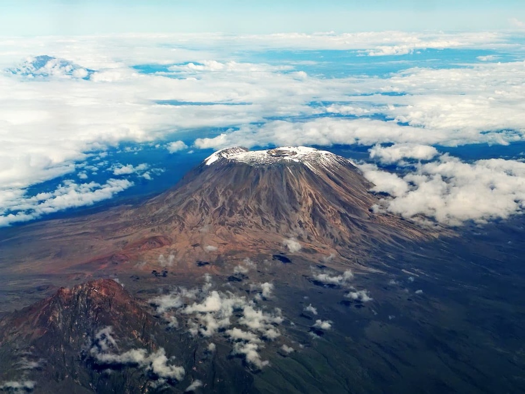
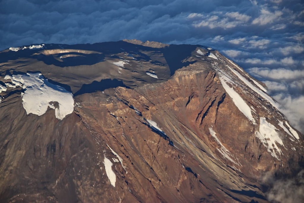
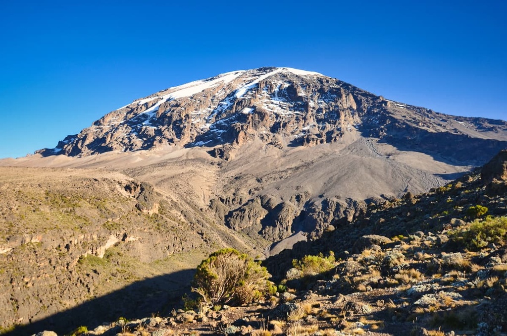
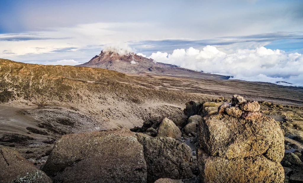
Kilimanjaro National Park covers 1,688 sq. km (652 sq. mi) of terrain in northern Tanzania in East Africa. Kilimanjaro itself is a dormant stratovolcano with three main volcanic peaks, all of which are located in the park. The peaks of Shira and Mawenzi are volcanically extinct and Kibo, where Uhuru Peak is located, is dormant.
The park was established in 1973. Initially, it only covered the mountain above the treeline and six forest corridors. In the years that followed, it became clear that it was important to protect the lowland forests in the region in order to maintain the mountain’s ecological integrity.
In 2005, the park was expanded to include the montane forests on Kilimanjaro’s lower slopes. The park is also a designated UNESCO World Heritage Site.
The small city of Moshi is located just to the south of Kilimanjaro National Park. Further to the west beyond Moshi, you can find Kilimanjaro International Airport and Arusha, the largest city in the northern region of Tanzania.
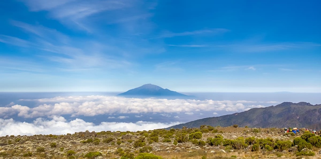
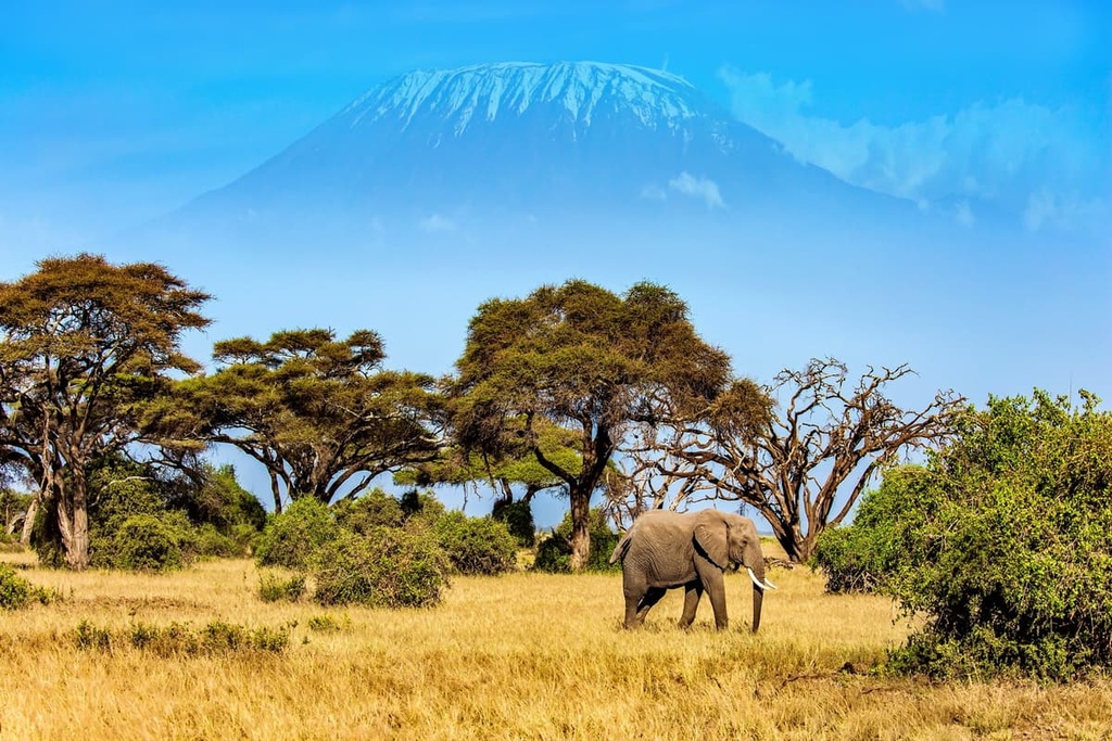
Arusha National Park and Mount Meru, Tanzania’s second tallest peak, both neighbor Kilimanjaro to the west. Meanwhile, Amboseli National Park lies slightly to the north of Kilimanjaro National Park across the border in Kenya.
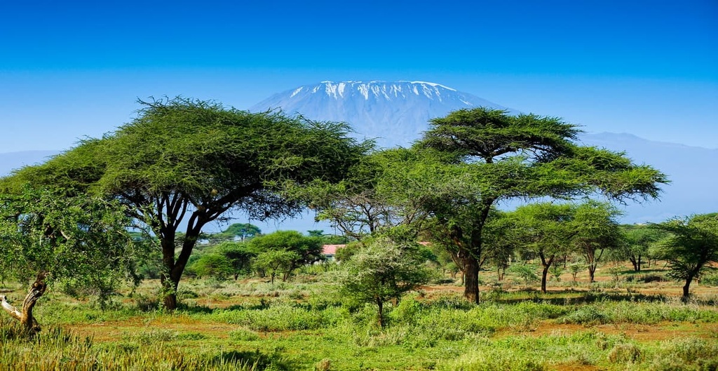
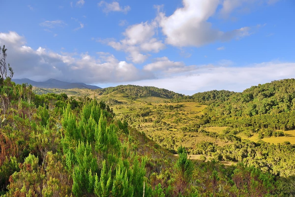
The region around Kilimanjaro is incredibly fertile and lush as a result of its nutrient-rich volcanic soils and abundant water sources. The mountain’s lower slopes and surrounding hills also boast many coffee and tea plantations as well as subsistence farms.
Kilimanjaro formed as a result of the Great Rift Valley system. As the region’s tectonic plates pulled apart, the thinning crust created the ideal conditions for volcanic activity. Volcanic activity around Kilimanjaro began about one million years ago. During this time, the lava that the volcanoes produced was primarily viscous and slow-spreading.
Shira was the first volcano in Kilimanjaro. It began erupting about 750,000 years ago and continued to be active for about 250,000 years. Eventually, it became extinct and collapsed into an enormous caldera.
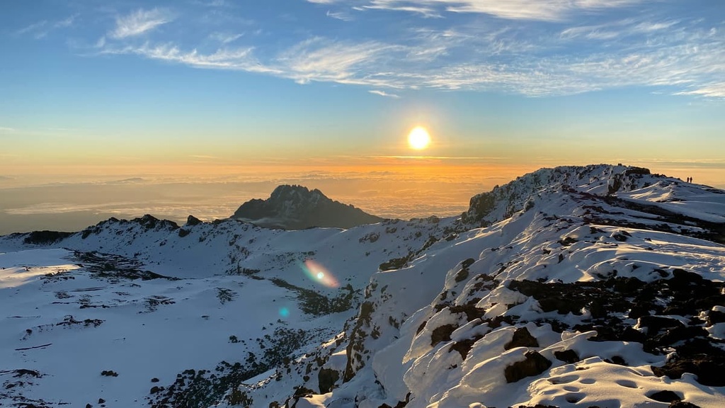
Shortly thereafter, Mawenzi began erupting. Kibo also formed about 460,000 years ago. That being said, despite the fact that it’s the only non-extinct volcano on the mountain, Kibo’s last documented volcanic activity occurred about 200 years ago and its last significant eruption was about 360,000 years ago.
The stratovolcano of Kilimanjaro is made primarily of ash, lava, and rock. It contains particularly large quantities of basalts and andesites. Kibo also contains a fair amount of obsidian.
Kibo has five main lava formations. The oldest is the lava tower group, which is composed mainly of phonotephrites and tephriphonolites that date back around 480,000 years. The rhomb porphyry group formed 460,000 to 360,000 years ago and is made up of tephriphonolite and phonolite lava.
Between about 360,000 to 335,000 years ago, the lent group formed. This group is characterized by aphyric phonolite lava with obsidian. Following this is the caldera rim group, which formed 275,000 to 170,000 years ago and is made up of igneous rocks such as quartz and feldspar. The final lava formation on the mountain is the inner crater group, which consists almost entirely of aphyric phonolites with rare instances of arginine phenocrysts.
Thousands of years of erosion post-eruption have given each of Kilimanjaro’s peaks a different shape. For example, Shira has flattened into a plateau whereas the steep-sided Mawenzi is covered by rugged rocks and deep-cut channels that make some parts nearly impassable. Kibo’s sides are mainly gentle slopes, so the hike to the summit is not too technically challenging.
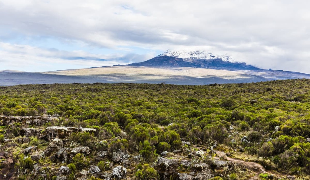
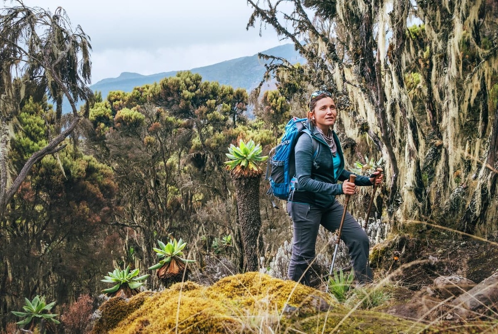
Kilimanjaro National Park encompasses five main vegetation zones: lower slopes/cultivation, montane forest, heath and moorland, alpine desert, and arctic summit. Across its vegetation zones and, in particular, in the park’s montane forest, the landscape supports high levels of biodiversity and several endangered species.
Mammals living on the mountain include duikers, hyrax, kudu, zebra, black and white colobus monkeys, buffalo, and leopards. Elephants have occasionally been spotted in the area but are generally only passing through the park rather than residing in it.
Although large wildlife like elephants, leopards, and buffalo are present in the park, it is not common to see them during a hike due to the high amount of human traffic on the mountain. However, visitors have a good chance of seeing black and white colobus monkeys in the park’s forests as well as a wide variety of birds such as trogons, hornbills, and turacos.
Here’s a quick overview of the different ecological zones found in the park:
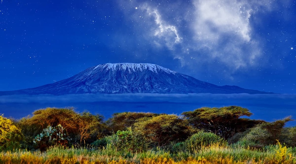
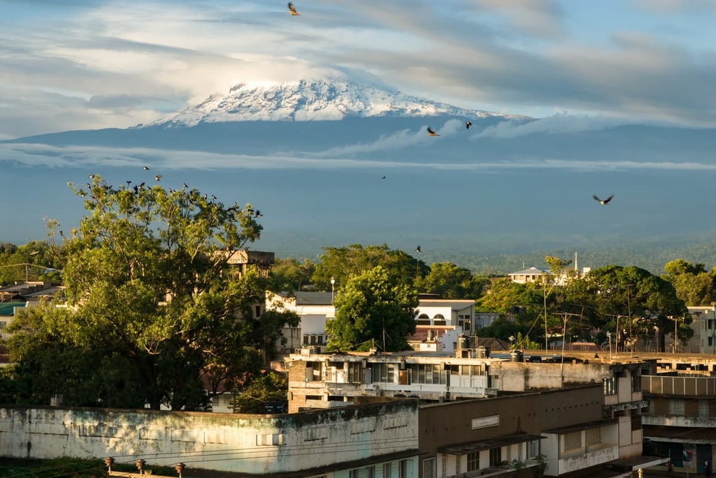
Kilimanjaro is one of only a few mountains in Africa with glaciers. However, Kilimanjaro’s snow caps are melting and have been reduced by about 80 percent since 1912. Some predict that the glaciers will be gone by 2030. The impact that melting glaciers might have on the farms and cities that rely on water from the mountain is unclear but worrisome.
Archeological evidence in the form of stone bowls dating back to 1000 BCE suggests that people have been living in what is now Kilimanjaro National Park for thousands of years.
The same conditions that make the fertile slopes on the mountain inviting today would have been equally appealing several thousand years ago. However, there is not much widely available written information about pre-colonial settlement in the area so there’s some debate over who lived in the region during this time and what their cultural practices were.
Kilimanjaro started to receive occasional references in written texts over the centuries as trade routes formed in the region. Records of the mountain started to increase as colonizing forces moved into East Africa. For a while, Kilimanjaro was actually believed to be the source of the Nile.
In 1889, German geographer Hans Meyer and Austrian climber Ludwig Purtcheller became the first Europeans to climb the mountain. As Tanzania had recently been annexed by Germany, they named the main peak Kaiser Wilhelm Spitz after the German emperor. After Tanzania gained independence in 1963, the peak was renamed Uhuru (“Freedom”) Peak.
The Kilimanjaro region is home to the Chagga tribe. The third-largest ethnic group out of Tanzania’s more than 120 tribes, the Chagga have a reputation for being economically successful and strong businesspeople.
Many people in the Chagga community live agricultural lifestyles and raise cattle. Bananas grow abundantly in the region and are considered to be a staple crop. In the Kilimanjaro region, bananas are either sold as fruit or are made for brewing a local type of alcohol.
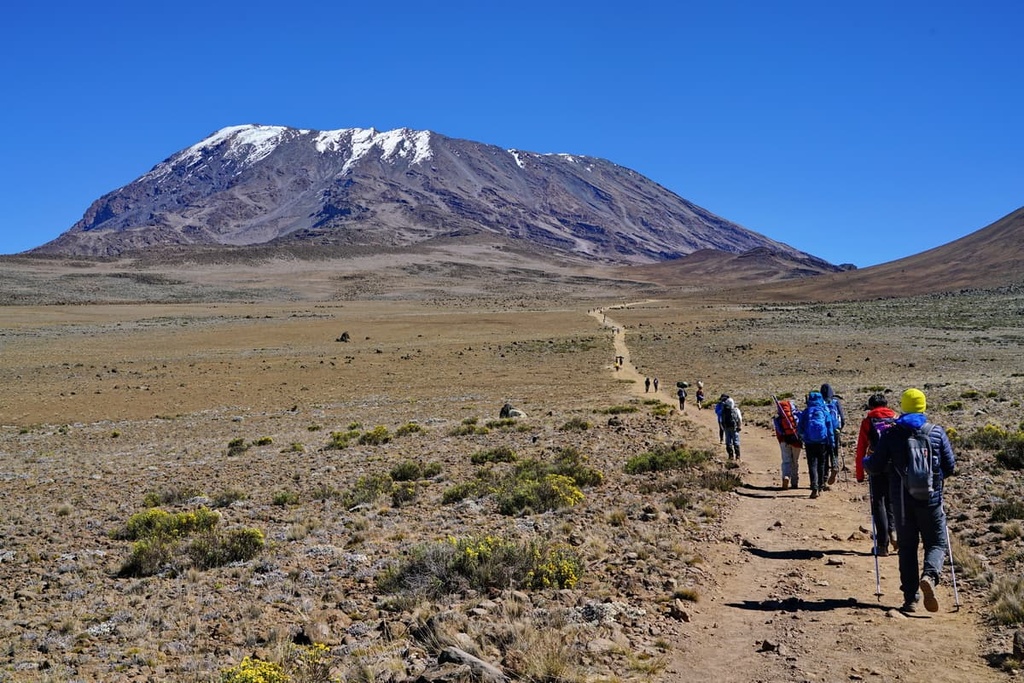
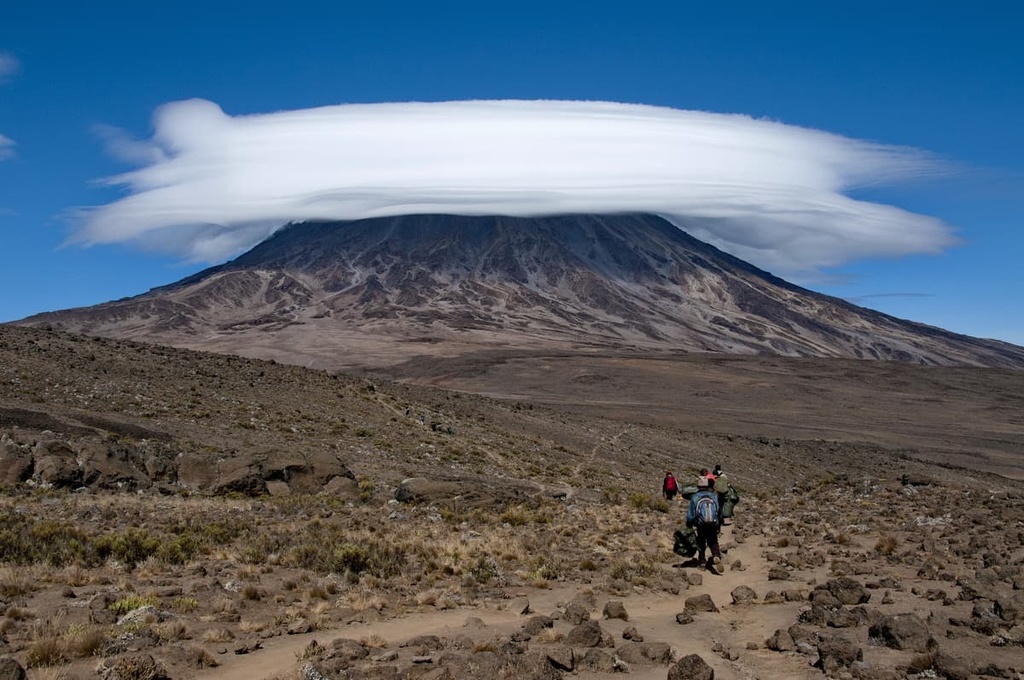
Most tourists who come to the park do so in an attempt to summit Kilimanjaro’s Uhuru Peak. There is roughly a 66 percent success rate for summiting the mountain. Most people who are unsuccessful in their summit attempt on Kilimanjaro have to turn back due to problems with altitude sickness.
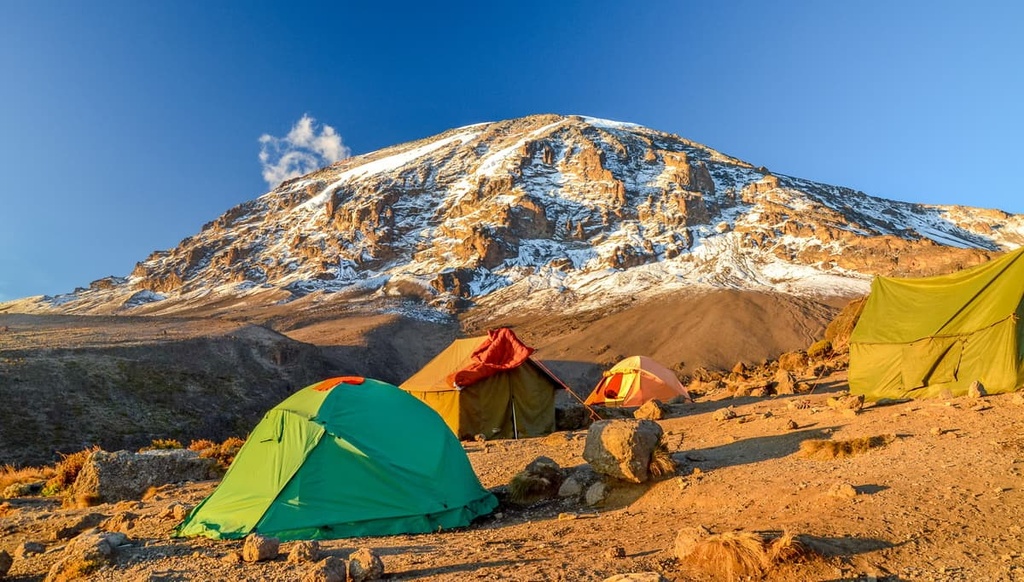
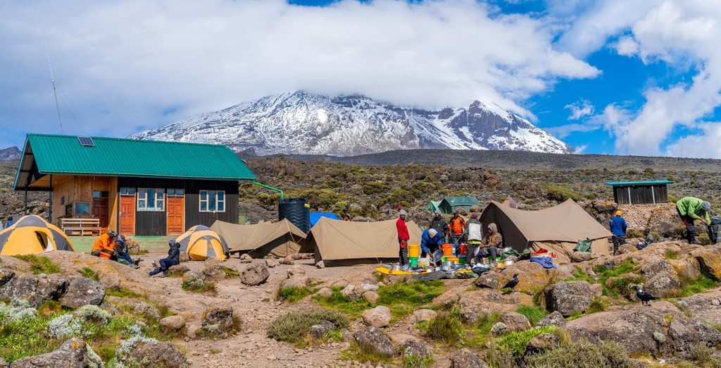
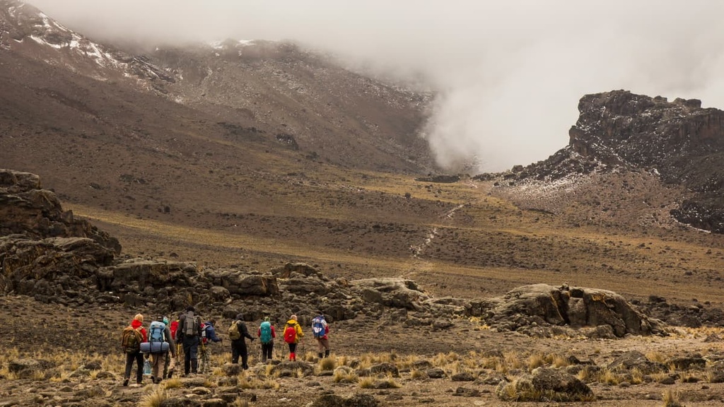
There are 7 main routes up Kilimanjaro. Summit ascents on the mountain take anywhere from 5 to 10 days depending on the chosen route and a hiker’s fitness level. Longer treks are typically recommended on Kilimanjaro as they provide climbers with more time to acclimatize. Also, note that a guide is required to climb Kilimanjaro, so independent ascents are prohibited.
There is also an option for a day hike on Kilimanjaro that allows visitors to pass through the montane forest up to the edge of the heath and moorland. The best hiking conditions on the mountain occur during the dry seasons, which are normally from December to March and June through October. However, these are also peak seasons, which means there will be more traffic on the trail.
With that in mind, here’s a quick overview of the major climbing routes on Kilimanjaro.
The Marangu route covers 70 km (43.5 mi) of terrain over five to six days. It is a popular route because it is considered to be relatively easy as far as the terrain goes. Most of the guided trips on the Marangu Route are relatively affordable, too because it requires fewer days in the national park than some of the alternatives.
However, the Marangu Route has a lower success rate than other routes because completing the hike in fewer days gives you less time to acclimatize. Additionally, it is the only route that goes up and comes down on the same trail. Camping is a possibility on the Marangu Route, but there are also huts available for those who would prefer not to camp.
The 61 km (38 mi) long Machame Route takes most people 6 to 7 days to complete. This trail is considered to be more challenging than the Marangu Route. But the extra days that you spend on the mountain increase the overall success rate for climbers on the Machame Route.
Even though it is slightly longer than the Marangu Route, the Machame Route is incredibly scenic because it offers views of the Shira Plateau and the Lava Tower. There are lots of ups and downs on this route, too, which help hikers acclimatize as it enables them to sleep at relatively lower elevations at night.
The Lemosho Route is a 7- to 8-day-long trek that covers about 67 km (41.5 mi) of trail. It starts on the western side of Kilimanjaro and cuts through the rainforest before meeting up with the Machame Route.
When compared to the other routes on the mountain, the Lemosho Route tends to be more expensive because it hikes through a more remote part of the park. However, it offers good opportunities for solitude on what is otherwise a very busy mountain.
Covering 58 km (36 mi) in 6 to 7 days, the Shira Route also traverses the west side of Kilimanjaro.
As the first part of this route follows a 4-wheel drive road, trekkers also have the opportunity to complete part of the climb in a vehicle, which can save you some time. However, driving part of the way up the mountain typically reduces your ability to acclimatize to the high elevation.
The Rongai Route is 74 km (46 mi) long and is typically completed in 6 or 7 days. As the only route that begins on the northern slopes of Kilimanjaro, the Rongai Route stays a bit drier than the other trails. This often makes it the preferred route during the rainy season.
Overall, many people find the Rongai Route to be less scenic than some of the other options. However, the route’s campsites generally provide great views and the route usually has a high success rate.
The Umbwe Route is a relatively short 48 km (30 mi) path that most people complete in 5 to 7 days. While the shortness of the Umbwe Route might be appealing, however, it is only recommended for experienced climbers. This is because, even though the route is not technical, it is quite steep and it has some exposed sections.
Many people regard the Umbwe Route to be one of the most difficult hikes on Kilimanjaro. This is due, in part to its steepness, but also because hiking up to the summit in such a short amount of time can make it difficult to acclimatize to the altitude.
The Northern Circuit is the longest route on Kilimanjaro. It is 88 km (54.5 mi) long and it takes most people 8 to 9 days to complete.
This route begins on the Lemosho Route but it eventually heads north toward Lava Tower before it makes its way to the summit. The Lemosho Route allows hikers to climb high and sleep low, too, so it has one of the highest success rates of any route on the mountain.
For those not looking to summit Kilimanjaro, it is possible to do a day hike in the park so you can appreciate the mountain in all its beauty. Depending on the company and guide you hire, a couple of different day hiking options may be available.
One of the more common day hikes leaves from Marangu Gate at 1,860 m (6,102 ft) in elevation and climbs 8 km (5 mi) through the forest to Mandara Hut at 2,700 m (8,858 ft). After resting for lunch, you can then follow a short trail that takes you up to see the Maundi Crater, where you can get views of Kilimanjaro and the surrounding landscape.
Moshi is the closest city to Kilimanjaro, so it is a popular starting location for trekkers. Meanwhile, Arusha, which is located about 50 km (30 mi) to the west of Moshi, is the largest city in northern Tanzania, which also makes it worth checking out. Kilimanjaro International Airport is located halfway between Moshi and Arusha, and it is a popular place to fly to if you’re looking to climb Kilimanjaro.
Here’s a look at the main cities in the greater Kilimanjaro region to help you plan your next trip to the park.
Moshi is a small but bustling city of around 200,000 people that serves as the base for most visitors who plan to hike Kilimanjaro.
The climate in Moshi during the summer months (December through February) can be hot and humid. Fruit and vegetables grow abundantly in this region and local markets are bursting with local produce, so be sure to sample the green bananas and locally grown coffee when you’re in Moshi.
Moshi has all of the amenities you would expect of a major city, including regular buses to Arusha and several big hospitals. Day trips to nearby Kikuletwa Hot Springs, Materuni Waterfall, and cultural coffee-making tours are all available in Moshi, too.
From budget hostels to fancy hotels, a wide range of different accommodations are available in Moshi for visitors to choose from. If you’re looking for a bite to eat while in Moshi, you can choose from street food vendors, outdoor cafés, and both local and international restaurants during your stay in the city.
Arusha is the largest city in the northern part of Tanzania with a population of just over half a million people.
It is the urban hub for tourists coming to visit Tanzania’s northern national parks, such as Serengeti, Tarangire, and Lake Manyara. Visitors to Arusha can choose from a local hotel or hostel in the city’s wonderfully chaotic center or they can find fancy hotels and lodges near the quieter edges of the city.

The city of Arusha has a lot for visitors to enjoy from local markets and museums to the nearby Arusha National Park. In addition to the international airport that lies 50 km (30 mi) to the east of the city, you can also fly into the Arusha Airport, which is located on the city’s western edge and offers connections to destinations around the country.


ultra
volcano
africa-4000ers
tanzania-ultras
ultra
volcano
africa-4000ers
tanzania-ultras


