
Scan the QR code and open PeakVisor on your phone
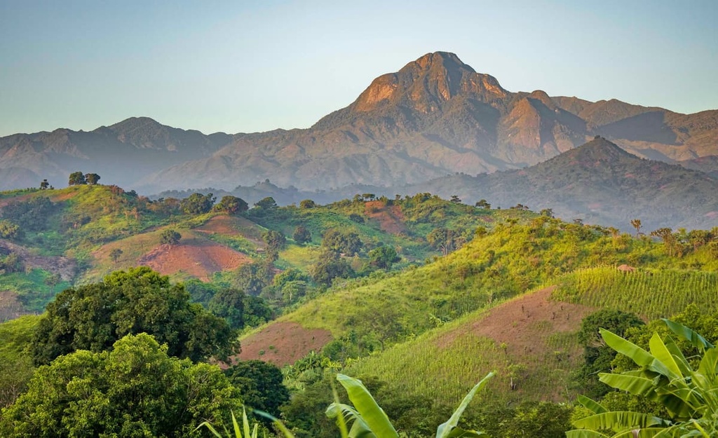
The Uluguru Mountains are a collection of peaks located in eastern Tanzania. The range is situated some 200 km (125 mi) inland from the Indian Ocean. The Uluguru Mountains, which include a main ridgeline and several isolated massifs, contain 26 named peaks. Within the range, the highest peak is Lukwangule (2,656 m/8,714 ft) but the most popular peaks among hikers are Lupanga and Bondwa Peak.
The Uluguru Mountains are a collection of peaks that are situated in eastern Tanzania. They are primarily located within the country’s Morogoro Region.
The mountain chain, which lies approximately 200 km (125 mi) inland from the Indian Ocean, is part of the Eastern Arc Mountains. The Eastern Arc Mountains are themselves a collection of ranges that stretch from southeastern Kenya to the Udzungwa Mountains in southeastern Tanzania.
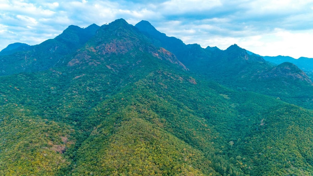
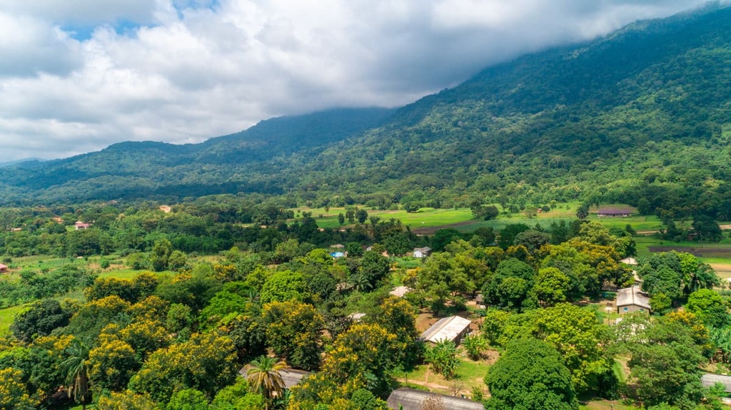
The Uluguru Mountains are about 45 km (28 mi) long. They consist of a main ridge that runs from north to south and five standalone massifs: Kitulangh’alo, Dindili, Mkumgwe, Mindu, and Nguru ya Ndege. The mountains in the range are steep and marked by cliffs and rocky outcrops.
A deforested saddle in the range called Bunduki Gap separates Uluguru North from Uluguru South. The range’s tallest peak, Lukwangule, is located in Uluguru South. The Lukwangule Plateau is about 20 sq km (7.5 sq mi) in area and it sits at over 2,300 m (7,545 ft) in elevation. However, most hikers in the range opt to visit Lupanga and Bondwa Peak in Uluguru North instead.
The range contains several nature reserves. One is made up of Uluguru North, Uluguru South, and Bunduki Forest Reserves, as well as an additional protected corridor in the Bunduki Gap.
Five additional forest preserves are located around the outlying massifs of the range and have been protected in order to preserve ecologically significant Eastern Arc habitats. These five protected areas are Kasanga, Mkangala, Mlaliwila, Ngambaula, and Tongeni River. In total, the reserves encompass about 35,700 ha (88,215 acres) of terrain.
The Eastern Arc mountains formed about 100 million years ago and they extend from the Taita Hills in southeastern Kenya to the Udzungwa Mountains in Tanzania.
The peaks in the chain are primarily block-fault mountains, so they formed as a result of periods of uplift followed by long stretches of stability and erosion. The Uluguru Mountains and the surrounding peaks of the Eastern Arc have long been considered to be of top conservation priority due to the high numbers of endemic species that they support.
Precambrian igneous and metamorphic rocks such as granulite, gneiss, and migmatite are the primary rocks found in the Uluguru Mountains. Soils in the range are primarily acidic lithosols and ferralitic red, yellow, and brown latosols. A few areas of the range, like the Lukwangule Plateau, are covered by peat deposits.
The soils here are generally fertile and the region is intensively used for agriculture. Expanding human settlements and forest conversion for cultivation have led to considerable soil erosion in the region, particularly rill erosion, over the past few decades.
The lush forests of the Uluguru Mountains support an incredibly high level of biodiversity. Here, the drier lowland coastal forests transition to rainforests, then to sub-montane, montane, and upper montane forests as elevation increases. Additionally, the Lukwangule Plateau supports Afromontane grasslands.
So far, scientists believe that the Uluguru Mountains house a minimum of 14 endemic vertebrate species, in addition to the other 16 animal and 26 tree species that are endemic to the Eastern Arc Mountains. The diverse habitats in the range also support high levels of biodiversity and other rare East African species.
A few of the bird species commonly found in the Uluguru Mountains include the western greenbul (Andropadus tephrolaemus), Sharpe’s akalat (Sheppardia sharpei), African tailorbird (Arthotomus metopias), and Bertram’s weaver (Ploceus bertrandi),
The range is also home to notable mammals such as the Zanzibar bushbaby (Galagoides zanzibaricus), the black and rufous elephant shrew (Rhynchocyon petersi), and the Abbott’s duiker (Cephalophus spadix).
The number of endemic invertebrates in the range is also particularly high. Approximately 86 percent of millipedes, 86 percent of linyphiid spiders, 27 percent of butterflies, 88 percent of harvestmen, 95 percent of montane ground-beetles, 100 percent of pselaphidae, and 91 percent of montane forest earwigs found in the range are endemic to the region.
Furthermore, the forests of the Uluguru Mountains are part of the main catchment area for the Ruvu River, which serves as a major water supply for Dar es Salaam. The range is also a catchment zone for the Morogoro River, which delivers water to the municipality of Morogoro.
With respect to weather patterns in the range, the region’s climate is heavily influenced by the Indian Ocean. As such, the eastern slopes of the Uluguru Mountains can see more than 300 cm (120 in) of rain annually.
Elevations below 1,000 m (3,280 ft) in the range would historically have transitioned from moist forest to savannah woodland, but most of this land has since been converted for farmland.
Major threats to the mountain habitats in the range are fires that spread from neighboring farmland, concentrated firewood collection, deforestation of unprotected forests (mainly in the north), human encroachment (mainly in the south), and invasive species (such as Maesopsis in the north and Rubus in the south).
The Uluguru Mountains are named after the Luguru tribe, who are also known as the Ruguru or Waluguru. The Luguru are a Bantu-speaking people who have lived in the area for about 300 years. Unlike many tribes in Tanzania, the Luguru tribe is a matrilineal society, and land claims in the tribe are passed down along female family lines.
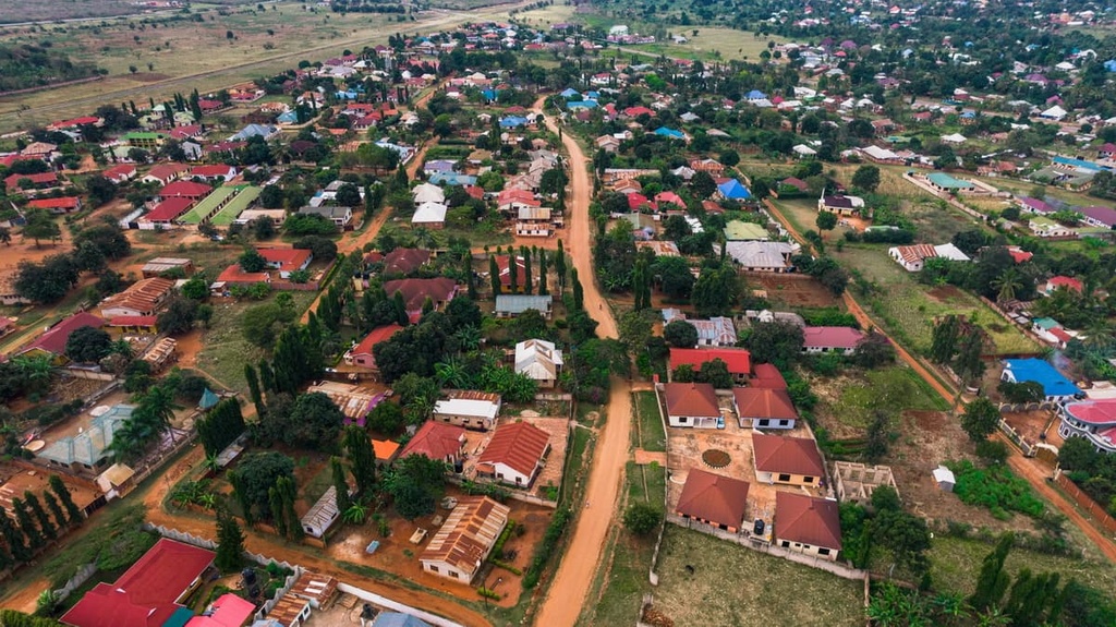
Approximately fifty villages border the forest reserve boundary around the range and at least 150,000 people live in the mountain area itself.
Many residents of the region practice subsistence agriculture, though more intensive commercial agriculture to produce crops such as rice, sorghum, maize, and cassava is also practiced in the area. However, people do not typically keep cattle in the region because of the tsetse flies, which can infect, weaken, and kill vertebrates like cows.
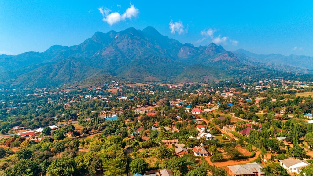
During the mid-1800s an east-west caravan route ran near the northern edge of the Uluguru Mountains. A man named Kisabengo founded a village as a stopover point for caravans to get supplies and porters. The town was initially called Simbamwene and later became the city of Morogoro that exists to this day.
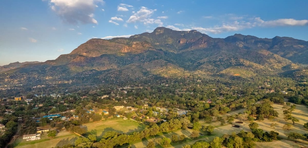
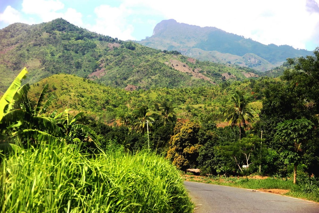
The most common hikes in the Uluguru Mountains for tourists staying in Morogoro are treks to Bondwa Peak, Lupanga, Choma Waterfall, or some combination of the three. Morningside is an often-used hut, campsite, and viewpoint for those turning their excursions to these places into a multi-day experience.
There is an online resource available that provides a series of maps of recorded footpaths for those looking to hike in some of the range’s steep mountains, but, for the most part, there are no established trails in the range. Rather, hikers tend to follow footpaths that have been used for years by local residents as they crisscross the region’s mountains.
A guide is required for hikes in the forests around the Uluguru Mountains. Additionally, because of how much rain the mountain range gets, all hikers in the region should come prepared with a rain jacket—even if it’s not the true rainy season.
While the Uluguru Mountains may not be the most famous hiking area in Tanzania, they do boast some interesting trails, including:
Morogoro borders the Uluguru Mountains to the north. Meanwhile, Dar es Salaam is situated a 3.5-hour drive to the east of the mountains. Furthermore, Julius Nyerere International Airport is located in Dar es Salaam, so the range itself is relatively easy to get to if you’re traveling to Tanzania from abroad.
Here’s a quick look at some of the many cities and towns that you can check out during your next trip to the Uluguru Mountains.
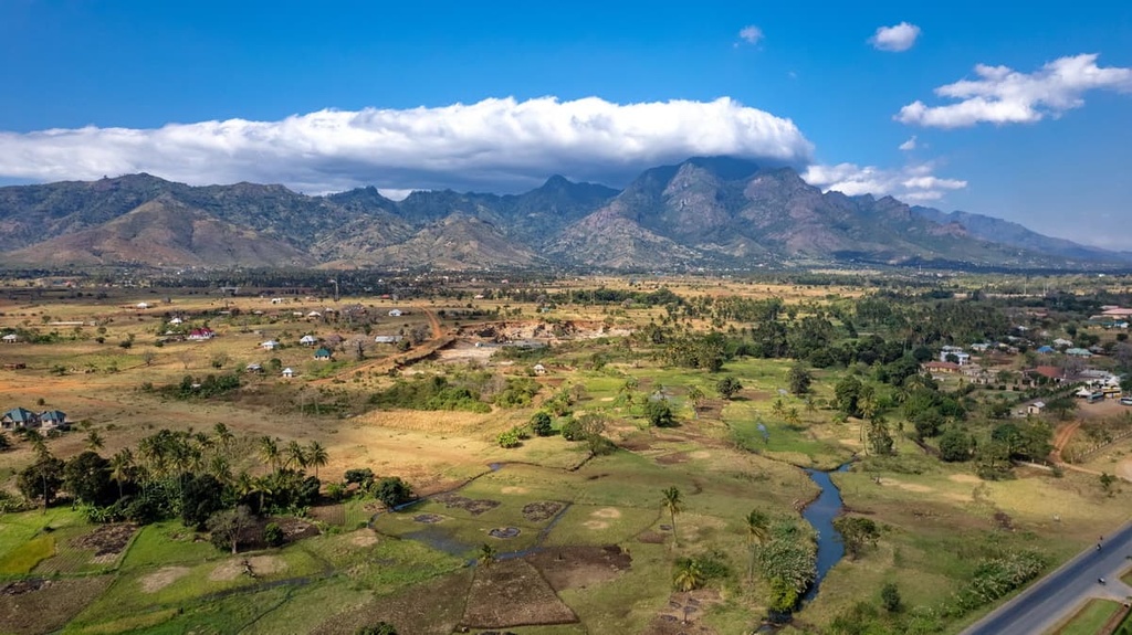
Morogoro is a city with a population of about 440,000 people. With its fertile soils and abundant rainfall, it is one of Tanzania’s major agricultural regions.
Visitors to the city of Morogoro will have very easy access to the Uluguru Mountains. In fact, the city is located just a short drive away from the popular Kinole Waterfall. It is also just a few hours’ drive from the city to Udzungwa National Park and Mikumi National Park.
In Morogoro, you can find a range of accommodation options from local hotels to upscale lodges. The dining options in Morogoro also run the gamut from street food to fancy restaurants, and the city is a particularly great place to try some Tanzanian delicacies.
With a population of about 6 million people, Dar es Salaam is easily the center of Tanzania’s economic and cultural life. It is a major port city that handles a lot of global shipping traffic each year, and it offers a convenient ferry for visitors looking to travel to Zanzibar.
Dar es Salaam is also home to the country’s largest airport, so it’s a classic starting point for visitors to Tanzania. From Dar es Salaam, it normally takes about 3.5 hours to reach Morogoro and the Uluguru Mountains by car.

German, British, and Arabic influence is easily seen throughout the city itself. Visitors to Dar es Salaam can explore the city’s many marketplaces (including the famous Kariakoo Market and Kivukoni Fish Market), where you can get fresh produce and seafood.
If you’re looking for other ways to pass the time in Dar es Salaam, consider checking out the National Museum and House of Culture or the Selous Game Reserve, the latter of which is just 4 hours away from the city by road. At night, you can also check out Dar es Salaam’s incredible nightlife scene, or you can dine at one of the city’s many fantastic restaurants.


