
Scan the QR code and open PeakVisor on your phone
The Pare Mountains include 52 named peaks. The highest is Shengena Peak at 2,463 m. Other notable peaks include Mjwini, Kindoroko and Hemwera.
The Pare Mountains are a collection of peaks located in northeastern Tanzania. The range is divided up into northern and southern subranges, both of which are part of the Eastern Arc Mountains. Within the range, there are 52 named mountains, the highest and most prominent of which is Shengana Peak (2,463 m/8,081 ft) in South Pare.
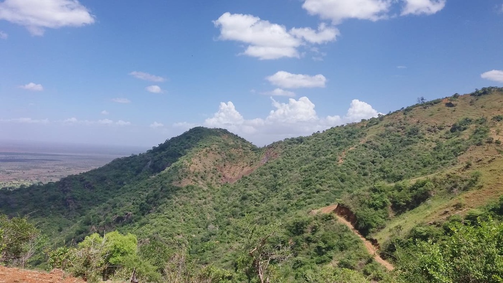
The North Pare Mountains and the South Pare Mountains are located in northeastern Tanzania. They begin about 35 km (20 mi) to the southeast of Kilimanjaro and end just to the north of the Usambara Mountains. To the east of the North Pare Mountains is Lake Jipe, which is located on Tanzania’s border with Kenya.
The North Pare Mountains in the Mwanga District of the Kilimanjaro Region contain six forest reserves: Kindoroko, Minja, Mramba, Kiverenge, Kamwella I, and Kamwella II. In total, these reserves cover 7,407 ha (18,303 acres) of terrain. In addition to this, there are nearly 300 clan forests that protect 371 ha (917 acres) of land in the region.
The South Pare Mountains are located in the Same District of the Kilimanjaro Region. Within the southern part of the range you’ll find:
In total, these reserves cover more than 27,168 ha (67,134 acres) of terrain.
Chome Nature Reserve encompasses 14,283 ha (35,294 acres) of land in the Pare Mountains, including Shengena Peak, the tallest mountain in the range. It was established as a forest reserve in 1957 and upgraded to a nature forest reserve in 2016.
The mountains in the Eastern Arc began forming around 100 million years ago. They reached a topography that’s somewhat similar to their current state at the start of the Miocene epoch about 25 to 30 million years ago.
The rocks in the range date back to the Precambrian epoch but have since been deformed from millions of years of uplift and erosion. The Eastern Arc Mountains are primarily composed of migmatites and granites, with some significant quartz veins running through them. Shengena Peak and the surrounding mountains in the South Pare are rich in mica deposits.
Soils around the Eastern Arc Mountains are typically sandy and nutrient-poor, which makes them adequate for agriculture but not particularly productive. The exception to this relatively low level of soil fertility in the region is in areas that have recently been covered in forest as the soils in these regions typically contain high levels of humus.
The Pare Mountains are generally considered to be of lower conservation priority than other sections of the Eastern Arc Mountains due to their lower levels of endemism.
The South Pare Mountains support a range of habitats including sub-montane, montane, and upper montane, as well as areas of montane heath within the Chome Nature Forest Reserve.
Some of the trees that you’ll find in the South Pare Mountains include Guinea plum (Parinari excelsa) in sub-montane forests, and Ocotea usambarensis, Albizia gummifera, and Podocarpus latifolius in montane forests. The South Pare white-eye (Zosterops winifredae) is a bird species that’s endemic to the range.
The mountains receive approximately 140 cm (55 in) of rain per year, primarily in the short rainy season that occurs in November and December and in the long rainy season from March through May.
Threats to forests in this part of the range have come from logging for valuable timber species and fires. When fires damage existing forests in the region, invasive trees like black wattle and Eucalyptus grow in. Oftentimes, these invasive species out-compete the range’s native flora.
The North Pare Mountains encompass montane forests, dry montane forests, dry woodlands, and heathlands. Some of the primary tree species that you’ll see in this part of the range include African cherry (Prunus africana), Albizia gummifera, and Newtonia buchananii. This part of the range is relatively dry when compared to other forests within the Eastern Arc.
There are approximately three endemic vertebrate species and three endemic plant species in the Pare Mountains. There have not been many biodiversity surveys done (particularly on reptiles, amphibians, and plants) in the region, so there is the possibility that the numbers of endemic species in the range are higher than is currently known. Threats to the forests here include overgrazing and fires, both of which create opportunities for invasive species to grow.
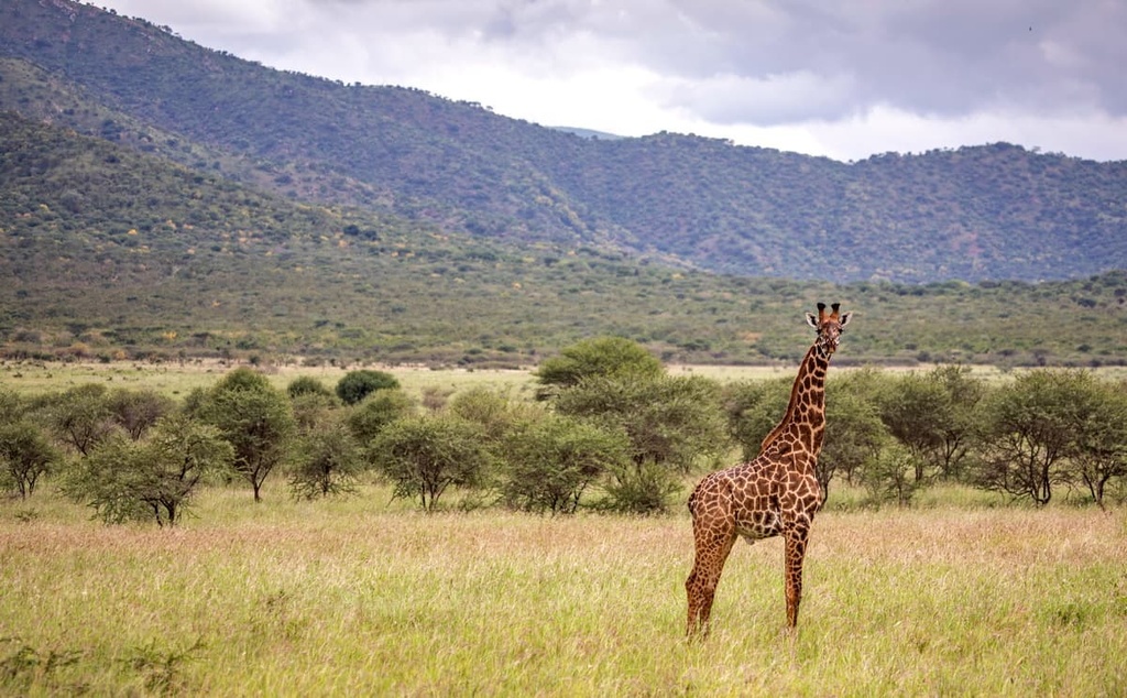
Although they are not known for their endemic species, the forests of the Pare Mountains still support a wide network of fauna. Hundreds of birds thrive in the Pare Mountains, including hawks, buzzards, eagles, shrikes, flycatchers, warblers, thrushes, and sunbirds. Genets, civets, mongoose, Syke’s monkeys, hyraxes, duikers, bushbucks, yellow baboons, elephant shrews, and other rodents can be found throughout the forests of the range, too.
To the Pare tribe, also called the Wapare, the mountains in this range have been home for at least 500 years. While many tribes in Tanzania today have begun to forgo traditional practices and adopt more urbanized lifestyles, the Pare are known for upholding their tribal traditions.
Traditional practices and knowledge continue to be shared within the Pare tribe to this day. This sharing of cultural knowledge and practices has helped conserve much of the region’s forests because many of them are considered sacred to the Pare. The Pare continue to practice traditional customs, such as collecting plants from within the region’s forests for medicinal uses and other cultural purposes.
Visitors to the Pare Mountains have the chance to stop by or stay in local villages and catch a glimpse of daily life. There are small factories throughout the region that produce bricks, pottery, and clothes, and many families in the area brew their own traditional alcohol. Weekly local markets bring people from surrounding villages together to sell produce, clothes, and day-to-day supplies.
Shengena Peak is the tallest peak in the Pare Range and is located within Chome Nature Forest Reserve in the South Pare Mountains. The closest town to the range is Same, which is located directly off the Segera-Moshi highway.
A visit to the North Pare Mountains can include hiking on trails that wind their way through cultivated land as well as forests. Hikes in both the North and South Pare Mountains can be arranged to include cultural tourism activities.
Without further ado, here are some of the best hikes in the Pare Mountains to check out during a trip to the region.
Shengena Peak is the highest mountain in the Pare Mountains, so it is understandably one of the region’s main attractions.
The two-hour drive from the town of Same to Chome Nature Forest Reserve is the route most commonly used to access Shengana Peak. There is also a visitor center for the reserve located just outside of Same. An alternative route to the forest reserve from Makanya approaches from the highway that’s situated to the south of Same.
Chome has two campsites, one of which is located inside the reserve and one of which is situated by the reserve’s entrance. Hikers can also find accommodations at local guest houses in Kisaka and in the other villages that border the reserve.
The hike to the top of Shengena Peak takes an average of six hours to complete. From the summit, hikers can enjoy panoramic views of Mkomazi National Park and Taita Hills, both of which are located across the border in Kenya.
Access to the North Pare Mountains is available through the town of Mwanga, which is located 55 km (35 mi) to the southeast of Moshi. From there, a sandy road leads visitors to Usangi village in the heart of the mountain range.
There are 11 peaks that surround the village, most of which offer ample adventure opportunities for hikers in the area. Additionally, visitors can book a variety of walking tours through the farmlands, forest reserves, and moorlands that are located around the village.
Along all of the main trekking routes in the North Pare Mountains, hikers can enjoy impressive vantage points that let you see well-known features like Lake Jipe and even Kilimanjaro when it’s not hidden in the clouds.
Some of the most popular day trips in this part of the range include hikes to the Mangatu moorland, visits to Goma Hill where Pare chiefs traditionally dug caves to hide from rival tribes and colonial powers, or treks to the summit of Kindorko (2,100 m/6,890 ft).
The Kindoroko Trail is a particularly popular option in the region as it leads visitors through a forest reserve where hikers will be able to spot monkeys and a wide variety of birds. If you’re new to traveling through the region, it’s typically best to organize a tour with a local guide who can help you navigate in the mountains and who can help arrange your accommodations.
The Pare Mountains run along a major road, B1, that leads from the north near Moshi toward coastal cities such as Tanga and Dar es Salaam. From Moshi, it is a 55 km (35 mi) drive to North Pare and a little over 100 km (60 mi) drive to South Pare. Kilimanjaro International Airport is also located between Moshi and Arusha, so the Pare Mountains are fairly accessible from elsewhere in Tanzania.
With that in mind, here are some of the best places to stay during a trip to the Pare Mountains.
A small town with a population of around 26,000 people, Same sits directly along the major highway that connects Dar es Salaam to the northern part of Tanzania. From the bus stand in Same, visitors can catch buses to communities on the coast or to both Moshi and Arusha. Same also offers quick access to the Usambara Mountains, which offer additional hiking opportunities.
In Same, visitors will find modest local hotels and guest houses that offer overnight accommodations. Most of the restaurants in the community serve up local cuisine, and there are a number of shops in the town that offer basic amenities and groceries for visitors and residents alike.
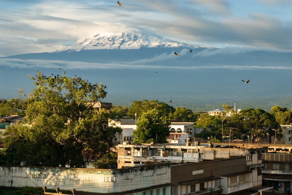
Moshi is a charming small city that’s located 55 km (35 mi) to the north of the North Pare mountains. It is situated a little over 100 km (60 mi) from Same and 40 km (25 mi) from Kilimanjaro International Airport. The population of Moshi is around 200,000 people, and the city sits at the base of the verdant foothills of Kilimanjaro.
Although it is most commonly used as a stopping point for those heading out or returning from a trek up Kilimanjaro, local guides in Moshi also offer day tours to nearby waterfalls and hot springs.
From vendors along the street to cute coffee shops and international restaurants, visitors will have a decent selection of food to enjoy in Moshi, too. Sleeping options in Moshi range from budget-friendly local hotels and hostels to nicer lodges that are situated around the edges of the city.
As it is home to half a million residents and it serves as the base for many local safari companies, Arusha is the urban heart of northern Tanzania. It is located 135 km (85 mi) from Mwanga in the North Pare, 185 km (115 mi) from Same in the South Pare, and 50 km (30 mi) from Kilimanjaro International Airport.
Guests in this slightly chaotic city filled with street vendors, jam-packed local buses, and motorcycle taxis weaving in and out of traffic will find a wide selection of food to enjoy from local delicacies to international cuisines. Arusha also offers accommodation options that range from budget-friendly motels and hostels to luxury lodges.

The city of Arusha borders Arusha National Park and Tanzania’s second tallest peak, Mount Meru. Day trips from Arusha can also be arranged to the nearby Tarangire and Lake Manyara national parks. Those looking to explore cultural activities in the city can visit The Cultural Heritage Center (an enormous museum and art store) or the Maasai market, where dozens of artisans sell their creations to the public.


The highest peak in the Pare Mountains is Shengena Peak, at 2,463 m.
The Pare Mountains have 52 named peaks.


