
Scan the QR code and open PeakVisor on your phone
Zambia is a landlocked African nation home to 21 million people. It’s located in south-central Africa and covers 752,617 square kilometers (290,587 sq mi). Zambia’s most stunning—and popular—topographical feature is undoubtedly Victoria Falls, the world’s largest waterfall. Meanwhile, the main feature of Zambia’s mountains is the Mafinga Hills, a vast plateau in the country’s east. These “hills” are named after their high point, Mafinga Central (2,339 m / 7,674 ft), the highest and the most prominent point in Zambia. In total, there are 2087 named mountains in the country.
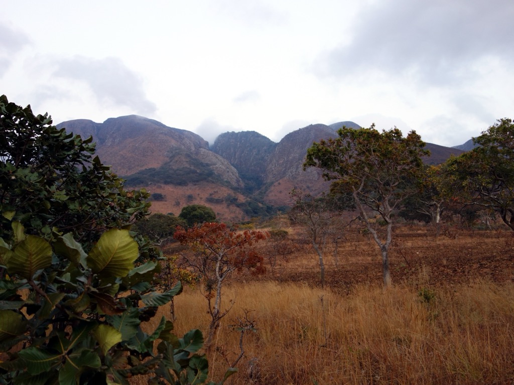
Zambia’s geography is characterized by a broad plateau, typically averaging between 1,000 to 1,400 meters (3,300 to 4,620 ft) above sea level. Consequently, Zambia lacks the extensive, high-altitude mountain ranges found in other nearby African nations, such as the highlands of Ethiopia. Instead, the topography features hills and escarpments representing the most dramatic relief.
The country's highest elevation region is within the Mafinga Hills, situated in the northeast along the border with Malawi. Reaching an approximate height of 2,339 meters (7,674 feet) on Mafinga Central—which also has slightly lower South and North subpeaks—this area is a rugged massif or steep hill system rather than a mountain range.
The Mafinga Hills form an important part of the watershed dividing the Zambezi River basin via its tributary, the Luangwa, from the Lake Malawi basin. They belong to the larger Kipengere Range, which runs between Zambia, Malawi, and Tanzania.
Another prominent geographic feature of Zambia is the Muchinga Escarpment, which defines the eastern edge of the Muchinga province's plateau. The escarpment is not a mountain range but rather a geological feature characterized by a steep, dramatic descent from the central plateau down into the Luangwa River valley. The escarpment profoundly influences regional drainage patterns, directing rivers into the Luangwa, and impacts local climate conditions. The renowned national parks of the Luangwa Valley lie below this prominent geological boundary.
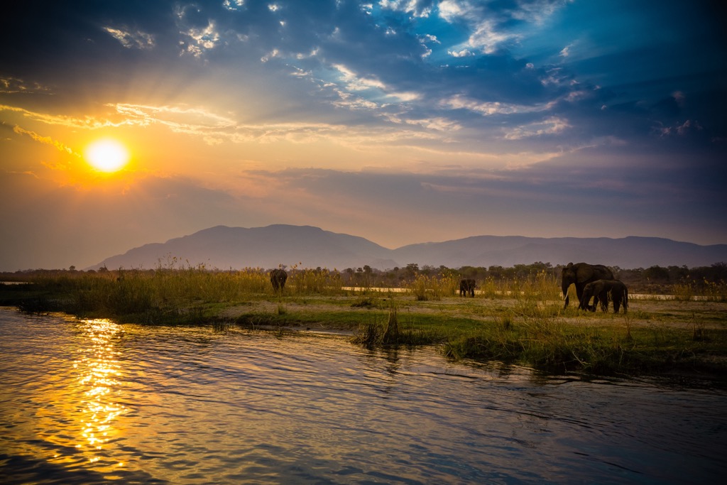
Zambia's landscape is also significantly defined by its major river systems and water bodies. The Zambezi River forms its southern border, famously plunging over the immense Victoria Falls (Mosi-oa-Tunya), one of the world’s largest waterfalls, which is shared with Zimbabwe. The Kafue and Luangwa rivers are major tributaries within Zambia, supporting extensive wildlife populations and defining large valley systems. The country also contains substantial lakes, including the vast artificial Lake Kariba (also shared with Zimbabwe), parts of Lake Tanganyika in the north, and the extensive, shallow wetlands of the Lake Bangweulu system.
Zambia experiences a tropical climate, though one moderated significantly by the plateau's altitude. There are three distinct seasons: a cool, dry season from May to August, a hot, dry season from September to October, and a warm, wet season from November to April. Rainfall varies across the country, generally increasing from south to north.
Clockwise from the north, Zambia is bordered by the Democratic Republic of the Congo, Tanzania, Malawi, Mozambique, Zimbabwe, Namibia, and Angola. It also has a minimal land border with Botswana to the south. At 135 meters (443 ft), this is the shortest international land border on Earth.
Zambia's geological foundation is largely composed of Precambrian rocks, some of the oldest crustal material on the African continent. Much of the country sits upon portions of stable cratonic blocks, such as the Congo Craton to the north and the Kalahari Craton in the south, interspersed and welded together by Proterozoic mobile belts.
These mobile belts—including the northeast-southwest trending Irumide Belt in the central and eastern parts of the country, the arcuate Lufilian Arc famous for the Copperbelt mineralization in the northwest, and the Zambezi Belt in the south—are zones of intense deformation, metamorphism, and granitic intrusion resulting from ancient continental collisions (orogenies) over a billion years ago.
The resistant metamorphic rocks, such as quartzites and schists, that form features like the Mafinga Hills, the country’s highest mountain range, are products of these ancient Precambrian geological processes and subsequent uplift.
Following the stabilization of this Precambrian basement, significant geological events included the development of rift basins during the late Paleozoic and Mesozoic eras, due to the breakup of the supercontinent Gondwana. These basins accumulated thick sequences of sedimentary rocks, which are today preserved in the major river valleys like the Luangwa, Luano-Lukusashi, and Mid-Zambezi. These strata include important coal deposits and preserve fossil evidence from that era.
Across much of western Zambia, the older geology is obscured by extensive deposits of sand, reflecting periods of more arid conditions and prolonged erosion and weathering.
Eastern Zambia, meanwhile, has been influenced by the southward movement of the East African Rift (where the African plate is splitting into two tectonic plates, the Somali and Nubian plates). This ongoing extensional tectonic activity is responsible for the formation of the Luangwa Rift Valley.
Zambia’s climactic pattern supports several major biomes. The most dominant is Miombo woodland, a type of tropical savanna characterized by Brachystegia and Julbernardia trees adapted to seasonal drought and fire, covering vast swathes of the plateau.
Other biomes include drier savanna grasslands, particularly in valley areas, and extensive wetlands and floodplains associated with the major rivers and lakes, locally known as dambos. Patches of dry evergreen forest and thickets occur, dominated by species like mopane (Colophospermum mopane), particularly in the north and in some river valleys. Characteristic trees such as the baobab (Adansonia digitata) also dot the landscape. True montane vegetation is limited to the small areas of the highest elevation.
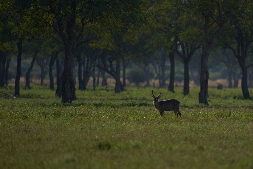
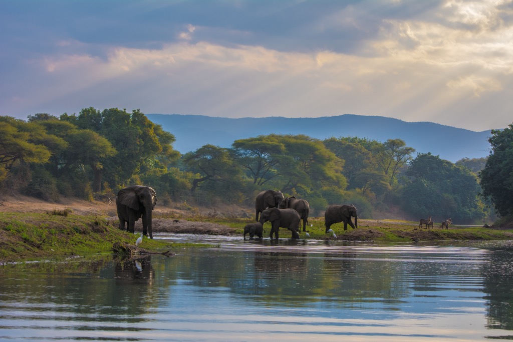
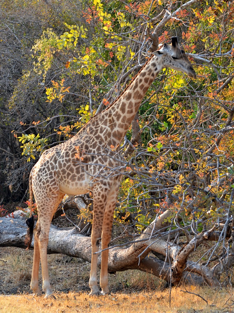
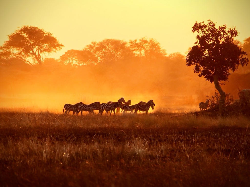
This habitat mosaic hosts significant biodiversity of fauna, too. Zambia is renowned for its large mammal populations, including substantial numbers of African elephant (Loxodonta africana), African buffalo (Syncerus caffer), hippopotamus (Hippopotamus amphibius), and various predators like lions (Panthera leo), leopards (Panthera pardus), and African wild dogs (Lycaon pictus). The country also boasts a remarkable diversity of antelope (Antilopini).
Particularly notable are Zambia's endemic or near-endemic ungulates. The Kafue lechwe (Kobus leche kafuensis) is found only on the Kafue Flats, while the black lechwe (Kobus leche smithemani) is restricted to the Bangweulu Wetlands. Thornicroft's giraffe (Giraffa camelopardalis thornicrofti) and Cookson’s wildebeest (Connochaetes taurinus cooksoni) have ranges largely confined to the Luangwa Valley ecosystem.
Avian diversity is also exceptional, with over 750 recorded species. The extensive wetlands are crucial for waterbirds, including significant populations of wattled cranes (Bugeranus carunculatus). Zambia's sole endemic bird species is the Chaplin's barbet (Lybius chaplini), a distinctive bird reliant on fig trees within woodlands in the southern part of the country.
Like much of central Africa, Zambia has a rich human history, evidenced by archaeological findings stretching back to the early Stone Age—such as the hominin remains found at Kabwe (Broken Hill Man)—roughly 300,000 years ago.
Beginning around two millennia ago, Bantu migrations introduced agriculture and ironworking, displacing earlier inhabitants and forming the basis of modern ethnic groups. Complex pre-colonial kingdoms subsequently emerged, including the Kazembe, Lozi, Bemba, and Chewa, which were often integrated into regional trade networks involving copper, ivory, and enslaved people.
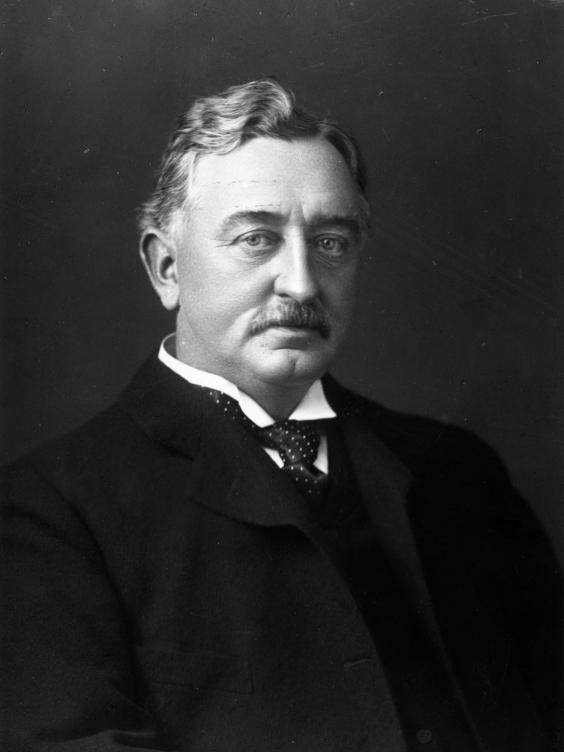
European exploration, notably by David Livingstone, intensified in the 19th century, preceding political control by Cecil Rhodes' British South Africa Company. The territory was consolidated as Northern Rhodesia in 1911 and became a British protectorate in 1924. Colonial economic activity focused intensely on Copperbelt mining, driving urbanization but also fueling African nationalism against racial discrimination and exploitation.
Zambia finally won independence on October 24, 1964. For much of the remaining 20th century, it was a one-party state under the socialist United National Independence Party. Still, internal pressure eventually led to the reintroduction of multi-party democracy in 1990.

Modern-day Zambia is broken into ten provinces: Central Province, Copperbelt, Eastern Province, Luapula, Lusaka, Muchinga, North-Western Province, Northern Province, Southern Province, and Western Province. The population is mostly concentrated around the capital, Lusaka, in the south, and the Copperbelt in the north. International tourism, particularly wildlife viewing and ecotourism, is a growing industry.
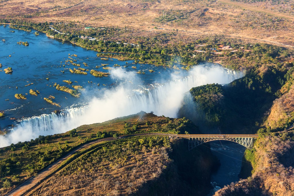
There are 34 game management areas and 20 national parks in Zambia. Overwhelmingly, the most famous and visited is Mosi-oa-Tunya National Park at Victoria Falls, which is also a UNESCO World Heritage Site. Other notables are Kafue National Park, Liuwa Plain National Park, and South Luangwa National Park, all famous for their wildlife.
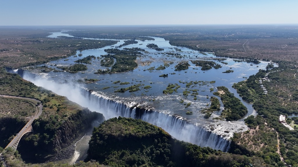
Mosi-oa-Tunya (Victoria Falls) is one of the world's largest waterfalls, where the Zambezi River flows over a cliff of 108 m (355 ft). Taking its vast width of 1,708 meters (5,604 ft) into account, Victoria Falls produces the world's largest sheet of falling water. The Zambian side of the falls is protected as Mosi-oa-Tunya National Park.
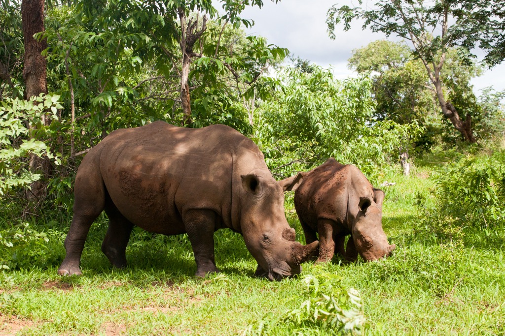
Though it’s Zambia’s smallest national park (approximately 66 sq km / 25 sq mi), the park protects pristine riverine forest and a wildlife sanctuary. This sanctuary hosts diverse species, including giraffe, zebra, buffalo, various antelope, abundant birdlife, and, notably, a population of southern white rhinoceros.
NOTE: Zimbabwe’s side of the falls also has a national park: Victoria Falls National Park. However, the national park in Zambia is Mosi-oa-Tunya National Park.
Kafue National Park, situated in central-western Zambia, is the country's oldest and largest national park (and second-largest in all of Africa), spanning a staggering 22,400 square kilometers (8,600 sq mi). The park is centered around the Kafue River and its tributaries. Habitats range from vast Miombo woodlands and Kalahari sandveld to extensive wetlands and seasonally inundated grasslands, such as the renowned Busanga Plains in the north.
This mosaic of habitats supports exceptional biodiversity, including significant populations of elephants, hippos, buffalo, and numerous antelope species like red lechwe. Important predator guilds feature lions, leopards, cheetahs, and African wild dogs. The park is also home to over 500 recorded bird species.
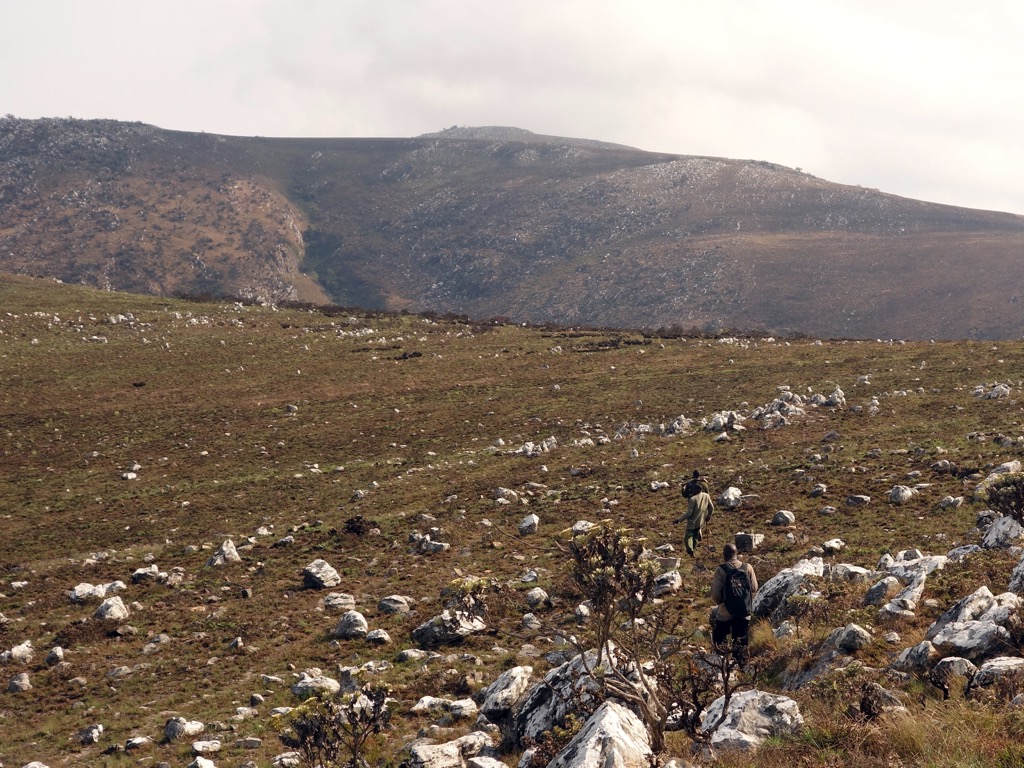
No peakbagger could visit Zambia without an attempt at Mafinga Central (2,339 m /7,674 ft), the country’s highest point, located on the border with Malawi. That said, Mafinga involves more of a remote trek than a climb. Access is the main challenge, and a climb is often undertaken from the Malawian side near Chisenga (approaches from the Zambian side are possible but less documented).
There are no formally marked trails, making competent navigation essential. GPS and proper planning are vital for route-finding across undulating grasslands and rocky sections. Reaching any potential starting point would require 4X4 transport due to poor road conditions. Prepare to be entirely self-sufficient regarding food, water, and equipment. But if your legs are sturdy and your navigation is competent, you should be able to hit the summit!
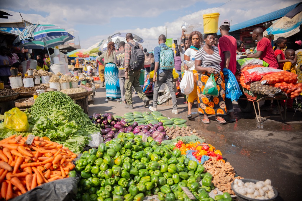
As Zambia's capital and largest city, Lusaka (pop. 3.3 million) is the nation's political, administrative, and commercial nerve center. Situated centrally on the plateau, it originated as a mere railway siding in the early 20th century but grew rapidly after becoming the capital in 1935.
Lusaka hosts national government institutions, diplomatic missions, and financial entities. Its character is marked by rapid urbanization, a diverse population drawn from across the country, and bustling markets, like Soweto Market. The Lusaka National Museum, another must-see, provides insights into Zambian history and culture.
Located near Victoria Falls in the Southern Province, Livingstone (pop. 177,000) serves as Zambia's tourist capital. Named after the Scottish explorer and missionary David Livingstone, it was the capital of Northern Rhodesia until 1935 and retains significant colonial-era architecture.
Its cultural importance stems from its proximity to the Falls, a UNESCO World Heritage site of immense natural and spiritual significance, and its historical role as a colonial outpost. The Livingstone Museum is one of the country's oldest and largest, housing important archaeological, ethnographic, and historical collections. The city is a hub for tourism, both related to the Falls and surrounding national parks.
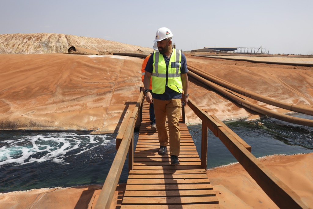
As the administrative capital of the Copperbelt Province and Zambia's third-largest city, Ndola (pop. 627,000) is historically and economically significant due to its central role in the nation's vital copper mining industry. Its development from the early 20th century was directly linked to the exploitation of the region's vast mineral wealth.


.jpg)