
Scan the QR code and open PeakVisor on your phone
Namibia is home to 694 named mountains. The highest is Königstein at 2,573 m.
Namibia is a country located in southern Africa along the Atlantic coast. It is home to the Namib and Kalahari deserts as well as the Skeleton Coast, Etosha Salt Pan, and lush Caprivi Strip. With only 2.5 million inhabitants, Namibia is one of the least densely populated countries in the world. There are 694 named mountains in Namibia, the highest and most prominent of which is Königstein (also known as Brandberg Mountain) at 2,573 m (8,442 ft) in elevation.
Namibia (officially the Republic of Namibia) is a country in southern Africa that contains 824,292 sq. km (318,261 sq. mi) of terrain along the continent’s Atlantic coast. It shares a border with South Africa to the south, Botswana to the east, and Zambia and Angola to the north. A very small section of northern Botswana along the Zambezi River also separates Namibia from nearby Zimbabwe.
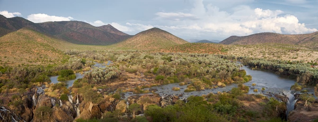
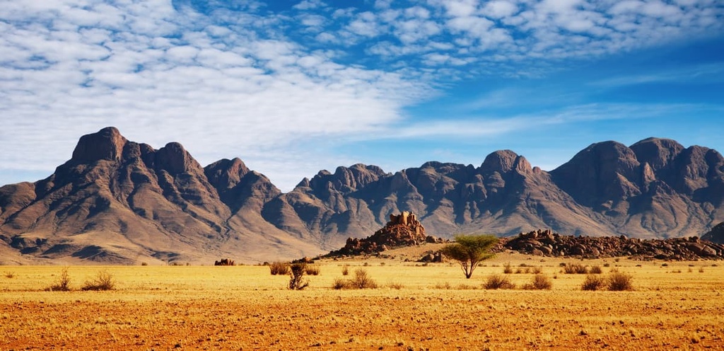
From west to east, there are three main zones of Namibia: the coastal Namib Desert, the central plateau, and the Kalahari. The central plateau region of the country ranges in elevation from lows of 975 m (3,200 ft) to highs of 1,980 m (6,500 ft). This region is bordered to the north by the Kunene and Okavango river valleys and to the south by Orange River.
Along the central plateau of Namibia, the country’s low-lying hills are often covered by shrub and savanna and punctuated by ravines. You will also find salt pans here, too, including the enormous Etosha Pan of Etosha National Park. Meanwhile, the savanna of Namibia stretches to the east where it fades into the Kalahari Desert.
The most prominent mountain in Namibia is Königstein, or Brandberg Mountain, followed by Moltkeblick (1,336 m/4,383 ft) and Schroffenstein (1,222 m/4,009 ft).
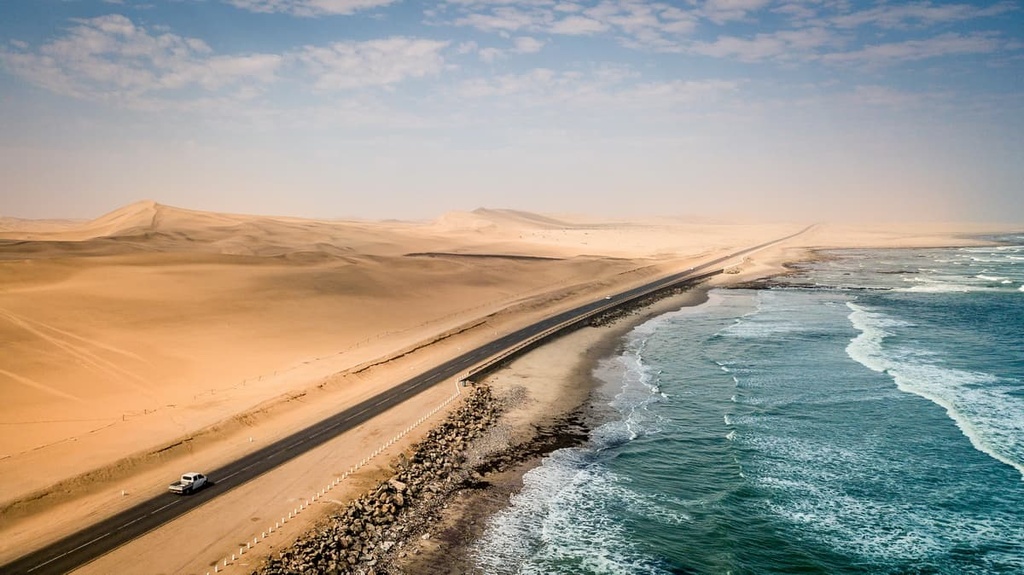
Major permanent rivers in Namibia include the Kunene (Cunene), Okavango (Cubango), Mashi (Kwando), and Zambezi along the country’s northern border and the Orange River, which is located in the southern part of the country. Notable seasonal rivers in Namibia include the Swakop and Kuiseb, which flow from the central plateau down the western escarpment and into the Namib Desert.
As far as cities go, Windhoek is Namibia’s capital and is centrally located within the country. Rundu is another major city that’s located in the northern part of the country near Namibia’s border with Angola. Walvis Bay is yet another noteworthy Namibian city that’s located along the coast.
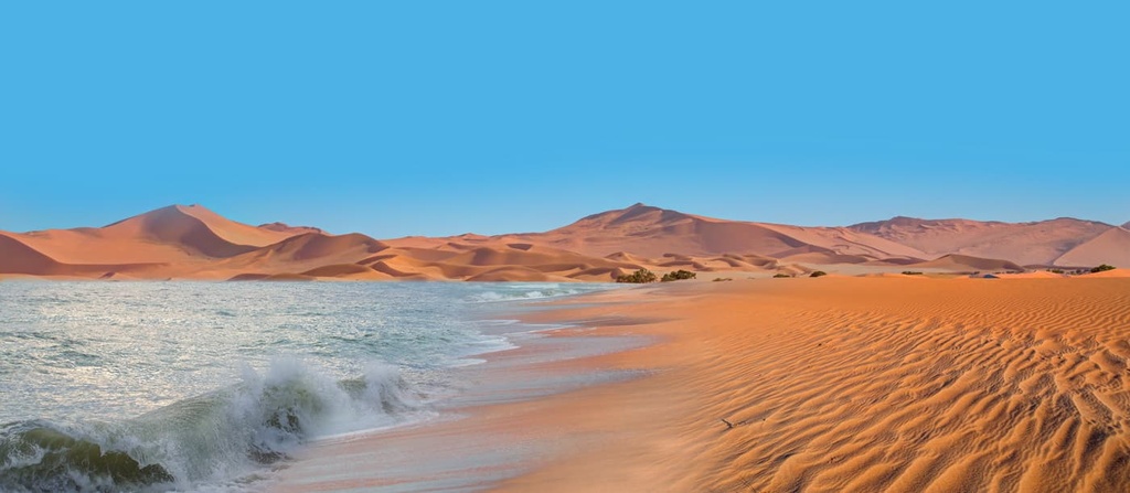
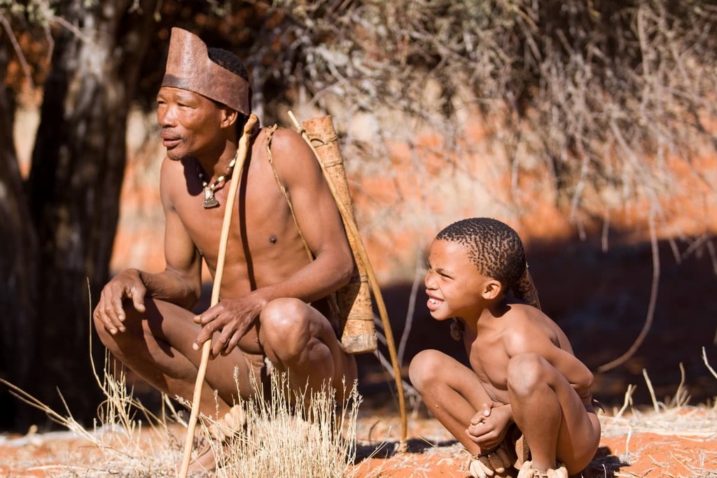
Namibia is home to two UNESCO World Heritage Sites: the Namib Sand Sea, where sand dunes meet the coast, and Twyfelfontein (ǀUi-ǁAis), which features thousands of cave paintings made by the ancestors of the modern-day San (Bushmen) people.
Some of the most visited national parks in Namibia include Etosha National Park, Skeleton Coast Park, Namib-Naukluft Park, Sperrgebiet National Park, and |Ai |Ais - Richtersveld Transfrontier Park, the latter of which is located on the country’s border with South Africa.
The separation of the African and South American continents about 120 million years ago greatly impacted Namibia’s geology. As the continents split apart, the release of pressure caused the edges of both continents to rise slightly. Parallel geologic formations can be seen in Namibia and in Brazil as a result of this tectonic activity.
More recently, the Kalahari Basin formed in Namibia where this raised escarpment starts sloping gently to the east. As the continents began to split, a period of volcanism also occurred that left behind what is known as a continental flood basalt province in both Namibia and Brazil.
A mountain-building event called the Damara orogeny occurred in the region that is now Namibia during the formation of the supercontinent of Gondwana around 550 million years ago. Many granite mountains from this orogeny exist in Namibia to this day, however they have since been shaped and exposed to the elements as a result of volcanic activity and thousands of years of erosion.

Additionally, mining accounts for about 25 percent of the country’s total economic activity. Natural resources in Namibia include diamonds, uranium, copper, gold, lead, tin, lithium, cadmium, zinc, salt, and vanadium.
The soil quality in Namibia ranges from pure sand and exposed bedrock to sandy soils, but, overall, the country is home to some fairly fertile land. Surprisingly, however, the viability of agriculture in much of Namibia is controlled more by rainfall rates and access to groundwater than it is by soil quality.
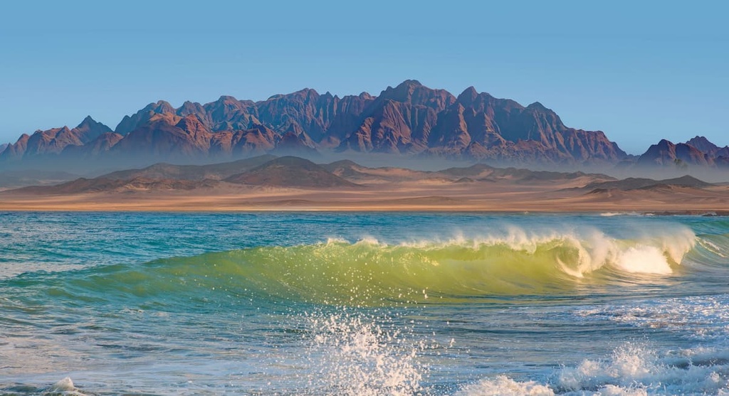
A significant factor in Namibia’s ecology is the Benguela Current. This current brings cold water up the coast of Namibia from Antarctica.
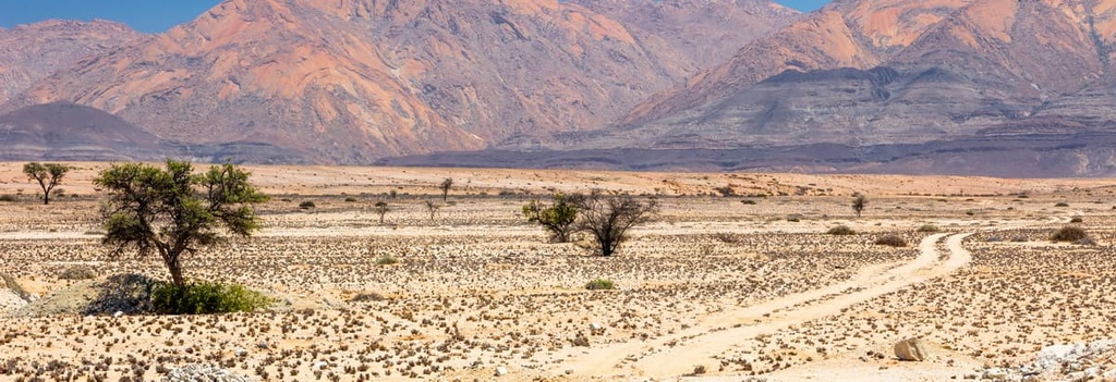
This cold water creates an inversion in the region that makes it extremely difficult for clouds to form around Namibia, thereby suppressing pretty much all rainfall in certain parts of the country. The persistence of these conditions over the past 55 to 80 million years has contributed to the formation of the Namib Desert, which is believed to be one of the oldest deserts in the world.
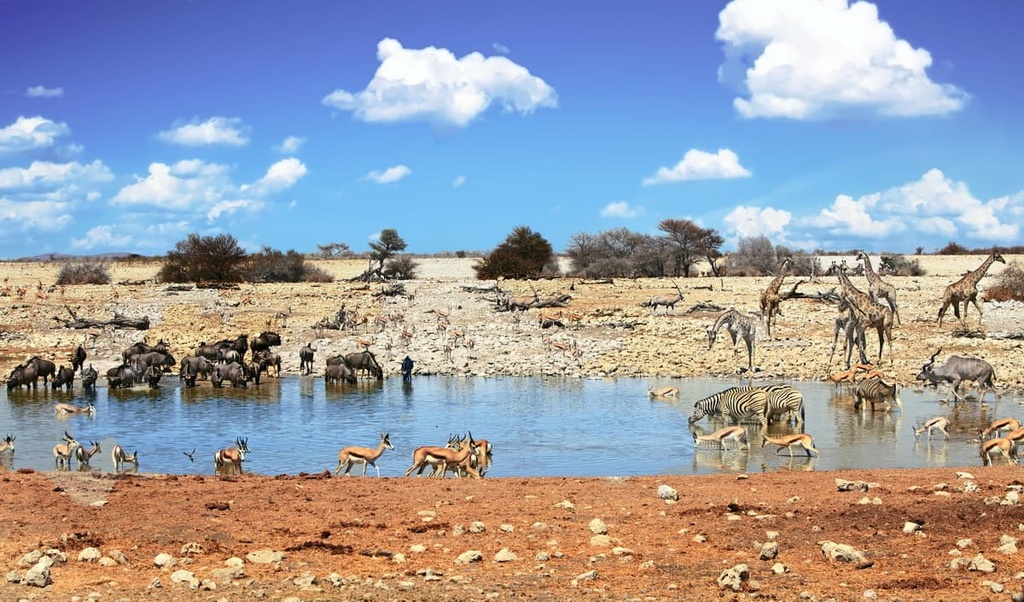
Despite being relatively dry, however, Namibia encompasses many habitats ranging from deserts to subtropical wetlands. A number of endemic plants live in the delicate desert ecosystems of Namibia, too. The country also employs several methods for managing its natural spaces and wildlife populations including through the formation of national parks, private conservancies, and communal conservancies.
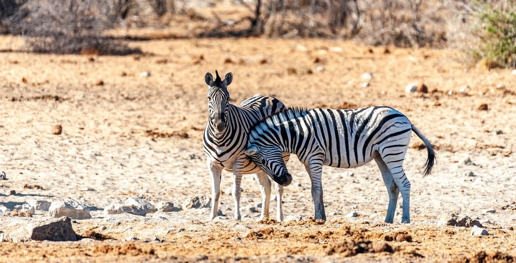
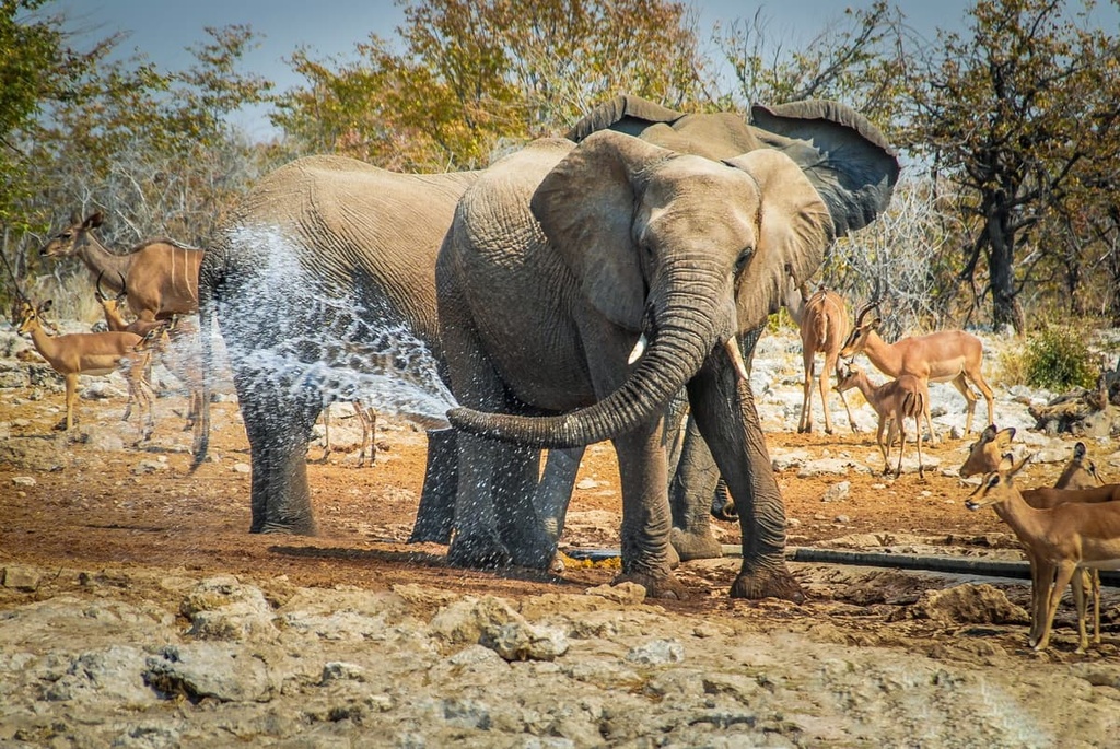
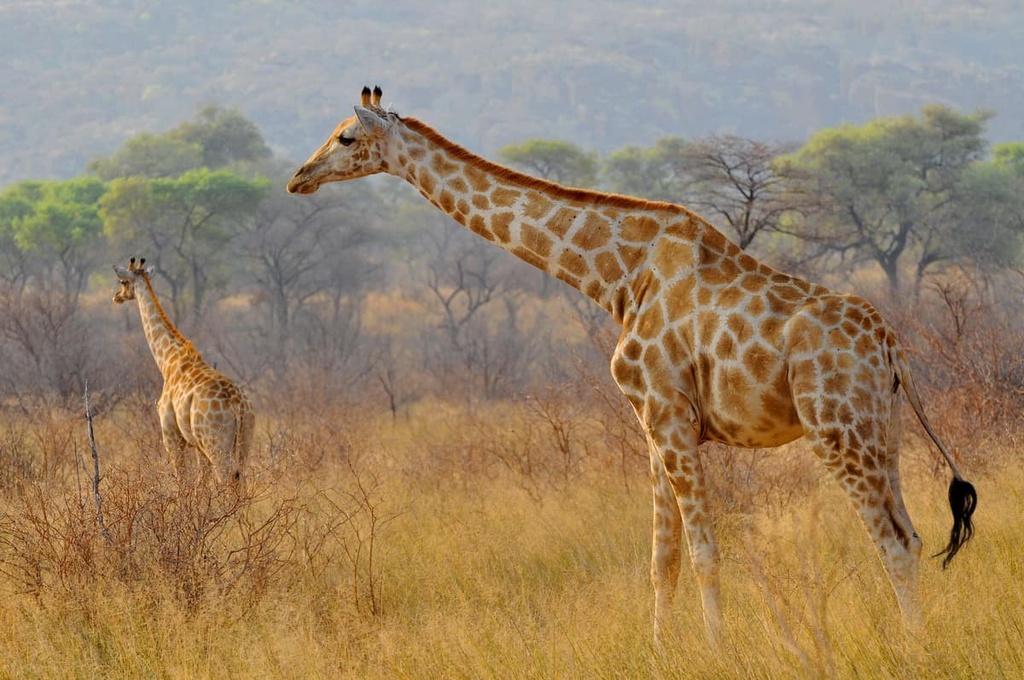
Thanks to the introduction of wildlife management techniques that can effectively combat the negative impacts of poaching, wildlife populations across the board are on the rise in Namibia. This includes populations of target species such as the black rhino and elephants as well as common game, such as oryx, springbok, and kudu. Some rare and endemic species, such as the Hartmann’s zebra and the black-faced impala, are also experiencing growing populations.
In addition to its populations of lions, leopards, wild dogs, and jackals, Namibia has the largest free-ranging cheetah population of any country on the planet. It is also home to roughly one-third of the world’s black rhino population.
The desert elephants of Namibia, while not a distinct subspecies from savannah elephants, have developed unique adaptations to survive in their desert environment. They have large feet for walking in sand, smaller herd sizes to decrease pressure on food and water sources, and they can go days without water because they’re able to absorb enough moisture from the vegetation they eat.
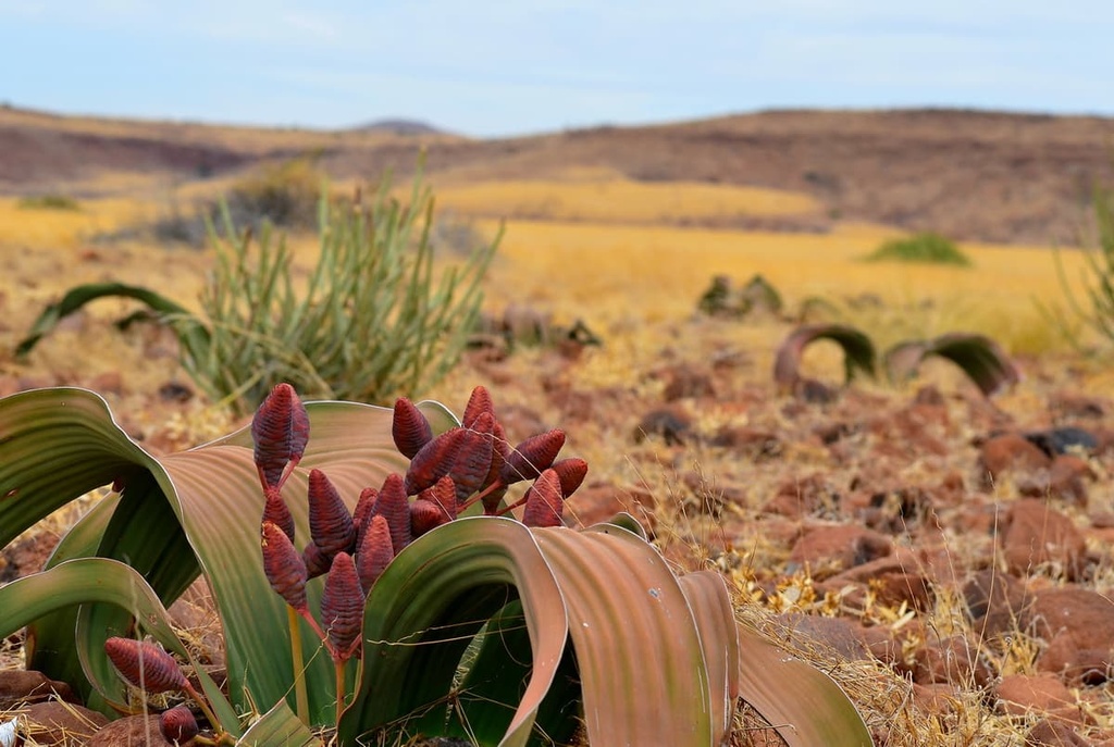
Namibia is also home to an impressive array of desert flora that is uniquely adapted to survive in extreme conditions.
These include quiver trees in the south, many varieties of aloe, and Welwitschia mirabilis, Namibia’s national plant. It grows only in the Namib Desert within Namibia and southern Angola. Some of these plants are close to 1,500 years old. In order for Welwitschia mirabilis to live in the desert where very little else can survive, the plant utilizes condensation from fog to meet its moisture needs.
The coast of Namibia is kept cool by the Benguela Current, and it receives less than 5 cm (2 in) of rain in a typical year. The plankton-rich waters in Namibia’s coastal areas support abundant marine life, including growing numbers of southern right whales.
While parts of the Namib Desert receive less than 2 cm (0.8 in) of rain annually, the central plateau experiences large fluctuations in temperature throughout the year and a fairly large range in precipitation depending on the region.
The southern and western portions of the central plateau get about 25 cm (10 in) rain each year. Meanwhile, the northern and central regions of the central plateau get about 50 cm (20 in) of precipitation. The Caprivi Strip and Otavi Mountains in the northern parts of the country also get more than 60 cm (24 in) of precipitation in any given year.
That said, multi-year droughts are common in Namibia. As a result, groundwater is important to ecosystems and cultivation in the country. The Kalahari region of the country also receives rainfall at rates similar to what you see on the central plateau, but it has less groundwater available.
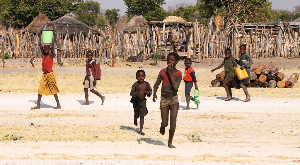
The San (Bushmen) people have lived in what is now Namibia for thousands of years. Evidence of their culture can be found across the country’s desert landscape. One notable cultural site in the country, Twyfelfontein, is marked with thousands of cave paintings that illustrate hunters, warriors, and wildlife.
There was very little European trade and commerce in what is now Namibia prior to the 1860s. During this time, the many ethnic groups that lived in the country created extensive clan systems and had conflicts with other groups over land and resources.
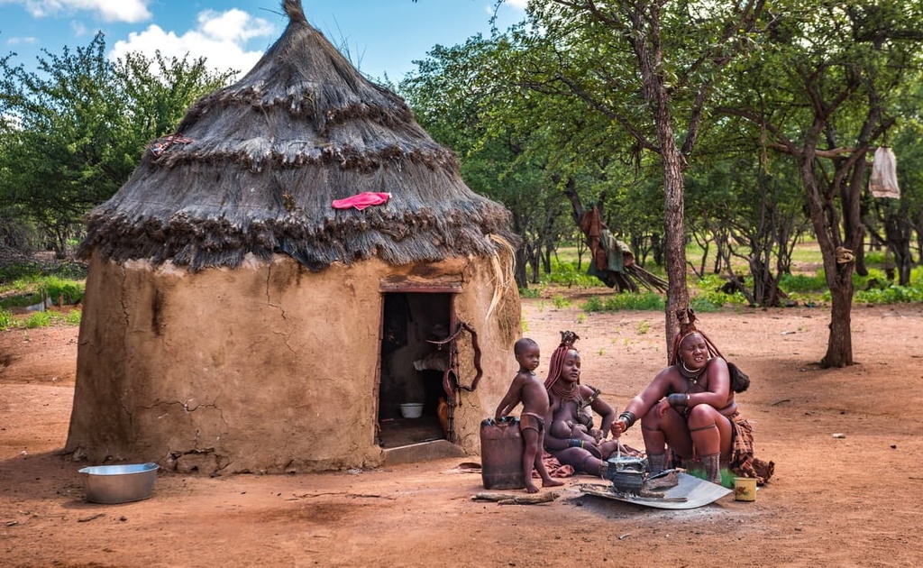
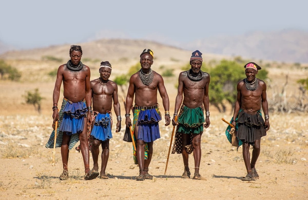
Among the largest ethnic groups in Namibia, there are the Nama, who traditionally had a pastoral economy; the Damara, who practiced pastoralism and hunting; the pastoral Herero; and the more agriculture-based Ovambo and Kavango in the north.
From the late 1700s into the early 1800s, trade routes were established through Namibia by Afrikaners, German missionaries, and other European traders. Most of these trade routes were created to support the movement of ivory and cattle. These traders also brought firearms to the region, which intensified conflict between tribes.
In the mid-1800s, the country saw increasing conflict between the Nama, who were migrating to the north, and Herero, who were moving to the south. The British nearly annexed Namibia as one of their colonies in the 1870s but didn’t follow through for economic reasons.
A few decades later, Germany declared South West Africa a German colony in the 1880s. The first major moments of resistance to European colonization in Namibia occurred in 1885 when the Herero pushed German forces back to Walvis Bay until support arrived.
Another period of resistance from the main ethnic groups in Namibia against the Germans took place between 1904 and 1907. Although the Herero had moments of success during this resistance, they were ultimately defeated through savage tactics by the Germans including mass slaughters and the establishment of concentration camps.
The Nama had intended to join the resistance earlier but an important letter between chiefs was intercepted, which delayed their involvement. By the end of the war, the Nama were also suffering, and they were eventually banished to concentration camps. Ultimately, the war and harsh living conditions reduced the Herero population by 85 percent and the Nama population by two-thirds.
From 1914 to 1915, South African troops invaded what is now Namibia and took over South West Africa during World War I. The country experienced economic downturn until the 1940s when market conditions improved for diamonds, cattle, and karakul sheep.
The movement for national liberation in what is now Namibia began in the mid-1900s. South Africa continued to control Namibia while also invading Angola. This crumbled in 1988 when South Africa’s invasion of Angola was defeated. South Africa’s defeat eventually started a series of events that led to official independence for Namibia in 1990.
Within Namibia, there are 14 major ethnic groups who speak around 26 languages between them. The main ethnic groups in Namibia are the Ovambo, Kavango, Herero, Damara, and Caprivian. Germans and Afrikaners make up the majority of the population of European descent in the country. English, Afrikaans, German, Oshivambo, Herero, and Nama are widely spoken languages throughout the country.
Namibia is relatively easy to navigate for independent travelers. That being said, tour guides are available at most destinations and are sometimes required depending on where you’re traveling.
If you’re planning to hike independently in Namibia, be sure to confirm what permits and fees you’ll be responsible for while planning your trip. It is also worth noting that it can get quite hot in the summer months (November through April) in Namibia, so most strenuous hikes are best done during the cooler months of the year.
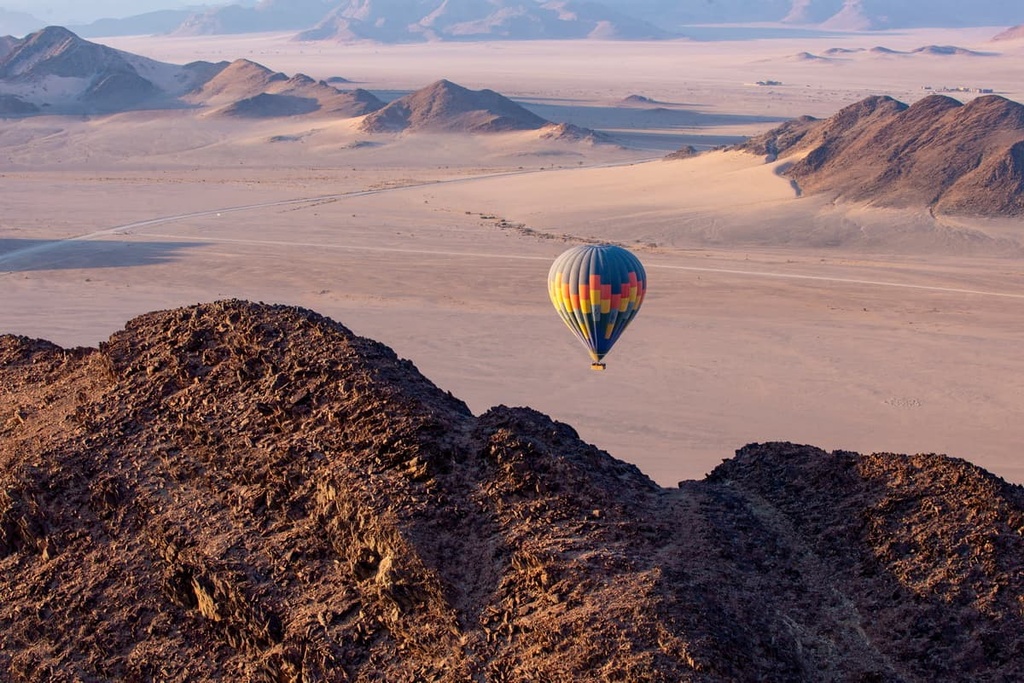
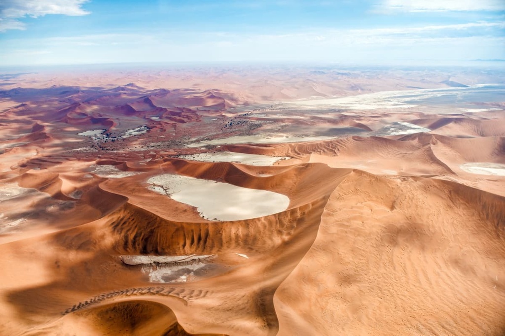
Namib-Naukluft National Park is situated in the Namib Desert, which is believed to be the oldest desert in the world. The park gained its current size of approximately 50,000 sq. km (19,305 sq. mi) and its national park status in 1972. Only some sections of the protected area are open to visitors, including the Naukluft Mountains, Sossuvlei and Deadvlei, and parts of the Kuiseb River.
The word vlei refers to a type of salt-clay pan. Deadvlei is one of the most famous examples of a vlei and it is located in the national park near the stunning Sossusvlei. Both of these vleis see a relatively large number of visitors each year, though Sossusvlei is arguably more popular because it is surrounded by gorgeous red sand dunes.
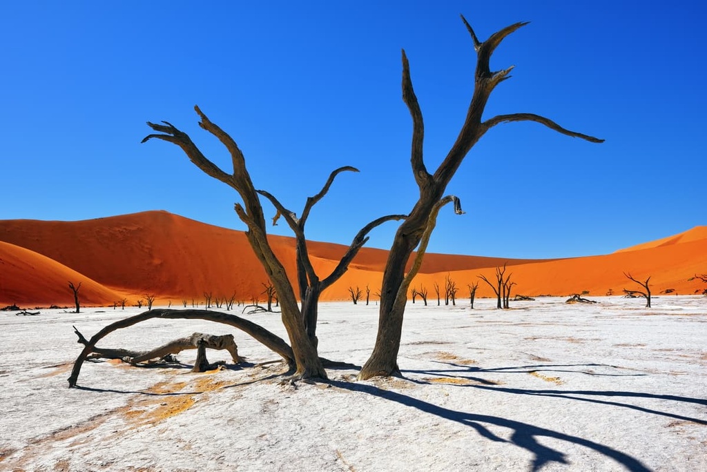
Both of these vleis formed thousands of years ago, when water flowed seasonally in the region. Eventually, these waterways dried up, leaving behind the salt pans that we see to this day. A few of these pans, such as Sossusvlei, still hold water during exceptionally rainy periods.
One of the most iconic and photographed spots in the park is Deadvlei, which rests at the foot of Big Daddy, a dune that reaches a height of approximately 350 m (1,148 ft). Getting to the top of the dune requires a strenuous hike, but afterward, hikers often enjoy a fun run down the enormous dune back to Deadvlei.
That being said, keep in mind that the sand can get hot quickly during the day, so always bring shoes when hiking in the Namib Desert. If hot temperatures are in the forecast during your trip, be sure to bring lots of water with you and consider starting your hike early in the day so you can avoid being outside during the hottest part of the afternoon.
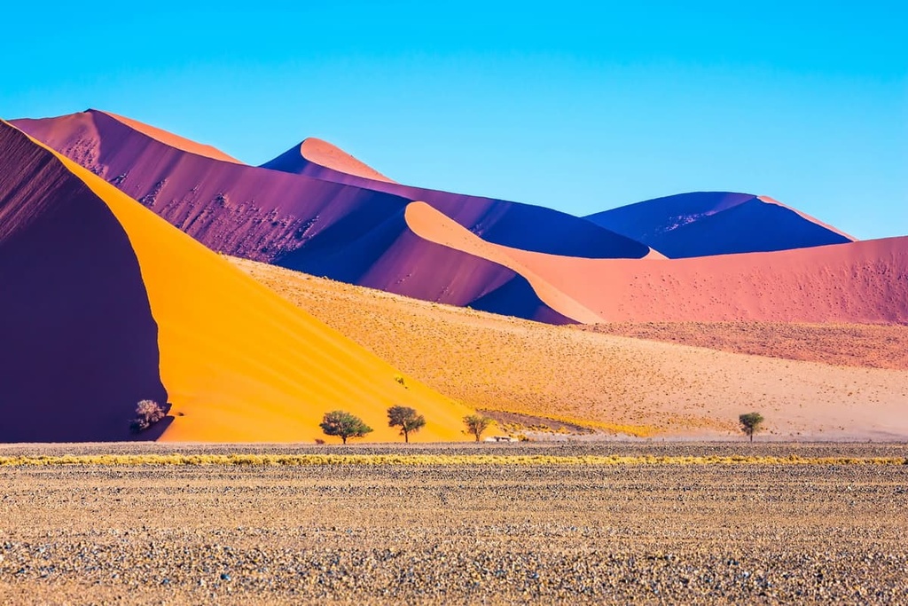
There are some paved roads into the park that lead to a few of its most famous destinations (including Soussusvlei), but other roads in the region are made of deep sand and require a 4-wheel drive vehicle to cross.
Don’t forget to let the air pressure out of your vehicle’s tires before attempting to drive on these roads. If you’re not an experienced driver on loose sand, consider hiring a tour guide to take you around the park instead.
Hiking in southern Namibia’s Fish River Canyon is a potential option between May and September each year. This roughly 85 km (53 mi) long trail runs through one of the world’s largest canyons. Although the length of the trail demands a good level of fitness, the trail itself is not technically difficult, and it generally takes four to five days to complete.
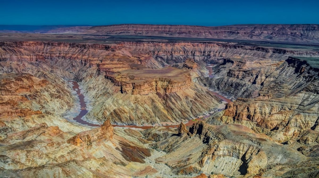
Hikers are required to have a permit and a guide in order to trek through Fish River Canyon. Reservations for hiking permits are limited to 30 hikers per day, so it is wise to book in advance. In order to book a permit, the group must have a minimum of 3 people, too. Solo travelers can contact guiding companies in the area to see if there are any organized trekking groups available that are open to individual hikers.
The town of Hobas is located near the start of the trail while the town of Ais Ais is situated at the end of the route. Hobas offers basic accommodation and Ais Ais has a lodge with hot springs for those who want to relax both before and after their trek.
Rising some 200 m (656 ft) like a tabletop on the horizon, Waterberg Plateau Park is a large protected area that’s located about 230 km (143 mi) to the north of Windhoek and 50 km (30 mi) to the east of Ojiwarongo. The park was declared a nature conservation area in 1972, and it covers 400 sq. km (155 sq mi) of terrain.
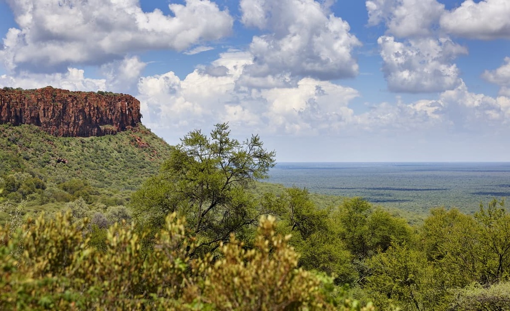
The plateau itself is made of red sandstone, though it’s arguably better known for its wildlife. Two types of rhinos have been reintroduced to the park in recent years. Additionally, more than 90 mammals and 200 bird species live in and around the park, including buffalos, antelopes, leopards, and cheetahs.
The plateau was also the site of the Battle of Waterberg in 1904. The battle followed a Herero uprising against German colonial forces. Sources say tens of thousands of Herero died in the battle, and, although it has not been officially recognized as such, some call the battle a genocide by German forces.
Numerous hikes leave from campsites and lodges in the park. There are options for both guided hikes up the escarpment and independent treks through the forest and grasslands. Some popular hikes in the park include the Dassie, Fountain and Porcupine Trail Loop, a moderately easy 10.5 km (6.5 mi) trail that runs along a stream before climbing to a scenic lookout point.
Another option for on-foot adventures in the park is to hire a guide for a day of rhino tracking. Doing so lets you explore the bush with an expert guide who can help you spot antelopes and other wildlife while on the search for rhinos.
Königstein, also known as Brandberg Mountain, is Namibia’s tallest peak at 2,573 m (8,442 ft) in elevation.
It is possible to climb to the summit of Königstein, but as the hike is strenuous, it is much more commonly completed during the cooler months of April through September. The hike can be completed in one to two days for fit and experienced hikers, but many groups choose to go at a slightly slower pace.
Keep in mind that a permit is required for all hikers on the mountain and can be obtained in Windhoek from the National Heritage Council. Once the permit is granted, groups are assigned a guide for their travels.
Königstein is located in the Erongo region in the western part of the country, approximately 30 km (19 mi) from the small town of Uis. While hiking on the mountain, be sure to keep an eye out for rock paintings in the region as there are many examples of these cultural artifacts on the mountain that date back several thousand years.
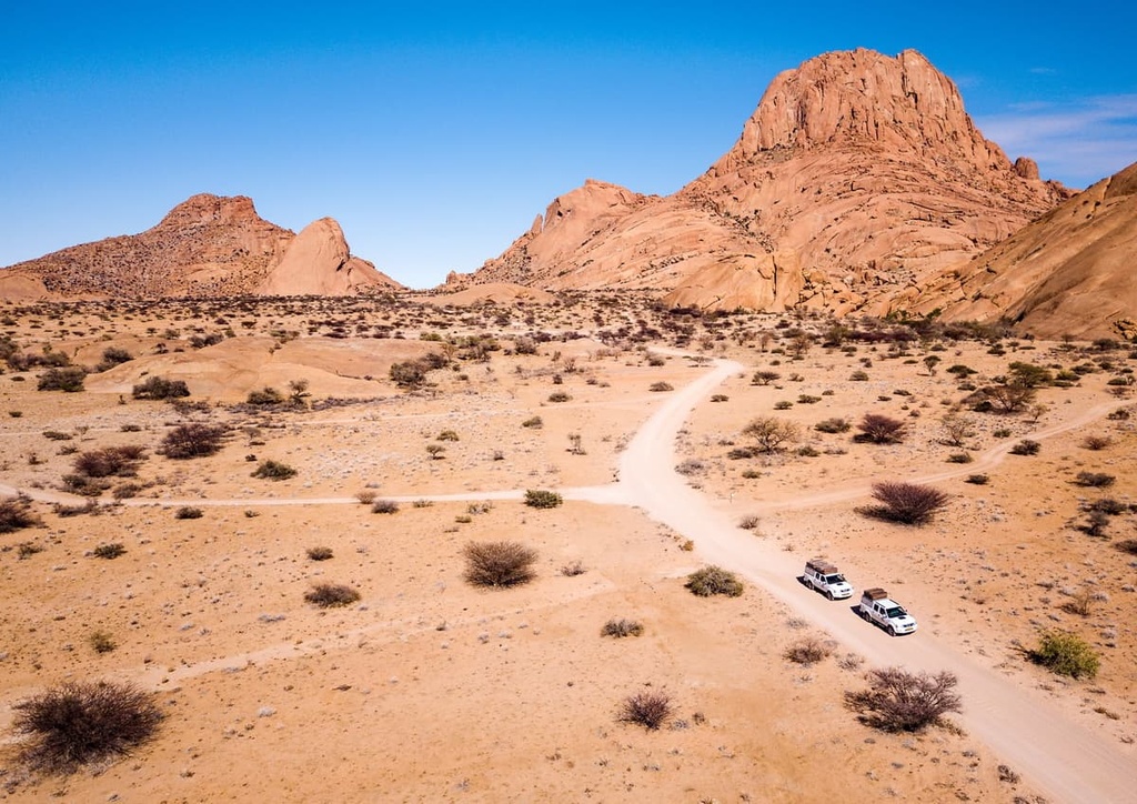
Nicknamed the ‘Matterhorn of Namibia,’ the granitic Spitzkoppe is a rugged peak that’s located a two-hour drive from Swakopmund. It rises about 650 m (2,132 ft) from surrounding plains and is a true wonder to behold.
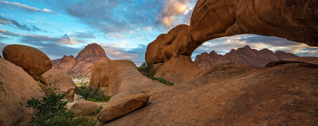
Although it is not the tallest mountain in Namibia, getting to the top of Spitzkoppe can be quite fun and it can be done along a relatively short hike. The mountain also offers rock climbing opportunities and plenty of options for campsites at its base.
Namibia is a very welcoming place for international travelers. Tourism is a big part of the country’s economy, so it’s possible to travel around either independently or as part of a tour group.
There are designated campsites located throughout Namibia, particularly near the country’s major outdoor attractions. Additionally, much of the country allows dispersed camping (always double-check local regulations before your trip), and renting both a car and gear in Namibia typically isn’t that challenging.
With that in mind, here’s a quick look at some of the most notable cities in the country that are worth checking out during your next trip to Namibia.
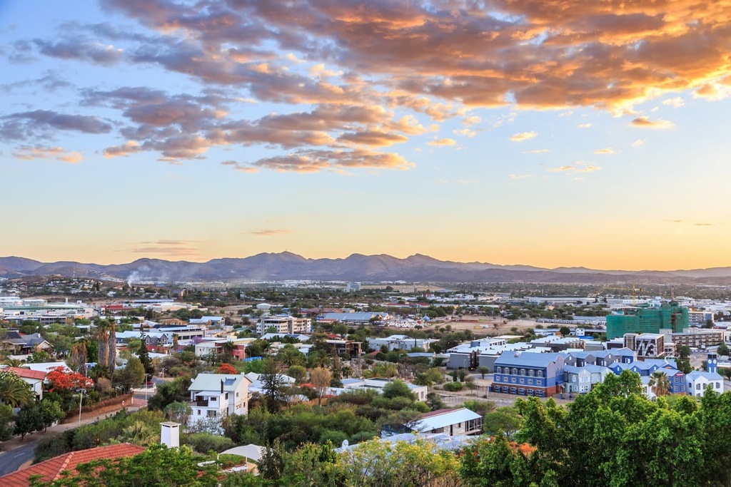
Namibia’s capital, Windhoek, has just over 400,000 inhabitants. Hosea Kutako International Airport lies just east of the city, and buses to South Africa leave regularly from Windhoek, too. Due to Windhoek’s location near the airport, many car rental and tour companies are based in the city, making it a convenient spot to begin your travels in the country.
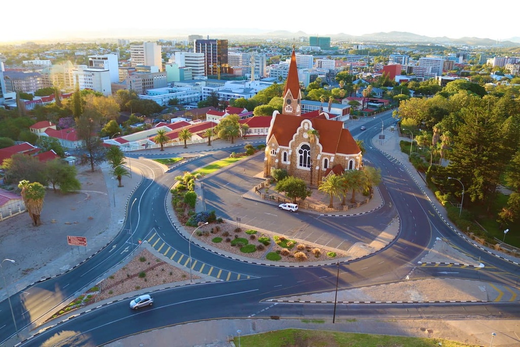
While in Windhoek, be sure to check out its many local art and history museums, as well as its local craft and food markets. Many of the city’s markets sell biltong, a type of dried meat that is often made from local game (be sure to take basic safety precautions when eating street food and game meat in the region to reduce your risk of food-borne illnesses).
Additionally, Windhoek offers a wide range of accommodation options for visitors to enjoy. You can find everything from hostels and hotels to large lodges both in and around the city during your travels.
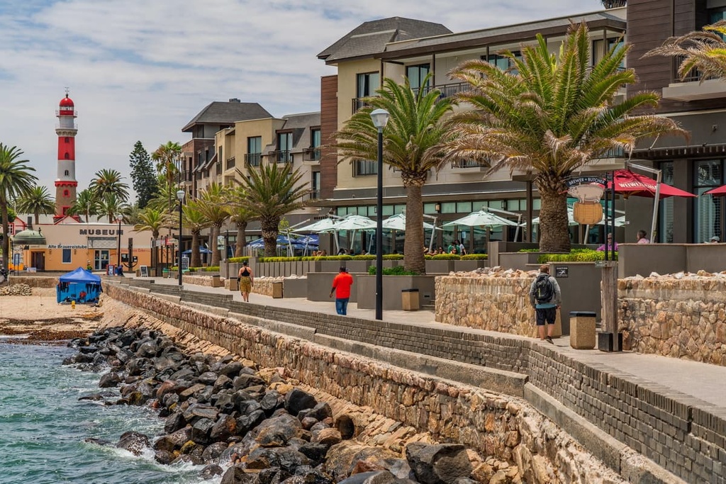
Swakopmund, a small city of 45,000 people, sits on the Atlantic coast of Namibia and is a popular destination among tourists. The town was founded in 1892 as the main harbor for German South West Africa, and this German influence is apparent in the city to this day.
The city of Swakopmund abuts dunes and the ocean, so it offers a host of adventure activities. Visitors in Swakopmund can explore the nearby dunes on foot or by ATV, swim or fish in the ocean, or go skydiving. As it is located only a short drive away, many tourists in Swakopmund also take a quick trip to Walvis Bay in the hopes of seeing flamingos.
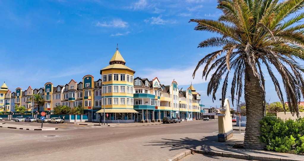
Swakopmund is a good stop over point for any visit to the Skeleton Coast and the Namib Desert, too. Visitors to Swakopmund can find everything from hostels to fancy hotels. The city also has a wide selection of restaurants to choose from. You can even grab a bite to eat from a restaurant near the Swakopmund Jetty if you want to enjoy an ocean view during your meal.
Rundu is the second-largest city in Namibia with around 90,000 inhabitants. The city sits near Namibia’s northern border with Angola along the Kavango River. Rundu is also a prime spot to stop and restock on supplies as you make your way to the Caprivi Strip and the numerous national parks and nature reserves in the area.
While in town, be sure to visit the area’s expansive local markets. Accommodation options in Rundu range from budget hotels to luxurious nature lodges that are located just outside the city. Meanwhile, the dining options in Rundu also include everything from local dishes to international cuisines.
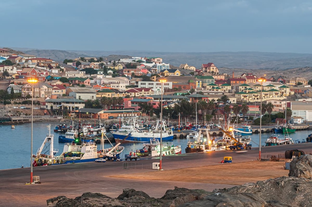
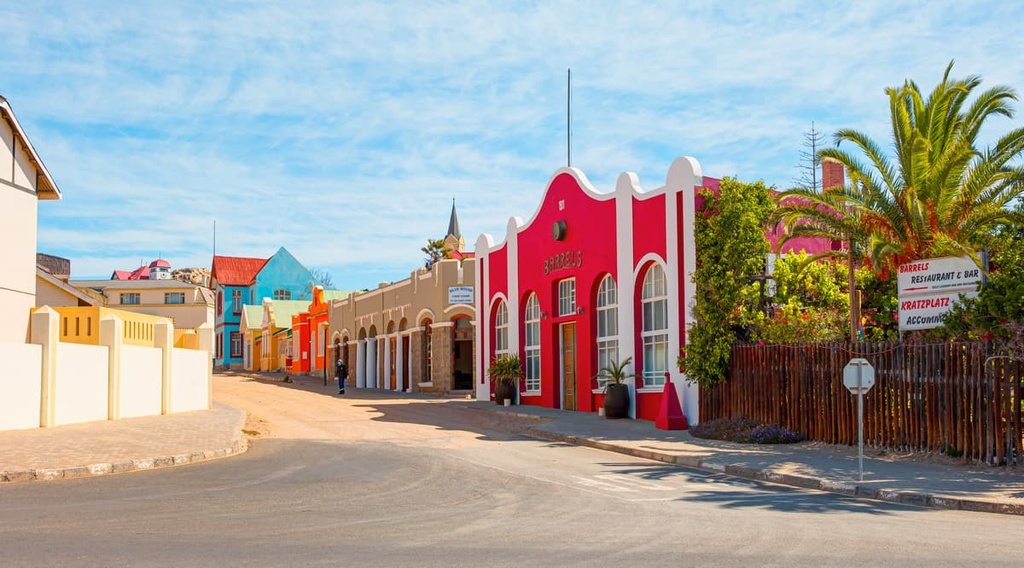
Although it is not technically a major city, Luderitz is a historic coastal town in Namibia that’s located near several quintessential destinations in the country. The town’s population is just under 13,000 people, so it’s a small city by regional standards.
That being said, you can find a number of important destinations just a short distance inland from Luderitz, such as Kolmanskoppe. This abandoned diamond mining town is open to visitors for a small fee. While in Kolmanskoppe, guests can wander through the old structures filled with sand that are slowly being reclaimed by the desert. Guided tours are available for those who want to learn more about the history of the area.
Slightly further inland from Kolmanskoppe, you can also find the Garub Plains. Here, visitors have the chance to spot Namibia’s small wild horse population, which is found only in this part of the country. While staying over in Luderitz, consider taking a drive or walk along the coast to catch a glimpse of the region’s seals and penguins.
The town also has modest accommodation offerings for visitors, including hotels and rental apartments. As it is located so close to the sea, Luderitz also boasts a great assortment of seafood restaurants, so there’s something for everyone to enjoy during a trip to the city.


Yes. Namibia has 694 named mountains. The highest is Königstein at 2,573 m.
The highest mountain in Namibia is Königstein, at 2,573 m.
Namibia has 694 named mountains.


