
Scan the QR code and open PeakVisor on your phone
Zimbabwe is home to 4,518 named mountains. The highest is Mount Nyangani at 2,593 m.
Zimbabwe is a landlocked country in southeastern Africa. With a population of 16.6 million, it has a total land area of 390,757 square kilometers (150,872 sq mi), making it the 60th-largest country in the world. The country’s highest and most prominent peak is Mount Nyangani (2,593 m / 8,507 ft). There are 4518 named mountains in Zimbabwe, mostly contained within the Eastern (Manica) Highlands, the country’s largest mountain range.
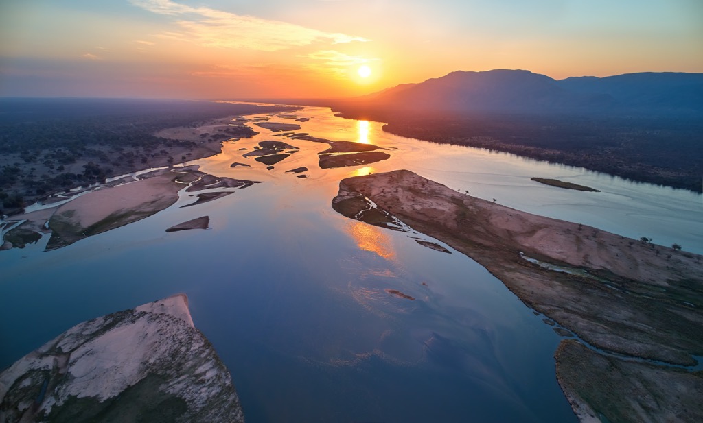
Four nations border Zimbabwe. Clockwise from the north, these are Zambia, Mozambique, South Africa, and Botswana. Two major rivers rim the country, the Zambezi to the north (marking the border with Zambia) and the Limpopo to the south (marking much of the border with South Africa). These rivers constitute the country’s two largest drainage basins.
Zimbabwe’s geography is defined by a vast central plateau that dominates much of the country. This plateau, known as the High Veld, sits at an average elevation of 1,200 to 1,600 meters (3,900 to 5,200 ft) above sea level. It's a region of rolling grasslands punctuated by granite hills and outcrops, creating a scenic mosaic that supports a variety of agricultural activities and wildlife.
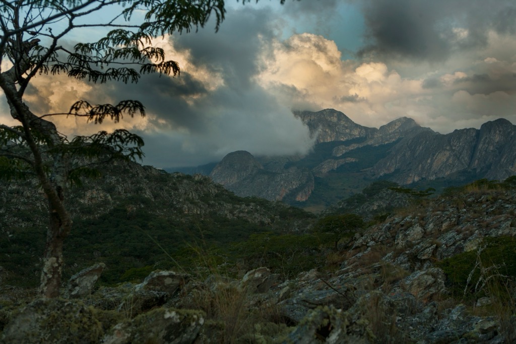
To the east, these plateaus give way to the dramatic Eastern Highlands, a mountainous region that forms a natural border with Mozambique and is home to 366 named peaks. These mountains, also known as the Manica Highlands, are the longest range in the country, running for around 300 kilometers (190 mi), dominated by Mount Nyangani (2,593 m / 8,507 ft), the country’s highest and most prominent peak. The range is split into several sub-ranges, including the Bvumba and Chimanimani Mountains. Here, the landscape is one of deep valleys, cascading waterfalls, and mist-shrouded peaks. The highlands offer a cooler climate and more abundant rainfall than the rest of the country, supporting lush forests.
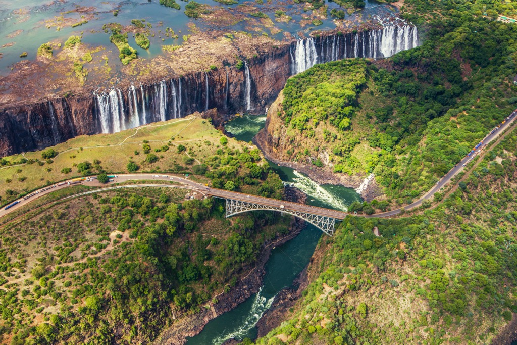
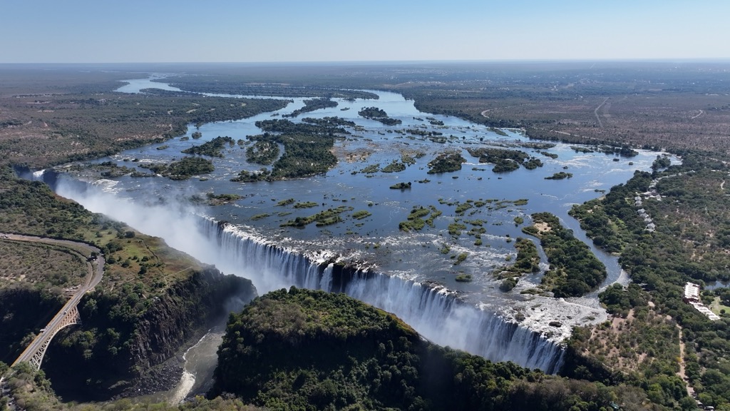
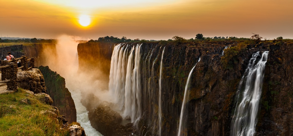
Zimbabwe is home to several world-famous natural destinations. Victoria Falls, the world’s largest waterfall by volume, is on the Zambezi River. It’s a UNESCO World Heritage Site and one of the Seven Natural Wonders of the World. Also known as “Mosi-oa-Tunya” or “smoke that thunders,” Victoria Falls is 1,708 meters (5,604 ft) wide and over 100 meters (330 ft) tall. It pumps out a staggering flow rate of 1,088 cubic meters per second (38,400 cu ft/s).
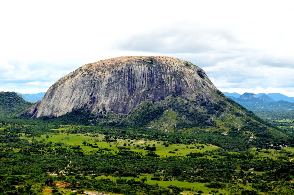
Zimbabwe and Zambia also share the world’s largest artificial lake, Lake Kariba (5,580 sq km / 2,150 sq mi). Its shores are home to floodplains, woodlands, and grasslands, supporting a rich array of wildlife. Other famed geographic sites include Mana Pools National Park, one of Africa’s most famous wildlife viewing destinations, and the Matobo Hills, a landscape of granite hills and balancing rocks home to ancient cave paintings, archaeological sites, and the grave of infamous English mining magnate and politician Cecil Rhodes (perhaps best known as the founder of the apartheid state Rhodesia).
The geological history of Zimbabwe's mountains is ancient and complex. It begins, arguably, with the formation of the mighty Zimbabwe Craton, which dates back billions of years to the Archean Eon. Cratons are dense, compacted blocks of Earth’s crust that have been subjected to intense tectonic, magmatic, and metamorphic forces. They are typically made of crystalline and metamorphic rocks like granite and gneiss.
Around 1.8 billion years ago, during the Proterozoic era, tectonic forces began to pull apart the area north of the Zimbabwe Craton, creating a rift zone known as the Zambezi Belt. This rifting process led to the thinning of the crust and the upwelling of magma, resulting in volcanic activity and the formation of sedimentary basins.
Between 800 and 500 million years ago, a major mountain-building event known as the Pan-African Orogeny occurred. This event involved the collision of continental plates, causing intense compression, folding, and uplift. The orogeny was crucial in shaping many African ranges, including Zimbabwe’s Eastern Highlands.
The collision of plates during the Pan-African Orogeny led to the uplift of the highlands, forming the mountainous terrain we see today. This uplift was accompanied by faulting, creating fractures and zones of weakness in the continental crust. These faults further shaped the landscape, influencing the flow of rivers and the formation of valleys.
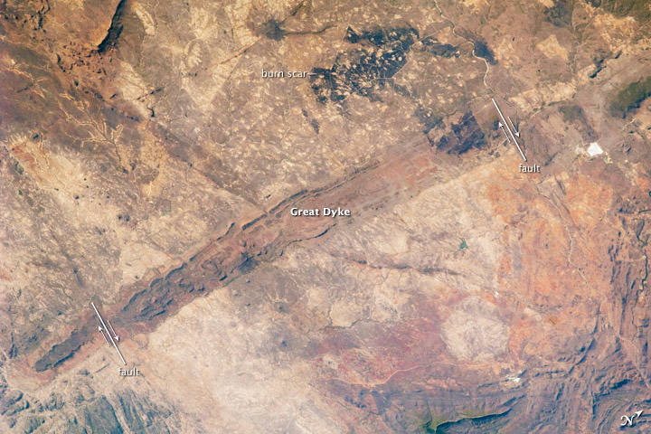
Another notable geological feature in Zimbabwe is the Great Dyke. This linear intrusion of igneous rock was formed when magma from deep within the mantle forced its way up through the crust and solidified around 2.5 billion years ago. It stretches over 550 kilometers (340 miles) north-south across the country, passing just west of the capital, Harare, and is up to 12 kilometers (8 mi) wide at some points. The Dyke is rich in minerals, including platinum, palladium, rhodium, chrome, and nickel.
Zimbabwe's varied topography and climate support a rich tapestry of ecosystems, from montane forests to savanna grasslands and wetlands. Due to their high altitude and rainfall, the Eastern Highlands are home to unique flora and fauna, including endemic species found nowhere else on Earth. These highlands are characterized by patches of evergreen forests, grasslands, and heathlands, comprising habitat for a plethora of species.
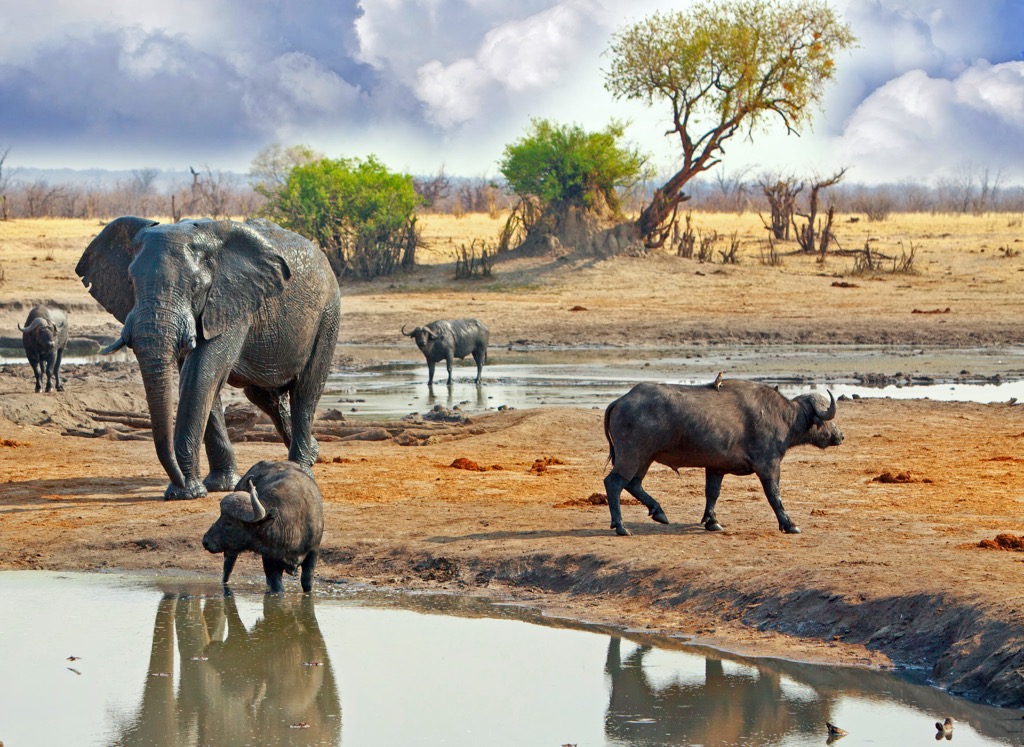
The vast Highveld plateau is dominated by savanna grasslands interspersed with acacia trees and shrubs. This ecosystem supports a diverse array of herbivores, including elephants, zebras, giraffes, and antelopes, as well as predators such as lions, leopards, and hyenas. The Zambezi and Limpopo valleys, with their riparian woodlands and floodplains, create important corridors for wildlife movement and provide habitat for numerous bird species, hippos, crocodiles, and other aquatic life.
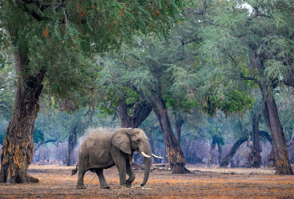
Some of the most iconic species of fauna found in Zimbabwe are the African buffalo (Syncerus caffer), the critically endangered black rhinoceros (Diceros bicornis), the African bush elephant (Loxodonta africana), southern giraffe (Giraffa giraffa), the vervet monkey (Chlorocebus pygerythrus), and the African leopard (Panthera pardus pardus).
A few more unique species are the critically endangered cave squeaker (Arthroleptis troglodytes), a small frog endemic to the Chimanimani Mountains, and the Kariba tilapia (Oreochromis mortimeri), a greenish-grey dotted fish found only in the rivers of the middle Zambezi valley.
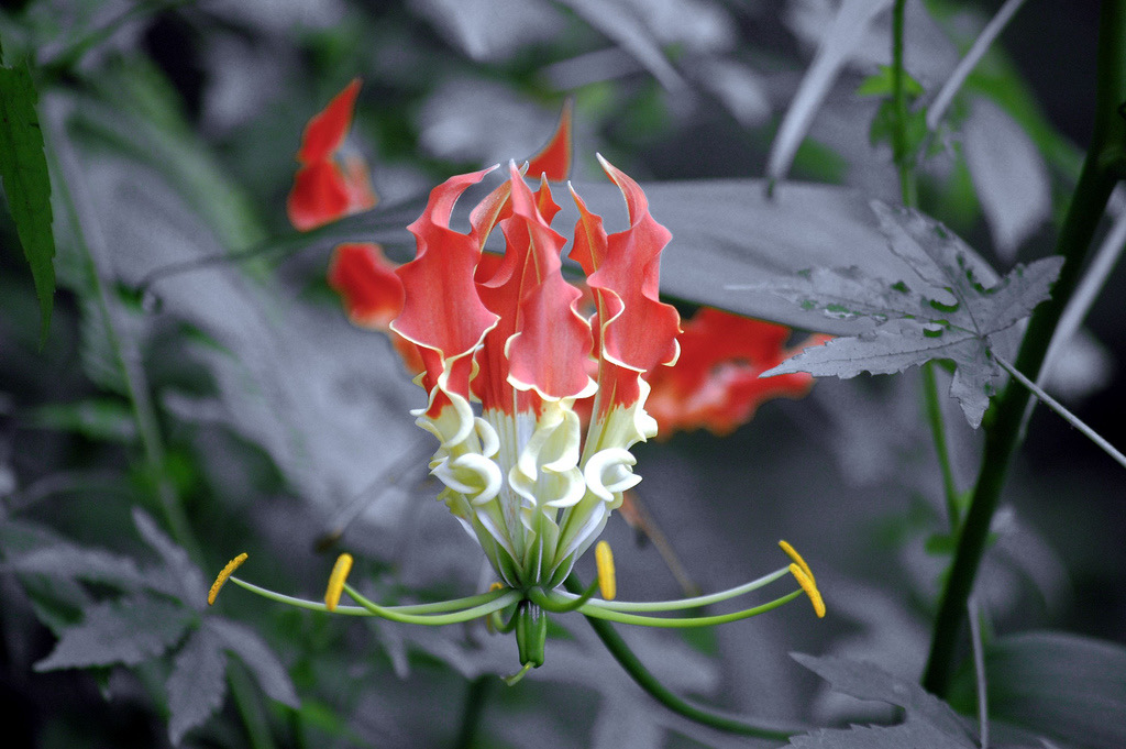
In terms of flora, Zimbabwe is well-known for its baobab trees (Adansonia digitata), the Zimbabwe aloe (Aloe excelsa), the candelabra tree (Euphorbia ingens), and the African horned cucumber (Cucumis metuliferus) a spiky orange melon that is remarkably high in Vitamin C. The country’s national plant is the Flame lily (Gloriosa superba), a fire-colored flower that is toxic to ingest due to high levels of colchicine, an alkaloid poison.
Human presence in Zimbabwe dates back to the earliest days of humankind, with archaeological evidence indicating hominids present as far back as 500,000 years ago. The San people, renowned for their hunter-gatherer lifestyle and expressive rock art, were among the earliest identifiable groups to leave a lasting legacy on the landscape. Their paintings are found in caves and rock shelters across Zimbabwe.
A wave of migration began to transform the region around the 1st century CE. Bantu-speaking peoples originating from further north in Africa gradually moved southwards, bringing agricultural knowledge and new social structures. This Bantu expansion, which solidified by the 5th century, marked a significant turning point in Zimbabwe's human history, as it was when ironworking technology first appeared.
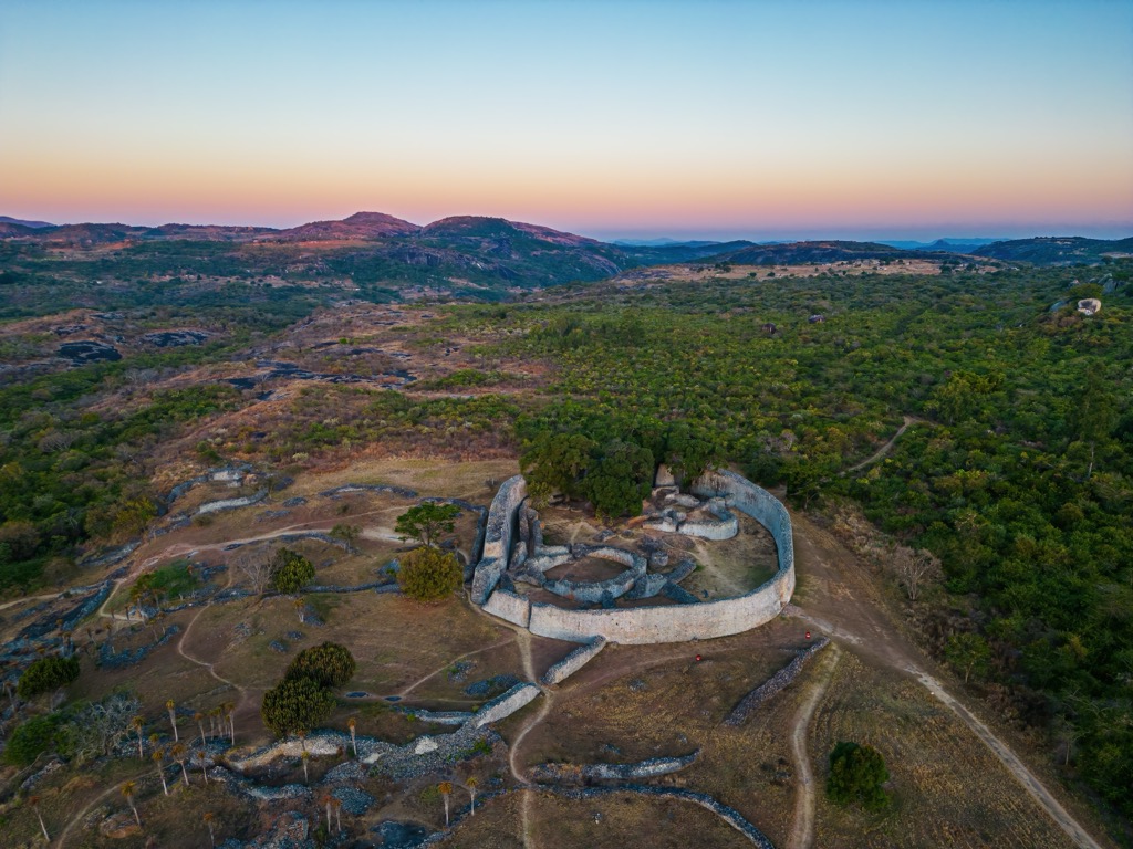
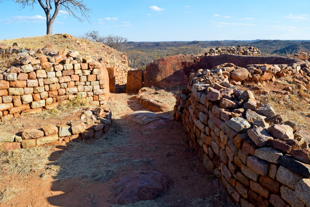
The Shona people, who migrated to the region between the 9th and 12th centuries, established the Kingdom of Zimbabwe. They cultivated crops like sorghum, millet, and beans and constructed impressive stone cities, the most famous being Great Zimbabwe, a UNESCO World Heritage Site in Masvingo. This city’s intricate stone walls and monumental architecture are still visible today. It served as a royal residence, a religious center, and a hub of trade, connecting the interior of southern Africa with the coastal Swahili trading networks. Gold, ivory, and other precious commodities routinely flowed through Great Zimbabwe.
The decline of Great Zimbabwe in the 15th century saw the rise of new Shona states, including the Mutapa and Rozvi Empire. The Mutapa Empire, centered in the north, controlled vast territories and engaged in extensive trade with Portuguese merchants who arrived on the coast in the 16th century. The Rozvi Empire, based in the southwest, maintained a powerful presence in the region until the 19th century. They were known for their strong military organization and their iron-fisted control of gold mining.
The arrival of Cecil Rhodes and the British South Africa Company in the late 19th century marked a turning point in Zimbabwe's history. Driven by ambitions of wealth and imperial expansion, whites colonized the land, displacing indigenous communities and exploiting its resources. The territory became known as Southern Rhodesia, and African resistance to colonial rule grew steadily. Organizations like the Rhodesia Native Association (later the African National Congress) emerged, advocating for self-determination and an end to discriminatory policies.
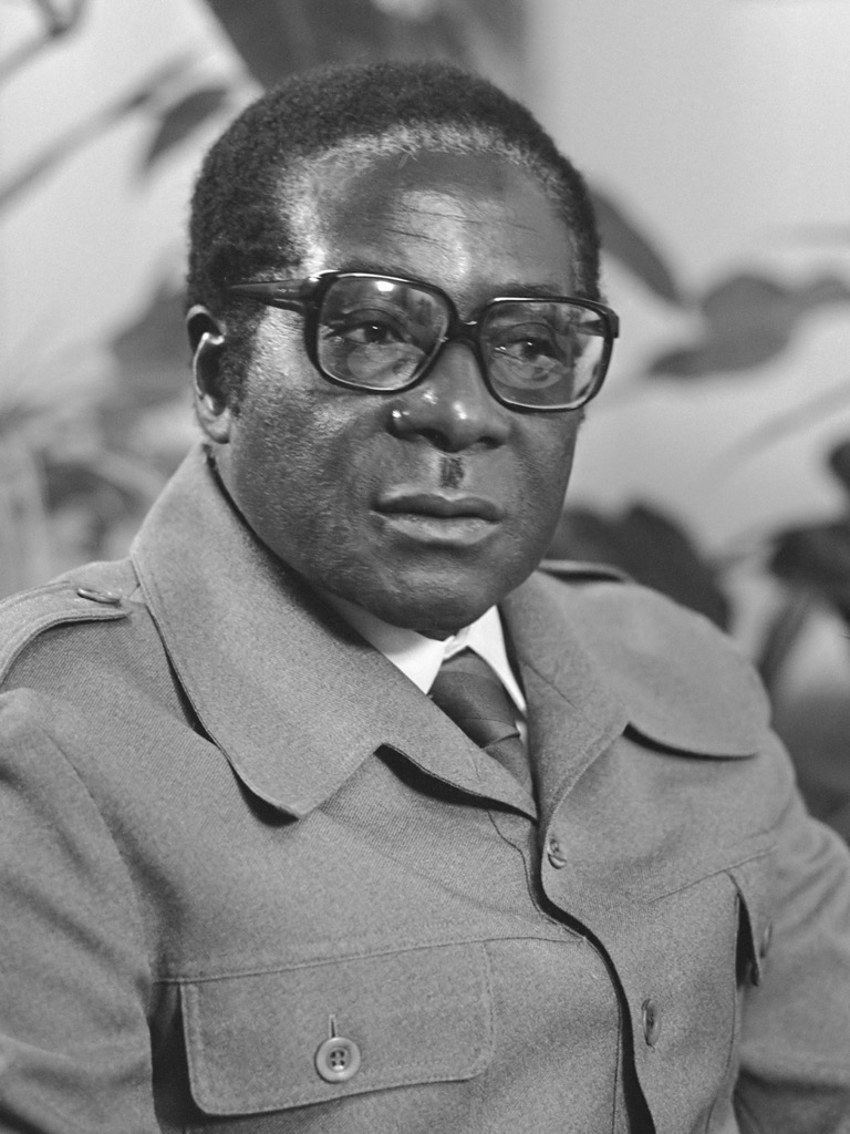
The struggle for independence intensified in the 1960s and 70s, with guerrilla movements like the Zimbabwe African National Liberation Army (ZANLA) and the Zimbabwe People's Revolutionary Army (ZIPRA) waging a protracted war against the white minority government. In 1980, after years of conflict and negotiations, Zimbabwe achieved independence. Robert Mugabe, a prominent leader of the liberation struggle, became the country's first prime minister.
The early years of independence held promise, with significant progress in education, healthcare, and infrastructure development. However, challenges soon emerged, including economic inequalities, political tensions, and social unrest. Land reform policies were implemented to address historical injustices in land ownership but often led to economic disruption and controversy. Today, the World Health Organization estimates that roughly 25 percent of the country's population is “food insecure,” and over 60 percent live below the poverty line.
Mount Nyangani (2,593 m / 8,507 ft), Zimbabwe’s highest peak, is an excellent adventure for an intrepid peak bagger. Located in Nyanga National Park, the peak is accessible via several trails and typically takes two to three hours to summit.
This newer trail, which begins in Mutarazi and Nyanga National Parks, is lauded as the “most beautiful trail in Zimbabwe. " It takes hikers to the summit of Chikorokoto (1,853 m / 6,079 ft), through the mighty Pungwe Gorge, and along the Pungwe River to its confluence with the Nyazengu River. Most hikers take around five nights to complete the trail, which is 64 kilometers (40 mi) long, though there are different variations you can tackle to add or shorten the length. More info here.
Binga (2,436 m / 7,992 ft) is the second-highest peak in the country, on the border with Mozambique. Like Nyangani, there are several options. However, regardless of your route choice, reaching the summit in one day takes seven to eight hours. Camping in the valley is a popular option, and there is also a hut for overnighters. This peak is inside Chimanimani National Park.
A 3.8-kilometer (2.4 mi) loop around Victoria Falls is a must-do for visitors to this spectacular waterfall. With little-to-no elevation gain, you can see the falls from a variety of angles and vistas. You’ll also be able to cross into neighboring Zambia if you so choose.
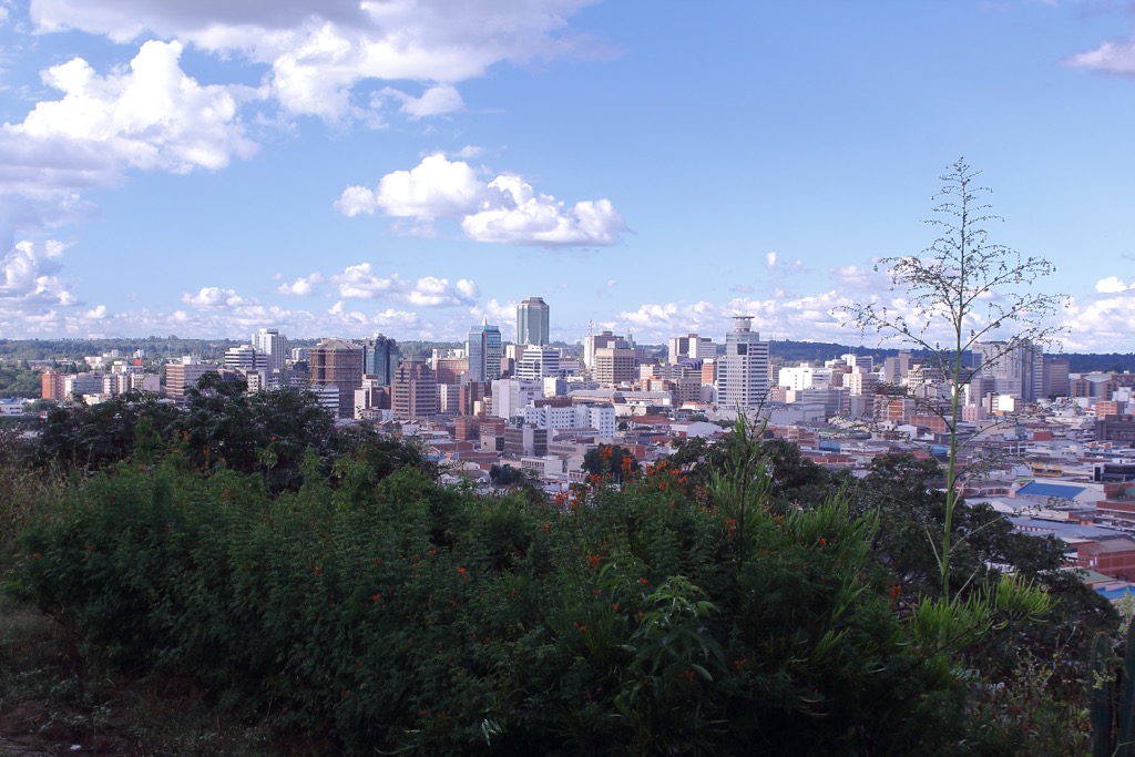
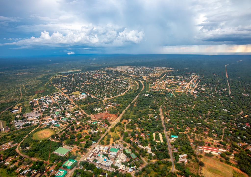
Harare, Zimbabwe’s capital and largest city, exudes the energy of a modern African city. Wide avenues are lined with jacaranda trees, colonial-era buildings whisper tales of bygone eras, and sprawling gardens offer respite from the urban bustle. With an estimated population of 1.6 million in 2024, Harare is a melting pot of cultures and a hub of activity.
Art enthusiasts can find inspiration at the National Gallery of Zimbabwe, which showcases a rich collection of contemporary and traditional Zimbabwean art. For a tranquil escape, the Harare Gardens provide a green oasis in the heart of the city. The Chapungu Sculpture Park's impressive stone sculptures by renowned Zimbabwean artists offer a unique cultural experience. To delve into the nation's history, the National Heroes Acre honors the heroes of the liberation struggle in the latter half of the 20th century.
Beyond the city limits, Lake Chivero Recreational Park has opportunities for boating, fishing, and game viewing. History buffs can explore the Domboshava National Monument, where impressive granite hills shelter ancient rock paintings, offering a glimpse into the lives of early inhabitants. The Epworth Balancing Rocks, a formation of precariously balanced boulders, is another sight to behold.
Zimbabwe's second-largest city, Bulawayo (pop. 690,000), exudes a more relaxed atmosphere than its bustling capital and retains a strong sense of history and tradition.
The Natural History Museum of Zimbabwe houses a vast collection of artifacts and exhibits. The National Museum is a good place to delve into the history and culture of the Ndebele people. History enthusiasts can also explore the Khami Ruins, a UNESCO World Heritage Site that preserves the remnants of a 15th-century stone city.
Just outside the city, Matobo National Park is a landscape of granite hills, balancing rocks, and ancient cave paintings. Hiking and rock climbing enthusiasts will find ample challenges and rewards in the Matobo Hills. Wildlife lovers can visit the Chipangali Wildlife Orphanage, a sanctuary for orphaned and injured animals. For a more immersive wildlife experience, Antelope Park, a private game reserve, offers lion conservation programs and various activities.
The town of Victoria Falls (pop. 35,000), is synonymous with the magnificent waterfall that shares its name. This tourism hub offers a range of activities and experiences centered around the awe-inspiring natural wonder.
Victoria Falls, or Mosi-oa-Tunya ("the smoke that thunders"), is a UNESCO World Heritage Site and one of the largest waterfalls in the world. Here, the Zambezi River plunges dramatically into a narrow gorge. The Victoria Falls Bridge, spanning the gorge, offers not only spectacular views but also the adrenaline rush of bungee jumping. During the dry season, adventurous souls can take a dip in the Devil's Pool, a natural infinity pool perched precariously at the edge of the falls.
The Zambezi National Park, bordering the falls, provides opportunities for game drives, river cruises, and walking safaris, allowing visitors to encounter the diverse native wildlife. For those seeking further adventure, the Batoka Gorge offers exhilarating white-water rafting. Just across the border in Botswana, Chobe National Park beckons with its renowned elephant herds and abundant wildlife.
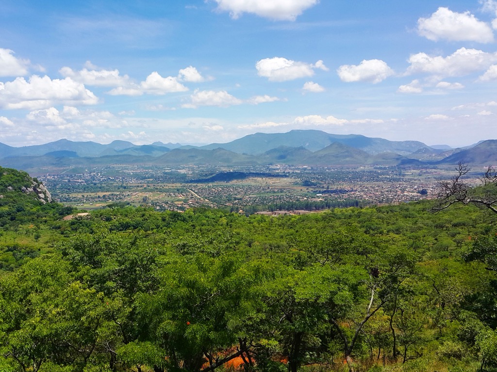
Nestled amidst the picturesque Eastern Highlands, Mutare (pop. 200,000) is a city of scenic beauty and tranquil charm. It enjoys a pleasant climate and is perhaps the best jumping-off point for the natural wonders of the Highlands.
The Mutare Museum showcases history and culture. Nature lovers can wander through the National Botanic Garden, which boasts a diverse collection of indigenous and exotic plants. The Cecil Kop Nature Reserve offers rewarding hiking trails for panoramic city views.
Mutare is a gateway to some of Zimbabwe's most spectacular natural attractions. The Bvumba Mountains with cascading waterfalls, lush forests, and diverse birdlife, are a paradise for hikers and nature enthusiasts. Nyanga National Park, home to Mount Nyangani (2,593 m / 8,507 ft), Zimbabwe's highest peak, offers breathtaking landscapes and challenging trails. Also, don’t miss Mutarazi Falls in nearby Mutarazi National Park. Mutarazi is Africa's second-highest waterfall (762 m / 2,500 ft)!


Yes. Zimbabwe has 4,518 named mountains. The highest is Mount Nyangani at 2,593 m.
The highest mountain in Zimbabwe is Mount Nyangani, at 2,593 m.
Zimbabwe has 4,518 named mountains.


