
Scan the QR code and open PeakVisor on your phone
/Ai-/Ais Richtersveld Transfontier Park (ARTP) has 47 named peaks. The highest is Hohenzollern at 1,509 m. Other notable peaks include Gorus, Vandersterrberg and Rosyntjieberg.
The /Ai-/Ais Richtersveld Transfrontier Park (ARTP) is a cross-border park between South Africa and Namibia of mountainous, arid habitat. There are 47 named mountains in /Ai-/Ais Richtersveld Transfrontier Park. Hohenzollern is the highest point, measuring 1,509 meters (4,951 ft). The most prominent mountain is Tatasberg.
The /Ai-/Ais Richtersveld Transfrontier Park spans 604,500 ha (1,493,752 acres), making it one of the world's largest transfrontier parks (those that extend internationally). The park occupies the southwestern portion of Namibia and the northwestern portion of South Africa’s Northern Cape province. It comprises the Ai-Ais Hot Springs Game Park in Namibia and the Richtersveld National Park in South Africa.
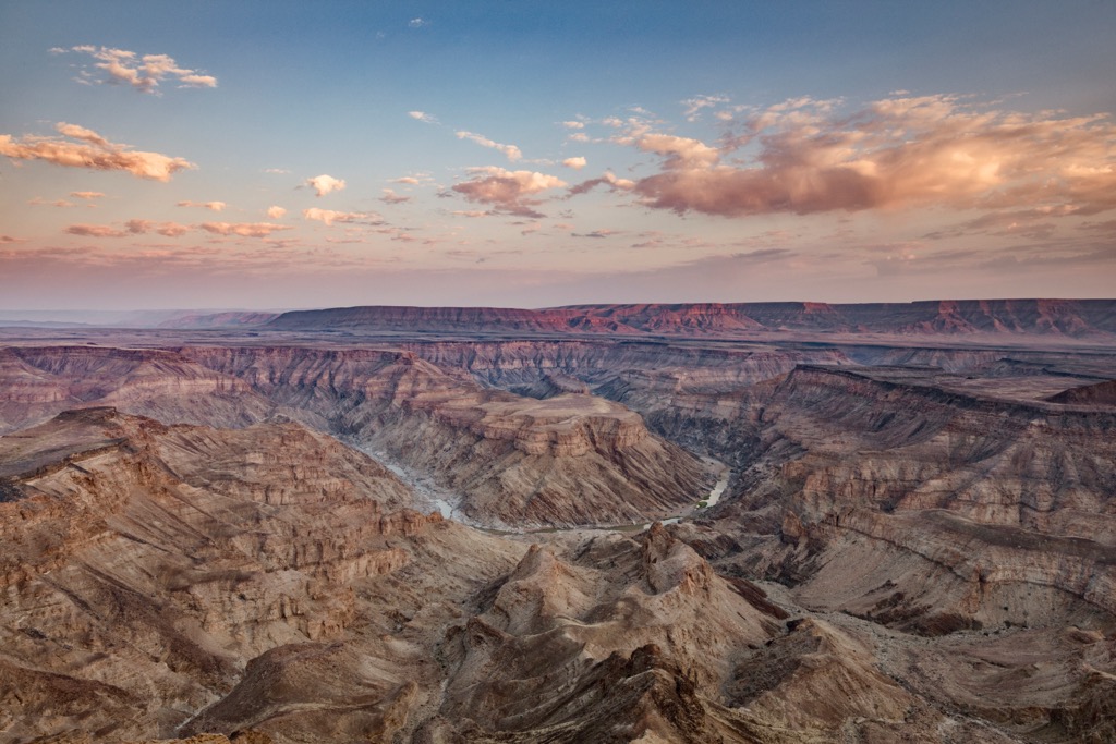
One of the park’s most notable features is the Fish River Canyon, often considered the second-largest canyon in the world after the Grand Canyon in the United States of America. The Fish River Canyon stretches over 160 km (100 mi), with depths reaching up to 550 meters (1,800 ft). The canyon is a testament to the erosive power of the Fish River, which has carved its way through the rocky terrain over millions of years.
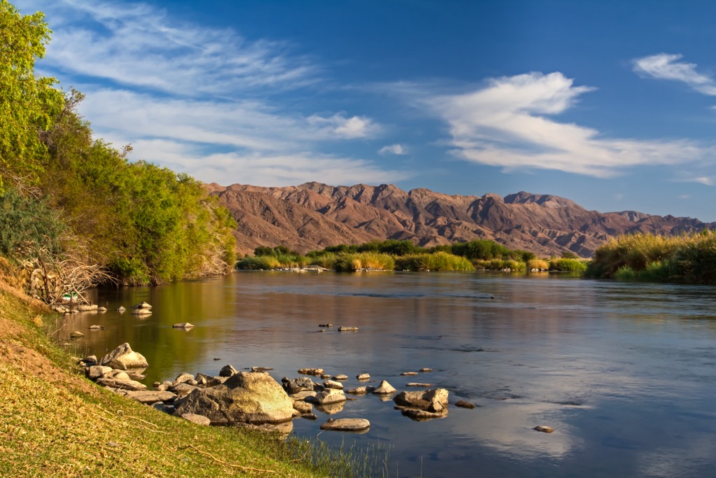
The Orange River flows through the park and is South Africa’s longest river, at 2,432 km (1,511 mi). As a Ramsar site, the Orange River is recognized as a wetland of international importance. This river plays a significant role in the park's geography, as it not only forms the international boundary between South Africa and Namibia but also provides a lifeline for vegetation and wildlife in the arid region.
Home to a rich diversity of plant life, the Richtersveld is renowned for its endemic species, including various succulents and unique desert-adapted vegetation. The Richtersveld features a harsh and dry climate in this desert landscape, with extreme temperatures of up to 53°C (127°F) recorded in mid-summer.
The park has two major climatic systems: a temperate winter rainfall region with high air humidity, contrasted by the high temperature with its summer rains yet low humidity further inland. For this reason, hiking activity is limited to April to September to avoid the extreme summer heat.
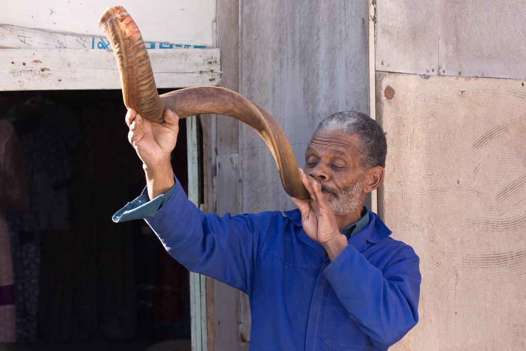
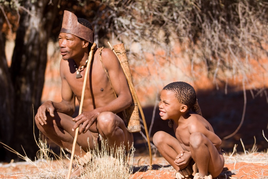
The /Ai-/Ais Richtersveld Transfrontier Park is communally owned and managed by the semi-nomadic Nama people, many of whom still follow the day-to-day traditions of their forefathers.
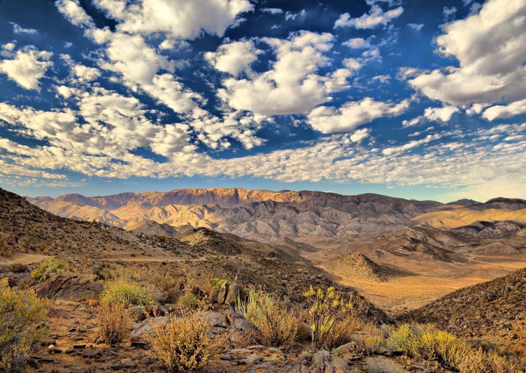
The /Ai-/Ais Richtersveld Transfrontier Park is also known for its unique geology, which features many distinct periods of geological history dating back 2,000 million years. The park is in a desert region, and mountains, canyons, and rocky outcrops characterize the area's geology.
The Orange River has played a significant role in shaping the landscape over millions of years. There are a variety of rock formations in this desert area, including granite, gneiss, and schist. The area is also rich in minerals, including copper, lead, zinc, and silver.
The /Ai-/Ais Richtersveld Transfrontier Park is a biodiversity hotspot home to a wide variety of flora and fauna. The park is home to over 360 species of flowering plants (angiosperms) on a surface area of 1 km² (0.4mi²) despite an average rainfall of only 68 mm (2.6 in) per year.
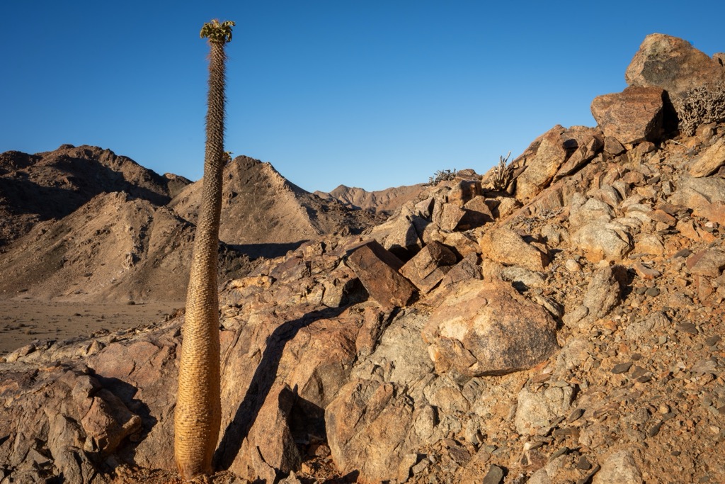
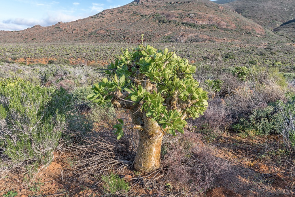
Two floristic kingdoms occupy the park, such as the succulent Karoo region of the Greater Cape Flora and the East Gariep Centre, the most important center of the Nama Karoo Region. The park boasts a high number of endemic plant species, many of which have adapted to survive in extreme arid conditions. Notable plant species include succulents such as the iconic Halfmens (Pachypodium namaquanum).
The park also supports diverse wildlife, including mammals like klipspringer, springbok, baboons, and Hartmann's mountain zebra. Birdwatchers can spot species such as raptors, waterbirds, and endemic desert species. The rivers within the park provide habitat for fish species, contributing to the overall ecological richness.
The Nama people inhabit the /Ai-/Ais Richtersveld Transfrontier Park, known for their nomadic pastoralist lifestyle and living in the region for centuries. Their traditional semi-nomadic pastoralist lifestyle relies on herding livestock and adapting to the region's arid conditions.
Stone tools and rock paintings dating back 4,000 years have been found in the park, created by the ancestors of the San and later the Khoikhoi, who brought the first livestock with them. The park also has traces of ancient human activity (10,000 - 100,000 years ago).
During the colonial period, European powers, notably the Dutch and later the British, established control over parts of southern Africa. The Richtersveld was no exception, and the colonial presence impacted the indigenous way of life. Displacement, conflicts, and changes in land use patterns were standard during this time.
Land ownership and use have been significant issues in the Richtersveld region. The indigenous communities, including the Nama people, faced challenges as European settlers and, later, the apartheid government sought control over the land.
In more recent times, there has been a growing awareness of the importance of recognizing and respecting the rights of indigenous peoples. Efforts have been made to address historical injustices and restore land rights to some extent. The establishment of transfrontier parks, like the /Ai-/Ais Richtersveld Transfrontier Park, involves collaboration between different countries and local communities.
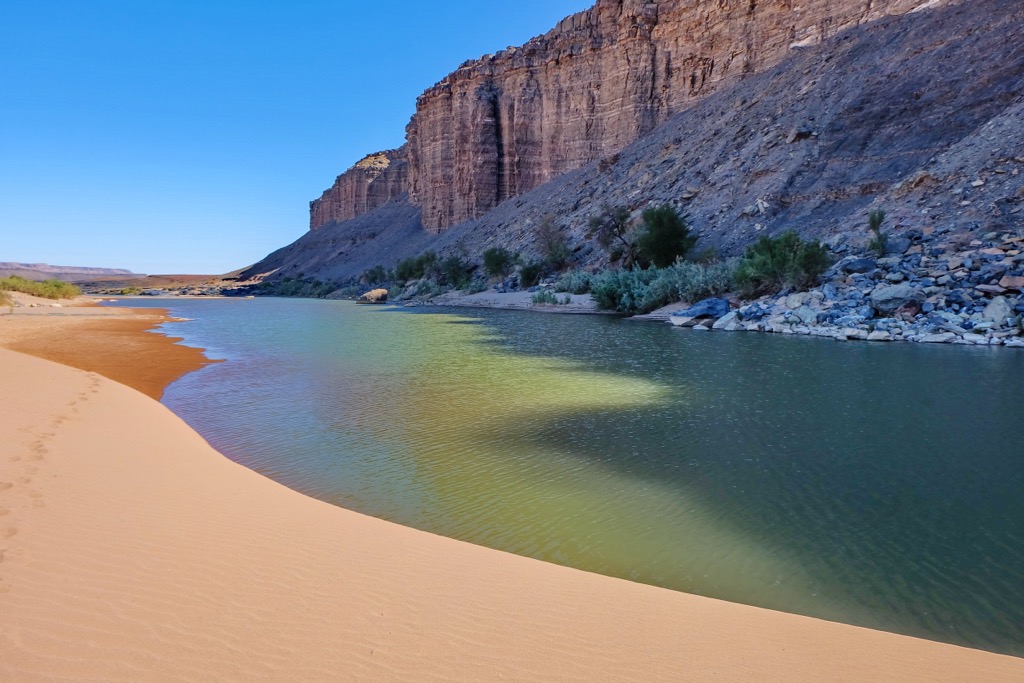
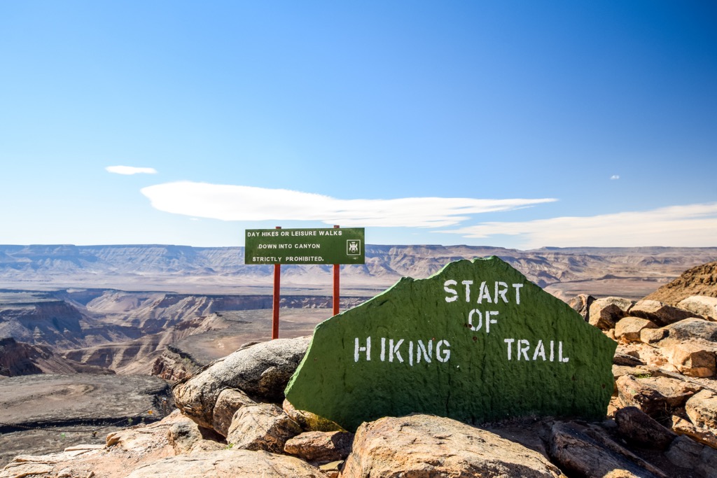
The Fish River Canyon Hike is an 85 km (53 mi) long hiking trail that takes 4 to 5 days to complete. The hike starts at the view site at Hobas and finishes at the Ai-Ais resort. The canyon was formed over millions of years through the erosive forces of the Fish River, creating a dramatic landscape.
The Fish River Canyon Hike follows the course of the Fish River through challenging and varied topography. The trail covers rocky terrain, sandy riverbeds, and steep ascents and descents, and hikers are treated to views of the Fish River Canyon and surrounding hills and valleys.
The Vensterval Trail is a 4-day hiking trail in the /Ai-/Ais Richtersveld Transfrontier Park. The trail is available between 1 April and 30 September and is conducted from a base camp called Hakiesdoring hiking camp, situated in the panoramic Ganakouriep Valley.
Hiring a qualified guide with extensive knowledge of the area with this terrain and climate is strongly recommended. The Vensterval Trail explores vast quartzite gorges, masses of botterboom (Tylecodon paniculatus), the crags of the Tswaies Mountain, and the fountains of Armanshoek. Along the trail, hikers view the surrounding peaks of Oemsberg, Claim Peak, and Vandersterrberg.
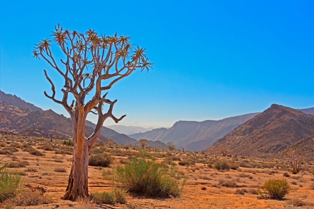
The Lelieshoek-Oemsberg Trail is a 3-day hike that offers outlooks onto the Richtersveld desert, the Orange River, and the mountains of Oemsberg, Rosyntjieberg, and Mount Ereubus. Hikers pass through desert flora and fauna, including quiver trees, half-mens, and leopards. The trail is open year-round, but hikers should avoid hiking during summer due to the extreme heat.
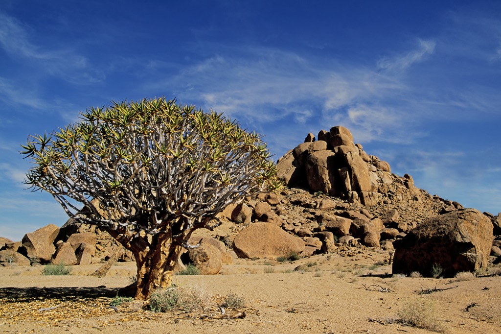
The Kodaspiek Trail is a 2-day hike across the Richterveld’s vast mountain desert wilderness. En route, hikers are afforded views of the surrounding hills, such as Numeesberg, Paradysberg, and Koeroegab. The trail is named after the Kodaspiek Mountain, the highest point at 979 meters (3,212 ft). During the trek, hikers encounter a staggering assortment of plant life and wildlife, such as Halfmens, aloes, quiver trees, and small reptiles, birds, and mammals.
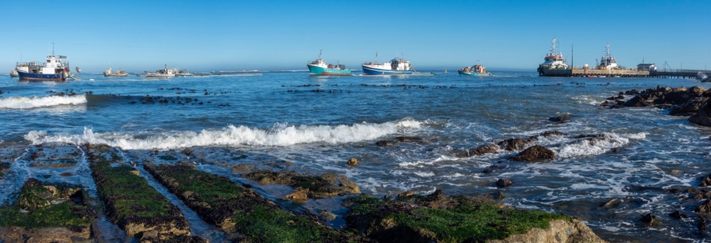
Port Nolloth is a small town located in the Northern Cape province of South Africa. It is a popular destination for tourists interested in fishing, diving, and exploring the nearby /Ai-/Ais Richtersveld Transfrontier Park.
Diving enthusiasts are drawn to Port Nolloth for its clear waters and diverse marine life. The area hosts several dive operators providing guided dives and equipment rental services.
Port Nolloth Beach is a spacious and well-maintained location for sunbathing and general beach-vibe relaxation.
The Port Nolloth Lighthouse, constructed in 1916 and still operational, is a historic landmark open to visitors. Guided tours are available for those interested in learning about its history.
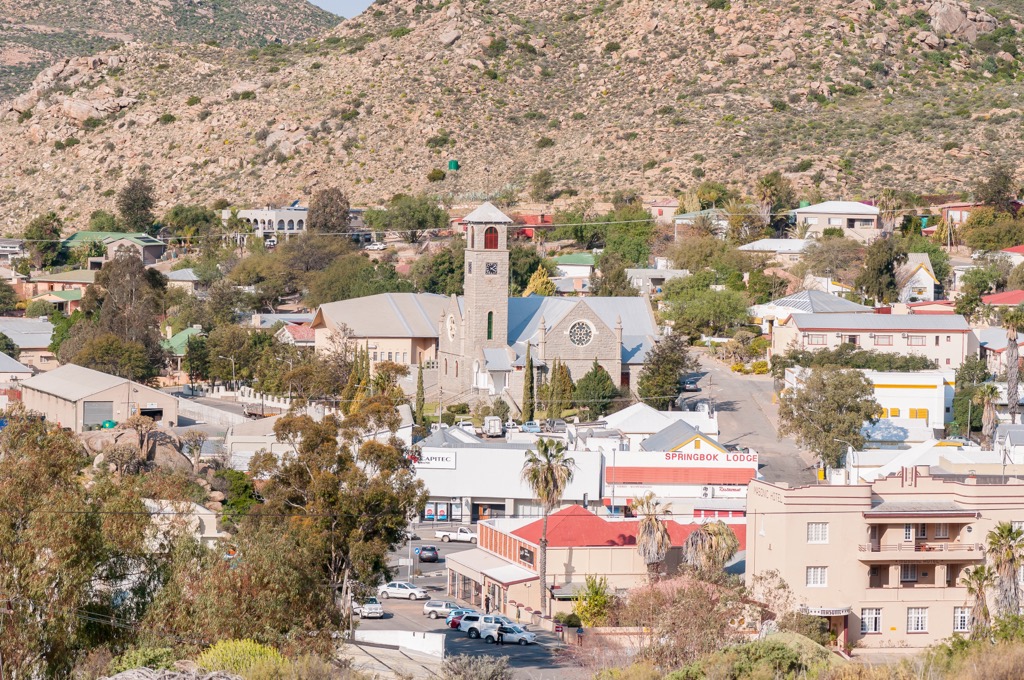
Springbok is a town located in the Northern Cape province of South Africa. It is known for its landscapes and wildlife reserves; mountains and deserts surround the town.
The Goegap Nature Reserve hosts diverse flora and fauna, including springboks, zebras, and ostriches. Visitors can explore the reserve on foot to encounter the resident plants and animals.
A few tour companies operate in this area to showcase Springbok’s history, nature, and adventure activities. Beskus Tours organizes multi-day tours featuring activities like canyoning and rappelling. Aukwatowa Tours specializes in multi-day safaris, and Hop-On Cultural Tours focuses on historical and heritage aspects, providing informative tours of Springbok.

The highest peak in /Ai-/Ais Richtersveld Transfontier Park (ARTP) is Hohenzollern, at 1,509 m.
Notable peaks in /Ai-/Ais Richtersveld Transfontier Park (ARTP) include Hohenzollern, Gorus, Vandersterrberg, Rosyntjieberg and Sekelberg.


.jpg)