
Scan the QR code and open PeakVisor on your phone
Namib-Naukluft National Park has 51 named peaks. The highest is Bakkenkop at 1,978 m. Other notable peaks include Satanskop, Bushman Hill and Dikwillem.
Namib-Naukluft National Park is in Namibia and is Africa's largest national park. The park features many landscapes, including towering sand dunes, expansive mud flats, a portion of the arid Namib Desert, and the Atlantic Ocean coastline. There are 51 named peaks in the park; Bakkenkop is the tallest at 1,978 m (6,490 ft), and Satanskop is the most prominent at 703 m (2,306 ft).
Namib-Naukluft National Park spreads along the southern half of the west coast of Namibia. The park spans 49,768 sq km (19,216 sq miles) from the coastline to the edge of the Great Escarpment.
The easternmost section of the park is home to the southern stretches of the Naukluft Mountains. These peaks are known for their abundant wildlife and feature small creeks, streams, and waterfalls.
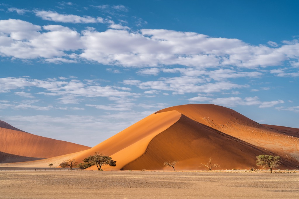
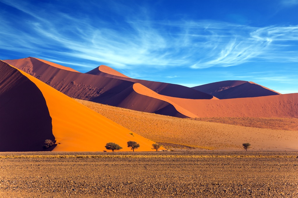
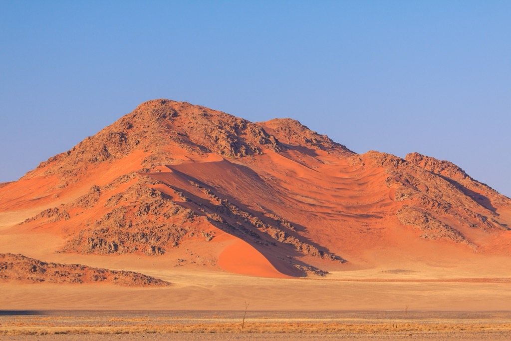
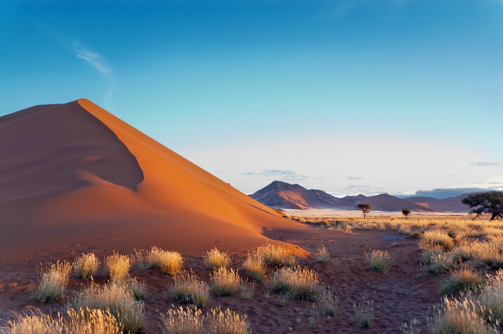
A portion of the Namib Desert, considered the oldest desert in the world, lies near the park's center. This expansive section is known for its vibrantly colored sand dunes. The burnt orange color comes from the oxidization of the iron within the sand, with the more vibrant dunes often being the oldest. The section of the Namib Desert in the park spans roughly 500 km (310 miles) in length and 100-180 km (62-112 miles) in width.
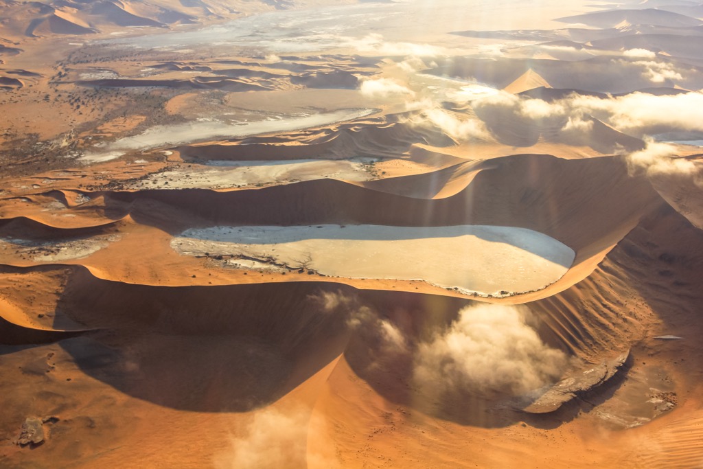
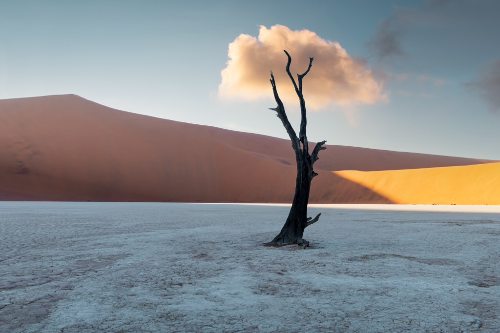
These distinctive dunes also feature gravel plains and rock outcroppings, known locally as kopjes and inselbergs. Another feature of the park is the unique salt and clay pans formed by dried-out basins. The most visited pans are Sossusvlei, Hiddenvlei, and Deadvlei.
The famous dunes taper off near the Atlantic coastline, giving way to mudflats, lagoons, and wetlands. These landscapes attract hundreds of thousands of birds, making the coastline popular amongst birdwatchers. Sandwich Harbor, which contains a bay in the north and a lagoon in the south, lies in the northwest section of the park.
Directly west of the park lies the Atlantic Ocean, while Dorob National Park is to the north. The Restricted Diamond Area and Tsau Khaeb National Park are south of the park, while the private NamibRand Nature Reserve is to the east.
The Naukluft Mountains and the Namib Desert mark the two major geological regions of Namib-Naukluft National Park.
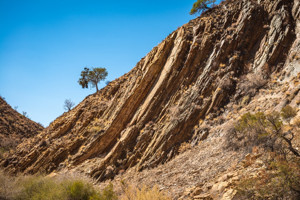
The Naukluft Mountains are composed of a nappe complex situated on a basal thrust fault. For millions of years, the fault has slowly moved the range southeast. The interbedded sediments of the range primarily consist of dolomites, shales, and quartzites.
The mineral sediments were deposited during the Damara orogeny, dating back 500-700 million years ago. Sediments in the Otavi Mountains are similar to those in the Naukluft Mountains.
The Namib Desert is the world’s oldest desert, dating back 55 million years. For comparison, the Sahara Desert is between two to seven million years old. For millions of years, seasonal rivers and washes have eroded the desert rock, turning it into sand and carrying it into the Atlantic Ocean. Sand deposited in the ocean by the Orange River is blown north along the coast before being carried back inland to form dunes. Ongoing erosion and wind patterns continue to shape the desert landscape.
The park sits at about 23-25 degrees south latitude, and its proximity to the equator results in scorching daytime temperatures. In contrast, the cold Atlantic Ocean current is so frigid that swimming without a wetsuit is uncomfortable or even dangerous. The gradient between these two extremes is a recipe for intense fog - the fog layer generally forms at night and burns off during the day. The continual southwesterly winds regularly push fog 40 km (25 miles) into the desert at night.
The dry air and cold Atlantic current also contribute to the region’s massive temperature swings. Daytime highs can reach above 40℃ (104℉), while nighttime can bring temperatures below freezing, especially inland. The swings are more intense inland, while the immediate coast is more moderate.
Despite the hyper-arid desert landscape, many animals inhabit the national park. Smaller animals include species of snakes, geckos, and various insects.
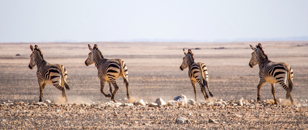
Mammals commonly found in the park are hyenas, leopards, baboons, cape foxes, bat-eared foxes, African wildcats, jackals, and zebra. Over 200 bird species live in the region, many of which inhabit the wetlands near the park’s coastline.
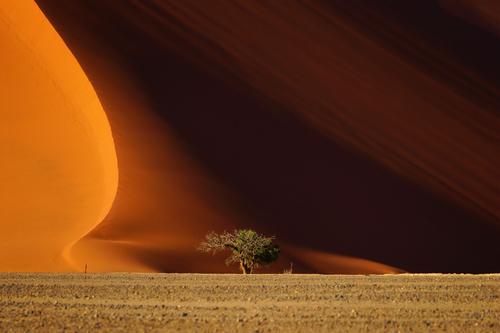
Extreme weather conditions have made it difficult for much plant life to survive. The park is home to cluster fig, Welwitschia, acacia, thorn trees, fields of lichen, and various Euphorbia species.
Regions along the coast receive essentially zero rain, with the precipitation increasing as one moves inland. Thus, barren sand dunes dominate the park’s western boundary closest to the ocean, while the easternmost sections feature small, desert-adapted trees.
Incredibly, a range of species have adapted to the arid coastline environment by collecting moisture from fog rather than rainfall. Most of the coast receives little to no rain over the course of a year; however, greenery dots the landscape on account of the dew that forms each night from the intense fog.
The human history of Namibia dates back thousands of years. During prehistoric times, the San, Damara, and Nama peoples inhabited the dry lands of present-day Namibia.
The Bantu people began inhabiting the region during the 14th century. The Bantu expansion from central Africa marked this period. The Ovambo people are the largest subgroup of the Bantu people, accounting for most of the country’s population.
Portuguese navigators were the first Europeans to arrive in present-day Namibia in 1485 and 1486. Finnish, German, and Swedish missionaries began arriving during the 19th century.
The Oorlam people from the Cape Colony moved into southern Namibia during the 18th century. Many of the Oorlam encounters with the Nama tribes were peaceful.
The late 19th century marked the beginning of more than 100 years of turbulence throughout the region. In 1880 the Nama-Herero War began after the German Empire deployed troops. Otto von Bismarck of Germany proclaimed present-day Namibia as South-West Africa in 1884. The Hereros heavily resisted German colonization in 1885, forcing the Germans to Walvis Bay. German settlers expanded throughout the area by the turn of the century.
The people of Namibia reignited their resistance in 1904, which nearly expelled the Germans, known as the German-Herero conflict. The Herero Genocide, in which German troops killed approximately 80% of the Herero and Nama populations (100,000 people), occurred during this time and was a precursor to the Holocaust.
During World War I, South African troops invaded and occupied Namibia. This invasion was part of WWI’s conquest of German colonies.
South Africa began enforcing apartheid in South West Africa during the 1940s. This racial discrimination and segregation took advantage of the black population in the area with enforced laws, curfews, and various other regulations.
The South West African National Union and South West African People’s Organization started movements in the 1950s and 1960s, demanding the decolonization of Africa. These movements escalated into the South African Border War.
The People’s Liberation Army of Namibia and the South West African People’s Organization waged resistance in 1966 against the South African forces. This fight led to the UN taking responsibility for the territory.
The UN recognized the South West African People’s Organization in 1973. Guerrilla warfare continued until 1990, when Namibia gained independence. The country is named after the Namib Desert, with Namib translating to “vast place.”
Economic disparity still dominates the nation, with most whites occupying a much higher economic class than most native Africans.
There are hiking trails located throughout Namib-Naukluft National Park. Below are a few of the park’s most popular trails:
This iconic loop trail lies in the Naukluft Mountains. Those visiting are likely to spot mountain zebra, kudu, and klipspringer. The Waterkloop Trail is 17 km (10.6 miles) long and features some exposed steep climbs.
The loop trail starts by walking upstream of the Naukluft River. Gorges, creeks, and rock pools offer multiple swimming opportunities along the route. On average, this hike takes between 6-7 hours to complete.
The Olive Trail also begins in the Naukluft Mountains. The route starts by climbing steeply up to a plateau, which offers a sweeping view of the range. The trail then descends into a gorge with quiver trees and euphorbias.
The gorge section of this route requires some scrambling over large rocks. This loop trail is 11 km (6.8 miles) long and takes an average of 4 hours to complete.
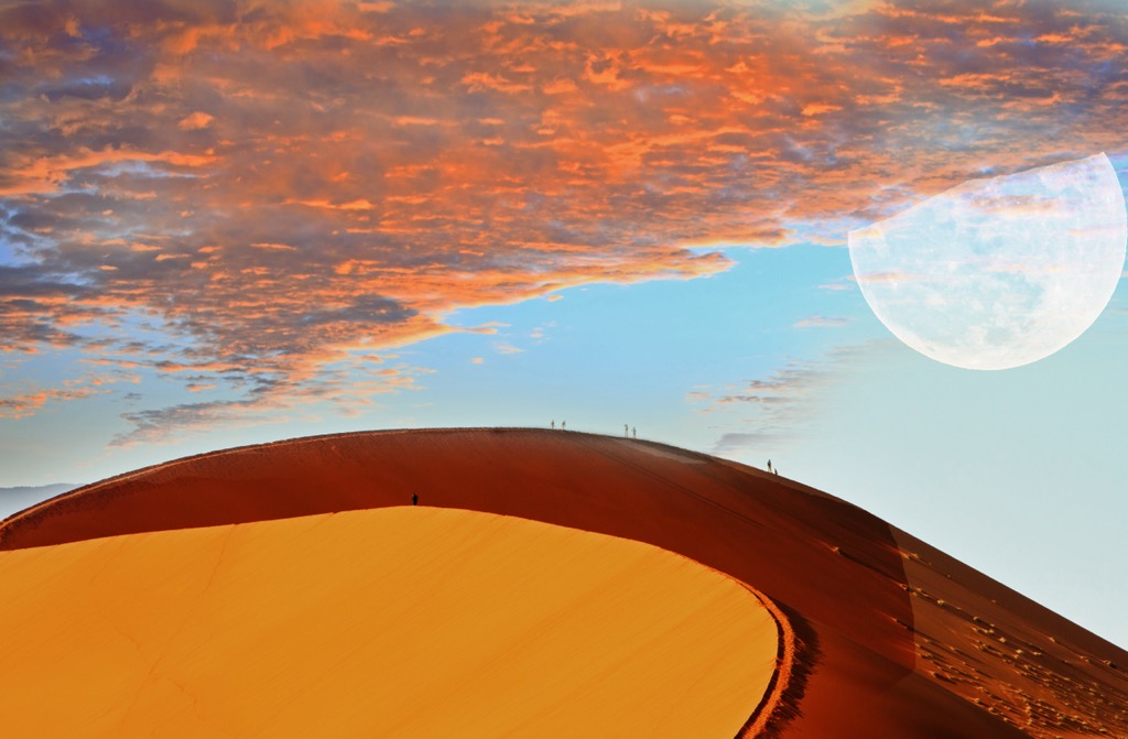
Dune 45 is one of the more famous sand dunes in the park, getting its name from its location 45 km (28 miles) north of the park entrance. The climb to the summit takes between 40-60 minutes.
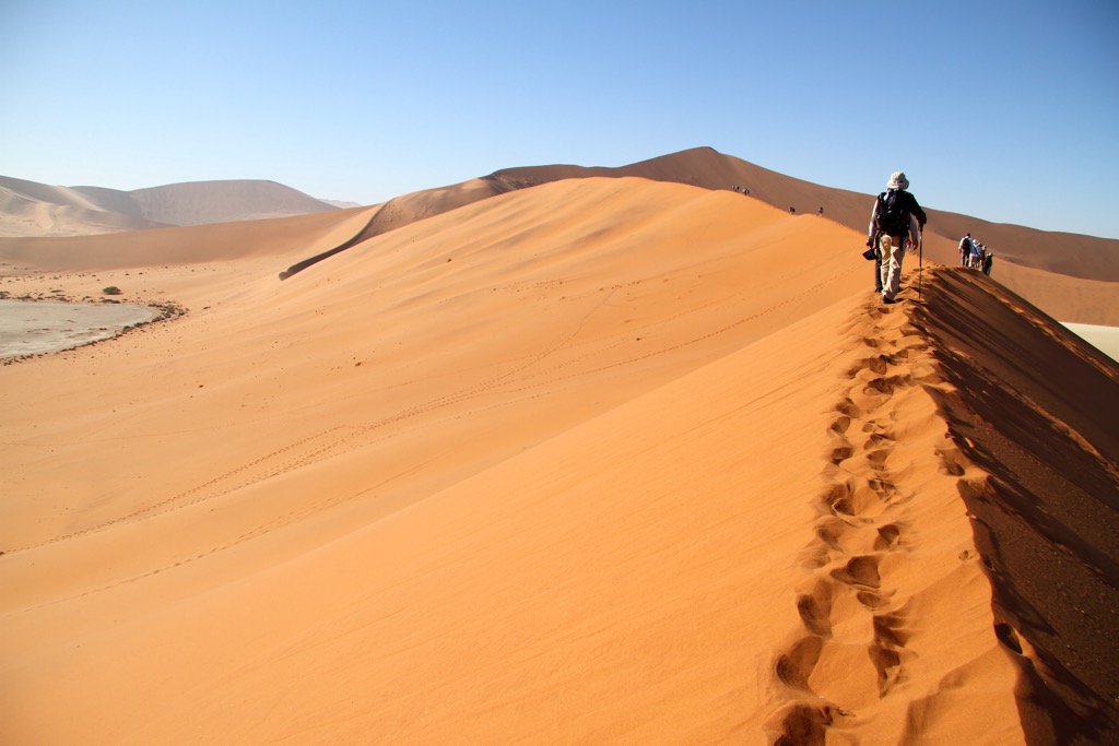
At 170 m (560 ft) tall, Dune 45 is one of the most popular spots to visit in the entire park. Many tourists wake up early to reach the summit before sunrise. Those planning this should bring warm layers as temperatures before dawn can be quite cold.
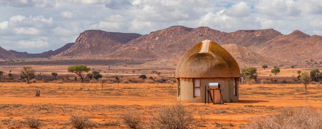
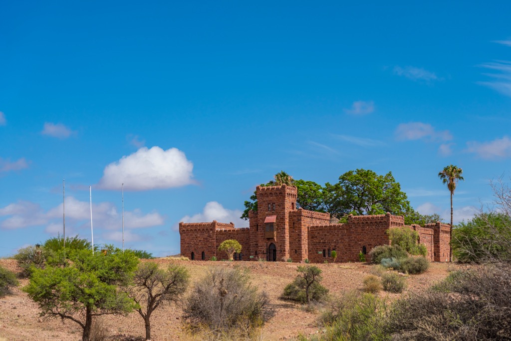
For those visiting, accommodation in the park is primarily through lodges and retreats. Solitaire and Sesriem are home to most of these hotels. Below are a few popular spots to stay in both of these places:
Solitaire is on the park's edge, just south of the Tropic of Capricorn. Situated on the 18,211 ha (45,000-acre) Solitare Land Trust, the community features a local bakery, cafe, and petrol station. Solitaire is known for having some of the best sunsets in Namibia.
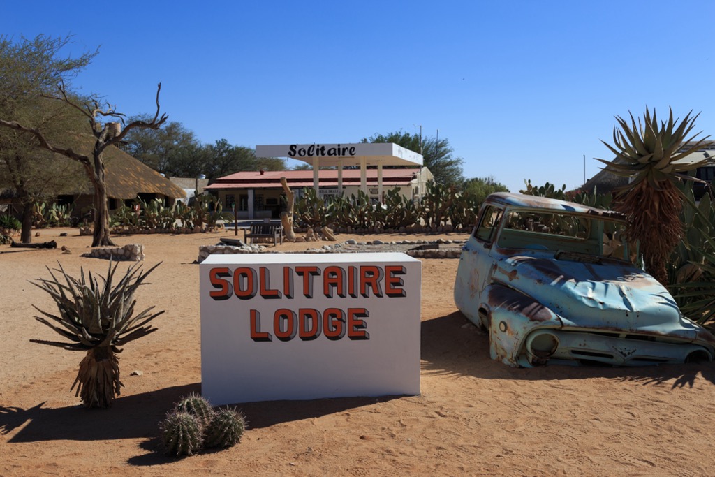
Solitaire Lodge and the Solitaire Desert Farm are the two accommodations in the area. The lodge features air-conditioned rooms, a pool, and ten campsites. The Solitare Desert Farm is located 7 km (4.3 miles) outside the village at the base of the Rand Mountains.
Located in the Namib Desert, Sesriem is a small settlement near the southern edge of the Naukluft Mountains. It acts as the main access point for the national park, with many tourists passing through to visit Sossusvlei.
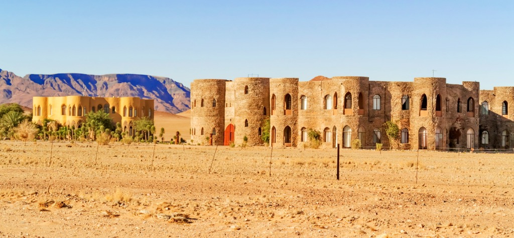
Popular accommodations include Sossusvlei Lodge and Dead Valley Lodge. The village is a filing station for those passing through and only features a few small kiosks. Hot air balloon rides are available for booking, many of which depart the area in the early morning.


The highest peak in Namib-Naukluft National Park is Bakkenkop, at 1,978 m.
Notable peaks in Namib-Naukluft National Park include Bakkenkop, Satanskop, Bushman Hill, Dikwillem and Chowagasberg.


