Scan the QR code and open PeakVisor on your phone
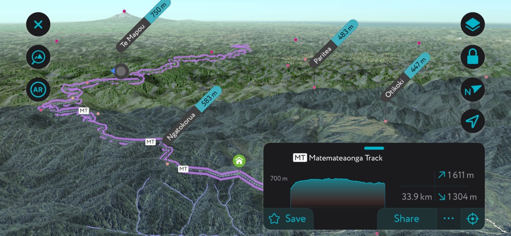
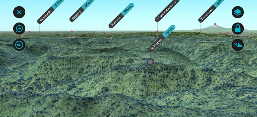
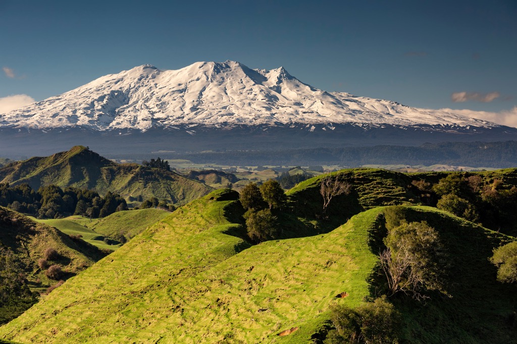
Whanganui National Park is located on New Zealand’s North Island. The park spans 74,203 ha (183,360 acres) and protects the riparian ecosystems and lowland forest along the Whanganui River. The park has 75 named mountains; Te Mapou is the highest (2,461 ft / 750 m) and most prominent (1,726 ft / 526 m).
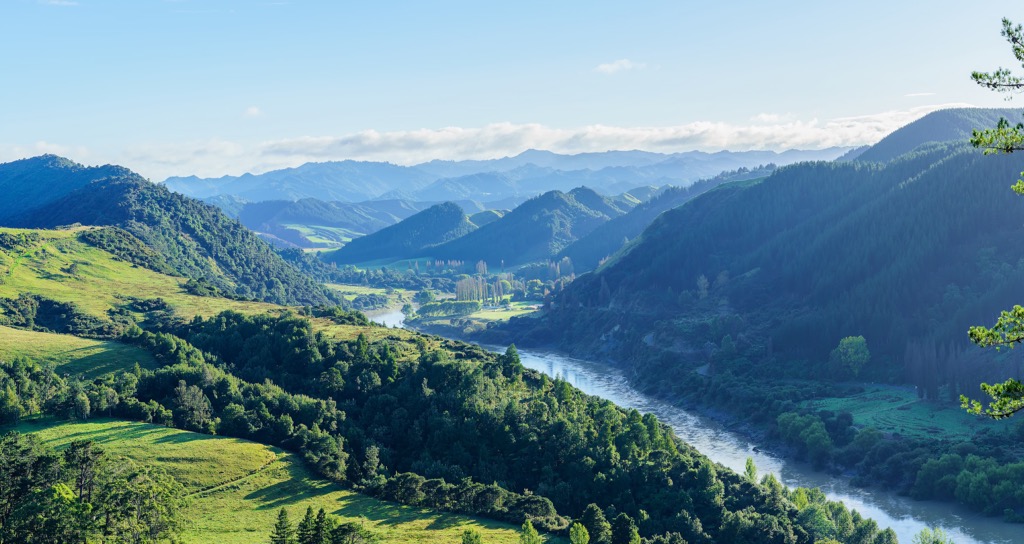
Located on New Zealand’s North Island, Whanganui National Park protects a northern section of the Whanganui River and the surrounding riparian and lowland forest ecosystems. The park is in the Stratford District of the Manawatu-Wanganui region. It was created in 1986 and covers 183,360 acres (74,203 ha). The river and surrounding landscape hold cultural importance to the indigenous Māori people.
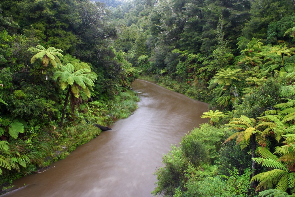
The park does not contain dramatic mountain landscapes like New Zealand’s Southern Alps. Instead, it offers the opportunity to explore the rugged lowland forests and to boat the Whanganui River. The river runs from Tongariro National Park to the Tasman Sea and is the longest navigable river in the country. It does not belong to the park but remains protected by law under its own legal identity.

The park’s mountains are part of the Kaweka Range, one of the ranges forming a mountainous spine from Wellington to East Cape. The park is sandwiched between Tongariro National Park and Egmont National Park - which protects the area around Mount Taranaki - to the east and west, respectively.
New Zealand’s geologic history dates back to the supercontinent Gondwana. Around 540 million years ago, New Zealand formed along the supercontinent’s perimeter. Rivers carried sediment, and underwater eruptions generated ash that hardened into the rocks underlying most of the country today.
New Zealand sits near the boundary between the Australian and Pacific plates. Around 100 million years ago, magma welled up and caused volcanic eruptions and splits along faults. By 85 million years ago, the Zealandia land mass separated from Gondwana and the Australian mainland, and began to drift across the Pacific Ocean.
Twenty-five million years ago, Zealandia split, and sections of the continent were uplifted. There has been further uplift in the last 1.8 million years, such as the Southern Alps on the South Island and volcanic eruptions, which continue in the present. During the Ice Age, glaciers carved out valleys and shifted rocks and sediment. Massive ice flows, such as the Tasman and Fox glaciers, continue to alter the landscape today.
The primary rock around the Whanganui River in Whanganui National Park is mudstone. New Zealand’s northern island is comprised mainly of sedimentary rock, including greywacke, marine greensand, mudstone, chert, limestone, and sandstone, as well as some volcanic rock. The greywacke contains marine fossils from when the land formed the ocean floor. Tributaries of the Whanganui River to the west have carved through the mudstone and etched a landscape of gorges, bluffs, and v-shaped valleys.

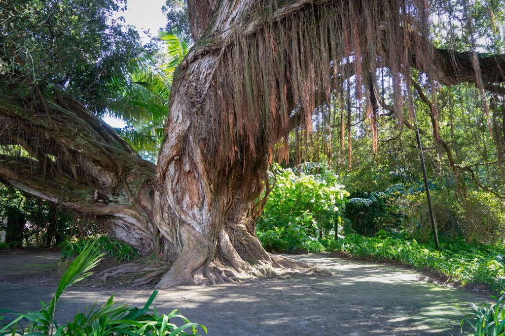
Protecting the river banks, lowland forests, and rolling hills around the Whanganui River, Whanganui National Park encompasses one of the most extensive tracts of lowland forest on the North Island. Although parts of the landscape show signs of early and mid-century settler homesteads, as seen in the photos above and below, many sections of rugged wilderness and native forest remain.
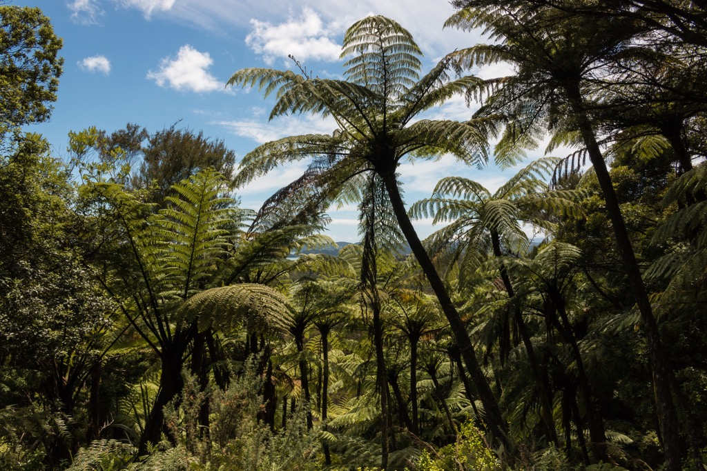
Large stands of podocarp-hardwood lowland forest grow in the park. Major canopy species include kāmahi and tawa, and ferns ranging from tiny species to the enormous 10 m (33 ft) tall mamaku (Sphaeropteris medullaris) dominate much of the understory. Podocarps, a conifer genus, include species such as rimu, mīro, and tōtara on ridges and exposed faces and kahikatea and mataī near rivers. Nīkau palm also prefers to grow along rivers and alluvial flats. Northern rātā, a tall flowering tree, is particularly beautiful in summer.
Other plant communities include black beeches that grow over shrubs along dry ridges. Orchids and silver and hard beech can be found throughout the park, while delicate species such as hutu, fuchsia, and the rare daisy brachyglottis turneri grow along steep-sided river banks.
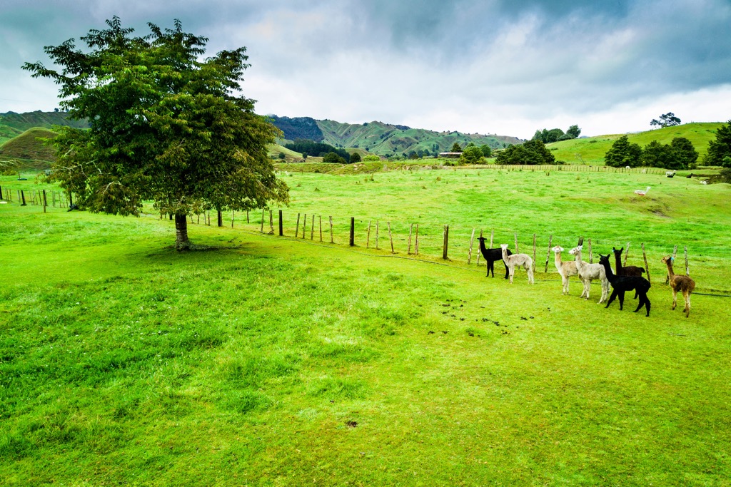
Some areas reflect historical disturbance and introduced species. Mangapurua Valley was used as pasture land until 1942 and remains deforested. The park is host to a number of invasive weeds, including buddleia, wattles, willows, Japanese honeysuckle, pines, Japanese walnut, gorse, and Himalayan honeysuckle.
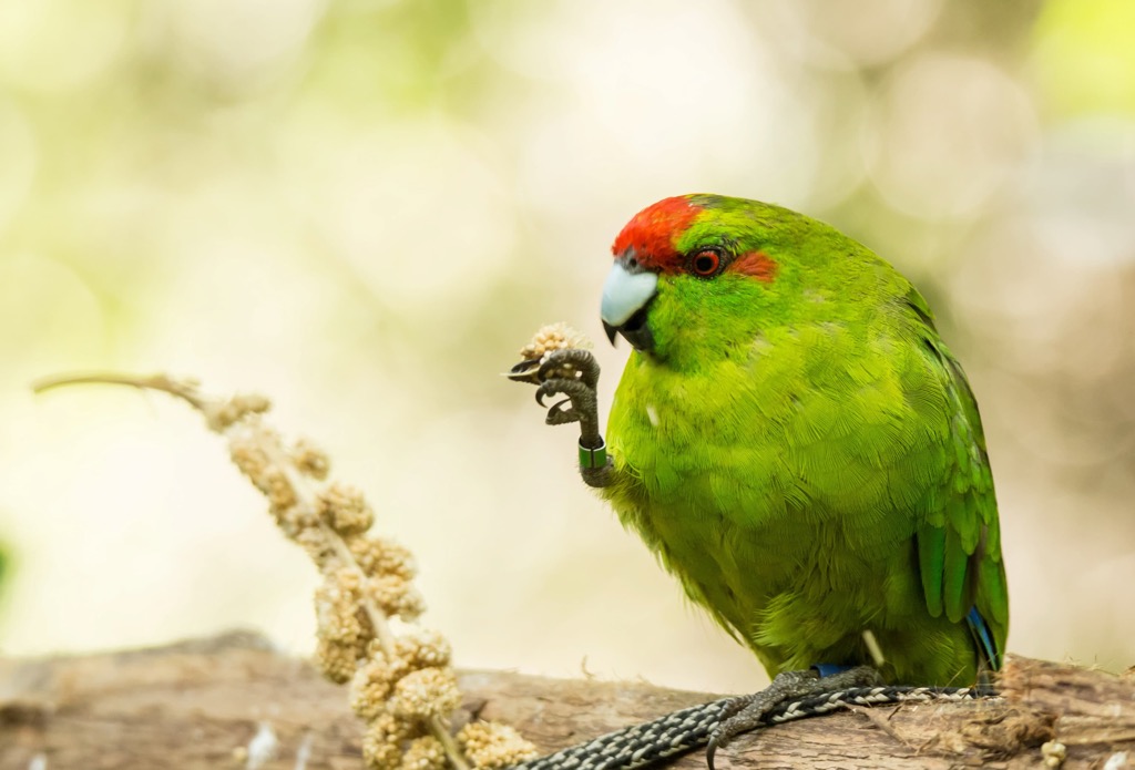
Whanganui National Park provides exceptional habitat for many bird species, including fantails, grey warblers, silvereyes, tomtits, robins, bellbirds, kererū/kūkupa, tūī, whiteheads, rifleman, yellow-crowned käkäriki, and New Zealand falcons. Kākāriki and kākā are found in old forest of Matemateaonga Range and sometimes the Heao catchment.
Cuckoos migrate through in spring and early summer, and the waterways throughout the park provide habitat to the whio (blue duck), an endemic species of torrent duck. The park also supports the North Island’s largest brown kiwi population, numbering several thousand.
The park’s aquatic habitats are home to eels, lamprey, freshwater crayfish called koura, and black flounder. Long-tailed bats prefer open areas along forest perimeters or around rivers, while short-tailed bats thrive in thicker bush.
Threats to native fauna come mainly from introduced species. These include goats, deer, pigs, possums, stoats, and rats. Hunting seasons exist to keep some of these non-native species in check.
The Maori have lived in New Zealand for about 700 years, having arrived from the Polynesian Islands in a series of canoe migrations between 1320 and 1350 CE. In addition to fishing, hunting, and gathering, they traditionally grew kumara.
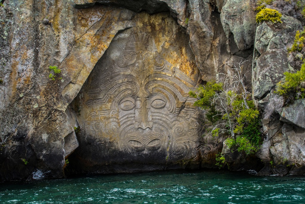
Specifically, the Māori have held spiritual and cultural ties to the Whanganui River and surrounding lands for over 600 years. Early inhabitants built sheltered terraces along the river. The Māori believe all river bends and rapids have a kaitiaki, or guardian, that protects the energy of that part of the river.
The Māori had excellent canoe skills and operated weirs and fishing traps. The arrival of riverboats shifted this cultural practice. European missionaries arrived in the 1840s to convert local people to Christianity and build chapels. As land was claimed and sold, mistrust grew among indigenous groups.

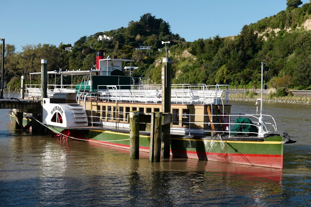
Settlements continued to grow, bringing flour mills built in the mid-19th century and riverboat services that connected people, mail, and goods between Whanganui and Taumarunui. Tourism grew via these waterways until the 1920s, when roads, railways, and other attractions shifted the flow of people.
Whanganui National Park was established in 1986 to protect part of the Whanganui River. Honoring indigenous legacy, the New Zealand government partnered with Te Whānau o Tīeke to rebuild a village at Tīeke along the river. Park authorities engage in ongoing conversations with indigenous groups to protect and honor sacred spots within the park.

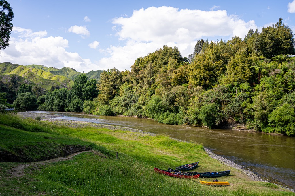
Whanganui National Park is open for hiking, kayaking and canoeing, fishing, camping, hunting, and biking. Boating the Whanganui River is considered one of the country’s “Great Walks” despite being a multi-day boat journey rather than a trail.
Those planning a trip down the river should come prepared with a life jacket, sleeping bag, waterproof clothes, change of clothes, extra food, and water. Visitors can purchase a guide booklet and maps to the Whanganui River from the New Zealand Canoeing Association or book a tour with a guide.
The Matemateāonga Track is 26 mi (42 km) one way and takes three to five days to hike. Mountain bikes will cover the distance in approximately half the time. The route follows an old Maori trail into the park’s wilderness, and there are huts to stay in along the way.
It is a challenging hike already, but there are options to add shorter day and overnight hikes to extend the adventure. Visitors can take a motorboat back to Pipiriki at the end of the route. The National Park provides a factsheet with maps and additional information.

The Whanganui is the country’s longest navigable river – boats can travel over 125 mi (200 km). There are huts and campsites along the river. One of the most iconic ways to experience the national park is to boat the Whanganui in a 54 or 90-mile (87 or 145 km) one-way trip that lasts three to five days. Between October and April, reservations are required at campsites and huts. During the off-season, accommodation is available on a first-come, first-serve basis.
The Mangapurua/Kaiwhakauka Track is two sections of the Mountains to Sea Cycle Trail. They are between 22 and 25 mi (35 and 40 km) and take two to three days to walk and one day to bike. Mangapurua Valley has open flats, while the Kaiwhakauka passes through patches of undisturbed native forest. There are campsites, most of them free, along the way. The national park has a brochure with detailed information about the route.
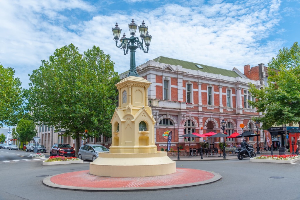
Whanganui National Park is located in the central part of the North Island. No major cities neighbor the national park, but the towns of Taumarunui and Wanganui lie to the north and south, respectively, and offer regular bus service. The smaller towns of Pipiriki, Ohinepane, and Whakahoro provide access points to the river. Auckland to the north and Wellington to the south are both a four-hour drive.
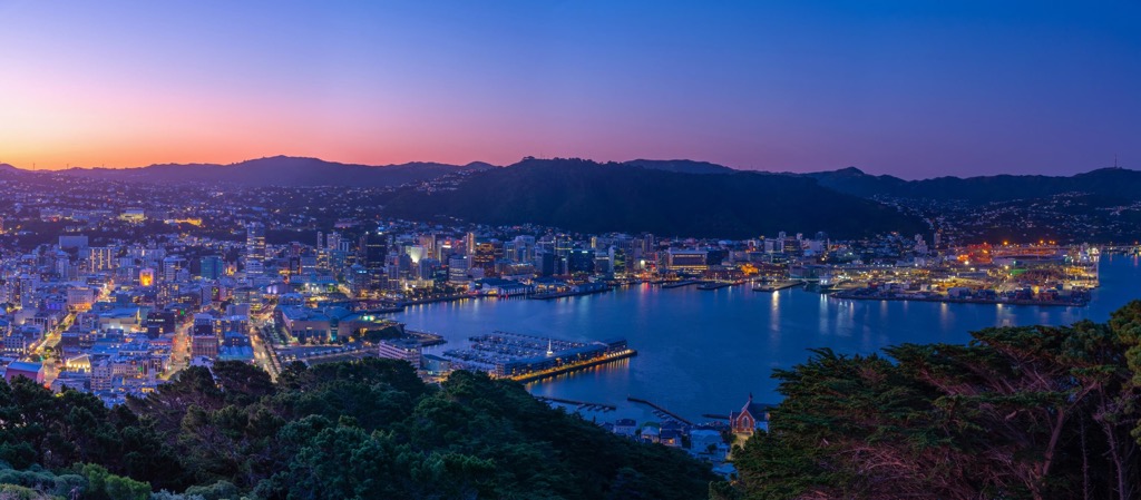
Wellington is New Zealand’s capital and home to around 213,000 people. The city sits on a picturesque harbor on the southern tip of the North Island.
Stop by the Museum of New Zealand Te Papa Tongarewa for exhibits on Māori and Pacific history and artwork, or stroll the Wellington Writers Walk for a series of sculptures with quotes from the country’s famous writers. A top attraction is a ride on the cable car from Lambton Quay up Kelburn Hill with a visit to the Botanic Gardens at the top.
The city is highly walkable and home to many cafes and a diverse dining scene ranging from ethnic cuisines to local Māori dishes. People staying a few days will find accommodation for a range of budgets.
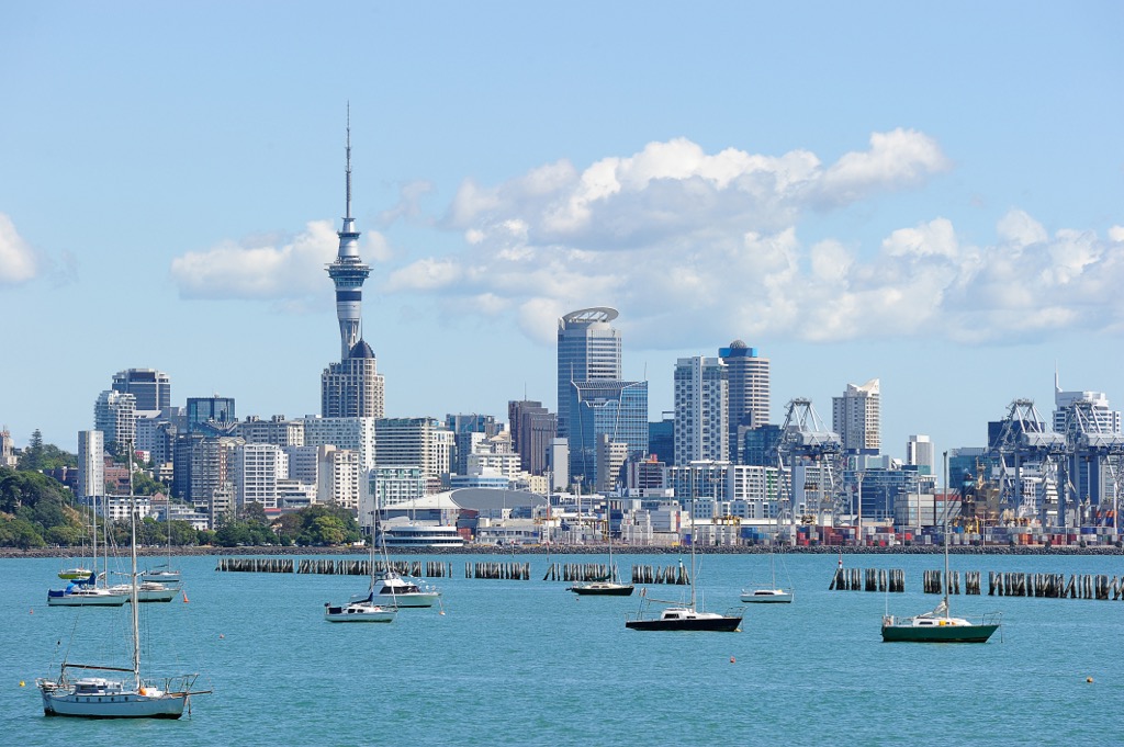
Auckland, New Zealand’s biggest city, has a population of 1.66 million and is the first destination for most people arriving on an international flight. The city is spread out; the neighborhoods around Newmarket, Ponsonby, Parnell, and Takapuna are worth a visit for their boutique shops, cafes, and beaches. The Auckland Art Gallery houses historical and contemporary works and highlights local artists.
A trip to Waiheke Island will fill a day or two with beaches, trails, and wineries. Other great spots are Goat Island for snorkeling and beaches on the west coast for surfing and coastal hiking trails.
The city offers a wide variety of restaurants and accommodations, ranging from hostels to luxury hotels.