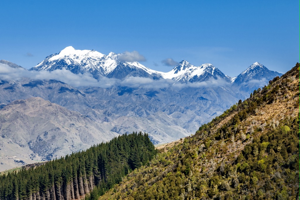
Mount Tapuae-o-Uenuku (Tapuaenuku) is the highest peak in the northeast of New Zealand’s South Island, standing at 2,885 metres (9,465 ft) high. The area is known for its stunning natural beauty and is home to a variety of flora and fauna. The climb offers breathtaking views of the surrounding landscape and is a great way to experience the natural beauty of New Zealand. Mount Tapuae-o-Uenuku and surrounding peaks have continuous snow cover in the winter which may persist into summer. The area is steep and dissected and gales are frequent.
The name translates from Māori as “footprint of the rainbow”, though it is usually regarded as being named after Chief Tapuaenuku. Mount Tapuae-o-Uenuku is a challenging climb and requires a high level of fitness and experience. The climb is not recommended for beginners and should only be attempted by experienced climbers with the right equipment.
By elevation Tapuae-o-Uenuku is
# 1 out of 1003 in the Kaikoura Ranges # 35 out of 1363 in Canterbury # 1 out of 363 in Marlborough # 1 out of 106 in Kaikōura District # 40 out of 8795 in New Zealand
By prominence Tapuae-o-Uenuku is
# 1 out of 1003 in the Kaikoura Ranges # 2 out of 1363 in Canterbury # 1 out of 363 in Marlborough # 1 out of 106 in Kaikōura District # 6 out of 8795 in New Zealand
We use GPS information embedded into the photo when it is available.
3D mountains overlay
Adjust mountain panorama to perfectly match your photos because recorded by camera photo position might be imprecise.
Move tool
Rotate tool
Zoom
More customization
Choose which peak labels should make into the final photo and what photo title should be.
Next
Photo Location
Satellitte
Flat map
Relief map
Latitude
Longitude
Altitude
OR
Latitude
°'''
Longitude
°'''
Apply
Register Peak
Peak Name
Latitude
Longitude
Altitude
Register
Teleport
PeakVisor
This 3D model of Sagarmatha National Park in Nepal was made using the PeakVisor app topographic data. The mobile app features higher precision models worldwide, more topographic details, and works offline. Download PeakVisor maps today.
Download OBJ model
PeakVisor
The download should start shortly. If you find it useful please consider supporting the PeakVisor app.
PeakVisor for iOS and Android
Be a superhero of outdoor navigation with state-of-the-art 3D maps and mountain identification in the palm of your hand!