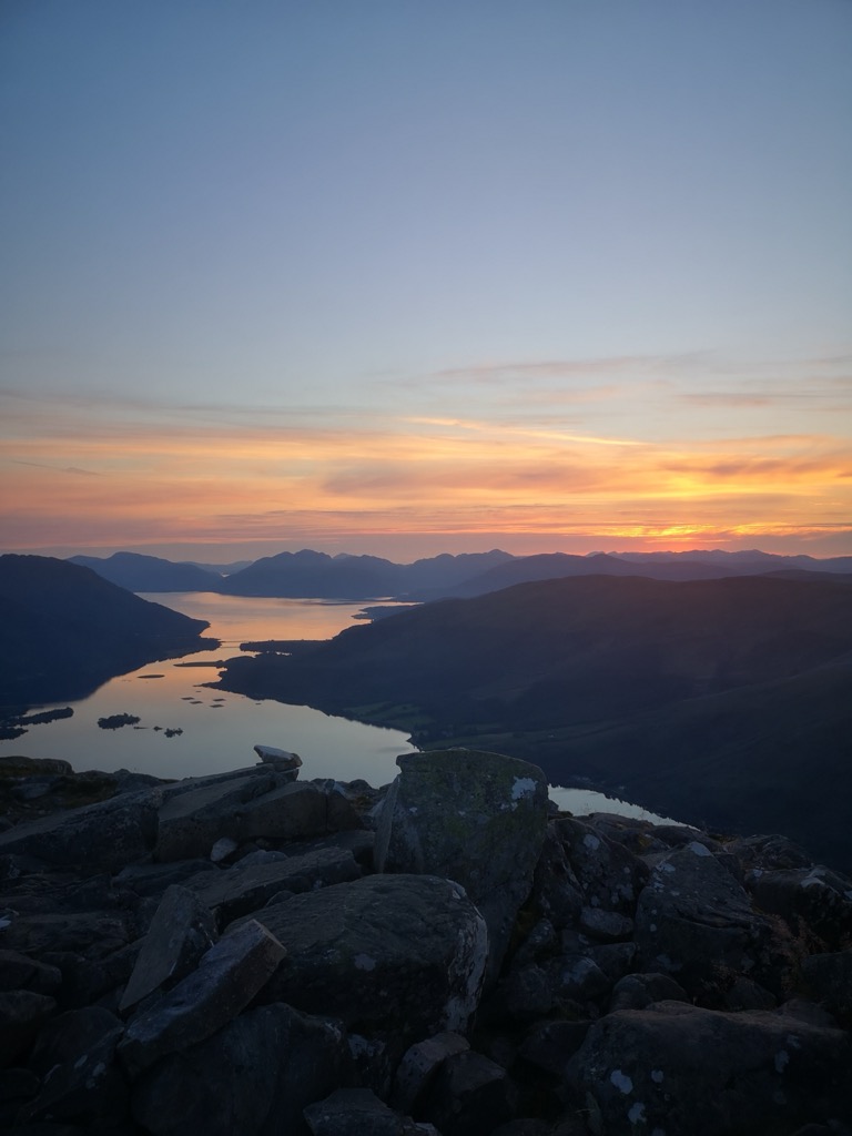
The Pap of Glencoe (Scottish Gaelic: Sgorr na Cìche) is a mountain on the northern side of Glen Coe, in the Highlands of Scotland. It lies at the western end of the Aonach Eagach ridge, directly above the point where the River Coe enters Loch Leven.
The Pap is so named as it has a distinctive conical shape resembling a female breast (see: pap), particularly when viewed from the west. It forms part of the "classic" view of the entrance to Glen Coe.
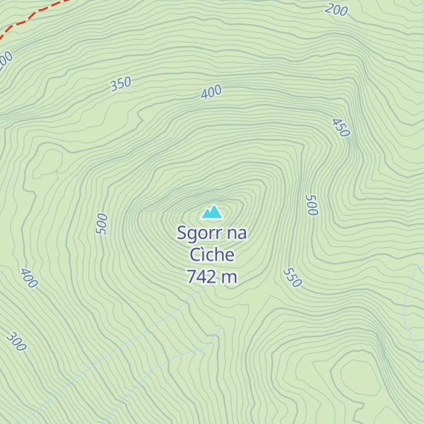
The simplest route of ascent starts from the unclassified road between Glencoe village and the Clachaig Inn. A pebble path leaves the road about 1 kilometre (5⁄8 mi) west of the youth hostel, and passes a white house on the left, reaching the bealach between the Pap and Sgor nam Fiannaidh, from where the Pap may be climbed. The final stretch up to the bealach forms a pathway by small gully; this section is often extremely muddy and boggy. The final 100 metres (330 ft) of ascent require some easy scrambling, and care is needed under winter conditions.
The Pap may also be climbed from the Kinlochleven side, though this is far less common.
We use GPS information embedded into the photo when it is available.
3D mountains overlay
Adjust mountain panorama to perfectly match your photos because recorded by camera photo position might be imprecise.
Move tool
Rotate tool
Zoom
More customization
Choose which peak labels should make into the final photo and what photo title should be.
Next
Photo Location
Satellitte
Flat map
Relief map
Latitude
Longitude
Altitude
OR
Latitude
°'''
Longitude
°'''
Apply
Register Peak
Peak Name
Latitude
Longitude
Altitude
Register
Teleport
PeakVisor
This 3D model of Sagarmatha National Park in Nepal was made using the PeakVisor app topographic data. The mobile app features higher precision models worldwide, more topographic details, and works offline. Download PeakVisor maps today.
Download OBJ model
PeakVisor
The download should start shortly. If you find it useful please consider supporting the PeakVisor app.
PeakVisor for iOS and Android
Be a superhero of outdoor navigation with state-of-the-art 3D maps and mountain identification in the palm of your hand!