
Scan the QR code and open PeakVisor on your phone
Glencoe National Nature Reserve has 25 named peaks. The highest is Bidean nam Bian at 1,150 m. Other notable peaks include Stob Coire nan Lochan, Stob Coire nam Beith and Stob Coire Sgreamhach.
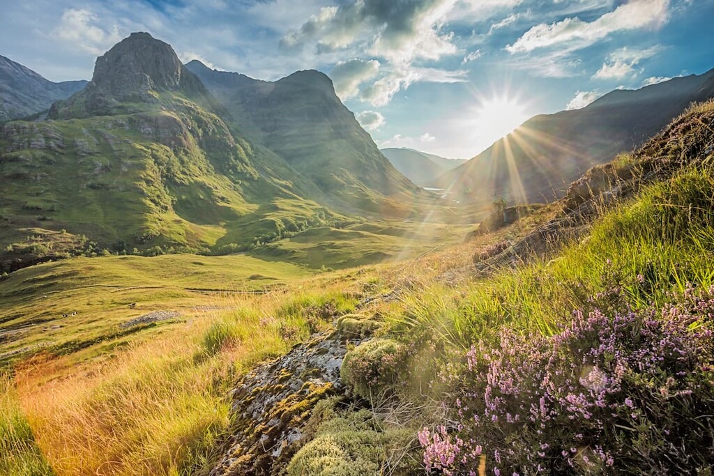
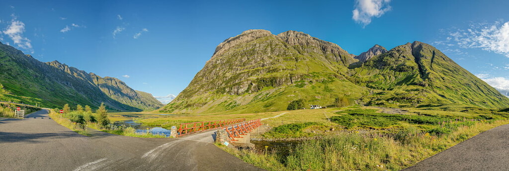
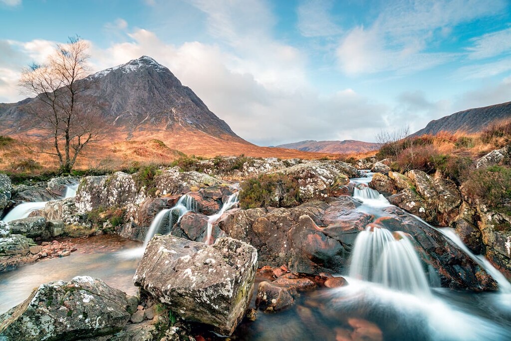
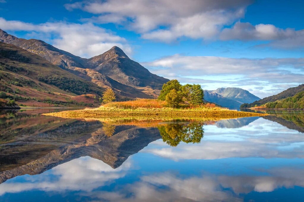
Home to one of Scotland's most iconic landscapes, Glencoe National Nature Reserve is a must for anybody looking to see the best of Britain. Encompassing over 21 square miles within the historic county of Argyll in western Scotland, Glencoe National Nature Preserve boasts the sublime U-shaped Glen Coe, the serene River Coe, and over a dozen breathtaking mountains.
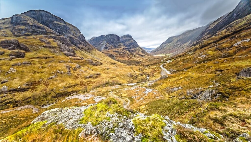
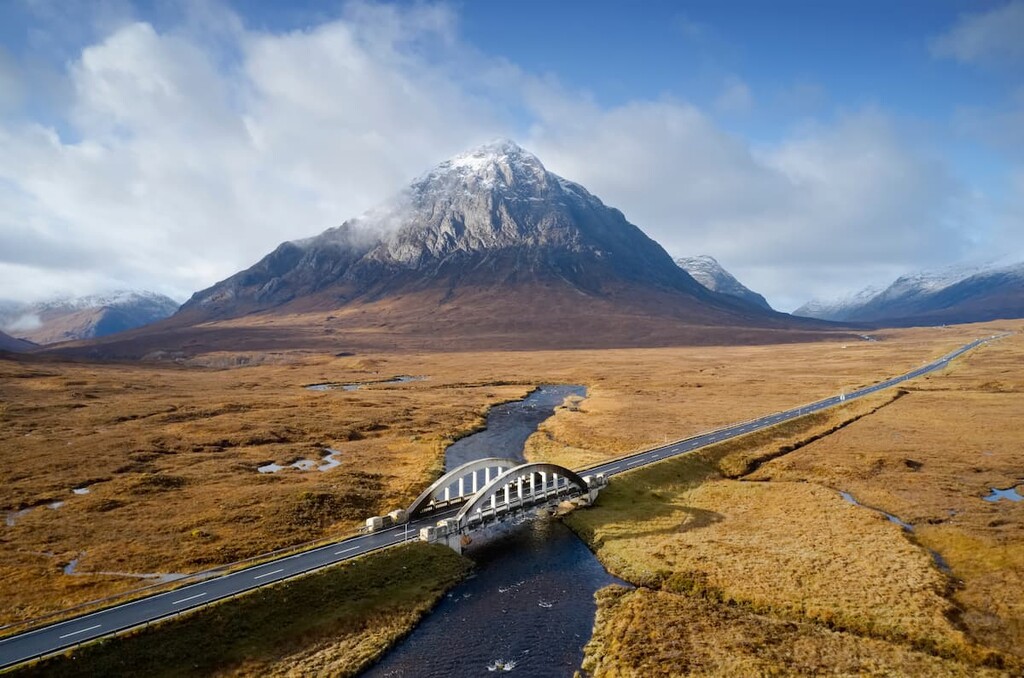
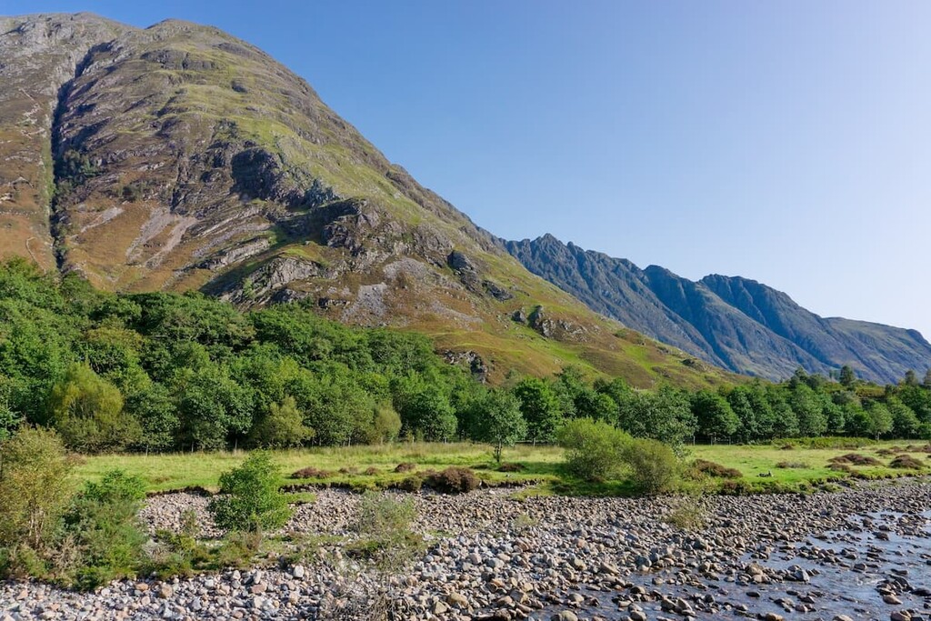
Glencoe National Preserve is regarded as the home of Scottish mountain climbing and is a popular spot for hikers of all abilities. The park is home to 8 Munros, the tallest of which is Bidean nam Bian (1,150 m). Other notable peaks include Glen Coe's famed "Three Sisters", Beinn Fhada (1,034 m), Geàrr Aonach (755 m), and Aonach Dubh (887 m). The latter two sisters converge at Stob Coire nan Lochan (1,109 m), a minor summit a mile northeast of Bidean nam Bian. Other notable and popular mountains and ridges in the park include Aonach Eagach (991 m), Stob Dubh (958 m), and Buachaille Etive Mòr (1,021 m).
Glen Coe was formed over 420 million years by the eruption of a supervolcano. Lava poured from both sides of the supervolcano onto soft, wet sediment, creating layers of rock. Then, another eruption caused lava flow across the landscape, creating andesite volcanic rock visible on the slopes of Aonach Dubh. Fault lines then controlled the volcano's eruptions for thousands of years, further shaping the land. During the last Ice Age 2 million years ago, a glacier carved away at the volcanic rock to create the sublime Glen Coe we see today.
As well as its natural beauty, Glencoe National Nature Reserve has cultural and historical significance. Legends state that Celtic folk hero Fingal lived in a house high up in the Glen Coe mountains. Glen Coe was also the site of the infamous Massacre of Glencoe in 1692 when Jacobite soldiers murdered 38 members of the MacDonald clan. Recently, Glen Coe has been used as a setting in several famous films, including Braveheart, Skyfall, and Rob Roy.
During your hiking adventure at Glencoe National Nature Reserve, be sure to keep an eye out for the region's rarer residents. As an unusual landscape, Glen Coe is home to some intriguing flora and fauna. While scaling the highest peaks in the park, watch out for golden eagles, ptarmigans, and white-throated dippers. At ground level, stop to admire red deer, mountain hares, and mountain goats.
Join over 150,000 mountaineers who visit Glencoe National Nature Reserve every year and discover some of the best hiking trails and destinations below.
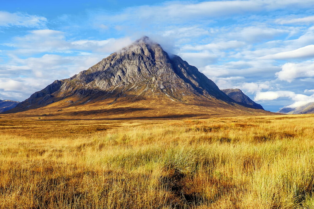
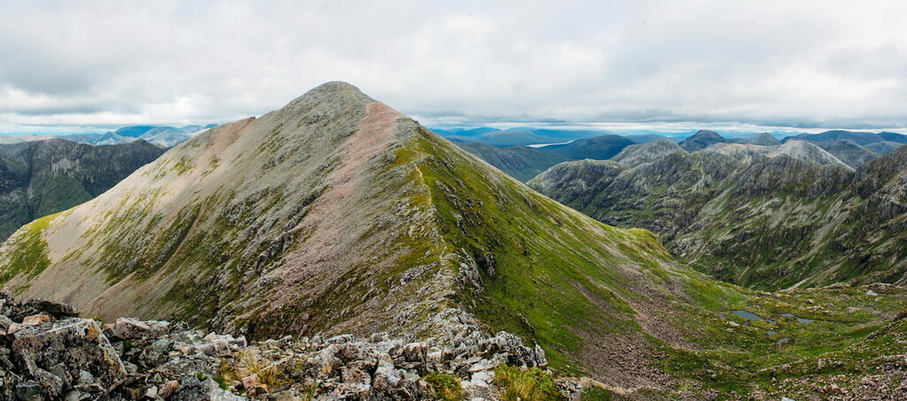
Buachaille Etive Mór is one of the most famous mountains in Scotland, featuring on many postcards and tourism websites due to its unique pyramidal shape. Around 30,000 hikers attempt to climb Buachaille Etive Mór each year. Despite being very popular, the hike up Buachaille Etive Mór is a steep and rugged walk that may require scrambling in certain areas. Buachaille Etive Mór technically contains four separate peaks: Stob Dearg (1,021 m), Stob na Broige (956 m), Stob na Doire (1,010 m), and Stob Coire Altruim (941 m). The walk is 8 miles, ascends 1,100 m, and takes around 8 hours to complete.
You can start this hike from the Altnafeadh layby along the A82 road. The easiest way up Buachaille Etive Mór is by following the clear Coire na Tulaich mountain path. Passing the Lagangarbh hut, continue through the moors keeping right over Allt Coire na Tulaich and climbing steeply up the corrie on the far side. This section of the walk is dangerous as the path will take you through a boulder field, and during the winter, the area is prone to avalanches.
Atop the ridge, turn left and make your way to a cairn that marks the summit of Stob Dearg, the highest of Buachaille Etive Mór's two Munros. Ensure you take a break and enjoy the panoramic views of Rannoch Moor. Retrace your steps to the top of Coire na Tulaich, and walk straight ahead to the summit of Stob na Doire. After a steep ascent to the summit, take care not to descend to the southeast and instead wait for the next mountain pass before scaling Stob Coire Altruim.
The final ascent of your journey takes you up Stob na Broige, which only officially became a Munro in 1997. Continue along the ridge to reach the summit of Stob na Broige. From the peak, you'll have sweeping views of Glen Evite.
To descend, you'll need to retrace your steps nearly as far as the mountain pass before Stob na Doire. From here, head down the trail to the north along the west side of Allt Coire Altruim. The path is generally good but may require some scrambling lower down. At the bottom of the glen, join the Lairig Gartain trail, which will lead you back to the A82. There's a short walk along busy main roads to get back to the layby, so be mindful of traffic.
Bidean nam Bian is the highest mountain in Glencoe National Nature Reserve and the highest point in the historic county of Argyll. Bidean nam Bian is notable for featuring one of Glen Coe's most famous natural attractions, "The Three Sisters", Beinn Fhada, Geàrr Aonach, and Aonach Dubh. Bidean nam Bian is a complex mountain with steep ridges, so hikers should map out their route well and come prepared. The mountain has also been known to hold snow long after winter, so check conditions and consider leaving this hike for the middle of summer. The walk up Bidean nam Bian is under 7 miles, ascends 1,316 m, and takes around 8 hours.
You can pick up this trail from the Three Sisters car park roughly halfway through Glen Coe. The hike begins with a walk between Geàrr Aonach and Aonach Dubh. Follow the trail out of the car park, crossing the River Coe footbridge and up towards Coire nan Lochan. The path heads up the left side of the corrie, and while the trail is well-defined, you may have to do some easy scrambling in steep areas.
Ensure you stop to admire the waterfalls that flow down the valley, as well as the peak of Stob Coire nan Lochan (1,115 m) up ahead. The easiest way to up onto Stob Coire nan Lochan's ridge is to leave the path just before the valley's box waterfall, climbing a grassy hillside to the west/southwest. Then, head northwest towards the mountain's north ridge. Turn left on the ridge to head for Stob Coire nan Lochan. The ridge is especially jagged but easier to traverse than it seems from below.
To reach Bidean nam Bian from here, head down the mountain pass between the peaks, following the path that keeps left of the steep mountainside. The summit of Bidean nam Bian boasts excellent views of the surrounding countryside, with Ben Nevis (1,345 m), Britain's highest mountain, 10 miles north, and Stob Dubh 2.5 miles east. Before the end of this walk, you'll get to bag one more Munro, Stob Coire Sgreamhach (1,072 m).
To reach Stob Coire Sgreamhach, continue along the ridge and onto Bealach Dearg mountain pass. The path is straightforward, with a slightly tricky section towards the summit of Stob Coire Sgreamhach. Similar to Stob na Broige, Stob Coire Sgreamhach was only promoted to a Munro in 1997. This peak has sublime vistas of Buachaille Etive Mór 3 miles east and Ben Starav (1,078 m) 7 miles south.
To descend, return to Bealach Dearg and head north down into Coire Gabhail. Be careful to avoid loose scree along this section. The path here keeps left of a stream in Coire Gabhail, commonly referred to as "The Lost Valley". Follow the path out of the valley to your right onto the slopes of Beinn Fhada. After crossing a stream with stepping stones, you'll head back into Glen Coe and through some woods just a short distance from your starting point.
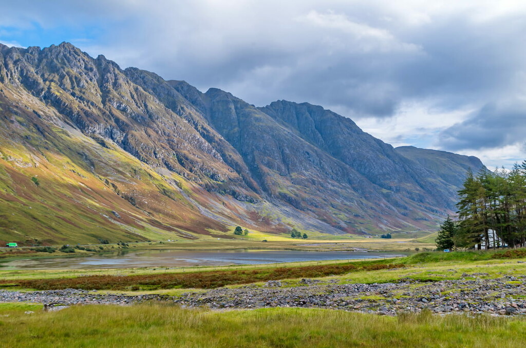
Boasting the narrowest ridge in mainland Britain, Aonach Eagach is among the most difficult climbs in western Scotland and isn't to be underestimated. This hair-raising ridge features two separate Munros to bag, Meall Dearg (952 m) and Sgor nam Fiannaidh (967 m). Anyone attempting Aonach Eagach should be good with heights and have plenty of scrambling experience. The hike is 6 miles, ascends 1,100 m, and takes around 8 hours.
This walk does not end at your starting point, so arrange transport from Glencoe Village or prepare for a long walk back. You can pick up this trail at a small car park along the A82 just south of the Glencoe Visitors Centre near Allt na Reigh. The initial path is slightly unclear but becomes better as you approach the trail to Am Bodach (1,032 m). The path weaves up the mountain, along a stream, avoiding cliffs around a gorge, before taking you onto the mountain pass between Am Bodach and Sron Garbh (873 m). Turn left on the ridge to reach the summit of Am Bodach.
The descent from Am Bodach requires scrambling and a head for heights. Watch your footing in poor weather, as the cliffs here feature some sheer drops. After this descent, the climb to the summit of Meall Dearg is easier but still requires some scrambling. Meall Dearg is notable for being the last peak scaled by Reverend A.E. Robertson, the first person to climb every Scottish Munro in 1901. Meall Dearg also offers excellent views of the rest of Glen Coe, with Stob Dubh and Bidean nam Bian visible 3 miles to the south.
Next, you'll have to make your way to Stob Coire Leith (938 m), along Aonach Eagach's infamous ridge. There are several rock stacks along this ridge, which require difficult scrambling. One of the hardest sections further along the ridge is aptly known as the 'Crazy Pinnacles'. One section towards the end of the ridge also requires hikers to climb down a rockface. After Stob Coire Leith the ridge relents, and a straightforward path leads to Aonach Eagach's second Munro, Sgor nam Fiannaidh.
To descend from the mountains, avoid the eroded and dangerous path into Clachaig Gully. The safest way to descend is by continuing along the ridge west. Continue past a large cairn ignoring the path to the left. Instead, bear right just before the path ascends towards two cairns and follow it until it connects with the Pap of Glencoe trail. The trail will eventually lead across the Allt a Mhuillin burn on the way to the Glencoe- Clachaig road, half a mile from Glencoe Village.
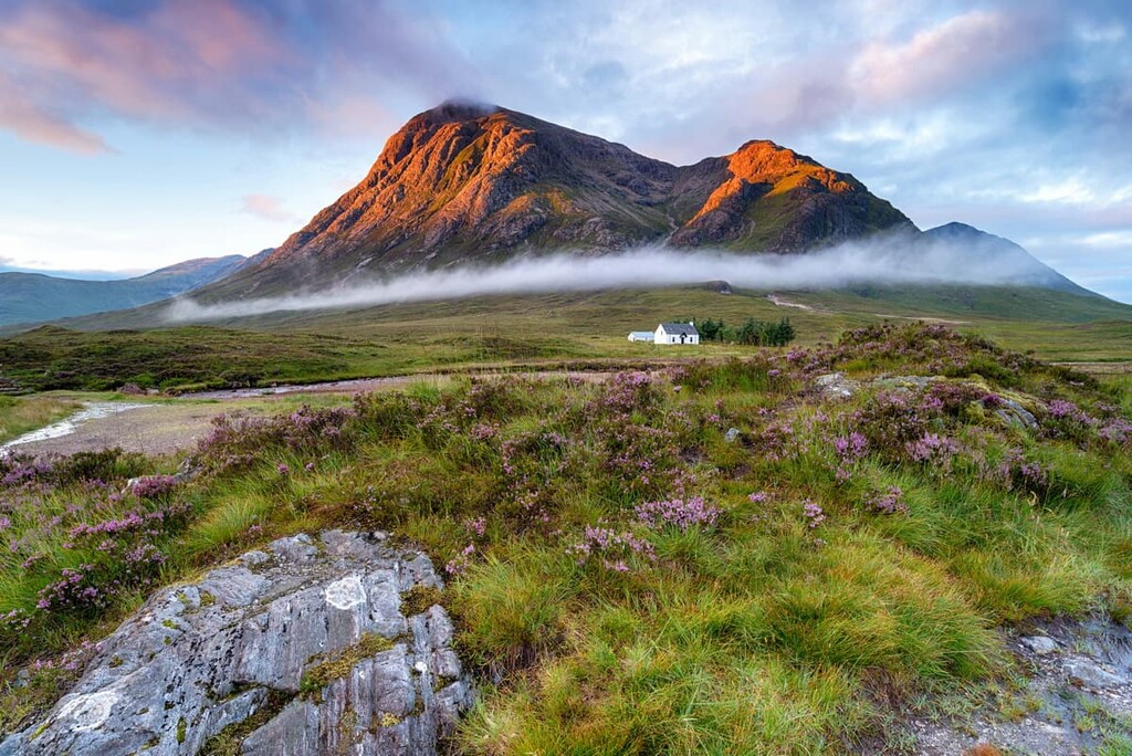
Buachaille Etive Mór's lesser-known neighbor Buachaille Etive Beag is another superb climb in Glencoe National Nature Reserve. Buachaille Etive Beag is considered a better mountain for beginners than its sibling while still providing the opportunity to bag two Munros, Stob Dubh an Stob Coire Raineach (925 m). This hike is 5 miles, ascends 900 m, and takes approximately 5 hours.
You can start your walk from the car park along the A82 near the famous beehive cairn. The path signposted the "Right of Way" is well-defined through Lairig Eilde. At a fork, keep left up to the ridge's lowest point, Mam Buidhe. From here, there are stunning views of Stob Coire Sgreamhach. When the path becomes gentler, head right along the mountain trail, past a cairn, and along the narrow ridge to reach the summit of Stob Dubh. Continue slightly past the summit for panoramas of Glen Etive with Ben Starav overlooking Loch Etive 7.5 miles southwest.
To reach Stob Coire Raineach, walk back to the mountain pass and head directly for the mountain. There are several routes up Stob Coire Raineach, so map your route out beforehand. After a quick yet rough walk, you'll reach the summit marked with a cairn. Be sure to admire the vast Rannoch Moor to the northeast before starting your descent. This is a there-and-back route, so retrace your steps again to the mountain pass, being careful not to get lost in poor visibility.
Towering over Glencoe Village, The Pap of Glencoe is a short and strenuous hike with some of Glen Coe’s most rewarding views of Loch Leven. The trail here is rough going, steep, and occasionally boggy, so ensure you dress appropriately. The hike up The Pap of Glencoe is 4 miles, ascends 7 miles, takes 3 to 5 hours.
Start your walk by parking up near the Clachaig Inn not far from Glencoe Village. Pass the Laraichean house on yoru left and walk through the next gate to locate the track. Turn right across the footbridge onto a wider path and continue along the hillside before crossing a stream. Careful of your footing as this area can be very boggy. The trail gets steeper at around 400 m when the path turns to the left.
Ignore any paths away from the main trail and continue onto The Pap’s col. At the base of the dome the climb becomes more difficult with the trail taking directly up the steep hillside in places, although you won’t need to scramble. As the path circles around the dome be sure to enjoy stunning vistas of Loch Leven and Ballachulish. The summit of Sgorr na Ciche is marked with a large cairn. This is a there-and-back walk so retrace your steps, being careful not to trip on the initial rugged section of The Pap’s dome.
Hikers looking for a popular easy stroll through this beautiful region of Scotland should consider hiking up Signal Rock (104 m). This walk will take you through verdant woodlands near the center of the park and affords gorgeous views of the surrounding mountains, including Bidean nam Bian. Signal Rock is also historically significant, as it was used as a gathering place for the MacDonald clan. Legend has it Signal Rock was also used by the Campbells to signal the start of the Glencoe Massacre. This short hike is around 1.5 miles, ascends 92 m, and takes around an hour to complete.
Start your hike from the Signal Rock car park along the A82 road. The clear tarmac path with an information board will take you first across the River Coe and then into An Torr woods. Upon entering the woods, first take the left fork and then keep right. You'll soon be able to identify the blue-marked trail, which will take you to the top of Signal Rock. Be sure to explore Signal Rock and learn about Toma a'Ghrianain (the Hill of the Sun) before retracing your steps.
Walk back through the last gate and turn left, following the black-marked trail. There are some steep sections here on the way to the top of An Torr. This part of the walk provides the best views of surrounding hills and mountains like Meall Mòr (676 m) to the west and Bidean nam Bian to the southeast. Retrace your steps to return to the Signal Rock car park.
Fort William is one of the closest major towns to Glencoe National Nature Reserve and is an idyllic location for avid adventurers to stay. Fort William draws hikers from around the world due to its association with Britain's highest mountain, Ben Nevis, which is just 7 miles from the town center.
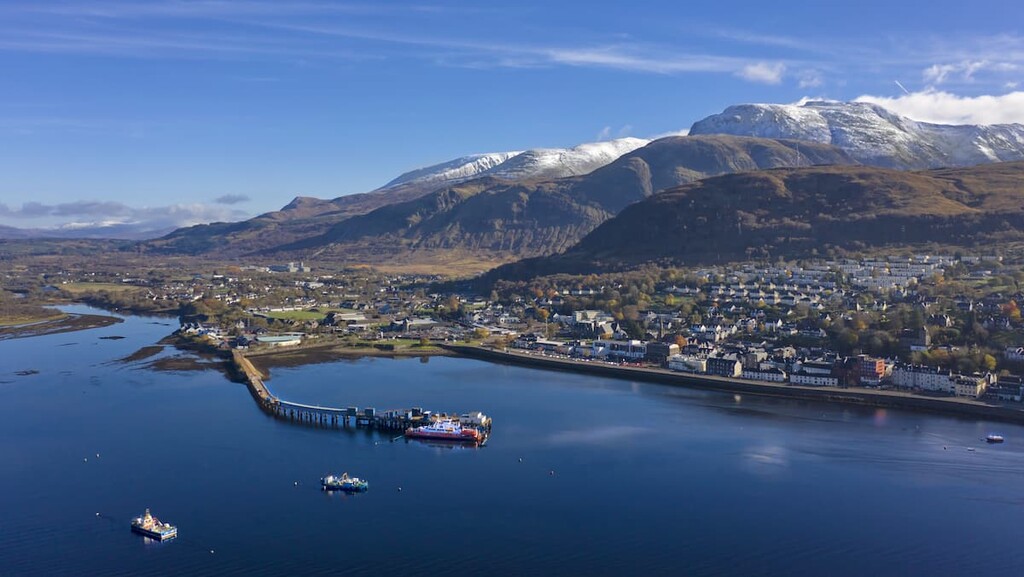
It's also easy to reach Glencoe National Nature Reserve, with a 17-mile drive down the A82, most of which runs along the edge of the scenic Loch Linnhe. Fort William also serves as a start and end for the long-distance West Highland Way. During your downtime, check out interesting local attractions like the Ben Nevis Distillery and the West Highland Museum. Fort William also has several affordable hotels, including Clan Macduff Hotel, Moorings Hotel, and The Imperial Hotel.
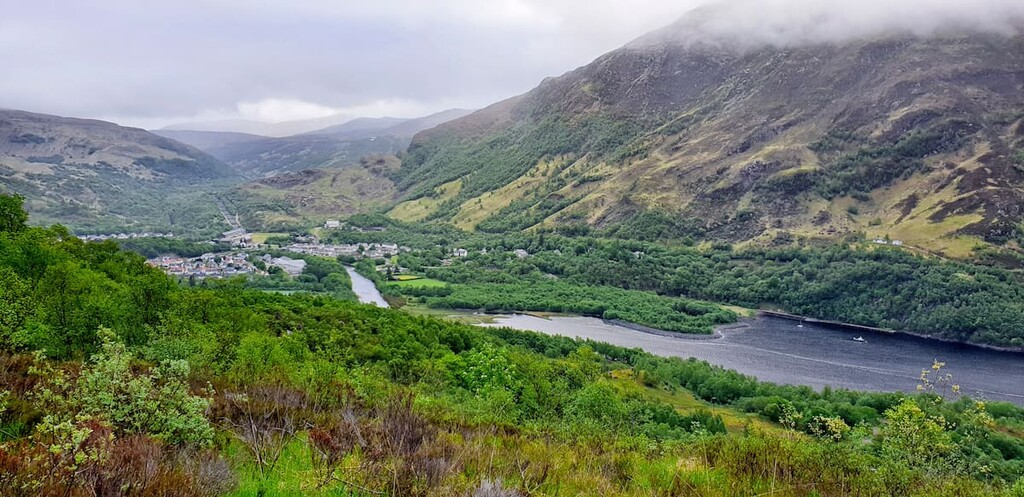
Glencoe is among the best and most convenient places to stay during your visit to Glencoe National Nature Reserve. This picturesque village is home to the Glencoe Visitors Centre and serves as a starting point for several hikes, including the Pap of Glencoe (742 m) and the Glencoe Lochan Trail. There are a few local attractions worth checking out, too, like the Glencoe Folk Museum. Anybody planning an overnight stay in Glencoe should try to book a room at Glencoe House or The Clachaig Inn.
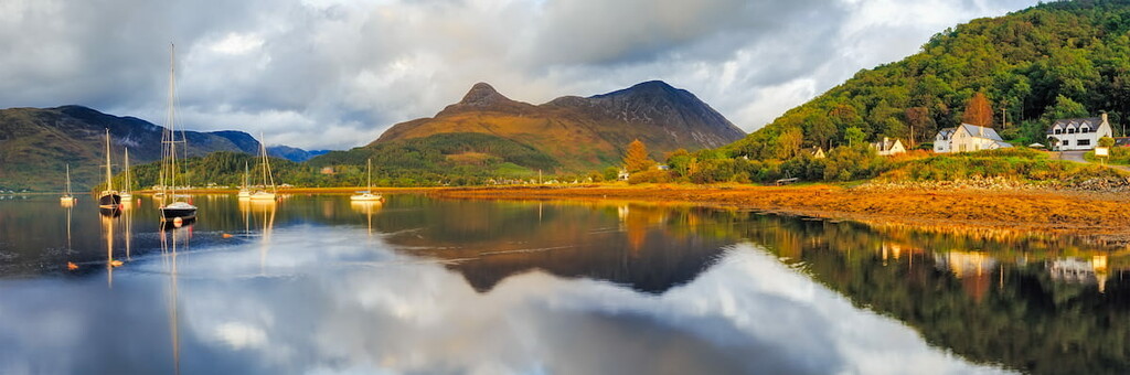
Along with Glencoe, Ballachulish is one of the most convenient places to stay near Glencoe National Nature Reserve. Sat just 2 miles west of Glencoe, Ballachulish is a former quarry village that now attracts hikers looking to stay near the likes of Beinn a' Bheithir (1,024 m) and Meall Mòr. Ballachulish also hosts its own annual Highland Games. Popular hotels include the Ballachulish Hotel and the Isles of Glencoe Hotel.
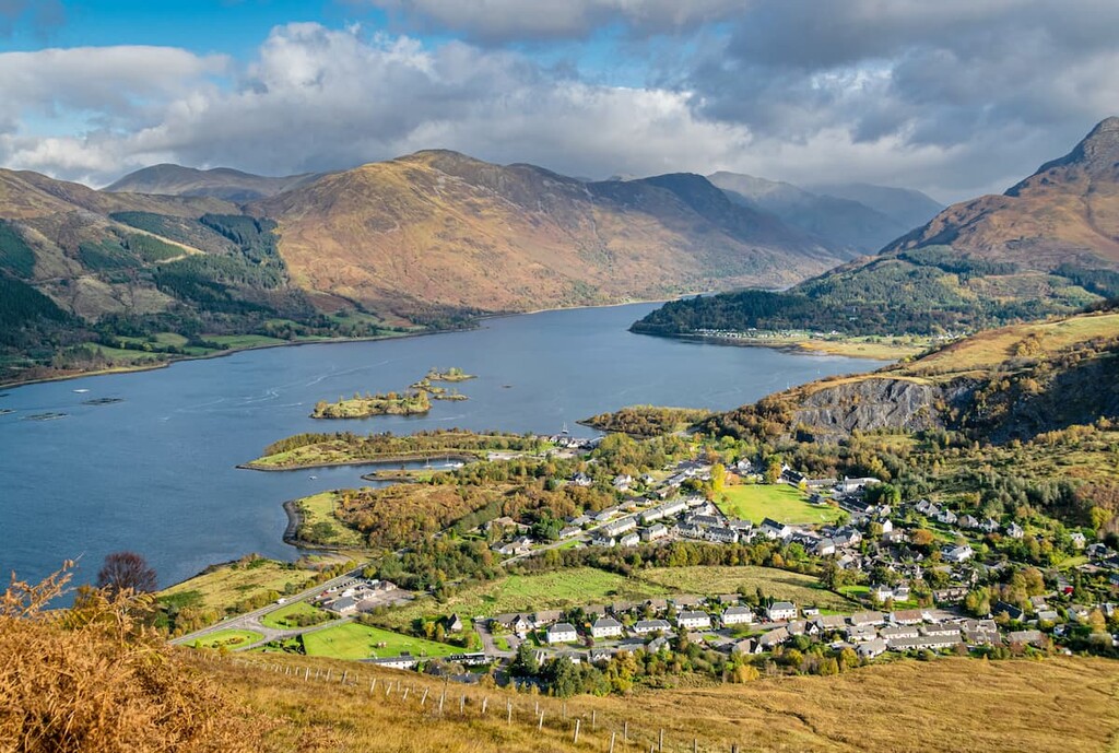
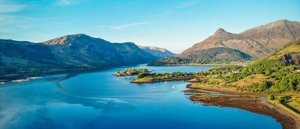
Situated where the River Leven runs into Loch Leven and encircled by sublime Munros, Kinlochleven is perhaps the prettiest village in the region. Anybody looking to discover the best of this area's beauty will want to stop off at the 120-m Steall Waterfall, the second-highest waterfall in Scotland. To reach Glencoe National Nature Reserve from Kinlochleven, follow the B863 road for 8 miles along Loch Leven to Glencoe. There are a few great hotels in Kinlochleven, including Macdonald Hotel and the Highland Gateway Inn.


The highest peak in Glencoe National Nature Reserve is Bidean nam Bian, at 1,150 m.
Notable peaks in Glencoe National Nature Reserve include Bidean nam Bian, Stob Coire nan Lochan, Stob Coire nam Beith, Stob Coire Sgreamhach and Stob Dearg.


