Scan the QR code and open PeakVisor on your phone
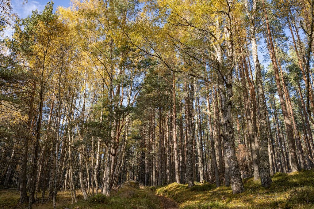
Abernethy National Nature Reserve is one of the largest nature reserves in Scotland, encompassing over 31,000 acres of Caledonian forests, mountain plateaus, and moorlands within Cairngorms National Park. The reserve's boundaries stretch from the River Nethy to the peak of Britain's second-highest mountain, Ben Macdui (1,309 m). The landscape is dominated by Abernethy Forest, one of the largest remaining areas of Highland pinewoods in Scotland.
This nature reserve offers visitors a broad scope of hiking opportunities, from gentle strolls through ancient pinewoods to treks up some of the highest mountains in Britain. Ben Macdui sits on the nature reserve's southern edge, and other notable Munros within the reserve include Cairn Gorm (1,244 m), Bynack More (1,090 m), and Beinn Mheadhoin (1,182 m).
Abernethy National Nature Reserve was established to preserve and restore the area's Caledonian pinewoods and protect local endangered wildlife. By some counts, Abernethy Forest is the largest native forest remaining in the UK. Deforestation has led to a large reduction in Caledonian woodlands in the Scottish Highlands, threatening local ecosystems. While hiking through the 10,000-acre Abernethy Forest, you'll want to keep an eye out for some of the region's rarest residents, including red squirrels, Scottish wildcats, and Scottish crossbills.
Discover one of the most precious environments in Britain and scale some of Scotland's best mountains at Abernethy National Nature Reserve. Read on to find out about some of the best hiking areas and where to stay.
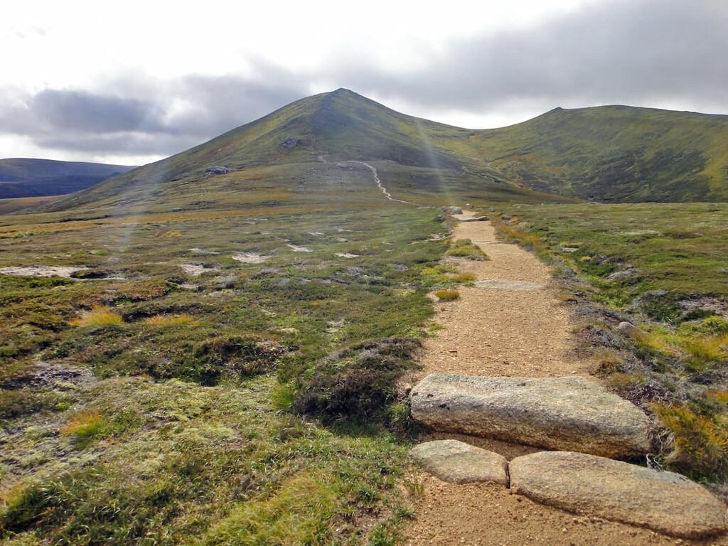
The second-highest peak in Britain, Ben Macdui attracts hikers from across the globe looking to bag the best Scottish Munros. By climbing the mountain from Speyside, hikers will have the opportunity to bag the other highest summit in the Abernethy National Nature Reserve, Cairn Gorm. Climbing Ben Macdui from Speyside is more difficult than the alternative route from Deeside, as it involves navigating the ski area and exposed mountain plateau. Hikers attempting this walk should come well-prepared and bring navigational equipment. The hike up Ben Macdui and Cairn Gorm is 11 miles, ascends 932 m, and takes around 8 hours.
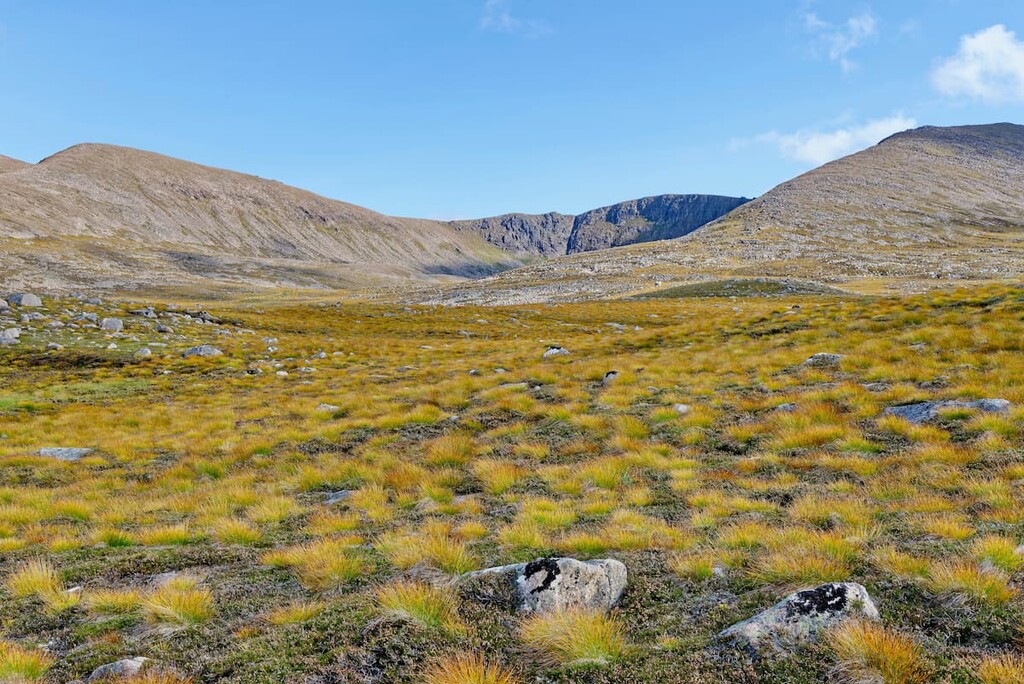
From the Cairngorm ski center car park, head west over a footbridge towards Coire an t-Sneachda. Before reaching this corrie, the path will fork. Keep to the right to avoid Coire an t-Sneachda, and instead cross over the Allt Coire an t-Sneachda and keep on the low wider path when you reach yet another fork. Cross another stream, and then follow the path as it ascends onto Creag an Leth-choin's (1,053 m) ridge. Atop the ridge, you'll need to walk through some boggy areas on the western slopes of minor top Cairn Lochan (1,216 m). The path here splits, but both trails rejoin further along.
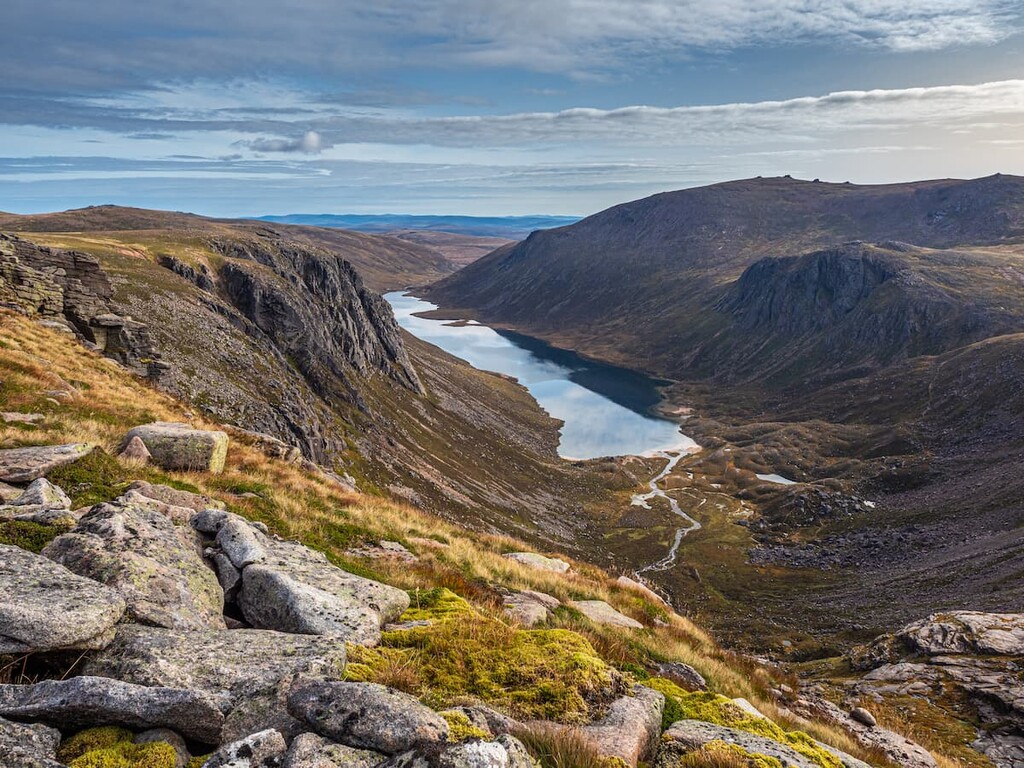
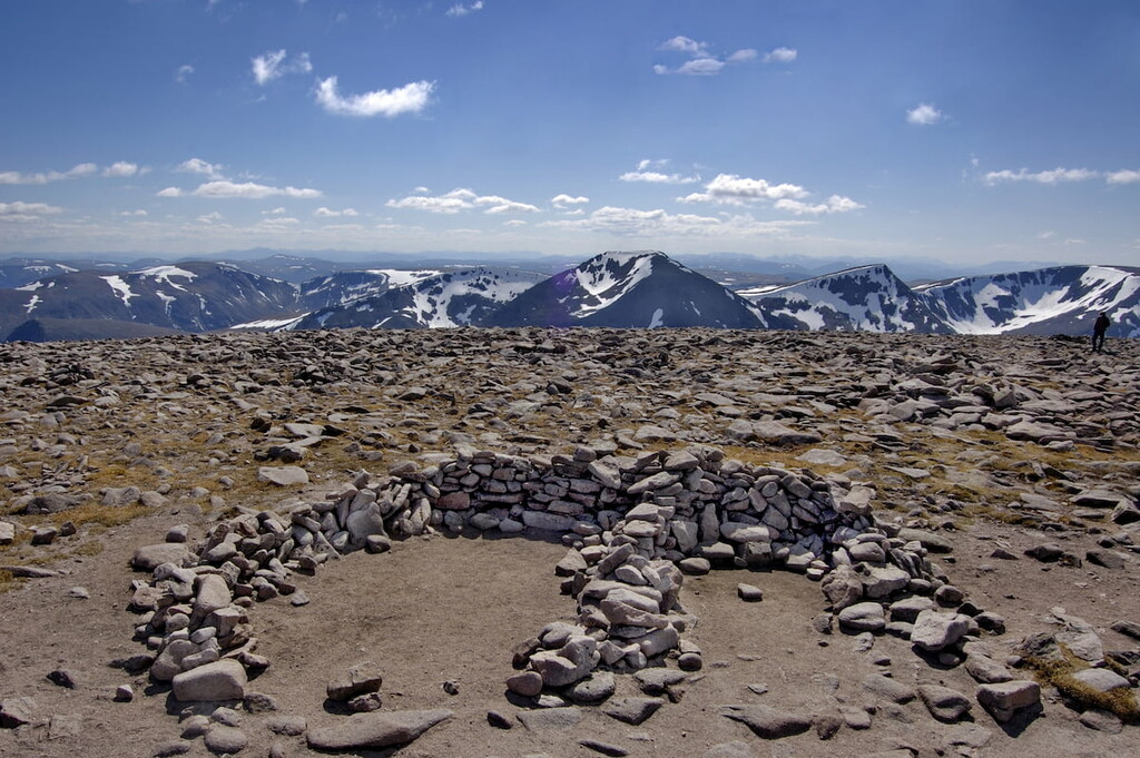
Passing on the western edge of Lochan Buidhe, you'll have to cross a boulder field and Cairn Gorm's plateau on the way to Ben Macdui. Enjoy panoramas of Cairn Toul (1,291 m) and Braeriach (1,296 m) across the famed Lairig Ghru before bypassing Ben Macdui's northern top on the way to its summit. The true summit is marked with a large cairn, a trig point, and a viewfinder; however, views of surrounding mountains are mostly obscured by the mountain's plateau.
Retrace your steps towards Lochan Buidhe, following the right path closer to the water. Hike through the exposed moorlands up onto the col between Stob Coire an t-Sneachda (1,176 m) and Cairn Lochan. Head to the right over Stob Coire an t-Sneachda before reaching the summit of Cairn Gorm. Views here are superior to Ben Macdui, with Rothiemurchus Forest to the north and Bynack More to the northeast. To descend, walk north to the Ptarmigan Restaurant. It is possible to ride the ski lift back down to the car park. If not, pass the restaurant and follow the Windy Ridge trail directly back to your starting point.
Hikers looking for a relatively simple yet lengthy Munro to bag during their visit to Abernethy National Nature Reserve should consider Bynack More. Less remote and more popular than Beinn Mheadhoin, Bynack More provides dramatic views of the northeastern Cairngorms and is considered a cornerstone of the range. You can climb Bynack More in a couple of different ways, with the most popular route from Glenmore Lodge near Loch Morlich. It's also possible to climb Bynack More from the Cairngorm ski center via The Saddle; however, this is a much more strenuous walk. The hike up Bynack More from Glenmore Lodge is 14 miles, ascends 756 m, and takes 7 hours.
Park at the Allt Mor car park and follow the clear path with purple waymarkers and an information board over a footbridge before crossing at a ford in another river. Turn right at the junction in the trail, passing through a glen towards the Ryvoan Path. Stop to admire the picturesque An Lochan Uaine before bearing right a fork signposted for Braemar. The trail passes over moorlands to the right of Loch a'Gharbh-choire before crossing Allt a'Garbh-choire.
Past the ruins of Bynack Stable, you'll cross the River Nethy and then follow a section of the long-distance Lairig an Laoigh uphill. The path then climbs steeply up onto the plateau north of Bynack More. Before reaching the lairig's highest point, follow the fork to the right to head directly for Bynack More. After navigating the mountain's steep ridge, you'll reach the summit. Views of the northeastern Cairngorms are tremendous, with Beinn a' Chaorainn (1,083 m) visible to the south across Dubh Lochan.
The easiest way to descend is to go back the way you came; however, you may want to extend your walk slightly southwards to see the Barns of Bynack, the largest granite tors in the Cairngorms range.
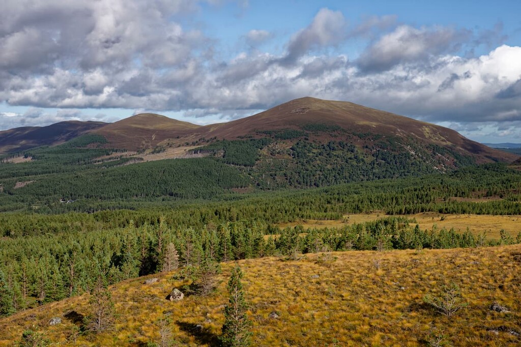
Meall a' Bhuachaille (810 m) is the perfect mountain for beginners, thanks to its clear pathways to the summit. It also provides stunning views across Cairngorms National Park without having to scale one of the range's more challenging Munros. Meall a' Bhuachaille is also the site of an annual hill running race from the Badaguish outdoor center. The most popular route for hikers is from the Glenmore visitors center. This hike is 5 miles, ascends 543 m, and takes roughly 4 hours.
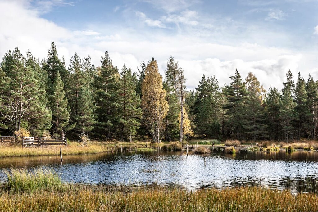
From the visitors center car park, head along the path and turn left just before the reindeer center. Turn right at a fork in the road, which will take you uphill through some woodlands. The main path will soon end and is replaced with a rougher, waymarked trail. The trail will take you through a valley with An Lochan Uaine on the opposite side. You can take a short detour down some steps to the water's edge or continue along the path uphill.
At another fork in the path, turn left down the trail signposted for Nethy Bridge. Just before the Ryvoan bothy, turn left on the well-defined track up Meall a' Bhuachaille. The top of the mountain is marked with a large cairn. From the summit, you'll get to enjoy views across the vast Abernethy Forest and of Cairn Gorm to the north. Continue along the path to the west to enjoy vistas of Loch Morlich below.
Upon reaching the bealach (mountain pass), you'll have the option to extend your walk or begin your descent. You can extend this walk by continuing to the summit of Creagan Gorm (735 m) and then along the ridge to Craigowrie before descending through the forest to the Badaguish outdoor center. If you plan on descending from Meall a' Bhuachaille, follow the clear path down from the bealach, which passes through the pinewoods and has orange waymarkers. Turn right at the signpost for the visitor center to return to your starting point.
No trip to Abernethy National Nature Reserve is complete without exploring the largest surviving section of Highland pinewoods in Scotland. There are numerous trails within Abernethy Forest, including well-marked trails near Nethy Bridge, ranging from a mile to over 5 miles in length. There's something for everyone in Abernethy Forest, whether you're trying to plan a family stroll or a long-distance trek. One of the best hikes in the forest is the Abernethy circuit, which will take you along the River Nethy and offers extensive views of Cairngorms range in the distance. This trail can be tough to follow, so map out your route and bring navigational equipment. This walk is 10 miles, ascends 242 m, and takes approximately 6 hours.
You can start this walk from the isolated Forest Lodge at the heart of the reserve. You find this building by taking the B970 from Nethy Bridge before following the minor road towards Loch Garten. Then take the first left towards Tulloch. After about 2 miles, you'll need to turn down a dirt road, passing a 'Welcome to Abernethy' sign. Further down the road, you'll reach the Forest Lodge. There's a parking area at a junction just before the lodge.
From the parking area, turn to the left and follow the path for Nethy Bridge. Pass the lodge and follow the path right over a footbridge. Stay on the main track as it passes into the forest and swings right. When you reach a three-way fork, keep straight. The trail then weaves and climbs into an open area that provides superb views of Cairn Gorm. Continue on the path as you walk through the Royal Society for the Protection of Birds' (RSPB) forest regeneration project, crossing a ford in a stream and ignoring the path off to the left.
Past a picturesque lochan, the track will disappear completely. Walk directly across the heather moorlands, which can be tricky and involves crossing another minor stream. Upon reaching a river, follow the faint path upstream. This beautiful area is home to several small waterfalls and is a great place to take a break. You'll soon come across a bridge with a wide path to your right, which you'll need to cross. After passing the ruins of Bynack Stable and the sign for the edge of the reserve, you'll need to bear right a fork before Loch Morlich.
Enjoy views here of Bynack More before continuing along the track back into the forest. To return, cross a small bridge and continue along the same path back into the woodlands. Keep left the fork in the road, and then turn right at the next junction. The track then emerges at the Forest Lodge.
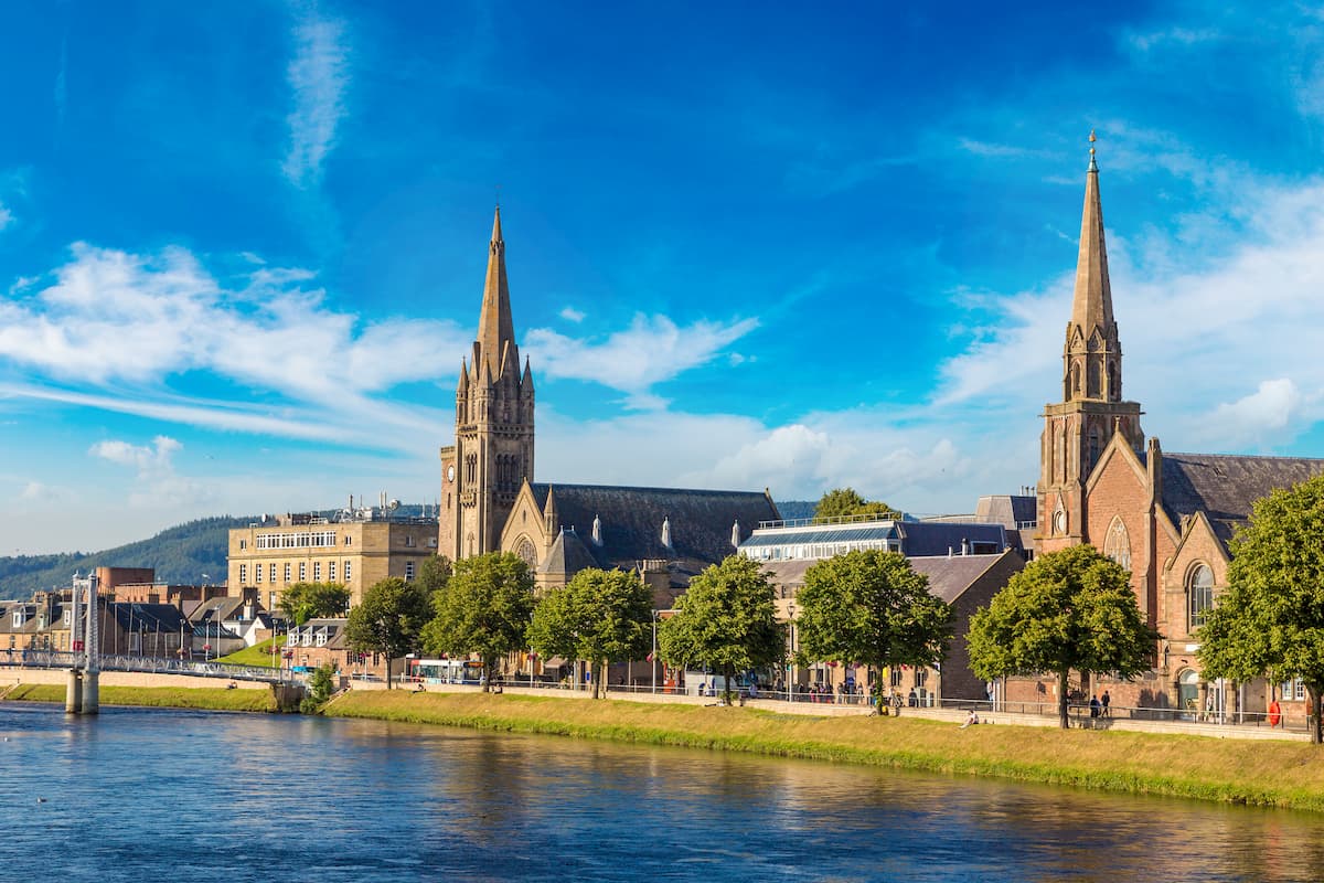
Hikers looking to stay in a major city during their visit to Abernethy National Nature Reserve should consider Inverness. The nearest major settlement, Inverness is just 30 miles from the reserve and can be easily reached along the A9 road. Widely regarded as the capital of the Highlands, Inverness is ideal for learning about local history and culture, with attractions like Inverness Castle and the Inverness Museum and Art Gallery. You won't be short of accommodation options during your stay in Inverness, with top hotels like The Royal Highland Hotel, Kingsmill Hotel, and Glen Mhor Hotel.
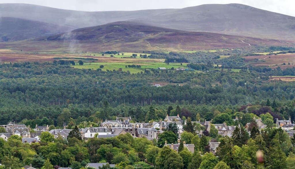
Perched on the River Nethy, Nethy Bridge is one of the most convenient places to stay in Abernethy National Nature Reserve. The administrative center of the reserve, Nethy Bridge,
is just a stone's throw from Abernethy Forest and some of the best mountains in the Cairngorms range. Nethy Bridge is hugely popular with tourists, and as a result, as several hotels, including Nethybridge Hotel, The Mountainview Hotel, and Ptarmigan Lodge.
Aviemore is a popular tourist spot thanks to nearby winter sports resorts and the views of the Cairngorms from across town. The town is also just 8 miles from Loch Morlich and the start of many hiking trails in the Abernethy National Nature Reserve. You'll also have the Rothiemurchus Forest right on your doorstep. If you're planning to spend your next getaway in Aviemore, book a room at the Cairngorm Hotel, Coylumbridge Hotel, or the Macdonald Highland Hotel.
Another significant town near Abernethy which is popular with tourists is Grantown-on-Spey. Sat at the north edge of the Cairngorm mountains, Grantown-on-Spey offers easy access to the reserve as well as some quaint local attractions, like the Grantown Museum, to keep you entertained during your downtime. You can also reach the center of the reserve by catching a train or bus to Aviemore. Some of the best hotels in Grantown-on-Spey include the Grant Arms Hotel, Craiglynne Hotel, and The Ben Mhor.