
Scan the QR code and open PeakVisor on your phone
Clyde Muirshiel Regional Park has 154 named peaks. The highest is Hill of Stake at 522 m. Other notable peaks include West Girt Hill, East Girt Hill and Misty Law.
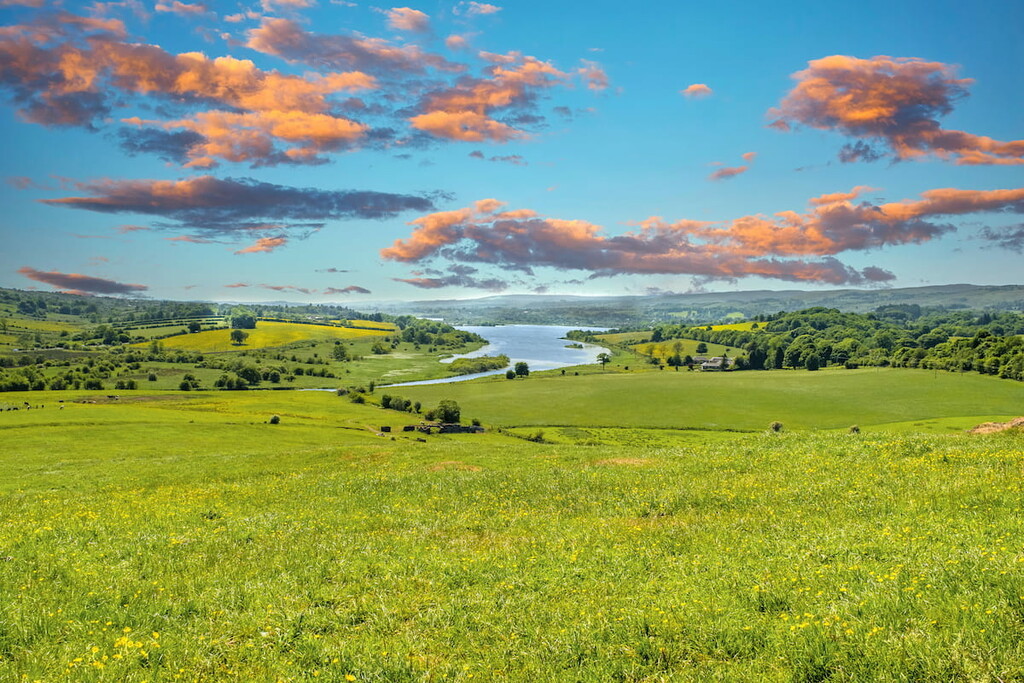
Situated on the western edge of mainland Scotland, Clyde Muirshiel Regional Park draws intrepid adventurers from across the U.K. Clyde Muirshiel Regional Park is Scotland's largest regional park, covering 108 square miles of rolling hills, lush woodlands, and tranquil lochs. Approximately 700,000 people visit Clyde Muirshiel Regional Park every year.
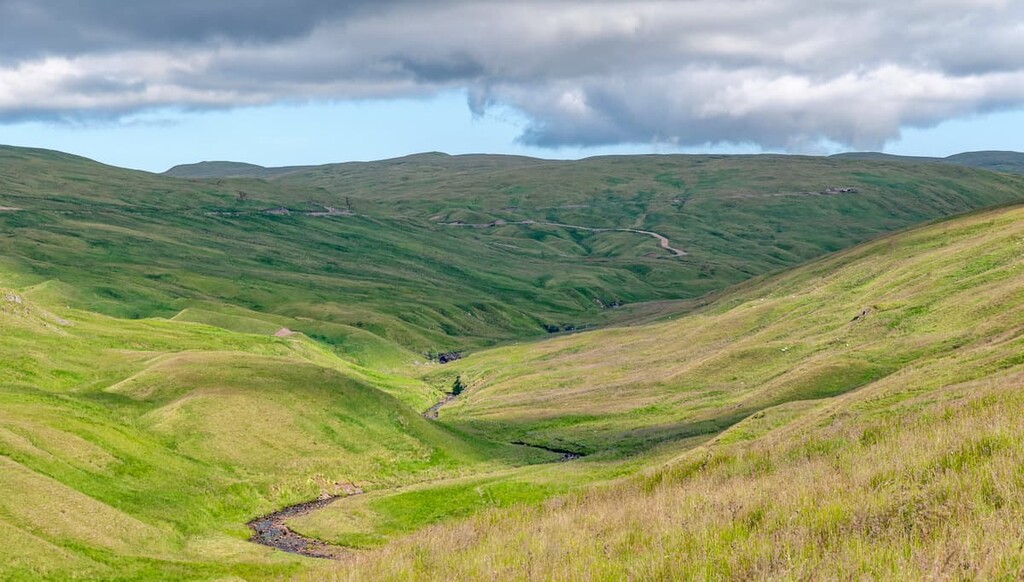
Clyde Muirshiel Regional Park has several distinct geographical features, most notably the Renfrewshire hills located at the park's heart. The Renfrewshire hills are popular with hill climbers as they offer some strenuous hikes with gorgeous panoramas of the park's lochs and the nearby Firth of Clyde. The highest and most prominent hill in the park in Hill of Stake (517 m). Other hills that are popular with hikers include Misty Law (503 m), Corlick Hill (303 m), and Dunrod Hill (291 m).
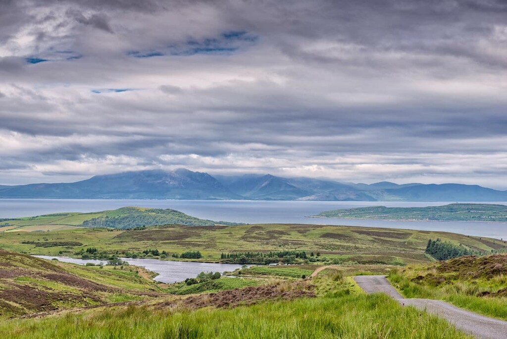
Another distinctive feature of Clyde Muirshiel Regional Park is its lochs. There are three significant lochs in the park, Loch Thom to the north and Castle Semple Loch and Barr Loch to the southeast. These lochs offer scope for watersports; for example, Loch Thom is a popular spot for sports fishing, while Castle Semple Loch is ideal for sailing. If you're looking to relax along the Scottish coastline, pay a visit to Lunderston Bay. Lunderston Bay is the closest sandy beach to Glasgow and a favorite location for relaxing within Clyde Muirshiel Regional Park.
During your visit to the Clyde Muirshiel Regional Park, ensure you watch out for some of the park's local residents. The Clyde Muirshiel Regional Park is home to an array of flora and fauna. While exploring the park's heather moorlands, be on the look-out of hen harriers, one of the rarest birds of prey in Britain, as well as skylarks, osprey, and buzzards.
Planning a trip to Clyde Muirshiel Regional Park? Check out these major hiking areas and the best places to stay during your visit.
Hill of Stake is the highest point in Renfrewshire and Clyde Muirshiel Regional Park. As a result, Hill of Stake is one of the park's most popular hiking destinations, as it provides a strenuous trek for experienced hikers. The majority of the route runs along a gravel path and is easy to follow before ending on open moorlands. While walking through the moorlands, be on the lookout for local bird species, including kestrels, skylarks, and ravens. The climb up Hill of Stake is 8 miles, ascends 510 m, and takes 5 to 6 hours.
You can pick up this trail from the Muirshiel Country Park Visitors Centre car park. You'll follow the miner's path west for around 2 miles before passing Barytes Mine. One of the park's most famous landmarks, the Barytes Mine was operational for over 200 years before its closure in 1969 and was an integral part of the local textiles industry.
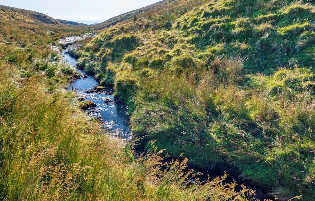
From the old mine, head directly south off the path and onto the rugged hillside before ascending to the peak of Hill of Stake. From atop the hill, you'll have views of the Islands of the Clyde to the west and the surrounding hills, including Irish Law (474 m) to the south. While exploring the Hill of Stake, consider visiting the remains of three aircraft which crashed into the hill during bad weather in the 1930s and 40s.
To descend, walk parallel to the boundary fence to the southeast on to Misty Law. From Misty Law, head northeast along Raith Burn before crossing the stream to return to the original track.
Corlick Hill provides hikers with some of the best uninterrupted vistas in the Clyde Muirshiel Regional Park, as well as a look at the area's ancient history. Most of this walk is over ill-defined tracks and open moorland, so ensure you map out a route beforehand. Corlick Hill is a popular area for birdwatching, with coal tits, ospreys, and willow warblers frequenting the hillside. The hike up Corlick Hill is just 6.3 miles, ascends 303 m, and takes approximately 4 hours.
To start this walk, locate the track about 0.5 miles north of the Whinhill golf course near Greenock. The trail will run for around 1.5 miles past Whitelees Cottage before reaching Corlick Hill. During your walk through this area, be on the lookout for the remains of Roman and Iron Age structures, including the Lurg Moor Roman Fortlet.
A short and steep walk will take to the top of Corlick Hill, which is marked with a trig point. Corlick Hill affords hikers stunning views of Gryfe Reservoir to the south, Dunrod Hill to the west. On a clear day, you can even spot Ben Lomond (974 m) 18 miles to the north.
To descend, walk southeast across the moors to the Gryfe Reservoir. You'll want to join the road from the reservoir and walk to its western edge, crossing a bridge along the way. At the path's junction, turn right and continue for 1.2 miles to reach your starting point.
Irish Law provides the best moorland hill walk in the Clyde Muirshiel Regional Park. While rambling over these rolling hills, you'll encounter an array of fascinating flora, such as cotton grass, bell heather, and sphagnum moss. You'll also be treated to some glorious views of the Scottish countryside. The majority of the walk is on gravel paths and open moorlands. The hike up Irish Law is 6.7 miles, ascends 484 m, and takes 3 or 4 hours.
You can start this walk by parking at the entrance to the Kelburn Wind Farm near Fairlie along the A760. The path will take you north onto the eastern slopes of Paton's Hill (388 m). After 1.8 miles, head off the path across a bridge to the summit of Feuside Hill (431 m). From Feuside Hill, loop in a southeastern direction over the minor summit of Little Irish Law to Irish Law's trig point.
From Irish Law, you'll be able to spot Goat Fell (874 m) on the Isle of Arran and Alisa Crag to the southeast. To reach Knockside Hills (440 m), walk south to the low point between the hills before traveling along the ridge to Knockside Cairns. Head back to your starting point by walking north before following the burn west. To leave the hillside, you'll need to cross the river at its narrowest point. You can locate the original trail near some sheep pens before heading downhill to the A760.
Kaim Hill (386 m) is a favorite summit among hikers as it boasts some of the best views of the Firth of Clyde and the coastline. During your trek up Kaim Hill, you'll pass some intriguing landmarks, such as the 15th-century ruins of Fairlie Castle and ring markings thought to be prehistoric art. Birdwatchers will also get the chance to spot buzzards, hen harriers, and skylarks on their journey. It's essential you map a route up Kaim Hill, as most of the walk is off-road and poor weather can make navigation difficult. The hike up Kaim Hill is 6 miles, ascends 386 m, and takes around 4 hours.
From Fairlie railway station, follow the path north and head right through the woods along the trail to Fairlie Castle. Heading east along the gravel road, ensure you stop to admire the charming Water of Fairlie Glen Falls. Leaving the wooded area, the path will take you by Fairlie Burn and then along a fence line to the summit of Lairdside Hill (331 m). From Lairdside Hill, it's a short walk west to the top of Kaim Hill. If you want to extend your walk slightly, pay a visit to the Kaim Hill Quarry, a millstone quarry most active during the 18th century.
From Kaim Hill, you can pick up a worn path that will lead you southwest onto Black Hill (220 m) and then south through Glenside Wood before looping north to Diamond Hill (141 m). Diamond Hill is one of the best areas to see the mysterious prehistoric ring markings. Continue north to get back to Fairlie Glen and the path to Fairlie Castle.
Perhaps the most popular walking trail in Clyde Muirshiel Regional Park, the Semple Trail offers an in-depth look at the park's nature and history. The Semple Trail takes hikers on a leisurely walk from visitor's center to visitor's center, taking in lochside views and historic landmarks like the 16th-century ruins of Collegiate Church along the way. The Semple Trail is 9 miles, ascends 125 m, and takes 6 to 7 hours to finish.
From the Castle Semple Visitor's Centre in Lochwinnoch, the path will take you along the banks of Castle Semple Loch before turning north into Parkhill Woods. Here, you'll pass over some minor hills, like Parkhill (91 m) and Courtshaw Hill (78 m) and see several landmarks along the way, including the 2nd-century Grotto and the ruinous Collegiate Church.
Upon leaving the woods, you'll scale Kenmure Hill (77 m) and pass by the Kenmure Hill Temple, which dates back to the 18th century. You'll then head through the sleepy village of Howwood before looping around to the opposite side of Castle Semple Loch. The trail here takes you away from the water's edge and along country roads through the hamlets of Earlshill and Newton of Belltrees.
The final stretch will lead you past Lochwinnoch railway station and RSPB Visitor's Centre before returning to your starting point. At the RSPB Visitor's Centre, you can take a detour to Tod's Seat, a "lookooterie" perched upon Castle Semple Loch, which is a superb spot for birdwatching.
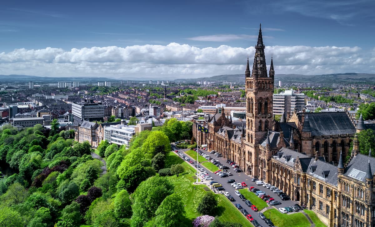
Despite being the most populated city in Scotland, Glasgow is just a stone's throw from some of the country's best hiking destinations, including Clyde Muirshiel Regional Park. Glasgow is just 26 miles from the center of Clyde Muirshiel Regional Park and offers some of the best cultural attractions in Scotland, like Kelvingrove Gallery and the Riverside Museum. If you're planning to stay in Glasgow, book a room at the Radisson RED, the DoubleTree, or Kimpton- Blythswood Square Hotel.
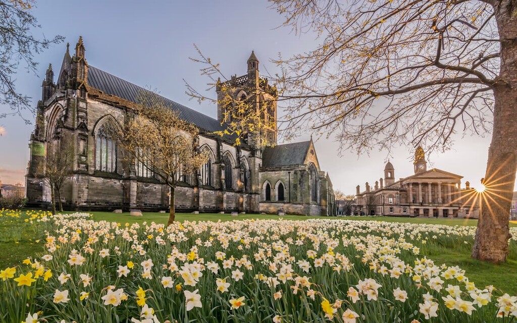
Sandwiched between Glasgow and the Clyde Muirshiel Regional Park, Paisley is ideal for travelers looking to mix country living with the big city. Just 12 miles outside Glasgow, Paisley is a reasonably large town, with some interesting local landmarks, like the 12th-century Paisley Abbey and the Coats Observatory, the oldest public observatory in Scotland. It's also only a short drive to the center of Clyde Muirshiel Regional Park, which is just 15 miles away. Hotels in Paisley include the Ashtree House Hotel and the Glynhill Hotel.
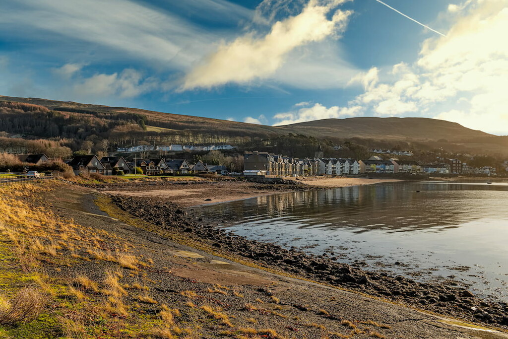
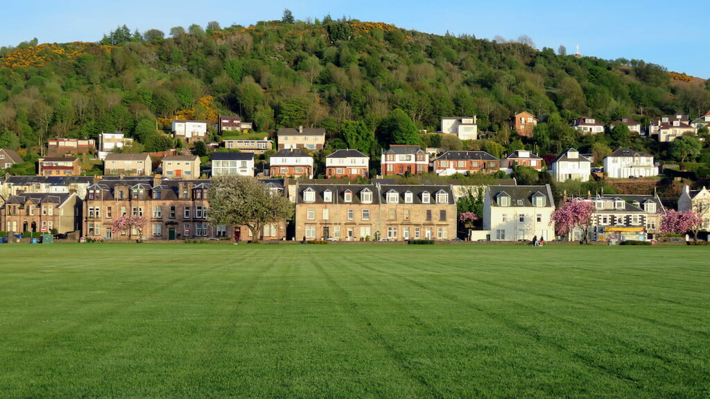
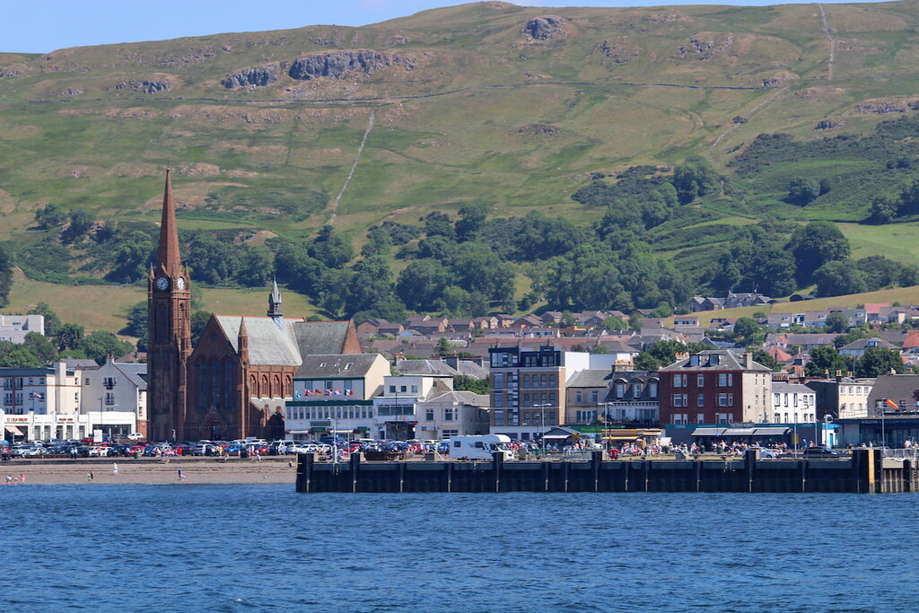
Sat where the River Clyde meets the Firth of Clyde, Greenock provides an idyllic base from which to explore the Clyde Muirshiel Regional Park. Despite being relatively large, Greenock has plenty of charm with views across Gourock Bay and historic attractions such as the 19th-century McLean Museum & Art Gallery. Greenock is also near some top hiking areas, with Corlick Hill and Lyle Hill (130 m) within 5 miles of the town center. Some of the best hotels in Greenock include The Waterfront and The Tontine Hotel.
The historic town of Largs is another excellent spot for an overnight stay near Clyde Muirshiel Regional Park. Overlooking the Firth of Clyde on the park's western edge, Largs is a popular seaside resort famed for its links to Vikings and for being the site of the Battle of Largs in 1263. While in Largs, ensure you swing by the vibrantly painted Kelburn Castle. Top hotels in Largs include the Peacock Guest House and the Brisbane House Hotel.
Perched on the serene Castle Semple Loch, Lochwinnoch sits high on people's lists of top destinations in Clyde Muirshiel Regional Park. During your stay, you'll be able to ramble along the Semple Trail or take a boat out onto the loch. This small village is home to several quaint hotels and guest houses, like Rosie's Cottage and the Lochview Lodges.


The highest peak in Clyde Muirshiel Regional Park is Hill of Stake, at 522 m.
Notable peaks in Clyde Muirshiel Regional Park include Hill of Stake, West Girt Hill, East Girt Hill, Misty Law and Creuch Hill.


