Lyle Hill stands at the West End of Greenock in Inverclyde, Scotland. It has scenic viewpoints accessible from Lyle Road, which was constructed in 1879–1880 and named after Provost Abram Lyle, well known as a sugar refiner. The hill's highest point is Craigs Top at 426 feet (130 m) above sea level, and before the road was constructed the hill was known as the Craigs, or as the Bingens (with various spellings).
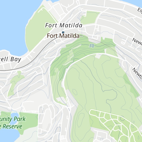
Adjacent to the highest point of the road, a scenic viewpoint looks out over Gourock and the Firth of Clyde to Cowal in the west, and north over the Fort Matilda area of Greenock to Argyll across the Clyde. There are benches, information points, and a beacon which is lit on significant occasions. Car parking spaces give views to the west, and a short distance further down the road the Free French Memorial is in the shape of the Cross of Lorraine combined with an anchor. Across the road, steps and a rough path lead up to a viewpoint at Craigs Top with views up the River Clyde as far as Glasgow.
We use GPS information embedded into the photo when it is available.
3D mountains overlay
Adjust mountain panorama to perfectly match your photos because recorded by camera photo position might be imprecise.
Move tool
Rotate tool
Zoom
More customization
Choose which peak labels should make into the final photo and what photo title should be.
Next
Photo Location
Satellitte
Flat map
Relief map
Latitude
Longitude
Altitude
OR
Latitude
°'''
Longitude
°'''
Apply
Register Peak
Peak Name
Latitude
Longitude
Altitude
Register
Teleport
PeakVisor
This 3D model of Sagarmatha National Park in Nepal was made using the PeakVisor app topographic data. The mobile app features higher precision models worldwide, more topographic details, and works offline. Download PeakVisor maps today.
Download OBJ model
PeakVisor
The download should start shortly. If you find it useful please consider supporting the PeakVisor app.
PeakVisor for iOS and Android
Be a superhero of outdoor navigation with state-of-the-art 3D maps and mountain identification in the palm of your hand!