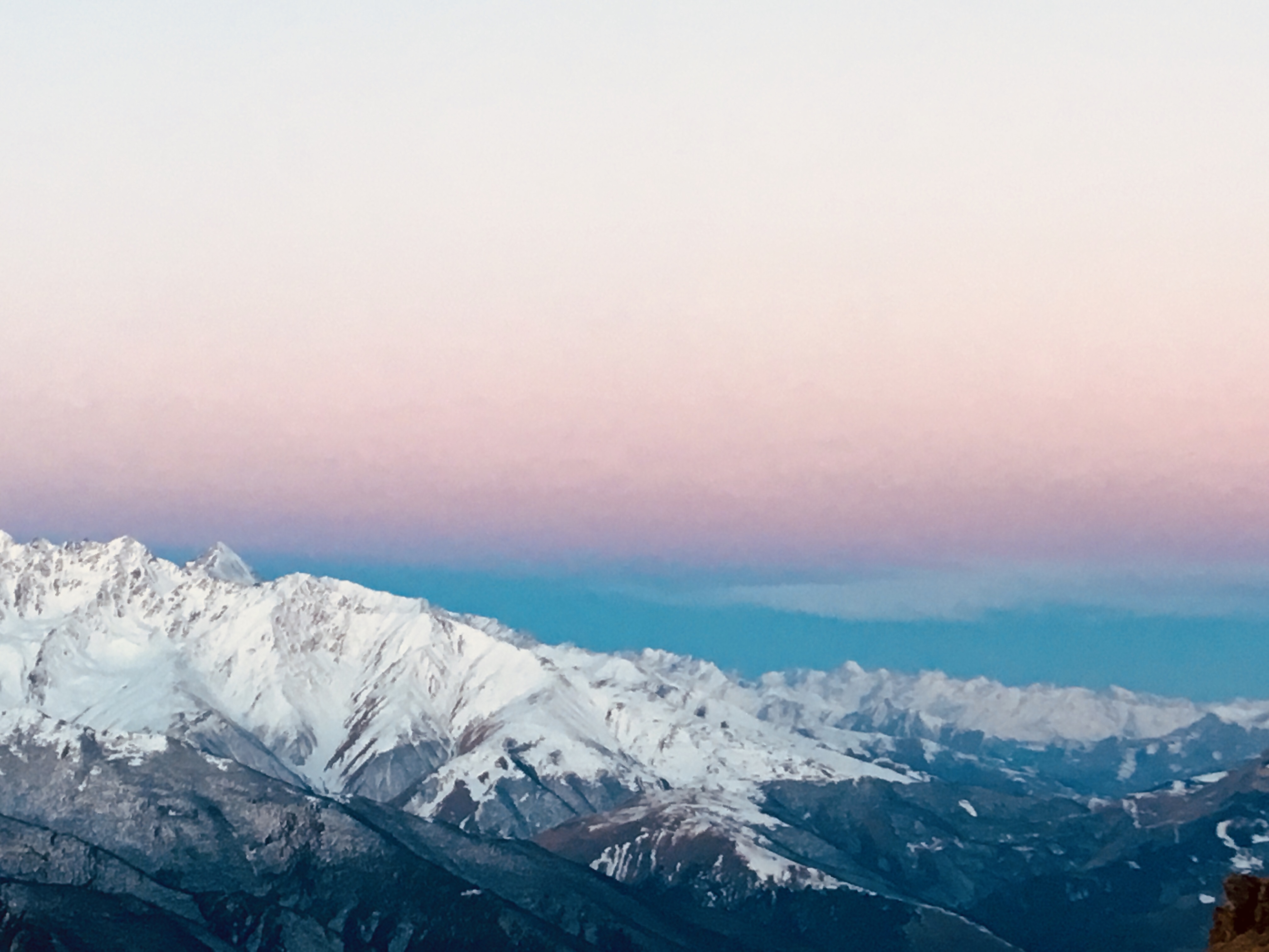
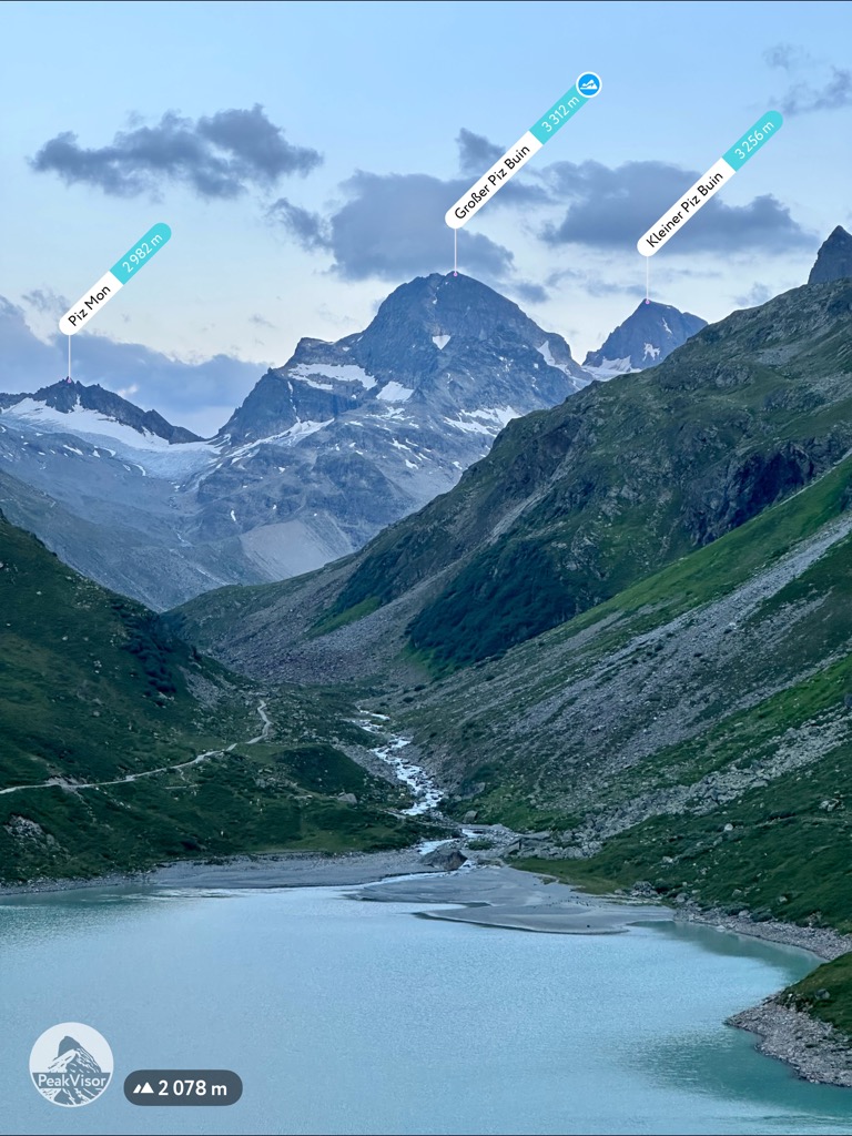
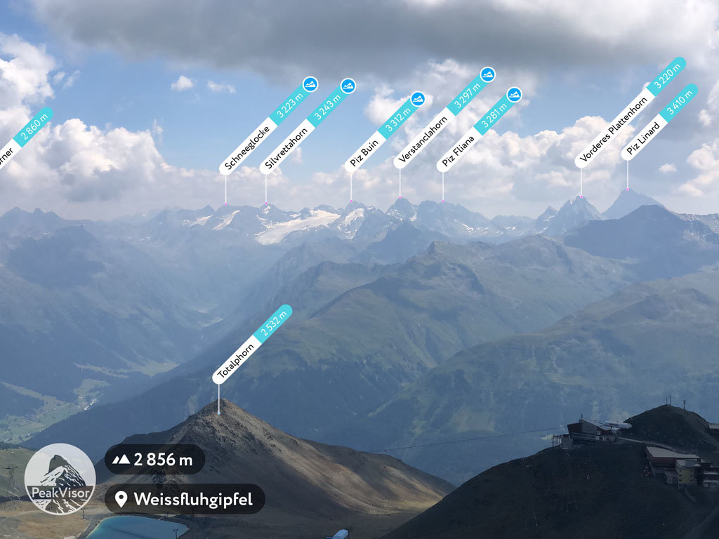
Piz Buin (German pronunciation: [ˌpits buˈiːn] ) is a mountain in the Silvretta range of the Alps on the border between Austria and Switzerland. It forms the border between the Swiss canton of Graubünden and the Austrian state of Vorarlberg and is the highest peak in Vorarlberg.
Its original name in the Romansh language is Piz Buin Grond. A similar but smaller summit nearby is called Piz Buin Pitschen at 3,255 m (10,680 ft). Piz Buin was first climbed on 14 July 1865 by Joseph Anton Specht and Johann Jakob Weilenmann, guided by Jakob Pfitscher and Franz Pöll. Piz Buin Pitschen was climbed three years later.
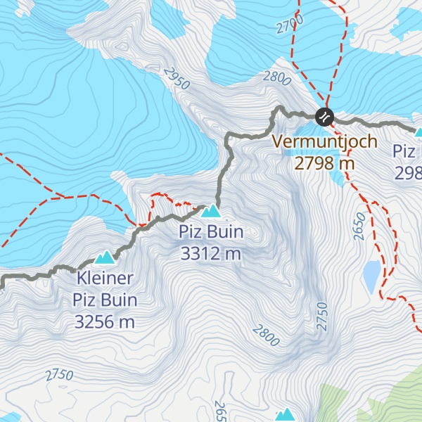
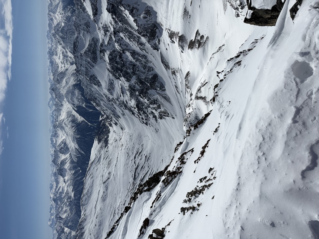
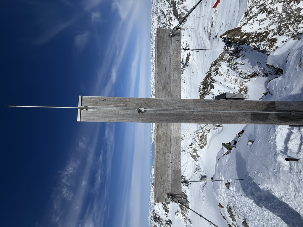
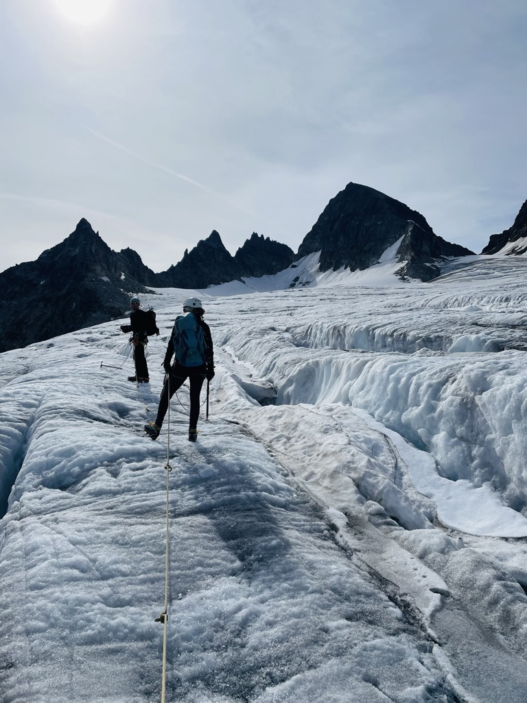
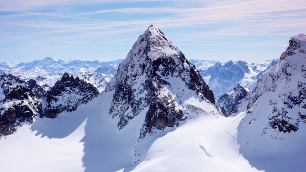
Piz Buin can be reached from the Wiesbadener hut, crossing the Vermunt glacier, climbing up the Wiesbadener ridge and hiking over the Ochsentaler Glacier to the Buin gap. From the gap there is a zigzag walk to the top, with only a 20 m (65 ft) steep step to surmount before reaching the relatively flat summit space, which has an old wooden cross on the very top. The border between Switzerland and Austria crosses the summit from East to West.
There's a demanding alpine trail (T5) leading to the summit.
The nearest mountain hut is Ehemalige Zollwachhütte located 702m/2 303ft ENE of the summit.
By elevation Piz Buin is
# 78 out of 2797 in the Western Rhaetian Alps # 75 out of 2367 in Grisons # 5 out of 414 in Region Engiadina Bassa/Val Müstair # 1 out of 664 in Bezirk Bludenz # 1 out of 1003 in Vorarlberg # 5 out of 321 in the Silvretta Alps
By prominence Piz Buin is
# 54 out of 2797 in the Western Rhaetian Alps # 54 out of 2367 in Grisons # 15 out of 414 in Region Engiadina Bassa/Val Müstair # 17 out of 664 in Bezirk Bludenz # 20 out of 1003 in Vorarlberg # 5 out of 321 in the Silvretta Alps
We use GPS information embedded into the photo when it is available.
3D mountains overlay
Adjust mountain panorama to perfectly match your photos because recorded by camera photo position might be imprecise.
Move tool
Rotate tool
Zoom
More customization
Choose which peak labels should make into the final photo and what photo title should be.
Next
Photo Location
Satellitte
Flat map
Relief map
Latitude
Longitude
Altitude
OR
Latitude
°'''
Longitude
°'''
Apply
Register Peak
Peak Name
Latitude
Longitude
Altitude
Register
Teleport
PeakVisor
This 3D model of Sagarmatha National Park in Nepal was made using the PeakVisor app topographic data. The mobile app features higher precision models worldwide, more topographic details, and works offline. Download PeakVisor maps today.
Download OBJ model
PeakVisor
The download should start shortly. If you find it useful please consider supporting the PeakVisor app.
PeakVisor for iOS and Android
Be a superhero of outdoor navigation with state-of-the-art 3D maps and mountain identification in the palm of your hand!


.jpg)